

floodplain mapping activities on kalona's west ditch - City of Kalona
floodplain mapping activities on kalona's west ditch - City of Kalona
floodplain mapping activities on kalona's west ditch - City of Kalona
SHOW LESS

Create successful ePaper yourself
Turn your PDF publications into a flip-book with our unique Google optimized e-Paper software.
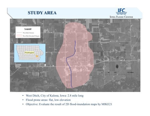
• West Ditch, <strong>City</strong> <strong>of</strong> Kal<strong>on</strong>a, Iowa: 2.8 mile l<strong>on</strong>g<br />
• Flood pr<strong>on</strong>e areas: flat, low elevati<strong>on</strong><br />
• Objective: Evaluate the result <strong>of</strong> 2D flood-inundati<strong>on</strong> maps by MIKE21