GEF Newsletter 4th Edition - UNDP Trinidad and Tobago
GEF Newsletter 4th Edition - UNDP Trinidad and Tobago
GEF Newsletter 4th Edition - UNDP Trinidad and Tobago

Create successful ePaper yourself
Turn your PDF publications into a flip-book with our unique Google optimized e-Paper software.
Developing Adaptation Strategies to Global Climate Change in <strong>Tobago</strong> -<br />
Using Participatory 3D Modelling Strategies<br />
By Bheshem Ramlal<br />
Most economic development in the Caribbean is located in the coastal zone of the isl<strong>and</strong>s <strong>and</strong> therefore,<br />
Global Climate Change, <strong>and</strong> the resulting sea level rise, is expected to significantly impact the stakeholders<br />
of the region. The livelihoods of many are predicted to be negatively impacted as a result of environmental<br />
change, coastal inundation, changing weather patterns <strong>and</strong> other consequences of climate change. As part<br />
of an effort to prepare Caribbean stakeholders to develop adaptation strategies to better cope with the<br />
changes that are already occurring <strong>and</strong> further changes that are anticipated, the University of the West<br />
Indies (UWI) with funding from the <strong>GEF</strong> SGP, in collaboration with CANARI, with funding from the Centre for<br />
Agriculture <strong>and</strong> Technical Cooperation (CTA), embarked on a project: participatory three dimensional mapping<br />
of the isl<strong>and</strong> of <strong>Tobago</strong>.<br />
Through this participatory process, participatory 3D modelling merges conventional spatial<br />
information (contours) with people's mental maps; makes information tangible <strong>and</strong> meaningful to<br />
all, <strong>and</strong> visualises scaled spatial knowledge.<br />
The project entailed two major components. Firstly, the building of a three dimensional model (3D) of the<br />
isl<strong>and</strong> of <strong>Tobago</strong>, complete with mapped locations of information from community stakeholders in order to<br />
identify possible impacts of climate change on their communities. The second component involved training of<br />
participants from several Caribbean isl<strong>and</strong>s to enable them to undertake similar activities in their own<br />
countries.<br />
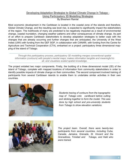
Students tracing of contours from the topographic<br />
map of <strong>Tobago</strong> onto cardboard before cutting<br />
<strong>and</strong> sticking together to form the model. This was<br />
done by high school <strong>and</strong> pre-university students<br />
from <strong>Tobago</strong> to show elevation variations.<br />
The project team. Overall, there were twenty-two<br />
participants from several countries, including Cuba,<br />
Canada, Jamaica, Grenada, St. Vincent <strong>and</strong> the<br />
Grenadines, <strong>Trinidad</strong> <strong>and</strong> <strong>Tobago</strong>, <strong>and</strong> Haiti who<br />
were trained.<br />
4