Precise Positioning Service Performance Standard - GPS.gov
Precise Positioning Service Performance Standard - GPS.gov
Precise Positioning Service Performance Standard - GPS.gov

You also want an ePaper? Increase the reach of your titles
YUMPU automatically turns print PDFs into web optimized ePapers that Google loves.
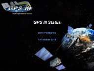
February 2007<br />
<strong>GPS</strong> PPS PS<br />
3.3 PPS SIS Coverage<br />
This section provides the PPS SIS coverage standards.<br />
There are two components of PPS SIS coverage: (1) the per-satellite coverage, and (2) the<br />
baseline 24-slot constellation coverage. These two components are interrelated. The per-satellite<br />
coverage depends primarily on the satellite antenna subsystem design, the on-orbit satellite<br />
pointing accuracy, and the satellite altitude (where the allowed range of satellite altitudes is defined<br />
by baseline 24-slot constellation architecture). The baseline 24-slot constellation coverage<br />
depends primarily on the per-satellite coverage coupled with the baseline 24-slot constellation<br />
architecture.<br />
Each component of PPS SIS coverage shall be as specified below.<br />
3.3.1 Per-Satellite Coverage<br />
Each healthy Navstar satellite transmits a PPS SIS which completely covers that portion of the<br />
surface of the Earth which is visible from the satellite's orbital position. The transmitted PPS SIS<br />
also completely covers the portion of the near-Earth region which extends from the surface of the<br />
Earth up to an altitude of 3,000 km above the surface of the Earth (i.e., the terrestrial service<br />
volume) which is visible from the satellite's orbital position (i.e., those portions of the resulting<br />
spherical shell surrounding the Earth which are not otherwise physically obscured by the Earth or<br />
by localized obstructions). These requirements apply at the worst-case satellite antenna pointing<br />
angle relative to the Earth.<br />
The guaranteed minimum user-received PPS SIS power levels are for the terrestrial service<br />
volume as specified in IS-<strong>GPS</strong>-200. Although IS-<strong>GPS</strong>-200 uses a 5 degree elevation angle as the<br />
reference value for specifying the guaranteed minimum user-received PPS SIS power levels, the<br />
per-satellite coverage is not artificially restricted to just those locations where the Navstar satellite<br />
viewing angle is greater than or equal to 5 degrees above the local horizon.<br />
The transmitted PPS SIS from each healthy Navstar satellite also covers the near-Earth region<br />
which extends from an altitude of 3,000 km above the surface of the Earth up to and including<br />
36,000 km above the Earth’s surface (i.e., the space service volume). The space service volume<br />
coverage is limited by physical obscuration by the Earth as well as by the transmitting satellite’s<br />
antenna gain pattern and free-space path loss. The limits of coverage are determined by the<br />
received power contour surface of -182 dBW assuming a linear receiving antenna with a minimum<br />
gain that varies from +3 dBic at 3,000 km altitude to +7 dBic at 36,000 km altitude. There are no<br />
explicit per-satellite coverage standards for the space service volume.<br />
3.3.2 Baseline Constellation Coverage<br />
The baseline 24-slot constellation continuously covers the entire terrestrial service volume.<br />
The baseline 24-slot constellation coverage for the space service volume varies significantly as a<br />
function of time and location within the space service volume. At certain times and locations, the<br />
baseline 24-slot constellation does not provide adequate coverage for instantaneous position<br />
solutions. Users operating at those times and locations are therefore limited to time-filtered<br />
position solutions propagated over time. There are no explicit constellation coverage standards for<br />
the space service volume.<br />
1 st Edition Page 20