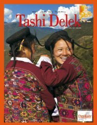
here's the link to the brochure X - Rainbow Photo Tours Bhutan
here's the link to the brochure X - Rainbow Photo Tours Bhutan
here's the link to the brochure X - Rainbow Photo Tours Bhutan
- No tags were found...

You also want an ePaper? Increase the reach of your titles
YUMPU automatically turns print PDFs into web optimized ePapers that Google loves.
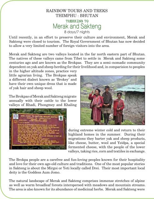
RAINBOW TOURS AND TREKS<br />
THIMPHU : BHUTAN<br />
Trekking <strong>to</strong><br />
Merak and Sakteng<br />
8 days/7 nights<br />
Until recently, in an effort <strong>to</strong> preserve <strong>the</strong>ir culture and environment, Merak and<br />
Sakteng were closed <strong>to</strong> <strong>to</strong>urism. The Royal Government of <strong>Bhutan</strong> has now decided<br />
<strong>to</strong> allow a very limited number of foreign visi<strong>to</strong>rs in<strong>to</strong> <strong>the</strong> area.<br />
designated a wildlife sanctuary in April 2003. Recent<br />
surveys of <strong>the</strong> area by <strong>the</strong> Department of Forests has<br />
identified 18 species of mammals and 119 species of<br />
birds. Some of <strong>the</strong> prominent mammals found in <strong>the</strong><br />
sanctuary are red pandas, goral, serow, Asiatic black<br />
bear, capped langur, Himalayan yellow throated<br />
marten, common leopard, Himalayan palm civet,<br />
forest pika, Moupin’s pika, barking deer, Himalayan<br />
stripped squirrel and <strong>the</strong> Assamese macaque.<br />
Special Yak dance in Sakteng<br />
Merak and Sakteng are two valleys located in <strong>the</strong> far north eastern part of <strong>Bhutan</strong>.<br />
The natives of <strong>the</strong>se valleys came from Tibet <strong>to</strong> settle in Merak and Sakteng some<br />
centuries ago and are known as <strong>the</strong> Brokpas. They are a semi–nomadic community<br />
dependent on yak and sheep herding for <strong>the</strong>ir livelihood and, in comparision <strong>to</strong> peoples<br />
in <strong>the</strong> higher altitude zones, practice very<br />
little agrarian living. The Brokpas speak<br />
a different dialect known as ‘Brokey’ and<br />
have <strong>the</strong>ir own unique dress that is made<br />
of yak hair and sheep wool.<br />
The Brokpas of Merak and Sakteng migrate<br />
annually with <strong>the</strong>ir cattle <strong>to</strong> <strong>the</strong> lower<br />
valleys of Rhadi, Phongmey and Khaling<br />
during extreme winter cold and return <strong>to</strong> <strong>the</strong>ir<br />
highland homes in <strong>the</strong> summer. During <strong>the</strong>ir<br />
migrations <strong>the</strong>y barter yak and sheep products,<br />
like cheese, butter, wool and Yeidpa, a special<br />
fermented cheese, with <strong>the</strong> people of <strong>the</strong> lower<br />
valleys, taking rice, corn and textiles in exchange.<br />
The Brokpa people are a carefree and fun-loving peoples known for <strong>the</strong>ir hospitality<br />
and love for <strong>the</strong>ir own age-old culture and traditions. One of <strong>the</strong> most popular s<strong>to</strong>ries<br />
in Sakteng is about <strong>the</strong> Mirgoi or Yeti locally called Drei. Their most important local<br />
deity is <strong>the</strong> Goddess Aum Jomo.<br />
The natural landscape of Merak and Sakteng comprises immense stretches of alpine<br />
as well as warm broadleaf forests interspersed with meadows and mountain streams.<br />
The area is also known for its abundance of medicinal herbs. Merak and Sakteng were<br />
Program1<br />
day<br />
Trekking<br />
Trashigang <strong>to</strong> Chaling (Alt: 7011 ft/2137 m) <strong>to</strong><br />
Chuthabthab (Alt: 9985 ft/3043 m)<br />
Time: 4 - 5 hrs.<br />
Distance: 6.2 mi/10 km<br />
Altitude gain: 2791 ft/851 m<br />
Altitude loss: 0 ft/0 m<br />
After breakfast, drive about half an hour <strong>to</strong> Ranjung where you can see a few well set<br />
up shops, <strong>the</strong> high school and <strong>the</strong> Woeselcholing monastery owned by Garab Rinpoche.<br />
In Rangjung you can visit a farm house <strong>to</strong> see raw silk being woven in<strong>to</strong> local fabrics.<br />
From Rangjung drive 1 1/2 hours through corn fields<br />
and past farm houses on a rough road <strong>to</strong> Chaling.<br />
Your trek begins above Chaling school at 7,011<br />
feet/2,137 metres. The trail from Chaling <strong>to</strong><br />
Chuthabthab is up hill through open hills overlooking<br />
<strong>the</strong> view of Galing, Bidung and Bartsam village in <strong>the</strong><br />
opposite direction. On this route you will see ancient<br />
mani walls and a chorten beside <strong>the</strong> trail. After<br />
trekking for one hour you reach Tsahey phu meadow, a rest place, <strong>the</strong>n continue trekking<br />
uphill through <strong>the</strong> open pastures. This pasture land belongs <strong>to</strong> villages of Chaling and<br />
Radhi and is used for grazing <strong>the</strong>ir cows. Fur<strong>the</strong>r along <strong>the</strong> trail<br />
<strong>to</strong> <strong>the</strong> campsite you<br />
will see cow huts<br />
near Sheytimi. From<br />
Sheytimi it is a one hour<br />
climb <strong>to</strong> Chuthabthab<br />
C a m p s i t e i n a<br />
b e a u t i f u l h i l l t o p<br />
meadow at 9,985 feet<br />
/3,043 metres.