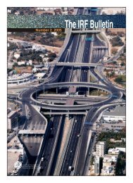
TRANSPORT
TRANSPORT
TRANSPORT
- No tags were found...

You also want an ePaper? Increase the reach of your titles
YUMPU automatically turns print PDFs into web optimized ePapers that Google loves.
MANAGEMENT<br />
Transport for Poverty<br />
Alleviation: An Approach in<br />
Bangladesh<br />
M. A. Quader<br />
Director, Rural Transport Improvement Project,<br />
Ministry of Local Government, Rural Development<br />
& Cooperatives (LGRD), Bangladesh<br />
Bangladesh is one of the few countries in the world where<br />
a full range of transport modes serves the needs of the<br />
economy and people. It has a vast network of highways<br />
and rural roads, a railway system, inland waterways, two<br />
seaports, maritime shipping, and civil aviation services,<br />
including a national airline.<br />
From an initially low-level transport endowment, Bangladesh<br />
has made significant strides towards developing a modern<br />
transport system. Most of the improvements have occurred<br />
in the road sector, which now boasts an impressive<br />
274,000km network.<br />
In 1984, the Government of Bangladesh outlined its rural<br />
development strategy, which focused on the development<br />
of physical infrastructure around roads, markets and<br />
storage facilities. Since that time, a range of mechanisms,<br />
including basic irrigation, have helped to accelerate<br />
economic growth and reduce poverty.<br />
Bangladesh remains primarily a rural society, with about<br />
80% of the population living in rural areas. Although rural<br />
Bangladesh is poor, it has a highly active local cash economy<br />
– in which mobility and trading are of crucial importance.<br />
Strategic Planning<br />
Rural transport is, therefore, of vital significance to poverty<br />
reduction – and poor access to transport in rural areas<br />
considerably constrains economic and social development.<br />
Accordingly, the Government’s rural development<br />
programme, which originated in the 1960’s, was conceived<br />
as an instrument for fostering agricultural production as<br />
well as economic growth. The rural development model<br />
emphasised the formation of co-operatives and the<br />
integration of support services provided by government<br />
departments. The model had four major elements:<br />
• A two-tier Co-operative System, comprising the<br />
Krishak Samabaya Samity (KSS) and the Thana 1 Central<br />
Cooperative Association (KCCA)<br />
• A Rural Works Programme (RWP)<br />
• The Thana Irrigation Programme (TIP)<br />
• The Thana Training and Development Centres (TTDC)<br />
Institutional Framework<br />
Bangladesh’s Local Government Engineering Bureau (LGEB)<br />
– which grew out of the previous Works Programme Wing<br />
(WPW) - was created in October 1984, and subsequently<br />
upgraded as the Local Government Engineering<br />
Department (LGED). The LGED currently has a permanent<br />
team of just over 10,250 engineers and staff, working under<br />
the executive authority of a Chief Engineer. 87.8% of the<br />
team is mobilised at the grassroots level, and the LGED is<br />
now one of the prime engineering organisations engaged<br />
in the development of rural transport infrastructure in<br />
Bangladesh.<br />
Rural Transport Infrastructure Development Activities<br />
The country’s road network may be broken down into the<br />
following main categories: National Highways; Regional<br />
Highways; and Zila, Upazila, Union and Village roads. 2<br />
Rural transport infrastructure activities are focused on<br />
the improvement of Upazila, Union and Village roads.<br />
Activities include the construction of bridges and culverts;<br />
development of growth centres and rural markets; tree<br />
planting on embankments; and routine maintenance of<br />
earth roads, as well as paved roads and structures.<br />
Planning Tools and GIS<br />
In the early 1980s, distinct plans were developed with<br />
respect to Upazilas and Unions and used as tools for<br />
planning and prioritising rural roads, bridges and culverts,<br />
and market development.<br />
LGED has further developed digitised maps (scale 1:500000)<br />
covering sub-district administrative units throughout the<br />
country. These enable ready access to key information such<br />
as the geographical locations of road networks and other<br />
important features. The maps and road inventories also<br />
serve as basic planning tools for rural road development,<br />
and are updated every year by the dedicated Geographic<br />
Information Systems (GIS) unit at headquarters level.<br />
IRF BULLETIN SPECIAL EDITION: RURAL <strong>TRANSPORT</strong>, VOLUME-2 | 23