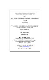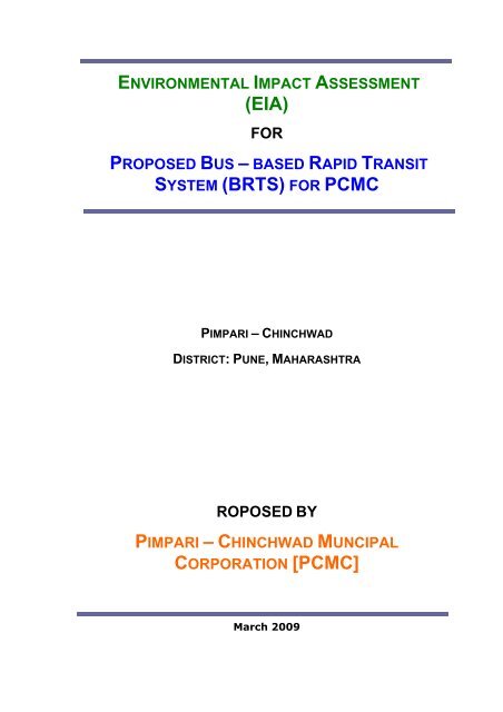
(EIA) SYSTEM (BRTS) FOR PCMC
(EIA) SYSTEM (BRTS) FOR PCMC
(EIA) SYSTEM (BRTS) FOR PCMC

You also want an ePaper? Increase the reach of your titles
YUMPU automatically turns print PDFs into web optimized ePapers that Google loves.
ENVIRONMENTAL IMPACT ASSESSMENT<br />
(<strong>EIA</strong>)<br />
<strong>FOR</strong><br />
PROPOSED BUS – BASED RAPID TRANSIT<br />
<strong>SYSTEM</strong> (BRTS) <strong>FOR</strong> <strong>PCMC</strong><br />
PIMPARI – CHINCHWAD<br />
DISTRICT: PUNE, MAHARASHTRA<br />
ROPOSED BY<br />
PIMPARI – CHINCHWAD MUNCIPAL<br />
CORPORATION [<strong>PCMC</strong>]<br />
March 2009
Rapid <strong>EIA</strong> Study for proposed BRTS<br />
Table of Content<br />
CONTENTS<br />
CONTENTS .................................................................................................................iii<br />
List of Tables ............................................................................................................... vii<br />
List of Figures ............................................................................................................ viii<br />
CHAPTER 1.................................................................................................................. 1<br />
INTRODUCTION......................................................................................................... 1<br />
1.1 PREAMBLE................................................................................................................................ 1<br />
1.2 OBJECTIVES OF THE <strong>EIA</strong> STUDY........................................................................................ 2<br />
1.3 METHODOLOGY OF THE STUDY......................................................................................... 3<br />
1.4 STRUCTURE OF <strong>EIA</strong> REPORT............................................................................................... 4<br />
CHAPTER 2.................................................................................................................. 6<br />
PROJECT DESCRIPTION.......................................................................................... 6<br />
2.1 INTRODUCTION....................................................................................................................... 6<br />
2.2 PROFILE OF THE CITY .......................................................................................................... 6<br />
2.2.1 Historical Background............................................................................................................ 7<br />
2.2.2 City’s Growth......................................................................................................................... 7<br />
2.3 VEHICULAR GROWTH AND COMPOSITION ..................................................................... 7<br />
2.4 REVIEW OF COMPREHENSIVE MOBILITY PLAN (CMP)................................................ 9<br />
2.5 PROPOSED BRT <strong>SYSTEM</strong> ..................................................................................................... 11<br />
2.5.1 Kalewadi Phata to Dehu-Alandi road................................................................................... 12<br />
2.5.2 Nashik phata to Wakad......................................................................................................... 13<br />
2.5.3 Proposed Structures along the Corridors.............................................................................. 15<br />
2.5.4 Design of Corridors.............................................................................................................. 20<br />
2.5.5 Location of Bus Stops .......................................................................................................... 21<br />
2.5.6 Typical Street Sections & Bus Stop Design ......................................................................... 21<br />
2.6 TRAFFIC STUDIES ................................................................................................................ 27<br />
2.7 DETAILED PLANS <strong>FOR</strong> REDEVELOPMENT ALONG CORRIDORS.............................. 27<br />
CHAPTER 3................................................................................................................ 28<br />
BASELINE ENVIRONMENTAL QUALITY............................................................ 28<br />
3.1 INTRODUCTION..................................................................................................................... 28<br />
3.2 SCOPE OF BASELINE STUDIES.......................................................................................... 28<br />
3.3 AIR ENVIRONMENT.............................................................................................................. 30<br />
3.3.1 Meteorology ........................................................................................................................ 30<br />
3.3.2 Ambient Air Quality............................................................................................................34<br />
3.4 NOISE ENVIRONMENT......................................................................................................... 37<br />
3.5 TRAFFIC STUDIES ................................................................................................................ 39<br />
Pimpri Chinchwad Muncipal Corporation<br />
iii
Rapid <strong>EIA</strong> Study for proposed BRTS<br />
Table of Content<br />
3.6 WATER ENVIRONMENT....................................................................................................... 50<br />
3.6.1 Hydrogeology...................................................................................................................... 55<br />
3.7 LAND ENVIRONMENT.......................................................................................................... 55<br />
3.7.1 Physiography....................................................................................................................... 55<br />
3.7.2 Relief & Drainage ............................................................................................................... 56<br />
3.8 GEOLOGY ................................................................................................................................ 57<br />
3.9 SEISMOLOGY.......................................................................................................................... 60<br />
3.10 LAND USE................................................................................................................................ 61<br />
3.11 SOIL .......................................................................................................................................... 64<br />
3.12 BIOLOGICAL ENVIRONMENT ............................................................................................ 67<br />
3.13 SOCIO ECONOMIC ENVIRONMENT.................................................................................. 69<br />
3.13.1 Demographic Profile ............................................................................................................ 69<br />
3.13.2 Socio-Economic Profile ....................................................................................................... 70<br />
3.13.3 Structures on the Route......................................................................................................... 71<br />
CHAPTER 4................................................................................................................ 73<br />
IMPACT ASSESSMENT ........................................................................................... 73<br />
4.1 INTRODUCTION..................................................................................................................... 73<br />
4.2 POLLUTION SOURCES ......................................................................................................... 73<br />
4.3 IDENTIFICATION OF IMPACTS ......................................................................................... 74<br />
4.4 AIR ENVIRONMENT.............................................................................................................. 76<br />
4.4.1 Construction Phase.............................................................................................................. 76<br />
4.4.2 Functional Phase ................................................................................................................. 78<br />
4.5 NOISE ENVIRONMENT......................................................................................................... 79<br />
4.5.1 Construction Phase.............................................................................................................. 80<br />
4.5.2 Functional Phase ................................................................................................................. 83<br />
4.6 IMPACT ON TRAFFIC ........................................................................................................... 83<br />
4.7.1 Construction Phase.............................................................................................................. 84<br />
4.7.2 Functional Phase ................................................................................................................. 85<br />
4.8 IMPACTS ON LAND ENVIRONMENT................................................................................. 85<br />
4.8.1 Land Use & Aesthetics........................................................................................................ 85<br />
4.8.2 Topography & Geology....................................................................................................... 86<br />
4.8.3 Soil ....................................................................................................................................... 86<br />
4.8.3.1Construction Phase ............................................................................................................... 86<br />
4.9 WASTE DISPOSAL..................................................................................................................87<br />
4.9.1 Construction Phase............................................................................................................... 87<br />
4.9.2 Functional Phase .................................................................................................................. 88<br />
4.10 BIOLOGICAL ENVIRONMENT ............................................................................................ 88<br />
Pimpri Chinchwad Muncipal Corporation<br />
iv
Rapid <strong>EIA</strong> Study for proposed BRTS<br />
Table of Content<br />
4.10.1 Construction Phase............................................................................................................... 88<br />
4.10.2 Functional Phase .................................................................................................................. 89<br />
4.11 SOCIO-ECONOMIC ENVIRONMENT.................................................................................. 89<br />
4.11.1 Job Opportunity.................................................................................................................... 89<br />
4.11.2 Improvement of Infrastructure Facilities.............................................................................. 89<br />
4.11.3 Wider Economic Growth...................................................................................................... 90<br />
4.11.4 Transportation ...................................................................................................................... 90<br />
4.11.5 Transient Labour Population ................................................................................................ 90<br />
4.11.6 Resettlement & Rehabilitation Issues................................................................................... 90<br />
4.12 SUMMARY OF IMPACTS ...................................................................................................... 90<br />
CHAPTER 5................................................................................................................ 93<br />
ENVIRONMENTAL MANAGEMENT PLAN ......................................................... 93<br />
5.1 INTRODUCTION..................................................................................................................... 93<br />
5.2 AIR ENVIRONMENT.............................................................................................................. 94<br />
5.2.1 Construction Phase.............................................................................................................. 94<br />
5.2.2 Functional Phase .................................................................................................................. 95<br />
5.3 NOISE ENVIRONMENT......................................................................................................... 96<br />
5.3.1 Construction Phase.............................................................................................................. 96<br />
5.3.2 Functional Phase .................................................................................................................. 96<br />
5.4 IMPACT ON WATER RESOURCES.................................................................................... 106<br />
5.4.1 Construction Phase............................................................................................................ 106<br />
5.4.2 Functional Phase ...............................................................................................................106<br />
5.5 IMPACTS ON LAND ENVIRONMENT............................................................................... 112<br />
5.5.1 Construction Phase............................................................................................................. 112<br />
5.5.2 Functional Phase ...............................................................................................................113<br />
5.6 BIOLOGICAL ENVIRONMENT .......................................................................................... 113<br />
5.6.1 Construction Phase............................................................................................................ 113<br />
5.6.2 Functional Phase ...............................................................................................................113<br />
5.7 IMPLEMENTATION SCHEDULE OF MITIGATION MEASURES ................................ 115<br />
5.8 ENVIRONMENTAL MANAGEMENT <strong>SYSTEM</strong> & MONITORING PLAN ...................... 116<br />
5.8.1 Environmental Management Cell....................................................................................... 116<br />
5.8.2 Environmental Monitoring ................................................................................................. 117<br />
5.8.3 Awareness & Training........................................................................................................ 120<br />
5.8.4 Record Keeping & Reporting............................................................................................. 120<br />
5.8.5 Environmental Audits & Corrective Action Plans ............................................................. 120<br />
5.8.6 Budget Provision for EMP ................................................................................................. 127<br />
ANNEXURE I........................................................................................................... 129<br />
Pimpri Chinchwad Muncipal Corporation<br />
v
Rapid <strong>EIA</strong> Study for proposed BRTS<br />
Table of Content<br />
ANNEXURE II ......................................................................................................... 130<br />
ANNEXURE III........................................................................................................ 131<br />
ANNEXURE IV ........................................................................................................ 141<br />
Pimpri Chinchwad Muncipal Corporation<br />
vi
Rapid <strong>EIA</strong> Study for proposed BRTS<br />
Table of Content<br />
LIST OF TABLES<br />
TABLE 1.1: SURVEY OF ENVIRONMENTAL ATTRIBUTES............................................................................ 3<br />
TABLE 2.1: VEHICLE REGISTRATION DETAILS IN <strong>PCMC</strong> AREA ................................................................. 7<br />
TABLE NO. 2.2: NEW REGISTRATIONS OF VEHICLES IN <strong>PCMC</strong>................................................................. 9<br />
TABLE NO. 2.3: PROPOSED BRTS........................................................................................................... 12<br />
TABLE NO. 2.4: LIST OF STRUCTURES ALONG THE CORRIDOR ................................................................ 16<br />
TABLE NO. 2.5: LIST OF STRUCTURES ALONG THE CORRIDOR ................................................................ 18<br />
TABLE 3.1: BASELINE DATA GENERATION ............................................................................................. 29<br />
TABLE 3.2: CLIMATOLOGICAL DATA – IMD PUNE ............................................................................... 31<br />
TABLE 3.3: WIND PATTERN – IMD PUNE.............................................................................................. 31<br />
TABLE 3.4: AMBIENT AIR QUALITY RESULTS....................................................................................... 35<br />
TABLE 3.5: NATIONAL AMBIENT AIR QUALITY STANDARDS (NAAQS)................................................. 36<br />
TABLE 3.6: NOISE MONITORING RESULTS .............................................................................................. 38<br />
TABLE 3.7: AMBIENT NOISE QUALITY STANDARDS................................................................................ 39<br />
TABLE 3.8: LOCATIONS AND SCHEDULE OF OUTER CORDON COUNTS.................................................... 40<br />
TABLE 3.9: LOCATIONS AND SCHEDULE OF COUNTS ON MAJOR ARTERIAL NETWORK OF <strong>PCMC</strong>............ 41<br />
TABLE 3.10: LOCATIONS OF TURNING MOVEMENT SURVEYS................................................................. 41<br />
TABLE 3.11: SUMMARY OF TRAFFIC COUNTS AT OUTER CORDON POINTS ............................................. 42<br />
TABLE 3.12: PASSENGER TRAFFIC VOLUME (IN VEHICLES AND PCUS) AT OUTER CORDON POINTS...... 43<br />
TABLE 3.13: SUMMARY OF MID-BLOCK COUNTS ON MAJOR ARTERIALS ............................................... 44<br />
TABLE 3.14: PASSENGER TRAFFIC VOLUME (IN VEHICLES AND PCUS) AT MID-BLOCK COUNT<br />
LOCATIONS.................................................................................................................................... 45<br />
TABLE 3.15: WATER SAMPLING LOCATIONS........................................................................................... 51<br />
TABLE 3.16: WATER SAMPLE ANALYSIS OF INDRYANI RIVER & NALA NEAR MUNICIPAL CORPORATION<br />
BOUNDARY.................................................................................................................................... 53<br />
TABLE 3.17: CHEMICAL ANALYSIS OF GROUND WATERS, NEAR CORRIDOR AREA ................................ 54<br />
TABLE 3.18: <strong>PCMC</strong> LAND USE AREAS ................................................................................................... 62<br />
TABLE 3.19: SOIL CHARACTERISTICS - NASHIK PHATA TO WAKAD BRT CORRIDOR ............................. 66<br />
TABLE 3.20: SOIL CHARACTERISTICS - KALEWADI PHATA TO CHIKHALI BRT CORRIDOR ..................... 66<br />
TABLE 3.21: LIST OF FLORA AND FAUNA................................................................................................ 67<br />
TABLE 3.22: POPULATION PROJECTIONS <strong>FOR</strong> THE NEXT 20 YEARS.......................................................... 69<br />
TABLE 4.1: POLLUTANT SOURCES & CHARACTERISTICS......................................................................... 74<br />
TABLE 4.2: IDENTIFICATION OF IMPACTS (CONSTRUCTION & FUNCTIONAL PHASE)............................... 75<br />
TABLE 4.3: PARTICULATE EMISSION RATE IN KG PER HOUR <strong>FOR</strong> DIFFERENT MOISTURE AND SILT<br />
CONTENT....................................................................................................................................... 77<br />
TABLE 4.4: EMISSIONS IN LB PER VEHICLE KILOMETRE <strong>FOR</strong> DIFFERENT SOIL PERCENTAGES AND<br />
VEHICLE WEIGHT.......................................................................................................................... 78<br />
TABLE-4.5: EMISSION FACTORS <strong>FOR</strong> DIFFERENT VEHICLES.................................................................. 79<br />
TABLE 4.6: NOISE LEVELS GENERATED FROM CONSTRUCTION EQUIPMENT........................................... 80<br />
TABLE 4.7: SUMMARY MATRIX OF PREDICTED IMPACTS DUE TO PROPOSED PROJECT ........................... 91<br />
TABLE 5.1: FUGITIVE DUST CONTROL MEASURERS................................................................................ 94<br />
TABLE 5.2: SUGGESTED PLANT SPECIES - GREEN BELT AREA.............................................................. 115<br />
TABLE 5.3: IMPLEMENTATION SCHEDULE........................................................................................... 116<br />
TABLE 5.4: SUGGESTED MONITORING PROGRAM DURING CONSTRUCTION PHASE .............................. 118<br />
TABLE 5.4: SUGGESTED MONITORING PROGRAM DURING OPERATION PHASE..................................... 119<br />
TABLE 5.5: RECORD KEEPING REQUIREMENTS ..................................................................................... 120<br />
TABLE 5.6: BUDGET PROVISION <strong>FOR</strong> EMP ........................................................................................... 128<br />
Pimpri Chinchwad Muncipal Corporation<br />
vii
Rapid <strong>EIA</strong> Study for proposed BRTS<br />
Table of Content<br />
LIST OF FIGURES<br />
FIGURE 2.1: CATEGORY WISE DISTRIBUTION OF VEHICLES...................................................................... 8<br />
FIGURE 2.2: IMPROVEMENTS TO ROAD NETWORK................................................................................... 11<br />
FIGURE 2.3: ROAD CORRIDORS PROPOSED.............................................................................................. 12<br />
FIGURE 2.4: MAJOR STRUCTURES ON THE CORRIDORS ............................................................................ 16<br />
FIGURE 2.5: TYPICAL CROSS SECTION OF 45 M ROW ............................................................................. 23<br />
FIGURE 2.6: CROSS SECTION AND PLAN AT BUS STOP LOCATION WITH MIXED VEHICLE LANE ELEVATED<br />
...................................................................................................................................................... 24<br />
FIGURE 2.7: TYPICAL CROSS SECTION AT BUS STOP LOCATION............................................................... 25<br />
FIGURE 2.8: PLANS AT BUS STOP LOCATION........................................................................................... 26<br />
FIGURE 3.1: CLIMATE CONDITIONS OF PUNE DISTRICT.......................................................................... 32<br />
FIGURE 3.2: WIND ROSE OF STUDY AREA, SUMMER............................................................................... 33<br />
FIGURE 3.3: AAQ AT NASHIK PHATA TO WAKAD BRT .......................................................................... 36<br />
FIGURE 3.4: AAQ AT KALEWADI PHATA TO CHIKHALI BRT.................................................................. 37<br />
FIGURE 3.5: SURVEY LOCATIONS............................................................................................................ 42<br />
FIGURE 3.6: PEAK HOUR TURNING MOVEMENTS AT KSB JUNCTION IN VEHICLES PER HOUR................ 46<br />
FIGURE 3.7: PEAK HOUR TURNING MOVEMENTS AT KSB JUNCTION IN PCU’S PER HOUR..................... 47<br />
FIGURE 3.8: PEAK HOUR TURNING MOVEMENTS AT NASHIK PHATA IN VEHICLES PER HOUR................ 48<br />
FIGURE 3.9: PEAK HOUR TURNING MOVEMENTS AT NASHIK PHATA IN PCU’S PER HOUR .................... 48<br />
FIGURE 3.10: PEAK HOUR TURNING MOVEMENTS AT KALEWADI CHOWK IN VEHICLES PER HOUR ....... 49<br />
FIGURE 3.11: PEAK HOUR TURNING MOVEMENTS AT KALEWADI CHOWK IN PCUS PER HOUR.............. 50<br />
FIGURE 3.12: IRRIGATION AND HYDROGEOLOGY OF PUNE ..................................................................... 55<br />
FIGURE 3.13: RELIEFS AND SLOPES OF THE PUNE DISTRICT.................................................................... 57<br />
FIGURE 3.14: GEOMORPHOLOGY OF PUNE .............................................................................................. 59<br />
FIGURE 3.15: GEOHYDROLOGY OF PUNE DISTRICT................................................................................. 60<br />
FIGURE 3.16: SEISMIC ZONE MAP OF INDIA ............................................................................................ 61<br />
FIGURE 3.17: LAND USE AND CROPPING PATTERN OF PUNE................................................................... 63<br />
FIGURE 3.18: SOIL PROFILE OF PUNE DISTRICT ...................................................................................... 64<br />
FIGURE 3.19: POPULATION GROWTH ...................................................................................................... 70<br />
FIGURE 4.1: PREDICTED NOISE LEVELS DURING CONSTRUCTION PHASE................................................ 83<br />
Pimpri Chinchwad Muncipal Corporation<br />
viii
Rapid <strong>EIA</strong> Study for proposed BRTS Chapter 1<br />
CHAPTER 1<br />
INTRODUCTION<br />
1.1 PREAMBLE<br />
Pimpri Chinchwad is one of the most vibrant industrial and urban<br />
settlement in Maharashtra. Its developed industrial sector,<br />
proximity to Pune and the growing IT sector draws a large group of<br />
people and businesses to settle in the city, temporarily or<br />
permanently. This creates a growing demand for urban<br />
infrastructure, especially for urban transport infrastructure and<br />
public transport.<br />
Pimpri Chinchwad Muncipal Corporation (<strong>PCMC</strong>) has undertaken an<br />
exercise of identifying the service need for urban transport and to<br />
satisfy the identified needs through a well designed and efficient<br />
network of Bus based Rapid Transit System (BRTS). As part of this<br />
exercise, <strong>PCMC</strong> has profiled the current transportation network and<br />
patterns in the city and has projected them for the future. Based on<br />
these, a Compressive Mobility Plan has been prepared, identifying<br />
the need for Urban Transport solutions along various corridors of<br />
the city<br />
A Bus – based Rapid Transit System (BRTS) has been chosen as the<br />
solution to the public transport service needs of <strong>PCMC</strong>. For<br />
proposed BRTS <strong>PCMC</strong> wants to take up two routes for immediate<br />
implementation are:<br />
1. Kalewadi to Dehu-Alandi road, and<br />
2. Nashik Phata to Wakad,<br />
Sr.<br />
No.<br />
1<br />
Road Name<br />
Kalewadi to Dehu<br />
Alandi Rd<br />
Length<br />
proposed<br />
(km)<br />
ROW<br />
proposed<br />
(m)<br />
Estimated<br />
Cost<br />
(Rs Crores)<br />
11.2 45.0 219.2<br />
2 Nashik phata to Wakad 8.02 45.0 206.82<br />
TOTAL 19.22 426.02<br />
Pimpri Chinchwad Muncipal Corporation 1
Rapid <strong>EIA</strong> Study for proposed BRTS Chapter 1<br />
As per the World Banks operational Policies on Environmental<br />
Impact Assessment proposed projects comes in B category<br />
The purpose of this Environmental Impact Assessment (<strong>EIA</strong>) study<br />
is to provide information on the surroundings and the extent of<br />
environmental impact likely to arise on account of proposed Busbased<br />
Rapid Transit System (BRTS) on environment. The social<br />
impact is also of vital importance in this study as this project may<br />
require land acquisition/removal of encroachments on the ROW.<br />
Another purpose of the study is to define an Environmental<br />
Management Plan (EMP) to minimize and mitigate the likely adverse<br />
environmental and social impacts.<br />
1.2 OBJECTIVES OF THE <strong>EIA</strong> STUDY<br />
The objective of the <strong>EIA</strong> study is:<br />
• To give brief description of the project.<br />
• To assess the present status (baseline) of air, water, land,<br />
noise, biological and socio-economic components of<br />
environment including parameters of human interest based on<br />
secondary data collected from various respective<br />
departments;<br />
• To identify, predict and evaluate environmental and social<br />
impacts expected during the construction phase and the<br />
functional phase in relation to the existing civic infrastructure<br />
and the sensitive receptors, if any;<br />
• To develop mitigative measures so as to minimize the<br />
pollution, environmental disturbance and the nuisance during<br />
construction and functional phases of the project; and<br />
• To design and specify the monitoring schedule, during<br />
construction and functional phases, necessary to ensure the<br />
implementation and the efficacy of the mitigative measures<br />
adopted<br />
Pimpri Chinchwad Muncipal Corporation 2
Rapid <strong>EIA</strong> Study for proposed BRTS Chapter 1<br />
1.3 METHODOLOGY OF THE STUDY<br />
Keeping in view the nature of activities, impact during operation<br />
phase of project and various environmental guidelines, area<br />
affected due to proposed BRTS (2 to 3 kms on either side of both<br />
the corridors) was identified as ‘Study Area’ for the purpose of <strong>EIA</strong><br />
study. To establish baseline status of air, water, noise, land,<br />
biological and socio-economic environment in the study area,<br />
secondary data is used from department like IMD, Environmental<br />
Department <strong>PCMC</strong>, Census dept, Environmental Status report, DPR<br />
of BRTS<br />
Sampling locations were identified on the basis of following criteria:<br />
• Predominant wind direction at the study area;<br />
• Existing topography;<br />
• Locations of the project activities;<br />
• Locations of sensitive areas;<br />
• Area that represents baseline conditions.<br />
The approach to data collection is outlined in Table 1.1 under the<br />
subhead, survey of environmental attributes.<br />
Table 1.1: Survey of Environmental Attributes<br />
Sr.<br />
No.<br />
1<br />
Attribute<br />
Ambient<br />
quality<br />
air<br />
Parameters<br />
SPM, SO 2 , NOx<br />
No. of Locations,<br />
Frequency of Monitoring,<br />
etc.<br />
Locations: 13<br />
SPM, SO 2 and NOx - One 24<br />
hourly sample<br />
Meteorology<br />
2<br />
3 Water quality<br />
4 Ecology<br />
Surface: Wind speed and<br />
direction, temperature,<br />
relative humidity and<br />
rainfall.<br />
Physical, Chemical and<br />
Biological parameters.<br />
Existing terrestrial and<br />
aquatic flora and fauna.<br />
Secondary data collection<br />
from IMD.<br />
Primary data – Sampling at 6<br />
locations for surface and at 20<br />
locations for ground water<br />
quality.<br />
Based on the data collected<br />
from secondary sources. Field<br />
studies for phytoplankton and<br />
zooplankton in water sources.<br />
Pimpri Chinchwad Muncipal Corporation 3
Rapid <strong>EIA</strong> Study for proposed BRTS Chapter 1<br />
6 Noise levels<br />
7 Land use<br />
8<br />
Socioeconomic<br />
Aspects<br />
Noise levels in dB(A)<br />
• Sound pressure level<br />
(SPL)<br />
• Equivalent sound<br />
pressure Level (L eq )<br />
Land use for different<br />
categories.<br />
Socio-economic<br />
characteristics of local<br />
population<br />
9 Geology Geology of the area<br />
10 Hydrology<br />
Drainage pattern, nature<br />
of streams, aquifer<br />
characteristics recharge<br />
and discharge areas.<br />
Continuous 24-hourly<br />
monitoring at different<br />
locations<br />
Based on data published in<br />
Primary Census abstract 2001<br />
and secondary data.<br />
Based on data collected from<br />
secondary sources. Field<br />
investigations<br />
Based on data collected from<br />
secondary sources.<br />
Based on data collected from<br />
secondary sources.<br />
1.4 STRUCTURE OF <strong>EIA</strong> REPORT<br />
The Environmental Impact Assessment (<strong>EIA</strong>) report contains<br />
baseline data, assessment of likely impacts, preparation of<br />
Environmental Management Plan. The report is compiled in following<br />
five chapters:<br />
Chapter 1 Introduction<br />
This chapter describes objectives and methodology for <strong>EIA</strong>.<br />
Chapter 2 Project Description<br />
This chapter gives a brief description of the historical background of<br />
city, physical characteristics of the city, vehicular growth and<br />
composition, Comprehensive Mobility Plan, BRT system Design,<br />
Details of the proposed project<br />
Chapter 3 Baseline Environmental Status of Project Area<br />
This chapter presents details of the baseline environmental status of<br />
all environmental attributes i.e. micro climatological condition, air<br />
quality, noise, traffic, water quality, soil quality, flora, fauna and<br />
socio-economic status etc based on secondary data collected from<br />
respective department.<br />
Pimpri Chinchwad Muncipal Corporation 4
Rapid <strong>EIA</strong> Study for proposed BRTS Chapter 1<br />
Chapter 4 Prediction and Evaluation of Impacts<br />
This chapter discusses the possible sources of pollution and<br />
environmental impacts due to proposed Bus based Rapid Transit<br />
System.<br />
Chapter 5 Environmental Management Plan<br />
This chapter deals with the Environmental Management Plan (EMP)<br />
for the proposed BRTS indicates measures proposed to minimize the<br />
likely impacts on the environment. It also describes the proposed<br />
environmental monitoring program.<br />
Pimpri Chinchwad Muncipal Corporation 5
Rapid <strong>EIA</strong> Study for proposed BRTS chapter 2<br />
CHAPTER 2<br />
PROJECT DESCRIPTION<br />
2.1 INTRODUCTION<br />
Pimpri-Chinchwad is a major industrial centre of the Pune region<br />
and also of the entire country. It has witnessed a high population<br />
growth rate of around 100% in the last two decades. The population<br />
is estimated to reach about 15.07 lakhs by 2011 from the current<br />
level of 12.8 lakhs. As the city continues to grow, the Pimpri-<br />
Chinchwad Municipal Corporation (<strong>PCMC</strong>), which is responsible for<br />
provision of infrastructure services, needs to prepare itself for<br />
providing quality services to its citizens in all areas of infrastructure,<br />
including provision of a reliable public transport system.<br />
Public transport system forms an important part of development<br />
projects. In order to provide effective and efficient transport<br />
facilities to the public, the transport authorities are looking at<br />
alternative systems which can meet the mobility needs of the<br />
people. Increasingly, such alternative systems like Mass Rapid<br />
Transit Systems (MRTS) are being planned in the major cities of the<br />
country. As the MRTS are expensive, it often becomes possible for a<br />
municipal body or a state government to cater only to a limited<br />
area, thus restricting its access to a limited population. A cost<br />
effective alternative is a Bus-based Rapid Transit System (BRTS),<br />
which can cater to the mobility needs of a larger population by<br />
covering a larger geographical area in a city.<br />
Recognizing that a BRTS will be a cost effective mode of transport<br />
to the public, <strong>PCMC</strong> has undertaken a detailed study on its<br />
feasibility and sustainability of the system<br />
2.2 PROFILE OF THE CITY<br />
The city of Pimpri-Chinchwad is situated northeast of Pune and is<br />
160 km from Mumbai, the capital city of Maharashtra. It is<br />
predominantly an industrial area, which has developed during the<br />
last four decades.<br />
Pimpri Chinchwad Muncipal Corporation 6
Rapid <strong>EIA</strong> Study for proposed BRTS chapter 2<br />
2.2.1 Historical Background<br />
Pimpri was basically established as a centre for refugees from<br />
Pakistan. Industrialisation in Pimpri area commenced with the<br />
establishment of Hindustan Antibiotics Limited in 1956. The<br />
establishment of the Maharashtra Industrial Development<br />
Corporation (MIDC) in 1961-62 considerably facilitated industrial<br />
development in the area. The establishment of large-scale core<br />
industries has led to the growth of ancillary and small-scale<br />
industries in and around this industrial belt. Today, Pimpri-<br />
Chinchwad is a major industrial centre of the Pune region and of the<br />
entire country.<br />
2.2.2 City’s Growth<br />
Development of the Pimpri-Chinchwad Municipal Corporation dates<br />
back to the establishment of industries such as Bajaj Auto and<br />
Telco, in the middle of the 20 th century. The establishment of the<br />
Pimpri-Chinchwad New Town Development Authority (PCNTDA) in<br />
the 1980s helped the development of residential colonies in the<br />
1990s to an extent. With the booming IT and ITeS sector in<br />
neighbouring Pune in the 1990’s, Pimpri-Chinchwad has seen large<br />
scale development of residential areas.<br />
2.3 VEHICULAR GROWTH AND COMPOSITION<br />
As on date, there are more than five lakh registered vehicles plying<br />
on the roads of <strong>PCMC</strong>. Apart from these, there are vehicles from<br />
PMC area using the roads of <strong>PCMC</strong> on a daily basis.Table 2 .1 below<br />
indicates the number of registered vehicles in PCMA, over the last<br />
five years.<br />
Table 2.1: Vehicle Registration details in <strong>PCMC</strong> area<br />
Year *<br />
Two<br />
Wheelers<br />
Auto<br />
Cars /<br />
LMVs<br />
Heavy<br />
Vehicles<br />
Others #<br />
Total<br />
2002 211,837 5,288 27,811 6,709 16,940 268,585<br />
2003 236,301 5,415 30,242 6,925 18,188 296,999<br />
2004 271,319 5,588 35,009 7,501 20,511 339,928<br />
2005 308,601 6,052 42,255 8,304 22,829 388,041<br />
Pimpri Chinchwad Muncipal Corporation 7
Rapid <strong>EIA</strong> Study for proposed BRTS chapter 2<br />
Year *<br />
Two<br />
Wheelers<br />
Auto<br />
Cars /<br />
LMVs<br />
Heavy<br />
Vehicles<br />
Others #<br />
Total<br />
2006 352,111 6,471 50,391 9,206 26,571 444,750<br />
2007 395,757 6,671 59,856 10,513 30,619 503,397<br />
AACGR<br />
13.31 4.76 16.57 9.40 12.57 13.39<br />
(%)<br />
Source: RTO, Pimpri-Chinchwad;<br />
*- as on Mar 31 of that year;<br />
# - Private vehicles/ambulances/delivery vans, school buses, tractors<br />
As given in the above table, the registered two wheelers at <strong>PCMC</strong><br />
have grown at a rate of 13.3% and cars have grown at 16.6%.<br />
Figure 2.1: Category Wise Distribution of Vehicles<br />
Auto-Rickshaws<br />
1%<br />
Category-wise Vehicles as on Mar 31, 2007<br />
Other Vehicles<br />
6%<br />
Heavy vehicles<br />
2%<br />
Cars/LMVs<br />
12%<br />
2 Wheelers<br />
Cars/LMVs<br />
Auto-Rickshaws<br />
Other Vehicles<br />
Heavy vehicles<br />
2 Wheelers<br />
79%<br />
There are more than 5.03 lakh registered vehicles in <strong>PCMC</strong> as on<br />
March 31, 2007. The vehicles have registered an annual growth of<br />
over 14% during the last five years. As the above figure indicates,<br />
about 79% of vehicles registered in <strong>PCMC</strong> are two-wheelers..<br />
Table 2.2 indicates the growth in the registration of new vehicles in<br />
the Pimpri-Chinchwad region. The high growth rates in the numbers<br />
of two-wheelers (mopeds and motorcycles) and four-wheelers (cars<br />
and light-motorised vehicles) indicate a growing dependence on<br />
private and own transport in <strong>PCMC</strong>.<br />
Pimpri Chinchwad Muncipal Corporation 8
Rapid <strong>EIA</strong> Study for proposed BRTS chapter 2<br />
Year *<br />
Table No. 2.2: New Registrations of Vehicles in <strong>PCMC</strong><br />
Two<br />
Wheelers<br />
Auto<br />
Cars /<br />
LMVs<br />
Heavy<br />
Vehicles<br />
Others #<br />
Total<br />
2002-03 25,625 263 3,223 470 1,793 31,374<br />
2003-04 34,518 173 4,839 578 2,323 42,431<br />
2004-05 30,481 384 6,166 991 1,900 39,922<br />
2005-06 41,296 419 8,136 3,702 893 54,446<br />
2006-07 43,626 200 9,465 4,048 1,308 58,647<br />
Source: RTO, Pimpri-Chinchwad<br />
2.4 REVIEW OF COMPREHENSIVE MOBILITY PLAN (CMP)<br />
The Comprehensive Mobility Plan aims at overall improvement in<br />
the movement of people within the city as well as into and out of it.<br />
The growth is creating a growing demand for urban infrastructure,<br />
especially for urban transport infrastructure and public transport.<br />
Pimpri Chinchwad Municipal Corporation (<strong>PCMC</strong>) had undertaken an<br />
exercise of identifying the service need for urban transport by<br />
preparing a CMP. As part of this exercise, <strong>PCMC</strong> has profiled the<br />
current transportation network and patterns in the city and has<br />
projected them for the future. Based on these, the needs for urban<br />
transport solutions along various corridors of the city have been<br />
identified. Road network improvement measures such as roadwidening,<br />
construction of fly-over and bridges have been<br />
recommended. A bus-based rapid transit system (BRTS) has been<br />
chosen as the solution to the public transport service needs of<br />
<strong>PCMC</strong>.<br />
The public transportation system in Pimpri-Chinchwad has not been<br />
able to provide the best services to its citizens. This has lead to<br />
steep increase in private ownership of vehicles, especially motorised<br />
two-wheelers. There is urgent need to address the main issues of<br />
patronage of public transport, poor level of service of the road<br />
network in <strong>PCMC</strong> and future traffic congestion on city roads caused<br />
by private vehicles. To address most of these urban transport<br />
problems being faced by <strong>PCMC</strong> currently and those anticipated in<br />
the future, a Comprehensive Mobility Plan (CMP) study has been<br />
undertaken, which proposes a bus-based rapid transit system<br />
Pimpri Chinchwad Muncipal Corporation 9
Rapid <strong>EIA</strong> Study for proposed BRTS chapter 2<br />
spread across the city of Pimpri-Chinchwad along a road network<br />
with high levels of service. The two main components of the CMP<br />
are – Traffic study and Land-use study.<br />
As a part of the traffic study, the following primary surveys have<br />
been conducted, in order to capture the current traffic patterns in<br />
the <strong>PCMC</strong> area:<br />
1. Classified Traffic Volume Counts at Outer Cordor points,<br />
2. Classified Traffic Volume Counts on the Internal Road Network<br />
of <strong>PCMC</strong> area,<br />
3. Opinion surveys at Outer Cordon points,<br />
4. Opinion surveys at Local Railway stations and the Inter-City<br />
bus terminus,<br />
5. Intersection turning movements counts at important junctions<br />
in <strong>PCMC</strong> area, and<br />
6. Speed and Delay surveys along important corridors in the<br />
city.<br />
A four stage travel demand model was developed to estimate<br />
Internal – Internal trips within <strong>PCMC</strong> Area, with the following<br />
models in each of the four stages:<br />
(i)<br />
Trip Generation Model<br />
i. Trip Production Model – Multiple linear regression<br />
model<br />
ii. Trip Attraction Model – Multiple linear regression<br />
model<br />
(ii)<br />
(iii)<br />
Trip Distribution Model – Gravity model with zone<br />
influence factors<br />
Mode Split Model – Multinomial Logit ModelTraffic<br />
Assignment Model – All-or-nothing for Transit Trips<br />
and Multinomial Logit based Multipath Assignment<br />
Model for other trips<br />
Pimpri Chinchwad Muncipal Corporation 10
Rapid <strong>EIA</strong> Study for proposed BRTS chapter 2<br />
Through detailed analysis of demand on high-density corridors, the<br />
following information was arrived at using the traffic model. It<br />
presents the demand for a public transit system along important<br />
road corridors in <strong>PCMC</strong> area.<br />
Corridor<br />
Corridor Peak traffic – Number of Bus-passenger<br />
Trips<br />
2008 2021<br />
PPD PHPDT PPD PHPDT<br />
Kalewadi to Delhu-Alandi 33,219 2,132 56,112 3,601<br />
Nashik Phata to Wakad 41,532 2,665 83,662 5,369<br />
2.5 PROPOSED BRT <strong>SYSTEM</strong><br />
Based on the current traffic and forecast demand, a bus-based rapid<br />
transit system was found to be the appropriate public transportation<br />
system for the city of Pimpri-Chinchwad.<br />
<strong>PCMC</strong> is proposing to improve its existing road network and also<br />
provide a public transportation system in the form of a BRT system<br />
along its major roads.<br />
Figure 2.2: Improvements to Road network<br />
4<br />
`<br />
B<br />
Road Network<br />
1 Aundh Ravet<br />
2 NH4<br />
3 Telco Road<br />
10<br />
1<br />
2<br />
D<br />
A<br />
5<br />
C<br />
4 Dehu-Alandi<br />
5 NH50 (Nashik phata to<br />
Moshi)<br />
6 MDR 31 to Dehu<br />
Alandi road via Auto<br />
Cluster<br />
7<br />
Kalewadi - KSB<br />
Chowk to Dehu Alandi<br />
road<br />
8<br />
Pune - Alandi<br />
3<br />
9<br />
Nashik phata to<br />
Wakad<br />
10<br />
Kiwale to Bhakti-Shakti<br />
6<br />
9<br />
8<br />
Road network<br />
Feeder routes<br />
Feeder Routes<br />
A<br />
Hinjewadi to Tata<br />
motors<br />
B<br />
Bhakti-Shakti to<br />
Talwade<br />
7<br />
C<br />
D<br />
Pradhikaran<br />
Road Parallel to Aundh<br />
Ravet<br />
Pimpri Chinchwad Muncipal Corporation 11
Rapid <strong>EIA</strong> Study for proposed BRTS chapter 2<br />
The proposed project involves construction of two Bus – based rapid<br />
Transit System (BRTS).corridors, Kalewadi to Dehu – Alandi road<br />
and Nashik Phata to Wakad. The details of the project is given<br />
below<br />
S.No.<br />
1<br />
Road Name<br />
Kalewadi to Dehu Alandi<br />
Rd<br />
Table No. 2.3: Proposed BRTS<br />
Length<br />
proposed<br />
(km)<br />
ROW<br />
proposed (m)<br />
Estimated<br />
Cost<br />
(Rs Crores)<br />
11.2 45.0 219.2<br />
2 Nashik phata to Wakad 8.02 45.0 206.82<br />
TOTAL 19.24 426.02<br />
Figure 2.3: Road Corridors Proposed<br />
2<br />
1<br />
1 Nashik phata - Wakad<br />
2 Kalewadi – KSB Chowk -<br />
Dehu-Alandi road<br />
Following is a brief description of the each of the project corridors.<br />
2.5.1 Kalewadi Phata to Dehu-Alandi road<br />
The road runs from South to North. Length of the road is 10.25 km.<br />
Kalewadi Phata is situated on the south side between Mula river at<br />
Boundary of <strong>PCMC</strong> and Pawana river. The existing road is used for<br />
BRT corridor after widening up to Chinchwad road. The road takes a<br />
Pimpri Chinchwad Muncipal Corporation 12
Rapid <strong>EIA</strong> Study for proposed BRTS chapter 2<br />
turn towards Pawana river through virgin land by the side of<br />
Pawana river. The road crosses Pawana river, Link road, Pune<br />
Mumbai rail line. Beyond rail line the road goes through Empire<br />
estate buildings on both sides, where 45 m wide space is left open<br />
for the proposed road. (Earlier this land belonged to Premier<br />
Automobiles.) On crossing old Mumbai Pune road, it takes turn<br />
towards North East along the deserted quarry and passes by the<br />
Auto Cluster and goes via Crematories towards north east along the<br />
vacant land of Finolex factory premises, via Commissioner’s<br />
bunglow to Telco chowk. Telco chowk is almost at geometric center<br />
of the <strong>PCMC</strong> area. Telco chowk is on Telco Road, which is parallel to<br />
Mumbai Pune NH4 old alignment. Telco factory is towards North<br />
East of the chowk. From the chowk, KT road goes up to Dehu-<br />
Alandi road via Shahunagar, Telco factory compound and crossing<br />
the Spine road.<br />
Out of 10.25 km length, existing road is available in about 9030 M<br />
length. About 1220 m length passes through virgin land and about<br />
2437 M is the length of elevated road containing flyovers on<br />
Mumbai Pune Road, ROB On Mumbai Pune Rail Line, Flyover on Link<br />
road, Flyover on D.P.Road & Pawana Bridge.<br />
The detailed drawing of BRTS is attached in Annexure I<br />
2.5.2 Nashik phata to Wakad<br />
The Pimpri Chinchwad Municipal Corporation has planned to develop<br />
all major missing DP links for better connectivity and overall<br />
development of the area. The proposed Road Link is one of the<br />
most important links, which connects the Arterial Roads of the<br />
<strong>PCMC</strong> area. The Link connects the Existing Mumbai-Pune Road to<br />
the Westerly Bypass (NH4) crossing the Aundh-Ravet Link Road.<br />
The NH-50 which terminates at the Nashik Highway Junction will get<br />
Direct connectivity to the Westerly Bypass (NH4) thus making<br />
access possible between Nashik-Mumbai, Nashik-Satara and vice<br />
versa. The Software Park of Pune which is located at Hinjewadi also<br />
gets direct access to the Northern and central parts of the <strong>PCMC</strong>.<br />
The link comprises of following major parts combined together in a<br />
single package:<br />
Pimpri Chinchwad Muncipal Corporation 13
Rapid <strong>EIA</strong> Study for proposed BRTS chapter 2<br />
• Flyover and ROB at Nashik phata (Old NH-4 junction)<br />
including bridge on River Pawana.<br />
• Road link between the interchange at Kasarwadi to Westerly<br />
Bypass at Wakad through Pimple Gurav, Vaidu Vasti,<br />
Kaspatewasti and Wakad .<br />
The flyover at Kasarwadi originates from the NH-50 @ 420m from<br />
the Nashik highway Junction. The Flyover crosses the Mumbai Pune<br />
road (old NH-4), Central railway (Mumbai-Pune line) and Pawana<br />
River.<br />
At the end of the Proposed Flyover on the South-western side of the<br />
Pawana River, the 45m DP link originates to continue further<br />
towards Gurav Pimpale, Vaidu wasti, Wakad and Westerly bypass. A<br />
two-lane unidirectional Flyover is proposed at the junction of the<br />
45m DP link and the Aundh-Wakad Link Road. The Flyover descends<br />
and the proposed road link of 45m continues ahead all along the<br />
existing road right upto the Wakad Junction with the NH-4 Westerly<br />
Bypass. The existing road continues from Ch.5+590 to Ch.7+411.<br />
At Ch: 7+411 (alternatively (Km0+360 of last existing road<br />
Section) the Ramp of the Flyover on Existing NH4 Bypass begins. It<br />
is proposed to Construct a Three Lane Flyover Parallel to the<br />
existing Three-Lane Flyover on the NH4-Bypass at Wakad. The<br />
Configurations for the Proposed Flyover shall be same as that of the<br />
existing Three-Lane Flyover. The Shape of the Pier and<br />
superstructure as shown in the Drawings shall be maintained by the<br />
Concessionaire.<br />
The 0+00 chainage of the proposed Road Link is proposed to be on<br />
the centerline of the existing Mumbai-Pune Road in the middle of<br />
the Nashik highway Junction. The Ramp of the Main Flyover of the<br />
proposed Interchange at Nashik Highway junction ends at CH:<br />
0+500 of the road link towards Gurav Pimpale. The next Flyover<br />
Proposed is a unidirectional Flyover starting at Ch:5+340 and ends<br />
on the existing road at proposed ch:5+891.345. The Flyover at the<br />
end of the Project road corridor is a Flyover proposed to be<br />
constructed parallel to the existing three lane Flyover.<br />
The Match point of the missing DP link with the 45m DP link<br />
continuing on existing Aundh-Wakad Road is 5+680. The Chainages<br />
Pimpri Chinchwad Muncipal Corporation 14
Rapid <strong>EIA</strong> Study for proposed BRTS chapter 2<br />
of the 45m DP road Package, from Wakad junction at NH4 Bypass<br />
to the T-junction of Aundh-Wakad Road with 45m DP link, are<br />
increasing from NH4 Bypass towards the Kaspatewasti/Aundh<br />
direction. Thereby the match point of 5+680 is Ch: 2+110.856. The<br />
Scope of proposed package mentions continuous chainages<br />
increasing from Kasarwadi Flyover to the Wakad Nh4-Bypass.<br />
The Nashik Highway Junction where the Project road starts and<br />
where an Interchange is proposed is a T-junction. The NH-50<br />
Terminates/originates from the Mumbai-Pune Road at this T-<br />
junction at Nashik Phata. The Mumbai Pune Road has a 61m ROW<br />
and the NH-50 has a 45m ROW. The NH-50 has presently a Four-<br />
Lane carriageway Configuration and the Mumbai Pune road is being<br />
developed as 10-lane divided carriageway configuration road. The<br />
Mumbai-Pune Road has a 19.2m wide divided concrete carriageway<br />
with each lane of concrete road having 9m widths. The service<br />
roads on either edge are 11m wide with a tree divider between the<br />
BT service roads and Concrete Main carriageways. Landscaping<br />
corridor is also provided beyond service road depending on available<br />
land.<br />
The existing Nashik Highway (NH-50) is four lane BT road divided<br />
carriageway with 1.20m median.<br />
The detailed drawing of BRTS (Nashik Phata to Wakhad) is attached<br />
in Annexure II<br />
The cross-section drawings and plan has been presented figure 2.5<br />
to figure 2.8. <strong>PCMC</strong> has made provisions for all road types of users<br />
for a safe and smooth commuting. A high level of service is aimed<br />
to be maintained.<br />
2.5.3 Proposed Structures along the Corridors<br />
Apart from the road infrastructure, some structures are being<br />
proposed along the corridor alignment in order to make the road<br />
network more efficient and improve the level of service of road<br />
users. These include facilities such as fly-overs and rail-over bridges<br />
(ROB).<br />
Pimpri Chinchwad Muncipal Corporation 15
Rapid <strong>EIA</strong> Study for proposed BRTS chapter 2<br />
The alignment of both proposed corridors crosses the Pawana River,<br />
the Mumbai-Pune railway line and the Old NH4. These three aspects<br />
are being bypassed by providing bridges.<br />
Figure 2.4: Major structures on the corridors<br />
Following is list of structures proposed along the corridor - Nashik<br />
phata to Wakad junction:<br />
Table No. 2.4: List of Structures along the Corridor<br />
S.No. Chainage Provision Particulars<br />
1 0970 MV lane + 1<br />
2 1560 Subway<br />
To be provided for entire 75 m<br />
width for defence land<br />
3 4140 MV lane level +1 Junction Kunal Icons<br />
4 5560<br />
Unidirectional flyover for<br />
M V lane<br />
5 5960 MV lane level +1<br />
6 7190 MV lane level +1<br />
BRTS @ grade Y Junction.<br />
T junction 24m D.P. Road to<br />
Kalewadi<br />
T junction 24.0 m; D. P. Road to<br />
Dange Chowk<br />
Pimpri Chinchwad Muncipal Corporation 16
Rapid <strong>EIA</strong> Study for proposed BRTS chapter 2<br />
A major interchange is proposed at the Nashik phata junction, at<br />
the start of the Road link is a six lane divided carriageway having<br />
total width of 24.20m. The ROB portion has additional footpaths of<br />
1.50m on each side and hence the roadway width in ROB portion is<br />
27.20m. The length of this main flyover is 542.66m.The flyover is<br />
provided with five ramps as details shown below.<br />
• Ramp R1 & L1<br />
The Ramps R1 & L1 are provided with two lanes and descend from<br />
the main flyover between the Railway Line and the River. These<br />
ramps provide access to the pocket between the Railway Line and<br />
the River and connect this area with the Mumbai-Pune Road and<br />
the Nashik highway NH-50. These ramps are a mandatory part of<br />
the Flyover.<br />
• Ramp R2 & L2<br />
The Ramps R2 and L2 connect the Main Flyover with the Mumbai-<br />
Pune Road. They provide access from Main Flyover to traffic coming<br />
from Pune and for traffic moving towards Mumbai.<br />
• Trumpet Loop LP1<br />
This trumpet loop LP1 is provided with single lane to provide access<br />
for traffic moving from the Westerly by pass and moving towards<br />
Pune.<br />
The 45m DP Link is proposed to have a 6-Lane Divided carriageway<br />
Configuration with Service roads on either end. The detailed<br />
configuration is as shown in the Typical Cross Sections which are<br />
part of the Drawing Volume of the Tender Document. The 45m DP<br />
link is proposed to develop to full 45m DP widths.<br />
The Flyover proposed at Ch: 5+575 is a unidirectional two-lane<br />
flyover without any ramps/branches. This Flyover has been<br />
proposed to avoid conflict at the T-Junction. This Flyover is part of<br />
this package and the shape of sub-structure /superstructure has to<br />
be strictly followed as shown in the Drawing Volume.<br />
Pimpri Chinchwad Muncipal Corporation 17
Rapid <strong>EIA</strong> Study for proposed BRTS chapter 2<br />
The link from Ch: 5+540 onwards follows the existing Road right<br />
upto the westerly Bypass. The Link crosses the Wakad Village and<br />
touches the Westerly Bypass at the Location where the existing<br />
Wakad Flyover crosses the Westerly Bypass. The Existing Flyover is<br />
a three lane Flyover. A Flyover is proposed parallel to the existing<br />
one with three-lane carriageway configuration and pier<br />
arrangements to be same as that of the existing one. The Flyover<br />
parallel to the Existing Flyover on the NH-4 bypass is proposed to<br />
have ramps descending to the 61m ROW edge of the existing NH4-<br />
Bypass.<br />
Various Vehicular Subways have been proposed at various locations<br />
in addition to Pipe culverts and Box Culverts. The Drawing volume<br />
and the Schedule B indicate the list of Structures to be constructed<br />
all along the corridor.<br />
Following is list of structures proposed along the corridor – Kalewadi<br />
phata to Dehu Alandi road:<br />
Table No. 2.5: List of Structures along the Corridor<br />
S.No. Chainage Provision Particulars<br />
1 1/610 Junction of Chinchwad road- Kalewadi road. Fly-over<br />
2 3/080 Centre of Pawana River River bridge<br />
3 3/250 Centre of D.P.Road Fly-over<br />
4 3/430 Centre of Link Road Fly-over<br />
5 3/640 Centre of Pune Mumbai Rail Line ROB<br />
6 4/290 Centre of Old Pune Mumbai Road Fly-over<br />
7 7/950 Spine road junction Fly-over<br />
Following are details of the above structures.<br />
Flyover at Chinchwad-Kalewadi junction<br />
• Spans - 7 spans of 25 m<br />
• Reinforced Earth portions- 135 m and 165 m<br />
• Total length is 475 m.<br />
• The clearance on the link road available is 5.50 m.<br />
Pimpri Chinchwad Muncipal Corporation 18
Rapid <strong>EIA</strong> Study for proposed BRTS chapter 2<br />
• The width of Flyover is 2 x 12.05 = 24.10 m .For each unit<br />
there is single circular pier. Diameter of pier is 2.50 m for<br />
each unit in 12.05 m width. The method of construction<br />
will be as stated in GS I.<br />
Pawana River Bridge<br />
A number of bridges have been built on Pawana river in past, details<br />
of these bridges are given in the book “Bridge in Maharashtra“.<br />
Rock is available in the riverbed. However there is standing water of<br />
about 3 m. depth always in the river. Temporary R.C.C. well is<br />
provided for dewatering and make open foundations.<br />
• The proposal for the bridge is to provide overall width = 2<br />
x 13.70 = 27.40 m. similar to ROB with footpath.<br />
• 4 spans of 30 m = 120 m<br />
• R.C.C. Box type abutment and return 2X10 m = 20 m<br />
• Approach on Kalewadi side reinforced = 100 m<br />
• Earth approach is proposed<br />
• Total Length = 240 m<br />
There are two structural units with a joint each of 13.70 m. Four<br />
Pre-cast pre-stressed girders are proposed. Wall type piers flared up<br />
to top are proposed to minimize the cost of foundation.<br />
Flyover on link Road<br />
• Spans – 3 spans of 30 m.<br />
• 5 span of 25 m<br />
• Total length is 215 m.<br />
• The clearance on the link road available is 7.50 m.<br />
The width of Flyover is 2 x 12.05 = 24.10 m .For each unit there is<br />
single circular pier. Diameter of pier is 2.50 m for each unit in 12.05<br />
m width. The method of construction will be as stated in GS I.<br />
Flyover on D.P. (18M) Road<br />
• Spans – 2 spans of 30 m.<br />
• 7 span of 25 m<br />
• Ramp Length of 110 m on both sides.<br />
• Total length is 175 m.<br />
Pimpri Chinchwad Muncipal Corporation 19
Rapid <strong>EIA</strong> Study for proposed BRTS chapter 2<br />
The clearance on the D.P. road is kept 5.50 m. By the two sides<br />
3.75 m. clear wide earthen ramps of length of 110m are provided<br />
as access from river bridge to Link Road below on the ground level.<br />
The width of Flyover is 2 x 12.05 = 24.10 m. For each unit there is<br />
single circular pier. Diameter of pier is 2.50 m for each unit in 12.05<br />
m width. The method of construction will be as stated in GS I.<br />
Rail Over Bridge<br />
One span of 22 m on the rail line, which is meant for shunting<br />
purpose. 1 span of 30 m is for Main line. At present there are 2<br />
lines. Provision is made for 3 additional lines thus 30 m can<br />
accommodate 5 lines. Railway land width is 52 m. The structure is<br />
built by railway over rail lines. The separate drawing is prepared;<br />
this will have to be approved by the railways. There are two<br />
separate units each having a width of 13.70 m. 4 nos. of pre-cast<br />
girders are in each unit. Pier consists of 4 circular columns under<br />
each girder for each unit. Depth is maintained at 2 m.<br />
2.5.4 Design of Corridors<br />
In terms of the configuration of road and BRT corridors, the<br />
following recommendations have been made in the study:<br />
1. Dedicated bus-lanes have been located in the middle of the<br />
carriageway, on either sides of the median,<br />
2. Bus-stops are located at a distance of about 250 m on either<br />
side of junctions and at mid-block locations at distances of<br />
500-700 m beyond junctions,<br />
3. In order to have least hindrances for pedestrians to cross<br />
roads to reach bus-stops, it has been recommended that the<br />
bus-stops be located at grade with the pedestrian lanes<br />
provided at the edge of RoW. The through traffic lanes on<br />
either sides of BRT lanes would be elevated to a minimum<br />
height of the buses. This would enable pedestrians to reach<br />
bus-stops with minimum impedance.<br />
4. Provision of separate lanes for pedestrians and non-motorised<br />
vehicles on either ends of RoW,<br />
Pimpri Chinchwad Muncipal Corporation 20
Rapid <strong>EIA</strong> Study for proposed BRTS chapter 2<br />
The corridors also have other components which are aimed at<br />
improving the traffic conditions on corridors. These include fly-overs<br />
at important junctions, rail-over bridges and bridges over rivers.<br />
Pedestrian under-passes and foot-over bridges have also been<br />
proposed to facilitate pedestrian crossings at crowded locations.<br />
Details of these components have been presented in the report.<br />
2.5.5 Location of Bus Stops<br />
Bus stops have been located on all the trunk corridors at a<br />
distance of 500 to 700 m. The bus stops are mid-block and away<br />
from road junctions. The distance of the nearest bus stop<br />
from any road junction is not more than 250 m. The location of<br />
the bus stop in each corridor and its size is determined by the<br />
ROW of the corridor and the ROW design. Land uses and density<br />
are also aligned similarly with higher FSI around bus stops<br />
2.5.6 Typical Street Sections & Bus Stop Design<br />
The design options of Corridors are primarily based on ROW,<br />
functional character (through traffic) and whether bus lanes are<br />
dedicated or not. The design considerations are as follows<br />
• Efficient movement of buses in the bus lanes<br />
• Safety and comfort of bus passengers while boarding,<br />
alighting and transferring<br />
• Safety and comfort of pedestrians<br />
• Efficient flow of mixed traffic<br />
As mentioned above, three kinds of bus stops have been<br />
conceptualized;<br />
• At-grade bus stops placed on the median between bus<br />
lanes and accessed through Foot<br />
• Over-Bridges, Underground bus stops placed under at-grade<br />
carriageway of mixed traffic, accessed directly from<br />
footpath,<br />
• At-grade bus stops placed under elevated carriageway of<br />
mixed traffic, accessed directly from footpath.<br />
Pimpri Chinchwad Muncipal Corporation 21
Rapid <strong>EIA</strong> Study for proposed BRTS chapter 2<br />
ROW 45 m:<br />
Salient features:<br />
• Central dedicated bus lanes, separated by a median.<br />
• Mixed traffic lanes provided on either side of bus lanes –<br />
four lanes on either side.<br />
• At bus stops two mixed traffic lanes are elevated while two<br />
remain at-grade to function as service lanes.<br />
• Buses which have to stop at the bus stop shall move under<br />
the flyover, hence mixed lanes are elevated by 5 m.<br />
• Median bus stops are at-grade and positioned below the<br />
elevated mixed traffic lanes.<br />
• Cycle track, footpath and a landscaped area has been<br />
provided adjoining the mixed traffic lanes.<br />
• At the bus stops, the bus shelter has been provided in the<br />
landscaped area between the through traffic lane and<br />
dedicated bus lane<br />
Pimpri Chinchwad Muncipal Corporation 22
Rapid <strong>EIA</strong> Study for proposed BRTS chapter 2<br />
Figure 2.5: Typical Cross Section of 45 m RoW<br />
Pimpri Chinchwad Muncipal Corporation 23
Rapid <strong>EIA</strong> Study for proposed BRTS chapter 2<br />
Figure 2.6: Cross Section and plan at Bus Stop location with Mixed vehicle lane elevated<br />
Pimpri Chinchwad Muncipal Corporation 24
Rapid <strong>EIA</strong> Study for proposed BRTS chapter 2<br />
Figure 2.7: Typical Cross Section at bus stop location<br />
Pimpri Chinchwad Muncipal Corporation 25
Rapid <strong>EIA</strong> Study for proposed BRTS chapter 2<br />
Figure 2.8: Plans at Bus Stop Location<br />
Pimpri Chinchwad Muncipal Corporation 26
Rapid <strong>EIA</strong> Study for proposed BRTS chapter 2<br />
2.6 TRAFFIC STUDIES<br />
In order to estimate travel demand for the present and the future,<br />
the following procedure has been considered:<br />
Step 1: In addition to the secondary data collected, extensive<br />
primary traffic surveys have been carried out to obtain data on<br />
baseline traffic and travel characteristics<br />
Step2: Travel demand model has been calibrated and validated to<br />
mimic the prevailing traffic and travel pattern in <strong>PCMC</strong> Area<br />
Step3: Future travel demand has been estimated based on<br />
anticipated growth in the city (population and land use)<br />
2.7 DETAILED PLANS <strong>FOR</strong> REDEVELOPMENT ALONG<br />
CORRIDORS.<br />
It is proposed that Detailed Redevelopment plans be prepared for all<br />
the land falling in the 500 m buffer of the BRT Corridors with the<br />
following principal objectives:<br />
1. Appropriation of land for widening the ROW where required<br />
2. Appropriation of land for secondary roads to serve the<br />
redevelopment area<br />
3. Appropriation of land for public facilities such as gardens,<br />
park, public plazas, informal markets, facilities for health and<br />
education, law enforcement, communications, power supply,<br />
water supply, sanitation and paid public parking near bus<br />
stops.<br />
4. To plan for enhanced level of services in the Corridor,<br />
commensurate with the changes in land use and density.<br />
Pimpri Chinchwad Muncipal Corporation 27
Rapid <strong>EIA</strong> Study for proposed BRTS chapter 3<br />
CHAPTER 3<br />
BASELINE ENVIRONMENTAL QUALITY<br />
3.1 Introduction<br />
Baseline environmental status forms the basis for evaluation of the<br />
proposed development on the existing site conditions. This can be<br />
broadly grouped into physical, social, aesthetic and economic<br />
environment. Physical environment includes air, water, land,<br />
aquatic and terrestrial flora & fauna, civic infrastructure, public<br />
services, etc. Social environment includes demography. Aesthetic<br />
environment includes historical monuments, archaeological or<br />
architectural sites at and in the vicinity of the proposed project<br />
activity.<br />
3.2 Scope of Baseline Studies<br />
For the present <strong>EIA</strong> study, the attributes of environment<br />
considered are:<br />
• Air environment (Meteorology, ambient air quality, noise<br />
levels, traffic pattern and traffic density);<br />
• Water environment;<br />
• Land environment (Geology, Geo-hydrology, land use, solid<br />
waste disposal, etc.);<br />
• Biological environment (Flora, fauna, vegetation,<br />
ecosystem); and<br />
• Socio-economic environment (Demography, occupational<br />
structure, educational, medical facilities, literacy etc.)<br />
It is important to define the study area for conducting the<br />
Environmental Impact Assessment Study to rightly assess the<br />
changes likely to arise due to the proposed developmental activity.<br />
In the proposed project, area affected due to BRTS (2 to 3 kms on<br />
either side of both the corridor) is identified as ‘Study Area’. The<br />
environmental parameters are studied to establish an existing<br />
environmental scenario for an study area, which is considered as an<br />
impact zone.<br />
Pimpri Chinchwad Muncipal Corporation 28
Rapid <strong>EIA</strong> Study for proposed BRTS chapter 3<br />
Following section of the report describes the baseline environmental<br />
scenario in the study area with respect to the above stated<br />
environmental attributes along with its monitoring details, results<br />
obtained, data analysis and the conclusions.<br />
The details of the sampling location in the study are given in Table<br />
3.1 and depicted in Figure 3.1.<br />
Table 3.1: Baseline Data Generation<br />
Sr.<br />
No.<br />
1<br />
Attribute<br />
Ambient<br />
quality<br />
air<br />
Parameters<br />
SPM, SO 2 , NOx<br />
No. of Locations,<br />
Frequency of Monitoring,<br />
etc.<br />
Locations: 13<br />
SPM, SO 2 and NOx - One 24<br />
hourly sample<br />
2<br />
Meteorology<br />
3 Water quality<br />
4 Ecology<br />
6 Noise levels<br />
7 Land use<br />
8<br />
Socioeconomic<br />
Aspects<br />
Surface: Wind speed and<br />
direction, temperature,<br />
relative humidity and<br />
rainfall.<br />
Physical, Chemical and<br />
Biological parameters.<br />
Existing terrestrial and<br />
aquatic flora and fauna.<br />
Noise levels in dB(A)<br />
• Sound pressure level<br />
(SPL)<br />
• Equivalent sound<br />
pressure Level (L eq )<br />
Land use for different<br />
categories.<br />
Socio-economic<br />
characteristics of local<br />
population<br />
9 Geology Geology of the area<br />
10 Hydrology<br />
Drainage pattern, nature<br />
of streams, aquifer<br />
characteristics recharge<br />
and discharge areas.<br />
Secondary data collection<br />
from IMD.<br />
Primary data – Sampling at 6<br />
locations for surface and at 20<br />
locations for ground water<br />
quality.<br />
Based on the data collected<br />
from secondary sources. Field<br />
studies for phytoplankton and<br />
zooplankton in water sources.<br />
Continuous 24-hourly<br />
monitoring at different<br />
locations<br />
Based on data published in<br />
Primary Census abstract 2001<br />
and secondary data.<br />
Based on data collected from<br />
secondary sources. Field<br />
investigations<br />
Based on data collected from<br />
secondary sources.<br />
Based on data collected from<br />
secondary sources.<br />
Pimpri Chinchwad Muncipal Corporation 29
Rapid <strong>EIA</strong> Study for proposed BRTS chapter 3<br />
3.3 Air Environment<br />
3.3.1 Meteorology<br />
Meteorology (weather and climate) is the key to understanding air<br />
quality. The essential relationship between meteorology and<br />
atmospheric dispersion mainly involves the wind in the broadest<br />
sense. Wind fluctuations over a very wide range of time accomplish<br />
the dispersion pattern and strongly influence various other<br />
associated processes.<br />
Climatological Data – IMD Pune<br />
Pune is more or less pleasantly characterised by dryness during<br />
most part of the year. It receives southwest monsoon rainfall<br />
measuring 722 mm in season on average for entire district;<br />
however study area receives 1000 to 1200 mm rainfall annually. On<br />
an average, the temperature during summer varies form 16.5°C to<br />
38.1°C. The average relative humidity during morning and evening<br />
is about 58% and 21%.<br />
The wind pattern as per the IMD observations shows that winds are<br />
generally light i.e. in the range of 1 to 19 kmph with some increase<br />
in the force during latter half of the summer and in the southwest<br />
monsoon season. The annual wind pattern shows the prominent<br />
wind directions as north-east, north-west, northwest followed by<br />
south-west.<br />
Climatological conditions of Pune are tabulated in Table 3.2 and<br />
Table 3.3 & shown in Figure 3.1.<br />
Pimpri Chinchwad Muncipal Corporation 30
Rapid <strong>EIA</strong> Study for proposed BRTS chapter 3<br />
TABLE 3.2: Climatological Data – IMD Pune<br />
Month Atmospheric Pressure<br />
(hPa)<br />
Temperature ( 0 C) Relative Humidity<br />
(%)<br />
Total Rainfall<br />
(mm)<br />
8:30<br />
hr<br />
17:30<br />
hr<br />
Max. Min. 8:30<br />
hr<br />
17:30<br />
hr<br />
January 12.5 11.6 30.3 11.4 74 31 0.0<br />
February 11.9 10.0 32.8 12.7 61 23 0.5<br />
March 13.2 10.6 36.0 16.5 50 21 5.3<br />
April 16.2 14.3 38.1 20.7 48 26 16.6<br />
May 20.7 18.8 37.2 22.5 58 38 40.6<br />
June 24.5 23.5 32.1 22.9 75 62 116.1<br />
July 25.0 24.7 28.3 22.0 84 76 187.2<br />
August 24.5 24.3 27.5 21.4 86 78 122.3<br />
September 23.8 23.6 29.3 20.7 83 71 120.0<br />
October 21.6 19.2 31.8 18.8 76 51 77.9<br />
November 16.6 15.4 30.5 14.7 72 42 30.2<br />
December 13.8 13.1 29.6 12.0 74 37 4.8<br />
Source: Climatological Tables- IMD Pune, 1951-1980<br />
TABLE 3.3: Wind Pattern – IMD Pune<br />
Wind Speed<br />
Seasonal % frequencies and predominant directions<br />
(kmph) Annual Summer Monsoon Postmonsoon<br />
Winter<br />
Data Recorded at 0830 hr<br />
0 – 1.0 (CALM) 58.36 56.52 25.41 78.69 91.11<br />
1.01 - 19.0 40.27 42.39 71.31 21.31 8.89<br />
20.0 - 61.0 1.37 1.09 3.28 0.00 0.00<br />
>61.0 0.0 0.0 0.00 0.00 0.00<br />
Predominant wind directions<br />
1 W W W E W<br />
2 SW SW SW W E<br />
3 S-SE S S SE-SW SW<br />
Data Recorded at 1730 hr<br />
0 - 1.0 (CALM) 21.64 8.70 5.74 47.54 38.89<br />
1.01 - 19.0 71.78 81.52 82.79 52.46 60.00<br />
20.0 - 61.0 6.58 9.78 11.47 0.00 1.11<br />
>61.0 0.0 0.0 0.00 0.00 0.00<br />
Predominant wind directions<br />
1 W W W E W<br />
2 NW NW SW W E<br />
3 SW SW NW NE NW<br />
Source: Climatological Tables- IMD Pune, 1951-1980<br />
Pimpri Chinchwad Muncipal Corporation 31
Rapid <strong>EIA</strong> Study for proposed BRTS chapter 3<br />
Figure 3.1: Climate Conditions of Pune District<br />
Pimpri Chinchwad Muncipal Corporation 32
Rapid <strong>EIA</strong> Study for proposed BRTS chapter 3<br />
Figure 3.2: Wind Rose of Study Area, Summer<br />
Calm Winds 65.9%<br />
Wind speed in Km/hr<br />
Pimpri Chinchwad Muncipal Corporation 33
Rapid <strong>EIA</strong> Study for proposed BRTS chapter 3<br />
The Pimpari Chinchwad experiences three distinct seasons of<br />
summer, monsoon and winter. Typical summer months are from<br />
March to May, with maximum temperatures ranging from 35 to<br />
39°C. The city often receives locally developed heavy<br />
thundershowers with sharp downpours in May. The nights however,<br />
are significantly cooler compared to most other parts in this region<br />
owing to its high altitude. The cities of Pune and Pimpri-Chinchwad<br />
receive moderate rainfall with an annual average of 722 mm,<br />
mainly between June and September as the result of southwest<br />
monsoon. July is the wettest month of the year. The weather is very<br />
pleasant in the city with average temperatures ranging from 20 to<br />
28°C. The city experiences winter from November to February. The<br />
day temperature hovers around 29°C while night temperature is<br />
below 10°C for most of December and January, often dropping to 5<br />
or 6°C.<br />
3.3.2 Ambient Air Quality<br />
Air pollution can cause significant effects on human beings, animals,<br />
vegetation and materials. However, proposed BRTS project is not a<br />
major contributor to the air pollution except for particulate matter<br />
emission during construction phase. As far as functional phase is<br />
concerned, emission due to vehicular traffic. Air environment<br />
monitoring covers the parameter for which National Ambient Air<br />
Quality standards have been defined by the Ministry of Environment<br />
and Forests. Accordingly, parameters monitored were Suspended<br />
Particulate Matter (SPM), Oxides of Nitrogen (NOx), and Sulphur<br />
Dioxide (SO2).<br />
An assessment of baseline air quality has been undertaken in view:<br />
(a) to establish the status of exposure of the major<br />
sensitive receptors, and<br />
(b) to identify the major air pollution sources and their<br />
impacts on the area surrounding the site.<br />
This assessment was accomplished by examining the sources of air<br />
emissions within vicinity of the proposed BRTS through site-specific<br />
background sampling program. The sources of air pollution in the<br />
region are identified as industries in the MIDC area, vehicular<br />
traffic, dust arising from unpaved roads etc.<br />
Pimpri Chinchwad Muncipal Corporation 34
Rapid <strong>EIA</strong> Study for proposed BRTS chapter 3<br />
Monitoring Network<br />
An ambient air quality network was established to ascertain the<br />
major air pollutants (SPM, SO2, NOX) with following considerations;<br />
• Meteorological conditions of the area;<br />
• Topography of the study area;<br />
• Representative background air quality/pollution pockets for<br />
obtaining baseline status; and<br />
• Representative likely impact areas.<br />
The monitoring stations were located so as to cover all the upwind,<br />
down wind areas with respect to the site. Air quality monitoring<br />
locations & results are described in Table 3.4<br />
Samples are collected and analysed as per IS: 5182 (part II, IV, VI<br />
and X).<br />
Results:<br />
Monitoring results are presented through Table 3.4. National<br />
Ambient Air Quality Standards (NAAQS) are presented in Table 3.5.<br />
TABLE 3.4: Ambient Air Quality Results<br />
Nashik Phata to Wakad BRT:<br />
Sr.<br />
No.<br />
Location Parameters (μg/m 3 )<br />
SPM SO 2 NO X<br />
1 Nashik Phata 135.8 12.6 9.45<br />
2 Sangavi 93.21 10.34 4.99<br />
3 Pimple Gurav 78.2 8.4 6.2<br />
4 Pimple Nilkh 75.19 10.2 5.82<br />
5 Kaspate Wasti 72.3 7.4 7.92<br />
6 Wakad 77.4 8.46 5.2<br />
Pimpri Chinchwad Muncipal Corporation 35
Rapid <strong>EIA</strong> Study for proposed BRTS chapter 3<br />
Kalewadi Phata to Chikhali BRT:<br />
Sr.<br />
No.<br />
Location Parameters (μg/m 3 )<br />
SPM SO 2 NO X<br />
1 Kalewadi Phata 102.98 12.69 4.16<br />
2 Sawant Petrol Pump 177.44 16.14 4.93<br />
3 Pimpri Camp 192.1 20.4 3.88<br />
4 Link Road 120.4 11.6 18.4<br />
5 Empire Estate 104.18 19.07 26.5<br />
6 KSB Chowk 170.2 20.23 29.8<br />
7 Telco Gate 80.54 8.5 9.3<br />
Table 3.5: National Ambient Air Quality Standards (NAAQS)<br />
Pollutant<br />
Concentration in Ambient Air<br />
Time Weighted<br />
Residential, Rural &<br />
Average Industrial Areas<br />
Sensitive Areas<br />
Other Areas<br />
SPM 24 hours 500 μg/m 3 200 μg/m 3 100 μg/m 3<br />
RSPM 24 hours 150 μg/m 3 100 μg/m 3 75 μg/m 3<br />
SO2 24 hours 120 μg/m 3 80 μg/m 3 30 μg/m 3<br />
NOX 24 hours 120 μg/m 3 80 μg/m 3 30 μg/m 3<br />
CO 8 hours 5 mg/m 3 2 mg/m 3 1 mg/m 3<br />
The ambient air quality results for both the corridors are presented<br />
in the Figure 3.3 to 3.4.<br />
Figure 3.3: AAQ at Nashik Phata to Wakad BRT<br />
Ambient Air Quality Concentrations<br />
160<br />
Concentrations<br />
140<br />
120<br />
100<br />
80<br />
60<br />
40<br />
20<br />
0<br />
Nashik<br />
Phata<br />
Sangavi<br />
Pimple<br />
Gurav<br />
Pimple<br />
Nilkh<br />
Kaspate<br />
Wasti<br />
Wakad<br />
SPM (μg/m3)<br />
SO2 (μg/m3)<br />
NO2 (μg/m3)<br />
Pimpri Chinchwad Muncipal Corporation 36
Rapid <strong>EIA</strong> Study for proposed BRTS chapter 3<br />
Figure 3.4: AAQ at Kalewadi Phata to Chikhali BRT<br />
250<br />
Ambient Air Quality Concentrations<br />
Concentrations<br />
200<br />
150<br />
100<br />
50<br />
SPM (μg/m3)<br />
SO2 (μg/m3)<br />
NO2 (μg/m3)<br />
0<br />
Kalewadi Phata<br />
Sawant Petrol Pump<br />
Pimpri Camp<br />
Link Road<br />
Empire Estate<br />
KSB Chowk<br />
Telco Gate<br />
Observations<br />
The maximum concentration of SPM is observed to be as 192.1 &<br />
177.44 µg/m 3 at Pimpri Camp & Sawant Petrol Pump. This could be<br />
due to the vehicular activity. However; the average concentrations<br />
of SPM are observed to be well within the given permissible limits at<br />
all stations.<br />
The Sulphur Dioxide levels monitored at all the locations are within<br />
permissible limits, with the highest value of 20.23 µg/m 3 observed<br />
at KSB Chowk. This higher value appears to be the result of the<br />
heavy traffic movement at that place.<br />
The Oxides of Nitrogen levels monitored at all the locations are also<br />
within the stipulated standards of 80 µg/m 3 . The highest value<br />
recorded is 29.8 µg/m 3 at KSB Chowk.<br />
3.4 Noise Environment<br />
The noise levels measurements were carried out using precision<br />
noise level meter. The noise level survey was carried out at both the<br />
corridors. The major source of noise identified in the study area has<br />
been predominantly the vehicular movement and the construction<br />
Pimpri Chinchwad Muncipal Corporation 37
Rapid <strong>EIA</strong> Study for proposed BRTS chapter 3<br />
activities. Ambient noise levels have been also monitored in<br />
residential and commercial areas.<br />
Selection of Locations for Monitoring<br />
Noise monitoring has been undertaken for the duration of 24 hrs at<br />
each location to cover up all the periods of the day to establish the<br />
baseline noise levels and assess the impact of the total noise<br />
generated by the operation of the proposed BRTS project.<br />
The details of noise monitoring locations & noise levels of both the<br />
corridors are given in Table no. 3.6<br />
Instrument Used for Monitoring<br />
Sound pressure level (SPL) measurements were automatically<br />
recorded with the help of an Integrated Sound Level Meter to give<br />
the equivalent noise level for every hour continuously for 24 hours<br />
in a day.<br />
Results<br />
Equivalent noise levels viz., L day and L night , at the noise monitoring<br />
locations are provided in Table 3.6 while noise standards are<br />
provided in Table 3.7.<br />
Table 3.6: Noise Monitoring Results<br />
Nashik Phata to Wakad BRT Corridor<br />
Values are in dB(A)<br />
Location<br />
Day Time<br />
Night Time<br />
Leq Limit Leq Limit<br />
Nashik Phata 86.76 65 58 55<br />
Sangavi 74.3 65 53.2 55<br />
Pimple Gurav 72.13 65 52.8 55<br />
Pimple Nilkh (Jagtap<br />
Dairy)<br />
52.4 55 43.2 45<br />
Kaspate Wasti 54.7 55 44.1 45<br />
Wakad 69.8 65 51.4 55<br />
Pimpri Chinchwad Muncipal Corporation 38
Rapid <strong>EIA</strong> Study for proposed BRTS chapter 3<br />
Kalewadi Phata to Chikhali BRT Corridor<br />
Values are in dB(A)<br />
Location<br />
Day Time<br />
Night Time<br />
Leq Limit Leq Limit<br />
Kalewadi Phata 77.85 65 54 55<br />
Sawant Petrol Pump 69.4 65 56.3 55<br />
Pimpri Camp 70.5 55 48 45<br />
Link Road 88.61 65 59.2 55<br />
Empire Estate 78.88 65 52.4 55<br />
KSB Chowk 84.28 65 53.2 55<br />
Telco Gate 66.5 75 49.8 65<br />
Note: Daytime: 6.00 a.m. to 10.00 p.m.<br />
Night time: 10.00 p.m. to 6.00 a.m.<br />
Table 3.7: Ambient Noise Quality Standards<br />
Limits in dB(A) Leq*<br />
Category of Area/Zone<br />
Day Time<br />
Night Time<br />
Industrial area 75 70<br />
Commercial area 65 55<br />
Residential area 55 45<br />
Silence Zone 50 40<br />
• Daytime shall mean from 6.00 a.m. to 10.00 p.m.<br />
• Night time shall mean from 10.00 p.m. to 6.00 a.m.<br />
• Silence zone is defined as an area comprising not less than 100 meters<br />
around hospitals, educational institutions and courts. The silence zones are<br />
zones, which are declared as such by the competent authority.<br />
• Mixed categories of areas may be declared as one of the four abovementioned<br />
categories by the competent authority.<br />
Observations<br />
Noise Levels observed at all the locations near the proposed BRTS<br />
are above the standard day time limits. Noise levels at some<br />
locations are exceeding the standard night time limit; however; this<br />
is attributable to vehicular traffic.<br />
3.5 TRAFFIC STUDIES<br />
To understand the baseline traffic and travel characteristics, trips in<br />
the <strong>PCMC</strong> Area have been divided into the following classes:<br />
E<br />
I<br />
I<br />
I<br />
E<br />
<strong>PCMC</strong> Area<br />
I<br />
E<br />
E<br />
Pimpri Chinchwad Muncipal Corporation 39
Rapid <strong>EIA</strong> Study for proposed BRTS chapter 3<br />
• Internal to Internal Trips (I to I) , where both ends of a trip<br />
(i.e., origin as well as destination) lie with in <strong>PCMC</strong>,<br />
• Internal to External Trips (I to E), where trips have origin in<br />
<strong>PCMC</strong> and destination outside,<br />
• External to Internal Trips (E to I), where trips have<br />
destination inside <strong>PCMC</strong> and origin outside, and<br />
• External to External Trips (E to E), where both ends of trips lie<br />
outside <strong>PCMC</strong><br />
Classified Traffic Volume Counts at Outer Cordon Points<br />
The points for this survey were located on the outer limits of the<br />
study area. Number of vehicles, by classification, crossing the<br />
survey location in both directions of the traffic was counted at these<br />
points, for 16 hours on a working day, starting from 6:00am in the<br />
morning to 10:00pm in the night. The following table presents<br />
locations and schedule of Outer Cordon Counts.<br />
Table 3.8: Locations and Schedule of Outer Cordon Counts<br />
Sr. No.<br />
V1<br />
V2<br />
V3<br />
V4<br />
V5<br />
V6<br />
Location<br />
Dapodi Bridge (on NH-4 going to Pune)<br />
Aundh Bridge (on Aund-Ravet Road)<br />
Bangalore Highway (after Wakad Junction)<br />
Mumbai Pune Expressway<br />
Nashik Highway (NH-50) before Toll Plaza<br />
On NH-4 before Nigdi Junction<br />
Classified Traffic Volume Counts on the Internal Road<br />
Network of <strong>PCMC</strong> Area<br />
The following table presents locations and schedule of classified<br />
traffic volume counts carried out on major arterial network in <strong>PCMC</strong><br />
Area.<br />
Pimpri Chinchwad Muncipal Corporation 40
Rapid <strong>EIA</strong> Study for proposed BRTS chapter 3<br />
Table 3.9: Locations and Schedule of Counts on major<br />
arterial network of <strong>PCMC</strong><br />
S.No.<br />
V7<br />
V8<br />
V9<br />
V10<br />
V11<br />
V12<br />
V13<br />
V14<br />
V15<br />
Location<br />
Between Nigdi Junction & Chinchwad Jn<br />
Between Pimpri Jn & Kasarwadi Jn<br />
Before KSB Chowk (after Thermax)<br />
On Telco Road - between KSB Chowk & NH-50<br />
Between Kalewadi Chowk & Dange Chowk<br />
On Dehu-Alandi Rd<br />
On Nigdi Jn to Dehu-Alandi Rd<br />
On NH-50 at Bhosari<br />
Small bridge parallel to Dapodi bridge (Bopodi)<br />
Intersection Turning Movement Counts on the Internal Road<br />
Network of <strong>PCMC</strong> Area<br />
Peak period intersection turning movement counts have been<br />
carried out at major intersections in <strong>PCMC</strong> Area. Morning 7:00 am<br />
to 11:00 am and evening 4:30 pm to 8:30 pm have been<br />
considered as peak periods.<br />
Table 3.10: Locations of Turning Movement Surveys<br />
S.No. Location Intersection Type<br />
T1 Nigdi Jn including Fly-over X Type<br />
T2 Chinchwad Jn X Type<br />
T3 Morwari Jn including Underpass X Type<br />
T4 KSB Chowk X Type<br />
T5 Dange Chowk X Type<br />
T6 Kasarwadi Jn T Type<br />
T7 Kalewadi Jn T Type<br />
Pimpri Chinchwad Muncipal Corporation 41
Rapid <strong>EIA</strong> Study for proposed BRTS chapter 3<br />
Figure 3.5: Survey Locations<br />
Analysis of Cordon Counts<br />
Classified traffic volume was counted for 16 hours at six cordon<br />
locations. The following table summarises traffic intensity at the<br />
cordon points in vehicles and PCUs (Passenger Car Units). For<br />
estimating PCUs, the PCU Factors as given in IRC: 106-1190 have<br />
been used.<br />
Table 3.11: Summary of Traffic Counts at Outer Cordon<br />
Points<br />
Count Location Total Vehicles Total PCUs<br />
V1 129710 145251<br />
V2 98044 133747<br />
V3 64686 76775<br />
V4 34472 44809<br />
V5 50384 64186<br />
V6 75531 93397<br />
The following table presents classified volume of passenger traffic at<br />
the six cordon points.<br />
Pimpri Chinchwad Muncipal Corporation 42
Rapid <strong>EIA</strong> Study for proposed BRTS chapter 3<br />
Table 3.12: Passenger Traffic Volume (in Vehicles and PCUs) at Outer Cordon Points<br />
Location<br />
Car,<br />
Jeep,<br />
Van<br />
2-Wheeler<br />
Auto<br />
Rickshaw<br />
Minibus<br />
Local<br />
Bus<br />
Intercity<br />
Bus<br />
Cycles<br />
Cycle<br />
Rick.<br />
Total<br />
Vehicles<br />
V1 35145 50938 20079 1209 3142 2265 7684 65 120527 130408<br />
V2 23932 26384 20233 3742 2547 3854 6395 0 87087 106260<br />
V3 31689 18863 1071 1159 194 1984 163 0 55123 53601<br />
V4 21784 5425 514 177 284 658 93 0 28935 28827<br />
V5 15940 17502 4643 958 764 1018 670 0 41495 40798<br />
V6 23693 20041 14366 374 3714 1229 5426 13 68856 81281<br />
Total<br />
PCUs<br />
Pimpri Chinchwad Muncipal Corporation 43
Rapid <strong>EIA</strong> Study for proposed BRTS chapter 3<br />
Mid Block Counts on Major Arterials<br />
Classified traffic volume was counted for 16 hours at nine mid-block<br />
locations on major arterial roads of <strong>PCMC</strong>. The following table<br />
summarises traffic volume observed in vehicles and PCUs<br />
(Passenger Car Units) at these nine locations.<br />
Table 3.13: Summary of Mid-block Counts on Major Arterials<br />
Count Location Total Vehicles Total PCUs<br />
V7 73798 86572<br />
V8 84792 90241<br />
V9 55211 61817<br />
V10 57122 59776<br />
V11 40988 41638<br />
V12 10636 10636<br />
V13 13414 12152<br />
V14 47683 50313<br />
V15 50992 49123<br />
The following table presents classified volume of passenger traffic at<br />
the nine mid-block count locations.<br />
Intersection Turning Movements<br />
Intersection turning movements observed at important junctions<br />
have been analysed for peak hour flows. The figure no. present<br />
peak hour turning flows at KSB junction.<br />
Pimpri Chinchwad Muncipal Corporation 44
Rapid <strong>EIA</strong> Study for proposed BRTS chapter 3<br />
Table 3.14: Passenger Traffic Volume (in Vehicles and PCUs) at Mid-block Count Locations<br />
Location<br />
Car,<br />
Jeep,<br />
Van<br />
2-Wheeler<br />
Auto<br />
Rickshaw<br />
Minibus<br />
Local<br />
Bus<br />
Intercity<br />
Bus<br />
Cycles<br />
Cycle<br />
Rick.<br />
Total<br />
Vehicles<br />
V7 19224 30211 8776 1261 2026 1512 3429 0 66439 70355<br />
V8 18564 42152 10555 891 2049 2083 2912 10 79216 79736<br />
V9 12293 25522 9036 330 321 528 3288 0 51318 53214<br />
V10 9791 28096 6836 304 325 749 5742 0 51843 49863<br />
V11 6897 19183 5257 352 899 537 4140 1 37266 35220<br />
V12 1717 5983 965 26 1 5 524 7 9228 7632<br />
V13 2811 6737 934 191 24 92 1797 9 12595 10419<br />
V14 11003 23617 5235 281 853 316 1495 1 42801 39600<br />
V15 13790 19770 5138 330 985 185 6342 0 46540 41370<br />
Total<br />
PCUs<br />
Pimpri Chinchwad Muncipal Corporation 45
Rapid <strong>EIA</strong> Study for proposed BRTS chapter 3<br />
Figure 3.6: Peak Hour Turning Movements at KSB Junction in<br />
Vehicles per Hour<br />
Peak Hour Intersection Flow Diagram in Vehicles Per Hour<br />
KSB Chowk<br />
Chikli<br />
1484<br />
TF<br />
1988<br />
TF<br />
F - Fast moving (motorised) Peak Hour: 18:00 to 19:00<br />
TS<br />
TS<br />
S - Slow moving (non-motorised)<br />
TF - Total fast moving (motorised) Total Junction Flow :<br />
TS - Total slow moving (non-motorised)<br />
180<br />
268<br />
693<br />
523<br />
F<br />
432<br />
8371<br />
40<br />
100<br />
40<br />
S<br />
N<br />
i<br />
g<br />
d<br />
i<br />
F S<br />
TF TS 403 133<br />
TF TS<br />
1639 204 558 50 1633 292<br />
672 109<br />
F S<br />
TF TS<br />
62 2<br />
TF TS<br />
880 102 397 25<br />
1827 211<br />
421 75<br />
T<br />
E<br />
L<br />
C<br />
O<br />
F<br />
813<br />
1523<br />
907<br />
S<br />
114<br />
297<br />
146<br />
TF<br />
1786<br />
TF<br />
3243<br />
TS<br />
284<br />
TS<br />
557<br />
Chinchwad<br />
Pimpri Chinchwad Muncipal Corporation 46
Rapid <strong>EIA</strong> Study for proposed BRTS chapter 3<br />
Figure 3.7: Peak Hour Turning Movements at KSB Junction in<br />
PCU’s per Hour<br />
Peack Hour Intersection Flow Diagram in PCUs Per Hour<br />
KSB Chowk<br />
Chikli<br />
1725<br />
TF<br />
2613<br />
TF<br />
F - Fast moving (motorised) Peak Hour: 18:00 to 19:00<br />
TS<br />
TS<br />
S - Slow moving (non-motorised)<br />
TF - Total fast moving (motorised) Total Junction Flow :<br />
TS - Total slow moving (non-motorised)<br />
87<br />
292<br />
746<br />
687<br />
F<br />
220<br />
9564<br />
19<br />
50<br />
18<br />
S<br />
F<br />
S<br />
TF<br />
TS<br />
491 70<br />
TF<br />
TS<br />
1930 101<br />
629 25<br />
1880 150<br />
N<br />
i<br />
g<br />
d<br />
i<br />
TF<br />
TS<br />
F S<br />
118 1<br />
760<br />
55<br />
TF<br />
TS<br />
T<br />
E<br />
L<br />
C<br />
O<br />
1111 51<br />
506 12<br />
2461<br />
103<br />
487 38<br />
TF<br />
TS<br />
1993<br />
143<br />
F<br />
S<br />
57 1009<br />
TF<br />
TS<br />
279 4281 149 2004<br />
73 1268<br />
Chinchwad<br />
As shown in the above figure, 18:00 to 19:00 hr is the peak hour at<br />
KSB Chowk. As shown in the figure, in the peak hour, there are<br />
about 9,600 PCUs. The traffic volume at this junction needs a grade<br />
separator. Considering the <strong>PCMC</strong> will grow in the North – South<br />
direction in future, a flyover in Chinchwad – Chikli direction is<br />
desirable.<br />
DAnge Chowk on Aundh – Ravet road is another busy junction in<br />
<strong>PCMC</strong>. Therefore, intersection turning movements have been<br />
observed at this junction. The following two figures present peak<br />
hour intersection turning movement diagrams.<br />
Pimpri Chinchwad Muncipal Corporation 47
Rapid <strong>EIA</strong> Study for proposed BRTS chapter 3<br />
Figure 3.8: Peak Hour Turning Movements at Nashik Phata in<br />
Vehicles per Hour<br />
Peack Hour Intersection Flow Diagram in Vehicles Per Hour<br />
Nashik Phata<br />
Nashik<br />
TF<br />
2209<br />
1164<br />
TF<br />
F - Fast moving (motorised)<br />
TS 205<br />
93 TS<br />
Peak Hour:10:00 to 11:00 hr<br />
S - Slow moving (non-motorised)<br />
TF - Total fast moving (motorised) Total Junction Flow : 7729<br />
TS - Total slow moving (non-motorised)<br />
F<br />
535<br />
1674<br />
S<br />
47<br />
158<br />
M<br />
u<br />
m<br />
b<br />
a<br />
i<br />
TF TS<br />
2515 108<br />
2307 55<br />
TF TS<br />
340 5<br />
1967 50<br />
F S<br />
824<br />
1980<br />
F<br />
88<br />
61<br />
S<br />
2804 149<br />
TF TS<br />
TF TS<br />
3641 208<br />
P<br />
u<br />
n<br />
e<br />
Figure 3.9: Peak Hour Turning Movements at Nashik Phata in<br />
PCU’s per Hour<br />
Peack Hour Intersection Fow Diagram in PCUs Per Hour<br />
Nashik Phata<br />
Nashik<br />
TF 2885 1510 TF<br />
F - Fast moving (motorised)<br />
TS 109<br />
45 TS<br />
Peak Hour:10:00 to 11:00 hr<br />
S - Slow moving (non-motorised)<br />
TF - Total fast moving (motorised) Total Junction Flow : 9923<br />
TS - Total slow moving (non-motorised)<br />
F<br />
821<br />
2064<br />
S<br />
23<br />
86<br />
M<br />
u<br />
m<br />
b<br />
a<br />
i<br />
TF TS<br />
3206 47<br />
376 2<br />
3315 28<br />
2939 26<br />
TF TS F S<br />
1134 43<br />
3519 67<br />
2385 24<br />
F S TF TS<br />
TF TS<br />
5003 112<br />
P<br />
u<br />
n<br />
e<br />
Pimpri Chinchwad Muncipal Corporation 48
Rapid <strong>EIA</strong> Study for proposed BRTS chapter 3<br />
As shown in the above figure, the peak hour traffic at Nashik Phata<br />
is very high and warrants a grade separator immediately. The peak<br />
hour traffic at this junction is nearly 10,000 PCU’s per hour.<br />
Leaving the traffic on Mumbai – Nashik directions, the turning traffic<br />
in all the other directions is quite high.<br />
The Kalewadi Chowk is the final major junction in <strong>PCMC</strong> where<br />
turning traffic was studied. The following two figures present<br />
turning traffic at Kalewadi Chowk.<br />
Figure 3.10: Peak Hour Turning Movements at Kalewadi<br />
Chowk in Vehicles per Hour<br />
Peack Hour Intersection Flow Diagram in Vehicles Per Hour<br />
Kalewadi Chowk<br />
Kalewadi<br />
TF<br />
811<br />
1268<br />
TF<br />
F - Fast moving (motorised)<br />
TS 82<br />
135 TS<br />
Peak Hour:10:00 to 11:00 hr<br />
S - Slow moving (non-motorised)<br />
TF - Total fast moving (motorised) Total Junction Flow : 4410<br />
TS - Total slow moving (non-motorised)<br />
F<br />
352<br />
459<br />
S<br />
36<br />
46<br />
M<br />
u<br />
m<br />
b<br />
a<br />
i<br />
TF<br />
1370<br />
TS<br />
190<br />
1151 141<br />
TF TS<br />
302 48<br />
849 93<br />
F S<br />
966<br />
1018<br />
F<br />
87<br />
154<br />
S<br />
1984 241<br />
TF TS<br />
TF TS<br />
1308 139<br />
P<br />
u<br />
n<br />
e<br />
Pimpri Chinchwad Muncipal Corporation 49
Rapid <strong>EIA</strong> Study for proposed BRTS chapter 3<br />
Figure 3.11: Peak Hour Turning Movements at Kalewadi<br />
Chowk in PCUs per Hour<br />
Peack Hour Intersection Fow Diagram in PCUs Per Hour<br />
Kalewadi Chowk<br />
Kalewadi<br />
TF 996 1467 TF<br />
F - Fast moving (motorised)<br />
TS 44 65 TS<br />
Peak Hour:10:00 to 11:00 hr<br />
S - Slow moving (non-motorised)<br />
TF - Total fast moving (motorised) Total Junction Flow : 5014<br />
TS - Total slow moving (non-motorised)<br />
F<br />
459<br />
537<br />
S<br />
18<br />
26<br />
M<br />
u<br />
m<br />
b<br />
a<br />
i<br />
TF TS 1098 41<br />
1778 95<br />
369 24<br />
1371 68<br />
1002 44<br />
TF TS F S<br />
1319 77<br />
2417 118<br />
F S TF TS<br />
TF TS<br />
1539 70<br />
P<br />
u<br />
n<br />
e<br />
The peak hour turning traffic at this junction, i.e., at Kalewadi<br />
Chowk is moderate and does not warrant a flyover immediately.<br />
However, considering the growth prospects in the influence area of<br />
this junction, it is recommended to acquire land for a flyover in near<br />
future.<br />
.<br />
3.6 Water environment<br />
Water quality of ground water as well as surface water resources<br />
close to propose BRTS area has been studied for assessing the<br />
water environment and to evaluate anticipated impact of the<br />
proposed project.<br />
The rivers Mula, Pawana and Indrayani form boundaries on three<br />
sides of the city.<br />
Sampling Locations<br />
In view to evaluate the water quality within the study area, water<br />
samples of surface as well as ground were collected. These samples<br />
Pimpri Chinchwad Muncipal Corporation 50
Rapid <strong>EIA</strong> Study for proposed BRTS chapter 3<br />
were analysed for their physico-chemical and biological parameters<br />
to ascertain the baseline water quality.<br />
Ground & Surface Water sampling locations are given in Table<br />
No.3.15<br />
Table 3.15: Water Sampling Locations<br />
Sr. No Location Sample Type<br />
<strong>PCMC</strong> Area Nashik Phata to Wakad BRT Corridor<br />
A1 Kasarwadi (NH-4 Near Nashik Phata) Bore well<br />
A2 Military Dairy Farm, Pimpri Bore well<br />
A3 Pimple Gurav Dug Well<br />
A4 Pimple Saudagar Bore well<br />
A5 Sangvi Bore well<br />
A6 Pimple Nilakh Bore well<br />
A7 Wakad Bore well<br />
A8 Wakad (Sufalam Nursery) Dug Well<br />
A9 Thergaon (Near Saw Mill) Bore Well<br />
A10 Rahatani (Near Nakhate Wasti) Dug Well<br />
<strong>PCMC</strong> Area Kalewadi Phata to Chikhali BRT Corridor<br />
B1 Pavana River, Kalewadi Stream<br />
B2 Kalewadi (In Lucky Bakery) Bore Well<br />
B3 Kalewadi Phata Bore Well<br />
B4 Chinchwadgaon (Near Date Nursing Home) Bore Well<br />
B5 Chinchwad (Near kohinoor Institute) Bore Well<br />
B6 TELCO Amriteshwar Society (Near High Court) Bore Well<br />
B7 Kudalwadi (Masjid Premises) Bore Well<br />
B8 Chikkhali Bore Well<br />
B9 Moshi Bore Well<br />
B10 Moshi (Ahead of Village, Alhat biulding) Dug Well<br />
Surface Water<br />
S1 Talwade Indrayani River<br />
S2 Ramdara Nala outfall to Indrayani River Nala<br />
S3 Ramdara Nala Flux in Indrayani River Nala<br />
S4 Moshi Nala Outfall to Indrayani River Nala<br />
S5 Moshi Nala Flux in Indrayani River Nala<br />
Pimpri Chinchwad Muncipal Corporation 51
Rapid <strong>EIA</strong> Study for proposed BRTS chapter 3<br />
S6 Charholi Indrayani River<br />
Methodology<br />
The samples were collected and analyzed as per the procedures<br />
specified in 'Standard Methods for the Examination of Water and<br />
Wastewater' published by American Public Health Association<br />
(APHA). The samples were taken as grab samples and were<br />
analyzed for various parameters and compared with the standards<br />
for drinking water quality as per IS: 10500 and IS: 2296 applicable<br />
for ground and surface water respectively.<br />
Results<br />
Analysis details of surface water and ground water are tabulated in<br />
Table 3.16 and Table 3.17.<br />
Pimpri Chinchwad Muncipal Corporation 52
Rapid <strong>EIA</strong> Study for proposed BRTS chapter 3<br />
Table 3.16: Water sample Analysis of Indryani River & Nala near Municipal Corporation Boundary<br />
Tests unit Indrayani<br />
River At<br />
Talwade<br />
Ramdara Nala<br />
outfall to<br />
Indrayani River<br />
Ramdara Nala<br />
Flux in<br />
Indrayani River<br />
Moshi Nala<br />
Outfall to<br />
Indrayani River<br />
Moshi Nala Flux<br />
in Indrayani<br />
River<br />
Indrayani River<br />
at Charholi<br />
pH μmhos/cm 6.7 6.5 6.5 6.7 6.6 6.6<br />
Conductivity mg/l 182 698 352 760 231 328<br />
Dissolved Oxygen mg/l 4 4 4.6 6.8 4.6 3.9<br />
Turbidity mg/l 14 2 5 11 5 10<br />
Total Dissolved solids mg/l 124 162 226 512 162 204<br />
Ammonical Nirogen mg/l
Sr.<br />
No.<br />
Rapid <strong>EIA</strong> Study for proposed BRTS chapter 3<br />
Location<br />
Table 3.17: Chemical Analysis of Ground Waters, Near Corridor Area<br />
Sample Type<br />
Topography<br />
Land use<br />
PO4<br />
(ppm)<br />
SO4<br />
(ppm)<br />
N<br />
(ppm)<br />
NO3<br />
(ppm)<br />
<strong>PCMC</strong> Area Nashik Phata to Wakad BRT Corridor<br />
A1 Kasarwadi Bore Well Plateau 56.7 28.4 3.42 15.2 12.9 0.15 730 ND 1.07 6.43<br />
A2<br />
Military Dairy Farm,<br />
Pimpri<br />
SiO2<br />
(ppm)<br />
Fe<br />
(ppm)<br />
Mn<br />
(ppb)<br />
As<br />
(ppb)<br />
Bore Well Plateau 64.4 43.5 2.5 11.1 12.8 0.03 1529 ND 0.97 -3.91<br />
A3 Pimple Gurav Dug Well Plateau 91.4 47 5.29 23.4 16.8 0.21 775 ND 1.29 -5.8<br />
A4 Pimple Saudagar Bore Well Plateau/ Agri 37.4 38.1 0.76 3.37 4.25 0.17 764 ND 3.32 2.45<br />
A5 Sangvi Borewell Near River 53.6 23.5 4.02 17.8 13.4 0.19 66.3 ND 1.22 -4.15<br />
A6 Pimple Nilakh Bore Well Plateau 35.7 22.6 3.49 15.5 15.2 0.18 561 ND 0.49 8.52<br />
A7 Wakad Bore Well Near River 40 17.5 2.24 9.91 14.8 0.2 741 ND 0.5 -1.02<br />
A8 Wakad Dug Well Plateau 37.4 42.5 5.36 23.8 13.3 0.13 741 ND 0.76 -6.01<br />
A9 Thergaon Bore Well Plateau 44.5 39.3 3.83 16.9 17.7 0.11 798 ND 0.95 -2.41<br />
A10 Rahatani Dug Well Plateau/ Agri 45.6 23.9 3.98 17.6 18.3 0.21 719 ND 0.99 -10.5<br />
B1<br />
Pavana<br />
Kalewadi<br />
River,<br />
<strong>PCMC</strong> Area Kalewadi Phata to Chikhali BRT Corridor<br />
Stream River 730 55.9 1.18 5.24 12.6 1.51 4735 ND 1.73 2.34<br />
B2 Kalewadi Bore well Plateau 64.7 39.8 4.88 21.6 17.6 0.14 1435 ND 1.12 -8.36<br />
B3 Kalewadi Bore well Plateau NA NA NA NA NA NA NA NA NA NA<br />
B4 Chinchwad Bore Well Plateau 43.1 22.7 0.42 1.85 5.72 0.12 1135 ND 0.56 -14<br />
B5 Chinchwad Bore Well Depression 92.2 2.47 0.72 3.2 5.02 0.46 1293 ND 1.09 4.3<br />
B6<br />
TELCO Amriteshwar<br />
Society<br />
Bore Well<br />
Near<br />
STR<br />
Small<br />
SAR<br />
Error<br />
(%)<br />
49.9 52.1 0.85 3.77 12 0.56 1281 ND 0.6 8.04<br />
B7 Kudalwadi Bore Well Depression 44.2 23.7 3.36 14.9 8.57 0.14 921 ND 0.74 5.55<br />
B8 Chikhali Well Pollute Stream 57.3 19.4 0.61 2.71 17.1 0.29 1011 ND 0.88 5.84<br />
B9 Moshi Bore Well In Stream 40 32.5 5.81 25.7 23.4 0.14 1101 ND 1.16 -7.21<br />
B10 Moshi Dug Well Plateau / Agri 51 50.9 5.73 25.4 14.8 0.05 1878 ND 1.01 -0.44<br />
Pimpri Chinchwad Muncipal Corporation 54
Rapid <strong>EIA</strong> Study for proposed BRTS chapter 3<br />
3.6.1 Hydrogeology<br />
Irrigation and Hydrogeology map of Pune is shown as Figure<br />
3.12<br />
Figure 3.12: Irrigation and Hydrogeology of Pune<br />
3.7 Land Environment<br />
3.7.1 Physiography<br />
Pune district lies in the eastern belt of Maharashtra state. The<br />
district has a shape of right-angled triangle with its hypotenuse<br />
stretched northwest down south east flanked by Akola, Sangamner,<br />
Pimpri Chinchwad Muncipal Corporation 55
Rapid <strong>EIA</strong> Study for proposed BRTS chapter 3<br />
Parner, Shrigonda tehsils and Karjat of Ahmednagar district. Its<br />
base towards south is contiguous with Wai, Khandala and Phaltan of<br />
Satara District and Malshiras of Solapur district. Mahad, Mangaon,<br />
Rocha, Pen and Panel of Rigor district and Morbid of Thane district<br />
border its perpendicular side of the east. The project site falls on<br />
western side of district.<br />
The western part of district is rugged comprising the Sahyadri<br />
ranges, where many peaks are over 1066 m above msl. The lowest<br />
elevation is 498 m near Indapur and the highest is 1403 m above<br />
msl located on south-west side.<br />
Sahyadri ranges are on west of district and has a breadth of 130 km<br />
along Sahyadris. In the south-east it stretches to about 210 km<br />
with gradual fall in altitude from 2000 to 1000 feet above msl. It<br />
narrows down in the east to just about 35 km. The hill ranges that<br />
make the district picturesque owe their origin to two district<br />
systems. The main range i.e. Sahyadris runs both in north as also in<br />
south over a distance of about 115 km. The other system comprises<br />
narrow ridges with flat tops stretching eastwards and gradually<br />
merging with the plains.<br />
3.7.2 Relief & Drainage<br />
Pune district is traversed by many rivers emanating from Sahyadris<br />
and flow from west to south. Bhima is the chief river. It constitutes<br />
the eastern border of the district for over 150 km. Its tributaries are<br />
Vel and Ghod in the left and Bhima, Indrayani, Mula, Mutha and<br />
Nira on the right. During rainy season all these rivers are in full<br />
swing but they shrink to almost a drain when the rainy season is<br />
over. Nira forms the southern boundary of the district. Other rivers<br />
that traverse the district are Kukdi, Mina, Andra, Karha, Shibganga,<br />
Pushpavati and Pavna.<br />
The <strong>PCMC</strong> area falls on eastern side of the Western Ghat called<br />
Sahyadri ranges. The site is situated near major urban and<br />
industrial agglomeration of Pune and Pimpri Chinchwad.. Reliefs and<br />
slopes of the Pune districts are shown in Figure 3.13.<br />
Pimpri Chinchwad Muncipal Corporation 56
Rapid <strong>EIA</strong> Study for proposed BRTS chapter 3<br />
Figure 3.13: Reliefs and Slopes of the Pune District<br />
3.8 Geology<br />
The area is covered by thick pile of Basaltic lava flow of Deccan Trap<br />
of Uppercretacious to “Palaeohoe” age. The basaltic flows are of two<br />
type viz. compound “pahoehoe” and “aa” flows. The pahoehoe flows<br />
contain several units which vary in thickness from less than a meter<br />
to several metres. The compound pahoehoe flows generally underlie<br />
or overlie a thick succession of aa flows, thereby constituting a<br />
regional marker for correlation. The thick lava succession has been<br />
grouped into seven formations. The oldest Lower Ratangarh<br />
Formation, consisting only of compound pahoehoe flows is restricted<br />
to the north-western parts of Ghod valley and in the central part in<br />
Pimpri Chinchwad Muncipal Corporation 57
Rapid <strong>EIA</strong> Study for proposed BRTS chapter 3<br />
the Bhima valley. A megacryst flow, M3 marks the top of his<br />
Formation. Overlying this formation is the Indrayani Formation<br />
comprising a thick succession of “aa” flows. This is succeeded by a<br />
sequence of “pahoehoe” flows grouped under Karla Formation.<br />
These Formations are confined to the north-western, central and<br />
eastern parts. Further east, the thickness decreases and the flows<br />
pinch out. Overlying this is a sequence of simpled and “aa” flows<br />
forming the Diveghat Formation which cover the southern part and<br />
a part of eastern margin. These flows show characteristics of both<br />
“aa” and “pahoehoe” types. The overlying Purandargarh and<br />
Mahabaleshwar Formations comprise flows of essentially “aa” types<br />
and their occurrence is mainly restricted to the south-western,<br />
north-western and central parts. These two Formations are<br />
separated by a megacryst basalt floe M4 which forms the top of the<br />
Pundagarh Formation. The basalts are essentially tholeiites without<br />
any marked variation.<br />
The basalts are intruded by dykes varying in thickness from 5-10<br />
metres and trending NNE-SSW. The dykes are cut by joints parallel<br />
to the walls and at right angles to the walls besides horizontal<br />
joints. The dyke rocks are fine to medium grained and shoe spares<br />
phenocrysts.<br />
<strong>PCMC</strong> area lies on high plateau. On the northern and western side,<br />
there are low hill. The western part of the area comprises the<br />
Sahyadri ranges where many peaks are over 1066 m above sea<br />
level.<br />
Pimpri Chinchwad Muncipal Corporation 58
Rapid <strong>EIA</strong> Study for proposed BRTS chapter 3<br />
The Geomorphology and Geohydrogeology maps published by<br />
Geological survey of India for Pune are also presented in Figure<br />
3.14& 3.15 respectively.<br />
Figure 3.14: Geomorphology of Pune<br />
Pimpri Chinchwad Muncipal Corporation 59
Rapid <strong>EIA</strong> Study for proposed BRTS chapter 3<br />
Figure 3.15: Geohydrology of Pune District<br />
3.9 SEISMOLOGY<br />
Pune District is classified under the Zone III as per the Bureau of<br />
Indian Standards (BIS) 2000 and as shown in Figure 3.16, seismic<br />
zone map for India. Zone III is defined as having a maximum<br />
intensity expected of around VII on MM scale.<br />
Pimpri Chinchwad Muncipal Corporation 60
Rapid <strong>EIA</strong> Study for proposed BRTS chapter 3<br />
Figure 3.16: Seismic Zone Map of India<br />
Pune Aurangabad Zone III Zone II<br />
3.10 LAND USE<br />
Zone<br />
Max. MSK Intensity<br />
2 VI<br />
3 VII<br />
4 VIII<br />
5 IX or higher<br />
The land use map published by the National Atlas and Thematic<br />
Mapping Organisation, Department of Science and Technology show<br />
that about 80% of the area around the project site is built up. The<br />
remaining land is under the forest, marshy/muddy flat, etc. The<br />
land use map of Pune district is presented in Figure 3.17<br />
Pimpri Chinchwad Muncipal Corporation 61
Rapid <strong>EIA</strong> Study for proposed BRTS chapter 3<br />
Land use of <strong>PCMC</strong>:<br />
The total area under the jurisdiction of <strong>PCMC</strong> measured 170.51 sq<br />
km. The detailed break-up of landuse pattern in <strong>PCMC</strong> area is given<br />
in Table No.3.18<br />
Table 3.18: <strong>PCMC</strong> Land Use Areas<br />
Proposed Land Use<br />
Area<br />
(Sq.km)<br />
% to<br />
Developed<br />
% to<br />
Total<br />
S.No.<br />
area Extent of<br />
Head<br />
Town<br />
1 Residential 84.22 62.72 49.39<br />
2 Commercial 2.97 2.21 1.74<br />
3 Industrial 18.82 14.02 11.04<br />
4 Public Utilities 1.74 1.29 1.02<br />
5 Public & Semi- public 5.79 4.32 3.40<br />
6 Transportation/ Circulation 16.42 12.23 9.63<br />
7 Open Spaces/ Recreation 4.32 3.22 2.53<br />
8 Barren/ Vacant Lands 0.00 0.00<br />
9 Water Bodies 4.96 2.91<br />
10 Quarry 0.00<br />
11 Agriculture & Reserve 31.27 18.34<br />
Sub-Total (Developed Area) 134.28 100.00 78.75<br />
Sub-Total (Un-Developed Area) 36.23 21.25<br />
Total 170.52<br />
Pimpri Chinchwad Muncipal Corporation 62
Rapid <strong>EIA</strong> Study for proposed BRTS chapter 3<br />
Figure 3.17: Land Use and Cropping Pattern of Pune<br />
Pimpri Chinchwad Muncipal Corporation 63
Rapid <strong>EIA</strong> Study for proposed BRTS chapter 3<br />
3.11 SOIL<br />
The district possesses mainly three varieties of soil i.e. black, red<br />
and yellow. At certain places these soils blend with one another.<br />
Bright yellow soil is found in project area. Figure 3.18 shows the<br />
soil profile of Pune District.<br />
Figure 3.18: Soil Profile of Pune District<br />
To assess the baseline soil status, sampling has been carried out in<br />
study area.<br />
Soil Sampling<br />
Soil sample were collected in and around the site to establish the<br />
baseline characteristics.<br />
Pimpri Chinchwad Muncipal Corporation 64
Rapid <strong>EIA</strong> Study for proposed BRTS chapter 3<br />
Methodology<br />
Soil sample have been collected using auger from a depth of 60 cm<br />
from the sampling locations. These are analysed for physical and<br />
chemical characteristics as per APHA methods, considering the<br />
guidelines provided in the manual “Soil chemical analysis” by M.L.<br />
Jackson (recommended by the Ministry of Environment and Forests<br />
– MoE&F).The results of the analysis are given in Table 3.19 &3.20.<br />
Pimpri Chinchwad Muncipal Corporation 65
Rapid <strong>EIA</strong> Study for proposed BRTS chapter 3<br />
Table 3.19: Soil Characteristics - Nashik Phata to Wakad BRT Corridor<br />
R.N. LOCALITY PH EC N P K Na Ca Mg CaCO3<br />
%<br />
OC<br />
org<br />
A 1 Near Nashik Phata 8.4 100 62.7 7.62 168 1.63 8.1 8.99 18.7 0.81 1.39<br />
A 2 Pimple Gurav 7.7 440 151 4.04 91.3 1 32.8 6.2 2 1.68 2.9<br />
A 3 Pimple nilakh 8.12 90 122 3.25 56.3 0.66 18.2 13.8 2.04 0.62 1.1<br />
A 4 Govind garden restaurant 8.5 220 87.8 7.65 93.8 0.99 14.3 10.6 20.2 0.71 1.23<br />
A 5 Thergaon sawmil 7.9 130 123 1.67 81.3 0.49 24.2 15.6 1.3 0.62 1.1<br />
A 6 in bet naundhroad n pimple saudagar 7.7 70 110 19.8 141 0.21 18.2 8.42 20.7 0.43 0.74<br />
A 7 Surgalam n Wakad 8.21 310 141 1.8 43.5 0.44 2.6 19.6 2.42 1.19 2.1<br />
Table 3.20: Soil Characteristics - Kalewadi Phata to Chikhali BRT Corridor<br />
LOCALITY PH EC N P K Na Ca Mg CaCO3 % OC org<br />
Kalewadi Phata 7.6 200 81.5 1.86 25 0.81 14.4 37.1 1.9 0.46 0.7<br />
Chinchwadgaon near date N.ho 8.7 110 50.2 40 182 0.81 13 6.06 19.5 0.06 0.11<br />
Pimprigaon near Sukhwani Complex 8.2 210 72.1 5.18 106 1.76 28 9.44 20.6 0.51 0.87<br />
Near KSB 8.1 80 62.7 10.2 101 0.37 18.1 7.8 20.1 1.47 2.53<br />
Mercedes benze main gate 7.7 60 216 8.87 112 0.3 21.2 12.4 20.7 0.79 1.36<br />
Near mercedes benze (on plate) 6.5 60 144 11.8 120 0.07 7.87 7.23 21.2 0.73 1.25<br />
Near mercedes benze (in stream) 8.2 130 81.5 21.7 24.8 0.52 16.4 11.8 19.6 0.62 1.06<br />
Chikhali towards talawade 8.1 60 94.1 33.4 87.3 0.31 14.4 12.7 20.5 0.4 0.68<br />
Chikhali 8.3 170 151 14.2 110 1.13 34.1 29.3 2.4 0.73 1.3<br />
Moshi near Alhat Building 7.9 250 81.5 3.06 42 0.78 32.7 30 2.4 0.52 0.9<br />
Moshi in Stream 8.4 230 78.4 0.74 27 0.78 36 19.2 2.4 0.93 1.6<br />
Pimpri Chinchwad Muncipal Corporation 66
Rapid <strong>EIA</strong> Study for proposed BRTS chapter 3<br />
Observations<br />
Sand Proportion: 33 % varies from 5.8% to 76.8%<br />
Silt Proportion: 51.9%, varies from 12.7% to 84.3%<br />
Clay Proportion: 15.3%, varies from 3.7% to 50.6%<br />
This shows that the area has got more percentage of Silt followed<br />
by Sand than Clay<br />
3.12 Biological Environment<br />
The ecological study was undertaken to understand the present<br />
status of ecosystem of the area, to predict changes as a result of<br />
proposed activities and to suggest measures for maintaining the<br />
conditions. This carried through secondary data collected from<br />
various Government agencies like Forest Department, Agriculture<br />
Department etc.<br />
Table 3.21 provides the list of flora and fauna of the study area.<br />
Table 3.21: List of Flora and Fauna<br />
Common Name Scientific Name Family<br />
A. FLORA<br />
Amba Mangifera indica Anacardiaceae<br />
Sitaphal Annona squamosa L. Annonaceae<br />
Ashok Polyalthia longifolia Annonaceae<br />
Saptaparni Alstonia scholaris Apocynaceae<br />
Kaner Nerium indicum Apocynaceae<br />
Sadaphuli Vinca rosea Apocynaceae<br />
Tad Borassus fabellifer Arecaceae<br />
Coconut Cocos nucifera Arecaceae<br />
Rui Calotropis gigantea Asclepiadaceae<br />
Dagadipala Tridax procumbens Asteraceae<br />
Neel Gulmohor Jacaranda mimosefolia Bignoniaceae<br />
Shalmali Bombax ceiba Bombacaceae<br />
Bahava Cassia fistula Caesalpiniaceae<br />
Cassia Cassia javanica Caesalpiniaceae<br />
Cassia Cassia siamea Caesalpiniaceae<br />
Takla Cassia tora Caesalpiniaceae<br />
Gulmohar Delonix regia Caesalpiniaceae<br />
Copper pod Peltophorum ferruginium Caesalpiniaceae<br />
Chinch Tamarindus indica Caesalpiniaceae<br />
Suru Casuarina equisetifolia Casuarinaceae<br />
Motha Cyperus spp. Cyperaceae<br />
Palash Butea monosperma Fabaceae<br />
Gokarna Clitoria ternatea Fabaceae<br />
Shisham Dalbergia sisso Fabaceae<br />
Pimpri Chinchwad Muncipal Corporation 67
Rapid <strong>EIA</strong> Study for proposed BRTS chapter 3<br />
Common Name Scientific Name Family<br />
Karanj Pongamia pinnata Fabaceae<br />
Mehndi Lawsonia inermis Lythraceae<br />
Jaswand Hibiscus rosasinensis Malvaceae<br />
Bakan neem Melia azedarach Meliaceae<br />
Ausrtalian babool Acacia auriculiformis Mimosaceae<br />
Kala shirish Albizia lebbeck Mimosaceae<br />
Vad Ficus benghalensis Moraceae<br />
Umbar Ficus glomerata Moraceae<br />
Pimpal Ficus religiosa Moraceae<br />
Shevga Moringa oleifera Moringaceae<br />
Nilgiri Eucalyptus globulus Myrtaceae<br />
Jambhul Eugenia jambolana Myrtaceae<br />
Boganvel Bouganvillea spectabilis Nyctaginaceae<br />
Surwal Andropogan contortus Poaceae<br />
Rohis Andropogon martinii Poaceae<br />
Dub Cynodon dactylon Poaceae<br />
Bordi Zizyphus jujuba Rhamnaceae<br />
Bor Zizyphus mauritiana Rhamnaceae<br />
Bakul Mimusops elengi Sapotaceae<br />
Rukhdo Ailanthus excelsa Simaroubaceae<br />
Pankanis Typha angustata Typhaceae<br />
B. FAUNA<br />
a. Birds<br />
Sparrow hawk Accipitter nisus Accipitridae<br />
Pariah Kite Milvus migrans Accipitridae<br />
Common Blue Kingfisher Alcedo atthis Alcedinidae<br />
Whitebreasted Kingfisher Halcyon smyrnensis Alcedinidae<br />
Little Egret Egretta garzetta Ardeidai<br />
Common Sandpiper Tringa hypoleucos Cacanidae<br />
Redwattled Lapwing Vanellus indicus Cacanidae<br />
Crimsonbrested Barbet Megalaima haenacephala Capitonidae<br />
Indian Ring Dove Streptopelia decaocta Columbidae<br />
Blue Rock Pigeon Columba livia Columbidie<br />
House Crow Corvus splendens Corvidae<br />
Crow pheasnt Centropus sinensis Cuculidae<br />
Koel Eudynamys scolopacea Cuculidae<br />
Black Drongo Dicrurus adsimilis Dicruridae<br />
Swallow Hirundo rustica Hirundinidae<br />
Yellow Wag Tail Motacilla flava Motacillidae<br />
Magpie robin Copsychus saularis Muscicapinae<br />
Indian Robin Saxicoloides fulicata Muscicapinae<br />
Purple Sunbird Nectarinia asiatica Nectariniidae<br />
Purple rumped Sunbird Nectarinia zeylonica Nectariniidae<br />
House Sparrow Passer domesticus Ploceidae<br />
Baya Ploceus philippinus Ploceidae<br />
Rose-ringed Parakeet Psittacula krameri Psittacidae<br />
Redvented Bulbul Pycnonotus cafer Pyconotidae<br />
Common Myna Acridotheres tristis Sturnidae<br />
b. Mammals<br />
Common Langur Presbetis entellus Cercopithecidae<br />
Five stripped Squirrel Funambulus penanti Sciuridae<br />
c. Reptiles<br />
Common garden lizard Calotes versicolour Agamidae<br />
Pimpri Chinchwad Muncipal Corporation 68
Rapid <strong>EIA</strong> Study for proposed BRTS chapter 3<br />
3.13 SOCIO ECONOMIC ENVIRONMENT<br />
3.13.1 Demographic Profile<br />
As per the 2001 census, population of Pimpri-Chinchwad was<br />
1,006,417 persons and the current population is estimated to be<br />
around 13.35 lakh persons<br />
Pimpri-Chinchwad has a literacy rate of 74% as per the 2001<br />
Census. More than 60% of the population growth in Pimpri-<br />
Chinchwad has been on account of migration largely due to the<br />
employment opportunities prevailing in the region. Pimpri-<br />
Chinchwad has a sex ratio of 916 females for every 1000 males as<br />
per Census 2001.<br />
Table 3.22: Population Projections for the next 20 years<br />
Census Year<br />
Population<br />
Decadal<br />
Change<br />
Decadal<br />
Growth Rate (%)<br />
1951 26,367 - -<br />
1961 39,654 13,287 50.39<br />
1971 98,572 58,918 148.58<br />
1981 251,769 153,197 155.42<br />
1991 520,639 268,870 106.79<br />
2001 1,006,417 485,778 93.30<br />
2011 1,507,243 500,826 49.76<br />
2021 2,150,317 643,074 42.67<br />
2031 2,907,757 757,440 35.22<br />
Pimpri Chinchwad Muncipal Corporation 69
Rapid <strong>EIA</strong> Study for proposed BRTS chapter 3<br />
Figure 3.19: Population Growth<br />
3,000<br />
Population Growth<br />
Thousands<br />
2,500<br />
2,000<br />
1,500<br />
Population<br />
1,000<br />
500<br />
-<br />
1951 1961 1971 1981 1991 2001 2011 2021 2031<br />
3.13.2 Socio-Economic Profile<br />
Pimpri-Chinchwad has a literacy rate of 74% as per the 2001<br />
Census. More than 60% of the population growth in Pimpri-<br />
Chinchwad has been on account of migration largely due to the<br />
employment opportunities prevailing in the region. Pimpri-<br />
Chinchwad has a sex ratio of 916 females for every 1000 males as<br />
per Census 2001. For the last two decades, the decadal growth rate<br />
of population has been in the range of 100% while the previous two<br />
decades witnessed population growth of around 150%.<br />
Pimpri Chinchwad Muncipal Corporation 70
Rapid <strong>EIA</strong> Study for proposed BRTS chapter 3<br />
3.13.3 Structures on the Route<br />
The development plan of the <strong>PCMC</strong> was approved in the year 1996<br />
considering the suggestions of citizens and Government. Over the<br />
period the entire development was not carried out and some<br />
encroachment was done at certain stretches of these corridors. The<br />
details of the encroachments on the corridors are presented below.<br />
Nashik Phata to Wakhad<br />
Sr.<br />
No.<br />
Village<br />
Area<br />
No. of<br />
Structure<br />
1 Bhosari(Kasarwadi) S. No. 84/1 to S.No. 88 38<br />
2 Pimple Gurav S. No. 503 to S.No. 446 15<br />
3 Pimple Saudagar S. No. 5 to S.No. 168 2<br />
4 Rahatani S. No. 6 to S.No. 19 2<br />
5 Pimple Nilakh S. No. 27 to S.No. 29 22<br />
6 Wakad S. No. 210 to S.No. 282 7<br />
Total 86<br />
Kalawadiphata to Dehu-Alandi Road<br />
Sr.<br />
No.<br />
Village Area No. of Structure<br />
1 Rahatani S. No. 47 to S.No. 71 40<br />
2 Rahatani S. No. 71 to S.No. 75 31<br />
3 Rahatani S. No. 80 to S.No. 97 138<br />
4 Rahatani & Thergaon S. No. 25 to S.No.35 81<br />
5 Pimpri Waghere S. No. 37 to S.No.126 7<br />
6 Chinchwad 0<br />
7 Chikhali (Kudalwadi) S. No. 15 to S.No.809 15<br />
Total 312<br />
The detailed socio economic assessment is required to be<br />
carried out to ascertain the status of the peoples living, likely<br />
population to be displaced and preparation of Resettlement<br />
and rehabilitation plan, Resettlement Action Plan (RAP).<br />
Pimpri Chinchwad Muncipal Corporation 71
Rapid <strong>EIA</strong> Study for proposed BRTS chapter 3<br />
Pimpri Chinchwad Muncipal Corporation 72
Rapid <strong>EIA</strong> Study for proposed BRTS chapter 4<br />
CHAPTER 4<br />
IMPACT ASSESSMENT<br />
4.1 INTRODUCTION<br />
This chapter identifies sources of pollution from proposed Bus –<br />
based Road Transit system and evaluation of various impacts on<br />
environmental attributes in the study area.<br />
"Environmental Impact" can be defined as any alteration of<br />
environmental conditions or creation of a new set of environmental<br />
conditions, adverse or beneficial, caused or induced by the action or<br />
set of actions under consideration.<br />
Generally, the environmental impacts can be categorized as either<br />
primary or secondary. Primary impacts are those, which are<br />
attributed directly by the project, secondary impacts are those,<br />
which are indirectly induced and typically include the associated<br />
investment and changed patterns of social and economic activities<br />
by the proposed action.<br />
The impacts have been predicted for the proposed BRTS assuming<br />
that the pollution due to the existing activities has already been<br />
covered under baseline environmental monitoring.<br />
Impact on various environmental parameters can be categorized<br />
into two phases, namely:<br />
• The construction phase: Impact during this phase may be<br />
regarded as temporary or short term; and<br />
• The functional phase: Impact during this phase shall have longterm<br />
effects.<br />
Various impacts during these two phases have been studied and are<br />
discussed in the subsequent sections.<br />
4.2 Pollution sources<br />
Pollutants generated in the proposed development of BRTS during<br />
both the construction and functional phases are solid, liquid and<br />
gaseous in nature. Also the generation of pollution could be<br />
continuous, periodic or accidental. Sources of pollutants and their<br />
Pimpri Chinchwad Muncipal Corporation 73
Rapid <strong>EIA</strong> Study for proposed BRTS chapter 4<br />
characteristics during the construction and functional phase are<br />
given below in Table 4.1.<br />
Table 4.1: Pollutant Sources & Characteristics<br />
Sr.<br />
No<br />
Activity / Area Pollutant Pollutant Characteristics Frequency<br />
CONSTRUCTION PHASE<br />
1. Site Preparation<br />
Air emissions – SPM,<br />
PM10, CO, NOx, SO2<br />
Dust from construction activities<br />
and excavation.<br />
Particulates, NOx and CO from<br />
vehicle exhaust<br />
Temporary during<br />
construction phase onlybulk<br />
of the emissions are<br />
expected from ground<br />
working and leveling<br />
activities.<br />
Earth / solid<br />
waste/demolition/exca<br />
vation<br />
Solid waste from construction<br />
activity and excavation.<br />
Periodic.<br />
Noise<br />
Noise generated from<br />
construction equipment and<br />
machinery<br />
Temporary during initial<br />
construction phase.<br />
2. Labour Camps<br />
Sewage<br />
Sewage generated from<br />
temporary labour camps on site<br />
Temporary – during the<br />
initial construction phase<br />
Solid Waste<br />
Solid Waste generated from<br />
temporary labour camps on site<br />
Temporary – during the<br />
initial construction phase<br />
FUNCTIONAL PHASE<br />
1. Vehicular movement Air emissions Vehicle exhaust emissions Continuous / Periodic<br />
Noise Vehicular Movement Continuous/ Periodic<br />
Water<br />
Presence of Oil & Grease, SS<br />
during rainy season<br />
Oil Spillage<br />
Periodic<br />
4.3 IDENTIFICATION OF IMPACTS<br />
The potential impacts due to proposed project have been identified<br />
in Table 4.2.<br />
Pimpri Chinchwad Muncipal Corporation 74
Rapid <strong>EIA</strong> Study for proposed BRTS chapter 4<br />
Sr.<br />
No<br />
Table 4.2: Identification of Impacts (Construction &<br />
Environmental<br />
Attributes<br />
Functional Phase)<br />
Aspect<br />
CONSTRUCTION PHASE<br />
1. Ambient Air Quality Dust emissions from site preparation,<br />
excavation, material handling & other<br />
construction activities at site.<br />
2. Noise Noise generated from construction<br />
activities, operation of construction<br />
equipment and their movement<br />
3. Water quality Surface runoff from project site<br />
Oil/fuel & waste spills.<br />
Improper debris disposal<br />
Discharge of sewage from labour<br />
camp.<br />
4. Land use Demolitiom/excavation/Structures on<br />
Route requires Rehabilitation<br />
Potential Impact<br />
Minor negative impact within site premises.<br />
No negative impact outside site premises.<br />
Short term<br />
Minor negative impact near noise<br />
generation sources within site.<br />
No significant impact on ambient noise<br />
levels outside site.<br />
Short term<br />
No significant negative impact.<br />
Short term<br />
Minor negative impact<br />
5. Topography & Geology Site development No significant impacts<br />
6. Soils Construction and excavation activity Minor negative impacts<br />
leading to topsoil removal & erosion.<br />
7. Ecology<br />
Habitat disturbance during Minor negative impacts<br />
Flora & Fauna<br />
construction activity<br />
Short term<br />
8. Socio-economy Increased job opportunity for locals.<br />
Economy related to material supply<br />
etc. expected to boom.<br />
Overall positive impact<br />
9. Traffic Pattern Vehicle movement and possibility of<br />
traffic congestions on the road.<br />
FUNCTIONAL PHASE<br />
1. Ambient Air Quality Particulate and gaseous emissions<br />
from increased vehicular movement<br />
2. Noise<br />
Noise from vehicle movement<br />
Minor negative impact<br />
Minor Negative impact along side the route.<br />
No negative impacts beyond 200 m from<br />
the road<br />
Minor negative impact to the receptors<br />
along side the roads especially at junctions<br />
and crossings.<br />
3. Water Quality Oil/fuel & waste spills.<br />
Minor negative impact<br />
Discharge of contaminated storm<br />
water<br />
4. Soils Fuel and material spills No negative impact<br />
5. Ecology<br />
Flora & Fauna<br />
Land use change, cutting of trees<br />
coming along the route<br />
Minor negative impact<br />
6. Social & Economic Resettlement and rehabilitation<br />
Improvement in Public<br />
Transportation<br />
7. Traffic Pattern Changes to Traffic, Parking and<br />
Access Separate route for Public<br />
Buses<br />
Minor Positive Impact<br />
Positive<br />
Pimpri Chinchwad Muncipal Corporation 75
Rapid <strong>EIA</strong> Study for proposed BRTS chapter 4<br />
These impacts are discussed phase wise in subsequent<br />
sections.<br />
4.4 AIR ENVIRONMENT<br />
4.4.1 Construction Phase<br />
• During this phase, SPM/ dust is expected to be the main<br />
pollutant associated with site development, stockpiles and<br />
material handling. Pollution emission sources will be<br />
distributed throughout the project site. The land acquired<br />
is fairly flat, so extensive development/formation work i.e.<br />
excavation, cutting, levelling etc. is not expected. It is also<br />
assumed that most of the excavated material will be used<br />
within the project, with minimal cut and fill material to<br />
come from outside the site. Hence, after taking adequate<br />
mitigation measures like regular water spraying/sprinkling<br />
on haulage roads, stockpile, material handling will<br />
decrease the SPM /dust levels considerably to have any<br />
significant impact.<br />
• Also, there will be slight increase in concentration of NOx<br />
and CO due to increased vehicular traffic. Regular<br />
maintenance of vehicles will be done to minimize<br />
automobile exhaust.<br />
• The impact of such activities would be temporary and<br />
restricted to the construction phase only. The impact will<br />
be confined within the project boundary and is expected to<br />
be negligible outside the project boundaries.<br />
Vehicles carrying construction material are expected to result in<br />
increased SPM levels near the haul roads. This can be of potential<br />
importance if the vehicles pass through the residential areas. At the<br />
construction yard, the dust levels are also expected to increase due<br />
to unloading of construction materials.<br />
The generation of fugitive dust by vehicular traffic is a function of<br />
soil properties and vehicular characteristics such as vehicle speed,<br />
weight, number of wheels etc. Dust generation is particularly<br />
Pimpri Chinchwad Muncipal Corporation 76
Rapid <strong>EIA</strong> Study for proposed BRTS chapter 4<br />
sensitive to soil particle size and can be estimated using the<br />
following equation.<br />
EVT<br />
5.9 (Sp/12) (Vv/30) (Mv/3)0.7 (Wv/4)0.5 ([365-<br />
=<br />
Dp]/365)<br />
Where,<br />
EVT = Emission factor (lb/vehicle mile travelled)<br />
Sp = Soil Content of Road Surface Material<br />
Vv = Mean Vehicle Velocity (miles/hour) = 17.75<br />
Mv = Mean Vehicle Mass (tons)<br />
Wv = Mean Number of Wheels = 6<br />
Dp<br />
Number of days per year with at least 0.01 inches of<br />
=<br />
precipitation=0<br />
With this formula, emissions are calculated for different vehicle<br />
mass and soil content for maximum possible velocity of about 17.75<br />
miles/hour (28.4km/hr). Table 4.3 and Table 4.4 present the<br />
values of emissions per vehicle mile. Even at worst value in the<br />
table (23.22 lb/vehicle mile), translates into 10.55 kg/km. If we<br />
consider it as a line source, its strength works out to be mere 5 g<br />
per minute. This is not expected to have any adverse impact on the<br />
ambient air quality.<br />
Table 4.3: Particulate Emission Rate in Kg per Hour for<br />
Different Moisture and Silt Content<br />
Moisture content %<br />
Silt content %<br />
10 15 20 25 30 35<br />
10 0.57 1.04 1.60 2.24 0.57 0.57<br />
20 0.21 0.39 0.61 0.85 0.21 0.21<br />
30 0.12 0.22 0.34 0.48 0.12 0.12<br />
40 0.08 0.15 0.23 0.32 0.08 0.08<br />
50 0.06 0.11 0.17 0.24 0.06 0.06<br />
55 0.05 0.10 0.15 0.21 0.05 0.05<br />
Pimpri Chinchwad Muncipal Corporation 77
Rapid <strong>EIA</strong> Study for proposed BRTS chapter 4<br />
Table 4.4: Emissions in lb per Vehicle Kilometre for Different<br />
Soil Percentages and Vehicle Weight<br />
Soil content (%) 2 5 8 11 14<br />
Mean Vehicle Mass<br />
(tonnes)<br />
15 2.20 5.50 8.79 12.09 15.39<br />
18 2.50 6.24 9.99 13.74 17.48<br />
21 2.78 6.96 11.13 15.30 19.48<br />
24 3.06 7.64 12.22 16.80 21.39<br />
27 3.32 8.29 13.27 18.25 23.22<br />
Emission from construction machinery<br />
The emissions from construction machinery would contain<br />
particulates, SOx, NOX, CO. However, the quantity of these<br />
pollutants is expected to be extremely low due to low fuel<br />
requirement and use of cleaner fuel like diesel. It is expected that<br />
the machinery will consume merely 20 to 30 L of diesel. The<br />
resultant emissions, therefore, are not expected to affect ambient<br />
air quality.<br />
4.4.2 Functional Phase<br />
During operation phase of project major pollutants expected from<br />
the vehicular movement are carbon monoxide and Oxides of<br />
Nitrogen and SPM.<br />
The concentration of various pollutants in the engine exhaust varies<br />
with the type of engine namely, spark ignition (petrol engine) or<br />
compression ignition (diesel engine) two stroke or four stroke<br />
engines; and also mode of engine operation. Table 4.5 gives the<br />
emission factor of various major pollutants from petrol, diesel and<br />
CNG engines.<br />
Pimpri Chinchwad Muncipal Corporation 78
Rapid <strong>EIA</strong> Study for proposed BRTS chapter 4<br />
TABLE-4.5: Emission Factors for Different Vehicles<br />
4.5 NOISE ENVIRONMENT<br />
The assessment of the impacts of noise on the surrounding<br />
community depends upon:<br />
i. Characteristics of noise source (instantaneous,<br />
intermittent, or continuous in nature),<br />
ii. Time of day at which noise occurs; and<br />
iii. Location of noise source.<br />
Pimpri Chinchwad Muncipal Corporation 79
Rapid <strong>EIA</strong> Study for proposed BRTS chapter 4<br />
4.5.1 Construction Phase<br />
Due to the various construction ativities , there will be temporary<br />
noise impacts in the immedia te vicin ty of the project corridor.The<br />
construction activities will include the excavation for foundations and<br />
grading o f the site and the construction of structures and facilities.<br />
Crushing plant, asphalt production plants, movement of heavy veh<br />
icles , loading , transportation and unloading of construction<br />
materials produces significant noise during construction stage. How<br />
ever, these increased noise levels will prevail only for a short<br />
duration during the preconstruction and construction stage<br />
General noise levels generated on account of from the operation of<br />
construction equipments and machinery are furnished in Table<br />
4.6.<br />
Table 4.6: Noise Levels Generated from Construction<br />
Equipment<br />
Equipment<br />
Noise Level at 1 m from source, dB(A)*<br />
Air Compressor 111<br />
Back Hoe/Loader 105<br />
Concrete Mixer 109<br />
Concrete Pump 94<br />
Concrete Vibrators 101<br />
Cranes - mobile 105<br />
Dump Truck 107<br />
Generator<br />
75 (as prescribed by CPCB)<br />
Hammering 110<br />
Jackhammer 112<br />
Average Noise Level 108<br />
*calculated noise levels referring to the source ColumbiaWorkshop1-ConstructionNoise.pdf<br />
The resultant average noise emission level, as calculated from<br />
information provided in Table 4.6 works out to 108 dB (A) and<br />
considering that all the pertinent equipments are in operation<br />
simultaneously. However, the actual noise levels are expected to<br />
be below the said levels, since simultaneous operation of all the<br />
equipments and machinery is a remote possibility.<br />
Noise Dispersion<br />
Pimpri Chinchwad Muncipal Corporation 80
Rapid <strong>EIA</strong> Study for proposed BRTS chapter 4<br />
• For the purpose of noise dispersion, it is assumed that all<br />
the noise generating sources from the site as one source.<br />
Hence, total noise from all equipments will be confined to<br />
about 108 dB(A). The dispersion of this noise is computed<br />
by using the following model.<br />
• Mathematical Model for Sound Wave Propagation<br />
• For an approximate estimation of dispersion of noise in the<br />
ambient from the source point, a standard mathematical<br />
model for sound wave propagation is used. The sound<br />
pressure level generated by noise sources decreases with<br />
increasing distance from the source due to wave<br />
divergence. An additional decrease in sound pressure level<br />
with distance from the source is expected due to<br />
atmospheric effect or its interaction with objects in the<br />
transmission path.<br />
• For hemispherical sound wave propagation through<br />
homogenous loss free medium, one can estimate noise<br />
levels at various locations, due to different sources using<br />
model based on first principles, as per the following<br />
equation:<br />
Lp 2 = Lp 1 - 20 Log (r 2 / r 1 ) .....(1)<br />
• Where Lp2 and Lp1 area Sound Pressure Levels (SPLs) at<br />
points located at distances r2 and r1 from the source. The<br />
combined effect of all the sources then can be determined<br />
at various locations by the following equation.<br />
Lp (total) = 10 Log (10 (Lp1/10) + 10 (Lp2/10) + 10 (Lp3/10) ……) ..…(2)<br />
Where, Lp1, Lp2, Lp3 are noise pressure levels at a point due<br />
to different sources.<br />
Based on the above equations a user-friendly model has been<br />
developed. The details of the model are as follows:<br />
∗ Maximum number of sources is limited to 200;<br />
∗ Noise levels can be predicted at any distance specified<br />
from the source;<br />
∗ Model is designed to take topography for flat terrain;<br />
Pimpri Chinchwad Muncipal Corporation 81
Rapid <strong>EIA</strong> Study for proposed BRTS chapter 4<br />
∗ Coordinates of the sources in meters;<br />
∗ Maximum and Minimum levels are calculated by the model;<br />
∗ Output of the model in the form of isopleths; and<br />
∗ Environmental attenuation factors and machine corrections<br />
have not been incorporated in the model but corrections<br />
are made for the measured Leq levels.<br />
Input to the Model<br />
The input to the model has been taken as the cumulative noise of<br />
all noise-generating sources. The resulting noise from the<br />
cumulative sources is taken as 108 dB(A).<br />
Coordinates X and Y are taken as input to the model is correlated<br />
with grid size and scale (1:100 m). Thus the center of the project<br />
area is defined as 0,0 coordinates.<br />
Noise Impact Analysis<br />
The isopleths and the noise levels obtained by modeling are<br />
presented in Fig-4.1. It is observed from isopleths that high noise<br />
levels will be confined to work zone areas only. It can be seen that<br />
noise levels get attenuated rapidly with the distance.<br />
The predicted noise levels indicate that the noise contours of 35<br />
dB(A) occurs within the project area only at a distance of about<br />
500-m from the center of the source. Thus, there will not be any<br />
significant increase in the present ambient noise levels..<br />
In summary, it can be stated that the noise impact due to<br />
construction activity shall be relatively significant at the place of<br />
activity itself while the noise impact on community as a whole shall<br />
be insignificant.<br />
Pimpri Chinchwad Muncipal Corporation 82
Rapid <strong>EIA</strong> Study for proposed BRTS chapter 4<br />
Figure 4.1: Predicted Noise Levels During Construction Phase<br />
-1000 -800 -600 -400 -200 0 200 400 600 800 1000<br />
1000<br />
1000<br />
800<br />
800<br />
600<br />
600<br />
400<br />
400<br />
200<br />
200<br />
0<br />
0<br />
-200<br />
-200<br />
-400<br />
-400<br />
-600<br />
-600<br />
-800<br />
-800<br />
-1000<br />
-1000<br />
-1000 -800 -600 -400 -200 0 200 400 600 800 1000<br />
4.5.2 Functional Phase<br />
The traffic noise will be from new generation passenger cars, and<br />
buses, which generate very little noise. Hence the impact during the<br />
operation phase is not expected to be felt outside the project<br />
boundaries. There would be smooth traffic flow hence no congestion<br />
and hence less noise at junctions and intersections.<br />
4.6 IMPACT ON TRAFFIC<br />
There would be increase in vehicular movements on the proposed<br />
BRTS corridors. The 45 ROW allows accommodating the various<br />
types of vehicles along with pedestrian pathways, cycle tracks thus<br />
resulting in lesser obstruction and fast movement of vehicles. This<br />
Pimpri Chinchwad Muncipal Corporation 83
Rapid <strong>EIA</strong> Study for proposed BRTS chapter 4<br />
would lead to the positive impact with respect to the existing<br />
situation and more and more people would opt for mass transit<br />
system.<br />
4.7 IMPACT ON WATER RESOURCES<br />
4.7.1 Construction Phase<br />
Construction activities for the proposed development can have<br />
minor impact on hydrology and ground water quality of the area<br />
incase the construction chemicals leaches into ground. minor impact<br />
on the surface water are expected. Potential impacts on the<br />
hydrology and ground water quality have been discussed with<br />
respect to the following:<br />
• Soil runoff from the site leading to off-site contamination<br />
(particularly during the rainy season).<br />
• Improper disposal of construction debris leading to off-site<br />
contamination of water resources.<br />
• Unaccounted disposal of domestic wastewater from<br />
temporary labour camps.<br />
• Spillage of oil and grease from the vehicles and wastewater<br />
stream generated from on- site activities such as vehicles<br />
washing, workshop etc.<br />
Construction & Development of site<br />
Development of the proposed site could lead to stockpiling and<br />
excavation activity on site, thereby causing erosion of base soil. The<br />
run off from the site may contain high quantity of suspended solids<br />
(SS). The impact of runoff may not be very significant except during<br />
rainy season.<br />
The impact also envisaged from the construction practices and the<br />
type of material used. Construction waste is likely to create<br />
significant impact. This type of waste would be stock piled and<br />
disposed off properly.<br />
Pimpri Chinchwad Muncipal Corporation 84
Rapid <strong>EIA</strong> Study for proposed BRTS chapter 4<br />
Water logging at certain stretches along the road can be caused due<br />
to various borrowing operations. During rains, these borrow areas<br />
get filled up and re m a ins water logged due to in adequate local<br />
drainage<br />
Construction of Bridge across Pawana river will cause siltation in<br />
river Due to massive engineering works the river waterway may<br />
have to be diverted. The water way will be constructed increasing<br />
velocity downstream. This will increase sediment load with the flow.<br />
The quantum of water required during construction phase is huge.<br />
Water will be sourced from Pawana river.<br />
Site workshop<br />
The repair and maintenance of equipments/vehicles on site would<br />
generate waste containing oil and grease. The wastewater stream<br />
would also be generated from vehicle washing. The impact can be<br />
mitigated to a great extent by installing oil and grease traps.<br />
Labour Colony<br />
During construction phase, sewage shall be generated from labour<br />
colony. High levels of BOD, SS, Nitrogen and E. coli would<br />
characterize the same. Significant water quality impact will occur, if<br />
the sewage is disposed without any prior treatment. Temporary<br />
soak pits and septic tanks shall be constructed on the site during<br />
construction phase to mitigate the impact.<br />
4.7.2 Functional Phase<br />
Contamination of surface & ground water may be possible due to<br />
accidental spillage of oil, grease and diesel from the vehicles during<br />
operation phase of project. Better storm-water drainage network<br />
along side of the route will minimize the waterlogging.<br />
4.8 Impacts on Land Environment<br />
4.8.1 Land Use & Aesthetics<br />
The proposed project will built on existing road and comes under<br />
<strong>PCMC</strong> limit. Land required for proposed project is in possession with<br />
<strong>PCMC</strong>. There is minor change in land use pattern of the area. The<br />
Pimpri Chinchwad Muncipal Corporation 85
Rapid <strong>EIA</strong> Study for proposed BRTS chapter 4<br />
list of structures comes in route of project is given in Chapter III.<br />
Peoples affected due the project will be compensated as per the<br />
provisions of the rules of the <strong>PCMC</strong>.<br />
Some roadway components, like heavy cuts and fills, vegetation<br />
clearing, large bridges, and interchanges, will create visual impacts<br />
and detract from the natural beauty of the area<br />
4.8.2 Topography & Geology<br />
The proposed activity during the construction phase would involve<br />
excavation work and minor leveling of site. Overall geology or<br />
topography of the region is not expected to change due to<br />
construction of these roads. No additional stresses will be imposed<br />
by the project on these parameters and hence no significant<br />
impacts are expected.<br />
4.8.3 Soil<br />
4.8.3.1Construction Phase<br />
Impact on soil owing to the project construction activity includes soil<br />
erosion, compaction, physical and chemical desegregations. Erosion<br />
of soil may occur due to removal of vegetation and excavation<br />
activity. Site selected for the project has sparse vegetation; hence<br />
impact owing to removal of vegetation would be minimal, however<br />
construction and associated activities would expedite erosion if not<br />
managed properly. Other factors contributing to soil erosion is<br />
increased runoff and decrease in permeability of the soil. Since<br />
proposed site is fairly leveled, excavation is expected to be minimal.<br />
Use of heavy machinery and storage of materials results in<br />
compaction of the soil. Compaction of the soil as well as mixing of<br />
construction material with soil would also lead to reduced infiltration<br />
of water, decrease in permeability and increased runoff. Both<br />
physical and chemical desegregations of soil would occur during the<br />
construction phase. Physical desegregations would occur due to<br />
excavation of different layers of soil and subsequent mixing of<br />
different layers and would lead to disruption of soil structure.<br />
Chemical desegregations and pollution of soil would be on account<br />
Pimpri Chinchwad Muncipal Corporation 86
Rapid <strong>EIA</strong> Study for proposed BRTS chapter 4<br />
of spillage of oil from vehicles used for transportation of<br />
construction material and from the building material used for<br />
construction purposes.<br />
Several environmental management measures will be implemented<br />
to minimize the soil erosion and other impacts such as removal and<br />
use of topsoil from construction activity for future plantation, etc.<br />
Impact on account of soil erosion is expected to be minimal.<br />
4.8.3.2 Functional Phase<br />
During the operation phase, carefully designed tree plantation and<br />
landscaped areas along sides of the roads will be maintained. No<br />
significant adverse impact is expected on the soils and areas around<br />
the site. The following management measures are proposed:<br />
• Storm water will be used to recharge the aquifer.<br />
• The entire site area will be well paved and thus there will be no<br />
leaching of any substances in case of spills<br />
Hence, no negative impact on soil quality is expected due to<br />
the project activities.<br />
4.9 WASTE DISPOSAL<br />
4.9.1 Construction Phase<br />
During the construction phase, solid waste generated will include<br />
vegetation/biomass from land clearing activities, waste from the<br />
labour camp and construction waste. Construction activities would<br />
generate solid wastes that need to be disposed; these are sand,<br />
concrete, gravel, stone, bricks, plastic, paper, wood, metal, glass<br />
etc. Exact estimation of these construction wastes is not practicable.<br />
Impact from this construction waste may arise owing to the<br />
shortage of dumping sites, increase in transportation and disposal<br />
cost and environmental deterioration. Potential pollution problems<br />
during construction activities include dumping of construction debris<br />
into or near by low-lying areas. Proposed mitigation measures will<br />
Pimpri Chinchwad Muncipal Corporation 87
Rapid <strong>EIA</strong> Study for proposed BRTS chapter 4<br />
suggest maximum reuse of construction waste on site or removal of<br />
waste from the site and proper disposal, which would reduce<br />
adverse the impact, if any, significantly.<br />
4.9.2 Functional Phase<br />
During operation phase no solid waste is anticipated from the<br />
project activity.<br />
4.10 BIOLOGICAL ENVIRONMENT<br />
The significance of ecological impacts is evaluated based on the<br />
criteria:<br />
• Habitat quality<br />
• Species affected<br />
• Size/abundance of habits/organisms affected<br />
• Duration of impacts<br />
• Magnitude of environmental changes<br />
4.10.1 Construction Phase<br />
The potential impacts of project construction on terrestrial ecology<br />
include:<br />
Terrestrial<br />
• Site development.<br />
• Noise & disturbance.<br />
Aquatic<br />
Surface runoff during rains<br />
Site Development:<br />
During road construction, the vegetation on the acquired land will<br />
be destroyed, and the local ecosystem changed. In addition, the<br />
destruction and fragmentation effect of the road construction may<br />
diminish the habitats for some of the animal species, so that there<br />
may not be enough roosting places any more for them to<br />
survive.The development of the proposed site may cause direct<br />
Pimpri Chinchwad Muncipal Corporation 88
Rapid <strong>EIA</strong> Study for proposed BRTS chapter 4<br />
impacts and loss of habitats and their associated flora & fauna. The<br />
list of trees to be cut are presented in Annexure - III<br />
Noise, air pollution & other disturbances:<br />
Air, noise and visual disturbance may be observed during the site<br />
development. The surrounding project site area is devoid of any<br />
major flora and fauna hence negative impacts are not envisaged.<br />
Aquatic ecology<br />
The study area has rivers Mula, Pawana and Indrayani. During<br />
construction phase of this kind of project will be confined to the site<br />
boundaries only. Hence, impacts on aquatic ecology cannot be<br />
expected.<br />
4.10.2 Functional Phase<br />
Potential impacts of this phase on terrestrial ecology include longterm<br />
air and noise pollution and disturbance generated by area<br />
lighting and traffic. However, as mentioned in earlier sections, the<br />
impact due to increased traffic is minimum. Also, the study area<br />
supports common species of fauna & flora. Hence, potential impacts<br />
from these sources are expected to be minimal and can be reduced<br />
considerably adopting adequate mitigation measures.<br />
4.11 SOCIO-ECONOMIC ENVIRONMENT<br />
4.11.1 Job Opportunity<br />
The local people would also get the job opportunities closer to their<br />
places of stay. Expenditure incurred by those employed at the<br />
project will boost local economy. Jobs would be created for<br />
unskilled, semi skilled as well as skilled labour category, for which<br />
local population would be given preference. Thus, the project is<br />
expected to contribute to the over all development of the area.<br />
4.11.2 Improvement of Infrastructure Facilities<br />
The development of project will also create or improve the<br />
amenities / services like power, road, communication, health,<br />
education, etc. thereby improving the life of local populace.<br />
Pimpri Chinchwad Muncipal Corporation 89
Rapid <strong>EIA</strong> Study for proposed BRTS chapter 4<br />
4.11.3 Wider Economic Growth<br />
The proposed project will increase the economic activities around<br />
the area, creating avenues for direct/indirect employment in the<br />
post project period. There would be a wider economic impact in<br />
terms of generating opportunities for other business like<br />
transportation, marketing, repair and maintenance tasks, etc.<br />
4.11.4 Transportation<br />
During functional phase, the vehicular movement would mainly<br />
comprise passenger cars and buses, two wheelers, cycles and light<br />
commercial vehicles. The impact would be mitigated by the<br />
suggested measures like better upkeep of vehicles and maintaining<br />
good road network.<br />
4.11.5 Transient Labour Population<br />
Construction activity may lead to influx of construction labours.<br />
Though majority of work force would be recruited locally, labours<br />
with specific skills, may be from outside. However, such labours<br />
would be limited in number. The camp shall be provided with all<br />
basic amenities like water supply, public toilet etc. Therefore no<br />
significant pressure on local infrastructure is envisaged.<br />
4.11.6 Resettlement & Rehabilitation Issues<br />
As the project is planned in <strong>PCMC</strong> area and the most of the<br />
structures on the rout alignment are encroached at few places. The<br />
detailed survey of the encroachments, property, number of families<br />
affected, their social status needs to be conducted thoroughly as the<br />
present data is not sufficient. After the detailed survey the<br />
rehabilitation and resettlement plan will be prepared.<br />
4.12 SUMMARY OF IMPACTS<br />
A summary of likely impacts due to proposed project is depicted in<br />
Table 4.7.<br />
Pimpri Chinchwad Muncipal Corporation 90
Rapid <strong>EIA</strong> Study for proposed BRTS chapter 4<br />
Table 4.7: Summary Matrix of Predicted Impacts Due to<br />
Proposed Project<br />
Sr.<br />
No<br />
Components Activities Predicted impacts Extent of Impacts<br />
CONSTRUCTION PHASE<br />
1. Ambient air<br />
quality<br />
-Dust emissions from site<br />
preparation, excavation,<br />
material handling and other<br />
construction activities at Site.<br />
2. Noise -Noise generated from<br />
construction activities and<br />
operation of construction<br />
equipment<br />
3. Water quality -Surface runoff from project<br />
site<br />
-Oil/fuel and waste spills.<br />
-Improper debris disposal<br />
-Discharge of sewage from<br />
labour camp.<br />
4 Land use &<br />
aesthetics<br />
5 Topography &<br />
geology<br />
Minor Negative impact<br />
inside project premises.<br />
No negative impact<br />
outside premises of<br />
site.<br />
Minor negative impact<br />
near noise generation<br />
sources inside<br />
premises.<br />
No significant impact on<br />
ambient noise levels<br />
outside premises.<br />
Minimal due to effective<br />
mitigation measures.<br />
-Land development Permanent positive<br />
impact<br />
Impacts are temporary during<br />
construction phase. Impacts will<br />
be confined to short distances, as<br />
coarse particles will settle within<br />
the short distance from activities.<br />
Temporary impacts during<br />
construction phase. No blasting or<br />
other high intensity noise<br />
activities envisaged. Baseline<br />
noise is within the standards.<br />
Contribution of noise will be<br />
confined in time and space<br />
Impact will be temporary. Local<br />
labour will be employed to reduce<br />
size of labour camps. No perennial<br />
surface water resource adjacent to<br />
site. Labour colonies shall be<br />
provided potable water for drinking<br />
and toilet facility.<br />
There will not be change in local<br />
land use pattern. The proposed<br />
development has also planned for<br />
landscaping areas, lawns, and<br />
open spaces. This will enhance<br />
the visual appeal of the area.<br />
-Existing site is fairly levelled No Significant Impacts Region is flat and hence no<br />
impacts on topography. No<br />
deposits of minerals on site<br />
leading to loss of revenue.<br />
Development is planned as per IS<br />
standards for earthquake<br />
protection.<br />
6. Soils -Construction activity leading<br />
to topsoil removal and<br />
erosion.<br />
7. Ecology,<br />
Flora & fauna<br />
-Habitat disturbance during<br />
construction activity<br />
Minor negative impact<br />
Minor negative impact<br />
Site is fairly levelled and will need<br />
minimum cutting and filling. Also<br />
adequate mitigation measures will<br />
reduce the same.<br />
The site and adjacent areas do<br />
not have any significant flora and<br />
fauna diversity and density. No<br />
endangered species recorded in<br />
study area. Development is<br />
planned in notified industrial area.<br />
Ancillary developments in the<br />
service sector is expected<br />
8. Socioeconomics<br />
Economy related to Overall positive impact<br />
commercial real estate<br />
development, material<br />
supply etc. expected to<br />
boom. Resettlement of<br />
project affected people<br />
9. Traffic pattern -Haul movement and Minor negative Impact The impact would be temporary<br />
Pimpri Chinchwad Muncipal Corporation 91
Rapid <strong>EIA</strong> Study for proposed BRTS chapter 4<br />
Sr.<br />
No<br />
Components Activities Predicted impacts Extent of Impacts<br />
possibility of traffic<br />
congestion outside the site<br />
on the bypass on the<br />
highway.<br />
and location specific.<br />
FUNCTIONAL PHASE<br />
1. Ambient air<br />
quality<br />
-Particulate and gaseous<br />
emissions from vehicle<br />
movement<br />
2. Noise -Noise from vehicle<br />
movement<br />
3. Water quality -Oil/fuel and waste spills.<br />
-Discharge of sewage.<br />
-Discharge of contaminated<br />
storm water<br />
4. Water<br />
availability<br />
5 Soils - Accidental Fuel and<br />
material spills<br />
Minor negative impact<br />
inside premises with no<br />
impact outside.<br />
Minor negative impact<br />
inside premises.<br />
No significant impact at<br />
sensitive receptors.<br />
No significant adverse<br />
impact<br />
No impact --<br />
No negative impact<br />
Limited along side the routes<br />
New generation vehicles will be<br />
plying on the roads, which<br />
generate less noise.<br />
No wastewater discharge outside<br />
the premises to the nearby water<br />
source.<br />
Excavated topsoil from the area<br />
will be preserved and reused for<br />
horticulture purpose.<br />
6. Ecology, -Land use change Minor negative impact --<br />
flora & fauna<br />
7. Socio-economy -Increased job opportunity<br />
-Project will involve few<br />
Overall positive impact Socio-economic status of the<br />
region will be improved.<br />
resettlement of encroachers<br />
-Better social infrastructure<br />
8. Traffic pattern Improved roads without any<br />
obstruction<br />
Positive Impact -<br />
Pimpri Chinchwad Muncipal Corporation 92
Rapid <strong>EIA</strong> Study for proposed BRTS chapter 5<br />
CHAPTER 5<br />
ENVIRONMENTAL MANAGEMENT PLAN<br />
5.1 INTRODUCTION<br />
It has been evaluated that the study area will not be adversely<br />
affected significantly and impacts are mainly exposed to be confined<br />
to the proposed corridors. Mitigation measures at the source level<br />
and an overall Management Plan are elicited to improve the<br />
supportive capacity and also to preserve the assimilative capacity of<br />
the receiving bodies. The Management Action Plan aims at<br />
controlling pollution at the source level to the maximum possible<br />
extent with the available and affordable technology followed by<br />
treatment measures.<br />
The Environmental Management Plan (EMP) is a site specific plan<br />
developed to ensure that the project is implemented in an<br />
environmental sustainable manner where all contractors and<br />
subcontractors, including consultants, understand the potential<br />
environmental risks arising from the proposed project and take<br />
appropriate actions. EMP also ensures that the project<br />
implementation is carried out in accordance with the design and by<br />
taking appropriate mitigative actions to reduce adverse<br />
environmental impacts during its life cycle.<br />
Development of site for proposed BRTS routes to a certain extent,<br />
create inevitable impacts mainly during construction phase, but<br />
these are temporary and rather marginal and can be reduced<br />
significantly with the help of effective EMP. The potential<br />
environmental impacts, which need to regulate are mentioned<br />
below:<br />
• Air pollution due to the emission of Particulate Matter and<br />
gaseous pollutants;<br />
• Noise pollution due to various noise generating equipment<br />
as well as vehicular movement;<br />
• Wastewater generation from sanitary/domestic activities;<br />
and<br />
Pimpri Chinchwad Muncipal Corporation 93
Rapid <strong>EIA</strong> Study for proposed BRTS chapter 5<br />
• Solid waste disposal.<br />
• To ensure better environment in & around the project site<br />
as well as the neighbouring population, an effective EMP is<br />
developed separately for construction and operational<br />
phase.<br />
5.2 AIR ENVIRONMENT<br />
5.2.1 Construction Phase<br />
To mitigate the impact of SPM/dust during the construction phase of<br />
the proposed project, the following measures are recommended:<br />
- A Fugitive dust control.<br />
- Procedural changes to construction activities.<br />
<br />
Fugitive Dust Control<br />
Source wise Fugitive dust control measures are tabulated below:<br />
Source<br />
Earth moving<br />
Disturbed<br />
surface areas<br />
Inactive<br />
disturbed<br />
surface areas<br />
Unpaved roads<br />
Open<br />
piles<br />
Track-out<br />
control<br />
storage<br />
Table 5.1: Fugitive Dust Control Measurers<br />
Control Measures<br />
- For any earth moving which are more than 30m from site<br />
boundary, conduct watering as necessary to prevent visible<br />
dust emissions.<br />
- Apply dust suppression measures frequently to maintain a<br />
stabilized surface;<br />
- Areas, which cannot be stabilized, as evidenced by wind driven<br />
dust, must have an application of water at least twice per<br />
day.<br />
- Apply dust suppressants in sufficient quantity and frequency to<br />
maintain a stabilized surface.<br />
- Water all roads used for any vehicular traffic at least twice per<br />
day of active operations; OR<br />
- Water all roads used for any vehicular traffic once daily and<br />
restrict vehicle speed to 20 kmph, which will reduce dust<br />
emission.<br />
- Apply water to at least 80 percent of the surface areas of all<br />
open storage piles on a daily basis when there is evidence of<br />
wind driven fugitive dust; OR<br />
- Install an enclosure all along the storage piles.<br />
- Downwash of construction vehicles (especially tyres) prior to<br />
departure from site.<br />
The most cost-effective dust suppressant is water. Water can be<br />
sprinkled by the handheld sprays or with the help of automatic<br />
sprinkler systems as the situation would demand. The incoming<br />
Pimpri Chinchwad Muncipal Corporation 94
Rapid <strong>EIA</strong> Study for proposed BRTS chapter 5<br />
loads of dusty materials could be covered to avoid spreading of<br />
dust. Besides; loss of material in transport, especially if material is<br />
transported off-site, can very well be minimised.<br />
Procedural Changes in Construction Activities<br />
• Material Production - The transport of materials such as<br />
concrete, asphalt, etc. to construction sites generate significant<br />
amounts of road dust, especially for sites that are relatively far<br />
off from the material manufacturers. Setting up the temporary<br />
portable concrete plants and/or asphalt plants at construction<br />
sites can eliminate haulage of these materials.<br />
• Idling Time Reduction - Construction equipment is generally<br />
left idling while the operators are on break or waiting for the<br />
completion of another task. Emissions from idling equipment<br />
tend to be high, since catalytic converters cool down, thus<br />
reducing the efficiency of hydrocarbon and carbon monoxide<br />
oxidation. Existing idling control technologies, which<br />
automatically shut the engine off after a preset time can reduce<br />
emissions, without intervention of the operators.<br />
• Improved Maintenance - Recognizing that significant emission<br />
reductions can be achieved through regular equipment<br />
maintenance, contractors could be asked to provide<br />
maintenance records for their fleet at regular intervals as a<br />
part of the contract awarded to them. A monetary<br />
incentive/disincentive provision could be made to encourage<br />
contractors to comply with the regular maintenance<br />
requirements.<br />
• Reduction of on-site construction time - Rapid on-site<br />
construction could reduce the duration of traffic interference<br />
and therefore, reduce emissions from traffic delay.<br />
5.2.2 Functional Phase<br />
To mitigate the impact of pollutants from vehicular traffic during the<br />
operational phase of the site, the following measures are<br />
recommended for implementation:<br />
• Vehicle emission controls; and<br />
Pimpri Chinchwad Muncipal Corporation 95
Rapid <strong>EIA</strong> Study for proposed BRTS chapter 5<br />
• Greenbelt development.<br />
Vehicle Emission Controls<br />
Vehicles (Cars, Buses, Two-Three wheelers and Light Commercal<br />
Vehicles) to be used should be confirmed to Euro-III norms, which<br />
are in force. Regular maintenance of the vehicle should be<br />
mandatory. Restriction of speed is also helpful in the reducing the<br />
emission rate. Instead of petrol, the fuels like CNG/LPG could be<br />
encouraged.<br />
Greenbelt Development<br />
Increasing vegetation in the form of greenbelt is one of the<br />
preferred methods to mitigate air pollution. Plants generate oxygen,<br />
serve as a sink for pollutants, reduce the flow of dust and reduce<br />
the noise pollution too along side the BRTS routes.<br />
5.3 NOISE ENVIRONMENT<br />
5.3.1 Construction Phase<br />
To mitigate the impact of noise from construction equipment, the<br />
following measures are suggested:<br />
• Noise prone activities could be restricted to the extent<br />
possible during night.<br />
• Workers employed in high noise areas would be rotated.<br />
Earplugs/muffs, or other hearing protective devices could be<br />
provided to those working very close to the noise generating<br />
machinery.<br />
5.3.2 Functional Phase<br />
To mitigate the impact of noise from Vehicular movement the<br />
following measures are recommended for implementation:<br />
Greenbelt Development:<br />
Noise attenuating / breaking species also could be planted in a<br />
greenbelt, especially surrounding the noise generating sources.<br />
Pimpri Chinchwad Muncipal Corporation 96
Rapid <strong>EIA</strong> Study for proposed BRTS chapter 5<br />
Noise Barriers:<br />
A noise barrier (also called a soundwall, sound berm, sound barrier,<br />
or acoustical barrier) is an exterior structure designed to protect<br />
sensitive land uses from noise pollution. Noise barriers are the most<br />
effective method of mitigating roadways, railway, and industrial<br />
noise sources – other than cessation of the source activity or use of<br />
source controls.<br />
In the case of surface transportation noise, other methods of<br />
reducing the source noise intensity include encouraging the use of<br />
hybrid and electric vehicles, improving automobile aerodynamics<br />
and tire and choosing low-noise paving<br />
Noise barriers will be constructed as per the guidelines issued by<br />
Govement of Maharashtra, Urban development department (Circular<br />
No. TPB 4308/4011/CR – 343/08/UD – 11: dated 3 rd Dec. 2008) for<br />
reducing Noise Pollution<br />
Following guidelines will be followed in designing, errection and<br />
selection of Noise barriers<br />
• The roadside noise barrier shall be provided if the flyovers or<br />
elevated roads and elevated rail networks passes through<br />
congested localities and the distance between opening in the<br />
building and parapet of such traffic works is less that 30 m<br />
• Noise barriers will need to be considered from both acoustic<br />
and non acoustic aspects. The acoustic design aspects include<br />
barrier acoustic aspects include aspects such as structural<br />
integrity, safety, aesthetics and reduction of potential<br />
negative effects of noise barriers.<br />
• Noise barriers should be such that it will shield receives from<br />
the noise generated by road traffic in excess of acceptable<br />
noise level of 60 db for roads with two or more lanes fronting<br />
on residential area, 65db for roads fronting on areas o mixed<br />
uses and 70 db for arterial and trunk roads. However, for<br />
arterial and trunk roads, the noise barriers should be capable<br />
of traffic in excess of acceptable noise level of 70db,<br />
regardless of the land use neither side of the road.<br />
Pimpri Chinchwad Muncipal Corporation 97
Rapid <strong>EIA</strong> Study for proposed BRTS chapter 5<br />
• The noise barriers may be in the form of vertical and crank<br />
top barriers, semi-enclosures, full enclosures and deck over.<br />
• A material that has a Transmission Loss (TL) of 33 db or<br />
greater shall be provided. Similarly the material surface<br />
density shall be less than 10 Kg/m 2<br />
• In the design of noise barriers, sound| “leaks” due to holes,<br />
slits, cracks or gaps through or beneath a noise barrier shall<br />
be avoided. Therefore to avoid reduction in acoustic<br />
performance or noise barriers, recess should be formed<br />
along the barrier to accommodate the street furniture as far<br />
as possible.<br />
• In general the following materials could be used:-<br />
• Steel<br />
• Aluminum<br />
• Polycarbonate or acrylic sheets<br />
• Concrete, brick or glass fiber reinforced concrete<br />
• Proprietary made acoustic panels<br />
• Noise barriers shall not be closer than 4.5 m. from carriage<br />
way to protect it from the impact of errant vehicles. If the<br />
space is limited say less than 1.5 m intentioned corrugated<br />
beam barriers or concrete profile barrier can be integrated<br />
with the noise barrier.<br />
• The material used shall have adequate fire resistance and a<br />
length of at 4 m made of non combustible elements shall be<br />
insisted in every 100mt of noise barriers. Emergency access/<br />
exist points are also required to assist evacuation.<br />
• If barriers shall not affect aesthetical perfection of both road<br />
users and residents. It should be properly blend into the local<br />
environment. It should be uniform and avoid glare and flider<br />
effects.<br />
• The barriers shall not affect aesthetical perception of both<br />
road users and residents. It should be properly blend into the<br />
local environment. It should also integrate and coordinated<br />
with the street furniture.<br />
Pimpri Chinchwad Muncipal Corporation 98
Rapid <strong>EIA</strong> Study for proposed BRTS chapter 5<br />
• As far as possible the tall sound barriers shall be avoided.<br />
Generally the height of barriers shall not be more that 3 m<br />
cantilever barriers may be built instead of very tall barrier.<br />
• Noise barriers should be designed so that they require<br />
minimal maintenance other that cleaning. Proper access<br />
should be provided for future maintenance.<br />
• Adequate ventilation shall be provided f barrier structure is an<br />
enclosure.<br />
• Noise barriers should form an integral part of road design.<br />
Noise Barriers Working:<br />
Noise barriers reduce the sound which enters a community from a<br />
busy highway by either absorbing the sound, transmitting it,<br />
reflecting it back across the highway, or forcing it to take a longer<br />
path over and around the barrier. A noise barrier must be tall<br />
enough and long enough to block the view of a highway from the<br />
area that is to be protected, the "receiver." Noise barriers provide<br />
very little benefit for homes on a hillside overlooking a highway or<br />
for buildings which rise above the barrier. A noise barrier can<br />
achieve a 5 dB noise level reduction, when it is tall enough to break<br />
the line-of-sight from the highway to the home or receiver. After it<br />
breaks the line-of-sight, it can achieve approximately 1.5dB of<br />
additional noise level reduction for each meter of barrier height.<br />
Pimpri Chinchwad Muncipal Corporation 99
Rapid <strong>EIA</strong> Study for proposed BRTS chapter 5<br />
Barrier Material:<br />
The design of and the materials used in noise barriers shall be<br />
selected to ensure that factors such as aging/corrosion resistance,<br />
stone impact resistance, colour resistance and fire resistance etc.<br />
can satisfy the requirements specified in noise barrier standard<br />
Concrete:<br />
Concrete is used in various ways in the construction of noise<br />
barriers. Precast planks slotted into H shaped uprights provide a<br />
rapid means of construction and can be easily repaired. One form<br />
of proprietary concrete noise barrier is constructed from linked<br />
precast panels set at varying angles so as to obviate the need for<br />
separate post supports. Concrete noise barriers benefit from lowmaintenance,<br />
but prefabricated noise barriers are relatively<br />
expensive. Special designed surface features can be beneficially<br />
employed to reflect sound at a desired angle, away from noise<br />
sensitive receivers. On a highway contract involving other concrete<br />
structures it may be economical to use in-situ concrete to construct<br />
noise barriers.<br />
Pimpri Chinchwad Muncipal Corporation 100
Rapid <strong>EIA</strong> Study for proposed BRTS chapter 5<br />
Metel:<br />
Metal noise barriers can be painted or coated in a wide range of<br />
colours. Steel is commonly used for supports. Sheet metal can be<br />
formed into lightweight hollow sections, which may contain fibre<br />
board or mineral wool absorbent materials. A number of profiled<br />
barrier systems, comprising horizontal panels spanning between<br />
galvanized steel posts, are commercially available. The metal<br />
sheeting on one side may be perforated to allow noise to interact<br />
with absorbent material within, and the corrugated profile provides<br />
structural rigidity. Aluminium is often used in proprietary systems<br />
because of its high strength to weight ratio; large panels may be<br />
easily erected with fewer supports (up to 5-meter spans).<br />
Metal Noise Barrier<br />
Metal Noise Barrier<br />
Pimpri Chinchwad Muncipal Corporation 101
Rapid <strong>EIA</strong> Study for proposed BRTS chapter 5<br />
Transparent Material:<br />
Transparent materials allow light to properties or areas which would<br />
otherwise be placed in the shadow of the barriers. At the top of a<br />
noise barrier, transparency (i.e. by using transparent panels) will<br />
reduce the visual impact of tall noise barriers and tinted material<br />
may enhance the appearance. “Windows” (i.e. incorporation of<br />
transparent panels at eye level of the noise barrier) may allow road<br />
users to orientate themselves by providing views of the surrounding<br />
area. Potential problems with birds flying into transparent barriers<br />
may be reduced by either using tinted material or by superimposing<br />
a pattern of thin opaque stripes.<br />
Transparent materials are noise reflecting and their use might<br />
therefore be restricted where reverberation would cause problems.<br />
Transparent panels may need to be protected from impact by errant<br />
vehicles. Consideration should also be given to the use of<br />
laminates, toughened glass, embedded mesh or other systems in<br />
order to control the spread of fragments in the event of damage.<br />
Maintenance requirements and expected life need to be considered<br />
when the use of transparent materials is proposed.<br />
Transparent Noise Barrier<br />
Pimpri Chinchwad Muncipal Corporation 102
Rapid <strong>EIA</strong> Study for proposed BRTS chapter 5<br />
Plastic:<br />
Apart from their use in transparent panels, plastics have also been<br />
used in absorbent panels and for supporting planted systems.<br />
Plastics may be coloured as required, but colour may bleach in<br />
strong sunlight. Susceptibility to bleaching can be tested in a<br />
weatherrometer. Plastics are prone to damage from fire and<br />
vandalism and some, e.g. polyethylene, become brittle after<br />
prolonged exposure to sunlight.<br />
Recycled Material:<br />
An increasing number of products are available which claim to be<br />
“environmentally friendly” by incorporating various recycled<br />
materials in their manufacture. Examples are: recycled plastics in<br />
supporting structures, waste materials from industrial processes in<br />
absorbers, sections of old tyres as planters, domestic waste<br />
transformed into compost.<br />
Sound Absorbent Materials:<br />
Acoustic requirements should be specified for the whole noise<br />
barrier structure (including panels and supporting structure) and<br />
Pimpri Chinchwad Muncipal Corporation 103
Rapid <strong>EIA</strong> Study for proposed BRTS chapter 5<br />
allowance should be made for a proportion of reflective supporting<br />
elements.<br />
Sound absorbent material may be fixed to a backing structure such<br />
as a framework of timber or steel, or the surface of a solid wall.<br />
Sound absorbent panels are often based on noise absorbent<br />
products developed for use in industrial environments and may be<br />
available in a range of colours. The aesthetic aspects including<br />
shape, colour and surface texture should be considered.<br />
Earth Berms and Retaining Structures<br />
If a road construction contract would otherwise have surplus<br />
material, landscaped berms can be provided at negligible cost; at<br />
the same time the inevitable impact on the surrounding area of<br />
hauling the surplus material off site can be avoided. The design of<br />
berms should be compatible with the local landscape character and<br />
topography. The surplus material may only be suitable for gentle<br />
slopes and large quantities may be needed to achieve a significant<br />
amount of screening.<br />
Where insufficient land is available to construct earth berms high<br />
enough with natural slopes, geotextile reinforcement may be used<br />
to steepen slopes, but at the risk of being visually incompatible.<br />
Alternatively, retaining methods such as reinforced and anchored<br />
earth construction, gabions, concrete or timber cribs, and other<br />
proprietary support systems may be used to support the traffic face<br />
with advantage.<br />
Pimpri Chinchwad Muncipal Corporation 104
Rapid <strong>EIA</strong> Study for proposed BRTS chapter 5<br />
Brick Noise Barrier<br />
Wooden Noise Barrier<br />
Tentative locations of noise barriers on both the corridors is given<br />
below<br />
Noise barrieres location on Kalewadi Phata to Dehu Alandi Road<br />
Sr.<br />
No.<br />
Noise barriers Location Name<br />
Length of noise<br />
barriers<br />
1 Flyover at Junction of Chinchwad Road –<br />
Kalewadi Road<br />
475 m<br />
2 Flyover on D. P. Road 175 m<br />
3 Flyover on Link Road 215<br />
4 Flyover on Pune Mumbai rail line<br />
5 Flyover on old Pune Mumbai road<br />
6 Flyover on Spine road junction<br />
Noise barriers location on Nashik Phata to Wakad Station<br />
Sr.<br />
No.<br />
Noise barriers Location Name<br />
Length of noise<br />
barriers<br />
1 Flyover at Kasaewadi 542.66 m<br />
2 Flyover at the junction of the 45 m D. P. Link<br />
and the Aundh – Wakad link road<br />
3 Flyover at Nashik Highway Junction<br />
Pimpri Chinchwad Muncipal Corporation 105
Rapid <strong>EIA</strong> Study for proposed BRTS chapter 5<br />
5.4 IMPACT ON WATER RESOURCES<br />
5.4.1 Construction Phase<br />
To prevent degradation and maintain the quality of the water,<br />
adequate control measures have been proposed to check the surface<br />
run-off, as well as uncontrolled flow of water into any nearby water<br />
body like small pond, stream, etc. Following management measures<br />
are suggested to protect the water quality during this phase.<br />
• Avoid excavation during monsoon season.<br />
• Care should be taken to avoid soil erosion.<br />
• Pit latrines and community toilets with temporary soak pits and<br />
septic tanks should be constructed on the site during<br />
construction phase to prevent the wastewater from entering<br />
into the water bodies.<br />
• To prevent surface and ground water contamination on account<br />
of oil/grease, etc. leak proof containers should be used for<br />
storage and transportation of oil/grease. The floors of<br />
oil/grease handling area should be kept effectively impervious.<br />
Any wash off from the oil/grease handling area or workshop<br />
should be drained through impervious drains and effluent<br />
should be treated appropriately before releasing it.<br />
• Construction activities generate disturbed soil, concrete fines,<br />
oils and other wastes. On-site collection and settling of storm<br />
water, prohibition of equipment wash downs, toxic releases<br />
from the construction site, etc. are some of the essential<br />
measures which prove helpful in minimising water pollution.<br />
5.4.2 Functional Phase<br />
Very limited use of water for plantation along the BRTS routes.<br />
• Storm Water Management:<br />
Most of the storm water produced along the BRTS routes will be<br />
channelled to the well laid out storm water network devised<br />
alongside of both the corridors and it will recharge in ground water<br />
recharge pit through sand filter.<br />
Pimpri Chinchwad Muncipal Corporation 106
Rapid <strong>EIA</strong> Study for proposed BRTS chapter 5<br />
• Rainwater harvesting:<br />
Rainwater harvesting can serve as a solution to the water problem<br />
in the water crises area by capturing the runoff. Rainwater<br />
harvesting helps in utilizing the primary source of water and<br />
prevent the runoff from going into sewer, thereby serving dual<br />
purpose: Making water available for future use and reducing the<br />
load on treatment plants. Recharging the water aquifers help in<br />
improving the quality of existing groundwater through dilution.<br />
Rainwater harvesting comprises of two components<br />
Storing Rainwater in ground water reservoirs for beneficial use in<br />
future<br />
Rain water harvesting for artificial recharge of ground water.<br />
In proposed BRTS collected rain water will recharge in ground<br />
water through recharge pit. The details of rainwater harvesting<br />
system along with the design basis are given below:<br />
Basis For Proposed System<br />
The basis considered for proposed system is<br />
• Data available and<br />
• Design considerations.<br />
Data<br />
For rainwater disposal data required is with respect to<br />
• Rainfall – annual rainfall and rainy days<br />
• Rainfall intensity - Maximum rainfall in one hour<br />
• Area to be considered for storm water drainage<br />
• Type of area i.e. paved area, open area etc.<br />
• Ground strata<br />
• Water table<br />
Rainfall Intensity<br />
This defines precipitation occurring in a given area over a period of<br />
unit time. It is independent of its actual duration. The practice is to<br />
keep record for every hour. The rainfall intensity data is available<br />
with Indian Meteorological Department for different Indian Cities. As<br />
Pimpri Chinchwad Muncipal Corporation 107
Rapid <strong>EIA</strong> Study for proposed BRTS chapter 5<br />
per record, maximum rainfall intensity for <strong>PCMC</strong> area is 55 mm per<br />
hour, which has been considered for the designs for this project.<br />
Area Covered<br />
It is proposed to provide system to cater storm water within the<br />
corridor premises and there will not be any contributory area<br />
outside the Project. Thus, for design of storm water drainage<br />
system along with rain water harvesting, total area considered is<br />
about 4500 Sqm<br />
• Width of road: 22.5 m<br />
• Distance between rainwater recharge pits: 200 m<br />
• Area covered for per pit: 200 x 22.5 = 4500 Sqm<br />
DESIGN CONSIDERATIONS<br />
The various design aspects catered are as follows.<br />
Rainfall Intensity<br />
The highest intensity recorded as per meteorological data is 55<br />
mm/hrand hence system is designed for rainfall intensity of 55<br />
mm/hr. This parameter is most critical from design point of view.<br />
Runoff Coefficient<br />
The runoff coefficient varies for different type of surface on which<br />
rainfall is received. The runoff coefficients considered for project<br />
area are<br />
Sr. Catchments Type<br />
Coefficient<br />
No.<br />
1 Building Roof drained by water pipes 1.0<br />
2 Concrete / asphalt paved area 0.8-0.90<br />
3 Streets 0.85 – 0.90<br />
4 Open area etc. 0.2-0.3<br />
Flow Calculations<br />
a) Total volume of rainfall collected per recharge pit<br />
= 4500 x 0.055 x 0.8<br />
= 198 m 3 /hr<br />
Pimpri Chinchwad Muncipal Corporation 108
Rapid <strong>EIA</strong> Study for proposed BRTS chapter 5<br />
Pimpri Chinchwad Muncipal Corporation 109
Rapid <strong>EIA</strong> Study for proposed BRTS chapter 5<br />
Disposal System.<br />
If rain water is allowed to pass through the recharge pits as it is,<br />
ground water quality is likely to be affected. In order to prevent its<br />
contamination and ensure quality for adjacent bore wells around the<br />
proposed corridors, which may be a water source for others. We<br />
have proposed simple sand filtration system. A typical sketch for<br />
such system is given below.<br />
The runoff collected from the road strecth is recharged using a<br />
percolation pit of size 1.5m x 1.5m x 1.5m with recharge bore. The<br />
harvested water is filtered using the layers of boulders, pebbles and<br />
gravel before it is recharged to the sub soil.<br />
Pimpri Chinchwad Muncipal Corporation 110
Rapid <strong>EIA</strong> Study for proposed BRTS chapter 5<br />
Typical Rain Water Harvesting Pit<br />
STEEL COVER<br />
0.3 m<br />
BOULDERS 5-20 cm<br />
1.2 m<br />
COARSE SAND 1.5-2 mm<br />
1.2 m<br />
GRAVELS 5-10 mm<br />
1.2 m<br />
BOULDERS 5-20 cm<br />
SECTION A-A<br />
1.5 m<br />
A<br />
A<br />
1.2 m<br />
PLAN<br />
RAIN HARVESTING RECHARGE PIT<br />
Pimpri Chinchwad Muncipal Corporation 111
Rapid <strong>EIA</strong> Study for proposed BRTS chapter 5<br />
5.5 Impacts on Land Environment<br />
5.5.1 Construction Phase<br />
Waste generated from construction activity includes construction<br />
debris, biomass from land clearing activities, waste from the labour<br />
camp, etc. Following section discusses management for each type of<br />
waste. Besides management of topsoil is an important area for which<br />
management measures are required.<br />
Construction Debris:<br />
The main sources of construction debris on proposed corridors are<br />
encroachments on the roads and eisting road.<br />
Construction debris is bulky and heavy and re-utilization and<br />
recycling is an important strategy for management of such waste. As<br />
concrete and masonry constitute the majority of waste generated,<br />
recycling of this waste by conversion to aggregate can offer benefits<br />
of reduced landfill space and reduced extraction of raw material for<br />
new construction activity. This is applicable to proposed site since the<br />
construction is to be completed in a phased manner.<br />
Recycled aggregate could be used for filler application, and as a subbase<br />
for road construction.<br />
Construction contractors could be asked to remove metal scrap from<br />
structural steel, piping, concrete reinforcement and sheet metal work<br />
from the site. A significant portion of wood scrap can be reused on<br />
site. Recyclable wastes such as plastics, glass fibre insulation, roofing<br />
etc shall be sold to recyclers. <strong>PCMC</strong> has demarcated the construction<br />
debris landfill site within its municipal limits.<br />
Waste from labour camp & Biomass:<br />
Waste generated from labour camps will mainly comprise the<br />
household domestic waste, which could be collected and composted<br />
on site along with the biomass from the land clearing activities. The<br />
non-compostable and non-recyclable portion of the waste shall be<br />
collected and transported to the nearest identified landfill site.<br />
Pimpri Chinchwad Muncipal Corporation 112
Rapid <strong>EIA</strong> Study for proposed BRTS chapter 5<br />
Topsoil Management<br />
To minimize disruption of soil and for conservation of topsoil, the<br />
contractor shall take the topsoil out separately and stockpile it.<br />
After the construction activity is over, topsoil shall be utilized for<br />
landscaping activity. Other measures, which would be followed to<br />
prevent soil erosion and contamination include:<br />
• Maximize use of organic fertilizer for landscaping and green<br />
belt development.<br />
• To prevent soil contamination by oil/grease, leak proof<br />
containers could be used for storage and transportation of<br />
oil/grease and wash off from the oil/grease handling area shall<br />
be drained through impervious drains and treated<br />
appropriately before disposal.<br />
• Removal of as little vegetation as possible during the<br />
development, and re-vegetation of bare areas after the project.<br />
• Working in a small area at a point of time (phase wise<br />
construction).<br />
5.5.2 Functional Phase<br />
• Solid waste generation is not anticipated during operation<br />
phase.<br />
5.6 BIOLOGICAL ENVIRONMENT<br />
5.6.1 Construction Phase<br />
Cutting, uprooting, coppicing of trees or small trees present in and<br />
around labour camps for cooking, burning or heating purposes will be<br />
prohibited and suitable alternatives for this purpose will be found.<br />
After completion of major construction work, the green belt will be<br />
developed as there will be no or less disturbance in these areas.<br />
5.6.2 Functional Phase<br />
Extensive plantation and landscaping is proposed to mitigate any<br />
impacts during this phase.<br />
• Plantation & Landscaping<br />
Pimpri Chinchwad Muncipal Corporation 113
Rapid <strong>EIA</strong> Study for proposed BRTS chapter 5<br />
Selection of the plant species to be done on the basis of their<br />
adaptability to the existing geographical conditions and the<br />
vegetation composition of the region. During the development of<br />
the green belt within the project area, emphasis shall be given on<br />
selection of plant species like nitrogen fixing species, species of<br />
ornamental values, species of very fast growth with good canopy<br />
cover etc.<br />
• Green Belt Development Plan<br />
Plantation has to be taken up suitably along both sides of both the<br />
corridors at 10 m center to center distance keeping in view the<br />
landscaping aspects. About 3800 trees will be planted on both the<br />
corridor. The maintenance of the plantation area will also be done<br />
by the <strong>PCMC</strong>. The cost of plantation is estimated at Rs.3,80,000.<br />
The trees will be planted in consultation with forest and horticulture<br />
department of Maharashtra Goverment.<br />
• Selection of plant species for Green belt development<br />
The selection of plant species for the development depends on<br />
various factors such as climate, elevation and soil. The list of plant<br />
species, which can be suitably planted, and having significant<br />
importance are provided in Table-5.2. The plants should exhibit the<br />
following desirable characteristic in order to be selected for<br />
plantation.<br />
i. The species should be fast growing and providing optimum<br />
penetrability.<br />
ii. The species should be wind-firm and deep rooted.<br />
iii. The species should form a dense canopy.<br />
iv. As far as possible, the species should be indigenous and locally<br />
available<br />
v. Species tolerance to air pollutants like SPM, SO 2 & NOx should<br />
be preferred.<br />
vi. The species should be permeable to help create air turbulence<br />
and mixing within the belt.<br />
vii. There should be no large gaps for the air to spill through.<br />
viii. Trees with high foliage density, leaves with larger leaf area and<br />
hairy on both the surfaces.<br />
ix. Ability to withstand conditions like inundation and drought.<br />
Pimpri Chinchwad Muncipal Corporation 114
Rapid <strong>EIA</strong> Study for proposed BRTS chapter 5<br />
x. Soil improving plants (Nitrogen fixing, rapidly decomposable leaf<br />
litter).<br />
xi. Sustainable green cover with minimal maintenance.<br />
Table 5.2: Suggested Plant Species - Green Belt Area<br />
Sr. No. Name COMMENT<br />
1 Acacia nilotica Direct Seedling Possible<br />
2 Albizzia sp. Drought Resistant, High Growth Rate<br />
3 Acacia auriculiformis Direct Seedling Possible, High Growth Rate<br />
4 Azadirachta indicata Direct Seedling Possible, Drought Resistant<br />
5 Annona squamosa Drought Resistant, High Growth Rate<br />
6 Bauhinia variegata Drought Resistant, High Growth Rate<br />
7 Cassia festula. Direct Seedling Possible, High Growth Rate<br />
8 Dalbergia sisoo High Growth Rate<br />
9 Erythrina indica High Growth Rate<br />
10 Ficus bengalensis High Growth Rate<br />
11 Ficus religiosa High Growth Rate<br />
12 Grewia sp. High Growth Rate<br />
13 Leuceana leucocephala High Growth Rate<br />
14 Morus indica/alba Drought Resistant<br />
15 Prosopis sp. Direct Seedling Possible, Drought Resistant<br />
16 Tamarindus indica Drought Resistant<br />
17 Terminelia arjuna High Growth Rate<br />
18 Zizyphus sp. Direct Seedling Possible, Drought Resistant,<br />
High Growth Rate<br />
Ornamental trees with spreading branches, shade giving with<br />
colorful flowers for people to relax. (Alstonia scholaris, Saraca<br />
asoca, Ailanthus excelsa, Peltophorum pterocarpum,<br />
Mimusops elengi, Tecoma stans, Cassia fistula, Cassia alata,<br />
Callistemon citrinus, Acalypha hispida, Caesalpinia<br />
pulcherrima, Calliandra haematocephala, Cestrum nocturnum,<br />
Erythrina indica, Murraya paniculata, Plumeria acuminata,<br />
Polyalthia longifolia, Polyalthia pendula, Putranjiva roxburghii,<br />
Tabernaemontana divaricata etc)<br />
5.7 IMPLEMENTATION SCHEDULE OF MITIGATION<br />
MEASURES<br />
The mitigation measures suggested above will be implemented so as<br />
to reduce the impact on environment due to the proposed<br />
development of BRTS Route. In order to facilitate easy<br />
implementation of mitigation measures, these are phased out as per<br />
the priority as given in Table 5.3.<br />
Pimpri Chinchwad Muncipal Corporation 115
Rapid <strong>EIA</strong> Study for proposed BRTS chapter 5<br />
TABLE 5.3: Implementation Schedule<br />
Sr. Recommendations<br />
Requirement<br />
No.<br />
1. Air pollution control Measures Before commissioning of respective<br />
operations<br />
2. Water Pollution Control Before commissioning of the<br />
Measures<br />
operations<br />
3. Noise Control Measures Along with the commissioning of the<br />
operations<br />
4. Ecological Preservation and Stage wise implementation<br />
Up gradation<br />
5.8 Environmental Management System & Monitoring Plan<br />
For the effective implementation of EMP, an Environmental<br />
Management System (EMS) should be established at the site. The<br />
EMS should include the following:<br />
• An environmental management cell.<br />
• Environmental Monitoring.<br />
• Personnel Training.<br />
• Regular Environmental Audits & Corrective Action.<br />
• Documentation – Standard operating procedures<br />
Environmental Management Plans & other records.<br />
5.8.1 Environmental Management Cell<br />
A Cell for Environmental Management within <strong>PCMC</strong> at the project<br />
level, will take the overall responsibility for co-ordination of the<br />
actions required for environmental management and mitigation, and<br />
for monitoring the progress of the proposed management plans and<br />
actions to be taken for the project. The Cell will be headed by a<br />
qualified environmental engineer and the other members of the cell<br />
that will include an environmental field officers, scientist, chemists<br />
and operators. The cell will report to city engineer of <strong>PCMC</strong> directly<br />
for regular compliances.<br />
The EMC will prepare a formal report on environmental<br />
management at six-monthly intervals. Reports on any urgent or<br />
significant issues may be prepared at shorter intervals. Apart from<br />
responsibilities listed above, the EMC will have the responsibility of<br />
the following:<br />
Pimpri Chinchwad Muncipal Corporation 116
Rapid <strong>EIA</strong> Study for proposed BRTS chapter 5<br />
To implement the environmental management plan,<br />
- To assure regulatory compliance with all relevant rules and<br />
regulations,<br />
- To minimize environmental impacts as by strict adherence<br />
to the EMP,<br />
- To initiate environmental monitoring as per approved<br />
schedule.<br />
- Maintain documentation of good environmental practices<br />
and applicable environmental laws as ready reference.<br />
- Maintain environmental related records.<br />
- Coordination with regulatory agencies, external consultants,<br />
monitoring laboratories.<br />
- All the Environment related aspects will be handled by a<br />
dedicated group and will be responsible for the compliance<br />
to all the issues<br />
- To manage post project-monitoring plan as per approved<br />
<strong>EIA</strong> & EMP.<br />
- To develop & maintain green belt<br />
- To work for continuous & regular improvement in<br />
environmental engineerring<br />
5.8.2 Environmental Monitoring<br />
The purpose of environmental monitoring is to evaluate the<br />
effectiveness of implementation of Environmental Management Plan<br />
(EMP) by periodically monitoring the important environmental<br />
parameters within the impact area, so that any adverse affects are<br />
detected and timely action can be taken.<br />
In consultation with MPCB, the <strong>PCMC</strong> will monitor ambient air quality,<br />
noise levels, groundwater quality and quantity, soil quality and solid<br />
wastes in accordance with an approved monitoring schedule. The<br />
monitoring protocol and location selection will have to be done<br />
carefully. The monitoring and sampling program should be discussed<br />
and approved by MPCB. A suggested monitoring protocol, based on<br />
the predicted impacts, is given in Table 5.4.<br />
Pimpri Chinchwad Muncipal Corporation 117
Rapid <strong>EIA</strong> Study for proposed BRTS chapter 5<br />
Table 5.4: Suggested Monitoring Program during Construction Phase<br />
Sr.<br />
No<br />
Environmental<br />
attribute<br />
No. of<br />
Locations<br />
1. Ambient Air Quality • Five stations<br />
per corridor<br />
Locations Name Parameters Period and Frequency<br />
• Chinchwad Road –<br />
Kalewadi Road Junction<br />
•<br />
Criteria Pollutants: SO 2 ,<br />
N0x, SPM, PM 10 , CO<br />
• 24-hr average sampling<br />
except for CO, which<br />
will be 8-hr sampling. –<br />
• Twice a week<br />
2. Ambient Noise • Five stations<br />
per corridor<br />
• Chinchwad Road –<br />
Kalewadi Road Junction<br />
•<br />
dB(A) levels<br />
Hourly day and night time<br />
Leq levels every quarter<br />
during construction phase<br />
Quarterly<br />
3. Water Quality Five Samples per • Mula River<br />
Drinking water parameters<br />
corridor<br />
• Bore Well Samples as per IS 10500.<br />
4. Soil quality Five Samples per Greenbelt area Organic matter, C, H, N, Quarterly<br />
corridor<br />
Alkalinity, Acidity, heavy<br />
metals and trace metal.<br />
Alkalinity, Acidity.<br />
5 Inventory of flora Project monitoring area Once a two year<br />
6 Socio-economic<br />
condition of local<br />
population<br />
Nearby areas of proposed<br />
corridors<br />
Physical Survey<br />
Once in two year<br />
Pimpri Chinchwad Muncipal Corporation 118
Rapid <strong>EIA</strong> Study for proposed BRTS chapter 5<br />
Table 5.4: Suggested Monitoring Program during Operation Phase<br />
Sr.<br />
No<br />
Environmental<br />
attribute<br />
No. of<br />
Locations<br />
1. Ambient Air Quality • Three stations<br />
per corridor<br />
Locations Name Parameters Period and Frequency<br />
• Chinchwad Road –<br />
Kalewadi Road Junction<br />
•<br />
Criteria Pollutants: SO 2 ,<br />
N0x, SPM, PM 10 , CO<br />
• 24-hr average sampling<br />
except for CO, which<br />
will be 8-hr sampling. –<br />
• Quarterly<br />
2. Ambient Noise • Five stations<br />
per corridor<br />
• Chinchwad Road –<br />
Kalewadi Road Junction<br />
•<br />
dB(A) levels<br />
3. Water Quality Four Samples per • Mula River<br />
Drinking water parameters<br />
corridor<br />
Bore Well Sample<br />
as per IS 10500.<br />
4. Soil quality Four Samples per Greenbelt area Organic matter, C, H, N, Twice a year<br />
corridor<br />
Alkalinity, Acidity, heavy<br />
metals and trace metal.<br />
Alkalinity, Acidity.<br />
5 Inventory of flora Project monitoring area Once a year<br />
6 Socio-economic<br />
condition of local<br />
population<br />
Nearby areas of proposed<br />
corridors<br />
Physical Survey<br />
• Hourly day and night<br />
time Leq levels<br />
• Twice a year<br />
• Twice a year<br />
Once in two year<br />
Pimpri Chinchwad Muncipal Corporation 119
Rapid <strong>EIA</strong> Study for proposed BRTS chapter 5<br />
Monitoring will be carried out externally through respective reputed<br />
agencies/laboratory. <strong>PCMC</strong> will deputs its environmental engineers<br />
for regular checking of monitoring programme in accordance with<br />
the suggested monitoring programme.<br />
5.8.3 Awareness & Training<br />
Training and human resource development is an important link to<br />
achieve sustainable operation of the facility and environmental<br />
management. For successful functioning of the project, relevant<br />
EMP should be communicated both during constructional and<br />
functional phases to all concerned staff and contractors.<br />
5.8.4 Record Keeping & Reporting<br />
Record keeping and reporting of performance is an important<br />
management tool. Records should be maintained for regulatory,<br />
monitoring and operational issues. Typical record keeping<br />
requirements is summarized in Table 5.5.<br />
Table 5.5: Record Keeping Requirements<br />
Parameter<br />
Particulars<br />
Solid Waste<br />
Handling &<br />
Disposal<br />
Regulatory<br />
Licenses<br />
(Environmental)<br />
Monitoring &<br />
Survey<br />
• Daily quantity of waste received<br />
• Daily quantity treated and recycled<br />
• Daily quantity sold<br />
• Environmental Permits / Consents from MPCB / MoEF (if<br />
required)<br />
• Copy of Waste manifests as per requirement<br />
• Records of all monitoring carried out as per the finalized<br />
monitoring protocol.<br />
Other • Log book of compliance<br />
• Employee environmental, health and safety records<br />
• Equipment inspection & calibration records, where<br />
applicable<br />
• Vehicle maintenance and inspection records<br />
5.8.5 Environmental Audits & Corrective Action Plans<br />
To assess whether the implemented EMP is adequate, periodic<br />
environmental audits will be conducted by Environment Cell. These<br />
audits will be followed by Corrective Action Plans (CAP) to correct<br />
various issues identified during the audits.<br />
Pimpri Chinchwad Muncipal Corporation 120
Rapid <strong>EIA</strong> Study for proposed BRTS chapter 5<br />
Environmentally Responsible Construction Practices<br />
EMP<br />
Identification<br />
Activity<br />
Measures<br />
EMP-CON-1<br />
EMP-CON-2<br />
EMP-CON-3<br />
River/Rail/Road<br />
Crossings<br />
Top Soil<br />
Preservation<br />
Trench<br />
Dewatering<br />
• Construction shall be expedited and<br />
use of equipment and mainline<br />
construction activities within rivers<br />
shall be limited to minimum<br />
• River crossings will be constructed as<br />
perpendicular to the axis of the river<br />
as far as practicable<br />
• All material and structures related to<br />
construction shall be cleared from the<br />
river and it's vicinity after construction<br />
• The mud and drilling fluids generated<br />
during the drilling operations shall be<br />
disposed-of in an approved manner<br />
• Spill prevention and control measures<br />
shall be taken. No storage of oil or<br />
lubricants shall be located near river<br />
or drains feeding the rivers.<br />
• Topsoil shall be segregated during<br />
trenching and stacked separately<br />
• Topsoil shall not be used for padding,<br />
backfill or trench breakers<br />
• Topsoil shall be stacked on the nontraffic<br />
side of the trench<br />
• At the completion of construction,<br />
topsoil shall be spread on top of the<br />
trench<br />
• Hoses used for dewatering shall not<br />
touch the trench bottom<br />
• Screens and filters shall be used to<br />
avoid pumping of sediments<br />
• Discharge of trench water or other<br />
forms of turbid water directly onto<br />
exposed soil or into any water body<br />
shall be avoided<br />
EMP-CON-4 Backfilling • Excavated and blast rock shall be<br />
used as backfill above the layer of<br />
padding<br />
• A crown of soil shall be kept to allow<br />
for future settling<br />
• Excess or unsuitable material shall be<br />
cleared from the site and disposed of<br />
at an approved location<br />
Pimpri Chinchwad Muncipal Corporation 121
Rapid <strong>EIA</strong> Study for proposed BRTS chapter 5<br />
EMP<br />
Identification<br />
Activity<br />
Measures<br />
EMP-CON-5 Restoration • Disturbed land shall be brought back<br />
to near original condition as soon as<br />
the construction activities are<br />
completed.<br />
• Landowners shall be allowed to<br />
cultivate land after restoration<br />
• Final grading shall be completed as<br />
soon as possible<br />
• After the trench is backfilled, rock<br />
which cannot be buried or hauled<br />
away shall be used for the soil<br />
erosion control measures and<br />
construction debris and other<br />
wastes shall be cleared from the<br />
RoU<br />
• RoW shall be graded to preconstruction<br />
contours, as practical,<br />
with a small crown of soft soil left over<br />
the trench to allow for future<br />
settlement<br />
• Fences and other facilities cut across<br />
during construction shall be repaired<br />
EMP-CON-6 Blasting • Blasting, if required, will be done in a<br />
controlled manner.<br />
• Minimal blasting shall be employed in<br />
human inhabited areas and forest<br />
areas<br />
• Appropriate warning shall be provided<br />
to the local inhabitants by means of<br />
signals, barricades, flags, sirens, etc.<br />
• Safe storage and handling practices as<br />
stipulated by the governmental<br />
authorities, in respect of explosives<br />
shall be followed<br />
• Only a licensed and experienced<br />
professional shall handle the blasting<br />
activity<br />
Pimpri Chinchwad Muncipal Corporation 122
Rapid <strong>EIA</strong> Study for proposed BRTS chapter 5<br />
EMP<br />
Identification<br />
EMP-CON-7<br />
EMP-CON-8<br />
Activity<br />
Hydrostatic<br />
Testing<br />
Special<br />
Precautions<br />
Measures<br />
• The potential environmental impacts<br />
from the withdrawal and discharge of<br />
hydrostatic testing water shall be<br />
minimized by recycling water during<br />
the testing of each stretch, if possible<br />
• Test water shall be disposed of in<br />
accordance with the requirements of<br />
the regulatory authorities<br />
• Test water shall be discharged back<br />
into the water body adopting soil<br />
erosion control measures<br />
• Precautionary measures shall be taken<br />
at tectonically active areas such as<br />
folds and faults, if any, en-route the<br />
BRTS.<br />
• Sand, aggregates and other quarry<br />
materials should be sourced from local<br />
authorised and licensed quarries<br />
• Creation of temporary tracks of trucks<br />
shall be avoided to the extent<br />
possible. However, in case truck<br />
tracks are made, the same shall be<br />
reinstated to its near original condition<br />
Pimpri Chinchwad Muncipal Corporation 123
Rapid <strong>EIA</strong> Study for proposed BRTS chapter 5<br />
Preservation of Environmental Quality<br />
EMP<br />
Identification<br />
Environmental<br />
Component<br />
EMP Measures<br />
EMP-EQ-1 Air Environment • Particulate emissions shall be<br />
controlled by water sprinkling<br />
wherever necessary.<br />
• Operation of temporary Concrete,<br />
Asphalt and Hot Mix Plants shall<br />
adhere to relevant emission norms<br />
of MoEF.<br />
• All vehicles shall have valid PUC<br />
certificate.<br />
• All DG sets shall meet emission<br />
norms.<br />
• On-site burning of construction<br />
wastes shall be prohibited<br />
• Materials having the potential to<br />
create dust shall not be loaded to<br />
a level higher than the side and<br />
tail boards, and shall be carried in<br />
vehicles fitted with cover lids<br />
• Excavated materials shall be<br />
placed in the designated<br />
dumping/disposal areas.<br />
• The heights from which materials<br />
are dropped shall be limited to 1.5<br />
m. to limit fugitive dust generation<br />
• All motorized vehicles on katcha<br />
roads on the site shall be allowed<br />
a maximum speed of 15<br />
kilometers per hour.<br />
EMP-EQ-2<br />
Noise<br />
Environment<br />
• Modern “quiet-running” equipment<br />
shall be used wherever available.<br />
• Each item of powered machinery<br />
used on site shall be properly<br />
maintained and serviced so as to<br />
minimize noise emissions<br />
• Earmuffs shall be provided to<br />
operators of heavy construction<br />
equipment<br />
• Stationary equipment shall be<br />
located so as to minimize noise<br />
impact on the community.<br />
• Equipment and plant shall not be<br />
kept idling when not in use.<br />
• Plant and equipment known to<br />
emit noise strongly in one<br />
Pimpri Chinchwad Muncipal Corporation 124
Rapid <strong>EIA</strong> Study for proposed BRTS chapter 5<br />
EMP<br />
Identification<br />
EMP-EQ-3<br />
Environmental<br />
Component<br />
Water<br />
Environment<br />
EMP Measures<br />
direction shall be oriented where<br />
possible, in a direction away from<br />
noise sensitive receptor<br />
• Liquid effluents from construction<br />
camps and spoiled/drained lubricant<br />
oil washings from construction<br />
machinery shall not be discharged<br />
to any water body without<br />
treatment<br />
• Temporary drainage channels shall<br />
be provided to minimize soil erosion.<br />
• Water used in washing and flushing<br />
pipelines shall be discharged into<br />
storm water drains or natural drains<br />
after settling.<br />
Pimpri Chinchwad Muncipal Corporation 125
Rapid <strong>EIA</strong> Study for proposed BRTS chapter 5<br />
EMP<br />
Identification<br />
MP-EQ-4<br />
Environmental<br />
Component<br />
Land<br />
Environment<br />
EMP Measures<br />
• All construction equipment and<br />
material shall be stored in a neat<br />
and orderly manner.<br />
• Any excess excavated material shall<br />
be removed from the construction<br />
site as soon as possible after the<br />
completion of excavation operations.<br />
• If any soil compaction occur outside<br />
embankment area within or outside<br />
the RoU due to movement/parking<br />
of heavy machinery, the top soil<br />
shall be ripped lightly prior to<br />
leaving the stretch<br />
• Excavated top soil shall be<br />
preserved near the trench<br />
• Land shall be reinstated after laying<br />
the Roads using the preserved top<br />
soil<br />
• Any kind of material resulting from<br />
clearing and grading shall not be<br />
deposited on temporary or<br />
permanent basis in the approach<br />
roads, railways, streams, ditches<br />
and any other position which may<br />
hinder the passage and/or natural<br />
water drainage<br />
• Barriers or other structures shall be<br />
provided in steep slope areas to<br />
prevent the removed material<br />
sliding downhill from RoU<br />
• Temporary sanitary facilities shall be<br />
provided for workmen by locating<br />
the facilities in an inconspicuous<br />
place as possible. These facilities<br />
shall be maintained in a clean,<br />
odour-free condition at all times<br />
taking care to avoid soil and<br />
groundwater contamination.<br />
• Cutting recently built or resurfaced<br />
roads shall be avoided except when<br />
this is essential for emergency<br />
repair. To facilitate this practice, the<br />
authority shall maintain close coordination<br />
with the agencies<br />
regarding their street resurfacing<br />
programs.<br />
Pimpri Chinchwad Muncipal Corporation 126
Rapid <strong>EIA</strong> Study for proposed BRTS chapter 5<br />
EMP<br />
Identification<br />
EMP-EQ-5<br />
Environmental<br />
Component<br />
Biological<br />
Environment<br />
EMP Measures<br />
• The vegetation shall be cut off at<br />
ground level leaving the roots intact<br />
to the maximum extent possible.<br />
Only stumps and roots directly over<br />
the trench would be removed<br />
Precautions shall be taken to<br />
minimize damage to native plants<br />
on the periphery of construction<br />
area<br />
• Minimum number of trees shall be<br />
cut while building road. Equal<br />
number of trees shall be planted<br />
under compensatory afforestation<br />
• Removing vegetation outside RoU<br />
shall be strictly prohibited<br />
EMP-EQ-6<br />
Socio-economic<br />
Environment<br />
• Prior information about the project<br />
shall be given to locals in the area<br />
• Caution shall be exercised to avoid<br />
disturbance to existing<br />
infrastructure along the BRTS route,<br />
such as telephone and electrical<br />
cables, water pipelines etc.<br />
• If the construction activity uncovers<br />
subsurface evidence of<br />
archaeological significance, the<br />
construction activity in the vicinity<br />
of the find shall be delayed until the<br />
archaeological department evaluates<br />
the find.<br />
• Induction of workers from areas<br />
outside the region could introduce a<br />
potential effect on the local culture,<br />
habits and economics. Therefore as<br />
far as possible locals shall be<br />
employed in construction activities<br />
5.8.6 Budget Provision for EMP<br />
It is necessary to include the environmental cost as a part of<br />
the budgetary cost component. It is proposed to take up<br />
protective measures like water sprinkling on road during<br />
constructions, noise barriers during operation phase, tree<br />
plantation.<br />
Pimpri Chinchwad Muncipal Corporation 127
Rapid <strong>EIA</strong> Study for proposed BRTS chapter 5<br />
Adequate budgetary provision will be made by the <strong>PCMC</strong> for<br />
execution of Environmental Management Plan. The details of<br />
budget is given Table 5.6. and Annexure IV<br />
Table 5.6: Budget Provision for EMP<br />
Sr. No. Environmental Aspect Total Expendature<br />
1<br />
Air Pollution<br />
• Water Sprinkling<br />
21,90,000<br />
2 Landscaping and Tree Plantation 53,80,000<br />
3<br />
Environmental Monitoring<br />
• Air, Water, Noise, Soil qulaity<br />
monitoring<br />
49,18,000<br />
4 Occupational Health & Medical Check up 10,00,000<br />
5 Social Development 50,00,000<br />
5 Total 1,84,88,000<br />
Pimpri Chinchwad Muncipal Corporation 128
Rapid <strong>EIA</strong> Study for proposed BRTS<br />
Annexures<br />
ANNEXURE I<br />
PROPOSED ROAD CORRIDOR<br />
Print & Attach PDF file (attched Anneure I) in A1 Size<br />
Pimpri Chinchwad Muncipal Corporation 129
Rapid <strong>EIA</strong> Study for proposed BRTS<br />
Annexures<br />
ANNEXURE II<br />
PROPOSED ROAD CORRIDOR – NASHIK PHATA TO WAKHAD<br />
Print & Attach PDF file (attched Anneure II) in A1 Size<br />
Pimpri Chinchwad Muncipal Corporation 130
Rapid <strong>EIA</strong> Study for proposed BRTS<br />
Annexures<br />
ANNEXURE III<br />
TREES ALONG THE ROUTE<br />
KALEWADI PHATA TO DEHU-ALANDI ROAD<br />
LEFT SIDE FROM KALEWADI PHATA<br />
Sr.<br />
No.<br />
COM.NAME<br />
BOTANICAL NAME<br />
GIRTH<br />
mtrs<br />
HEIGHT<br />
mtrs<br />
1 Raintree Siemea saman 0.90 7.5<br />
2 Raintree Siemea saman 0.78 6<br />
3 Raintree Siemea saman 0.30 4.5<br />
4 Raintree Siemea saman 0.81 7.5<br />
5 Raintree Siemea saman 0.90 9<br />
6 Raintree Siemea saman 0.90 10.5<br />
7 Raintree Siemea saman 0.96 10.5<br />
8 Raintree Siemea saman 1.20 9<br />
9 Pimpal Ficus religiosa 0.90 9.6<br />
10 Raintree Siemea saman 0.90 10.5<br />
11 Raintree Siemea saman 0.90 9<br />
12 Raintree Siemea saman 0.90 8.7<br />
13 Raintree Siemea saman 0.96 7.5<br />
14 Raintree Siemea saman 0.81 10.5<br />
15 Raintree Siemea saman 0.60 9<br />
16 Vad Ficus bengalnsis 0.45 4.5<br />
17 Raintree Siemea saman 0.66 7.5<br />
18 Raintree Siemea saman 0.72 9<br />
19 Raintree Siemea saman 0.69 10.5<br />
20 Raintree Siemea saman 0.90 9<br />
21 Raintree Siemea saman 0.96 10.5<br />
22 Raintree Siemea saman 0.75 7.5<br />
23 Raintree Siemea saman 0.81 12<br />
24 Umbar Ficus recemosa 0.60 6<br />
25 Raintree Siemea saman 0.81 9<br />
26 Raintree Siemea saman 0.90 7.5<br />
27 Raintree Siemea saman 0.75 9<br />
28 Raintree Siemea saman 1.05 7.5<br />
29 Pimpal Acasia spp. 0.90 7.5<br />
30 Pimpal Acasia spp. 0.90 7.5<br />
31 Raintree Siemea saman 0.90 7.5<br />
32 Raintree Siemea saman 0.90 7.5<br />
33 Vad Ficus bengalnsis 0.60 4.5<br />
34 Raintree Siemea saman 1.05 7.5<br />
35 Raintree Siemea saman 0.75 9<br />
36 Raintree Siemea saman 0.90 10.5<br />
37 Vad Ficus bengalnsis 1.59 12<br />
38 Raintree Siemea saman 1.20 10.5<br />
39 Gulmohar Delonix regia 0.60 7.5<br />
40 Raintree Siemea saman 1.05 10.5<br />
41 Kadunimb Azardiracta indica 0.60 7.5<br />
Pimpri Chinchwad Muncipal Corporation 131
Rapid <strong>EIA</strong> Study for proposed BRTS<br />
Annexures<br />
Sr.<br />
No.<br />
COM.NAME<br />
BOTANICAL NAME<br />
GIRTH<br />
mtrs<br />
HEIGHT<br />
mtrs<br />
42 Ashok Polyantha longifolia 0.30 9<br />
43 Kadunimb Azardiracta indica 0.30 4.5<br />
44 Trunk - 0.45 7.5<br />
45 Mango Mangifera indica 0.60 6<br />
46 Jambul Syzigiums cumini 0.60 7.5<br />
47 Vad Ficus bengalnsis 0.60 7.5<br />
48 Kadunimb Azardiracta indica 0.30 7.5<br />
49 Raintree Siemea saman 0.60 6<br />
50 Vad Ficus bengalnsis 0.69 7.5<br />
51 Vad Ficus bengalnsis 0.60 9<br />
52 Vad Ficus bengalnsis 0.69 7.5<br />
53 Vad Ficus bengalnsis 0.75 7.5<br />
54 Vad Ficus bengalnsis 0.60 4.5<br />
55 Raintree Siemea saman 0.75 7.5<br />
56 Raintree Siemea saman 0.81 4.5<br />
57 Raintree Siemea saman 0.81 4.5<br />
58 Subabhul Leucaena leucocephala 0.39 3<br />
59 Nilgiri Eucalyptus species 0.60 12<br />
60 Suru Casurina equisitifolia 0.45 6<br />
61 Subabhul Leucaena leucocephala 0.54 7.5<br />
62 Kadunimb Azardiracta indica 0.30 6<br />
63 Raintree Siemea saman 0.69 7.5<br />
64 Raintree Siemea saman 0.60 4.5<br />
65 Raintree Siemea saman 0.60 4.5<br />
66 Umbar Ficus recemosa 0.45 4.5<br />
67 Umbar Ficus recemosa 0.60 4.5<br />
68 Subabhul Leucaena leucocephala 0.75 7.5<br />
69 Vad Ficus bengalnsis 0.75 9<br />
70 Mango Mangifera indica 0.36 4.5<br />
71 Kadunimb Azardiracta indica 0.45 7.5<br />
72 Jambul Syzigiums cumini 0.30 4.5<br />
73 Subabhul Leucaena leucocephala 0.30 3<br />
74 Pimpal Ficus religiosa 0.30 3<br />
Pimpri Chinchwad Muncipal Corporation 132
Rapid <strong>EIA</strong> Study for proposed BRTS<br />
Annexures<br />
RIGHT SIDE FROM KALEWADI PHATA<br />
SR.NO<br />
Others<br />
(Specify)<br />
COM.NAME<br />
BOTANICAL NAME<br />
GIRTH<br />
mtrs<br />
HEIGHT<br />
mtrs<br />
1 Avenue vad Ficus bengalnsis 0.30 1.5<br />
2 Avenue pimpal Ficus religiosa 0.60 7.5<br />
3 Avenue vad Ficus bengalnsis 0.60 3<br />
4 trunk - 0.78 6<br />
5 trunk - 0.90 7.5<br />
6 Avenue raintree Siemea saman 0.90 6<br />
7 Avenue raintree Siemea saman 0.96 7.5<br />
8 Avenue raintree Siemea saman 0.60 6<br />
9 Avenue raintree Siemea saman 0.90 7.5<br />
10 Avenue raintree Siemea saman 1.05 10.5<br />
11 Avenue raintree Siemea saman 0.90 7.5<br />
12 Avenue raintree Siemea saman 0.90 7.5<br />
13 Avenue raintree Siemea saman 0.60 9<br />
14 Avenue raintree Siemea saman 0.75 7.5<br />
15 Avenue vad Ficus bengalnsis 0.60 4.5<br />
16 Avenue raintree Siemea saman 0.81 7.5<br />
17 Avenue raintree Siemea saman 0.75 4.5<br />
18 Avenue raintree Siemea saman 0.81 7.5<br />
19 Avenue raintree Siemea saman 0.60 6<br />
20 Avenue raintree Siemea saman 0.69 11.4<br />
21 Avenue raintree Siemea saman 0.42 4.5<br />
22 Avenue raintree Siemea saman 0.39 6.6<br />
23 Avenue raintree Siemea saman 0.90 9<br />
24 Avenue raintree Siemea saman 0.75 10.5<br />
25 Avenue umbar Ficus recemosa 1.05 9<br />
26 Avenue raintree Siemea saman 0.60 7.5<br />
27 Avenue vad Ficus bengalnsis 0.30 7.5<br />
28 Avenue raintree Siemea saman 0.45 7.5<br />
29 Avenue vad Ficus bengalnsis 0.45 4.5<br />
30 badam Prunus dulsis 0.30 4.5<br />
31 badam Prunus dulsis 0.30 4.5<br />
32 Avenue raintree Siemea saman 0.75 7.5<br />
33 Avenue vad Ficus bengalnsis 0.51 4.5<br />
34 Avenue vad Ficus bengalnsis 0.54 3<br />
35 Avenue suru Casurina equisitifolia 0.60 4.5<br />
36 Avenue umbar Ficus recemosa 0.30 3<br />
37 Avenue devkapashi<br />
Coclospermun<br />
inerme 0.69 7.5<br />
38 Avenue babhul Acasia Species 0.60 6<br />
Pimpri Chinchwad Muncipal Corporation 133
Rapid <strong>EIA</strong> Study for proposed BRTS<br />
Annexures<br />
AUTO CLUSTER TO CHAUDHARY NAGAR<br />
RIGHT SIDE FROM AUTO CLUSTER<br />
SR.NO COM.NAME BOTANICAL NAME<br />
GIRTH<br />
mtrs<br />
HEIGHT<br />
mtrs<br />
1 Apta 0.30 3<br />
2 Bahuniya Bahuniea tomantosa 0.60 3.6<br />
3 Raintree Siemea saman 0.45 4.5<br />
4 Bahuniya Bahuniea tomantosa 0.60 4.5<br />
5 Bahuniya Bahuniea tomantosa 0.30 6<br />
6 Bahuniya Bahuniea tomantosa 0.45 4.5<br />
7 Bahuniya Bahuniea tomantosa 0.30 4.5<br />
8 Bahuniya Bahuniea tomantosa 0.18 3<br />
9 Bahuniya Bahuniea tomantosa 0.90 6<br />
10 Bahuniya Bahuniea tomantosa 0.78 3<br />
11 Limboni 1.20 9<br />
12 Raintree Siemea saman 0.90 7.5<br />
13 Raintree Siemea saman 0.60 6<br />
14 Boganwel 0.30 2.1<br />
15 Tabubea Tabubea rosea 0.90 3<br />
16 Morpankh 0.30 7.5<br />
17 Raintree Siemea saman 0.90 7.5<br />
18 Raintree Siemea saman 0.30 4.5<br />
19 Raintree Siemea saman 0.30 6<br />
20 Raintree Siemea saman 0.30 7.5<br />
21 Pimpal Ficus religiosa 0.60 7.5<br />
22 Kapus 0.30 4.5<br />
23 Babhul Acasia Species 0.30 3<br />
24 Morpankh 0.30 3<br />
25 Morpankh 0.30 3<br />
26 Morpankh 0.30 4.5<br />
27 Morpankh 0.60 6<br />
28 Pheshia 0.60 4.5<br />
29 Bottlebush Acasia spp. 0.60 4.5<br />
30 Pheshia Acasia spp. 0.60 10.5<br />
31 Raintree Siemea saman 1.20 6<br />
32 Bottlebush Callistemom lanciolatus 0.30 3<br />
33 Subabhul Ficus bengalnsis 0.30 9<br />
34 Subabhul Leucaena leucocephala] 0.30 4.5<br />
35 Kadunimb Azardiracta indica 0.30 3<br />
36 Jambhul Syzigium cumini 0.60 4.5<br />
37 Jambhul Syzigium cumini 0.30 4.5<br />
38 Jambhul Syzigium cumini 0.30 6<br />
39 Jambhul Syzigium cumini 0.30 7.5<br />
40 Jambhul Syzigium cumini 0.30 3<br />
41 Pheshia 0.60 3<br />
42 Bottlebush Callistemom lanciolatus 0.30 3<br />
43 Pipani Ficus nana 0.90 10.5<br />
Pimpri Chinchwad Muncipal Corporation 134
Rapid <strong>EIA</strong> Study for proposed BRTS<br />
Annexures<br />
SR.NO COM.NAME BOTANICAL NAME<br />
GIRTH<br />
mtrs<br />
HEIGHT<br />
mtrs<br />
44 Pipani Ficus nana 0.30 6<br />
45 Nirgil 0.60 7.5<br />
46 Pipani Ficus nana 0.90 3<br />
47 Apta 0.90 3<br />
48 Nirgil Eucalyptus species 0.90 10.5<br />
49 Nirgil Eucalyptus species 0.60 7.5<br />
50 Nirgil Eucalyptus species 0.90 7.5<br />
51 Yuja 0.90 6<br />
52 Raintree Siemea saman 0.78 7.5<br />
53 Kadunimb Azardiracta indica 0.60 9<br />
54 Raintree Siemea saman 0.90 7.5<br />
55 Raintree Siemea saman 0.30 6<br />
56 Raintree Siemea saman 0.30 7.5<br />
57 Raintree Siemea saman 0.60 7.5<br />
58 Raintree Siemea saman 0.66 7.5<br />
59 Raintree Siemea saman 0.90 7.5<br />
60 Pimpal Ficus religiosa 0.60 6<br />
61 Pimpal Ficus religiosa 0.30 3<br />
62 Pimpal Ficus religiosa 1.20 12<br />
63 Vad Ficus bengalensis 0.30 3<br />
64 Pimpal Ficus religiosa 0.60 7.5<br />
65 Pimpal Ficus religiosa 0.90 9<br />
66 Pimpal Ficus religiosa 1.20 12<br />
67 Pimpal Ficus religiosa 0.90 10.5<br />
68 Pimpal Ficus religiosa 1.20 12<br />
69 Subabhul Leucaena leucocephala] 1.20 12<br />
70 Kadunimb Azardiracta indica 0.60 10.5<br />
71 Subabhul Leucaena leucocephala] 0.60 7.5<br />
72 Nirgil Eucalyptus species 0.60 9<br />
73 Pipani Ficus nana 0.60 12<br />
74 Pimpal Ficus religiosa 0.60 6<br />
75 Raintree Siemea saman 0.90 10.5<br />
76 Raintree Siemea saman 0.90 10.5<br />
77 Raintree Siemea saman 0.60 12<br />
78 Raintree Siemea saman 0.90 9<br />
79 Raintree Siemea saman 0.90 7.5<br />
80 Pimpal Ficus religiosa 1.20 9<br />
81 Pimpal Ficus religiosa 1.20 10.5<br />
82 Pimpal Ficus religiosa 1.38 12<br />
83 Pimpal Ficus religiosa 1.50 10.5<br />
84 Nirgil Eucalyptus species 0.90 12<br />
85 Pimpal Ficus religiosa 1.50 13.5<br />
86 Pimpal Ficus religiosa 1.50 10.5<br />
87 Babhul 0.60 9<br />
88 Babhul 0.90 10.5<br />
89 Raintree Siemea saman 0.60 9<br />
90 Raintree Siemea saman 0.60 7.5<br />
91 Raintree Siemea saman 0.30 4.5<br />
Pimpri Chinchwad Muncipal Corporation 135
Rapid <strong>EIA</strong> Study for proposed BRTS<br />
Annexures<br />
SR.NO COM.NAME BOTANICAL NAME<br />
GIRTH<br />
mtrs<br />
HEIGHT<br />
mtrs<br />
92 Raintree Siemea saman 0.90 10.5<br />
93 Raintree Siemea saman 0.30 10.5<br />
94 Subabhul Leucaena leucocephala] 0.78 10.5<br />
95 Raintree Siemea saman 0.69 7.5<br />
96 Nirgil Eucalyptus species 0.60 12<br />
97 Raintree Siemea saman 0.30 7.5<br />
98 Raintree Siemea saman 0.60 9<br />
99 Raintree Siemea saman 0.30 10.5<br />
100 Raintree Siemea saman 0.30 6<br />
101 Raintree Siemea saman 0.30 4.5<br />
102 Babhul 0.30 6<br />
103 Raintree Siemea saman 0.60 7.5<br />
104 Raintree Siemea saman 0.60 12<br />
105 Gulmohar Delonix regia 0.90 6<br />
106 Gulmohar Delonix regia 0.30 7.5<br />
107 Raintree Siemea saman 0.30 3<br />
108 Raintree Siemea saman 0.30 4.5<br />
109 Raintree Siemea saman 0.60 4.5<br />
110 Raintree Siemea saman 0.90 6<br />
111 Pimpal Ficus religiosa 0.90 7.5<br />
112 Pimpal Ficus religiosa 0.90 6<br />
113 Pipani Ficus nana 0.30 4.5<br />
114 Pimpal Ficus religiosa 0.60 7.5<br />
115 Pimpal Ficus religiosa 0.90 9<br />
116 Pimpal Ficus religiosa 0.60 6<br />
117 Pimpal Ficus religiosa 0.90 10.5<br />
118 Pimpal Ficus religiosa 0.90 7.5<br />
119 Pimpal Ficus religiosa 0.90 9<br />
120 Vad Ficus bengalensis 0.60 10.5<br />
121 Pimpal Ficus religiosa 0.90 4.5<br />
122 Pimpal Ficus religiosa 0.90 7.5<br />
123 Pimpal Ficus religiosa 0.90 4.5<br />
124 Pimpal Ficus religiosa 0.90 4.5<br />
125 Pimpal Ficus religiosa 0.60 4.5<br />
126 Pimpal Ficus religiosa 0.90 6<br />
127 Pimpal Ficus religiosa 0.90 7.5<br />
128 Vad Ficus bengalensis 0.60 3<br />
129 Vad Ficus bengalensis 0.30 3<br />
130 Pimpal Ficus religiosa 0.60 4.5<br />
131 Vad Ficus bengalensis 0.30 3<br />
132 Pimpal Ficus religiosa 0.30 4.5<br />
133 Umbar Ficus recemosa 0.30 3<br />
134 Suru Casurina equisitifolia 0.60 12<br />
135 Suru Casurina equisitifolia 0.60 12<br />
136 Bor Zizipus jujube 0.60 4.5<br />
137 Kadunimb Azardiracta indica 0.60 4.5<br />
138 Subabhul Leucaena leucocephala] 0.30 4.5<br />
Pimpri Chinchwad Muncipal Corporation 136
Rapid <strong>EIA</strong> Study for proposed BRTS<br />
Annexures<br />
AUTO CLUSTER TO CHAUDHARY NAGAR<br />
RIGHT SIDE FROM AUTO CLUSTER<br />
SR.NO COM.NAME BOTANICAL NAME<br />
GIRTH<br />
mtrs<br />
HEIGHT<br />
mtrs<br />
1 Raintree Siemea saman 1.20 13.5<br />
2 Raintree Siemea saman 0.72 13.5<br />
3 Raintree Siemea saman 0.90 10.5<br />
4 Gulmohar Delonix regia 0.60 6<br />
5 Chinch God Tamarind indica 1.20 9<br />
6 Limboni 0.60 6<br />
7 Limboni 0.90 7.5<br />
8 Keshia 0.45 9<br />
9 Kadunimb Azardiracta indica 0.90 10.5<br />
10 Gulmohar Delonix regia 1.35 12<br />
11 Kadunimb Azardiracta indica 0.60 6<br />
12 Kadunimb Azardiracta indica 0.78 9<br />
13 Kadunimb Azardiracta indica 0.99 7.5<br />
14 Subabhul Leucaena leucocephala 0.30 7.5<br />
15 Limboni 0.78 8.7<br />
16 Kapus Siemea saman 0.30 3<br />
17 Kadunimb Azardiracta indica 0.60 6<br />
18 Subabhul Leucaena leucocephala 0.30 6<br />
19 Kadunimb Azardiracta indica 0.60 6<br />
20 Kadunimb Azardiracta indica 0.60 7.5<br />
21 Umbar Ficus recemosa 0.30 3<br />
22 Kadunimb Azardiracta indica 0.60 7.5<br />
23 Kadunimb Azardiracta indica 0.60 9<br />
24 Kapus Coclospermun inerme 0.30 3<br />
25 Babhul Acasia Species 0.30 3<br />
26 Kadunimb Azardiracta indica 0.30 3<br />
27 Raintree Siemea saman 1.20 7.5<br />
28 Raintree Siemea saman 1.20 7.5<br />
29 Kadunimb Azardiracta indica 0.90 6<br />
30 Vad Ficus bengalensis 1.20 10.5<br />
31 Umbar Ficus recemosa 0.90 9.6<br />
32 Phulora 0.30 7.5<br />
33 Raintree Siemea saman 0.30 3<br />
34 Raintree Siemea saman 0.30 4.5<br />
35 Raintree Siemea saman 0.30 3<br />
36 Raintree Siemea saman 0.30 3.6<br />
37 Nirgil Eucalyptus species 0.30 4.5<br />
38 Nirgil Eucalyptus species 0.30 6<br />
39 Gulmohar Delonix regia 0.30 6<br />
40 Gulmohar Delonix regia 0.48 6<br />
41 Gulmohar Delonix regia 0.30 3<br />
42 Gulmohar Delonix regia 0.30 4.5<br />
43 Gulmohar Delonix regia 0.48 1.5<br />
Pimpri Chinchwad Muncipal Corporation 137
Rapid <strong>EIA</strong> Study for proposed BRTS<br />
Annexures<br />
44 Gulmohar Delonix regia 0.30 3<br />
45 Gulmohar Delonix regia 0.30 4.5<br />
46 Raintree Siemea saman 0.30 4.5<br />
47 Raintree Siemea saman 0.30 3<br />
48 Gulmohar Delonix regia 0.60 7.5<br />
49 Nirgil Eucalyptus species 0.60 10.5<br />
50 Gulmohar Delonix regia 0.90 9<br />
51 Naral Coccus nulifera 0.90 4.5<br />
52 Naral Coccus nulifera 0.90 6<br />
53 Ashok Polyantha longifolia 0.60 10.5<br />
54 Ashok Polyantha longifolia 0.30 7.5<br />
55 Ashok Polyantha longifolia 0.60 10.5<br />
56 Trunk 0.78 7.5<br />
57 Trunk 0.90 7.5<br />
58 Badam Ficus 0.60 7.5<br />
59 Badam Ficus 0.30 3<br />
60 Mango Mangifera indica 0.30 3<br />
61 Naral Coccus nulifera 0.90 3<br />
62 Umbar Ficus recemosa 0.90 4.5<br />
63 Badam Ficus 0.30 3<br />
64 Raintree Siemea saman 0.60 4.5<br />
65 Badam Ficus 0.60 4.5<br />
AUTOCLUSTER TO RIVER END & PETROL PUMP<br />
SR.NO COM.NAME BOTANICAL NAME<br />
GIRTH<br />
MTRS<br />
HEIGHT<br />
MTRS<br />
1 Raintree Siemea saman 0.30 7.5<br />
2 Pimpal Acasia spp. 1.20 10.5<br />
3 Vad Ficus bengalnsis 4.50 10.5<br />
4 Kadunimb Azardiracta indica 0.60 10.5<br />
5 Kadunimb Azardiracta indica 0.60 6<br />
6 Kadunimb Azardiracta indica 0.69 7.5<br />
7 Kadunimb Azardiracta indica 0.60 9<br />
8 Kadunimb Azardiracta indica 0.69 10.5<br />
9 Vad Ficus bengalnsis 1.80 12<br />
10 Kadunimb Azardiracta indica 0.60 10.5<br />
11 Kadunimb Azardiracta indica 0.90 12<br />
12 Kadunimb Azardiracta indica 0.60 9<br />
13 Pimpal Acasia spp. 0.30 7.5<br />
14 Trunk - 0.30 6<br />
15 Mango Mangifera indica 0.60 7.5<br />
16 Mango Mangifera indica 0.90 9<br />
17 Mango Mangifera indica 0.60 7.5<br />
18 Mango Mangifera indica 0.60 9<br />
19 Mango Mangifera indica 0.90 10.5<br />
20 Vad Ficus bengalnsis 0.60 6<br />
21 Suru Casurina equisitifolia 1.80 3<br />
22 Kadunimb Azardiracta indica 0.30 7.5<br />
23 Subabhul Leucaena leucocephala 0.48 10.5<br />
Pimpri Chinchwad Muncipal Corporation 138
Rapid <strong>EIA</strong> Study for proposed BRTS<br />
Annexures<br />
SR.NO COM.NAME BOTANICAL NAME<br />
GIRTH<br />
MTRS<br />
HEIGHT<br />
MTRS<br />
24 Pimpal Acasia spp. 0.30 4.5<br />
25 Subabhul Leucaena leucocephala 0.30 7.5<br />
26 Kadunimb Azardiracta indica 0.60 6<br />
27 Vad Ficus bengalnsis 0.45 4.5<br />
28 Kadunimb Azardiracta indica 0.48 7.5<br />
29 Kadunimb Azardiracta indica 0.60 10.5<br />
30 Subabhul Leucaena leucocephala 0.48 12<br />
31 Kadunimb Azardiracta indica 0.30 7.5<br />
32 Subabhul Leucaena leucocephala 0.30 6<br />
33 Subabhul Leucaena leucocephala 0.30 7.5<br />
34 Pimpal Acasia spp. 0.60 9<br />
35 Subabhul Leucaena leucocephala 0.30 7.5<br />
36 Kadunimb Azardiracta indica 0.30 10.5<br />
37 Subabhul Leucaena leucocephala 0.30 10.5<br />
38 Suru Casurina equisitifolia 0.30 7.5<br />
39 Suru Casurina equisitifolia 0.30 10.5<br />
40 Trunk - 0.60 7.5<br />
41 Subabhul Leucaena leucocephala 0.69 4.5<br />
42 Subabhul Leucaena leucocephala 0.78 10.5<br />
43 Subabhul Leucaena leucocephala 0.81 12<br />
44 Bottle Bush Bahunea Tomantosa 0.90 13.5<br />
45 Subabhul Leucaena leucocephala 0.78 7.5<br />
46 Gulmohar Delonix regia 0.69 12<br />
47 Gulmohar Delonix regia 0.90 13.5<br />
48 Kadunimb Azardiracta indica 0.30 12<br />
49 Saphpharni 0.48 4.5<br />
50 Pimpal Acasia spp. 0.30 4.5<br />
51 Vad Ficus bengalnsis 0.30 4.5<br />
52 Babhul Ficus bengalnsis 0.90 7.5<br />
53 Raintree Siemea saman 0.60 10.5<br />
54 Kadunimb Azardiracta indica 0.60 7.5<br />
55 Gulmohar Delonix regia 0.30 7.5<br />
56 Kadunimb Azardiracta indica 0.48 7.5<br />
57 Kadunimb Azardiracta indica 0.69<br />
58 Kadunimb Azardiracta indica 0.69<br />
59 Kadunimb Azardiracta indica 0.72<br />
60 Gulmohar Delonix regia 0.36<br />
61 Gulmohar Delonix regia 0.30<br />
62 Gulmohar Delonix regia 0.60<br />
63 Kadunimb Azardiracta indica 0.60<br />
64 Kadunimb Azardiracta indica 0.78<br />
65 Kadunimb Azardiracta indica 0.66<br />
66 Kadunimb Azardiracta indica 0.60<br />
67 Jambhul Syzigiums cumini 1.02<br />
68 Mango Mangifera indica 0.90<br />
69 Kadunimb Azardiracta indica 0.60<br />
70 Chinch Tamerind indica 0.60<br />
71 Mango Mangifera indica 0.90<br />
Pimpri Chinchwad Muncipal Corporation 139
Rapid <strong>EIA</strong> Study for proposed BRTS<br />
Annexures<br />
SR.NO COM.NAME BOTANICAL NAME<br />
GIRTH<br />
MTRS<br />
HEIGHT<br />
MTRS<br />
72 Mango Mangifera indica 1.20<br />
73 Karanj Terminalia katappa 0.30<br />
74 Kadunimb Azardiracta indica 0.30<br />
75 Raintree Siemea saman 1.20<br />
76 Mango Mangifera indica 1.08<br />
77 Mango Mangifera indica 0.81<br />
78 Karanj Terminalia katappa 0.60<br />
79 Karanj Terminalia katappa 0.60<br />
80 Karanj Terminalia katappa 0.69<br />
81 Karanj Terminalia katappa 0.81<br />
82 Mango Mangifera indica 0.90<br />
83 Mango Mangifera indica 0.90<br />
84 Subabhul Leucaena leucocephala 0.30<br />
Pimpri Chinchwad Muncipal Corporation 140
Rapid <strong>EIA</strong> Study for proposed BRTSchapter 2<br />
ANNEXURE IV<br />
BUDGETRY PROVISIONS <strong>FOR</strong> EMP<br />
Sr. No.<br />
Environmental Monitoring<br />
Environmental<br />
Aspect<br />
No of<br />
Sampling<br />
Locations<br />
Sampling<br />
Period<br />
No of<br />
days<br />
No of<br />
Samples<br />
Rate<br />
per<br />
Sample<br />
Total<br />
Amount<br />
Construction Phase<br />
1 Air Environment 10<br />
Twice a<br />
Week<br />
104 1040 3000 3120000<br />
2<br />
Noise<br />
hourly<br />
10<br />
Environment<br />
monitoring<br />
104 24960 50 1248000<br />
3<br />
Water<br />
Environment<br />
10 Quarterly 4 40 3500 140000<br />
4 Soil Samples 10 Quarterly 4 40 4000 160000<br />
5 Inventry of Flora<br />
Both the<br />
corridors<br />
1 50000 50000<br />
6<br />
Socieoeconomic<br />
condition of local<br />
1 200000 200000<br />
area<br />
Total 4918000<br />
Sr. No.<br />
Environmental<br />
Aspect<br />
No of<br />
Sampling<br />
Locations<br />
Sampling<br />
Period<br />
No of<br />
days<br />
No of<br />
Samples<br />
Rate<br />
per<br />
Sample<br />
Total<br />
Amount<br />
Operation Phase<br />
1 Air Environment 10 Quarterly 40 400 3000 1200000<br />
2<br />
Noise<br />
hourly<br />
10<br />
Environment<br />
monitoring<br />
4 960 50 48000<br />
3<br />
Water<br />
Twice a<br />
8<br />
Environment<br />
year<br />
2 16 3500 56000<br />
4 Soil Samples 8<br />
Twice a<br />
year<br />
2 16 4000 64000<br />
5 Inventry of Flora<br />
Both the<br />
corridors<br />
1 50000 50000<br />
6<br />
Socieoeconomic<br />
condition of local<br />
area<br />
1 200000 200000<br />
1618000<br />
Tree Plantation<br />
Pimpri Chinchwad Muncipal Corporation 141
Rapid <strong>EIA</strong> Study for proposed BRTSchapter 2<br />
Sr. No.<br />
Environmental<br />
Aspect<br />
No of<br />
Sampling<br />
Locations<br />
Sampling<br />
Period<br />
Rate<br />
per<br />
Sample<br />
Total<br />
Amount<br />
1 Tree Plantation 3800 Once 100 380000<br />
2 Landscaping<br />
on both<br />
the<br />
corridors Once 5000000 5000000<br />
Total 5380000<br />
Air Environment<br />
Sr. No.<br />
Environmental<br />
Aspect<br />
1 Air Environmnet<br />
No of<br />
Sampling<br />
Locations<br />
3 ( one<br />
tanker<br />
per<br />
corridor)<br />
Sampling<br />
Period<br />
NO of<br />
days<br />
No of<br />
samples<br />
Rate<br />
per<br />
Sample<br />
Total<br />
Amount<br />
Per day 365 1095 2000 2190000<br />
Pimpri Chinchwad Muncipal Corporation 142