


Create successful ePaper yourself
Turn your PDF publications into a flip-book with our unique Google optimized e-Paper software.
18<br />
<strong>Banff</strong> National Park of Canada<br />
BANFF NATIONAL PARK is the birthplace of Canada’s<br />
national park system, created around the warm mineral<br />
springs near <strong>Banff</strong> townsite. Visit the Cave and Basin National<br />
Historic Site for the full story.<br />
Established in 1885<br />
Size: 6 641 km2 (2 564 sq. mi.)<br />
TRANS-CANADA<br />
HIGHWAY<br />
Speed limit: 90 km/hr (55 mph)<br />
70 km/hr (43 mph) near Lake Louise<br />
Drive with care on this busy<br />
highway. Look for two animal<br />
overpasses just west of <strong>Banff</strong>,<br />
built to allow wildlife to cross<br />
the road safely.<br />
Trans-Canada Highway<br />
construction is underway<br />
east of Lake Louise. Obey<br />
construction speed-zone signs<br />
and flag people. Anticipate<br />
some delays.<br />
1<br />
The Town of <strong>Banff</strong><br />
ALL SERVICES<br />
Explore Canada’s first national<br />
park community.<br />
Population 8,352<br />
2<br />
The Village of Lake<br />
Louise<br />
MOST SERVICES<br />
Experience the hospitality of<br />
this hiker’s haven.<br />
Population 1,500<br />
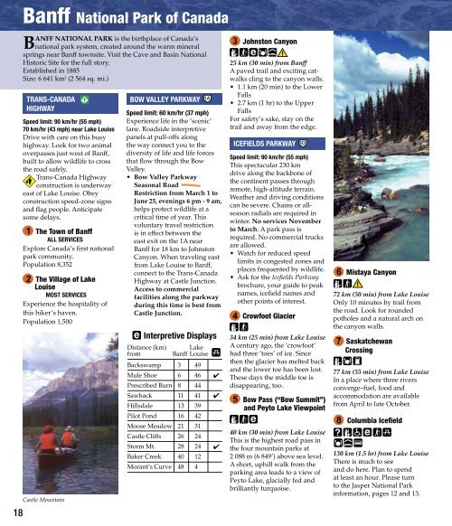
Castle Mountain<br />
BOW VALLEY PARKWAY<br />
Speed limit: 60 km/hr (37 mph)<br />
Experience life in the ‘scenic’<br />
lane. Roadside interpretive<br />
panels at pull-offs along<br />
the way connect you to the<br />
diversity of life and life forces<br />
that flow through the Bow<br />
Valley.<br />
• Bow Valley Parkway<br />
Seasonal Road<br />
Restriction from March 1 to<br />
June 25, evenings 6 pm - 9 am,<br />
helps protect wildlife at a<br />
critical time of year. This<br />
voluntary travel restriction<br />
is in effect between the<br />
east exit on the 1A near<br />
<strong>Banff</strong> for 18 km to Johnston<br />
Canyon. When traveling east<br />
from Lake Louise to <strong>Banff</strong>,<br />
connect to the Trans-Canada<br />
Highway at Castle Junction.<br />
Access to commercial<br />
facilities along the parkway<br />
during this time is best from<br />
Castle Junction.<br />
Interpretive Displays<br />
Distance (km)<br />
from<br />
Lake<br />
<strong>Banff</strong> Louise<br />
Backswamp 3 49<br />
Mule Shoe 6 46<br />
Prescribed Burn 8 44<br />
Sawback 11 41<br />
Hillsdale 13 39<br />
Pilot Pond 16 42<br />
Moose Meadow 21 31<br />
Castle Cliffs 26 24<br />
Storm Mt. 28 24<br />
Baker Creek 40 12<br />
Morant’s Curve 48 4<br />
3<br />
Johnston Canyon<br />
25 km (30 min) from <strong>Banff</strong><br />
A paved trail and exciting catwalks<br />
cling to the canyon walls.<br />
• 1.1 km (20 min) to the Lower<br />
Falls<br />
• 2.7 km (1 hr) to the Upper<br />
Falls<br />
For safety’s sake, stay on the<br />
trail and away from the edge.<br />
ICEFIELDS PARKWAY<br />
Speed limit: 90 km/hr (55 mph)<br />
This spectacular 230 km<br />
drive along the backbone of<br />
the continent passes through<br />
remote, high-altitude terrain.<br />
Weather and driving conditions<br />
can be severe. Chains or allseason<br />
radials are required in<br />
winter. No services November<br />
to March. A park pass is<br />
required. No commercial trucks<br />
are allowed.<br />
• Watch for reduced speed<br />
limits in congested zones and<br />
places frequented by wildlife.<br />
• Ask for the Icefields Parkway<br />
brochure, your guide to peak<br />
names, icefield names and<br />
other points of interest.<br />
4<br />
Crowfoot Glacier<br />
34 km (25 min) from Lake Louise<br />
A century ago, the ‘crowfoot’<br />
had three ‘toes’ of ice. Since<br />
then the glacier has melted back<br />
and the lower toe has been lost.<br />
These days the middle toe is<br />
disappearing, too.<br />
5<br />
Bow Pass (“Bow Summit”)<br />
and Peyto Lake Viewpoint<br />
40 km (30 min) from Lake Louise<br />
This is the highest road pass in<br />
the four mountain parks at<br />
2 088 m (6 849’) above sea level.<br />
A short, uphill walk from the<br />
parking area leads to a view of<br />
Peyto Lake, glacially fed and<br />
brilliantly turquoise.<br />
6<br />
Mistaya Canyon<br />
72 km (50 min) from Lake Louise<br />
Only 10 minutes by trail from<br />
the road. Look for rounded<br />
potholes and a natural arch on<br />
the canyon walls.<br />
7<br />
Saskatchewan<br />
Crossing<br />
77 km (55 min) from Lake Louise<br />
In a place where three rivers<br />
converge–fuel, food and<br />
accommodation are available<br />
from April to late October.<br />
8<br />
Columbia Icefield<br />
130 km (1.5 hr) from Lake Louise<br />
There is much to see<br />
and do here. Plan to spend<br />
at least an hour. Please turn<br />
to the Jasper National Park<br />
information, pages 12 and 13.