Gulfport SmartCode - Mississippi Renewal
Gulfport SmartCode - Mississippi Renewal
Gulfport SmartCode - Mississippi Renewal

Create successful ePaper yourself
Turn your PDF publications into a flip-book with our unique Google optimized e-Paper software.
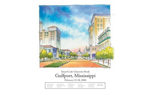
<strong>SmartCode</strong> Charrette Book<br />
<strong>Gulfport</strong>, <strong>Mississippi</strong><br />
February 23-28, 2006<br />
Robert Alminana<br />
Oliver Kuehne<br />
Susan Poliwka<br />
Christopher Ross<br />
Joanna Alimanestianu<br />
Jeff Bounds<br />
DeWayne Carver<br />
Anne Daigle<br />
Victor Deupi<br />
Laura Hall<br />
Susan Henderson<br />
Josie Holden<br />
Knight Martorell<br />
Johnny Olsen<br />
Christian Preus<br />
Sandy Sorlien<br />
William Wright
Acknowledgements:<br />
Contents<br />
THE DESIGN TEAM:<br />
Robert Alminana, Project Director, HDR<br />
Victor Deupi, Institute of Classical Architecture<br />
Oliver Kuehne, HDR<br />
Laura Hall, Fisher and Hall Urban Design<br />
Susan Poliwka, HDR<br />
Susan Henderson, Placemakers<br />
Christopher Ross, HDR<br />
Josie Holden, Architect<br />
Debra Hempel, Charrette Coordinator<br />
Knight Martorell, Architect<br />
Joanna Alimanestianu, Architect<br />
Johnny Olsen, Guild Hardy Architects<br />
Jeff Bounds, <strong>Gulfport</strong> volunteer<br />
Christian Preus, Landscape Architect<br />
DeWayne Carver, Hall Planning & Engineering<br />
Sandy Sorlien, Smart Code writer<br />
Anne Daigle, Planner<br />
William Wright, Balch and Bingham, LLP<br />
SPECIAL THANKS TO:<br />
The Honorable Brent Warr, Mayor, City of <strong>Gulfport</strong>, and Laura Warr<br />
<strong>Gulfport</strong> City Councilman Gary Hollimon, Ward 1<br />
<strong>Gulfport</strong> City Councilwoman Libby Milner Roland, Ward 2<br />
<strong>Gulfport</strong> City Councilwoman Ella Holmes-Hines, Ward 3<br />
<strong>Gulfport</strong> City Councilman Jackie Smith, Ward 4<br />
<strong>Gulfport</strong> City Councilman Brian Carriere, Ward 5<br />
<strong>Gulfport</strong> City Councilman Neil Resh, Ward 6<br />
<strong>Gulfport</strong> City Council President Barbara Nalley, Ward 7<br />
City of <strong>Gulfport</strong> staff: David Nichols, Chief Administration Officer; George Carbo, Director of Urban Development;<br />
Bob Sutton, Director of Economic Development; Harry Hewes, City Attorney; Ray Eaton, Planning Administrator;<br />
Tyrus Cohan, GIS Manager; Rebecca Kajdan, Kelly Jakubik, and Sandy Hill, Mayor’s Office.<br />
President Dr Willis Lott and Vice-Chancellor Dr Regie Sykes, <strong>Mississippi</strong> Gulf Coast Community College.<br />
And the many other officals, neighbors, citizens, and architects who participated in the preparation of these plans.<br />
1. Background<br />
2. The <strong>SmartCode</strong> Charrette<br />
3. Architectural Precedents<br />
4. Public Space: Improved Connectivity & Parks and Open Spaces<br />
5. Jones Park<br />
6. The Port and Downtown<br />
7. The Port<br />
8. Casinos<br />
9. The Downtown<br />
10. The West Side<br />
11. The East Side<br />
12. Historic Neighborhoods<br />
13. Soria City Cottage Court<br />
This document was prepared by Robert Alminana and Susan Poliwka of HDR|Town Planning with assistance from members of the Design Team.<br />
2<br />
<strong>SmartCode</strong> Charrette Book • <strong>Gulfport</strong>, <strong>Mississippi</strong> • February 2006
Background<br />
Background<br />
August 29, 2005:<br />
Hurrican Katrina hits the <strong>Mississippi</strong> Gulf Coast<br />
October 11-17, 2005:<br />
The Governor’s Commission on Recovery, Rebuilding and <strong>Renewal</strong> and the<br />
Congress for the New Urbanism (CNU) organize the <strong>Mississippi</strong> <strong>Renewal</strong> Forum<br />
in Biloxi.<br />
December 1, 2005:<br />
January 19-20, 2006:<br />
Robert Alminana of HDR presents the <strong>Gulfport</strong> report to the community at St<br />
Joseph’s Church in Orange Grove.<br />
HDR facilitates a public downtown revitalization workshop sponsored by the<br />
City and the <strong>Gulfport</strong> Downtown Association.<br />
Katrina’s destruction on <strong>Gulfport</strong>’s West Side<br />
<strong>Gulfport</strong> Harbor Master’s Station<br />
February 23-28, 2006:<br />
Our effort culminates with the 6-day <strong>SmartCode</strong> charrette.<br />
This series of Post-Katrina events was aimed at helping the community:<br />
1. Recover from and seize the opportunity created by the devastation;<br />
2. Help citizens, community leaders, homeowners, property owners, and developers rebuild better<br />
than before Katrina.<br />
Miss. <strong>Renewal</strong> Forum Team Leaders in Biloxi, Oct 05<br />
Governor Haley Barbour addressing the Forum<br />
<strong>SmartCode</strong> Charrette Book • <strong>Gulfport</strong>, <strong>Mississippi</strong> • February 2006<br />
<br />
<br />
<br />
<br />
<br />
<br />
<br />
<br />
<br />
<br />
<br />
<br />
<br />
<br />
<br />
<br />
<br />
<br />
<br />
<br />
<br />
<br />
<strong>Gulfport</strong> Report presented to the <strong>Gulfport</strong> Community on<br />
<br />
<br />
Dec 1, 2005<br />
3
The <strong>SmartCode</strong> Charrette<br />
The <strong>SmartCode</strong> Charrette Objectives<br />
• To offer direct and immediate help to the homeowners in deciding whether to rebuild<br />
their damaged or destroyed properties and how best to do it.<br />
• To listen to citizens, community leaders and elected officials over and over again, to<br />
hear what they have to say about their future.<br />
• To publicly present and discuss ideas about the planning of the city.<br />
• To offer some of the tools that will help <strong>Gulfport</strong> achieve a balanced development in a<br />
beautiful and prosperous environment.<br />
• To help the community and its leaders prepare an updated urban development code<br />
in the form of a calibrated <strong>SmartCode</strong>.<br />
• To help implement the visions and recommendations of ongoing planning efforts.<br />
The <strong>SmartCode</strong> Charrette significantly relied and built on the work accomplished during the<br />
October 2005 Rebuilding Charrette (refer to the Redevelopment Master Plan Charrette Book<br />
for the <strong>Gulfport</strong>, MS of October 31, 2005).<br />
Opening Presentation<br />
Designers on Bus Tour with Mayor Warr<br />
Design Pin-up and Public Review<br />
Designers at work in the Studio<br />
House Planning Asisstance Day<br />
House Planning Assistance Day<br />
4<br />
<strong>SmartCode</strong> Charrette Book • <strong>Gulfport</strong>, <strong>Mississippi</strong> • February 2006
Local Architectural Precedents<br />
Great Southern Hotel, <strong>Gulfport</strong> - 1900’s<br />
Pine Hill Hotel on the Bay, Harrison County<br />
Hotel Galvez, Galveston, TX<br />
Great Southern Hotel, <strong>Gulfport</strong> - 1900’s<br />
Pine Hill Hotel on the Bay, Harrison County<br />
Silvey’s Apartments and Cottage, <strong>Gulfport</strong> - 1920’s<br />
<strong>SmartCode</strong> Charrette Book • <strong>Gulfport</strong>, <strong>Mississippi</strong> • February 2006<br />
5
General Urban and Architectural Precedents<br />
Hotel in Cannes, France<br />
Casino - Monte Carlo<br />
Port of Nice, France<br />
Hotel in Cannes, France<br />
Casino - Monte Carlo<br />
Port of Nice, France<br />
Hotels and Residential Buildings in Cannes, France<br />
Casino - Monte Carlo<br />
Port of Nice, France<br />
6<br />
<strong>SmartCode</strong> Charrette Book • <strong>Gulfport</strong>, <strong>Mississippi</strong> • February 2006
<strong>SmartCode</strong><br />
What <strong>SmartCode</strong> does:<br />
- Smartcode makes <strong>Gulfport</strong>’s existing type of traditional neighborhoods legal to<br />
build on new sites.<br />
- Smartcode enables the future vision and preserves and restores the past character<br />
of such neighborhoods.<br />
S<br />
M A R T<br />
C<br />
O D E<br />
T1<br />
- Smartcode enables sustainable plans for future development to accomplish the<br />
infilling of sprawl areas and hurricane-damaged areas while retaining local<br />
character.<br />
- Smartcode protects the natural beauty of the area by keeping development<br />
compact.<br />
T2<br />
- Smartcode reduces the infrastructure costs of growth to <strong>Gulfport</strong> by encouraging<br />
more compact development.<br />
T3<br />
- Smartcode reduces congestion and driving time by moving ordinary destinations<br />
closer to where people live and by using street networks to move traffic rather<br />
than single arterial roads.<br />
T4<br />
- Smartcode benefits both residents and developers because it lets both parties<br />
know what is expected and what to expect. The forms of building are specified<br />
at time of adoption, and so long as developers are willing to develop according<br />
to the residents’ vision, they may proceed quickly and without costly delays and<br />
uncertainty.<br />
T5<br />
- Smartcode reduces acrimony and improves fairness of the development process<br />
by reducing variances and appeals, providing a better outcome and greater<br />
community harmony.<br />
T6<br />
- Smartcode makes it possible for growth to improve the quality of life rather than<br />
degrade it.<br />
- Smartcode results in streets and development which improve property values<br />
rather than reducing them.<br />
- Provides a diversity of living options for residents on the Coast by keeping rural and<br />
sub-urban areas peaceful and keeping urban areas lively.<br />
City of <strong>Gulfport</strong>, <strong>Mississippi</strong><br />
DRAFT 03-06-06 - Subject to review and approval of City Attorney,<br />
Planning Commission and Mayor and City Council<br />
7<br />
<strong>SmartCode</strong> Charrette Book • <strong>Gulfport</strong>, <strong>Mississippi</strong> • February 2006
<strong>SmartCode</strong><br />
Code Calibration performed at the Charrette:<br />
- We addressed questions and concerns about <strong>SmartCode</strong> in public/official meetings.<br />
- We customized the <strong>SmartCode</strong> for <strong>Gulfport</strong> character such as its stunning natural beauty and historic urban form.<br />
- We calibrated metrics of setbacks, height, lot widths, etc.<br />
- We mapped the T-zones city-wide, working with Mayor, City Council, city planners, and citizens.<br />
- We set aside the current Special Districts (current Industrial zones) such as the airport, the sites along<br />
- We suggested a Restoration District associated with architectural standards/special requirements.<br />
- We correlated the code to the regulating plan to make the plan operational.<br />
- We legally connected the code to <strong>Gulfport</strong> regulations and named authorities for plan review and variance/warrant<br />
procedures in <strong>Gulfport</strong>.<br />
Recommendations:<br />
1. We recommend that the calibrated <strong>SmartCode</strong> be adopted as an optional overlay throughout the City, side by side<br />
with the existing Zoning Code. We believe that when offered a choice, developers and citizens will quickly realize that<br />
using the <strong>SmartCode</strong> is simpler and more predictable, therefore safer for their applications or their neighborhoods.<br />
2. With the support of Mayor Warr and Councilwoman Libby Roland, we also recommend that the calibrated<br />
<strong>SmartCode</strong> be made mandatory in the Downtown south of the tracks.<br />
3. We recommend a Design Review Process:<br />
Architectural design review assures a level of quality, predictability, and therefore value, as does the <strong>SmartCode</strong>.<br />
Design review is recommended for strategic areas like T5, T6, and Historic Preservation or Restoration Districts.<br />
Developers and potential homeowners are more likely to invest if they can be reasonably sure of the development<br />
that will follow. A city may have an excellent plan and superb zoning ordinances, but without an official design review<br />
process, the built environment remains somewhat unpredictable.<br />
Three options exist for design review that will assure the City of <strong>Gulfport</strong> of predictable, quality design:<br />
A. Hire a Town Architect as a member of the Planning Department to perform reviews on an as-needed basis.<br />
B. Form a Design Review Board (DRB) composed of a cross-section of local design and development<br />
professionals and City staff. The DRB would meet biweekly or monthly to review plans.<br />
C. Contract with a remote Town Architect or Design Reviewer who visits <strong>Gulfport</strong> monthly for personal plan<br />
review with owners, builders, developers, and City Staff<br />
Examples of buildings and streetscapes illustrating the character and beauty of <strong>Gulfport</strong>, used ofr calibrating the <strong>SmartCode</strong><br />
8<br />
<strong>SmartCode</strong> Charrette Book • <strong>Gulfport</strong>, <strong>Mississippi</strong> • February 2006
Improved Connectivity<br />
Public Parks & Open Spaces<br />
Additional connectivity is needed both to facilitate movement within the city and<br />
to provide for several unique situations such as the movement of large quantities<br />
of freight to and from the Port in the least disruptive manner. It is also required to<br />
improve the local as well as regional south-north movement. Additional connectivity<br />
could be achieved by adding new sections of roads (orange lines) and enlarging<br />
portions of existing ones (brown lines).<br />
The proposed plan shows the existing parks, the proposed parks, and links between<br />
the parks and the communities. The network is a system of loops that make it feasible<br />
for a person to bike or walk continuously and end up where they began, on a large<br />
or small scale.<br />
Note: This Page edited from the December 2005 <strong>Mississippi</strong> <strong>Renewal</strong> Forum Charrette Report<br />
<strong>SmartCode</strong> Charrette Book • <strong>Gulfport</strong>, <strong>Mississippi</strong> • February 2006<br />
10
Jones Park<br />
Jones Park is the little engine that has never made it up the<br />
hill. It has been over-loved and underutilized for years. Family<br />
reunions, carnivals, overflow parking and school picnics have<br />
abused what should be the “Central Park” of the coast. With<br />
no hierarchy of or defined public spaces, park goers are<br />
overwhelmed by the scale of the facility and feel no intimacy with<br />
the land.<br />
The proposed design for Jones Park defines functional areas<br />
that will facilitate multiple uses. By minimizing the amount<br />
of impervious surfaces and managing stormwater in an<br />
environmentally holistic way, the park will be a model for future<br />
development along the coast. The ultimate goal for the space<br />
is to create a family-friendly park that meshes with surrounding<br />
development, while making a visual statement from Beach<br />
Boulevard.<br />
The following list explains the amenities in and associated with<br />
the park:<br />
The Horticultural Gardens will educate locals and tourists about<br />
the rich coastal landscape, and provide a meeting space for avid<br />
gardeners.<br />
The Veteran’s Memorial is located for visibility from the road<br />
as well as accessibility from the park. The local chapter of the<br />
Veteran’s of Foreign Wars will update the monument to honor our<br />
fallen heroes.<br />
The Pavilions will play an important role in bringing this large<br />
area to a human scale. These outdoor rooms will provide<br />
shade for picnics and people-watching as well as house public<br />
restrooms.<br />
The Amphitheater will be a regional attraction. With the<br />
harbor as stage backdrop, concert goers will take in a beautiful<br />
view while listening to “Jazz in the Park”, watching a community<br />
performance, or just watching the boats come in.<br />
The Community Lawn will provide several functional uses while<br />
framing the view of the <strong>Gulfport</strong> Harbor from Beach Boulevard.<br />
1. Open Space for free-play: Frisbee, Football, or Picnicking.<br />
2. Parade Ground for “Cruisin’ the Coast”: Reinforcing the lawn<br />
with a subsurface cell system will create an annual display area<br />
for the antique cars that have become a beloved tradition. The<br />
nine foot wide concrete walking track around the lawn will serve<br />
as a “Parade Loop” for the participants.<br />
3. Friday Night Flicks: The lawn will become a “Walk-in” Theater<br />
on Friday nights during the summer. Families will bring their<br />
blankets and chairs to the lawn to watch family movies on a<br />
screen in front of the harbor. Local snow cone vendors, hotdog<br />
First Jones Park Design from October 2005 Charrette<br />
stands, and popcorn and cotton candy makers will pay a fee to the<br />
Parks Commission to enter the park and serve goods to the people to<br />
create a fun atmosphere for everyone.<br />
The Fountain located in the center of the lawn will serve as a focal<br />
point from all angles of the lawn as well as from Beach Boulevard.<br />
The Children’s Play Area adjacent to the lawn will include<br />
playground equipment and interactive fountains, and benches for<br />
supervising parents.<br />
The Fisherman’s Village in the northeast corner of the harbor,<br />
centered around the relocated Ship Island Ferry Dock, will create<br />
a harbor haven for tourists and local fishermen and boaters. It will<br />
include a bait shop, fish market, deli, and other small retail shops.<br />
Fishing Rodeo Pavilions will be located around a traffic circle in<br />
the main entrance to the park. These four pavilions will host the<br />
annual Deep Sea Fishing Rodeo and accommodate vendors for the<br />
event. The “circle” will have a platform for the display of the trophy<br />
fish. When this area is not being used for events such as the Rodeo,<br />
Jones Park Design updated in February 2006<br />
the pavilions can be rented by the public for birthday parties, family reunions, or<br />
other public uses.<br />
Park Maintenance<br />
Although this is not an amenity, it is imperative that the park be maintained on<br />
a consistent basis. A maintenance plan will need to be structured and followed.<br />
The design confines lawn areas to eliminate any confusion on what should and<br />
shouldn’t be mowed.<br />
Fredrick Law Olmsted, the father of landscape architecture, once said, “such<br />
public grounds, are a necessity for civilized urban living.” A new Jones Park is<br />
such a necessity for the New Gulf Coast.<br />
11<br />
<strong>SmartCode</strong> Charrette Book • <strong>Gulfport</strong>, <strong>Mississippi</strong> • February 2006
36th Ave<br />
33rd Ave<br />
30th Ave<br />
30th Ave<br />
Broadway<br />
Broadway<br />
23th Ave<br />
20th Ave<br />
The Port & the Downtown<br />
North Broadway<br />
(25th Avenue)<br />
Downtown<br />
15th St<br />
14th St<br />
Old Oasis Casino Area<br />
13th St<br />
Beach Boulevard<br />
27th Ave<br />
20th Ave<br />
11th St<br />
Jones Parkway<br />
Marina/Harbor<br />
Beach Boulevard<br />
existing buildings<br />
proposed buildings<br />
The Downtown and the Port of <strong>Gulfport</strong> are envisioned<br />
as the two halves of one strong, vibrant and memorable<br />
heart of <strong>Gulfport</strong>. They reinforce each other, knitting<br />
together a fabric that draws on the economic strength<br />
generated by the port, the business and cultural intensity<br />
of the downtown, the beauty of the beach and the new<br />
Jones Park, and all of the amenities and entertainment<br />
opportunities associated with the new heart of <strong>Gulfport</strong>.<br />
Port/Cruise District<br />
12<br />
<strong>SmartCode</strong> Charrette Book • <strong>Gulfport</strong>, <strong>Mississippi</strong> • February 2006
The Port & the Downtown<br />
1<br />
Redesign 25th Avenue<br />
10<br />
9<br />
7<br />
1 8<br />
4<br />
11<br />
2<br />
3<br />
4<br />
5<br />
6<br />
Gateway to Port<br />
Ferry Terminal<br />
Redesign Beach Boulevard<br />
Jones Park<br />
30th Avenue Truck Boulevard<br />
6<br />
2<br />
5<br />
3<br />
7<br />
13th Street Redesign<br />
8<br />
23rd Avenue Enhancement<br />
14<br />
9<br />
10<br />
Culture and Arts District<br />
New Townhouses<br />
13<br />
11<br />
Downtown Hotel(s)<br />
9<br />
9<br />
10<br />
7<br />
6<br />
1 8<br />
11<br />
14<br />
4<br />
2<br />
1<br />
2<br />
Redesign 25th Avenue<br />
Gateway 5 to Port 3<br />
1 8<br />
12<br />
11<br />
4<br />
1 Redesign 25th Avenue<br />
2 2<br />
3<br />
5<br />
Gateway to Port<br />
Ferry Terminal<br />
3<br />
4<br />
5<br />
6<br />
7<br />
Redesign Beach Boulevard<br />
Jones Park<br />
30th Avenue 13 Truck Boulevard<br />
13th Street Redesign<br />
15<br />
1<br />
2<br />
3<br />
4<br />
5<br />
6<br />
7<br />
8<br />
9<br />
10<br />
11<br />
12<br />
Redesign 25th Avenue<br />
Gateway to Port<br />
Ferry Terminal<br />
Redesign Beach Boulevard<br />
Jones Park<br />
30th Avenue Truck Boulevard<br />
13th Street Redesign<br />
23rd Avenue Enhancement<br />
Culture and Arts District<br />
New Townhouses<br />
Downtown Hotel(s)<br />
Cruise Terminal<br />
12 Cruise Terminal<br />
13 Small Craft Harbor<br />
14 Mixed Use: Residential / Commercial / Retail<br />
15 Palace Hotel<br />
View of Downtown through Jones Park: New Hotels on old 1st Baptist Church site - by Knight Martorell<br />
3<br />
Ferry Terminal<br />
8<br />
23rd Avenue Enhancement<br />
13<br />
Small Craft Harbor<br />
14<br />
3<br />
4 Redesign Beach Boulevard 12 9 Culture and Arts District<br />
5 Jones Park<br />
10 New Townhouses<br />
15<br />
6 30th Avenue 13 Truck Boulevard 11 Downtown Hotel(s)<br />
7 13th Street Redesign<br />
12 Cruise Terminal<br />
<strong>SmartCode</strong> Charrette Book • <strong>Gulfport</strong>, <strong>Mississippi</strong> • February 2006<br />
8 23rd Avenue Enhancement 13 Small Craft Harbor<br />
14 Mixed Use: Residential / Commercial / Retail<br />
15 Palace Hotel<br />
13
The Port of <strong>Gulfport</strong><br />
The Vision<br />
The Port of <strong>Gulfport</strong> is envisioned as an extension of Downtown <strong>Gulfport</strong>, South<br />
of Beach Boulevard, destined to thrive on its unique character as well as reinforce<br />
and complement the Downtown. The Port and the Downtown together will be the<br />
engine that will distinguish <strong>Gulfport</strong> as an important regional and State center.<br />
Jones Park: improved access and circulation, passive green<br />
space with amphitheater and horticulture gardens.<br />
20th Ave<br />
Broadway<br />
Reconfigure the East Pier to improve pedestrian and vehicle<br />
access and parking. Provide retail uses, boat launch facility,<br />
ferry terminal, marina, fishing, mooring for visiting boats,<br />
as well as ample parking for vehicles and boat trailers.<br />
Encourage residential “Citadel” development along end of<br />
pier.<br />
30th Ave<br />
Enlarge West Pier for added Port capacity. Rail access would be<br />
re-routed for entry at 30th Avenue, which would become the main<br />
access point, at grade, for freight and commercial truck traffic as well.<br />
Enlarge the Central Pier for added Port capacity accessible for trucks. Develop<br />
north Port into a mixed-use street and block pattern for casinos, hotels and related<br />
buildings. Address FEMA ABFE requirements with structured parking stacked with<br />
development above, and raised streets. Strengthen area as tourist destination<br />
with Aquarium and cruise ship terminal.<br />
14<br />
<strong>SmartCode</strong> Charrette Book • <strong>Gulfport</strong>, <strong>Mississippi</strong> • February 2006
The Port of <strong>Gulfport</strong><br />
Port Promenade: Typical<br />
Typical Port Village Street<br />
Beach Boulevard<br />
Broadway<br />
30th Avenue Truck Route<br />
Jones Parkway<br />
Harbor Way<br />
Palace Parkway<br />
Port Village Promenade<br />
Rail<br />
Typical Port Village Street<br />
Beach Boulevard<br />
Broadway<br />
30th Avenue Truck Route<br />
Port Promenade at Cruise Terminal<br />
Jones Parkway<br />
Harbor Way<br />
Palace Parkway<br />
Port Village Promenade<br />
Rail<br />
Proposed Circulation Plan and Street Typology<br />
Due to the FEMA Advisory Base Flood Elevations (ABFE), development in the Port Area will have to be raised<br />
above sea level. ABFEs for the area can be accomodated by building parking for the development below,<br />
with raised streets to maintain active uses at the ground level.<br />
Port Village: Typical<br />
15<br />
<strong>SmartCode</strong> Charrette Book • <strong>Gulfport</strong>, <strong>Mississippi</strong> • February 2006
The Port of <strong>Gulfport</strong><br />
Initial Design from October 2005 <strong>Renewal</strong> Charrette<br />
Bird’s Eye View Illustrating a detail of the Vision for the Port of <strong>Gulfport</strong> - by Knight Martorell<br />
16<br />
<strong>SmartCode</strong> Charrette Book • <strong>Gulfport</strong>, <strong>Mississippi</strong> • February 2006
Casinos<br />
Casino on the water’s edge - by Michael Imber<br />
Casino - Grand Hotel - by Michael Imber<br />
Casino and Residential Towers - by Marianne Cusato<br />
Note: This page has been edited from its corresponding section in the December 2005 <strong>Mississippi</strong> <strong>Renewal</strong> Forum Charrette Report.<br />
<strong>SmartCode</strong> Charrette Book • <strong>Gulfport</strong>, <strong>Mississippi</strong> • February 2006<br />
17
Downtown<br />
A View of Broadway Looking South Towards the Port - by Knight Martorell<br />
<strong>SmartCode</strong> Charrette Book • <strong>Gulfport</strong>, <strong>Mississippi</strong> • February 2006<br />
18
Downtown<br />
30th Avenue: Mixed-use boulevard functions<br />
as primary truck route to and from the port<br />
and accommodates multi-family residential<br />
and various commercial uses. 30th Avenue<br />
stays at-grade from the Port to meet the<br />
proposed elevated I-10 connector north of<br />
the urbanized area.<br />
13th Street: Broad Boulevard with planted<br />
median, lined with a mix of civic, commercial<br />
and residential buildings; larger blocks to the<br />
south might accommodate performing arts<br />
center<br />
30th Avenue<br />
Broadway<br />
23rd Avenue<br />
14th Street<br />
13th Street<br />
15th Street<br />
20th Avenue<br />
15th Street: important eastern<br />
gateway into the downtown;<br />
civic focus with existing city hall,<br />
courthouse, and church.<br />
14th Street: Central pedestrian-friendly main street:<br />
character changes from civic focus around 21st Ave to<br />
retail focus around the 25th Ave and entertainment<br />
focus around 27th Ave. It is terminated to the east with<br />
the library and a new proposed square.<br />
27th Avenue<br />
Beach Boulevard<br />
23rd Avenue: Mixed-use boulevard, accommodates<br />
higher density residential as well as civic and some<br />
commercial uses.<br />
existing buildings<br />
proposed buildings<br />
Broadway (25th Ave): Pedestrian-friendly mixed-use retail main<br />
street, tall buildings at Beach Blvd from southern gateway into<br />
downtown and the new harbor district<br />
Proposed Plan of Downtown <strong>Gulfport</strong><br />
19<br />
<strong>SmartCode</strong> Charrette Book • <strong>Gulfport</strong>, <strong>Mississippi</strong> • February 2006
Downtown - Streets<br />
14th Street: Existing Condition<br />
14th Street Typical Proposed Street Section<br />
13th Street: Existing Condition<br />
13th Street Typical Proposed Street Section<br />
20<br />
<strong>SmartCode</strong> Charrette Book • <strong>Gulfport</strong>, <strong>Mississippi</strong> • February 2006
Downtown - Streets<br />
30th Avenue: Existing Conditions<br />
30th Avenue Proposed Street Section<br />
Broadway Avenue: Existing Conditions<br />
Broadway Avenue: Proposed Street Section<br />
21<br />
<strong>SmartCode</strong> Charrette Book • <strong>Gulfport</strong>, <strong>Mississippi</strong> • February 2006
Downtown - Train Depot<br />
Proposed Strategy for Downtown Train Depot<br />
Create a heart for the proposed downtown Culture and<br />
Arts District: form new plaza at existing train depot<br />
parking lot at 27th Ave between 13th and 14th Street for<br />
outdoor markets, concerts, etc.<br />
13th Street<br />
27th Avenue<br />
14th Street<br />
Rendering by Knight Martorell<br />
Plan<br />
<strong>SmartCode</strong> Charrette Book • <strong>Gulfport</strong>, <strong>Mississippi</strong> • February 2006<br />
Section<br />
22
36th Ave<br />
33rd Ave<br />
30th Ave<br />
30th Ave<br />
1<br />
Eastern and Northern Downtown<br />
Broadway Broadway<br />
13th St<br />
27th Ave<br />
Beach Boul<br />
Pass Road<br />
11th St<br />
Broadway<br />
Beach Boulevard<br />
Northern edge of Downtown at 25th St/Pass Road<br />
Western Edge of Downtown<br />
Northern Downtown:<br />
o 25th St/Pass Road: a mix of commercial and residential buildings with activity<br />
“nodes” at key intersections:<br />
o 17th St: important connector to western neighborhoods<br />
o 19th St: local east-west route; eastern terminus is Soria City School<br />
o Pass Road: Key east-west route; existing commercial corridor presents a<br />
development opportunity for campus like business or institutional use<br />
o 28th St: Northern gateway into downtown: beginning of palm trees in wide<br />
median.<br />
Old Oasis Casino Area<br />
o Site lined with row houses along 11th St and 37th Ave to transition to adjacent single-family<br />
neighborhood<br />
o New buildings fronting Beach Boulevard.<br />
o Height limited at western edge forming transition to single family residential.<br />
o Height builds toward the east.<br />
o New residential development.<br />
23<br />
<strong>SmartCode</strong> Charrette Book • <strong>Gulfport</strong>, <strong>Mississippi</strong> • February 2006
The West Side<br />
Broad Avenue - North - South Transect<br />
These neighborhoods, lying west of the Downtown and<br />
between the beach and the CSX Railroad, were hit very hard<br />
by Katrina. In most of this area, the first block or two nearest<br />
the shore were completely destroyed, leaving only mature<br />
trees and building foundations. The next block or two north<br />
of this destruction were also badly damaged, by water, wind<br />
and debris pushed from the shoreline blocks.<br />
The preliminary flood surface elevation maps for West Beach<br />
include new, higher elevations for habitable floors in much<br />
of the frontage along Beach Boulevard. Not coincidentally,<br />
the destruction was generally greatest in these new areas<br />
mapped by FEMA.<br />
West Side Neighborhood Detail<br />
Note: This Page edited from the December 2005 <strong>Mississippi</strong> <strong>Renewal</strong> Forum Charrette Report<br />
24<br />
<strong>SmartCode</strong> Charrette Book • <strong>Gulfport</strong>, <strong>Mississippi</strong> • February 2006
The East Side<br />
V.A.<br />
Hospital<br />
Tegarden<br />
Road<br />
Cowan<br />
Road<br />
East Side: Areas of Intervention<br />
View of Proposed Condominiums at Tegarden Plaza at East Beach Boulevard - by Victor Deupi<br />
25<br />
<strong>SmartCode</strong> Charrette Book • <strong>Gulfport</strong>, <strong>Mississippi</strong> • February 2006
The <strong>Gulfport</strong> Veterans Administration Hospital campus is an approximately<br />
147-acre site to the west of Courthouse Rd. in <strong>Gulfport</strong>. South to north it<br />
spans from the northern right of way of Beach Blvd (Hwy. 90) over the CSX<br />
railroad tracks to just south of the EC Elementary School. It was already<br />
scheduled to be abandoned by the VA by 2009, and since Hurricane Katrina,<br />
the VA has apparently decided to not re-occupy the site except for a possible<br />
small temporary mobile hospital unit.<br />
The East Side - V.A. Hospital<br />
Based on a cursory look around on 14 October 2005, most of the buildings<br />
appear to have survived Katrina though many have substantial wind and<br />
water damage. The historic chapel lost part of its south wall, the historic<br />
guard house is gone. The buildings adjacent to the coast appear to have<br />
been washed through, though exterior walls are fairly intact. Much of the<br />
Mediterranean detail in the buildings has survived intact and those should<br />
be conserved and reused as quickly as possible to avoid their continued<br />
degradation.<br />
Building Condition, Post-Katrina<br />
Several different possible uses have been suggested, all with the intent to<br />
keep the historic south campus in the public realm. Some <strong>Gulfport</strong> citizens<br />
have suggested the possibility of the campus continuing as a medical facility<br />
with a specific focus of either pediatrics or a clinic facility dedicated to the<br />
needs of retirees. Either would require a hard look at whether it is feasible for<br />
a medical facility, even a clinic, to lie right on the coast line, under threat of<br />
every storm that comes ashore. Others have proposed an educational focus<br />
for the facility. The primary goal is to avoid placing the south campus, with its<br />
picturesque Mediterranean buildings and impressive stand of live oaks, in the<br />
hands of a private developer who might choose to keep the grounds off limits<br />
to the general public.<br />
With the primary goal of preserving and enhancing the historic 1917 buildings<br />
in mind, we suggest that a service entry road be brought in just to the south of<br />
the railroad tracks, on the wide right of way from Hewes Av. to the NW corner<br />
of the site. A parking deck can be sited to be accessible from this road, and all<br />
trucks could serve the site from it as well.<br />
Note: This Page edited from the December 2005 <strong>Mississippi</strong> <strong>Renewal</strong> Forum Charrette Report<br />
<strong>SmartCode</strong> Charrette Book • <strong>Gulfport</strong>, <strong>Mississippi</strong> • February 2006<br />
Site of <strong>Gulfport</strong> V.A. Hospital<br />
26
The East Side : Cowan Road at East Beach Blvd.<br />
Cowan Road at East Beach Boulevard: Proposed Design Strategy<br />
• Establish a traditional neighborhood development with resort amenities along<br />
the waterfront.<br />
• Develop Cowan Road as a mixed-use, retail and commercial boulevard from the<br />
waterfront to the new Railroad Street extension.<br />
• Reconstruct the damaged Fire Station at the intersection of Cowan and Township<br />
Roads, providing greater public presence and a higher architectural standard.<br />
• Line the center aisle of Cowan Road with pavilions, trees, and plantings as<br />
necessary.<br />
• Create a new Residential Square at the intersection of Township Road, and West<br />
Cedar and Laurel Drives.<br />
• Provide a variety of residential types that include estate lots, cottages,<br />
townhouses, live-work units, apartment lofts and condominiums.<br />
• Steadily increase the intensity as the neighborhood approaches the waterfront<br />
with 8-12 storey apartments, hotels and condominiums lining Beach Boulevard.<br />
• Step back the apartments, hotels and condominiums along the waterfront so as<br />
to create a stunning skyline that respects the scale and character of the adjacent<br />
residential neighborhood, without blocking Gulf views from the public realm.<br />
• Create a new Waterfront Green along Beach Boulevard where the apartments,<br />
hotels and condominiums meet the estate lots.<br />
• Provide Cottage Closes at the Waterfront Green and Township Square as a<br />
transition from the urban to the residential.<br />
Neighborhood Plan by Victor Deupi and Johnny Olsen<br />
27<br />
<strong>SmartCode</strong> Charrette Book • <strong>Gulfport</strong>, <strong>Mississippi</strong> • February 2006
The East Side: Cowan Road<br />
Cowan Road Elevation - by Johnny Olsen<br />
Proposed Condominium building at Cowan Rd. and Beach Blvd<br />
by Victor Deupi<br />
Proposed condominium building on Cowan Rd. between Township Road and Beach Blvd<br />
by Victor Deupi<br />
View down Cowan Road - by Victor Deupi<br />
28<br />
<strong>SmartCode</strong> Charrette Book • <strong>Gulfport</strong>, <strong>Mississippi</strong> • February 2006
The East Side: Tegarden Neighborhood Strategy<br />
Tegarden Road at Each Beach Blvd: Proposed Design Strategy<br />
• Establish a traditional neighborhood development with an arts and<br />
entertainment district by the waterfront.<br />
• Create a new waterfront plaza at the intersection of Tegarden Road, 16th<br />
Street and Beach Boulevard.<br />
• Develop Tegarden Road as a mixed-use, retail and commercial corridor from<br />
the waterfront to Railroad Street.<br />
• Create a new Residential Square surrounding the Lynn Meadows Discovery<br />
Center.<br />
• Provide a variety of residential types that include estate lots, cottages,<br />
townhouses, live-work units, apartment lofts and condominiums.<br />
• Steadily increase the intensity as the neighborhood approaches Beach<br />
Boulevard with 8-12 story apartments and condominiums lining the<br />
waterfront plaza.<br />
• Step back the apartment and condominiums along the waterfront to create<br />
a stunning skyline that respects the scale and character of the adjacent<br />
residential neighborhood, without blocking Gulf views from the public<br />
realm.<br />
Neighborhood Plan - by Victor Deupi and Johnny Olsen<br />
29<br />
<strong>SmartCode</strong> Charrette Book • <strong>Gulfport</strong>, <strong>Mississippi</strong> • February 2006
The East Side: Tegarden at East Beach Blvd.<br />
Proposed condominium building at Tegarden and Beach Blvd. - by Victor Deupi<br />
Proposed Pavillion - by Victor Deupi<br />
30<br />
<strong>SmartCode</strong> Charrette Book • <strong>Gulfport</strong>, <strong>Mississippi</strong> • February 2006
Historic Neighborhoods<br />
Turkey Creek<br />
Old North <strong>Gulfport</strong><br />
2nd Street<br />
Soria City<br />
<strong>Gulfport</strong> has many historic neighborhoods, such as the West Side, Gaston Point, Gulf Garden, Park Place, Central <strong>Gulfport</strong>, the Quarters, Soria City, Broadmoor, Second Street, Magnolia<br />
Grove, Hardy Court, Handsboro, <strong>Mississippi</strong> City, Old North <strong>Gulfport</strong>, or Turkey Creek. Many, particularly those near the beach, have been severely, sometimes almost entirely destroyed<br />
by Katrina. The priority is to both rebuild those communities, respecting the traditional patterns of urbanism, and make them even better places than they were, by improving the<br />
infrastructure and bringing them to higher safety standards. The illustrations on this page demonstrate how some of these places could be built or rebuilt.<br />
Note: This Page edited from the December 2005 <strong>Mississippi</strong> <strong>Renewal</strong> Forum Charrette Report<br />
<strong>SmartCode</strong> Charrette Book • <strong>Gulfport</strong>, <strong>Mississippi</strong> • February 2006<br />
31
Soria City Cottage Court<br />
The cottage court is an ideal solution for infill in historic neighborhoods. It provides a dignified solution to affordable housing. This<br />
location is proposed for Soria City at Pratt & 20th, and would add 15 new homes on 2/3 acre or 22 du/acre situated around a small park.<br />
It would work well for other historic neighborhoods such as <strong>Mississippi</strong> City.<br />
Existing Site<br />
Proposed Cottage Court - by Knight Martorell<br />
Proposed Soria City location for a Cottage Court<br />
32<br />
<strong>SmartCode</strong> Charrette Book • <strong>Gulfport</strong>, <strong>Mississippi</strong> • February 2006