Allan James_Geomorphic Continuity - Lower Yuba River Accord
Allan James_Geomorphic Continuity - Lower Yuba River Accord
Allan James_Geomorphic Continuity - Lower Yuba River Accord

Create successful ePaper yourself
Turn your PDF publications into a flip-book with our unique Google optimized e-Paper software.
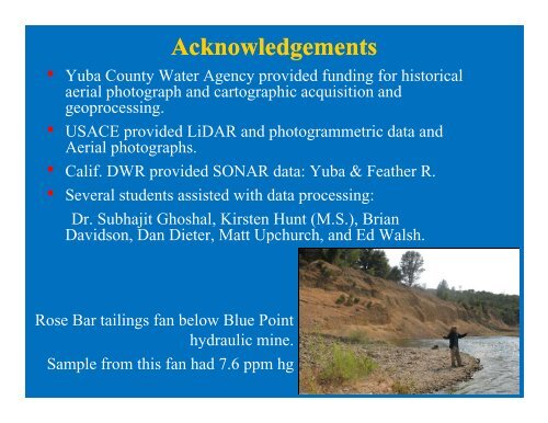
Acknowledgements<br />
• <strong>Yuba</strong> County Water Agency provided funding for historical<br />
aerial photograph and cartographic acquisition and<br />
geoprocessing.<br />
• USACE provided LiDAR and photogrammetric data and<br />
Aerial photographs.<br />
• Calif. DWR provided SONAR data: <strong>Yuba</strong> & Feather R.<br />
• Several students assisted with data processing:<br />
Dr. Subhajit Ghoshal, Kirsten Hunt (M.S.), Brian<br />
Davidson, Dan Dieter, Matt Upchurch, and Ed Walsh.<br />
Rose Bar tailings fan below Blue Point<br />
hydraulic mine.<br />
Sample from this fan had 7.6 ppm hg