PDF Garden City Area Plan - Horry County Government
PDF Garden City Area Plan - Horry County Government
PDF Garden City Area Plan - Horry County Government

You also want an ePaper? Increase the reach of your titles
YUMPU automatically turns print PDFs into web optimized ePapers that Google loves.
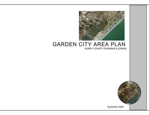
GARDEN CITY AREA PLANHORRY COUNTY PLANNING & ZONINGNovember 2006
Table of ContentsIntroduction to <strong>Area</strong> <strong>Plan</strong>s in <strong>Horry</strong> <strong>County</strong> ……………………………………………………………….page 1The <strong>Garden</strong> <strong>City</strong> <strong>Plan</strong>ning Process …………………………………………………………………………page 1Part 1: Traffic and Circulation ……………………………………………………………………………...page 2Part 2: Parks and Recreation ………………………………………………………………………………..page 5Part 3: Natural Resources and the Environment ……………………………………………………………page 6Part 4:The East Coast Greenway …………………………………………………………………………...page 8Part 5: Public Safety . ……………………………………………………………………………………….page 9Part 6: Stormwater Management ……………………………………………………………………………page 11Part 7: Land Use …………………………………………………………………………………………….page 13T a b l e o f C o n t e n t sCurrent Land Use Map……………………………………………………………………………………….page 18Current Zoning Map …………………………………………………………………………………………page 19Future Land Use Map……………………………………………………………………………………….. page 20Parking and Beach Access Map…………………………………………………………………………….. page 21Part 8: Implementation Tables………………………………………………………………………………..page 22
WHAT ARE AREA PLANS?In an effort to keep pace with the changes that are occurring throughout<strong>Horry</strong> <strong>County</strong>, <strong>County</strong> Council has authorized the creation of area plansfor a number of communities. There are currently two area plans indevelopment, while studies have been completed for three additionalareas of the <strong>County</strong>. Study areas can be added as future growth dictates.<strong>Area</strong> plans are designed to give the community an opportunity todiscuss the direction of growth and development in their area. <strong>Area</strong>plans also allow citizens to make recommendations to <strong>County</strong> Councilon how questions regarding development in their community should beapproached. <strong>Area</strong> plans can be used to cover elements of the <strong>Horry</strong><strong>County</strong> Comprehensive <strong>Plan</strong>, such as the land use element, in greaterdetail; they can also address issues that community members feel areimportant, but are not discussed in the Comprehensive <strong>Plan</strong>.Each committee, set up by the <strong>Horry</strong> <strong>County</strong> <strong>Plan</strong>ning Commission,determines the direction and scope of the plan that they are creating.When the committee has created a working plan it is presented to thecommunity for comment and discussion. The plan can then be revisedand additional comments sought. Once an area plan has been finalizedand accepted by <strong>County</strong> Council, it becomes a component of theComprehensive <strong>Plan</strong> that will be referenced when action are taken thataffect the specified area are taken.THE GARDEN CITY PLANNINGPROCESSAt the request of <strong>Horry</strong> <strong>County</strong> Council the <strong>Plan</strong>ning Commission hasundertaken a study of the <strong>Garden</strong> <strong>City</strong> area and developed a plan toaddress development and other issues. District 5 CouncilRepresentative Howard Barnard III liaised with the Town of SurfsideBeach and Georgetown <strong>County</strong> to ensure that the plan took intoconsideration its links to the wider region and invited representativesfrom both areas to participate on the committee.GARDEN CITY COMMUNITYPLAN COMMITTEEChairman, Pamela Hobeika, <strong>Plan</strong>ning Commission, District 4Ed McMenamin, <strong>Plan</strong>ning Commission, District 5Andy Woodward, <strong>Garden</strong> <strong>City</strong>Jim Allison, <strong>Garden</strong> <strong>City</strong>Howard Gold, <strong>Garden</strong> <strong>City</strong>David Benton, Town of Surfside BeachAl Hitchcock, Murrells Inlet 2007The <strong>Garden</strong> <strong>City</strong> Community <strong>Plan</strong> Committee held ten meetings overthe course of 2005 – 2006 to develop the plan. As the first step in theplanning process a community meeting was held at Seaside ElementarySchool on January 25, 2005. Approximately 125 residents attendedand offered suggestions and advice on a wide range of issues. On thebasis of community input, the committee developed the <strong>Garden</strong> <strong>City</strong>Community <strong>Plan</strong>.The <strong>Garden</strong> <strong>City</strong> study area is roughly bounded by the Town ofSurfside beach to the north, Georgetown <strong>County</strong> to the south, theAtlantic Ocean to the east and Highway 17 Bypass to the west. Thestudy area is approximately 5.5 square miles, with 1.8 miles ofbeachfront. Based on 2000 U.S. Census data the population of the<strong>Garden</strong> <strong>City</strong> area was 9,357.Housing in <strong>Garden</strong> <strong>City</strong> is varied with 2,896 single-family homes,2,209 townhouses, condominiums and apartments, and 2,987 mobilehomes. A significant portion of the housing stock is occupied on a parttime, seasonal basis.The <strong>Garden</strong> <strong>City</strong> Community <strong>Plan</strong> addresses six broad topics:• Traffic and Circulation• Parks and Recreation• Natural Resources and the Environment• The East Coast Greenway• Public Safety• Stormwater Management• Land Useintro<strong>Garden</strong> <strong>City</strong> Community <strong>Plan</strong>1
ISSUE 1.5Parking is in short supply along roads in the beach area, particularlyduring tourist season.STRATEGIES: ✓1. Develop a parking plan for the <strong>Garden</strong> <strong>City</strong> beach area.2. Identify streets connecting to Waccamaw Drive that could supportpaved on-street parking.3. Require that all new parking improvements in the public right-ofwayuse pervious paving materials to limit stormwater impacts.4. Enforce the “No Overnight Parking” ordinance in beach accessareas.ISSUE 1.6Hurricane evacuation routes are insufficient to serve the growingpopulation on the South Strand.STRATEGIES: ✓1. Participate in meetings and engage officials to emphasize need forsouthern evacuation route.2. Work with SCDOT to identify a corridor for a southern evacuationroute.3. Support groups that are lobbying for state and federal funding for asouthern evacuation route.4. Support the efforts of the Southern Evacuation Lifeline TaskForce.ISSUE 1.7Residents are concerned with pedestrian safety along WaccamawDrive.STRATEGIES: ✓1. Request that SCDOT add crosswalks on Waccamaw Drive atbeach access points.2. Provide signage along Waccamaw Drive advising motorists to beaware of pedestrians and cyclists.3. Explore feasibility of constructing the East Coast Greenway alongWaccamaw Drive, providing a dedicated path of sufficient size toaccommodate pedestrian and cyclist traffic.part1Traffic and Circulation4
EXISTING CONDITIONSThe availability of parks and recreation facilities is a key quality-of-lifeissues for any community. <strong>Horry</strong> <strong>County</strong> owns and maintains one parkin the <strong>Garden</strong> <strong>City</strong> area, the Elizabeth Street Park at the intersection ofPine Avenue and Elizabeth Drive. <strong>Horry</strong> <strong>County</strong> is responsible for onepublic boat ramp, the Stanley Drive Boat Landing at Stanley Drive andFirst Avenue.In addition to the park and boat landing, there are opportunities forrecreation at the beach and along the marsh walk. Walking, jogging,swimming and a variety of sports can all be enjoyed along thebeachfront. The marsh walk adjacent to the saltmarsh provides a uniqueopportunity to enjoy physical activity while studying the diversesaltmarsh environment. <strong>Horry</strong> <strong>County</strong> maintains sixteen (16) publicaccess points to the beach along the length of the <strong>Garden</strong> <strong>City</strong>shoreline. The beach and the saltmarsh are exceptional and uniquerecreational and environmental resources that need to be maintainedand protected for use by residents and visitors.ISSUES & STRATEGIESISSUE 2.1Residents have only one small park available in <strong>Garden</strong> <strong>City</strong>.STRATEGIES: ✓1. Explore options for adding additional park space in <strong>Garden</strong> <strong>City</strong>where feasible.2. Work with developers to ensure that any substantial redevelopmentin <strong>Garden</strong> <strong>City</strong> provides an open space/recreation component.3. Spend any “fee in lieu of open space” money collected from newdevelopment in <strong>Garden</strong> <strong>City</strong> within the <strong>Garden</strong> <strong>City</strong> area.4. Research possibility of a special tax district for recreation similarto Socastee.ISSUE 2.2Residents would like to see more organized recreational opportunitiesin the <strong>Garden</strong> <strong>City</strong> area.STRATEGIES: ✓1. Disseminate information concerning Parks and Recreationsponsored events as widely as possible.2. Explore all opportunities to bring recreational andcultural events to the <strong>Garden</strong> <strong>City</strong> community.part2Parks and RecreationCOMMUNITY GOALS• Provide sufficient park space and recreational opportunities for theresidents of <strong>Garden</strong> <strong>City</strong>.5
EXISTING CONDITIONSpart3The most sought-after natural resource in <strong>Garden</strong> <strong>City</strong>, and the reasonso many people want to visit or move permanently to the area, is thebeach. Residents and visitors alike have access to 1.8 miles of white,sandy beach in <strong>Garden</strong> <strong>City</strong>. There are 16 public access pointsmaintained by <strong>Horry</strong> <strong>County</strong>; a number of these access points haveparking associated with them.The saltmarsh that runs from Murrells Inlet in Georgetown <strong>County</strong> into<strong>Horry</strong> <strong>County</strong> is another prime natural resource of significant value toboth residents and visitors. The saltmarsh is a diverse ecological habitatthat provides a home to many different species of fish, crab and shrimp.There is a boardwalk adjacent to Atlantic Avenue that runs across themarsh providing opportunities for visitors to observe the marshenvironment close-up.<strong>Horry</strong> <strong>County</strong> Environmental Services is tasked with the important roleof keeping the beaches and marshes in the unincorporated parts of thecounty clean and free of debris. During the tourist seasonEnvironmental Services cleans the beach and picks up trash on a dailybasis, as well as removes trash along the marsh walk.The health of these ecosystems is of vital importance to the well beingof <strong>Garden</strong> <strong>City</strong>. Maintaining and enhancing the marsh and the beach isvital to the continued economic health of <strong>Garden</strong> <strong>City</strong>, as well as beingimportant to the quality-of-life enjoyed by residents.COMMUNITY GOALS• Protect, maintain and enhance the natural resources that are uniqueto <strong>Garden</strong> <strong>City</strong>.• Recognize and protect the unique environment of the saltmarsh.• Maintain the beach through periodic renourishment efforts.ISSUE 3.1<strong>Garden</strong> <strong>City</strong> residents want to protect and preserve the unique naturalresources that make the area such an enjoyable place to live and visit.STRATEGIES: ✓1. Work with the <strong>Garden</strong> <strong>City</strong> Community Association to form a<strong>Garden</strong> <strong>City</strong> Beautification Committee to organize beach,neighborhood and road right-of-way clean ups andbeautification projects.2. Assist the Community Association in participating inprograms (ex. Adopt a Highway) and applying for grantsthat will provide financial support for these efforts.3. Ensure that the provisions of the <strong>Horry</strong> <strong>County</strong>Landscape, Buffer and Tree Ordinance are enforcedthroughout the <strong>Garden</strong> <strong>City</strong> area.4. Explore the possibility of developing an overlay for<strong>Garden</strong> <strong>City</strong> to better protect key natural assets.Environmental Resources6
ISSUE 3.2<strong>Garden</strong> <strong>City</strong> residents welcome tourists to their community and wouldlike to ensure that these visitors understand the unique environmentwhich they are visiting, the rules of behavior and the repercussions oftheir actions.STRATEGIES: ✓1. Cooperate with the <strong>Garden</strong> <strong>City</strong> Community Association indesigning and posting signage around beach and marsh accessesclarifying rules and effects of pollution on these natural resources.2. Assist the <strong>Garden</strong> <strong>City</strong> Community Association in working withhotels and area rental companies in distributing educationalmaterials on beach rules and the effects of pollution on <strong>Garden</strong><strong>City</strong>’s unique natural resources to their clientele.ISSUE 3.3The beach is central to the economic well being of <strong>Garden</strong> <strong>City</strong>, as wellas a prime recreational resource for community members, and needs tobe properly maintained.STRATEGIES: ✓1. Support efforts to secure funding for periodic beachrenourishment.2. Ensure that <strong>Garden</strong> <strong>City</strong> beaches are regularly examined todetermine periodic maintenance needs.3. Work with Environmental Services to make certain that dailymaintenance needs are met; particular emphasis needs to be placedon trash and debris removal.4. Signage regarding rules and ordinances pertaining to beach useshould be posted conspicuously.ISSUE 3.4Keeping the marsh clean and free of debris is importantto the overall environmental and economic well being of<strong>Garden</strong> <strong>City</strong>.STRATEGIES: ✓part3Environmental Resources1. Work with the <strong>Garden</strong> <strong>City</strong> Community Association,Murrells Inlet 2007 and the Spring Tide: A Day for the Inletvolunteer organization to fund, develop, implement andmonitor programs to keep the marsh free of trash and debris.7
EXISTING CONDITIONSpart4The East Coast Greenway is a multi-use urban trail system extendingfrom Maine to the Florida Keys. <strong>Horry</strong> <strong>County</strong> and Georgetown<strong>County</strong> have a master plan for the Greenway and segments have beeninstalled in Myrtle Beach, North Myrtle Beach and Georgetown<strong>County</strong>.The SCDOT is a strong supporter of bicycle and pedestrian facilitiesand has made them an integral part of current and new projects.Funding is available for Greenway projects through the Grand Strand<strong>Area</strong> Transportation Study (GSATS) Transportation ImprovementProgram (TIP).In <strong>Garden</strong> <strong>City</strong> the proposed Greenway route runs south alongWaccamaw Drive from Surfside Beach to Atlantic Avenue, it thenfollows Atlantic Avenue to U.S. Highway 17 Business where it headssouth into Georgetown <strong>County</strong>.Proposed <strong>Garden</strong> <strong>City</strong> sections:Melody Lane to Atlantic Avenue – 7,500 feetAtlantic Avenue to Boardwalk – 750 feetBoardwalk to US 17 Business – 3,400 feetUS 17 Business to Georgetown <strong>County</strong> – 6,900 feetThe development of the East Coast Greenway offers a unique openingto improve and enhance pedestrian and cycling opportunities availablein <strong>Garden</strong> <strong>City</strong>, while addressing some of the recreation needs andsafety concerns of the community.COMMUNITY GOALS• Complete the East Coast Greenway through <strong>Garden</strong> <strong>City</strong>connecting Georgetown <strong>County</strong> segments with the Town ofSurfside Beach.ISSUE 4.1Construct the East Coast Greenway to enhance pedestrian and cyclingopportunities and improve safety in <strong>Garden</strong> <strong>City</strong>.STRATEGIES: ✓1. Divide the proposed East Coast Greenway section running through<strong>Garden</strong> <strong>City</strong> into three distinct segments: the first segment will runfrom Georgetown <strong>County</strong> along Highway 17 Business toAtlantic Avenue.2. Focus on one segment at a time beginning with the firstsegment.3. Conduct due diligence to determine feasibility ofconstructing first segment.4. Notify property owners along the affected route and hold acommunity meeting to receive input.5. Work to obtain funding for the project.East Coast Greenway8
EXISTING CONDITIONSPublic safety is extremely important to the overall well being of acommunity. High quality police, fire and emergency services providersserve the <strong>Garden</strong> <strong>City</strong> community.Police protection is provided by the <strong>Horry</strong> <strong>County</strong> Police Department(24) hours a day, seven days a week. There is one patrolman for thearea dealing with traffic violations and other incidents as needed. Thereis a year-round beach patrol for <strong>Garden</strong> <strong>City</strong> beaches; this patrol isresponsible for all violations that take place on the beach and also forthe public accesses to the beach. <strong>Garden</strong> <strong>City</strong> has a Police CommunityOutreach Team available to address specific concerns of residents inthe area. In 2006 the <strong>Horry</strong> <strong>County</strong> Police Department is scheduled toopen precincts in order to meet the expanding needs of <strong>Horry</strong> <strong>County</strong>residents; the South Strand will be served from the county facility onScipio Lane off Holmestown Road.The Murrells Inlet/<strong>Garden</strong> <strong>City</strong> Fire District provides fire protection tothe <strong>Garden</strong> <strong>City</strong> community. Service is provided out of the stationlocated on Azalea Avenue just south of Atlantic Avenue. The station,together with the Murrells Inlet station, is manned 24 hours a day,seven days a week by the 28 professional career personnel of theMurrells Inlet/<strong>Garden</strong> <strong>City</strong> Fire District. First responder emergencyservices are also provided from the station. <strong>Horry</strong> <strong>County</strong> providesambulance service and EMS out of the Surfside station to residents inthe <strong>Garden</strong> <strong>City</strong> area.COMMUNITY GOALS• Maintain and enhance the existing high level of service providedby the <strong>Horry</strong> <strong>County</strong> Police Department and the MurrellsInlet/<strong>Garden</strong> <strong>City</strong> Fire District.• Work closely with public safety providers to address issues quicklyand comprehensively.ISSUE 5.1<strong>Garden</strong> <strong>City</strong> residents want to ensure that their roads are safe and thattraffic enforcement is proactive and ongoing in the <strong>Garden</strong> <strong>City</strong> area.STRATEGIES: ✓1. <strong>Horry</strong> <strong>County</strong> Police should continue efforts to deter speeding andother violations and should maintain a visible profile in <strong>Garden</strong><strong>City</strong>, particularly during the tourist season.2. Patrol staffing levels should be examined periodically in order toassure proper coverage in the <strong>Garden</strong> <strong>City</strong> community.3. <strong>Garden</strong> <strong>City</strong> residents who are experiencing problems in a specificarea or on a specific street should contact the Community OutreachTeam through the <strong>Horry</strong> <strong>County</strong> Police Department at 915-5350 toschedule a meeting to resolve the issue.ISSUE 5.2The <strong>Garden</strong> <strong>City</strong> beach is the number one attraction for visitors andresidents and needs to remain clean, safe and family friendly.STRATEGIES: ✓1. Work to ensure that violations/violators are dealt with on a timelybasis.2. Work with the beach patrol to identify and resolveproblems expeditiously.3. Beach patrol staffing levels should be examinedperiodically to ensure sufficient coverage.part5Public Safety9
part5ISSUE 5.3Public SafetyBeach parking is limited, particularly during prime tourist season, andthe public parking in the beach access needs to be available for dayusers. Illegal parking along Waccamaw Drive needs to be addressed.STRATEGIES: ✓1. Develop a parking plan for the <strong>Garden</strong> <strong>City</strong> beach area that willhelp alleviate parking problems.2. Work with the <strong>Horry</strong> <strong>County</strong> Police Department beach patrol toensure that public parking places in the beach access areas are notbeing used by condo visitors for overnight parking.3. Work with the <strong>Horry</strong> <strong>County</strong> Police Department patrol officers toenforce parking regulations along Waccamaw Drive and adjacentstreets.10
EXISTING CONDITIONSThe topography of <strong>Garden</strong> <strong>City</strong> makes stormwater management achallenge. A number of areas in the community experience localizedflooding following significant rain events. Over the last five years,Engineering and Stormwater staff have worked to develop a set ofstandards and design criteria that now allow <strong>Horry</strong> <strong>County</strong> to beproactive in its approach to stormwater and flooding issues.The <strong>Horry</strong> <strong>County</strong> Stormwater Management and SedimentationControl Ordinance, which was passed in 2000, set the standards thatgovern all new development in the unincorporated portions of thecounty. Stormwater Management is responsible for the enforcement ofthe ordinance. The <strong>Horry</strong> <strong>County</strong> Stormwater Management DesignManual provides assistance to the professionals who are involved in thedesign and construction of adequate stormwater management facilitiesthat meet all the requirements imposed by <strong>Horry</strong> <strong>County</strong> Council.part6StormwaterThe new stormwater ordinance allows Stormwater Management to dealeffectively with stormwater issues that arise as new developmentoccurs in <strong>Horry</strong> <strong>County</strong>. Assuring that the appropriate stormwatersystem has been designed and built for a new development is one of themany jobs that are handled by Stormwater Management. Developmentthat occurred prior to the creation of current regulations was subject toless stringent requirements and many of these older developments haveexperienced problems with stormwater and flooding over the years.Stormwater Management is working aggressively to deal with theseproblems and has an active program for the cleaning and maintenanceof major and minor ditch outfalls. Where the problems are theresponsibility of a homeowners association (HOA) or a propertyowners association (POA), Stormwater Management can recommendthat the association contact a licensed engineer to assess the problemand offer the appropriate solution.Stormwater Projects in <strong>Garden</strong> <strong>City</strong>• Outfall problems around Indigo Creek• Drainage problems in the Jamestown and Jensen communities• A recently completed project adjacent to the Kings Grantsubdivision that has resolved flooding issues along Frontage Road• Calhoun Drive Drainage ProjectCurrent Activities in the <strong>Garden</strong> <strong>City</strong> <strong>Area</strong>Inlet Square Mall <strong>Area</strong> – Drainage problems have been ongoing inthe vicinity of Inlet Square Drive. This area is served by 24-inch outfallpipe running under Highway 17 Bypass and continuing to McDowellShortcut Road. Stormwater Management has studied the problem anddetermined that two specific issues need to be addressed. First, theoutfall running downstream to McDowell Shortcut is insufficientlysized and needs to be enlarged. Second, the outfall pipe under Highway17 Bypass is undersized and needs to be replaced with a larger pipe.Stormwater Management staff is working with affected propertyowners and the SCDOT to resolve a number of outstanding issues thatwill allow the appropriate fixes to be made to the outfall.<strong>Garden</strong> Lakes VillageDrainage and flooding problems have been ongoing forresidents of <strong>Garden</strong> Lakes Village. Stormwater managementis working with residents and adjacent property owners tocraft a solution that will alleviate the problems.11
COMMUNITY GOALS• Continue to seek solution to the drainage problems in <strong>Garden</strong> <strong>City</strong>.• Work with new development and redevelopment projects in the<strong>Garden</strong> <strong>City</strong> area to improve drainage and to implement innovativestormwater practices.ISSUE 6.1<strong>Garden</strong> <strong>City</strong> homeowners, particularly those who live in olderneighborhoods that were built prior to current stormwater standards,continue to experience periodic problems with stormwater runoff andflooding.STRATEGIES: ✓1. Residents with specific problems should contact the StormwaterDepartment through the Road and Drainage Hotline at 381-8000 sothat a member of the Stormwater Management team can come andassess their flooding problems and begin to craft a solution.2. Home owners associations (HOA) and property ownersassociations (POA) that are responsible for drainage and detentionpond maintenance within their subdivisions need to keep theirmaintenance programs up to date.3. Stormwater Management should continue to seek solutions to theflooding and drainage problems within the <strong>Garden</strong> <strong>City</strong> area.4. Stormwater Management should step up efforts to inform propertyowners about ongoing projects and anticipated projects in the<strong>Garden</strong> <strong>City</strong> area and throughout all of <strong>Horry</strong> <strong>County</strong>.STRATEGIES: ✓1. Stormwater Management should ensure that all new developmentand redevelopment projects in the <strong>Garden</strong> <strong>City</strong> area meet or exceedcurrent stormwater standards.2. Stormwater Management should explore current and newtechniques for dealing with runoff and flooding and shouldrecommend their inclusion into new developments whereappropriate.3. Stormwater Management should require that all public projectsundertaken in the <strong>Garden</strong> <strong>City</strong> area use Low Impact Development(LID) practices as a positive example for private developmentoccurring in the <strong>Garden</strong> <strong>City</strong> area.4. <strong>Garden</strong> <strong>City</strong> residents who believe that ongoing constructionprojects are causing drainage and flooding problems should contactStormwater Management on the Road and Drainage Hotline at381-8000.part6StormwaterISSUE 6.2New development and redevelopment have the potential to makeexisting stormwater problems worse.12
EXISTING CONDITIONS<strong>Garden</strong> <strong>City</strong> contains a mix of residential, commercial, resort andrecreational land uses. The <strong>Garden</strong> <strong>City</strong> area can be divided into twosections: east of Highway 17 Business consists mainly of residentialand resort residential uses and also contains the downtown beachcommercial district; the area immediately adjacent to and west ofHighway 17 Business and to the west is a mix of commercial andresidential property containing the largest parcels of undeveloped landin <strong>Garden</strong> <strong>City</strong>.Commercial activity has developed in a linear pattern along Highway17 Business; while many of the parcels have been developed, thereremain a considerable number of undeveloped parcels. Directlyadjacent to the commercial development to the east of Highway 17Business are residential neighborhoods. These are a mix of singlefamily,duplex and multi-family units; there are also three large mobilehome parks in the area. The beachfront is dominated by high-rise multifamilystructures interspersed with mid-rise condominium units, singlefamilystructures and duplex units.part7Land UseTo the west of Highway 17 Business a mix of commercial developmentis adjacent to single-family and multi-family structures and two golfcourses. There is also a mobile home park in this area. Inlet SquareMall is located at the convergence of Highway 17 Business andHighway 17 Bypass. Also located west of Highway 17 Business isSeaside Elementary School.Highway 17 Bypass is home to a mix of residential, commercial andrecreational uses. At the northern-most corner of the study area arelocated the two largest undeveloped tracts of land remaining in <strong>Garden</strong><strong>City</strong>, one of which is 350+ acres. There are a number of trade shopslocated along the Bypass together with an office park. There are also anumber of smaller undeveloped parcels along the Bypass corridor.13
COMMUNITY GOALS• Promote high quality residential and commercial development.• Create a more aesthetically pleasing commercial corridor alongU.S. 17 Business.• Minimize the potential adverse effects of commercial developmenton adjacent residential development.• Limit future high-rise development in <strong>Garden</strong> <strong>City</strong>.• Alleviate parking congestion in the areas adjacent to the beach.• Encourage the development of single-family homes strengthening<strong>Garden</strong> <strong>City</strong>’s reputation as a family-friendly beach.• Develop additional zoning districts that meet the unique needs of abeach community.• Promote pedestrian-friendly neighborhoods.• Ensure that all structures in <strong>Garden</strong> <strong>City</strong> are properly maintainedand code compliant.ISSUE 7.1Residents of <strong>Garden</strong> <strong>City</strong> want to maintain the quality of <strong>Garden</strong> <strong>City</strong>by holding development to a high standard.STRATEGIES: ✓1. Explore options for mixed-use and traditional neighborhooddevelopment in both green field development and redevelopment.2. When rezoning property in <strong>Garden</strong> <strong>City</strong>, ensure that newdevelopment or redevelopment will be sensitive to density,buffering, traffic and circulation patterns of the surrounding area.3. Major commercial developments within <strong>Garden</strong> <strong>City</strong> of five ormore acres should be in <strong>Plan</strong>ned Development Districts (PDDs) toensure that they will meet appropriate standards.4. Work with Stormwater Management to introduce low-impactdesign options.5. Encourage infill development that is compatible with surroundinguses.6. Encourage office or other low intensity uses when newdevelopment is directly adjacent to residential development.7. Avoid spot zoning of commercial or multi-family uses in singlefamilyneighborhoods.ISSUE 7.2The U.S. 17 Business commercial corridor, due to its close proximity toresidential development, has the potential to negatively impact adjacenthomes; U.S. Highway 17 Bypass also has areas where impacts fromcommercial development can adversely affect residential communities.STRATEGIES: ✓1. Develop an overlay for U.S. 17 Business and/or U.S. Highway 17Bypass addressing issues including:• Building façade and roofs• Parking areas• Lighting• Utility locations and dumpsters• Accessory structures• Outdoor display and storage• Access management• Signage• Landscaping and buffer requirements2. Develop overlays for commercial areas whereappropriate to address additional aesthetic issues.3. Encourage office or other low intensity useswhen new development is directly adjacent toresidential development.part7Land Use14
part7ISSUE 7.3Many residents of <strong>Garden</strong> <strong>City</strong> do not want to see any additional highrisedevelopment.STRATEGIES: ✓1. Rezone properties on the west side of Waccamaw Drive that arecurrently zoned Resort Residential (RR) to General Residential(GR-7).2. Rezone properties along the beachfront to reflect current use andheight.Land UseISSUE 7.4Excessive parking in the right-of-way along Waccamaw Drive andadjoining roads can create hazardous conditions for drivers, cyclistsand pedestrians.STRATEGIES: ✓1. Develop a parking plan for the <strong>Garden</strong> <strong>City</strong> beach area.2. Identify streets connecting to Waccamaw Drive that couldsupport paved on-street parking.3. Develop an overlay for the beach district that requiresprovision of additional parking for large single-familyand duplex properties.4. Coordinate efforts to develop parking guidelineswith the Georgetown <strong>County</strong> <strong>Plan</strong>ning Commission asit seeks to address the same issue.15
ISSUE 7.5The commercial heart of the beach district located on Atlantic Avenuewould be well served by the development of an identity that is uniqueto <strong>Garden</strong> <strong>City</strong> and the South Carolina low country.STRATEGIES: ✓STRATEGIES: ✓1. Explore options, including the Town of Surfside Beach’s zoningordinance that allows a single-family structure on a lot less than4,000 square feet in size.2. Form a committee to look at the Waccamaw to North Dogwoodarea to determine if a smaller lot with reduced setbacks withinpredetermined boundaries will allow <strong>Garden</strong> <strong>City</strong> property ownersto build single-family structures that enhance the reputation of<strong>Garden</strong> <strong>City</strong> as a family beach.3. If it is determined that a new zoning district allowing smaller lotswould be beneficial and an ordinance is passed, a secondcommittee should be formed to discuss the area from NorthDogwood to U.S. 17 Business.part7Land Use1. Work with property owners in downtown <strong>Garden</strong> <strong>City</strong> to developan overlay addressing:o Signageo Building facadeso Setbackso Streetscapeso Landscapingo Parkingo Lightingo Utility screening2. Identify potential funding sources to assist with streetscape,sidewalks, parking and traffic-calming improvements.ISSUE 7.6The <strong>Garden</strong> <strong>City</strong> area bounded by Waccamaw Drive to the east, NorthDogwood to the west, Hawes Avenue to the North and MagnoliaAvenue to the south is experiencing increased duplex development dueto the inability of property owners to build two single-family homeswhile meeting current lot and setback requirements; the area fromNorth Dogwood to U.S 17 Business is also seeing increased duplexactivity.16
ISSUE 7.7Residents of <strong>Garden</strong> <strong>City</strong> want to maintain and enhance the areasreputation as a “family friendly beach” and to provide sidewalks andother pedestrian and cyclist friendly amenities for all resident andvisitors.STRATEGIES: ✓1. Redevelopment that takes place on the streets between U.S. 17Business and Waccamaw Drive should be required to installsidewalks along the right-of-way.2. Pursue enhancement and other funds in order to add sidewalksalong streets between U.S. 17 Business and Waccamaw Drive, andanywhere else that would be considered appropriate within <strong>Garden</strong><strong>City</strong>.3. The East Coast Greenway project should be considered as a way toenhance the sidewalk along Waccamaw Drive.ISSUE 7.8<strong>Garden</strong> <strong>City</strong> residents are proud of their community and want toensure that all structures within the community are properlymaintained and code compliantSTRATEGIES: ✓1. Work with the <strong>Horry</strong> <strong>County</strong> Code EnforcementDepartment to identify properties that arenot being maintained to current codes.FUTURE LAND USE MAP( See Attached Land Use Maps)The Future Land Use Map is intended to provide guidance for growthand development in the <strong>Garden</strong> <strong>City</strong> area. The map is one of manypossible factors to be taken into account when considering a rezoningrequest or discussing a potential development.PROPOSED LAND USE CATEGORIESCommercial – provides opportunities for transportation-relatedservices, regional shopping operations and other commercial activitiesthat would benefit from a location adjacent to a high volume arterialroad.Institutional – provides for uses such as government buildings,schools, etc.Neighborhood Office-Retail – intended to provide space for retailestablishments and businesses offering services that cater tosurrounding neighborhoods; they can also provide locations forprofessional offices. Also appropriate are compatible residential uses.Ocean Front Residential – allows higher-density residentialdevelopment.Mixed Use – intended to provide the opportunity for a mix ofcommercial, professional and residential uses. Appropriate activitieswould include Traditional Neighborhood Development.Medium Density Residential – provides areas for residential housingopportunities up to a density of seven units per acre.17part7Land Use
18GARDEN CITY STUDY AREACURRENT LAND USE
GARDEN CITY STUDY AREACURRENT ZONING191819
GARDEN CITY STUDY AREAPROPOSED LAND USE20
GARDEN CITY STUDY AREAPARKING AND BEACH ACCESS21
1.1.Issues & Strategies Agency Timeframeshort mid long currentThe road network in <strong>Garden</strong> <strong>City</strong> requires periodic maintenance and repair.Work to identify roads in need of repair and inform appropriateentity, e.g. SCDOT, <strong>Horry</strong> <strong>County</strong> or the responsible Home SCDOT, <strong>Plan</strong>ning,✓Owners Association.EngineeringTraffic congestion is a growing issue; specific problems exist at the intersections of Atlantic Avenue and U.S. 17Business, Inlet Square Drive and U.S. 17 Business, <strong>Garden</strong> <strong>City</strong> Connector and U.S. 17 Business, and <strong>Garden</strong> <strong>City</strong>Connector and U.S. 17 Bypass. Congestion on Atlantic Avenue becomes acute during certain periods of the peaktourist season.Work through the Grand Strand <strong>Area</strong> Transportation Study(GSATS) to implement improvements recommended in the U.S.Highway 17 Business Corridor Study, to include:1a Close median cuts and consolidate curb access points. SCDOT, <strong>Plan</strong>ning ✓1b1c1d1eSignalize the U.S. 17 Business and Woodland Drive intersectionwith pedestrian indications.SCDOTAdd eastbound and westbound back-to-back left turn lanes onAtlantic Avenue east of U.S. 17 Business. SCDOTImplement aesthetics improvement plan throughout the <strong>Garden</strong><strong>City</strong> area <strong>Plan</strong>ning Department ✓Provide pedestrian signal indications and crosswalks at theintersection of U.S. 17 Business and Rebecca Lane.SCDOT1f Improve geometry and add turn lanes where necessary. SCDOT ✓1g2.3.1.2.Install additional lane on U.S. 17 Business to accommodateacceleration and deceleration movements. SCDOTWork through SCDOT to provide appropriate signage along U.S.17 Business clearly indicating alternate routes to the beach. SCDOT, <strong>Plan</strong>ningAssist SCDOT, <strong>Horry</strong> <strong>County</strong> Engineering and affectedsubdivision homeowner associations in the study of possible SCDOT, <strong>Plan</strong>ning,improvements at problem intersections.EngineeringPublic transit is inadequate to serve the needs of <strong>Garden</strong> <strong>City</strong> residents; transportation service to and from the beacharea should be studied to determine if it would alleviate parking issues along Waccamaw Drive and adjacent roadways.Work with COAST RTA to ensure adequate service connectingthe South Strand to the rest of the Grand Strand. COAST RTA, <strong>Plan</strong>ningAssist COAST RTA in identifying special needs clients thatwould benefit from public transportation. COAST RTA, <strong>Plan</strong>ning✓✓✓✓✓✓✓✓part8I m p l e m e n t a t i o n22
3.1.2.3.4.5.1.2.Issues and Strategies Agency Timeframeshort m i d long currentInvestigate potential of shuttle service from U.S. 17 Business tothe beach. COAST RTA, <strong>Plan</strong>ning ✓Pedestrian and bike facilities are lacking throughout the <strong>Garden</strong> <strong>City</strong> area. The need is particularly acute in beachareas including streets running from U.S. 17 Business to Waccamaw Drive.Ensure that all new development in <strong>Garden</strong> <strong>City</strong> providesadequate pedestrian and bike facilities.<strong>Plan</strong>ning DepartmentRequire any infill development and/or new development to addsidewalks along existing roads that bound property. <strong>Plan</strong>ning DepartmentWork through the GSATS to request transportationenhancement funds to be used on sidewalk construction. <strong>Plan</strong>ning, Engineering✓ ✓Explore all funding options and grant opportunities that wouldallow the <strong>Garden</strong> <strong>City</strong> community to build and enhance the✓ ✓sidewalk network.<strong>Plan</strong>ning DepartmentUse funding available through GSATS for the East CoastGreenway to build linear multi-use path through <strong>Garden</strong> <strong>City</strong>from the Georgetown <strong>County</strong> line to the Town of Surfside✓ ✓ ✓Beach.<strong>Plan</strong>ning DepartmentParking is in short supply along roads in the beach area, particularly during tourist season.Develop a parking plan for the <strong>Garden</strong> <strong>City</strong> beach area. <strong>Plan</strong>ning Department ✓Identify streets connecting to Waccamaw Drive that couldsupport paved on-street parking.<strong>Plan</strong>ning Department3.Require that all new parking improvements in the public right-ofwayuse pervious building materials to limit stormwater impacts. <strong>Plan</strong>ning Department✓4. Enforce the “No Overnight Parking” ordinance in beach accessareas. <strong>Plan</strong>ning Department ✓Hurricane evacuation routes are insufficient to serve the growing population on the South Strand.1.2.3.4.Participate in meetings and engage officials to emphasize needfor southern evacuation route. CommunityWork with SCDOT to identify a corridor for a southernevacuation route. <strong>Plan</strong>ning Department ✓Support groups that are lobbying )or state and federal fundingfor a southern evacuation route. Community✓Support the efforts of the Southern Evacuation Lifeline TaskForce. Community, <strong>Plan</strong>ning ✓✓✓✓✓part8I m p l e m e n t a t i o n23
1.2.3.1.2.3.4.1.2.1.2.3.4.Issues and Strategies Agency TimeframeResidents are concerned with pedestrian safety along Waccamaw Drive.Request that SCDOT add crosswalks on Waccamaw Drive atbeach access points.Provide signage along Waccamaw Drive advising motorists tobe aware of pedestrians and cyclistsExplore feasibility of constructing the East Coast Greenwayalong Waccamaw Drive, providing a dedicated path of sufficientsize to accommodate pedestrian and cyclist traffic.<strong>Plan</strong>ning DepartmentSCDOT, <strong>Plan</strong>ning<strong>Plan</strong>ning DepartmentResidents have only one small park available in <strong>Garden</strong> <strong>City</strong>.Explore options for adding additional park space in <strong>Garden</strong> <strong>City</strong>where feasible. Parks & Recreation, <strong>Plan</strong>ning ✓Work with developers to ensure that any substantialredevelopment in <strong>Garden</strong> <strong>City</strong> provides an openspace/recreation component. <strong>Plan</strong>ning Departmentshort mid long current✓✓✓ ✓Spend any “fee in lieu” money collected from new developmentin <strong>Garden</strong> <strong>City</strong> within the <strong>Garden</strong> <strong>City</strong> area.Parks & Recreation,<strong>Plan</strong>ning, Open Space BoardResearch possibility of a special tax district for recreation similar <strong>Plan</strong>ning, Parks,to Socastee.Administration ✓Residents would like to see more organized recreation opportunities in the <strong>Garden</strong> <strong>City</strong> area.Disseminate information concerning Parks and Recreationsponsored events as widely as possible. Parks & RecreationExplore all opportunities to bring recreational and cultural events✓to the <strong>Garden</strong> <strong>City</strong> community. Parks & Recreation<strong>Garden</strong> <strong>City</strong> residents want to protect and preserve the unique natural resources that make the area such an enjoyableplace to live and visit.Work with the <strong>Garden</strong> <strong>City</strong> Community Association to form a<strong>Garden</strong> <strong>City</strong> Beautification Committee to organize beach,neighborhood and road right-of-way clean ups and beautification✓projects.GCCA, <strong>Plan</strong>ningAssist the Community Association in participating in programs(ex. adopt a highway) and applying for grants that will providefinancial support for these efforts.GCCA, <strong>Plan</strong>ningEnsure that the provisions of the <strong>Horry</strong> <strong>County</strong> Landscape,Buffer and Tree Ordinance are enforced throughout the <strong>Garden</strong><strong>City</strong> area. <strong>Plan</strong>ning DepartmentExplore the possibility of developing an overlay for <strong>Garden</strong> <strong>City</strong>to better protect key natural assets. <strong>Plan</strong>ning Department24✓✓✓✓✓✓part8I m p l e m e n t a t i o n
1.2.1.2.3.4.1.Issues and Strategies Agency Timeframeshort mid long current<strong>Garden</strong> <strong>City</strong> residents welcome tourists to their community and would like to ensure that these visitors understand theunique environment which they are visiting, the rules of behavior and the repercussions of their actions.Cooperate with the <strong>Garden</strong> <strong>City</strong> Community Association indesigning and posting signage around the beach and marshareas clarifying rules and effects of pollution on these natural✓resources.GCCA, <strong>Plan</strong>ningAssist the <strong>Garden</strong> <strong>City</strong> Community Association in working withhotels and area rental companies in distributing educationalmaterials on beach rules and the effects of pollution on <strong>Garden</strong>✓<strong>City</strong>’s unique natural resources to their clientele.GCCA, <strong>Plan</strong>ningThe beach is central to the economic well being of <strong>Garden</strong> <strong>City</strong>, as well as a prime recreational resource for communitymembers, and needs to be properly maintained.Support efforts to secure funding for periodic beachrenourishment. Community ✓Ensure that <strong>Garden</strong> <strong>City</strong> beaches are regularly examined todetermine periodic maintenance needs. Environmental ServicesWork with Environmental Services to make certain that dailymaintenance needs are met; particular emphasis needs to beplaced on trash and debris removal. Environmental ServicesSignage regarding rules and ordinances pertaining to beach use✓should be posted conspicuously.GCCA, <strong>Plan</strong>ningKeeping the marsh clean and free of debris is important to the overall environmental and economic well being of <strong>Garden</strong><strong>City</strong>.Work with the <strong>Garden</strong> <strong>City</strong> Community Association, MurrellsInlet 2007 and the Spring Tide: A Day for the Inlet volunteerorganization to fund, develop, implement and monitor programs✓ ✓to keep the marsh free of trash and debris.GCCA, <strong>Plan</strong>ning✓✓part8I m p l e m e n t a t i o n1.2.3.4.Construct the East Coast Greenway to enhance pedestrian and cycling opportunities and improve safety in <strong>Garden</strong> <strong>City</strong>.Divide the proposed East Coast Greenway section runningthrough <strong>Garden</strong> <strong>City</strong> into three distinct segments; the firstsegment will run from Georgetown <strong>County</strong> along Highway 17✓Business to Atlantic Avenue.<strong>Plan</strong>ning DepartmentFocus on one segment at a time beginning with the firstsegment. <strong>Plan</strong>ning Department ✓Conduct due diligence to determine feasibility of constructingfirst segment. SCDOT, <strong>Plan</strong>ning ✓Notify property owners along the affected route and hold acommunity meeting to receive input.<strong>Plan</strong>ning Department✓25
5.1.2.1.2.3.1.2.3.1.2.Issues and Strategies Agency TimeframeWork to obtain funding for the project. <strong>Plan</strong>ning Department ✓ ✓short mid long curent<strong>Garden</strong> <strong>City</strong> residents want to ensure that their roads are safe and that traffic enforcement is proactive and ongoing inthe <strong>Garden</strong> <strong>City</strong> area.<strong>Horry</strong> <strong>County</strong> Police should continue efforts to deter speedingand other violations and should maintain a visible profile in<strong>Garden</strong> <strong>City</strong> particularly during tourist season <strong>Horry</strong> <strong>County</strong> PolicePatrol staffing levels should be examined periodically in order toassure proper coverage in the <strong>Garden</strong> <strong>City</strong> community. <strong>Horry</strong> <strong>County</strong> PoliceThe <strong>Garden</strong> <strong>City</strong> beach is the number one attraction for visitors and residents and needs to remain clean, safe andfamily friendly.Work to ensure that violations/violators are dealt with on a timelybasis. <strong>Horry</strong> <strong>County</strong> Police ✓Work with the beach patrol to identify and resolve problemsexpeditiously. GCCA, Community, Police ✓Beach patrol staffing levels should be examined periodically to✓ensure sufficient coverage. <strong>Horry</strong> <strong>County</strong> PoliceBeach parking is limited, particularly during prime tourist season, and the public parking in the beach access needs tobe available for day users. Illegal parking along Waccamaw Drive needs to be addressed.Develop a parking plan for the <strong>Garden</strong> <strong>City</strong> beach area that willhelp alleviate parking problems.<strong>Plan</strong>ning DepartmentWork with the <strong>Horry</strong> <strong>County</strong> Police Department beach patrol toensure that public parking places in the beach access areas arenot being used by condo visitors for overnight parking. <strong>Horry</strong> <strong>County</strong> PoliceWork with the <strong>Horry</strong> <strong>County</strong> Police Department patrol officers toeliminate illegal parking along Waccamaw Drive and adjacentstreets. <strong>Horry</strong> <strong>County</strong> Police<strong>Garden</strong> <strong>City</strong> homeowners, particularly those who live in older neighborhoods that were built prior to currentstormwater standards, continue to experience periodic problems with stormwater runoff and flooding.Home Owners Associations and Property Owners Associationsthat are responsible for drainage and detention pondmaintenance within their subdivisions need to keep theirmaintenance programs up to date. HOAs and POAsStormwater Management should continue to seek solutions tothe flooding and drainage problems within the <strong>Garden</strong> <strong>City</strong> area. Stormwater Management✓✓✓✓✓✓✓part8I m p l e m e n t a t i o n26
3.1.2.3.1.2.3.4.5.6.1.Issues and Strategies Agency TimeframeStormwater Management should step up efforts to informproperty owners about ongoing projects and anticipated projectsin the <strong>Garden</strong> <strong>City</strong> area and throughout all of <strong>Horry</strong> <strong>County</strong>. Stormwater ManagementNew development and redevelopment have the potential to make existing stormwater problems worseStormwater Management should ensure that all newdevelopment and redevelopment projects in the <strong>Garden</strong> <strong>City</strong>area meet or exceed current stormwater standards. Stormwater ManagementStormwater Management should explore current and newtechniques for dealing with runoff and flooding and shouldrecommend their inclusion into new developments whereappropriate. Stormwater ManagementStormwater Management should require that all public projectsundertaken in the <strong>Garden</strong> <strong>City</strong> area use Low ImpactDevelopment (LID) practices as a positive example for privatedevelopment occurring in the <strong>Garden</strong> <strong>City</strong> area. Stormwater Managementshort mid long currentResidents of <strong>Garden</strong> <strong>City</strong> want to maintain the quality of <strong>Garden</strong> <strong>City</strong> by holding development to a high standard.Explore options for mixed-use and traditional neighborhooddevelopment in both green field development and✓redevelopment.<strong>Plan</strong>ning DepartmentWhen rezoning property in <strong>Garden</strong> <strong>City</strong>, ensure that newdevelopment or redevelopment will be sensitive to density,buffering, traffic and circulation patterns of the surrounding area. <strong>Plan</strong>ning DepartmentMajor commercial developments within <strong>Garden</strong> <strong>City</strong> of five ormore acres should be in <strong>Plan</strong>ned Development Districts (PDDs)✓to ensure that they will meet appropriate standards. <strong>Plan</strong>ning DepartmentWork with Stormwater Management to introduce low-impactdesign options. <strong>Plan</strong>ning Department ✓Encourage infill development that is compatible with surroundinguses. <strong>Plan</strong>ning Department ✓Encourage office or other low intensity uses when newdevelopment is directly adjacent to residential development. <strong>Plan</strong>ning DepartmentThe U.S. 17 Business commercial corridor, due to its close proximity to residential development, has the potential tonegatively impact adjacent homes; U.S. Highway 17 Bypass also has areas where impacts from commercialdevelopment can adversely affect residential communities.Develop an overlay for U.S. 17 Business and/or U.S. Highway17 Bypass <strong>Plan</strong>ning Department ✓✓✓✓✓✓part8I m p l e m e n t a t i o n27
2.3.1.2.1.2.3.4.1.2.1.Issues and Strategies Agency Timeframeshort mid long currentDevelop overlays for commercial areas where appropriate toaddress additional aesthetic issues.Encourage office or other low intensity uses when newdevelopment is directly adjacent to residential development.<strong>Plan</strong>ning Department<strong>Plan</strong>ning DepartmentResidents of <strong>Garden</strong> <strong>City</strong> do not want to see any additional high-rise development.Rezone properties on the west side of Waccamaw Drive that arecurrently zoned Resort Residential (RR) to General Residential✓7 (GR-7). <strong>Plan</strong>ning DepartmentRezone properties along the beachfront to reflect current useand height. <strong>Plan</strong>ning Department ✓✓ ✓Excessive parking in the right-of-way along Waccamaw Drive and adjoining roads can create hazardous conditions fordrivers, cyclists and pedestrians.Develop a parking plan for the <strong>Garden</strong> <strong>City</strong> beach area. <strong>Plan</strong>ning Department ✓Identify streets connecting to Waccamaw Drive that couldsupport paved on-street parking.Develop an overlay for the beach district that requires provisionof additional parking for large single-family and duplexproperties.Coordinate efforts to develop parking guidelines with theGeorgetown <strong>County</strong> <strong>Plan</strong>ning Commission as it seeks toaddress the same issue.<strong>Plan</strong>ning Department<strong>Plan</strong>ning Department<strong>Plan</strong>ning DepartmentThe commercial heart of the beach district located on Atlantic Avenue would be well served by the development of anidentity that is unique to <strong>Garden</strong> <strong>City</strong> and the South Carolina low country.Work with property owners in downtown <strong>Garden</strong> <strong>City</strong> to developan overlay <strong>Plan</strong>ning Department ✓Identify potential funding sources to assist with streetscape,✓sidewalks, parking and traffic-calming improvements. <strong>Plan</strong>ning DepartmentThe <strong>Garden</strong> <strong>City</strong> area bounded by Waccamaw Drive to the east, North Dogwood to the west, Hawes Avenue to theNorth and Magnolia Avenue to the south is experiencing increased duplex development due to the inability of propertyowners to build two single-family homes while meeting current lot and setback requirements; the area from NorthDogwood to U.S 17 Business is also seeing increased duplex activity.Explore options, including the Town of Surfside Beach’s zoningordinance that allows a single-family structure on a lot less than✓4,000 square feet in size. <strong>Plan</strong>ning Department✓✓✓✓✓part8I m p l e m e n t a t i o n28
2.3.1.2.3.1.Issues and Strategies Agency TimeframeForm a committee to look at the Waccamaw to North Dogwoodarea to determine if a smaller lot with reduced setbacks withinpredetermined boundaries will allow <strong>Garden</strong> <strong>City</strong> propertyowners to build single-family structures that enhance thereputation of <strong>Garden</strong> <strong>City</strong> as a family beach.If it is determined that a new zoning district allowing smaller lotswould be beneficial and an ordinance is passed, a secondcommittee should be formed to discuss the area from NorthDogwood to U.S. 17 Business<strong>Plan</strong>ning Department<strong>Plan</strong>ning Departmentshort mid long currentResidents of <strong>Garden</strong> <strong>City</strong> want to maintain and enhance their reputation as a “family friendly beach” and to providesidewalks and other pedestrian and cyclist friendly amenities for all resident and visitors.Redevelopment that takes place on the streets between U.S. 17Business and Waccamaw Drive should be required to install✓sidewalks along the right-of-way.<strong>Plan</strong>ning DepartmentPursue enhancement and other funds in order to add sidewalksalong streets between U.S. 17 Business and Waccamaw Drive,and anywhere else that would be considered appropriate within✓ ✓<strong>Garden</strong> <strong>City</strong>.<strong>Plan</strong>ning DepartmentThe East Coast Greenway project should be considered as away to enhance the sidewalk along Waccamaw Drive.<strong>Plan</strong>ning Department✓✓✓ ✓<strong>Garden</strong> <strong>City</strong> residents are proud of their community and want to ensure that all structures within the community areproperly maintained and code compliantWork with the <strong>Horry</strong> <strong>County</strong> Code Enforcement Department toidentify properties that are not being maintained to current✓codes. Community, <strong>Plan</strong>ningpart8I m p l e m e n t a t i o n29
GARDEN CITY PARKING PLANHORRY COUNTY PLANNING & ZONINGNOVEMBER 2006
INTRODUCTIONNumerous sections of the <strong>Garden</strong> <strong>City</strong> Community <strong>Plan</strong> citethe need to address transportation and mobility related issues.Such problems are a tangible indicator of increased use andstress on the limited carrying capacity of land andinfrastructure resources. Carrying capacity describes theamount of development an area can accommodate withoutundergoing irreversible ecological change or damage due tosome threshold limits to growth. Limits may beenvironmental (air and water quality), physical (infrastructurecapacity) or psychological (perceptions of crowdingaesthetics). In terms of urban ecology, numerous componentindicators determine a specific geographies urban carryingcapacity. Two such components are traffic and parking.Problems with either component may be indicators of largeruse and threshold issues.In the <strong>Garden</strong> <strong>City</strong> community, the indicators point to theneed for mitigating action to lessen the overall carryingcapacity impact to the entire urban ecosystem (residentialresources, natural resources, business resources, communityfacilities, etc.). This part or sub-element of the <strong>Garden</strong> <strong>City</strong>Community <strong>Plan</strong> outlines some of the strategies that may beemployed to specifically address the indicator issues.Developing a comprehensive multi-modal parking strategy isnot an exact science, as every community’s urban experienceis unique. However, through the pursuit of a numerouscomplimentary strategies that seek a balance betweenrequiring too much parking and careful management of theexisting parking supply, the overall negative impact of the seissues may be alleviated.The following document organizes strategies, that as part ofan overall parking plan, may best suite the nature of theparking problem and the desired solution of the <strong>Garden</strong> <strong>City</strong>Community. It is important to note that a combination ofstrategies utilized in tandem will most effectively address theissues cited by the community plan.PARKING STRATEGY FRAMEWORKStrategies to Reduce Parking DemandSet maximum parking requirementsPrice parkingOffer commuter benefitsImprove pedestrian, transit, bicycle facilitiesStrategies to Accommodate Parking DemandSet minimum parking requirementsProvide on-street parkingProvide parking information to usersRegulate parkingShare ParkingEstablish remote parkingpart1.1P a r k i n g P l a n
Sub - Part 1.1: Parking <strong>Plan</strong>part1.1PARKING FACILITY/BEACH ACCESS ASSESSMENTStreet/Access Location# Off-street # On-street ParkingParking Parking SubtotalPotential for Additional ParkingMelody Lane 6 0 6 No additional parking potentialHawes Avenue 12 0 12 No additional parking potentialWoodland Drive 0 5 5 No additional parking potentialCalhoun Road 18 12 30 No additional parking potentialSeabreeze Drive 7 0 7 Potential for as many (7) diagonal on opposite sideSunset Drive 8 0 8 Potential to split long spots for (8)Holiday Drive 9 0 9 Potential to split long spots for (9)Anglers Drive 10 0 10 Potential to split long spots for (10)Oak Avenue 5 0 5 No additional parking potentialYaupon Avenue 9 0 9 Potential for +/- 12 spots streetside on YauponMagnolia Avenue 65 0 65 No additional parking potentialAzalea Avenue 12 12 24 No additional parking potentialHolly Avenue 4 0 4 Need paving for (4) additional, up to (16) streetsideCedar Street 5 0 5 Potential for +/- 16 parallel.Total Spaces 170 29 199 82P a r k i n g P l a nRight of Way CharacteristicsAtlantic Avenue = 70 variableWaccamaw Drive to Dogwood Drive = 100 feetDogwood Drive to the marsh = 60 feetWaccamaw Drive = 60 variableMelody Lane to Cypress Avenue = 75 feetCypress Avenue to <strong>County</strong> Line = 60 feet2
PARKING STRATEGIESStrategyImplementationResponsibilityTimeframe1. Require additional on-site parking to be provided by the developers ofcondominium and single-family beachfront units.<strong>Plan</strong>ningImmediately2. Consult Engineering/Public Works on feasibility of expanding markedspaces in available areas of public realm.<strong>Plan</strong>ning & Engineering Immediately3. Undertake comprehensive signage program for all available parkingfacilities.<strong>Plan</strong>ningShort Term4. Pursue TEA-21 grant funding for parallel space improvement in rights-ofwaythat may accommodate such spaces.<strong>Plan</strong>ning & GrantsShort Term5. Create usable map for all available beach access and parking facilities. <strong>Plan</strong>ning & GIS Short Term6. Provide bicycle rack at all available beach access points. <strong>Plan</strong>ning Short Term7. Prohibit golf cart parking in car spaces. Provide expanded golf cart<strong>Plan</strong>ningShort Termfacilities at each beach access.8. Explore creation of privately operated shuttle system to facilitate shortdistance park and ride options (pay to park in a lot and utilize free shortrangeshuttle opportunities); possible public/private partnerships.9. Explore the feasibility of public garage development on available sitesthroughout community.10. Establish local committee to monitor implementation of strategies andreport on change of conditions to parking plans.<strong>Plan</strong>ning & local businessgroups/partnerships<strong>Plan</strong>ning & Engineering<strong>Garden</strong> <strong>City</strong> <strong>Area</strong> <strong>Plan</strong>Committee & <strong>County</strong> CouncilLong TermLong TermImmediatelypart1.1P a r k i n g P l a n3
Expansion and Maintenance of Existing ParkingFacilities.The <strong>Garden</strong> <strong>City</strong> beach area boasts (13) total public beachaccess points with parking provisions ranging from marked,paved spaces to sand lot spaces with wheel stops. Although,most spaces are in good condition, all would benefit from aregular maintenance and revitalization program. Though thearea provides limited opportunities for the allocation of newparking facilities, there is potential for expansion in many ofthe lots that currently contain spaces.As each lot varies by size and the number of spaces, variablemethods may be used to achieve a modest overall increase inparking facilities. Some lots have room to add a small numberof additional spaces, while other lots appear to contain oversizedspaces that may be further subdivided to achieve a moreefficient use of the limited area. Numerous on-street parkingopportunities exist within the rights-of-way associated withthe side streets that run perpendicular to the entire length ofWaccamaw Drive. Further inspection of the available spacesshould be conducted in consultation with both the <strong>Horry</strong><strong>County</strong> Engineering and Public Works Departments in orderto identify absolute potential and possible cost of parkingfacility expansion in the public realm.Ensuring the Efficient Use of Public Parking FacilitiesProper identification in conjunction with a comprehensivewayfinding program will ensure that all public parking spacesare marketed to the proper users. Besides making it easier forthe potential user to make the proper parking decisions, sucha program caneffectively complementthe function of otherparking options such as“park and ride” facilities.Whether operatedprivately or through apotential public-privatepartnership, such optionsmay relieve the pressureto accommodate increasing numbers of users in a finiteamount of parking facilities. The success of such a program,along with other pedestrian-oriented components, is entirelydependent on the users’ability to make their way to thedesired destination (beach access point) and back to theirrespective modes of transportation (parking lot).Additional pedestrian components such as sidewalks,crosswalks, bike racks, trash receptacles and golf cart spacesmay be utilized to enhance theeffectiveness of a multi-modalcirculation system that relievespressure on traditional parkingfacilities. If users feelcomfortable in theirengagement with thepublic/pedestrian realm, theymay be more inclined tochoose alternative circulationmethods such as bike or golfcart, or just walking to andfrom their vehicle or residence.part1.1P a r k i n g P l a n8
Residential Parking Overlay ZoneA Residential Parking Overlay Zone may be established torequire additional parking facilities for newly developingresidential and single-family structures in the delineatedoverlay area. In addition, the Overlay can establish anorganizational framework for a seasonal parking permitsystem intended to address parking issues identified byspecific sections 1 of the <strong>Garden</strong> <strong>City</strong> Community <strong>Plan</strong>.Residential Parking Overlay BoundariesThe boundaries of the proposed overlay area should befocused on the areas where parking issues may be identifiedas most extreme. When considered in the context oftransient/visitor uses, beach access points and available publicparking facilities, this area tends to be primarily east of themarsh and located on the grid-format street system adjacentthe beach. A possible overlay may be applied within thefollowing boundaries: Melody Lane (Northeast), WaccamawDrive (Southeast), Georgetown/<strong>Horry</strong> <strong>County</strong> border (South)and Dogwood Drive (Northwest).All parcels falling within the bounds of the delineatedResidential Parking Overlay are subject to the supplementalstandards required of the overlay. In addition, the overlayarea may assist the establishment of a framework for theimplementation of a parking permit system and help generateessential capital if additional public parking facilities are tobe pursued.1 <strong>Garden</strong> <strong>City</strong> Community <strong>Plan</strong> Part 1: Traffic and Circulation, Issue:Parking is in short supply along roads in the beach area, particularlyduring tourist season.Supplemental Development & Design RequirementsIn addition to the requirements of the applicable underlyingzoning district, the following supplemental developmentregulations should apply to all new development of parcelsthat fall within the boundaries of the Residential ParkingOverlay Zone.All new development or re-development of single-familyresidential or multi-family residential structures shouldprovide adequate parking facilities in accordance with theprovisions of the parking ratio listed in the table below:Single Family, Attached 2 spaces per unitSingle Family, DetachedUnits =/ 2,000 square feet 4 spaces per unit, plus 1space for every additional1,000 square feetMulti-family Unit1 bedroom 1 space per unit2 bedroom 1.5 spaces per unit3 bedroom 2 spaces per unitGuest Parking1 space per every 5 unitsIn order to address concerns that additional parking facilitiesand associated impervious surface coverage will furtherexacerbate existing stormwater issues, pervious materialsmay be required of all parking in excess of two (2) spaces. Anumber of pervious paving alternatives from grass pavers topervious concrete may be used to mitigate the effect ofexpanding parking requirements.part1.1P a r k i n g P l a n10