- Page 1: Detailed Project ReportIWMP-IV th ,
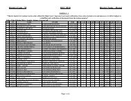
- Page 6 and 7: Table 1.2: Approved plan Preliminar
- Page 8 and 9: S.No.CriteriaMaximumScoreRanges & S
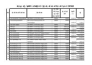
- Page 10 and 11: S.No. Code of MWS Name of MWS Latit
- Page 13 and 14: 2.2: Area and Land use:Village wise
- Page 15 and 16: 2.3: Physiogaphy:The watershed has
- Page 17 and 18: Table 2.6: Details of Soil ErosionS
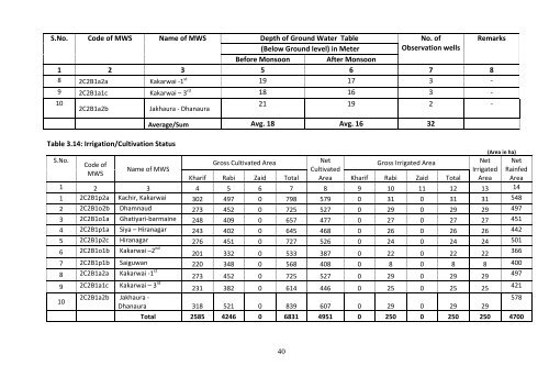
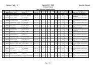
- Page 19 and 20: S.No. Code of MWS Name of MWS Name
- Page 21 and 22: S.No. Code of Name of MWS Name of N
- Page 23 and 24: S. N. Code ofMWSName ofMWSName of G
- Page 25 and 26: Table 3.4: Details of Village Infra
- Page 27 and 28: 3.4: Crops & Productivity:Table 3.6
- Page 29 and 30: 3.5: Live Stock:The details of live
- Page 31 and 32: Table.3.9: Details of Livestock Pro
- Page 33 and 34: 3.6: Livelihood Status:The details
- Page 35 and 36: Table 3.11: Details of Livelihood S
- Page 37 and 38: S. Code of Name of MWS Name of Name
- Page 39 and 40: Table 3.12: Details of Present Live
- Page 41: S.No.Code ofMWSName ofMWSName ofGPN
- Page 45 and 46: Table 4.2: Details of Staff at PIAS
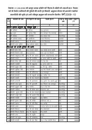
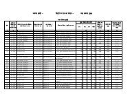
- Page 47 and 48: S.No. Name of GP Name/ Father or Hu
- Page 49 and 50: S.No. Name of GP Name/ Father or Hu
- Page 51 and 52: 4.2: User Group (UG)User Groups are
- Page 53 and 54: S.No.Code ofUserGroupName ofGramPnc
- Page 55 and 56: S.No.Code ofUserGroupName ofGramPnc
- Page 57 and 58: S.No.Name of GPName ofVillageName o
- Page 59 and 60: 4.4: Convergence in IWMP‐6 th :Se
- Page 61 and 62: 5.2 Work Phase:Following are the ma
- Page 63 and 64: S.No Particular of Measures/Activit
- Page 65 and 66: S.No Particular of Measures/Activit
- Page 67 and 68: S.No Particular of Measures/Activit
- Page 69 and 70: S.No Particular of Measures/Activit
- Page 71 and 72: S.No Particular of Measures/Activit
- Page 73 and 74: S.No Particular of Measures/Activit
- Page 75 and 76: S.No Particular of Measures/Activit
- Page 77 and 78: S.No Particular of Measures/Activit
- Page 79 and 80: S.No Particular of Measures/Activit
- Page 81 and 82: S.No Particular of Measures/Activit
- Page 83 and 84: S.No Particular of Measures/Activit
- Page 85 and 86: S.No Particular of Measures/Activit
- Page 87 and 88: S.No Particular of Measures/Activit
- Page 89 and 90: S.No Name of GP Activity Proposed N
- Page 91 and 92: 5.4: PRODUCTION SYSTEM ACTION PLAND
- Page 93 and 94:
S.NoName ofGPActivity Proposed Crop
- Page 95 and 96:
S.NoName ofGPActivity Proposed Crop
- Page 97 and 98:
S.NoName ofGPActivity Proposed Crop
- Page 99 and 100:
S.NoName ofGPActivity Proposed Crop
- Page 101 and 102:
S.NoName ofGPActivity Proposed Crop
- Page 103 and 104:
Table 6.2: Training to stakeholders
- Page 105 and 106:
CHAPTER‐7PHASING OF PROGRAMME AND
- Page 107 and 108:
Year wise Physical and Financial Ac
- Page 109 and 110:
S.No.Physical and Financial targets
- Page 111 and 112:
S.No.Physical and Financial targets
- Page 113 and 114:
S.No.Physical and Financial targets
- Page 115 and 116:
Table 7.2: Details of proposed wate
- Page 117 and 118:
9.1 Employment Generation and Check
- Page 119 and 120:
MAPS117
- Page 121 and 122:
119
- Page 123 and 124:
121
- Page 125 and 126:
123
- Page 127 and 128:
125
- Page 129 and 130:
127
- Page 131 and 132:
129
- Page 133 and 134:
131
- Page 135 and 136:
133
- Page 137 and 138:
PREPARATION OF DPRDetail Project Re
- Page 139 and 140:
S.No.Name ofWorkBenefitedarea (ha)F
- Page 141 and 142:
S.No.Beneficiary wise details of Pr
- Page 143 and 144:
S.No.Beneficiary wise details of Pr
- Page 145 and 146:
S.No.Beneficiary wise details of Pr
- Page 147 and 148:
S.No.Beneficiary wise details of Pr
- Page 149 and 150:
S.No.Field No. /Area of workManday
- Page 151 and 152:
S.No.Name ofWorkBenefitedarea (ha)F
- Page 153 and 154:
S.No.Name ofWorkBenefitedarea (ha)F
- Page 155 and 156:
S.No.Beneficiary wise details of Pr
- Page 157 and 158:
S.No.Beneficiary wise details of Pr
- Page 159 and 160:
S.No.Beneficiary wise details of Pr
- Page 161 and 162:
S.No.Name ofWorkBenefitedarea (ha)F
- Page 163 and 164:
S.No.Field No. /Area of workManday
- Page 165 and 166:
Total0.616 1818 50 (3.60+.60)/2*1.0
- Page 167 and 168:
S.No.Beneficiary wise details of Pr
- Page 169 and 170:
S.No.Beneficiary wise details of Pr
- Page 171 and 172:
S.No.Field No. /Area of workManday
- Page 173 and 174:
S.No.Beneficiary wise details of Pr
- Page 175 and 176:
S.No.Beneficiary wise details of Pr
- Page 177 and 178:
S.No.Beneficiary wise details of Pr
- Page 179 and 180:
S.No.Beneficiary wise details of Pr
- Page 181 and 182:
S.No.Field No. /Area of workManday
- Page 183 and 184:
S.No.Name ofWorkBenefitedarea (ha)F
- Page 185 and 186:
S.No.Name ofWorkBenefitedarea (ha)F
- Page 187:
S.No.Beneficiary wise details of Pr
- Page 190 and 191:
S.No.Beneficiary wise details of Pr
- Page 192 and 193:
S.No.Beneficiary wise details of Pr
- Page 194 and 195:
S.No.Name ofWorkBenefitedarea (ha)F
- Page 196 and 197:
S.No.Beneficiary wise details of Pr
- Page 198 and 199:
S.No.Beneficiary wise details of Pr
- Page 200 and 201:
S.No.Field No. /Area of workManday
- Page 202 and 203:
S.No.Beneficiary wise details of Pr
- Page 204 and 205:
S.No.Beneficiary wise details of Pr
- Page 206 and 207:
S.No.Name ofWorkBenefitedarea (ha)F
- Page 208 and 209:
S.No.Beneficiary wise details of Pr
- Page 210 and 211:
S.No.Name ofWorkBenefitedarea (ha)F
- Page 212 and 213:
S.No.Name ofWorkBenefitedarea (ha)F
- Page 214 and 215:
S.No.Name ofWorkBenefitedarea (ha)F
- Page 216 and 217:
S.No.Plan Estimate Village- KachirN
- Page 218 and 219:
S.No.Name ofWorkBenefitedarea (ha)F
- Page 220:
S.No.Name ofWorkBenefitedarea (ha)F
- Page 223 and 224:
S.No.Beneficiary wise details of Pr
- Page 225 and 226:
S.No.Name ofWorkBenefitedarea (ha)F
- Page 227 and 228:
S.No.Beneficiary wise details of Pr
- Page 229 and 230:
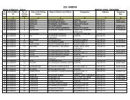
S. No. Code of MWS Village Structur
- Page 231 and 232:
S. No. Code of MWS Village Structur
- Page 233 and 234:
Annexure‐IIIParametersS.No Name o
- Page 235:
S.No Name of Structure Structure co