Godalming - Bloomsbury Auctions
Godalming - Bloomsbury Auctions
Godalming - Bloomsbury Auctions

You also want an ePaper? Increase the reach of your titles
YUMPU automatically turns print PDFs into web optimized ePapers that Google loves.
outer pages soiled, a few short tears, [Chubb CXL], oblong 4to, [1757].<br />
£150 – £200<br />
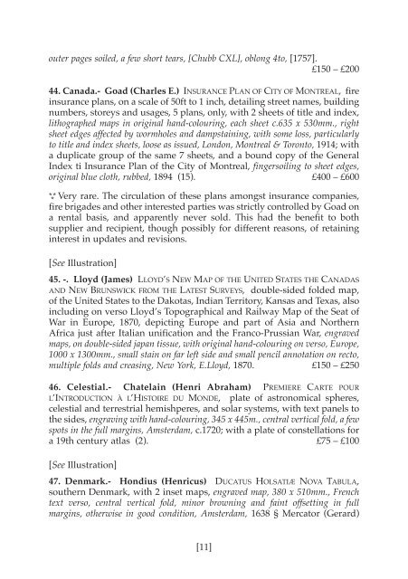
44. Canada.- Goad (Charles E.) INSURANCE PLAN OF CITY OF MONTREAL, fire<br />
insurance plans, on a scale of 50ft to 1 inch, detailing street names, building<br />
numbers, storeys and usages, 5 plans, only, with 2 sheets of title and index,<br />
lithographed maps in original hand-colouring, each sheet c.635 x 530mm., right<br />
sheet edges affected by wormholes and dampstaining, with some loss, particularly<br />
to title and index sheets, loose as issued, London, Montreal & Toronto, 1914; with<br />
a duplicate group of the same 7 sheets, and a bound copy of the General<br />
Index ti Insurance Plan of the City of Montreal, fingersoiling to sheet edges,<br />
original blue cloth, rubbed, 1894 (15). £400 – £600<br />
* * * Very rare. The circulation of these plans amongst insurance companies,<br />
fire brigades and other interested parties was strictly controlled by Goad on<br />
a rental basis, and apparently never sold. This had the benefit to both<br />
supplier and recipient, though possibly for different reasons, of retaining<br />
interest in updates and revisions.<br />
[See Illustration]<br />
45. -. Lloyd (James) LLOYD’S NEW MAP OF THE UNITED STATES THE CANADAS<br />
AND NEW BRUNSWICK FROM THE LATEST SURVEYS, double-sided folded map,<br />
of the United States to the Dakotas, Indian Territory, Kansas and Texas, also<br />
including on verso Lloyd’s Topographical and Railway Map of the Seat of<br />
War in Europe, 1870, depicting Europe and part of Asia and Northern<br />
Africa just after Italian unification and the Franco-Prussian War, engraved<br />
maps, on double-sided japan tissue, with original hand-colouring on verso, Europe,<br />
1000 x 1300mm., small stain on far left side and small pencil annotation on recto,<br />
multiple folds and creasing, New York, E.Lloyd, 1870. £150 – £250<br />
46. Celestial.- Chatelain (Henri Abraham) PREMIERE CARTE POUR<br />
L’INTRODUCTION À L’HISTOIRE DU MONDE, plate of astronomical spheres,<br />
celestial and terrestrial hemishperes, and solar systems, with text panels to<br />
the sides, engraving with hand-colouring, 345 x 445m., central vertical fold, a few<br />
spots in the full margins, Amsterdam, c.1720; with a plate of constellations for<br />
a 19th century atlas (2). £75 – £100<br />
[See Illustration]<br />
47. Denmark.- Hondius (Henricus) DUCATUS HOLSATIÆ NOVA TABULA,<br />
southern Denmark, with 2 inset maps, engraved map, 380 x 510mm., French<br />
text verso, central vertical fold, minor browning and faint offsetting in full<br />
margins, otherwise in good condition, Amsterdam, 1638 § Mercator (Gerard)<br />
[11]