October 2010 - Trout Lake School
October 2010 - Trout Lake School
October 2010 - Trout Lake School

You also want an ePaper? Increase the reach of your titles
YUMPU automatically turns print PDFs into web optimized ePapers that Google loves.
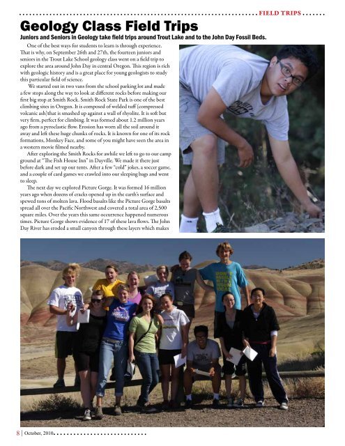
. . . . . . . . . . . . . . . . . . . . . . . . . . . . . . . . . . . . . . . . . . . . . . . . . . . . . . . . . . . . . . . . . . . . . . . FIELD TRIPS . . . . . . .Geology Class Field TripsJuniors and Seniors in Geology take field trips around <strong>Trout</strong> <strong>Lake</strong> and to the John Day Fossil Beds.One of the best ways for students to learn is through experience.That is why, on September 26th and 27th, the fourteen juniors andseniors in the <strong>Trout</strong> <strong>Lake</strong> <strong>School</strong> geology class went on a field trip toexplore the area around John Day in central Oregon. This region is richwith geologic history and is a great place for young geologists to studythis particular field of science.We started out in two vans from the school parking lot and madea few stops along the way to look at different rocks before making ourfirst big stop at Smith Rock. Smith Rock State Park is one of the bestclimbing sites in Oregon. It is composed of welded tuff (compressedvolcanic ash)that is smashed up against a wall of rhyolite. It is soft butvery firm, perfect for climbing. It was formed about 1.2 million yearsago from a pyroclastic flow. Erosion has worn all the soil around itaway and left these huge chunks of rocks. It is known for one of its rockformations, Monkey Face, and some of you might have seen the area ina western movie filmed nearby.After exploring the Smith Rocks for awhile we left to go to our campground at “The Fish House Inn” in Dayville. We made it there justbefore dark and set up our tents. After a few “cold” jokes, a soccer game,and a couple of card games we crawled into our sleeping bags and wentto sleep.The next day we explored Picture Gorge. It was formed 16 millionyears ago when dozens of cracks opened up in the earth’s surface andspewed tons of molten lava. Flood basalts like the Picture Gorge basaltsspread all over the Pacific Northwest and covered a total area of 2,500square miles. Over the years this same occurrence happened numeroustimes. Picture Gorge shows evidence of 17 of these lava flows. The JohnDay River has eroded a small canyon through these layers which makes8 | <strong>October</strong>, <strong>2010</strong>. . . . . . . . . . . . . . . . . . . . . . . . . . . .