Wildlife Insider Spring Summer 2010 - Louisiana Department of ...
Wildlife Insider Spring Summer 2010 - Louisiana Department of ...
Wildlife Insider Spring Summer 2010 - Louisiana Department of ...

You also want an ePaper? Increase the reach of your titles
YUMPU automatically turns print PDFs into web optimized ePapers that Google loves.
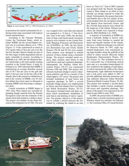
Figure 2. Land change 1887 vs. 1996 (Penland et. al. 2003)as protection for coastal communities by reducingstorm surge associated with tropicalstorms and hurricanes.According to the National WetlandsCenter, the Terrebonne Basin, which includesIDBIR, has the second highest erosionrate in <strong>Louisiana</strong> (Barras et al. 1994)(Figure 2.). It has experienced as much as10.2 square miles <strong>of</strong> loss per year over thelast few decades. Barrier islands are part <strong>of</strong>the final stages <strong>of</strong> delta degradation and arequite vulnerable to erosion. According toMcBride et al. 1989, the Isle Dernieres barrierisland chain is the most rapidly erodingcoastline in the United States. A study byPenland et al. 2003 indicated that IDBIR isexperiencing an average shoreline erosionrate <strong>of</strong> 38.7 feet per year on the gulf sideand 8.2 feet per year on the bay side <strong>of</strong> theislands. Due to the extensive wetland loss atand in the vicinity <strong>of</strong> IDBIR, over 85 milliondollars have been spent or allocated tokeeping IDBIR from becoming a subaqueousshoal.Coastal restoration at IDBIR began in1991 when Wine Island was recreated bypumping dredge material from the HoumaNavigation Canal onto the remnants <strong>of</strong> theisland which had eroded to a shallow shoal.The project was funded via the Water ResourcesDevelopment Act <strong>of</strong> 1986. The areawas wrapped with a rock dike and materialwas pumped to a +4 feet to +7 feet elevation.Also in the early 1990s, the development<strong>of</strong> large scale beach/marsh restorationprojects were initiated via the Coastal WetlandsPlanning Protection and RestorationAct (CWPPRA). In 1999, the Isle DernieresRestoration East and Trinity IslandsProjects (TE-20 and TE-24) were created.These projects were designed to rebuildportions <strong>of</strong> these islands using a hydraulicdredge. The projects included marsh creation,dune creation, sand fences to trapwind blown sand and vegetation plantings.Subsequently, the Whiskey Island RestorationProject (TE-27) was constructedbetween 1998 and 2000. This project alsoutilized a hydraulic dredge to create a dune/marsh platform and fill in a breach <strong>of</strong> theisland (approx. 657 acres). The project alsoincluded installation <strong>of</strong> sand fences andvegetation plantings. In 2007, a secondhydraulic dredge project was implementedat Trinity and East Islands (New Cut Duneand Marsh Restoration Project, TE-37).This project included marsh and dune creation,beach nourishment, installation <strong>of</strong>sand fences and planting <strong>of</strong> native vegetation.The primary objective <strong>of</strong> this projectwas to solidify a breach between the twoislands by widening the island in an areaknow as “New Cut.” Also in 2007, materialwas pumped from the Houma NavigationCanal to Wine Island in an effort to beneficiallyuse dredge material to widen theisland. Unfortunately, this project had minimalbenefits due to the low quality <strong>of</strong> materialpumped from the navigation channeland impacts from hurricanes Gustav andIke. Overall, these projects were critical forthe longevity <strong>of</strong> the islands. Without restoration,the islands were expected to disappearby 2004 (McBride et al. 1989).A majority <strong>of</strong> restoration at IDBIR utilizeda hydraulic dredge to borrow sedimentfrom water bottoms to nourish thebeach and bayside marshes <strong>of</strong> the islands.However, a different technique was utilizedfor Raccoon Island. In 1997, eight segmentedbreakwaters were constructed usinglarge boulders along the gulfside <strong>of</strong> theisland to reduce erosion (Raccoon IslandBreakwaters Demonstration Project, TE-29) (Figure 3). This technique proved tobe a successful way <strong>of</strong> decreasing erosionrates and, as a secondary/unanticipated effect,resulted in the trapping <strong>of</strong> sand depositswhich increased the width <strong>of</strong> the island.Subsequently, eight additional breakwatersand a rock groin were added in 2007 toprovide additional shoreline protection andtrap sediment (Raccoon Island ShorelineProtection/Marsh Creation Project, TE-48).This project also includes a second phasethat includes a marsh creation component(60 acres) and vegetation plantings. Thisphase <strong>of</strong> the project was expected to be initiatedin late 2009 or early <strong>2010</strong>.In 2009, the preservation <strong>of</strong> IDBIR continuedwhen a second restoration project atWhiskey Island was initiated. On February11, the <strong>Louisiana</strong> Office <strong>of</strong> Coastal Restora-Photo courtesy <strong>of</strong> Weeks MarineDredge and material pumped into dune creation site.Winter <strong>2010</strong>LDWF file photo5