Dr. Michael John Willis - Cornell University
Dr. Michael John Willis - Cornell University
Dr. Michael John Willis - Cornell University
Create successful ePaper yourself
Turn your PDF publications into a flip-book with our unique Google optimized e-Paper software.
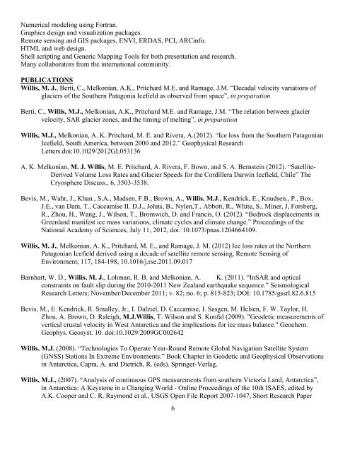
Numerical modeling using Fortran.Graphics design and visualization packages.Remote sensing and GIS packages, ENVI, ERDAS, PCI, ARCinfo.HTML and web design.Shell scripting and Generic Mapping Tools for both presentation and research.Many collaborators from the international community.PUBLICATIONS<strong>Willis</strong>, M. J., Berti, C., Melkonian, A.K., Pritchard M.E. and Ramage, J.M. “Decadal velocity variations ofglaciers of the Southern Patagonia Icefield as observed from space”, in preparationBerti, C., <strong>Willis</strong>, M.J., Melkonian, A.K., Pritchard M.E. and Ramage, J.M. “The relation between glaciervelocity, SAR glacier zones, and the timing of melting”, in preparation<strong>Willis</strong>, M.J., Melkonian, A. K. Pritchard, M. E. and Rivera, A.(2012). “Ice loss from the Southern PatagonianIcefield, South America, between 2000 and 2012.” Geophysical ResearchLetters.doi:10.1029/2012GL053136A. K. Melkonian, M. J. <strong>Willis</strong>, M. E. Pritchard, A. Rivera, F. Bown, and S. A. Bernstein (2012). “Satellite-Derived Volume Loss Rates and Glacier Speeds for the Cordillera Darwin Icefield, Chile” TheCryosphere Discuss., 6, 3503-3538.Bevis, M., Wahr, J., Khan., S.A., Madsen, F.B., Brown, A., <strong>Willis</strong>, M.J., Kendrick, E., Knudsen., P., Box,J.E., van Dam, T., Caccamise II. D.J., <strong>John</strong>s, B., Nylen,T., Abbott, R., White, S., Miner, J, Forsberg,R., Zhou, H., Wang, J., Wilson, T., Bromwich, D. and Francis, O. (2012). “Bedrock displacements inGreenland manifest ice mass variations, climate cycles and climate change.” Proceedings of theNational Academy of Sciences, July 11, 2012, doi: 10.1073/pnas.1204664109.<strong>Willis</strong>, M. J., Melkonian, A. K., Pritchard, M. E., and Ramage, J. M. (2012) Ice loss rates at the NorthernPatagonian Icefield derived using a decade of satellite remote sensing, Remote Sensing ofEnvironment, 117, 184-198, 10.1016/j.rse.2011.09.017Barnhart, W. D., <strong>Willis</strong>, M. J., Lohman, R. B. and Melkonian, A. K. (2011). “InSAR and opticalconstraints on fault slip during the 2010-2011 New Zealand earthquake sequence.” SeismologicalResearch Letters; November/December 2011; v. 82; no. 6; p. 815-823; DOI: 10.1785/gssrl.82.6.815Bevis, M., E. Kendrick, R. Smalley, Jr., I. Dalziel, D. Caccamise, I. Sasgen, M. Helsen, F. W. Taylor, H.Zhou, A. Brown, D. Raleigh, M.J.<strong>Willis</strong>, T. Wilson and S. Konfal (2009). "Geodetic measurements ofvertical crustal velocity in West Antarctica and the implications for ice mass balance." Geochem.Geophys. Geosyst. 10. doi:10.1029/2009GC002642<strong>Willis</strong>, M.J. (2008). “Technologies To Operate Year-Round Remote Global Navigation Satellite System(GNSS) Stations In Extreme Environments.” Book Chapter in Geodetic and Geophysical Observationsin Antarctica, Capra, A. and Dietrich, R. (eds). Springer-Verlag.<strong>Willis</strong>, M.J., (2007). “Analysis of continuous GPS measurements from southern Victoria Land, Antarctica”,in Antarctica: A Keystone in a Changing World - Online Proceedings of the 10th ISAES, edited byA.K. Cooper and C. R. Raymond et al., USGS Open File Report 2007-1047, Short Research Paper6


