The Geothermal Institute brochure - UniServices
The Geothermal Institute brochure - UniServices
The Geothermal Institute brochure - UniServices
You also want an ePaper? Increase the reach of your titles
YUMPU automatically turns print PDFs into web optimized ePapers that Google loves.
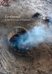
<strong>Geothermal</strong> Project Examples<strong>The</strong> <strong>Geothermal</strong> <strong>Institute</strong> through its affiliated research groups hasundertaken a number of geothermal projects both in New Zealand andinternationally in recent years. <strong>The</strong>se projects include:<strong>Geothermal</strong> Exploration and DevelopmentIsland of Nevis, Caribbean - greenfield exploration involving acombination of geoscientific data (geological and geophysical mapping)led to the drilling of several successful exploration wells and thediscovery of an economically exploitable high temperature resource.Montserrat - A geophysical survey involving two types ofelectromagnetic sounding (MT & CSAMT) methods were employed toestablish the structure and distribution of potential fluid resource onthis volcanic island. A zone of apparent high permeability was foundnear Saint George’s Hill. This site has now become the focus of apotential high temperature geothermal power development.Sumatra, Indonesia - Joint Geophysical Imaging (JGI usingelectromagnetic and seismic data) of greenfield geothermal sites inSumatra was completed to determine drilling targets for a geothermalpower development. A seismic survey was conducted using acombination of surface and borehole instruments, with emphasisplaced on S-wave splitting associated with zones of aligned, highpermeability, fractures. Existing MT data was analysed for previouslyignored polarization effect related to oriented fractures. Following theJGI data analysis, and in combination with geological data, severalpotential drilling targets were identified.Utah & Nevada, USA - geophysical and geological data acquisitionand analysis at the geothermal field at Box Elder, Utah, and at NyeCounty, Nevada.Rwanda - Completed a successful geological survey for geothermalpotential in Rwanda which has lead to IESE securing a new project tocomplete a geophysical survey for determining drilling targets.Olkaria, Kenya - a UNEP funded project to pioneer Joint GeophysicalImaging (JGI). Before the survey, the target area had an averageproductivity of 2MW/well. By using JGI, the developer realised anincrease in average productivity to 5MW/well.Krafla Volcanic Field, Iceland - deployment of a network ofborehole and surface seismometers, and electromagnetic (MT and TEM)soundings. <strong>The</strong> integrated model of the field provided optimum drillingtargets, and subsequent drilling yielded one of the most productivewells in the field.Coso geothermal fields, California, USA - 12 station boreholenetworks in 100 metre boreholes. Installation, operation, and analysisof the Coso <strong>Geothermal</strong> Field seismic network, leading to thedevelopment of S-wave splitting tomography for locating fractures asdrilling targets. Subsequent electromagnetic and drilling studiesconfirmed the locations and sizes of potential high permeability zones.Puna, Hawaii, USA geothermal fields - 8 station boreholenetworks at 100 metres.Engineered geothermal projects (EGS)Basel, Switzerland – construction of a 6 station seismometer andaccelerometer monitoring network, including instruments at 1.2 and2.7km deep, followed by the collaborative analysis of inducedseismicity.Paralana, Australia – installation of a network of 8 borehole stationsat depth of 1.8kms. This seismic network provides real-time feedback onthe field during drilling and hydro fracturing.Reservoir ModellingWairakei, New Zealand - 3D modelling has resulted in Governmentsupported funding and consents.Ohaaki, New Zealand - high concentrations of carbon dioxide gasrequired different techniques. Models are being used to plan for futuresustainable productivity.Wayang Windu, Indonesia - a modelling study for the applicationof the expansion of generation capacity.Other <strong>Geothermal</strong> Reservoir Modelling Sites - Mokai andNgawha (New Zealand), Dieng, Darajat, Silangkitang, Namora(Indonesia), Leyte, Northern Negros, Bacman (Philippines), Olkaria(Kenya), East Mesa (USA), Fushime, Kakkonda (Japan) and Los Humeros(Mexico).<strong>Geothermal</strong> Process EngineeringKawerau, New Zealand – Modelling of a whole geothermal processplant with different process configurations to optimize energy andremoval of non condensable gases.Ngawha, New Zealand – Modelling of a geothermal pipeline andprocess plant to optimize plant operating scenarios to optimize energyrecovery.Seismic Monitoring of <strong>Geothermal</strong> FieldsWairakei <strong>Geothermal</strong> Field, New Zealand - installed a world-classborehole seismic array in the oldest operating geothermal field in NewZealand, providing real-time date about the microearthquake activity inthe field. Data is used to monitor, manage and possibly expand futureoperations.Montserrat, Caribbean - 4 borehole seismometers and stringmeters for active volcanic monitoring at 250kms.Muara Laboh, Indonesia - 3 borehole and 6 surface geothermalmonitoring stations.


