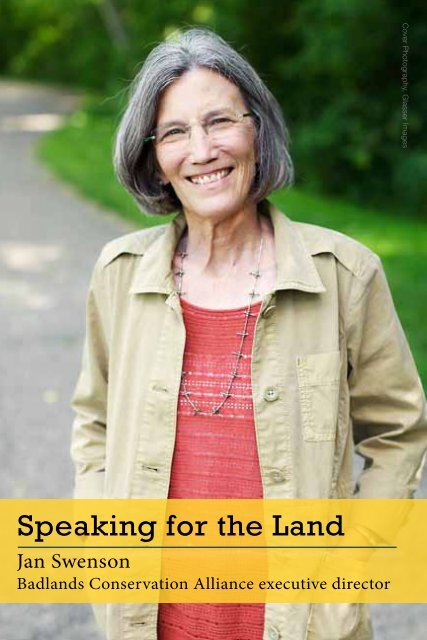
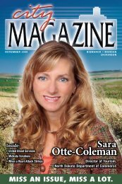
Speaking for the Land Jan Swenson Badlands Conservation Alliance executive director Cover Photography, Glasser Images
“What alerted me was flares,” said Bismarck’s Jan Swenson, referring to how, on a family vacation, she was inspired to become a passionate environmentalist speaking out on behalf of the Dakota Prairie Grasslands. “We left for Yellowstone on a Friday evening after work and going through the Badlands, all of a sudden, there were strange orange lights on the horizon!” The more Swenson investigated the reason behind the orange lights, the more disturbed she became and the more she felt a calling to be proactive about saving portions of a landscape she cherished. Today, Swenson is serving her 11th year as executive director of the Badlands Conservation Alliance (BCA), an organization founded in 1999 and dedicated to the preservation of the badlands, prairies and grasslands comprising North Dakota’s public lands. Driven by the unprecedented frenzy of industrial development in oil country, the central focus of BCA’s work is to advocate for the adoption of a formal plan to set aside just over 1/10th of one percent of the land area of North Dakota located in the Dakota Prairie Grasslands and designate it as “Wilderness.” Only 1/10 of one percent, nearly the identical amount of the state’s land area is currently protected as Wilderness: Chase Lake Wildlife Refuge in Stutsman County, Lostwood Wildlife Refuge in Burke County and Theodore Roosevelt Wilderness within the larger North and South Units of Theodore Roosevelt National Park. The BCA Proposal at a Glance: • Bullion Butte - “Island in the Sky” Skirted by the Little Missouri River’s Big Bend, the spectacular Bullion Butte is a pivotal landmark in the southern Badlands. • Kendley Plateau - “Heart of the Badlands” Largest of the proposed areas, Kendley Plateau lies east across the Little Missouri River from Bullion Butte. • Long X Divide - “Southern Sister” Long X Butte, with its sparsely vegetated strata, juniper-rich canyons, prairie uplands and mature river-bottom cottonwood forest, lies immediately south of the North Unit of Theodore Roosevelt National Park. • Twin Buttes - “Pronghorn Horizon” The Twin Buttes area rises up and away from the rough Badlands country of the Little Missouri Valley. • Lone Butte Special Management Area - “Under the Edge” Just east of Long X Divide, this remote, rugged terrain is ideal habitat for bighorn sheep and elk. • Sheyenne - “Prairie Eden” The Sheyenne National Grassland, an hour’s drive from North Dakota’s largest metropolitan area, is the nation’s largest remnant tallgrass prairie in public ownership. The designation called for in the BCA plan would be historic: the first time National Grasslands managed by the U.S. Forest Service is granted the “Wilderness” label. “Wilderness,” in this case, is defined by the congressional Wilderness Act of 1964, signed into law by President Lyndon B. Johnson. The act established permanent protection for “land retaining its primeval character and influence, without permanent improvements or human habitation . . . .” Wilderness can only be designated by an act of the U.S. Congress and can only be established on federal lands. [[ North Dakota is on top right now in so many things. This could be one more instance where North Dakota shows the nation that our parties can work together for the common good. AUGUST 2012 | THECITYMAG.COM | 7 CITY MAGAZINE COVER STORY