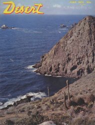
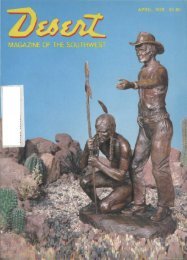
Zane Grey Country PHOENIX AND Tucson have long been <strong>the</strong> recognized "fun in <strong>the</strong> sun" cities <strong>of</strong> Arizona, yet Flagstaff, on U. S. 66, if for nothing more than tourist volume, should rate very high. The number one side trip from Flagstaff is definitely <strong>the</strong> Grand Canyon, with Oak Creek Canyon and <strong>the</strong> first capital, Prescott, as close seconds. There is a third trip, however, which, in <strong>the</strong> short span <strong>of</strong> 350 miles, takes in some <strong>of</strong> <strong>the</strong> most historic and scenic areas <strong>of</strong> <strong>the</strong> state. Zane Grey immortalized <strong>the</strong> Tonto Basin and Mogollon ("Muggy-Own") Rim and this trip goes through both, with some very excellent scenery and a few Indian dwellings as well. Drive south out <strong>of</strong> Flagstaff on Interstate 17 toward Camp Verde. Montezuma Well is <strong>the</strong> first stop, approximately 10 miles north <strong>of</strong> Camp Verde. From time to time visitors to this historic site have created problems by dropping coins and o<strong>the</strong>r objects into <strong>the</strong> well. The really big attraction in <strong>the</strong> area is <strong>the</strong> Montezuma Castle National Monument. but ano<strong>the</strong>r point <strong>of</strong> worthwhile interest is <strong>the</strong> splendid cavalry museum at Fort Verde. It is one <strong>of</strong> <strong>the</strong> best such displays in <strong>the</strong> nation. From Camp Verde <strong>the</strong> route lies eastward to <strong>the</strong> little settlement <strong>of</strong> Strawberry. The road is unnumbered, but as <strong>the</strong>re is only one road a wrong turn isn't possible. The settlement <strong>of</strong> Strawberry 20 / Dcrert <strong>Magazine</strong> / November, 1966 is <strong>the</strong> site <strong>of</strong> <strong>the</strong> oldest standing schoolhouse in <strong>the</strong> state. Built in 1885 <strong>of</strong> hand hewn logs, it is an interesting place to visit. Just south <strong>of</strong> Strawberry is Pine where <strong>the</strong> oldest annual Pioneer Day celebration in Arizona is held. Take State 87 south. Five miles south <strong>of</strong> Pine is <strong>the</strong> turn-<strong>of</strong>f to Tonto Natural Bridge; 400 feet long, 180 feet high, with a 150 foot span. It is a spectacular sight, and much easier to reach than most <strong>of</strong> <strong>the</strong> o<strong>the</strong>r natural bridges in <strong>the</strong> southwest. Next stop is Payson, under <strong>the</strong> Mogollon Rim. It is a thriving town <strong>of</strong> approximately 2,000, built primarily on a lumber and cattle economy. The largest seismological observatory in <strong>the</strong> Western Hemisphere is located just five miles north <strong>of</strong> town, and for those interested by Jan S. Paul in <strong>the</strong> Zane Grey saga, an inquiry will get quick directions to <strong>the</strong> site <strong>of</strong> <strong>the</strong> old Zane Grey cabin where he lived and wrote his famous stones <strong>of</strong> <strong>the</strong> Mogollon Rim. Payson also boasts <strong>the</strong> world's oldest rodeo, started in 1884 and held each August. South from Payson <strong>the</strong> road drops into <strong>the</strong> very heart <strong>of</strong> <strong>the</strong> Tonto Basin. Fifteen miles south <strong>of</strong> Payson, our route leaves State 87 in favor <strong>of</strong> State 188, <strong>the</strong> direct road to Roosevelt Dam. Just beyond <strong>the</strong> town <strong>of</strong> Roosevelt is <strong>the</strong> Tonto National Monument on State 88, <strong>the</strong> Apache Trail. State 88 goes on south to Globe, but we shortly head back north on State 288. This road passes <strong>the</strong> Sierra Ancha Experimental Forest; however, our main objective is <strong>the</strong> town <strong>of</strong> Young. Here is something unique in our present jet age; a quiet, simple place, unmarred by <strong>the</strong> hustle and bustle. There's no electricity nor telephone service in Young and <strong>the</strong> nearest doctor is at Globe, 90 miles back down <strong>the</strong> road we just came over. Life is simple and it takes a sturdy breed to live <strong>the</strong>re, but just for a little while it's a welcome change. Beyond Young <strong>the</strong> road tops <strong>the</strong> Mogollon Rim and crosses State 160, continuing back to <strong>the</strong> northwest along <strong>the</strong> top <strong>of</strong> <strong>the</strong> Rim. From here you can look into <strong>the</strong> Basin and see all <strong>the</strong> places you have been. This Rim road ends at State 65 midway between Strawberry and Clint Wells. It's possible to go back to Flagstaff via Camp Verde, but more new scenery unfolds by going right on State 65. At Clint Wells <strong>the</strong> route leaves <strong>the</strong> numbered road in favor <strong>of</strong> an unnumbered road north. This road passes through Happy Jack and along <strong>the</strong> eastern shores <strong>of</strong> Lake Mormon and <strong>the</strong> ra<strong>the</strong>r curious Mary Lake—eight miles long and less than a mile wide. There used to be a dirt road past tiny Marshall Lake to Walnut Canyon National Monument, but it is now necessary to drive out <strong>of</strong> Flagstaff on 66 to reach this monument. Our road joins Interstate 17 three miles south <strong>of</strong> Flagstaff. While <strong>the</strong> entire loop may be made in one day without strain, a more leisurely trip can be made by stopp:ig overnight in Payson, or at one <strong>of</strong> <strong>the</strong> eight Forest Service camps in <strong>the</strong> Basin and Rim area. In any event, eat lunch in Young. TK place may be simple and slow-paced, but <strong>the</strong> food is excellent. •
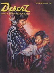
•***••- ; • ' • ' . .'•'•