Hydrology Background
Hydrology Background
Hydrology Background

You also want an ePaper? Increase the reach of your titles
YUMPU automatically turns print PDFs into web optimized ePapers that Google loves.
HYDROLOGY
HYDROLOGYThe science of water, its properties,distribution and circulation, both onthe surface and underground.
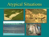
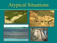
The mostHYDROLOGY is:(a) important(b) dynamic(c) elusive(d) all of the abovecomponent of a wetland.
Wetlands gainand lose waterconstantlythrough avariety ofpathwaysWetland <strong>Hydrology</strong>
Climatic Water BudgetsTwin CitiesETThief River FallsPRECIPSacramento CAMoisture deficitSoil moisture lossSoil moisture gainMoisture surplusWebWIMP - http://climate.geog.udel.edu/~wimp/
Factors that Influence <strong>Hydrology</strong> Water Inputs and Outputs Geomorphic setting (landscape) Stratigraphy Soil texture and drainage Plant cover
Wetlands in LandscapesFringes of lakes andoceans
Wetlands in LandscapesClosed depression with a fluctuating water table:
Wetlands in LandscapesClosed depression with a perched water table:
Wetlands in LandscapesWetlands in depressions
Wetlands in LandscapesRiverine (floodplain) wetlands
Wetlands in LandscapesFloodplain morphology
Wetlands in LandscapesWetlands on slopes:
Observable Characteristics - examples Large wetland, small watershed:groundwater source Wetland on slope, not in floodplain:ground water discharge Wetland in small depression, with fine-textured,mottled soils:Periodic saturation, intermittent hydrology
A condition in whichwater from anysource temporarily orpermanently covers aland surface.Inundation
A condition in whichwater stands in aclosed depression.The water is removedonly by percolation,evaporation, ortranspiration.Ponding
FloodingThe soil surface istemporarily covered withflowing water from anysource, such as overflowingstreams or rivers, runofffrom adjacent slopes, andinflow from high tides.FloodedPonded
SaturationCondition in which alleasily drained poresbetween soil particles aretemporarily orpermanently filled withwater.
Gw in pore spaces
The upper surface ofgroundwater, or thelevel at which waterstands in an unlinedborehole.Water Table
Capillary fringeA zone immediately above the water table in which wateris drawn upward by capillary action.UnsaturatedZoneZone oftensionsaturationSaturatedZone
For field assessment and hydrology field indicators,we are concerned with level of water in an unlinedborehole (water table) without regard to capillaryfringe. The technical standard of 12” accounts forcapillary action. Do not try to assess capillary fringein the field.