SHLAA - Allerdale Borough Council
SHLAA - Allerdale Borough Council
SHLAA - Allerdale Borough Council

You also want an ePaper? Increase the reach of your titles
YUMPU automatically turns print PDFs into web optimized ePapers that Google loves.
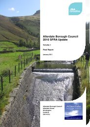
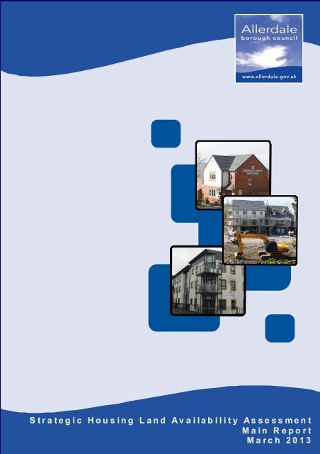
“<strong>Allerdale</strong> – a great place to live, work and visit”S t r a t e g i c H o u s i n g L a n d A v a i l a b i l i t y A s s e s s m e n tM a i n R e p o r tM a r c h 2 0 1 3
Important Notice – DisclaimerIn relation to the information contained within the <strong>Allerdale</strong> <strong>Borough</strong> <strong>Council</strong> Strategic HousingLand Availability Assessment (<strong>SHLAA</strong>), the <strong>Council</strong> makes the following disclaimer withoutprejudice:• The <strong>SHLAA</strong> only identifies sites with future development potential. It does not allocate sitesto be developed. The <strong>Council</strong> will decide the allocation of sites for future housingdevelopment through the Site Allocations process.• The identification of potential housing sites within the <strong>SHLAA</strong> does not imply that the<strong>Council</strong> would necessarily grant planning permission for residential development on thesesites. Any applications would be considered against the appropriate policies in the relevantdevelopment plan documents and having regard to any other material considerations.• The inclusion of potential housing sites within the study does not prevent them from beingconsidered for other purposes.• The boundaries of sites are based on the information available at the time. The <strong>SHLAA</strong>does not limit an extension or contraction of these boundaries for the purpose of a planningapplication.• The fact that a site is not included in the study does not preclude the possibility of planningpermission for residential development being granted on it. It is acknowledged that sites willcontinue to come forward that may be suitable for residential development that have notbeen identified in the <strong>SHLAA</strong>.• The categorisation of sites in terms of whether they are considered deliverable ordevelopable is based on an assessment at the time of the study. Circumstances orassumptions may change which may mean that sites could come forward sooner or laterthan originally envisaged.• The housing capacity of site included in the <strong>SHLAA</strong> has been estimated using a benchmarkof 30 dwellings per hectare. However this does not mean that this density is appropriate foreach individual site, which would need to be assessed through the planning process when aplanning application is submitted.• The information included in the <strong>SHLAA</strong> is ‘snapshot’ based on information that wasavailable at the time of the study, and is therefore unable to take account of any changes incircumstances. It is important to recognise that:• There may be additional constraints on some sites that were not identified at the timeof the assessment• Constraints identified on some sites may now have been addressed• Sites identified in the document may have secured permission since the informationwas compiled and published.Applicants are therefore advised to carry out their own analysis of sites to identify any constraintsor other information for the purpose of a planning application and not rely solely on the findings ofthe <strong>SHLAA</strong>.
1 Introduction2 Methodology3 Identifying4 Gross5 56 ListFuture Housing Requirementscapacity of <strong>SHLAA</strong> sitesyear supply of deliverable sitesof deliverable sites1381315177 Listof developable sites 21A1 SettlementA2 Deliverablehierarchyand developable site maps2526
A lle rda leLocal PlanEvidence Base1 IntroductionNational planning policy requirements inrelation to housing supplyThis Strategic Housing Land AvailabilityAssessment (“<strong>SHLAA</strong>”) has been prepared by<strong>Allerdale</strong> <strong>Borough</strong> <strong>Council</strong> (“the <strong>Council</strong>”) toprovide an assessment of the amount of landavailable for housing development bothcurrently and in the future.A top priority for Government is to ensure thatland availability is not a constraint on thedelivery of new housing. The new NationalPlanning Policy Framework (“NPPF”) statesthat local planning authorities should prepare<strong>SHLAA</strong>s to establish realistic assumptionsabout the availability, suitability and the likelyeconomic viability of land to meet theidentified need for housing during the planperiod.Purpose of this <strong>SHLAA</strong> documentThe <strong>Council</strong> are in the process of preparing annew Local Plan (“The emerging Local Plan”)will eventually replace the current Local Planthat was adopted in 1999.The emerging Local Plan sets out the<strong>Council</strong>’s long-term vision for the <strong>Borough</strong> forthe period 2011-2028. This includes thestrategy/target for housing growth and deliveryand also the general geographic distribution ofdevelopment within the <strong>Borough</strong>.Before the emerging Local Plan can beformally adopted by the <strong>Council</strong> it mustsuccessfully pass an examination in publicand be found ‘sound’. One of the key tests ofsoundness is that the housing strategy/targetis deliverable.In order to demonstrate that the housingstrategy/target is deliverable, the <strong>Council</strong> mustprovide evidence that there is:i. An adequate supply of housing land tofulfil the overall target set out in the plan.ii.iii.Enough housing land within each of thekey settlements and tiers of settlementhierarchy to deliver the spatial strategySufficient ‘deliverable’ sites in order toprovide a supply for the first five years ofthe planDocument formatThe report comprises:Chapter 2: describes the methodology whichwas followed in preparing this study.1 <strong>SHLAA</strong>: Main Report
Evidence BaseA lle rda leLocal PlanSection 3: sets out the future housingrequirements for the <strong>Allerdale</strong> <strong>Borough</strong> interms of numbers and geographicaldistribution, as set out in the emerging LocalPlansettlements included within the settlementhierarchy that contain sites that areconsidered to be developable/deliverable inthe <strong>SHLAA</strong>.Section 4: identifies the gross capacity of allsites included in the <strong>SHLAA</strong> and comparesthis against the housing target set out in theemerging Local PlanSection 5: identifies the gross capacity of thedeliverable <strong>SHLAA</strong> sites and compares thisagainst the housing requirement for the first 5years as set out in the emerging Local PlanSection 6: provides a list of deliverable siteswithin those settlements included within thesettlement hierarchySection 7: provides a list of developable siteswithin those settlements included within thesettlement hierarchyAppendix A1: Illustrates the settlementhierarchy as set out in the emerging LocalPlanAppendix A2: Includes maps of those<strong>SHLAA</strong>: Main Report 2
A lle rda leLocal PlanEvidence Base2 MethodologyCore Requirements of the AssessmentThe <strong>SHLAA</strong> Practice Guidance states that, asa minimum a <strong>SHLAA</strong> should provide thefollowing core outputs to identify opportunitiesfor housing development:1. A list of sites, cross-referenced to mapsshowing locations and boundaries ofspecific sites2. The potential quantity of housing thatcould be delivered on each identified site3. Any potential constraints on thedeliverability of identified sites4. An indication of when each identified siteis likely to be developedIdentifying sites to be considered in the<strong>SHLAA</strong>Stage 1 - Desk top studyThis involved using existing informationsources to identify sites with the potential todeliver housing. These included:• Registers of land owned by public sectororganisations• The National Land Use Database (NLUD)• Cumbria County <strong>Council</strong>’s EmploymentLand Availability• The West Cumbria Employment Land &Premises Study• Submissions to the <strong>Council</strong> from localresidents proposing residential land forinclusion in the next Local PlanStage 2 - Call for SitesLandowners, developers and other interestedparties were invited to submit sites forinclusion in the <strong>SHLAA</strong> , which theyconsidered to have the potential to bedeveloped as housing. Two call for sites havebeen undertaken: the first in June 2008 andthe second in July 2011.Assessing Site SuitabilityInformation was gathered on each site toassess their suitability. This involvedconsulting the following organisations:• United Utilities (gas/water/electric/sewageconstraints)• Cumbria Highways (access/highwaycapacity)• Environment Agency (Flooding Issues)• Natural England (Biodiversity/Landscape3 <strong>SHLAA</strong>: Main Report
Evidence BaseA lle rda leLocal PlanIssues)• English Heritage (Historic environmentconstraints)• <strong>Allerdale</strong> <strong>Borough</strong> <strong>Council</strong>(Contamination/Mining constraints)Each site has been assessed by planningofficers in order to obtain a detailedassessment on the location characteristics ofeach site including topography, surroundinguses, potential landscape impact and meansof access.From these surveys potential on-siteconstraints were noted and supplemented byinformation included in the <strong>Council</strong>’s existingevidence base:• Strategic Flood Risk Assessment• Open Space Audit & Needs Assessment• Cumbria Biodiversity Database• Cumbria Landscape Character Guidance• Local Geodiversity Action Plan forCumbriaEach <strong>SHLAA</strong> site has been assessed in termsof accessibility. This was undertaken using amodelling system that rated each site frominaccessible to excellent based on the numberof services that could be accessed via eachmode of transport.Discounting sitesThe first sieve involved discounting those siteswhich were wholly unsuitable for housingdevelopment.Sites were discounted if:• Considered to be in beneficial use• In a location detached from anyestablished settlement• Located wholly within Flood Zone 3• The means of access is consideredsubstandard and/or dangerous, orsignificant highway capacity constraintshave been identified• Planning permission has been grantedand/or development has commenced• Subject to severe utilities infrastructureconstraints (e.g. maintenance strips)• Below 0.3ha in area• Development would adversely affect theinterest of a protected site (e.g. Site ofSpecial Scientific Interest [SSSI])<strong>SHLAA</strong>: Main Report 4
A lle rda leLocal PlanEvidence Base• Development would have a harmful impactupon a Historic Asset (e.g. listed building,Scheduled Ancient Monument, sensitivearchaeological area)• Development would have harmfullandscape impact• Topography rendered the site unsuitablefor developmentAssessing site availabilityThe NPPF states that one of the key tests todetermine whether a site can be considered tobe deliverable or developable is whether it isavailable for development. Those sites fulfillingthe first sieve criteria were subject to anavailability assessment to determine whetherthe owner of a site was willing to allow it to bedeveloped as housing in the future.It was assumed that those sites that had beensubmitted to the <strong>Council</strong> by landowners andagents acting on their behalf has indicated theirwillingness to release the land for housing.Therefore these sites were deemed to haveautomatically fulfilled this test.For those sites that identified by the <strong>Council</strong>,ownership details were obtained from the LandRegistry. The owners were then contacted tosee whether they would consider releasing theland for housing.Sites were considered unavailable andtherefore discounted at this stage, if:• The Land Registry was unable to provideownership data• No response from the owner was receivedfollowing an approach from the <strong>Council</strong>.• Following an approach from the councilthe owner indicated that they did not wantto develop the siteAssessing site achievabilityThose sites deemed to be available were thenassessed in terms of their achievability. Thiswas essentially an assessment as to theeconomic viability of the site and the whetherthe site would yield a enough profit to makedevelopment a realistic proposition.A strategic viability model was used for thisexercise. Sites were classified in terms of:• Size: large, medium or small,• Type: brownfield or greenfield• Market value: high, medium or low (based5 <strong>SHLAA</strong>: Main Report
Evidence BaseA lle rda leLocal Planon average house prices at parish level)Taking into account the location (in terms ofland value/market attractiveness), area (interms of the number of dwellings that could bedelivered) and the need for remediation (interms of brownfield land) sites were then givena rating of viable, marginal or unviable.The difficult housing market conditions causedby the economic downturn has been factoredinto the assessment in order to avoid an overlyconservative approach. In some cases theviability rating has been adjusted taking intoaccount both historical trends and localknowledge of the housing market (e.g. demandand/or desirability of areas/settlements).Only the most constrained and thereforeultimately unviable sites were discounted at thisstage. Given the timeframe of the <strong>Allerdale</strong>Local Plan (2011-2028) it is likely that housingmarket will improve. Therefore it wasconsidered essential to allow for a certain levelof flexibility within our viability assessments.Assessing site deliverabilityThose sites considered to be both available andachievable were then assessed in terms of thelikelihood of when they would be developed.The assessment was based on deductivereasoning taking into account the economicviability of the site, the level of demand forhousing in the locality and utilities constraints(i.e. the capacity of wastewater treatmentfacilities) were factored into this assessment.Based on a combination of these factors siteswere then classified into two categories:• Deliverable (A realistic prospect thathousing will be delivered on the site within5 years)• Developable (There is a reasonableprospect that housing will be delivered onthe site later in the plan period within the6-15 year timeframe)Estimating housing capacity of <strong>SHLAA</strong> sitesPotential housing capacity of <strong>SHLAA</strong> sites hasbeen estimated based on assumptions inrelation to:• Density• Net developable area (“NDA”)In relation to density, the proposed densitystandard set out in the emerging Local Plan, of<strong>SHLAA</strong>: Main Report 6
A lle rda leLocal PlanEvidence Base30 dwellings per hectare, has been used.With regards to NDA, assumptions were madein relation to the percentage of the area of thesite that would be taken up by infrastructure(roads, hard standing) and open space):• Sites > 3 hectares: 75% NDA• Sites 2-3 hectares: 80% NDA• Sites 1-2 hectares: 85% NDA• Sites
Evidence BaseA lle rda leLocal Plan3 Identifyingfuture housing requirementsEstablishing the level of future housinggrowth for the <strong>Borough</strong>One of the principal roles of the emergingLocal Plan is to establish the target for thenumber of houses that will need to bedelivered in the <strong>Borough</strong> over the next planperiod (2011-2028).Based on up-to-date population, householdformation and economic forecasting the<strong>Council</strong> has arrived at a proposed housinggrowth target of 5168 dwellings, whichequates to a requirement to deliver 304dwellings per annum.Proposed settlement hierarchyThe emerging Local Plan also sets out howfuture housing growth will be managed anddistributed throughout the <strong>Borough</strong>. A mapillustrating the proposal spatial strategy andgeographical dispersal of settlements isincluded in Appendix A1.It is proposed that these dwellings will bedistributed within a proposed settlementhierarchy comprising of:Principle Service Centre (“PSC”):WorkingtonIn addition to statistical forecasting the <strong>Council</strong>has also considered the following additionalcriteria/considerations:• Potential land availability and knowninfrastructure capacity.Workington has been identified as thePrincipal Service Centre in recognition of itrole as the main housing, employment andretail centre.Key Service Centres (“KSC”):• Past levels of house completions (whichgive some guide to the capacity of theconstruction industry to deliver and thelevel of market demand)AspatriaMaryportWigtonCockermouthSilloth• The need to maximise the delivery ofaffordable housing and to respond to andsupport growth in the local economy.Key Service Centres have been designated onthe basis that they are the recognised urbancentres in the plan area and offer a good<strong>SHLAA</strong>: Main Report 8
A lle rda leLocal PlanEvidence Baserange of services.Local Service Centres (“LSC”):AbbeytownBrighamBroughton MoorFlimbyKirkbrideThursbyAllonbyBroughtonDearhamGreat CliftonProspectThe Local Service Centres have beenselected on the basis of having a shop, schooland public transport. It was considered thatthese services were core facilities for acommunity and a good basis to build futuresustainability.Rural Villages (“RV”):AnthornBlennerhassetBolton Low HousesBowness on SolwayBridekirkCamertonCrosby VillaDeanscalesEaglesfieldGilcruxGreysouthernBlencogoBlitterleesBothelBranthwaiteBroughton CrossCrosbyDeanDovenbyFletchertownGlassonHaytonIrebyLangriggLittle CliftonMockerkinOughtersidePapcastleParsonbyPort CarlisleTallentireUllockWestnewtonKirkbamptonLittle BamptonMawbrayNewton ArloshOultonPardshawPlumblandSkinburnessTorpenhowWavertonRural Villages have been identified by takingthe settlements designated as either a limitedgrowth village or an infill village in the currentLocal plan and applying an additionalrequirement for each settlement to be locatedwithin 2.5 miles from a primary school. Theaim of this approach is to try and ensure thatthe smaller rural settlements are retained inthe hierarchy to allow small scale infilldevelopment that can contribute to thesustainability of these communities.Proposed distribution of housing growthThe Local Plan seeks to ensure that themajority of development will be located in theexisting urban centres that provide the bestrange of services, employment opportunities9 <strong>SHLAA</strong>: Main Report
Evidence BaseA lle rda leLocal Planand access to public transport. This isconsidered to be the most sustainableapproach as it makes the most use of existingphysical, utility and social infrastructure andalso reduces the need to travel.However it is considered that the smaller ruralsettlements should have the opportunity toaccommodate small-scale infill developmentwhere appropriate. This is essential if they areto remain sustainable and to address some ofthe local need for housing and employmentoutside the main centres.Table xx illustrates how the <strong>Council</strong> proposesto distribute future housing growth betweeneach tier of the hierarchy.the main towns of Aspatria, Cockermouth,Maryport, Silloth, Wigton and Workington.Proposed housing targetsBased on the proposed distribution of theoverall housing target, the following housingnumbers are set for each tier of the settlementhierarchyTotalPrinciple Service centre (PSC) 1809Key service centres (KSC) 2015Local service centres (LSC) 1034Rural villages (RV) 310Annual1061196118TOTAL 5168 304Table xx: Housing growth targets f or each tier of the settlementhierarchy.%Principle Service centre (PSC) 35%Key service centres (KSC) 39%Local service centres (LSC) 20%Rural villages (RV) 6%Table xx: Distribution of housing target between each tier ofthe settlement hierarchy.Using the proposed distribution of housinggrowth set out in the Local Plan, the bulk ofhousing development would be located withinTherefore the <strong>Council</strong> must demonstrate thatis enough land can be provided to meet:• A gross housing target of 5168 dwellingsover the plan period and the numbersrequired at each tier of the settlementhierarchy:• PSC: 1809 dwellings• KSC: 2015 dwellings<strong>SHLAA</strong>: Main Report 10
A lle rda leLocal PlanEvidence Base• LSC: 1034 dwellings• RV: 310 dwellingsEstablishing the housing target for the firstfive years of the PlanThe NPPF requires that local planningauthorities identify annually sufficientdeliverable sites to provide five years worth ofhousing against their housing requirements.Local planning authorities with a recordpersistent under delivery of housing areexpected add a buffer of 20% to their five yeartarget. Based on historic rates of housingdelivery, the <strong>Council</strong> considers itself to be a20% buffer authority.Based on a target of 5168 dwellings to bedelivered over a 17 year period (2011-2028),the annualised target is 304 dwellings. Thisgives a 5 year supply target of 1520 dwellings.However when the 20% buffer required by theNPPF is added, this increases the 5 yearsupply target to 1820 dwellings. Table xxillustrates this calculation:Based on the proposed distribution of theoverall housing target, the following 5 yearsupply targets are set for each tier of thesettlement hierarchy:HousingNumbersa Total 5168b Annualised Target (a/17) 304c 5 Year Target (bx5) 1520d 5 Year Target + buffer ((cx0.2)+c) 1820e Annualised Target + buffer (d/5) 364Total 18205 YearSupplyTargetPrincipal Service Centre 637Key Service Centre 710Local Service Centre 364Rural Villages 109Table xx: Housing growth targets f or each tier ofthe settlement hierarchy.Therefore in order to demonstrate a 5 yearssupply of deliverable sites the <strong>Council</strong> mustestablish that is:• An adequate supply of deliverable11 <strong>SHLAA</strong>: Main Report
Evidence BaseA lle rda leLocal Plan<strong>SHLAA</strong> site that will provide 1820dwellings during the first 5 years of theplan and the numbers required at each tierof the settlement hierarchy:• PSC: 637 dwellings• KSC: 710 dwellings• LSC: 364 dwellings• RV: 109 dwellings<strong>SHLAA</strong>: Main Report 12
A lle rda leLocal PlanEvidence Base4 Grosscapacity of <strong>SHLAA</strong> sitesMeeting the housing growth target set outin the <strong>Allerdale</strong> Core StrategyThe emerging Local Plan sets out housinggrowth target for the <strong>Borough</strong> of 5168dwellings over the plan period 2011-2028.No. Dwellingsin the emerging Local Plan to be found sound,it must be also be demonstrated that there areenough sites of sufficient capacity of located inright places. The <strong>Council</strong> must to establishthat the spatial strategy and the proposeddistribution of housing growth identified in theemerging Local Plan is achievable.Local Plan housing target 5168Total capacity of <strong>SHLAA</strong> sites 10896Table xx: Comparison of the cumulative capacity of <strong>SHLAA</strong>sites against the housing target set out in theemerging Local PlanPrincipal ServiceCentre<strong>SHLAA</strong>SiteCapacityLocal PlanTarget2433 1809Table xx illustrates that based on theassumption in relation to density and NDA, thesum of the capacity of the sites included in the<strong>SHLAA</strong> considered to have potential forresidential development is 10738 dwellings.The cumulative capacity of the <strong>SHLAA</strong> sitesexceeds the proposed housing target set outin the emerging Local Plan. Therefore it canbe demonstrated that sufficient land has beenidentified to fulfil it.Meeting the housing targets for each tierof the proposed settlement hierarchyKey Service Centres 5266 2015Maryport 1183 620Cockermouth 653 517Wigton 1053 517Aspatria 591 207Silloth 56 155Local Service Centre 2048 1034Rural Villages 1148 310TOTAL 10977 5168Table xx: Housing growth targets f or each tier of thesettlement hierarchy.In order for the housing strategy/target set out13 <strong>SHLAA</strong>: Main Report
Evidence BaseA lle rda leLocal PlanTable xx illustrates that based on the totalcapacity <strong>SHLAA</strong> sites within each tier of thesettlement hierarchy exceed the target set outin the emerging Local Plan.In terms of the larger settlements in thehierarchy which have their identified growthtargets, with the exception of Silloth, there issufficient land to meet this requirement over theplan period.The results of the <strong>SHLAA</strong> demonstrate that theproposed housing strategy contained within theCore Strategy is deliverable at a strategic level:• The gross capacity of sites includedexceeds the proposed housing target forthe plan period• The gross capacity of sites includedexceeds the housing targets identified foreach tier of the proposed settlementhierarchy<strong>SHLAA</strong>: Main Report 14
A lle rda leLocal PlanEvidence Base5 5year supply of deliverable sitesEnsuring a supply of deliverable housingland during the first five years of the CoreStrategyA sufficient number of <strong>SHLAA</strong> sites have beenidentified to demonstrate that there is asufficient amount of land for housing to fulfil theproposed housing target set out in the emergingLocal Plan and that the distribution of thisgrowth, is achievable.The final test that must be fulfilled in order forthe <strong>Council</strong> to establish that the housingstrategy/target set out within the emerging LocalPlan is sound is to demonstrate a supply ofdeliverable land for the first five years of theplan.The NPPF requires that local planningauthorities identify annually sufficientdeliverable sites to provide five years worth ofhousing against their housing requirements.Local planning authorities with a recordpersistent under delivery of housing areexpected add a buffer of 20% to their five yeartarget. Based on historic rates of housingdelivery, the <strong>Council</strong> considers itself to be a20% buffer authority.Establishing the housing target for the firstfive years of the PlanBased on a target of 5168 dwellings to bedelivered over a 17 year period (2011-2028),the annualised target is 304 dwellings. Thisgives a 5 year supply target of 1520 dwellings.However when the 20% buffer required by theNPPF is added, this increases the 5 yearsupply target to 1820 dwellings. Table xxillustrates this calculation:Therefore in order for the <strong>Council</strong> todemonstrate a supply of deliverable housingland during the first five years of the emergingLocal Plan it must be established that there aresufficient deliverable sites identified in the<strong>SHLAA</strong> to meet the supply target of 1820dwellingsHousingNumbersa Total 5168b Annualised Target (a/17) 304c 5 Year Target (bx5) 1520d 5 Year Target + buffer ((cx0.2)+c) 1820e Annualised Target + buffer (d/5) 36415 <strong>SHLAA</strong>: Main Report
Evidence BaseA lle rda leLocal Plan5 YearTargetDeliverable<strong>SHLAA</strong> sitecapacitythe necessary upgrades to the WwTW to beimplemented.Total 1820 3160Principal Service Centre 637 1010Key Service Centre 710 1091Maryport 218 432Cockermouth 182 0Wigton 182 336Aspatria 73 266Silloth 55 57Local Service Centre 364 416Rural Villages 109 643Table xx: Housing growth targets f or each tier of the settlementhierarchy .Table xx illustrates that there is an adequatesupply of deliverable <strong>SHLAA</strong> sites within eachtier of the hierarchy to support the delivery ofthe housing strategy during the first five years ofthe plan.There are insufficient deliverable site identifiedwithin settlement of Cockermouth. This is due tocapacity problems at the wastewater treatmentworks (“WwTW”) serving the town. In this caseit is proposed to phase housing delivery in thetown to the back end of the plan period to allow<strong>SHLAA</strong>: Main Report 16
A lle rda leLocal PlanEvidence Base6 <strong>SHLAA</strong>- List of deliverable sitesPrincipal Service Centre<strong>SHLAA</strong> Ref Location Settlement Site SiteArea capacityEXWK27 Land off Woodville Way Harrington Workington 3.6 82EXWK20 Land at Main Road (c) Harrington Workington 4.7 107EXWK28 Land at Northfield Avenue Harrington Workington 0.4 11EXWK21 Land off Stainburn Rd Stainburn Workington 1.6 43EXWK08 Land at Whitestiles Seaton Workington 1.3 33EXWK11 Land off St Andrews Road Stainburn Workington 1.0 26N11.WK08 Land off Ashfield Road Ashfield Road Workington 10.0 225EXWK22 Land at Eastlands Farm Harrington Workington 1.5 38EXRU19 Land at Whitestiles, Seaton Seaton Seaton 2.7 65AAWK35 Land off Barnett Drive Seaton Seaton 0.6 18N11.WK19 Land opposite Yearl Rise Seaton Seaton 7.3 164N11.WK18 Land at Derwent Avenue Seaton Seaton 1.4 36EXWK33 Land off Seaton Road Seaton Workington 7.2 162TOTAL 1010Key Service Centres<strong>SHLAA</strong> Ref Location Settlement Site Area Site capacityEXAS03 Land adj. Aspatria RUFC Aspatria 2.6 62EXAS06 Land at Harriston Road Aspatria 9.05 204EXMP05 Land at Netherhall Road Maryport 7.82 176N11.MP01 Land adj White Croft Maryport 11.39 256AASL20 Land off Fell View Silloth 0.74 20AASL18 Port of Silloth Silloth 1.09 28AASL01 Rear of Epsom Green Silloth 0.3 8EXWG07 Land at Syke Road Wigton 3.11 70EXWG16 Land at Lowmoor Road Wigton 2.07 50EXWG25 Land off West Road Wigton 8.3 187EXWG13 Land at Bushgill Head Farm Wigton 0.5 14AAWG04 Land at Standingstone Heights Wigton 0.61 16TOTAL 109117 <strong>SHLAA</strong>: Main Report
Evidence BaseA lle rda leLocal PlanLocal Service Centres<strong>SHLAA</strong> Ref Location Settlement Site Area Site capacityEXRU221 Land at Abbey Farm Abbeytown 2.93 70RU66 Land Near Christ Church Allonby 0.77 21EXRU130 Land at Croft House Allonby 0.31 8RU17 Land at South Terrace Broughton 1.03 26EXRU15 Land at South Terrace Broughton 0.66 18EXRU127 Land at Rose Farm Broughton 1.9 48EXRU185 Land at Rose Farm Broughton 1.2 31EXRU161 Land at Broughton Moor Broughton Moor 1.6 41EXRU04 Land to south of Great Clifton Great Clifton 6.78 153TOTAL 416Rural Villages<strong>SHLAA</strong> Ref Location Settlement Site Area Site capacityN11.SL04 Blitterlees Blitterlees 1.6 41EXRU96 Land at Bothel Bothel 1.3 33RU58 Grange farm Bridekirk 1.14 29EXRU222 Land at Bridekirk Bridekirk 1.73 44EXRU160 Land at Birkby Lodge Crosby 0.6 16EXRU85 Land at Crosby Crosby 0.42 11RU55 Land nr Midcroft Court Dean 0.52 14EXRU208 Land nr Mellfield Dean 0.43 12AARU128 Land at Well Head Farm, Dean Dean 0.6 16EXRU11 Home Farm Deanscales 0.72 19EXRU170 Dovenby Hall (a) Dovenby 0.59 16EXRU144 West End Farm Eaglesfield 0.46 12RU20 Land Eaglesfield Eaglesfield 2.3 62EXRU24 Land at Flimby Flimby 3.16 71EXRU21 Land at Gilcrux Gilcrux 0.72 19EXRU77 Land at Gilcrux Gilcrux 0.75 20EXRU189 Retreat Farm Gilcrux 0.58 16EXRU108 Land at Hayton Hayton 0.6 16EXRU194 Land at Sun Croft Ireby 0.8 22RU44 Land nr School Kirkbampton 0.53 14EXRU111 Land at Kirkbampton Kirkbampton 0.63 17EXRU121 Land at Kirkbampton Kirkbampton 1.04 27EXRU128 Land at Little Broughton Little Broughton 0.5 14EXRU65 Land East of Seaview Tallentire 0.43 12EXRU92 Land at Tallentire Tallentire 0.39 11EXRU154 Land at Tallentire Tallentire 0.73 20EXRU231 Land at North Lodge Tallentire 0.7 19EXRU06 Land near Solway View Tallentire 0.3 8EXRU101 Land at Westnewton Westnewton 0.46 12TOTAL 643<strong>SHLAA</strong>: Main Report 18
A lle rda leLocal PlanEvidence Base7 <strong>SHLAA</strong>- List of developable sitesPrincipal Service Centre<strong>SHLAA</strong> Ref Location SettlementSiteAreaSitecapacityEXWK35 Land adjoining Little Croft Harrington Workington 0.8 22EXWK13 Land at Stocks Hill Harrington Workington 0.4 9N11.WK12 Northside Pumping Station Harrington Workington 0.3 8N11.WK03 Former Garth School Coronation Drive Workington 0.5 14N11.WK10 Fire Station Frances Croft Workington 0.5 12N11.WK02 Town Hall Oxford St Workington 0.3 8AAWK05 Site adj Town Quay Stanley Street Workington 0.4 10AAWK22 Land at Mossbay Road Workington Workington 2.5 59EXWK30 Land off Woodville Way (b) Harrington Workington 3.7 84AAWK23 Former Corus Steel Works Derwent Road Workington 25.2 567EXWK24 Land at Stoneyheugh Stoneyheugh Workington 15.4 346EXWK23 Land adj Eddycroft Workington 0.6 16AAWK47 Millburn Croft, Low Seaton (b) Millburn Croft Seaton 0.7 19AAWK36 Land at Sunnyside Sunnyside Seaton 0.3 9AAWK32 Land off Park Avenue Park Avenue Seaton 0.7 18EXWK34 Land at Derwent Close Derwent Close Seaton 2.4 58EXWK04 Land at Lowca Lane Lowca Lane Seaton 3.6 81EXWK31 Land near Coachman Inn Seaton 3.73 83TOTAL 142319 <strong>SHLAA</strong>: Main Report
Evidence BaseA lle rda leLocal PlanLocal Service Centre<strong>SHLAA</strong> Ref Location Settlement Site Area SiteCapacityAAAS02 Land at Station Road Aspatria 0.9 23AAAS11 Land off Pringle Aspatria 0.4 10AAAS05 Aspatria Car Park Aspatria 0.5 12EXAS05 Land at Brayton Road Aspatria 1.8 46AAAS03 Land at Outgang Road Aspatria 1.2 31EXAS06 Land at Harriston Road Aspatria 9.05 204EXCK13 Land off Castlegate Drive Cockermouth 4.9 109EXCK10 Land off Strawberry How Road (b) Cockermouth 11.6 263EXCK14 Land off Strawberry How Road (a) Cockermouth 4.1 92EXCK11 Land off Lorton Road Cockermouth 1.4 36N11.CK02 Fire Station Cockermouth 1.1 27EXCK04 Land at Lorton Road Cockermouth 5.6 126AAMP19 Land at Mulgrew Close Maryport 0.4 10AAMP04 Maryport Harbour (a) Maryport 1.5 38AAMP05 Maryport Harbour (b) Maryport 0.9 24EXMP01 Land adj Parkside residential care home Maryport 1.4 35AAMP29 Land at Glasson Industrial Estate Maryport 2.4 58EXMP07 Land to the rear of Brooklands (Rose Vale) Maryport 2.7 65EXMP04 Land adj to Rose Vale Maryport 1.7 42N11.MP04 Ewanrigg Maryport 9.2 207N11.MP03 Ewanrigg Hall Maryport 6.7 151EXMP03 Land at Ellenborough Maryport 1.2 31RU07 Land opp Borriskill (Rose Vale) Maryport 4.0 90AAWG23 Land at The Oaks Wigton 0.5 15EXWG08 Land at Kirkland Road Wigton 3.9 88AAWG06 Land off Redmayne Close Wigton 0.8 23EXWG27 Park Square Wigton 3.8 86EXWG33 Land at Highmoor Park Wigton 8.9 200N11.WG05 Land adjacent to Brookside Centre Wigton 0.3 8N11.WG04 Land adj Howrigg Bank Wigton 3.2 72EXWG28 Land adjoining auction mart Wigton 3.0 68EXWG23 Land at Standingstone Heights Wigton 3.1 70EXWG24 Land at Station Hill Wigton 3.9 87TOTAL 4176<strong>SHLAA</strong>: Main Report 20
A lle rda leLocal PlanEvidence BaseLocal Service Centre<strong>SHLAA</strong> Ref Location Settlement Site Area Site capacityEXRU186 Land at Abbeytown Abbeytown 3.5 78EXRU78 Land at School Brow Brigham 0.8 22EXRU84 Land at Lawson Garth Brigham 0.9 23EXRU157 Land at Spring Croft Close Brigham 0.3 9EXRU150 Land to the rear of Kirklea Broughton 0.7 18AARU125 East Elms Farm Broughton 0.3 8EXRU38 Land at Heatherfields Broughton Moor 2.2 54EXRU45 Land adj Wilsons Terrace Broughton Moor 0.4 12EXRU211 Newlands Park Dearham 3.7 84RU64 Land adj Craika Farm Dearham 3.7 84RU36 Land to the rear of Pow Hall Dearham 2.1 50EXRU124 Land at Dearham Dearham 3.4 77EXRU47 Land at Dearham Dearham 1.7 44AARU93 Mid Town Farm Dearham 1.3 33EXRU123 Land at Dearham Dearham 1.5 38EXRU181 Land at Dearham Dearham 0.4 11RU15 Land at Grange Farm Flimby 0.5 13AARU130 Land at Risehowe Industrial Estate Flimby 1.9 49EXRU71 Land at William Street Great Clifton 0.6 16EXRU224 Land at William Street Great Clifton 0.4 11EXRU118 Land at Great Clifton Great Clifton 1.7 44RU05 Land at Lowther Street Great Clifton 1.0 24AARU21 Land off Moor Road Great Clifton 1.0 26EXRU39 Land at Moor Road, Great Clifton 0.3 8RU63 Land off Chestnut Grove Kirkbride 0.6 16RU62 Land off West Lane Kirkbride 2.0 47AARU64 Land near Bridge Hill Kirkbride 1.7 43RU28 Land to the rear of Bank End Prospect 1.2 30EXRU42 Field to rear of Greenbank Close, Prospect 1.6 42RU32 Land adj The Steadings Thursby 5.1 115EXRU106 Land adj Stonehouse Park Thursby 1.0 26EXRU146 Land at Matty Lonning Thursby 12.4 279RU30 Land nr How End Farm Thursby 6.7 150AARU135 Land at Thursby Glebe Thursby 1.0 26AARU95 Land at Old Vicarage Thursby 0.4 10AARU102 Land south of Green Close Thursby 0.5 14TOTAL 163221 <strong>SHLAA</strong>: Main Report
Evidence BaseA lle rda leLocal PlanRural Villages<strong>SHLAA</strong> Ref Location Settlement Site Area Site capacityAARU105 Land near Blencogo School Blencogo 0.4 10RU26 Land adj Ravenswood Blencogo 0.3 8AARU106 Land opposite Blencogo Farm Blencogo 0.4 11N11.SL06 Land nr Blitterlees Farm Blitterlees 0.6 16EXRU178 Garage at Brough Hill Bolton Low Houses 0.7 19RU71 Land adj Brookside Bolton Low Houses 0.6 15EXRU180 Land at Bothel Parks Bothel 0.5 14EXRU227 Land at Bothel Bothel 0.4 11AARU36 Land at Bothel Parks Bothel 0.8 22AARU35 Land off School Lane (a) Bothel 0.4 11RU27 Land at Broughton Broughton 0.4 11EXRU18 Land at Broughton Cross Broughton Cross 0.5 13EXRU66 Land at Broughton Cross Broughton Cross 1.9 49AARU16 Land off Lonsdale Close Crosby Villa 0.6 16EXRU164 Land at Gilcrux Gilcrux 0.6 17AARU29 The Garth Gilcrux 0.3 8EXRU156 Fish Farm Gilcrux 3.0 68AARU113 Land off Mill Road Glasson 0.6 16RU47 Midtown Farm Kirkbampton 0.3 8RU14 Land at Scots Croft Little Clifton 1.8 46EXRU151 Land at West End Farm Newton Arlosh 0.9 24EXRU12 Land at Sunny Bank Newton Arlosh 0.5 14RU59 Land near the Joiner's Arms Newton Arlosh 0.5 12EXRU114 Land at Oulton Oulton 0.8 21EXRU54 Land adj Rectory Farm House Parsonby 0.6 15AARU122 Land at 270 Skinburness Road Skinburness 0.5 12EXRU37 Land at The Beeches, Waverton Waverton 0.6 16TOTAL 505<strong>SHLAA</strong>: Main Report 22
A lle rda leLocal PlanEvidence BaseA1Appendix 1: Spatial distribution of settlements23 <strong>SHLAA</strong>: Main Report
Evidence BaseA lle rda leLocal PlanA2Appendix 2: Maps of deliverable and developable sitesPrinciple Service Centre:Workington (including Harrington, Seaton, Siddick and Stainburn)Key Service Centres:AspatriaMaryportWigtonCockermouthSillothLocal Service Centres:AbbeytownBrighamBroughton MoorFlimbyKirkbrideThursbyAllonbyBroughtonDearhamGreat CliftonProspectRural Villages:Anthorn* Blencogo Blennerhasset* BlitterleesBolton Low Houses Bothel Bowness on Solway * Branthwaite*Bridekirk Broughton Cross Camerton* CrosbyCrosby Villa Dean Deanscales DovenbyEaglesfield Fletchertown Gilcrux GlassonGreysouthern Hayton Ireby KirkbamptonLangrigg* Little Bampton* Little Clifton Mawbray*Mockerkin* Newton Arlosh Oughterside* OultonPapcastle* Pardshaw* Parsonby* Plumbland*Port Carlisle* Skinburness Tallentire Torpenhow*Ullock* Waverton Westnewton* No developable/deliverable sites have been identified in these rural villages<strong>SHLAA</strong>: Main Report 24
A lle rda leLocal PlanEvidence BasePrincipal Service CentreWorkingtonDeliverable and Developable Sites25 <strong>SHLAA</strong>: Main Report
Evidence BaseA lle rda leLocal PlanWorkington (North)<strong>SHLAA</strong>: Main Report 26
A lle rda leLocal PlanEvidence BaseWorkington (South)27 <strong>SHLAA</strong>: Main Report
Evidence BaseA lle rda leLocal PlanHarrington<strong>SHLAA</strong>: Main Report 28
A lle rda leLocal PlanEvidence BaseSeaton29 <strong>SHLAA</strong>: Main Report
Evidence BaseA lle rda leLocal PlanStainburn<strong>SHLAA</strong>: Main Report 30
A lle rda leLocal PlanEvidence BaseKey Service CentresMaryportCockermouthWigtonSillothAspatriaDeliverable and Developable Sites31 <strong>SHLAA</strong>: Main Report
Evidence BaseA lle rda leLocal PlanMaryport (North)<strong>SHLAA</strong>: Main Report 32
A lle rda leLocal PlanEvidence BaseMaryport (South)33 <strong>SHLAA</strong>: Main Report
Evidence BaseA lle rda leLocal PlanCockermouth (West)<strong>SHLAA</strong>: Main Report 34
A lle rda leLocal PlanEvidence BaseCockermouth (East))35 <strong>SHLAA</strong>: Main Report
Evidence BaseA lle rda leLocal PlanWigton (North)<strong>SHLAA</strong>: Main Report 36
A lle rda leLocal PlanEvidence BaseWigton (South)37 <strong>SHLAA</strong>: Main Report
Evidence BaseA lle rda leLocal PlanSilloth<strong>SHLAA</strong>: Main Report 38
A lle rda leLocal PlanEvidence BaseAspatria39 <strong>SHLAA</strong>: Main Report
Evidence BaseA lle rda leLocal PlanLocal Service CentresAbbeytownAllonbyBrighamBroughtonBroughton MoorDearhamFlimbyGreat CliftonKirkbrideProspectThursbyDeliverable and Developable Sites<strong>SHLAA</strong>: Main Report 40
A lle rda leLocal PlanEvidence BaseAbbeytown41 <strong>SHLAA</strong>: Main Report
Evidence BaseA lle rda leLocal PlanAllonby<strong>SHLAA</strong>: Main Report 42
A lle rda leLocal PlanEvidence BaseBrigham43 <strong>SHLAA</strong>: Main Report
Evidence BaseA lle rda leLocal PlanBroughton<strong>SHLAA</strong>: Main Report 44
A lle rda leLocal PlanEvidence BaseBroughton Moor45 <strong>SHLAA</strong>: Main Report
Evidence BaseA lle rda leLocal PlanDearham<strong>SHLAA</strong>: Main Report 46
A lle rda leLocal PlanEvidence BaseFlimby47 <strong>SHLAA</strong>: Main Report
Evidence BaseA lle rda leLocal PlanGreat Clifton<strong>SHLAA</strong>: Main Report 48
A lle rda leLocal PlanEvidence BaseKirkbride49 <strong>SHLAA</strong>: Main Report
Evidence BaseA lle rda leLocal PlanProspect<strong>SHLAA</strong>: Main Report 50
A lle rda leLocal PlanEvidence BaseThursby51 <strong>SHLAA</strong>: Main Report
Evidence BaseA lle rda leLocal PlanRural VillagesBlencogo Blitterlees Bolton Low HousesBothel Bridekirk Broughton CrossCrosby Crosby Villa DeanDeanscales Dovenby EaglesfieldFletchertown Gilcrux GlassonGreysouthern Hayton IrebyKirkbampton Little Clifton Newton ArloshOulton Skinburness TallentireWaverton WestnewtonDeliverable and Developable Sites<strong>SHLAA</strong>: Main Report 52
A lle rda leLocal PlanEvidence BaseBlencogo53 <strong>SHLAA</strong>: Main Report
Evidence BaseA lle rda leLocal PlanBlitterlees<strong>SHLAA</strong>: Main Report 54
A lle rda leLocal PlanEvidence BaseBolton Low Houses55 <strong>SHLAA</strong>: Main Report
Evidence BaseA lle rda leLocal PlanBothel<strong>SHLAA</strong>: Main Report 56
A lle rda leLocal PlanEvidence BaseBridekirk57 <strong>SHLAA</strong>: Main Report
Evidence BaseA lle rda leLocal PlanBroughton Cross<strong>SHLAA</strong>: Main Report 58
A lle rda leLocal PlanEvidence BaseCrosby59 <strong>SHLAA</strong>: Main Report
Evidence BaseA lle rda leLocal PlanCrosby Villa<strong>SHLAA</strong>: Main Report 60
A lle rda leLocal PlanEvidence BaseDean61 <strong>SHLAA</strong>: Main Report
Evidence BaseA lle rda leLocal PlanDeanscales<strong>SHLAA</strong>: Main Report 62
A lle rda leLocal PlanEvidence BaseDovenby63 <strong>SHLAA</strong>: Main Report
Evidence BaseA lle rda leLocal PlanEaglesfield<strong>SHLAA</strong>: Main Report 64
A lle rda leLocal PlanEvidence BaseGilcrux65 <strong>SHLAA</strong>: Main Report
Evidence BaseA lle rda leLocal PlanGlasson<strong>SHLAA</strong>: Main Report 66
A lle rda leLocal PlanEvidence BaseHayton67 <strong>SHLAA</strong>: Main Report
Evidence BaseA lle rda leLocal PlanIreby<strong>SHLAA</strong>: Main Report 68
A lle rda leLocal PlanEvidence BaseKirkbampton69 <strong>SHLAA</strong>: Main Report
Evidence BaseA lle rda leLocal PlanLittle Clifton<strong>SHLAA</strong>: Main Report 70
A lle rda leLocal PlanEvidence BaseNewton Arlosh71 <strong>SHLAA</strong>: Main Report
Evidence BaseA lle rda leLocal PlanOulton<strong>SHLAA</strong>: Main Report 72
A lle rda leLocal PlanEvidence BaseSkinburness73 <strong>SHLAA</strong>: Main Report
Evidence BaseA lle rda leLocal PlanTallentire<strong>SHLAA</strong>: Main Report 74
A lle rda leLocal PlanEvidence BaseWaverton75 <strong>SHLAA</strong>: Main Report
Evidence BaseA lle rda leLocal PlanWestnewton<strong>SHLAA</strong>: Main Report 76