- Page 1: Onondaga LakeRemedial Design Elemen
- Page 4 and 5: DRAFTTable of Contents (cont.)Secti
- Page 6 and 7: DRAFTTable of Contents (cont.)Figur
- Page 8 and 9: DRAFTList of AcronymsAMPASLFBAFBSQV
- Page 11 and 12: DRAFTOnondaga LakeSyracuse, New Yor
- Page 13 and 14: DRAFTSemi-Palmated Sandpiper is are
- Page 15 and 16: DRAFTHABITATMODULEUsing this method
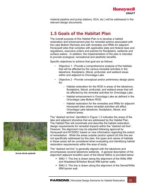
- Page 17 and 18: DRAFTA musk turtle basks on a shore
- Page 20 and 21: DRAFTBald eagles have returnedto On
- Page 22: ONONDAGA LAKEREMEDIAL DESIGN ELEMEN
- Page 25: SMU 8Remediation Area A(Low Energy)
- Page 29: W3B5B2A8ADitch A5B3B2ASMU 3SMU 21SM
- Page 33: SMU 5SMU 6Ley CreekSMU 8SYW-12Remed
- Page 37 and 38: historical and current habitat (or
- Page 39 and 40: DRAFTuse. Based on a survey of thes
- Page 41: DRAFT• construction of a thin-lay
- Page 45 and 46: TABLE 1.1ONONDAGA LAKEREMEDIAL DESI
- Page 47: Lake OutletSawmill CreekLakelandNin
- Page 51 and 52: DRAFTA great blue heron preys on am
- Page 53 and 54: DRAFTTransient cold waterfish, such
- Page 55 and 56: DRAFTthe construction of the Willis
- Page 57 and 58: DRAFTIndustrial discharges resultin
- Page 59 and 60: DRAFTOnondaga Lake Parkway is a pop
- Page 61 and 62: DRAFTfacilities remove floating deb
- Page 63 and 64: DRAFT(NAVD 1988). NAVD 1988 is the
- Page 65 and 66: DRAFTwaste in Remediation Area B an
- Page 67 and 68: DRAFTLake sturgeon currently exist
- Page 69 and 70: DRAFT1978, USFWS, 2009). The water
- Page 71 and 72: DRAFTLey Creek and adjacent Wetland
- Page 73 and 74: DRAFTSYW-10 is forested wetland loc
- Page 75 and 76: DRAFTWastebeds 1-8 site located adj
- Page 77 and 78: DRAFTWhite oak foliageforested area
- Page 79 and 80: DRAFTinvestigation in 1998 and 2000
- Page 81 and 82: DRAFTHarbor Brook flows into Ononda
- Page 83 and 84: DRAFTTributary 5A flows into Ononda
- Page 85 and 86: DRAFTof flower parts precluded defi
- Page 87 and 88: DRAFTMonitoring Data Assessment Rep
- Page 89 and 90: DRAFTSmallmouth Bass is a popular g
- Page 91 and 92: DRAFTRed-winged blackbirds live on
- Page 93 and 94:
DRAFTas beaver (Castor canandensis)
- Page 95 and 96:
DRAFTBald eagles have become common
- Page 97 and 98:
ONONDAGA LAKEREMEDIAL DESIGN ELEMEN
- Page 99:
HoneywellTABLE 2.2ONONDAGA LAKE ELE
- Page 103:
Original Shoreline of Onondaga Lake
- Page 107:
PUBFxPSS1A PSS1APFO1APFO1EPFO1ER2UB
- Page 113:
Remediation Area FLiverpoolMarinaSM
- Page 116 and 117:
DRAFTHydraulic dredging operationsu
- Page 118 and 119:
DRAFTparticular construction activi
- Page 120 and 121:
DRAFTImpacted wetlands will be rest
- Page 122 and 123:
DRAFTRemediation Area D - Addendum
- Page 124 and 125:
DRAFTlake activities. The remaining
- Page 126 and 127:
the presence of plants living in th
- Page 128 and 129:
DRAFTShort-term effects will includ
- Page 130 and 131:
DRAFTthat contain exposed Solvay wa
- Page 132 and 133:
DRAFTExpected Effects of Remedial A
- Page 135:
HoneywellONONDAGA LAKEREMEDIAL DESI
- Page 138 and 139:
HoneywellONONDAGA LAKEREMEDIAL DESI
- Page 143:
Remediation Area CSMU 8Remediation
- Page 147:
BR-7SYW-6Remediation Area FRemediat
- Page 151:
Proposed WBB/HB Acreages WithinHabi
- Page 154 and 155:
DRAFTWetland HabitatTypesFloating a
- Page 156 and 157:
DRAFTGuildsA guild is a collectiono
- Page 158 and 159:
DRAFTbrown trout is considered repr
- Page 160 and 161:
DRAFTRepresentativeBenthic Macro-In
- Page 162 and 163:
4.5 Habitat Module DevelopmentDRAFT
- Page 164 and 165:
DRAFT• Remediation Areas B, C, an
- Page 166 and 167:
DRAFTThe ring-neck duck is a type o
- Page 168 and 169:
DRAFTvarious other young-of-year fi
- Page 170 and 171:
4.7 Existing Conditions Illustrated
- Page 172 and 173:
HoneywellONONDAGA LAKEREMEDIAL DESI
- Page 174 and 175:
HoneywellONONDAGA LAKEREMEDIAL DESI
- Page 177 and 178:
HoneywellONONDAGA LAKEREMEDIAL DESI
- Page 179 and 180:
HoneywellONONDAGA LAKEREMEDIAL DESI
- Page 181:
HoneywellTABLE 4.2bPHENOLOGY INFORM
- Page 185:
HoneywellTABLE 4.4SUMMARY OF PHYSIC
- Page 188 and 189:
HoneywellONONDAGA LAKEREMEDIAL DESI
- Page 190 and 191:
HoneywellONONDAGA LAKEREMEDIAL DESI
- Page 192 and 193:
HoneywellONONDAGA LAKEREMEDIAL DESI
- Page 194 and 195:
HoneywellONONDAGA LAKEREMEDIAL DESI
- Page 196 and 197:
HoneywellONONDAGA LAKEREMEDIAL DESI
- Page 198 and 199:
ONONDAGA LAKEREMEDIAL DESIGN ELEMEN
- Page 200 and 201:
ONONDAGA LAKEREMEDIAL DESIGN ELEMEN
- Page 202 and 203:
HoneywellTABLE 4.9 (Continued)SUMMA
- Page 205:
SMU 8RAA-1RAA-20.1 Ac.12ARemediatio
- Page 209:
Remediation Area C(Medium Energy)SM
- Page 213 and 214:
DRAFTSection 5: Preliminary Designs
- Page 215 and 216:
DRAFTremedies have not been establi
- Page 217 and 218:
DRAFTherbaceous species typically h
- Page 219 and 220:
DRAFTThe mouth of Ninemile Creek an
- Page 221 and 222:
DRAFTThis exposed Solvay Waste alon
- Page 223 and 224:
DRAFTThe low-lying portion of the s
- Page 225 and 226:
DRAFTRemediation Area E (SMU 6 and
- Page 227 and 228:
DRAFT(Figures 5.18 and 5.19). The r
- Page 229 and 230:
DRAFTwould then be incorporated int
- Page 231 and 232:
DRAFTRemediation Area A is one of t
- Page 233 and 234:
DRAFTCommon Goldeneye is a species
- Page 235 and 236:
DRAFTThe monitoring program will be
- Page 237:
DRAFTOnondaga Lake• substrate com
- Page 241 and 242:
HoneywellTABLE 5.2ONONDAGA LAKEREME
- Page 243 and 244:
HoneywellONONDAGA LAKEREMEDIAL DESI
- Page 245 and 246:
HoneywellONONDAGA LAKEREMEDIAL DESI
- Page 247 and 248:
HoneywellONONDAGA LAKEREMEDIAL DESI
- Page 249:
SMU 8Remediation Area A(Low Energy)
- Page 259:
W3B5B2A8ADitch A5B3B2ASMU 3SMU 21RA
- Page 275:
SMU 5SMU 6Ley CreekSMU 8SYW-12Remed
- Page 285:
Mound for WaterfowlNestingBraided C
- Page 289:
owerSMU 8Remediation Area B1-3' Sha
- Page 293:
8RemediationArea CSMU 8Remediation
- Page 297:
SMU 8Remediation Area A(Low Energy)
- Page 301:
WFineGravelTopsoilDitch ASMU 3SMU 2
- Page 305:
SMU 5SMU 6Ley CreekSMU 8SYW-12Remed
- Page 308 and 309:
DRAFTBeauchamp, W.W. (1908) Past an
- Page 310 and 311:
DRAFTEffler, Steven W., S.M O’Don
- Page 312 and 313:
DRAFTKappel, W.M. and W.S. McPherso
- Page 314 and 315:
DRAFTNYFA. (2005) New York Flora As
- Page 316 and 317:
DRAFTOCDWEP (2004) Ambient Monitori
- Page 318 and 319:
DRAFTScott, W.B., and E.J. Crossman
- Page 320 and 321:
DRAFTUSEPA (2008) Wetland Restorati
- Page 323:
DRAFTAppendix AAmphibians and Repti
- Page 326 and 327:
DRAFTTURTLESStandard English Name (
- Page 329:
PATH: I:\Honeywell.1163\43776.Habit
- Page 345:
OutletLOCATOR90690616160BloodyBrook
- Page 349:
LOCATOROutlet906905616160BloodyBroo
- Page 353:
DRAFTAppendix DSuitability of Resto
- Page 356 and 357:
DRAFTsubcordatum), and water smartw
- Page 358 and 359:
DRAFTsoft substrate (Module 6A), wh
- Page 360 and 361:
DRAFTBirds - Suitable habitat condi
- Page 362 and 363:
DRAFTwith slightly larger substrate
- Page 364 and 365:
DRAFTlikely create places for finer
- Page 366 and 367:
DRAFTSuitability of Restoration in
- Page 368 and 369:
DRAFTrepresentative fish species, s
- Page 371:
DRAFTAppendix EMaster List of Plant
- Page 374 and 375:
DRAFTWetland Woody Vegetation(Modul
- Page 376 and 377:
DRAFTNortheast Wetland Seed Mix(Mod
- Page 378 and 379:
DRAFTDeep Emergent (Nonpersistent)
- Page 380 and 381:
DRAFTSalt Marsh(Module 6A, Water 1
- Page 382:
DRAFTCommon NameBig bluestemPartrid