Alan Watchman
Alan Watchman
Alan Watchman
- No tags were found...

You also want an ePaper? Increase the reach of your titles
YUMPU automatically turns print PDFs into web optimized ePapers that Google loves.
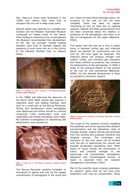
COALITIONNo. 10, July 2005Sea. Open-cut mines were developed in the1960s and railway lines were built totransport the iron ore to deep water ports.Depuch Island was selected as a suitable portlocation and the Western Australian Museumconducted an impact study of the island.After finding an extensive array of petroglyphsthe Museum recommended that developmentof the site not proceed. Instead loadingfacilities were built at Dampier despite thepresence of much more rock art in the vicinityof the Dampier facilities than on DepuchIsland.yet it does not have World Heritage status. Aninventory of the rock art has not beencompiled. There has been no regularmonitoring of rock art sites and no ongoingresearch. Federal and State governments havenot been concerned about the stability orprotection of the petroglyphs, and there is noplan of management for the region (Bednarik,2002).The reason that the rock art is now in publicfocus is because further gas and chemicalplants are planned for construction and therock art will once again be impacted. Thechemical plants will produce nitrogen andsulphur oxides, and ammonia gas emissionsand these artificial by-products may enhancethe deterioration of the petroglyphs. In 2004 astudy of the chemical effects on the surfaceof the rock art was commenced (MacLeod,2005), but the planned development is likelyto proceed for economic reasons.Figure 1. Example of rock carving on the Burrup Peninsula.Courtesy Robert BednarikIn the 1980s and following the discovery ofthe North West Shelf natural gas reserves atreatment plant and loading facilities werebuilt on a small part of the Burrup Peninsula.During that development some petroglyphswere destroyed and others moved to a fencedcompound. Little conservation work wasundertaken and limited recordings were made.No scientific investigations of weathering anddeterioration were carried out.Figure 2. Rock art of the Burrup Peninsula. Courtesy RobertBednarikThe Burrup Peninsula contains hundreds ofthousands of figures and may be the largestconcentration of petroglyphs in the world andFigure 3. Recent rock carving on the Burrup Peninsula. CourtesyRobert BednarikThe scope of the research involves modellingthe predicted and known ground level ambientconcentrations and the deposition rates ofnitrogen dioxide, sulphur dioxide and ammoniafrom the existing and proposed industrial andshipping sources. The mineralogy andchemistry of the rock types will be studiedwith the aim of determining the natural andpossible accelerated weathering rates. Othertopics of study include the examination ofcolour and physical changes to theengravings, the microclimate, atmosphericdeposition and microbiological activity. Areport is expected from the researchmanagement committee in 2007.Part of the scientific study is being undertakenby research teams that do not have priorexperience with rock art conservation. Some15