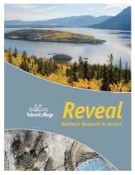
Dawson Climate Change Adaptation Plan, Revised ... - Yukon College
Dawson Climate Change Adaptation Plan, Revised ... - Yukon College
Dawson Climate Change Adaptation Plan, Revised ... - Yukon College

You also want an ePaper? Increase the reach of your titles
YUMPU automatically turns print PDFs into web optimized ePapers that Google loves.
Community <strong>Adaptation</strong> Projecta return period of 50-100 years (Janowicz, 2002). After a major flood in 1979, a dyke was raisedto the point that the community is now considered safe from a 200-year flood 2 .Climatic data from <strong>Dawson</strong> indicates a frost-free period of greater than 80 days, a vegetativeperiod in excess of 110 days and an average number of growing degree days 3 greater than 1200(Smith et al., 2004). When factoring in the availability of irrigation water from the rivers, and thehigh quality of the top soil, this region has the best agricultural possibilities in <strong>Yukon</strong> (SynergyWest Ltd., 1975; Tarnocai et al., 1988). There is market gardening at 9 Mile Island on the <strong>Yukon</strong>River, and in the Henderson’s Corner area on the Klondike River. There are extensive agriculturallands in the Sunnydale area although they are not farmed intensively.Trapping is an important, if irregular, land use in <strong>Dawson</strong> and trapping concessions aredistributed around the region. Lands within approximately 8 km of <strong>Dawson</strong> are reservedfor Tr’ondëk Hwëch’in Elders. The most significant species for trapping are: marten (Martesamericana), lynx (Lynx canadensis), wolf (Canis lupis), wolverine (Gulo gulo), fox (Vulpes vulpes),and some beaver (Castor canadensis) and mink (Mustela vison). Hunting is another land usethat provides an important source of food for residents. Moose (Alces alces) is the main specieshunted, followed by caribou (Rangifer tarandus), and Fannin’s sheep and Dall’s sheep (Ovis dalli).Most hunting takes place in August, September and October, primarily along the local roads andrivers.In summer and fall, chum (Oncorhynchus keta) and chinook (O. tshawytscha) salmon ascendthe <strong>Yukon</strong> River to their spawning grounds. Salmon fisheries, a feature of the region dating backto prehistory, harvest salmon in gill nets and fish wheels along the <strong>Yukon</strong> River near <strong>Dawson</strong>.A part of the annual harvest is used for subsistence food consumption by humans or as dogfood. Salmon caught in the <strong>Yukon</strong> River, to a limited extent, are also sold locally to residents inthe community. Other fish species found in the <strong>Yukon</strong> River include: lake whitefish (Coregonusclupeaformis), broad whitefish (C. nasus), round whitefish (Prosopium cylindraceum), inconnu(Stenodus leucichthys nelma), least cisco (C. sardinella), arctic cisco (C. autumnalis), bering cisco(C. laurettae), northern pike (Esox lucius), arctic grayling (Thymallus arcticus arcticus), burbot(Lota lota), longnose suckers (Catostomus catostomus), slimy sculpin (Cottus cognatus), arcticlamprey (Lampetra camtschatica) and lake chub (Couesius plumbeus).There are several species sensitive to disturbance in the landscape around <strong>Dawson</strong>. The Speciesat Risk Public Registry recognizes four species found in the <strong>Dawson</strong> region listed on the Speciesat Risk Act (SARA); these species are listed in Table 1. Only those species legally recognized bySARA have been listed. The fact that other species considered threatened are present in the<strong>Dawson</strong> region should be noted 4 .2. The term “200-year flood” is used to describe the recurrence interval of floods. “100-year recurrence interval”means that the probability that a river will flow as high as the 100-year flood line in any given year is 1 in 100.Statistically speaking, each year begins with the same 1% chance that a 100-year event will occur. However, justbecause a 100-year flood happened last year does not mean that it will not happen this year since future rainfall andfloods do not depend on the rainfall and floods that happened in the past. Past records are mainly used to show whatkind of river flows can be expected (USGS, 2009).3. Growing degree days (GDD) are used to estimate the growth and development of plants and insects duringthe growing season. The basic assumption is that development will only occur if the air temperature exceeds someminimum developmental threshold or base temperature. A linear increase in development is assumed if there isan increase in temperature or heat energy accumulation. The base temperatures are different for each organism.(OMAFRA, 2009).4. For example, those species considered threatened by the Committee on the Status of Endangered Wildlife inCanada (COSEWIC; http://www.cosewic.gc.ca/eng/sct0/rpt/dsp_booklet_e.htm).16