
You also want an ePaper? Increase the reach of your titles
YUMPU automatically turns print PDFs into web optimized ePapers that Google loves.
EITHER I ENCLOSE A CHEQUE FOR:<br />
(DON'T FORGET TO INCLUDE DELIVERY)<br />
OR PLEASE CHARGE MY CREDIT CARD:<br />
NAME MR / MRS / MS/MISS<br />
JOB TITLE: COMPANY NAME:<br />
ADDRESS:<br />
DAYTIME TELEPHONE NUMBER:<br />
E-MAIL ADDRESS:<br />
£<br />
H O W T O O R D E R<br />
TELEPHONE 0843 2160 450 Please have your credit card details to hand.<br />
POST this completed form to: <strong>Map</strong> <strong>Marketing</strong> Limited,<br />
FREEPOST (SWB30952),<br />
Okehampton,<br />
EX20 3ZZ<br />
FAX this completed order form to 0843 2160 448<br />
VISIT OUR WEBSITE at www.mapmarketing.com<br />
FREE Purchase 4 or more products featuring a blue code from this catalogue, and have the lowest priced item in your<br />
order absolutely FREE! Simply make your selections and write FREE in the Total column for the least expensive item.<br />
CODE<br />
DESCRIPTION – Please write below the description of your chosen product.<br />
PERSONALISED PRODUCTS: Please follow instructions listed with each product. We will require either a full<br />
address & postcode, a specific year and/or a personalised message, which should be supplied with your order. Price each Qty Totals<br />
If you are not completely satisfied with your purchases, simply call us<br />
within 14 days to arrange a full and prompt exchange or refund.<br />
* CV2 Number<br />
MasterCard & VISA<br />
*Amex 4-digit Card<br />
Security Code<br />
These details are mandatory to complete.<br />
Please make your cheque payable to<br />
MAP MARKETING LIMITED<br />
POSTCODE:<br />
YOUR SIGNATURE PLEASE: DATE:<br />
GREAT BRITAIN DELIVERY<br />
Orders under £30 – please add £4.95<br />
Orders up to £75 – please add £6.95<br />
Orders over £75 – please add £8.95<br />
PLEASE ALLOW UP TO 14 DAYS FOR DELIVERY<br />
Expiry<br />
Date:<br />
If you would like to hear about Special Offers via the Internet (not more than 3 times per year), please register your<br />
e-mail address. Your details will remain private as we do not release e-mail addresses to outside organisations.<br />
Subtotal<br />
Delivery<br />
Please tick<br />
credit card used:<br />
3<br />
From time to time we make our customer database (not credit card information) available to carefully selected companies. If you would prefer us to keep your details private, please tick this box.<br />
/<br />
Total<br />
*Your Card Security<br />
Code (CV2 number)<br />
is the last 3 digits which<br />
appear on the back<br />
of your MasterCard<br />
or VISA card on the<br />
signature strip (usually<br />
separated by a space from<br />
other numbers on the back<br />
of your card).<br />
*American Express<br />
Credit Card Users:<br />
Look for the 4-digit code<br />
printed on the front of<br />
your card just above and<br />
to the right of your main<br />
credit card number.<br />
WMMC<br />
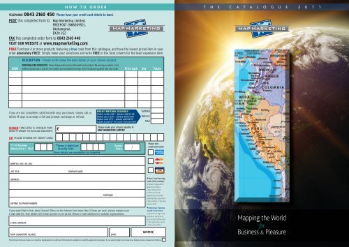
T H E C A T A L O G U E 2 0 1 1<br />
<strong>Map</strong>ping the World<br />
for<br />
Business & Pleasure
1<br />
Welcome to our collection of the finest<br />
map products in the world<br />
C<br />
atering for both business and leisure, our<br />
comprehensive range of maps and related<br />
products have been selected to give you<br />
maximum choice and excellent value for money.<br />
Why not take advantage of our very special offer?<br />
Purchase 4 or more products featuring a blue code<br />
from this catalogue and you can have the lowest<br />
value item absolutely FREE.<br />
In addition to our stock products, we also offer a unique<br />
bespoke mapping service that allows you to build your<br />
own maps from a wide and growing range of map<br />
bases. See pages 7 & 8 for more information about<br />
this popular service.<br />
Our Customer Services team promise a fast, friendly<br />
and efficient service that includes a guarantee of<br />
satisfaction or your money will be cheerfully refunded.<br />
CONTENTS<br />
PAGE<br />
World and Europa <strong>Map</strong>s 1-2<br />
British Isles Planning <strong>Map</strong>s 3-4<br />
Regional Road Road <strong>Map</strong> Series 4<br />
NHS Primary Care <strong>Map</strong> 5<br />
London Regional <strong>Map</strong>s 5-6<br />
London Regional <strong>Map</strong>s and Promotional <strong>Map</strong>ping 6<br />
<strong>Map</strong>s Made to Order – BuildYour Own! 7-8<br />
Postcode <strong>Map</strong>s & Related Products 9<br />
Postcode District <strong>Map</strong>s 10<br />
Postcode Sector <strong>Map</strong>s 11<br />
International <strong>Map</strong> Range 12<br />
<strong>Map</strong> Desk Mats & Hometown Jigsaw Puzzle 13<br />
Aerial Photography and Canvas <strong>Map</strong>s – Centred onYour Home 14<br />
<strong>Map</strong> Jigsaws Centred onYour Home 15<br />
My House History Portfolio &YourYear~Your World~Jigsaw Puzzle 16<br />
Personalised World Traveller <strong>Map</strong> 17<br />
Personalised Newspaper Jigsaws 17<br />
Business Planning Wall Charts 18-19<br />
<strong>Map</strong> <strong>Marketing</strong> Limited<br />
Customer Service Centre<br />
Unit 4A, Hatherleigh Industrial Estate,<br />
Holsworthy Road,<br />
Hatherleigh, Devon EX20 3LP<br />
London Office<br />
1st Floor, The Omega Building,<br />
Smugglers Way,<br />
Wandsworth, London SW18 1AZ<br />
Telephone: 0843 2160 450 (for both locations)<br />
Fax: 0843 2160 448 (for both locations)<br />
World and Europa <strong>Map</strong>s <strong>Map</strong> <strong>Marketing</strong> Best Sellers<br />
GIANT WORLD POLITICAL MAP<br />
This spectacular giant-sized map has been designed to make<br />
an impression! Fully up-to-date, the map features traditional<br />
political colouring with country boundaries, main cities,<br />
principal roads, railways, time clocks and international<br />
airports clearly marked. Also features attractive and subtle<br />
relief shading on land masses and ocean depths, giving<br />
the map a stunning ‘3-D’ effect.<br />
Size 120 x 184cm<br />
Scale 1:20 000 000 (315 miles: 1 inch)<br />
Code GWLD Price £45.99 (laminated)<br />
Code GWLDF Price £139.99 (framed – aluminium only)<br />
WORLD POLITICAL MAP<br />
This magnificent map has been specially designed for the<br />
office or boardroom, but will look equally impressive in the<br />
classroom or home. Completely revised and updated, the<br />
countries are clearly defined with political colouring and<br />
main cities are clearly marked. Also features a panel<br />
showing time zone clocks, country flags and<br />
socio-economic data for each individual country.<br />
Size 83 x 120cm Scale 1: 34 000 000 (537 miles: 1 inch)<br />
Code BEX Price £26.99 (laminated) or £79.99 (framed)<br />
Our 3 framing options are displayed below.<br />
The framed prices throughout this brochure include<br />
the laminated map of your choice.<br />
EUROPA POLITICAL MAP<br />
Revised and very comprehensive, this map covers the whole<br />
of Europe as far as Moscow to the north and south to north<br />
Africa. Each country is shown in a different colour from its<br />
neighbours, and the country names are given in the native<br />
language of that country. The key/legend is present in 6<br />
languages. Features cities, main roads, airports, canals<br />
and rivers. For framing options see below.<br />
Size 109 x 93cm Scale 1:4 000 000 (64 miles:1 inch)<br />
Code EUR Price £26.99 (laminated) or £79.99 (framed)<br />
European Postcode <strong>Map</strong> also available - see Page 12<br />
If you need assistance or advice<br />
on our range, contact us today<br />
on 0843 2160 450.<br />
We are here to help.<br />
YOUR CHOICE OF FINISH<br />
All our maps and charts are<br />
permanently bonded between<br />
two sheets of tough, flexible,<br />
crystal-clear plastic (unless otherwise<br />
annotated). This transforms<br />
an ordinary paper map into a<br />
virtually indestructible reference<br />
and business planning tool.<br />
▲ ▲ ▲<br />
L A M I N AT E D T O L A S T<br />
The surface can be written on with dry or wet-wipe pens<br />
allowing you to update information at a stroke.<br />
For the perfect finish, why not order your map framed?<br />
All our maps can be supplied expertly mounted and framed<br />
in any of the three trims illustrated here. The map of your<br />
choice is laminated, framed<br />
and arrives ready to display<br />
with a hanging kit.<br />
A popular option and<br />
excellent value for money.<br />
Code AFR<br />
SATIN FINISH ALUMINIUM FRAME<br />
Price (which includes any selected standard map) £79.99 each.<br />
We also do magnetic versions of most of our maps, please call<br />
Customer Services for more details.<br />
When ordering, simply add the frame Code listed below to<br />
the Code of the map as shown in this catalogue.<br />
Code DFR<br />
DARK WOOD FRAME<br />
These illustrations show Code LFR<br />
details of the maps at<br />
LIGHT actualWOOD size. FRAME<br />
Telephone Customer Services on 0843 2160 450 email: sales@mapmarketing.com www.mapmarketing.com Telephone Customer Services on 0843 2160 450 email: sales@mapmarketing.com www.mapmarketing.com 2
3<br />
British Isles <strong>Map</strong>s Regional Road <strong>Map</strong> Series<br />
BRITISH ISLES PLANNING MAPS<br />
Specially designed with UK strategic planning in mind,<br />
each of these indispensable reference maps show:<br />
• National, County & Unitary Authority boundaries.<br />
• Motorways and primary road routes.<br />
• Major towns and cities.<br />
• A large-scale inset of London (4 miles:1 inch).<br />
This business planning series is updated annually ensuring<br />
you get the very latest information. All the maps in this<br />
popular range are available either in Standard size or, for<br />
those big planning or presentation requirements, SuperSize.<br />
Available laminated or framed in one of 3 options<br />
(see page 2 for framing choices). The framed price<br />
includes the map you have selected.<br />
STANDARD SIZE 120 x 83cm<br />
Scale 1: 800 000 (121 /2 miles: 1 inch)<br />
Price £26.99 (laminated) £79.99 (framed)<br />
SUPERSIZE 174 x 120cm<br />
Scale 1:440 000 (7 miles: 1 inch)<br />
Price £95.00 (laminated) £150.00 (framed)<br />
STANDARD<br />
SUPERSIZE<br />
WRITE ON, WIPE OFF SURFACE<br />
SPECIAL OFFER<br />
Purchase 4 or more products featuring a blue code from this<br />
catalogue, and have the lowest value item in your order<br />
absolutely FREE! Simply write FREE in the Sub Total<br />
column for the lowest valued item on the Order Form, which<br />
you will find on the back cover of this catalogue.<br />
▲ ▲<br />
▲<br />
▲ ▲<br />
UK POSTCODE AREAS<br />
Displays all 124 Postcode Area boundaries and corresponding<br />
letters in red (including Northern Ireland). Features a high<br />
density of place names within each of the Postcode<br />
Area boundaries.<br />
Code BIPA Prices listed on Page 3.<br />
Please note; we also carry a full range of detailed District and Sector<br />
Postcode maps and products. These can be found on pages 10-11<br />
of this catalogue. Alternatively, visit our Postcode Products website at<br />
www.postcode-maps.com and let our on-line Postcode Wizard<br />
help you choose the right map for your area.<br />
COUNTIES, DISTRICTS & UNITARY AUTHORITIES<br />
Counties and Unitary Authorities are clearly displayed in<br />
different tints, subdivided where applicable into Districts.<br />
This highly attractive map also includes handy small scale<br />
map insets of the whole of Ireland and UK Postcode Areas.<br />
An additional information panel lists population statistics<br />
for all Counties, Districts and Unitary Authorities.<br />
Code BIC Prices listed on Page 3.<br />
UK SALES & MARKETING<br />
Designed for maximum business planning flexibility, this<br />
popular map features small scale insets showing regional TV<br />
coverage areas (including overlap & population served) and<br />
a handy UK Postcode Areas map. Population figures by<br />
County & Unitary Authority are listed in a separate<br />
information panel. Town and city stamps are also<br />
keyed to population data.<br />
Code UKM Prices listed on Page 3.<br />
BRITISH ISLES MOTORING<br />
Route planning information down to ‘B’ road detail<br />
featuring attractive physical relief colouring. Small scale<br />
Ireland and UK Postcode Areas insets. Mileage chart between<br />
over 60 cities. Listing of contact details for major airports,<br />
rail and ferry operators.<br />
Code BIM Prices listed on Page 3.<br />
Purchase 4 or more products from this catalogue featuring<br />
a blue code and you can have the lowest value item in your<br />
order absolutely FREE.<br />
NATIONAL HEALTH SERVICE MAP<br />
Compiled in consultation with Health Authorities, this map is a<br />
‘must’ for professionals working in, or marketing to, the National<br />
Health Service. Illustrates Health Authority and Primary Care<br />
boundaries. Major acute hospitals are clearly marked.<br />
Code NHS Price £39.99 (laminated) or £79.99 (framed)<br />
Please note; we also carry a full range of NHS Primary Care Trust<br />
maps. Please see page 5 for further information. Alternatively,<br />
visit our NHS map products website at www.nhs-map.info<br />
REGIONAL ROAD MAP SERIES<br />
These maps cover the whole of Great Britain in considerable<br />
detail. Most roads are shown with motorways, trunk roads,<br />
dual carriageways, main and secondary routes all prominently<br />
depicted in an easy to read style. A helpful mileage guide is<br />
included along with city centre street plans for the major<br />
cities on each map. Ideal for regional route planning, these<br />
maps also feature helpful information such as railways, airports,<br />
county boundaries and rivers.<br />
If these maps don’t cover the area you require, then why not<br />
take a look at our popular Bespoke <strong>Map</strong>ping service where we<br />
can build maps to your exact specifications – see pages 7 & 8.<br />
Size 96 x 130cm Scale 1: 250 000 (4 miles:1 inch)<br />
Price £26.99 (laminated) or £79.99 (framed)<br />
Code Description<br />
RRM1 Northern Scotland, Orkney & Shetland<br />
RRM2 Western Scotland & the Western Isles<br />
RRM3 Southern Scotland & Northumberland<br />
RRM4 Northern England<br />
RRM5 East Midlands & East Anglia including London<br />
RRM6 Wales & West Midlands<br />
RRM7 South West England & South Wales<br />
RRM8 South East England including London<br />
Telephone Customer Services on 0843 2160 450 email: sales@mapmarketing.com www.mapmarketing.com Telephone Customer Services on 0843 2160 450 email: sales@mapmarketing.com www.mapmarketing.com<br />
4
5<br />
NHS Primary Care <strong>Map</strong>s London Regional <strong>Map</strong>s – Promotional <strong>Map</strong>ping<br />
NHS PRIMARY CARE MAP SERIES<br />
Revised to include the 2006 reconfigurations, this series covers<br />
the entire country in 7 sheets, displaying the Primary Care<br />
boundaries and names presented on a large scale base map.<br />
The map base shows details down to “B” road level and<br />
hospitals are annotated by a numbered icon cross-referred<br />
to an index of hospital names printed within an information<br />
panel on the map. Most of the sheets in this series are<br />
presented at a scale of 1:235 000 or 3.6 miles to 1 inch<br />
(unless otherwise stated). Sheet sizes are shown individually.<br />
Price £39.99 (laminated) £79.99 (framed)<br />
Code Description Size<br />
NHS-SCOT 1 Scotland<br />
Scale 1:310 000 (4.9 miles :1 inch)<br />
120 x 167 cm<br />
NHS-NE 2 Northern England 120 x 167 cm<br />
NHS-WALES 3 Wales 91 x 127 cm<br />
NHS-MID 4 Midlands & Eastern 120 x 167 cm<br />
NHS-SW 5 South West England 107 x 147 cm<br />
NHS-SE 6 South East & Central England 91 x 127 cm<br />
NHS-LON 7 Greater London<br />
Scale 1:45 000 (1 mile : 1.4 inches)<br />
107 x 147 cm<br />
BUILD YOUR OWN NHS MAPS<br />
Using the latest digital map bases, we can now create maps<br />
to your exact specification centred on a location of your<br />
choice with details you want.Your map can combine<br />
healthcare boundaries with Postcode and /or Country/Unitary<br />
Authority boundaries. There are many other layers of<br />
information that can be added including surgeries, radial circles,<br />
symbols and logos. Call our Bespoke <strong>Map</strong>ping team on<br />
0843 2160 455 to discuss your particular requirements or,<br />
alternatively, visit our website at www.bespokemaps.net<br />
to explore further the many options now available.<br />
LONDON REGIONAL MAPS<br />
100 MILES AROUND LONDON<br />
Specially produced for the commercial driver and practical<br />
motorist, covers from Bristol to the east coast and from<br />
Stoke-on-Trent to the south coast. Roads are colour coded<br />
for easy use. Our framing options can be found on page 2.<br />
Size 90 x 105cm<br />
Scale 1: 316 800 (5 miles:1 inch)<br />
Code 100 LON Price £ 26.99 (laminated)<br />
£ 79.99 (framed)<br />
To view our complete range of Ordnance Survey mapping<br />
visit our website: www.mapmarketing.com<br />
▲<br />
▲<br />
LONDON MAIN ROADS & THE M25<br />
A comprehensive route map of Greater London bounded by<br />
the M25 motorway. Major roads are clearly numbered and<br />
named through the Capital. A full street index is printed<br />
on the reverse.<br />
Size 93 x 118cm Scale 1: 63 360 (1 mile:1 inch)<br />
Code LON MAIN RDS<br />
Price £26.99 (laminated) or £ 79.99 (framed)<br />
Framing options are illustrated on page 2.<br />
A-Z CENTRAL LONDON STREET MAP<br />
Bordered by Neasden, Wimbledon, Elmstead, and Wanstead.<br />
Shows Postcode districts and borough boundaries. Comes<br />
complete with an index to streets.<br />
Size 76 x 102cm Scale 1: 21 477 (1 mile : 3 inches)<br />
Code CENT Price £26.99 (laminated) or £79.99 (framed)<br />
Framing options are illustrated on page 2.<br />
Telephone Customer Services on 0843 2160 450 email: sales@mapmarketing.com www.mapmarketing.com Telephone Customer Services on 0843 2160 450 email: sales@mapmarketing.com www.mapmarketing.com 6<br />
▲<br />
▲<br />
Corporate & Promotional <strong>Map</strong>ping<br />
U K , W O R L D A N D E U R O P E A N M A P S T A I L O R E D T O R E F L E C T Y O U R C O R P O R A T E I D E N T I T Y .<br />
<strong>Map</strong>s make ideal promotional items to support corporate awareness campaigns and brand<br />
building activities. Unlike many promotional products, maps are highly valued, appreciated by<br />
recipients and ensure that your message remains highly visible.<br />
We carry an extensive range of “off the shelf” map products<br />
designed to facilitate branding with your corporate logo or<br />
message.<br />
From design through to finished product, our full service package<br />
includes lamination and framing. We can even handle distribution<br />
to your own database – a total service package from one<br />
source.<br />
RIGHT: A UK distribution map designed to display depot regions for Burdens Limited.<br />
BELOW: framed wall map installed at FPDSavills offices, London.<br />
BELOW: UK delivery costs breakdown<br />
map by Royal Mail postcode area<br />
for Halfen-Deha.<br />
ABOVE: Giant world map branded for DHL Freight.<br />
To discuss your specific requirements, please contact our promotional mapping team on 0843 2160 445
7 7<br />
<strong>Map</strong>s Made to Order <strong>Map</strong> Desk Mats & Hometown Puzzle<br />
MAPS MADE TO ORDER – FROM ONLY £65<br />
Can’t find the map you really need in this catalogue? Advances in<br />
digital print technology now enable us to create bespoke maps to<br />
your exact specifications! We give you control over the precise<br />
geographical area you wish to cover – seamless and site-centred.<br />
It’s a flexible, easy to use service and our expert Bespoke <strong>Map</strong>ping<br />
Team are on hand to guide you through the process.<br />
At <strong>Map</strong> <strong>Marketing</strong> we hold a library of digital map files that cover<br />
the whole of Great Britain at various levels of scale and detail.<br />
Our growing selection of map bases includes mapping from<br />
Ordnance Survey and Bartholomew, two of the most highly<br />
respected cartographic publishers in the world.<br />
Our five most popular map bases are illustrated to the right. Add<br />
to these from a range of FREE boundary sets to further enhance<br />
and customize your made-to-order map. For the perfect finish,<br />
choose from a comprehensive and growing portfolio of specialist<br />
add-on features that include:<br />
• distance radials • customised text & symbols<br />
• area masking • company logos<br />
• framing services • dry-wipe lamination<br />
Your map can be as sophisticated or as simple as you require, and<br />
our extra services can turn your map into an indispensable<br />
strategic planning tool.<br />
“ I used <strong>Map</strong> <strong>Marketing</strong> to detail our regional coverage across the<br />
south of England, a tool needed to plan tactical activity and specific<br />
journey plans. The team were helpful and professional, and we were<br />
delighted with the end product. The map is used on a regular basis<br />
and has proven to be an extremely useful planning tool.”<br />
Thomas Seymour, Coca-Cola Enterprises.<br />
Contact us today on 0843 2160 455 to discuss your specific requirements<br />
or, alternatively, why not visit us at www.bespokemaps.net<br />
to review in greater detail the range of our services.<br />
www.bespokemaps.net<br />
▲<br />
GREYSCALE MAPPING (sample displayed right)<br />
is very effective for use with one of our FREE<br />
colour data sets, e.g., Postcode Sector<br />
boundaries in red. All our map bases are<br />
available in greyscale or in full colour output.<br />
FREE BOUNDARY SETS<br />
Make your map work that much harder<br />
for you by adding one or more of these<br />
FREE data sets as overlays.<br />
Full and up to date Postcode Area, District<br />
or Sector boundaries. A popular option.<br />
Postcodes explained on page 10.<br />
County, District, Unitary Authority, Ward<br />
boundaries or Parlimentary Constituency.<br />
NHS boundaries including Strategic Health<br />
Authority & Primary Care Trust boundaries<br />
and hospital locations.<br />
For more information on boundary sets visit<br />
our website or contact us today to discuss<br />
your specific requirements.<br />
Telephone Bespoke Customer Services on 0843 2160 455 email: bespokes@mapmarketing.com www.bespokemaps.net Telephone Customer Services on 0843 2160 450 email: sales@mapmarketing.com www.mapmarketing.com<br />
▲<br />
▲<br />
▲<br />
▲<br />
▲<br />
▲<br />
A selection of our most popular mapping bases offering maximum<br />
scale flexibility and wide choice of styles (illustrated below).<br />
GB PLANNER’S MAPPING from <strong>Map</strong> <strong>Marketing</strong><br />
The crisp, uncluttered design of this mapping makes it an ideal<br />
multi-purpose base suitable for large regional coverage containing<br />
more than one county (e.g., South West England). Well suited to<br />
route planning & territory management applications.<br />
• Main routes & county boundaries shown<br />
• Colour-coded route planning detail<br />
• Well suited for use with extra information layers<br />
GB ROUTES & COUNTIES MAPPING – Bartholomew <strong>Map</strong>ping Solutions<br />
An excellent base map containing a high level of detail. This<br />
choice works particularly well where coverage of individual<br />
counties is required.<br />
• Clearly displays motorways<br />
• Shows A, B & unclassified roads<br />
• Colourful and easy to read detail<br />
• Excellent choice for route planning applications<br />
LANDRANGER LOCAL MAPPING from Ordnance Survey<br />
This popular map base features a high level of concentrated<br />
detail for mapping at a local scale.<br />
• Full street plan layouts (streets are not named)<br />
• Displays all roads, railways & major landmarks<br />
• Shows public rights of way & tourist information<br />
• National Grid squares shown to aid navigation<br />
ORDNANCE SURVEY STREET VIEW MAPPING<br />
Detailed street level map sourced from Landplan® data and the<br />
Ordnance Survey Roads database.<br />
• Clear street-level detail<br />
• Streets names, building outlines, railways, water features<br />
and woodland.<br />
• Public interest points including Post Offices, fire stations,<br />
hospitals, libraries and schools.<br />
ORDNANCE SURVEY VECTORMAP DISTRICT MAPPING<br />
A simplified version of the OS Landranger providing street<br />
names for selected main roads.<br />
• Urban areas precisely highlighted.<br />
• Main arterial roads named<br />
• Clear base ideal for the addition of data sets.<br />
LONDON STREET LEVEL MAPPING – Bartholomew <strong>Map</strong>ping Solutions<br />
Extremely high degree of detail at full street level for<br />
Greater London within the M25 Motorway.<br />
• Borough boundaries clearly displayed<br />
• Shows railway & tube stations, hospitals & schools<br />
• Works well with Postcode boundaries added<br />
1<br />
2<br />
3<br />
4<br />
✓<br />
✓<br />
✓<br />
✓<br />
OUR 4 STEP GUIDE TO<br />
CREATING YOUR MAP<br />
It couldn’t be simpler!<br />
Choose Your Area – define the geographical area<br />
your map should cover, e.g. • a radius around a<br />
centre point • a list of Postcodes • a specific County<br />
or District • north, south, east & west points • an<br />
NHS area or particular Strategic Health Authority •<br />
Choose Your <strong>Map</strong> Base – consider what you require<br />
from the map • level of detail to be displayed • size<br />
of the area to be covered • full colour output or<br />
greyscale presentation •<br />
Choose Additional Features – add some additional<br />
FREE data layers as outlined above • radial circles<br />
• area masking • custom text • symbols •<br />
Choose Your Finish – bespoke maps are available in<br />
a variety of finishes • paper • encapsulated in dry/wet<br />
wipe film • expertly mounted and framed<br />
• magnetic backing •<br />
We offer a complimentary advisory service and<br />
are happy to give you our recommendations as to<br />
the most suitable map base, size, scale etc. Ring us<br />
today on 0843 2160 455 or visit us online to<br />
explore further how we can help.<br />
8
9<br />
Postcode <strong>Map</strong>s and Products Postcode District <strong>Map</strong>s<br />
POSTCODE MAPS AND PRODUCTS<br />
Advances in digital print technology enable us to keep our Postcode maps right up to date with Royal Mail Postcode boundary changes.<br />
All of our maps are created direct from digital files and stock is printed on a daily basis ensuring you get the very latest, accurate Postcode<br />
information. When the Royal Mail announce changes, our boundary files are rapidly updated and the current data introduced<br />
immediately into our stock products.<br />
Additionally, as a valued customer, we will notify<br />
you each time Postcode changes effect any maps<br />
you have previously purchased from us giving you<br />
the opportunity to replace your maps with updated<br />
new editions.<br />
▲<br />
POSTCODE AREAS MAP<br />
This map presents the Postcode Area boundaries<br />
and corresponding letters clearly shown in red<br />
with County and Unitary Authorities boundaries<br />
in green for the whole of the UK. The map base<br />
shows motorways, primary & ‘A’ roads, and<br />
features 7 types of town/city ‘stamps’ based<br />
on population ranging from 2000 to 1 million<br />
plus inhabitants. Also features a Greater London<br />
large-scale map insert (4 miles = 1 inch).<br />
Available paper, laminated or framed<br />
(see page 2 for framing options).<br />
Size 120 x 83 cm<br />
Scale 1:800 000 (12.5 miles = 1 inch)<br />
Code Description Price<br />
BIPAP Paper edition £19.95<br />
BIPA Laminated version £26.99<br />
BIPA+ Framed (see page 2) £79.99<br />
2009 COLLINS POSTCODE ATLAS<br />
This excellent business planning atlas shows the<br />
Postcode Area & District boundaries and codes<br />
for the whole of the UK in an easy to use atlas<br />
format at a scale of 4.15 miles to the inch. The<br />
London section includes Sector level information<br />
at 3.17 inches to the mile with a complete<br />
index to London street names. This superb<br />
atlas also contains selected conurbation<br />
maps, administrative areas and London<br />
borough mapping. Fully indexed.<br />
▲ Detail above shown at ACTUAL SIZE<br />
▲<br />
Hardback 224 pages. Size 30 x 22 cm<br />
Code ATPC Price £70.00<br />
▲ Detail above shown at ACTUAL SIZE<br />
POSTCODE MAP OF GREATER LONDON<br />
Displays (in different colours) the Postcode Areas and the<br />
District boundaries (the first part of the Postcode or the<br />
Outward Code) within Greater London marginally beyond the<br />
M25 motorway. Main roads, underground stations and sporting<br />
venues are indicated. Detail of this map is shown below.<br />
Size 93 x 118 cm Scale 1:64 221 (1 mile: 1 inch)<br />
Code GLPC Price £26.99 (laminated) or £79.99 (framed)<br />
POSTCODE DISTRICT MAPS<br />
This District map series shows the first half of the Postcode (or the Outward Code) with complete<br />
coverage of Britain on 6 sheets at a scale of 5 miles to the inch.The Area and District Postcode boundaries<br />
appear prominently in red with County & Unitary Authority boundaries displayed in purple. The<br />
detailed map base shows motorways, primary, “A” & “B” roads. Most sheets also contain city plan map<br />
insets showing street level detail (listed in brackets with each sheet).<br />
• Size 91 x 127cm Scale 1:320 000 (5 miles: 1 inch)<br />
• Code – see listing below for the laminated Codes.Add a P to the Code for paper, or if<br />
framed, add the Code of the framing style you require from the options illustrated on page<br />
2 of this catalogue;Add a H to the Code for hanging strips (hanging strips are black and<br />
come with two hanging clips for each map).<br />
• Price £24.95 (paper) £34.95 (laminated) £44.95 (laminated with hanging strips) £79.95 (framed)<br />
Code Description<br />
D1 Southwest England & South Wales (Cardiff & Bristol)<br />
D2 Southeast England & the Midlands (Birmingham, Bristol & London)<br />
D3 Wales & the Midlands (Liverpool, Birmingham, Cardiff & Bristol)<br />
D4 Northern England (Newcastle Upon Tyne, Leeds, Manchester & Liverpool)<br />
D5 South and Central Scotland (Glasgow, Edinburgh & Newcastle Upon Tyne)<br />
D6 Northern Scotland (Uist, Orkney & Shetland)<br />
If you are unsure which District map you require, call our Customer Service<br />
team on 0843 2160 450 for assistance. Alternatively, visit our Postcode<br />
Products website at www.postcode-maps.com If the coverage you<br />
need requires 2 or more sheets from this series, you may wish to consult with<br />
our Bespoke <strong>Map</strong>ping team on 0843 2160 455 who can, in most<br />
instances, get all the Districts you require on a single sheet.<br />
ROYAL MAIL POSTCODE UPDATE<br />
The Royal Mail releases changes in Postcodes approximately<br />
twice a year via their publication Postcode Update. If you<br />
would like to receive notification of these updates, simply<br />
register now on www.postcode-maps.co.uk/go<br />
and <strong>Map</strong> <strong>Marketing</strong> will e-mail you twice a year with a hypertext<br />
link into the latest Postcode Update. Registration will<br />
also give you access to Address Finder and Postcode Finder.<br />
Telephone Customer Services on 0843 2160 450 email: sales@mapmarketing.com www.mapmarketing.com Telephone Customer Services on 0843 2160 450 email: sales@mapmarketing.com www.mapmarketing.com<br />
1<br />
5<br />
3<br />
6<br />
▲<br />
4<br />
2<br />
DISTRICT MAP DETAIL<br />
FREE<br />
10
11<br />
Postcode Sector <strong>Map</strong>s and Products Postcode Sector <strong>Map</strong>s and Products<br />
POSTCODES<br />
HOW THEY ARE STRUCTURED<br />
Each Postcode (1.8 million in the UK) is a<br />
combination of between 5 and 7 numbers and<br />
letters representing 6 distinct levels of information<br />
presented in two halves. The first half, the<br />
Outward Code, represents one of 124 Postcode<br />
Areas in one of 2869 Districts. The second half<br />
of the Postcode, or the Inward Code, defines a<br />
Sector (nearly 9500) and a handful of<br />
addresses called Unit Postcodes.<br />
Take for example,the Postcode: SW18 1AZ<br />
OUTWARD INWARD<br />
S W 1 8 1 A Z<br />
Area District Sector Unit<br />
Level 1: Areas<br />
The country is segmented into 124 Areas which are<br />
denoted by the first two letters of the Postcode,<br />
e.g. SW<br />
Level 2: Districts<br />
Each Area is subdivided into Districts which are<br />
denoted by the number(s) in the first half of the<br />
Postcode (or Outward Code), e.g. SW18<br />
Level 3: Subdistricts<br />
This level of Postcode is a special division within<br />
the District Outward code and only occurs in<br />
certain densely populated location in London,<br />
For instance, the House of Commons’ Postcode<br />
is SW1A 0AA<br />
Level 4: Sectors<br />
Each District is further broken down into<br />
individual Sectors, which are denoted by<br />
the first number in the second part of the<br />
Postcode, e.g. SW18 1<br />
Level 5 & 6: Subsectors & Units<br />
These final two levels of the Postcode pinpoint<br />
a group of addresses, or even in some cases an<br />
individual business premises, e.g. SW18 1AZ<br />
POSTCODE PLANNING<br />
STARTER PACK<br />
Our laminated Postcode Areas<br />
<strong>Map</strong> and the Collins Postcode<br />
Atlas makeperfect companions<br />
for a variety of business<br />
planning application where<br />
Postcode are key. Select both<br />
of these products and pay only<br />
£77.50, that’s a saving of<br />
£19.49, over 20% off the<br />
individually priced items!<br />
Code PCPACK<br />
Price £77.50<br />
Telephone Customer Services on 0843 2160 450 email: sales@mapmarketing.com www.mapmarketing.com Telephone Customer Services on 0843 2160 450 email: sales@mapmarketing.com www.mapmarketing.com<br />
▲<br />
POSTCODE SECTOR MAPS<br />
The 37 sheets in this series display all of the first part of the Postcode and the first number of the second part of the Postcode (or Inward<br />
Code) at a scale of 2.4 miles to the inch. Area, District and Sector boundaries are shown in red with County & Unitary Authority<br />
boundaries displayed in green. The highly detailed map base shows motorways through to unclassified roads. Where applicable, some<br />
sheets also contain city plan map insets showing street level detail (highlighted with * or listed in the brackets below for each sheet).<br />
• Size 73 x 107cm Scale 1:150 000 (2.4 miles: 1 inch) - unless otherwise stated<br />
• Code – see listing below for the laminated Codes. Add a P to the Code for paper, or if framed, add<br />
the Code of the framing style you require from the options illustrated on page 2 of this catalogue.<br />
Add a H to the Code for hanging strips (hanging strips are black and come with two hanging<br />
clips for each map).<br />
• Price £24.95 (paper) £34.95 (laminated) £44.95 (laminated with hanging strips) £79.95 (framed)<br />
If you are unsure which Sector map you require, call our Customer Service team on<br />
0843 2160 450 for assistance. Alternatively, you can visit our Postcode Products website at<br />
www.postcode-maps.com If the coverage you need requires 2 or more sheets from this<br />
series, you may wish to consult with our Bespoke <strong>Map</strong>ping team on 0843 2160 455 who can, in<br />
most instances get all the Sectors you require on a single sheet.<br />
Code Description<br />
S1 Cornwall & Scilly Isles<br />
S2 North Devon<br />
S3 South Devon<br />
S4 Hampshire, IOW and East Dorset<br />
S5 Kent and East Sussex<br />
S6 Avon and Wiltshire (Bristol*)<br />
S7 Berkshire, Buckinghamshire<br />
& Oxfordshire<br />
S8 London* and the M25<br />
1:100 000<br />
S9 East Anglia (South)<br />
S10 South West Wales<br />
S11 South Wales (Cardiff*)<br />
S12 Central Wales and Herefordshire<br />
S13 Birmingham* & West Midlands<br />
SECTOR MAP DETAIL<br />
Code Description<br />
S14 East Midlands<br />
S15 East Anglia (North)<br />
S16 North Wales and Anglesey<br />
S17 Manchester* & Merseyside<br />
(Liverpool*)<br />
S18 Humberside & N E Midlands<br />
(Leeds /Bradford /Sheffield*)<br />
S19 Lancashire and The Isle of Man<br />
S20 Yorkshire and the East Riding<br />
(Leeds /Bradford*)<br />
S21 North Cumbria<br />
S22 Durham, Tyne & Tees<br />
(Newcastle Upon Tyne*)<br />
S23 Dumfries and South Ayrshire<br />
S24 Islay and Kintyre<br />
Code Description<br />
S25 Glasgow* and the Clyde<br />
S26 Edinburgh* & Borders<br />
S27 Mull & Tiree<br />
S28 Scottish Highlands (South)<br />
S29 Angus, Tayside & Fife<br />
S30 Uist & Skye<br />
S31 Scottish Highlands (Central)<br />
S32 Aberdeenshire<br />
S33 Lewis & Harris<br />
S34 Scottish Highlands (North)<br />
S35 John O’Groats, Shetlands & Orkneys<br />
S36 Northern Ireland (Belfast*)<br />
1:210 000<br />
S37 Central London 1:21 000<br />
12
International <strong>Map</strong>s <strong>Map</strong> Desk Mats & Hometown Puzzle<br />
When ordering any of these international maps, simple write the<br />
map title in the Description box on the Order Form.<br />
Price each £26.99 (laminated) or £79.99 (framed)<br />
Framing options can be found on page 2 of this catalogue.<br />
Code EUROPE SCALE SIZE cm<br />
AUSTRIA Austria 1: 600 000 116 x 78<br />
ACAUSTPC Austrian Postcodes 1: 500 000 122 x 86<br />
BEL Belgium 1: 250 000 117 x 97<br />
DEN Denmark 1: 400 000 79 x 108<br />
EURPC Europe Postcodes 1: 4 300 000 127 x 96<br />
FRA France 1: 1 000 000 100 x 111<br />
ACFRAAD France Administration 1: 1 200 000 94 x 99<br />
ACPARENV Paris Environs 1: 100 000 133 x 100<br />
GERM Germany 1: 800 000 100 x 130<br />
ACGERMPC Germany Postcodes 1: 700 000 128 x 98<br />
IRE Ireland 1: 500 000 99 x 84<br />
ITALY Italy 1: 1 000 000 101 x 120<br />
NETH Netherlands 1: 250 000 128 x 100<br />
ACNETHPC Netherlands Postcodes 1: 250 000 128 x 100<br />
NOR Norway 1: 1 000 000 69 x 101<br />
SCAN Scandinavia 1: 2 000 000 122 x 102<br />
S+P Spain and Portugal 1: 1 000 000 125 x 99<br />
AMERICAS<br />
USA-POL USA Political 1: 5 700 000 109 x 69<br />
N-AM North America 1: 10 000 000 110 x 75<br />
WI+C West Indies &<br />
the Caribbean 1: 8 000 000 109 x 75<br />
MIDDLE EAST<br />
ME Middle East 1: 4 000 000 76 x 102<br />
AFRICA<br />
AF Africa 1: 10 000 000 82 x 107<br />
AF-N+W Africa North West 1: 4 000 000 122 x 100<br />
AF-NE Africa North East 1: 4 000 000 100 x 100<br />
ASIA<br />
IPFE India, China, Pakistan<br />
& the Far East 1: 9 000 000 74 x 118<br />
OCEANIA<br />
AUST Australia 1: 6 000 000 76 x 102<br />
A+PO Australia &<br />
Pacific Ocean (multi scale) 76 x 102<br />
MAP DESK MAT SERIES<br />
This series of robust A2 (42 x 59cm) desk mats feature excellent<br />
cartographic bases designed with the desk top in mind.They are<br />
encapsulated in a clear, hard wearing PVC top surface with rigid<br />
inner support card, and non-slip black PVC base.<br />
Price £12.76 (ex VAT) £15.31 (inc VAT) each. Product codes below.<br />
WORLD Political colouring with international boundaries<br />
clearly defined. Capital and main cities, principal routes, main<br />
railway and international airports displayed. Also features time<br />
zone clocks and useful volume/capacity, length & area<br />
conversion table. Code DESKWLD<br />
EUROPE Political colouring featuring international boundaries,<br />
capital & main cities, railway, motorway & principal routes and a<br />
useful chart displaying distances between major European cities.<br />
Code DESKEUR<br />
UNITED KINGDOM Features two UK maps presented side<br />
by side. One contains County, District and Unitary Authority<br />
boundaries along with motorways and primary routes. The<br />
other displays Postcode Area boundary information. Also<br />
includes more detailed inset of Greater London within the<br />
M25. Code DESKUK<br />
13 Telephone Customer Services on 0843 2160 450 email: sales@mapmarketing.com www.mapmarketing.com Telephone Customer Services on 0843 2160 450 email: sales@mapmarketing.com www.mapmarketing.com<br />
14<br />
▲<br />
HOMETOWN PUZZLE MAP JIGSAW PUZZLE<br />
This made-to-order, 400-piece jigsaw features an extract from the<br />
renowned US Geological Survey mapping centred on a US address of your<br />
choice. The fascinating detail includes named roads, contour lines, water<br />
features and shows notable buildings/structures. Covers an area 4 miles<br />
north/south and 6 miles east/west. When ordering please provide a full<br />
address including city, state and US zip code.<br />
Assembled size: 32 x 47cm<br />
Code JUS Price £22.97 (ex VAT) £27.56 (inc VAT)<br />
To view our complete range of personalised gift ideas visit our site: www.mapmarketing.com
15<br />
Personalised Canvas <strong>Map</strong>s & Aerial Photography – Centred on your Home <strong>Map</strong> Jigsaws – Centred on your Home<br />
AERIAL PHOTOGRAPHY – CENTRED ON YOUR HOME!<br />
Extracted from the renowned Millennium <strong>Map</strong>, the whole of England & Wales has been<br />
photographed from the air resulting in a stunning, highly detailed “real life” picture of<br />
the world you live in today.The spectacular result is a truly unique and inspiring “snap shot”<br />
which will delight and fascinate for many years to come. The 60cm (24 inch) square<br />
map tile displays 1.6 miles east to west & north to south around your selected point.<br />
Choose from the 4 options below. Framing options are also illustrated below.<br />
Available for England and Wales only.<br />
Code Description Price<br />
AP Aerial Photograph - quality gloss £39.13 (ex VAT)<br />
art print £46.96 (inc VAT)<br />
APL Aerial Photograph - laminated only £44.25 (ex VAT)<br />
£53.10 (inc VAT)<br />
APCF Aerial Photograph - laminated with £53.60 (ex VAT)<br />
a Classic frame £64.32 (inc VAT)<br />
APDF Aerial Photograph - laminated with £62.12 (ex VAT)<br />
a Deluxe frame £74.54 (inc VAT)<br />
When ordering please provide full address & postcode.<br />
YOUR CHOICE OF FRAMING OPTIONS<br />
For a perfect finish, why not order your map framed in either our popular<br />
Classic trim or superb Deluxe frame. Your map is laminated, mounted on<br />
rigid board, expertly framed by our experienced craftsmen in your selected<br />
trim and arrives ready to display.<br />
▲ Deluxe frame ▲ Classic frame<br />
A CANVAS WALL MAP – CENTRED ONYOUR HOME!<br />
Offering a fascinating insight into your local area this truly is a unique gift. These Canvas <strong>Map</strong>s display the spectacular landscape and<br />
cartographic detail of one’s local area. Supply us with a full address and postal code, choose from one of our three excellent map bases<br />
(illustrated below) and your canvas will be hand crafted to your exact specification using the highest quality materials.<br />
Aerial Photography<br />
A popular “best seller”, the whole of England & Wales has been<br />
photographed from the air resulting in a stunning highly detailed “real life”<br />
picture of the country we live in today. Choose a centre point and the result<br />
is a truly unique & inspiring “snap shot” which will delight and fascinate for<br />
years to come. Available for England and Wales only.<br />
The 46 cm (approx 18” x 18”) square map displays an area 1.43 square miles (2.3 km)<br />
at a scale of 1:5000.<br />
Code FRAMCAP Price £56.52 (ex-VAT) Price £67.82 (inc VAT)<br />
Ordnance Survey Landranger <strong>Map</strong>ping<br />
An ideal & popular choice with full GB coverage, packed with interesting<br />
cartographic features. Landranger mapping will bring your community and<br />
surrounding countryside alive with vibrant colour detail. Explore and enjoy<br />
the geography around your home.<br />
The 46 cm (approx 18” x 18”) square map displays an area 14.3 square miles (23 km)<br />
at a scale of 1:50 000<br />
Code FRAMCLR Price £60<br />
Ordnance SurveyVictorian <strong>Map</strong>ping<br />
Packed full of period detail, this fascinatingVictorian mapping displays your<br />
selected locality as it was over 100 years ago. Available for England and Wales only.<br />
The 46 cm (approx 18” x 18”) square map displays an area 2.89 square miles (4.6 km)<br />
at a scale of 1:10 000.<br />
Code FRAMCVIC Price £60<br />
SUPERB MAP JIGSAWS – Centred onYour Home<br />
Where you live is a bit of a puzzle!<br />
A unique 255 or 400-piece map jigsaw made from quality 1.5mm<br />
millboard centred on a place of your choice. Choose from any one of<br />
the 5 excellent map bases illustrated below.The result is an intriguing<br />
puzzle that will certainly draw on your local knowledge while you<br />
assemble it. For that added personal touch, there is an area on<br />
the box lid for you to write a description, title or message.These<br />
made-to-order map jigsaws make ideal and prestigious gifts for<br />
any occasion.<br />
Area coverages as listed below are approximate.<br />
Assembled sizes:<br />
255-piece 27x37cm Price £16.16 (ex VAT) £19.39 (inc VAT)<br />
400-piece 32x47cm Price £22.97 (ex VAT) £27.56 (inc VAT)<br />
ORDNANCE SURVEY LANDRANGER MAPPING<br />
An ideal and popular choice for rural coverage and packed with<br />
cartographic detail. All the jigsaws on this page contain a<br />
house-shaped piece at the jigsaw puzzles’s centre!<br />
255-piece - 8 miles north/south & 11 miles east/west. Code LA<br />
400-piece - 9 miles north/south & 141/2 miles east/west. Code LA4<br />
ORDNANCE SURVEY VICTORIAN MAPPING<br />
Packed with period detail, this fascinating map base displays<br />
the selected locality as it appeared over 100 years ago.<br />
England & Wales only. All the jigsaws on this page contain<br />
a house-shaped piece at the jigsaw puzzles’s centre!<br />
255-piece - 1.7 miles north/south & 2.2 miles east/west. Code VM<br />
400-piece - 2 miles north/south & 3 miles east/west. Code VM4<br />
ORDNANCE SURVEY STREETVIEW MAPPING<br />
This map base offers street level coverage for towns & villages<br />
outside of London.The map detail also includes street names.<br />
Have fun putting your community together!<br />
255-piece - 2 miles north/south & 2.6 miles east/west. Code OV<br />
400-piece - 2.4 miles north/south & 3 1/2 miles east/west. Code OV4<br />
BARTHOLOMEW LONDON MAPPING<br />
This selection offers colourful and highly detailed street level<br />
coverage of Greater London inside the M25.<br />
255-piece - 2 miles north/south & 2.6 mile east/west. Code LON<br />
400-piece - 2.4 miles north/south & 3 1/2 miles east/west. Code LON4<br />
AERIAL PHOTOGRAPH JIGSAW PUZZLE<br />
A popular “best seller”, these made-to-order 255 or 400-piece jigsaws<br />
feature a stunning aerial photograph centred on a place of choice.<br />
And to help you get started, the centrepiece is shaped like a house!<br />
An ideal and challenging gift for armchair explorers of all ages.<br />
Available for England and Wales only.<br />
255-piece - 3 /4 mile north/south & 1 mile east/west.<br />
400-piece - 0.9 mile north/south & 1.4 miles east/west.<br />
Code APH (255-piece - assembled size 27 x 37 cm)<br />
Price £22.97 (ex VAT) £27.56 (inc VAT)<br />
Code APH4 (400-piece – assembled size 32 x 47 cm)<br />
Price £25.52 (ex VAT) £30.62 (inc VAT)<br />
Telephone Customer Services on 0843 2160 450 email: sales@mapmarketing.com www.mapmarketing.com Telephone Customer Services on 0843 2160 450 email: sales@mapmarketing.com www.mapmarketing.com 16<br />
▲<br />
▲ ▲ ▲ ▲<br />
When ordering all <strong>Map</strong> jigsaw products please provide full address & postcode.<br />
Personalise your map jigsaw<br />
puzzle anyway you like!<br />
The centre piece of your hand-made<br />
jigsaw is shaped like a house.
17<br />
My House History Portfolio and Your Year ~ Your World ~ Jigsaw Puzzles Personalised World Traveller <strong>Map</strong> and Newspaper Jigsaws Puzzles<br />
A SUPERB ARCHIVE OF HISTORICAL MAPS – CENTRED ON YOUR HOME<br />
The my house history Portfolio features a fascinating and personalised<br />
dossier tracing the geographical history of your home, property<br />
and local area from the mid 19th century to the present day.<br />
This unique, made-to-order document presents historical Ordnance Survey<br />
map extracts centred on your home or area of choice. The OS mapping is<br />
taken from individual surveys of your area which commenced circa 1841<br />
through to the 1970s. After the initial survey, the mapping for every county<br />
in England & Wales was further revised between 3 and 5 times during this<br />
period, thus your personal Portfolio will contain multiple extracts illustrating<br />
those survey editions allowing you to trace how your property and the<br />
surrounding community has evolved over the intervening years. A typical<br />
Portfolio contains 7 historical map extracts at two different scales; 1:2 500<br />
and 1:10 560.<br />
In addition to the above historical mapping your Portfolio will contain a<br />
contemporary (circa 2000) full-colour aerial photograph; scale 1: 2 500 and<br />
a complimentary full-colour extract taken from the current OS Landranger<br />
map base presented at 1:50 000 scale (worth £5.95). Again, both extracts<br />
will be centred on your Portfolio’s location.<br />
PERSONALISED WORLD MAP JIGSAW PUZZLE<br />
This exciting, personalised 400-piece jigsaw puzzle<br />
features a full colour political world map – a different<br />
style and content for every year from 1890 to the<br />
current year - reproduced from the internationally<br />
famous Collins Bartholomew World Through Time<br />
historic cartographic archive.<br />
These handsome, made-to-order puzzles contain a<br />
panel at the bottom to carry your own personal<br />
gift message (up to 60 characters). Once the<br />
recipient completes their special year puzzle, your<br />
personalised message will be revealed. Also, the<br />
map jigsaw puzzle is “framed” in a stylish text<br />
border containing highlights of significant events<br />
from the chosen year.<br />
Our map jigsaw puzzles are individually created<br />
based on your selected special year - each year<br />
features a different view of the World taken from<br />
our historic archive (1890 to present).<br />
Your jigsaw will arrive in an attractive presentation<br />
box, which, for that added personal touch, contains<br />
an area on the box lid allowing you to write your<br />
own message to the recipient.<br />
An ideal and prestigious<br />
gift for any occasion.<br />
Your personalised Portfolio also contains a profile of the landscape<br />
character for the region where your property is situated, courtesy<br />
of The Countryside Agency.<br />
The Portfolio is presented in a handsome, high quality storage binder.<br />
Code PF1 Price £39.95 Available for England & Wales only.<br />
When ordering please provide full address & postcode.<br />
An ideal and personalised gift, perfect<br />
for armchair explorers everywhere!<br />
This unique jigsaw puzzle (a different world map for each year) can be personalised using up<br />
to 60 characters actually displayed on the jigsaw in a special area at the bottom. Made<br />
using 1.5mm millboard, these superb jigsaws are hand-finished by our expert craftsmen.<br />
The completed puzzle measures 472 x 312mm (18 x 12 inches).<br />
Code JHCUK £17.38 (ex VAT) £20.86 (inc VAT)<br />
Also available as a larger framed wall map:<br />
see www.mapmarketing.com for more details.<br />
PERSONALISED WORLD TRAVELLER MAP<br />
Where in the World have you been?<br />
This spectacular – and personalised - highly detailed<br />
map gives you the opportunity to reminisce with<br />
family and friends charting your global travel<br />
adventures.<br />
Comes complete with 100 map pins (20 each of five<br />
colours) allowing you to construct a personalised key<br />
to what each colour pin represents; where you have<br />
visited, dream destinations, places you’ve lived.You<br />
decide. The laminated surface also allows you to write<br />
notes on the map, such as details and dates connected<br />
to your travels. For the perfect finish, the map is<br />
expertly edged in your choice of either dark or<br />
light wood oak and arrives ready to display.<br />
Specify up to 70 characters (including spaces) for the<br />
personalisation to be printed in the title box on the<br />
map (if ordering by post please enclose an additional<br />
sheet of paper containing your personal message).<br />
Size: 103 x 65cm<br />
Please allow up to 14 days for delivery<br />
Code WTM-DF<br />
DARK WOOD FRAME<br />
NEWSPAPER FRONT PAGE JIGSAWS<br />
The past meets the present with this superb 400-piece<br />
jigsaw puzzle featuring the front page of The Times<br />
of London newspaper on a date of your choice.<br />
These fascinating 400-piece jigsaws are individually created<br />
using high quality mono reproductions taken from original<br />
archive editions dating as far back as 1920*. What in the<br />
world was happening on that special day? Simply choose a<br />
date and you will be 400 pieces away from finding out!<br />
Your newspaper jigsaw assembles to virtually the actual size<br />
of the original front page (48 x 34cm)! The centrepiece is<br />
shaped like an open newspaper and the puzzle also comes<br />
with a full-sized paper copy of the selected front page to<br />
use as a guide. Each jigsaw is made to order using quality<br />
1.5mm Millboard and will arrive in an attractive presentation<br />
box, which, for that added personal touch, contains an<br />
area allowing you to inscribe a unique message.<br />
Code Description Price<br />
T The Times £19.56 (ex VAT) £23.47 (inc VAT)<br />
*Subject to availability<br />
Code W TM-LF<br />
LIGHT WOOD FRAME<br />
Make a gift of history for a present not forgotten<br />
Code Description Price<br />
WTM-DF World Travellers <strong>Map</strong> – Dark Oak Frame £59.95<br />
WTM-LF World Travellers <strong>Map</strong> – Light Oak Frame £59.95<br />
Decorative, interactive and truly engaging, this unique personalised map will delight even<br />
the most discerning world traveller and makes an ideal gift for any special occasion.<br />
The centrepiece is shaped<br />
like an open newspaper!<br />
For an added personal touch, there is an area on the<br />
box lid for you to write a description, title or message.<br />
Telephone Customer Services on 0843 2160 450 email: sales@mapmarketing.com www.mapmarketing.com Telephone Customer Services on 0843 2160 450 email: sales@mapmarketing.com www.mapmarketing.com 18
19<br />
Business Planning Wall Charts<br />
EXTRA LARGE SIZE: 90x120cm (36x48”)<br />
DRY & WET WIPE<br />
ALL IN ONE<br />
YEAR ON YEAR USE<br />
ADJUSTABLE DATE STRIPS<br />
▲<br />
▲<br />
▲<br />
▲<br />
▲<br />
▲<br />
▲<br />
MARK-IT WALL CHARTS<br />
Laminated to last with a ‘write-on, wipe-off’ surface, each<br />
chart in this popular range comes complete with a FREE<br />
Accessory Kit containing marker pen, fixing pins, and a range of<br />
coloured stickers. Most are double-sided for increased flexibility<br />
(i.e. you choose portrait display one side or landscape the other).<br />
All planners are 60 x 90cm (unless otherwise stated).<br />
Price (unless otherwise stated) £11.00 (ex VAT)<br />
£13.20 (inc VAT) each<br />
PERPETUAL YEAR PLANNER<br />
Use the same calendar planner year after year. Comes complete<br />
with a set of self-stick date strips, which you can re-position for<br />
the New Year within seconds (see illustration). Alternatively you<br />
could re-position each month as you complete it, and keep a<br />
rolling year ahead to view.<br />
Price £14.00 (ex VAT) £16.80 (inc VAT)each Code PYP<br />
GIANT DATED YEAR PLANNER<br />
Double-sized, this chart has extra large boxes allowing far more<br />
information to be displayed. Now features the 52 ‘business weeks’<br />
in addition to all European Union public holiday dates. Printed<br />
one side only; turn it over at year end and you have a great<br />
whiteboard! Size: 90 x 120cm.<br />
Year 2011 Code 11YP<br />
Year 2012 (available from July 2011) Code 12YP<br />
MONTH PLANNER<br />
Keep track of everything that can happen in one month.<br />
Room for every appointment, holiday, deadline etc. A box<br />
for every day of the month and a column for memos, etc.<br />
Code MP<br />
WEEK PLANNER<br />
Features heavy blue vertical lines to give one column for each of<br />
the seven days of the week plus one extra column for notes or<br />
memos. Each column also contains thinner guide lines to assist<br />
in writing/updating. Code WP<br />
MULTI-PURPOSE PLANNER<br />
The multi-purpose line grid design is ideal for planning, charts and<br />
written information of all kinds. Each side is divided into 12 columns<br />
x 32 rows, with space for headings on both. Code MPP<br />
OUTLINE MAP PLANNER not illustrated<br />
A basic outline of the UK to enable you to plan or display<br />
whatever you require clearly without the distraction of the<br />
information contained within an ordinary road map. Printed<br />
with one large map on the vertical option and 2 smaller maps<br />
side-by-side on the horizontal reverse. Code OMP<br />
GRAPH PLANNER<br />
One side is printed with metric divisions, the other has 12<br />
divisions to the inch. Ideal for statistical analysis, plotting<br />
sales graphs, floor plans, etc. Code GP<br />
FLEXIBLE WHITEBOARD<br />
Designed to suit your individual chart needs. The reverse side is<br />
left unprinted providing you with maximum planning space.<br />
Code WB<br />
2009 Collins Britain Fold out Road Atlas<br />
A revolutionary new road<br />
atlas of Britain with large<br />
pages folded into a more<br />
portable sized product. The<br />
atlas has detailed road maps,<br />
a selection of urban maps of<br />
major cities and a wide range<br />
of town centre plans.The<br />
neat, easy to handle,<br />
portable format is ideal for<br />
use in the car and easy to<br />
store on the bookshelf.<br />
Despite the compact size of<br />
the atlas each mapping page<br />
folds out to reveal a large<br />
area of mapping at a scale of<br />
3.2 miles to 1 inch. The<br />
handy spiral binding means<br />
that the atlas lies flat and<br />
can be folded back on itself<br />
for ease of use.<br />
An ideal purchase for those who want a handy compact<br />
sized atlas without compromising on the map detail.<br />
Code ATFOLD £12.99<br />
TERMS & CONDITIONS<br />
• If you are not entirely satisfied with your purchase, simply telephone us<br />
on 0843 2160 450 within 14 days of receipt of your purchase to arrange<br />
for a replacement or refund.<br />
• The delivery charges outlined on the Order Form are applicable to Great<br />
Britain deliveries only. Should you require an international delivery, we<br />
will be happy to quote for this service.<br />
• Our standard delivery is within 14 working days upon receipt of your<br />
order, unless otherwise stated. Next day Express deliveries are available<br />
- please telephone our Customer Services team on 0843 2160 450<br />
for a quote.<br />
• Where products in this catalogue attract VAT, both the inclusive and<br />
exclusive prices are shown.<br />
• Prices were correct at the time of going to press. We reserve the right to<br />
alter prices and will advise you of any such alteration at the time an<br />
order is received.<br />
• Products attracting VAT in this catalogue have been priced based on a<br />
VAT rate of 20%, however should this rate change, these prices will be<br />
re-calculated at the time of purchase using the prevailing VAT rate.<br />
Telephone Customer Services on 0843 2160 450 email: sales@mapmarketing.com www.mapmarketing.com Telephone Customer Services on 0843 2160 450 email: sales@mapmarketing.com www.mapmarketing.com<br />
20