Download the Regional Trails brochure - Galloping Goose Trail
Download the Regional Trails brochure - Galloping Goose Trail
Download the Regional Trails brochure - Galloping Goose Trail
- No tags were found...

You also want an ePaper? Increase the reach of your titles
YUMPU automatically turns print PDFs into web optimized ePapers that Google loves.
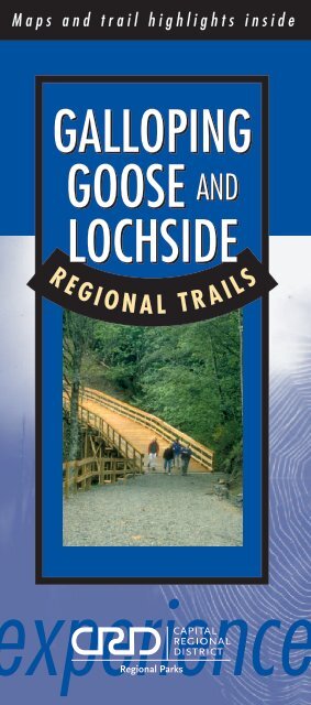
Maps and trail highlights insideGALLOPINGGOOSE ANDLOCHSIDEREGIONAL TRAILSxperience
welcome toBe alert! The <strong>Galloping</strong><strong>the</strong> <strong>Galloping</strong> <strong>Goose</strong> andLochside regional trailscome and experience <strong>the</strong> best of <strong>the</strong> Capital Region —from urban back streets to farmland and ruggedwilderness, all within a day’s travel of Victoria. The<strong>Galloping</strong> <strong>Goose</strong> and Lochside regional trails covermore than 80 kilometres, connecting downtown withSooke and <strong>the</strong> Saanich Peninsula. No matter whichdirection you choose, <strong>the</strong>se day-use trails offerspectacular West Coast scenery.You can cycle, stroll, run or even ride a horse through<strong>the</strong> rural sections. Whe<strong>the</strong>r you’re commuting to work,meandering on a weekend afternoon or pacingyourself from Sidney to Sooke, <strong>the</strong> trails are yours toenjoy and yours to protect.<strong>Trail</strong> etiquette• Share <strong>the</strong> trail and keep right except to pass.• When passing, alert o<strong>the</strong>r trail visitors and usecaution, particularly around horses.• Respect <strong>the</strong> trail environment and neighbouringlands.• Yield to farm equipment.• Cyclists, control your speed and yield to pedestriansand horse riders.• Lochside <strong>Trail</strong>: Keep your dog on a leash at all times.• <strong>Galloping</strong> <strong>Goose</strong> <strong>Trail</strong>: Keep your dog under controland on <strong>the</strong> trail.• Pick up your dog’s droppings.<strong>Goose</strong> and Lochside regional trailstraverse urban landscapes and workingagricultural areas. Some sections follow or cross publicroadways. Use caution and obey traffic rules on roadsand at road crossings. Give way to farm equipmentusing <strong>the</strong> trails.Part of something bigger The<strong>Galloping</strong> <strong>Goose</strong> <strong>Regional</strong> <strong>Trail</strong> is part of <strong>the</strong> TransCanada <strong>Trail</strong>, a national trail linking every province andterritory. The Trans Canada <strong>Trail</strong> will eventually link <strong>the</strong><strong>Galloping</strong> <strong>Goose</strong> <strong>Trail</strong> north to <strong>the</strong> Cowichan Valley andbeyond.Tales of <strong>the</strong> trails The trails travel overpicturesque former railway lines. The <strong>Galloping</strong> <strong>Goose</strong><strong>Trail</strong> was named for <strong>the</strong> gas-powered passenger carthat carried mail and 30 passengers twice dailybetween Victoria and Sooke during <strong>the</strong> 1920s.Beginning in 1917, <strong>the</strong> Lochside <strong>Trail</strong> hosted a daily74-passenger General Electric gas car that transportedpassengers and freight between Victoria and asteamship dock at Patricia Bay.The heritage of <strong>the</strong> past —The trails of <strong>the</strong> futureTHE ORIGINAL “GALLOPING GOOSE”
SW ARTZ BAYGALLOPINGGOOSE ANDLOCHSIDEREGIONAL TRAILSPLEGEND<strong>Galloping</strong> <strong>Goose</strong><strong>Regional</strong> <strong>Trail</strong>Lochside<strong>Regional</strong> <strong>Trail</strong><strong>Regional</strong> ParkO<strong>the</strong>r ParklandParkingToiletsSAAN IC H IN LETNORTHSAANICHVictoriaInternationalAirport33SidneyBC Ferries toTsawwassenand Gulf IslandsPsee map3Washington StateFerries to AnacortesBAZAN BAYPInformation1525Distance fromJohnson StreetBridge (km)BrentwoodBayCENTRALSAANICHTO DUNCANPC O RDO V ABAY55HIGHLANDSSAANICHPPLANGFORDPPCOLWOODVIEWROYALESQUIMALT0SwitchBridgeVICTORIAPSOOKEsee map1Johnson StBridgeOAK BAYTO PORT RENFREWSO O K EBASINPMETCHOSINSTRAIT O FJUAN DE FUC APsee map2
LAN G FO RDLAK ELANGFORDGlen Lake RdMarwood Ave20TO SOOKEFLO REN C ELAK EWitty‘s Lagoon<strong>Regional</strong> ParkG LEN LAK EPHappy Valley RdLatoria RdJacklin RdMETCHOSINMillstream RdTHETIS LAK ETrans-Canada Hwy 1Duke RdSooke RdWishart RdMill Hill<strong>Regional</strong> ParkAtkins AveGoldstreamAldeane Ave15COLWOODMetchosin RdSix Mile RdAvePLagoon RdRoyal Roads UniversityESQ UIM ALTLAG O O NAlbert Head Lagoon<strong>Regional</strong> ParkFrancis/KingThetis Lake <strong>Regional</strong> Park<strong>Regional</strong> ParkPOld Island Hwy10Ocean BlvdVIEWROYAL1ESQ UIM ALTHARBO URFort Rodd HillNationalHistoric SiteGALLOPINGGOOSEREGIONALVictoria General HospitalTRAILSTRAIT O F JUAN DE FUC AHPO RTAG EIN LETHelmcken RdBurnside Rd WP25SAANICHG O RG EAdmirals RdIN LETCraigflower RdESQUIMALTLEGEND<strong>Galloping</strong> <strong>Goose</strong><strong>Regional</strong> <strong>Trail</strong>Lochside<strong>Regional</strong> <strong>Trail</strong><strong>Regional</strong> ParkO<strong>the</strong>r ParklandParkingToiletsInformationDistance fromJohnson StreetBridge (km)Tillicum RdCarey RdPatricia Bay Hwy 17Burnside Rd EGorge RdSelkirkTrestle5Esquimalt RdIN N ERHARBO URQuadra StMcKenzie AveSwan LakeNature Sanctuary0Douglas StJohnson StBridgeDallas RdSaanich RdSwitchBridgeBlanshard StPandora AveJohnson StVICTORIABay StBeacon Hill Park-TO SIDNEYRIDING “THE GOOSE” NEAR MATHESON LAKEIN METCHOSINCYCLE DAY TRIPFrom Victoria, follow <strong>the</strong> <strong>Galloping</strong> <strong>Goose</strong><strong>Trail</strong>, <strong>the</strong>n Atkins Avenue, to Mill Hill <strong>Regional</strong>Park. 12 km one wayCYCLE DAY TRIPFrom Victoria, follow <strong>the</strong> <strong>Galloping</strong> <strong>Goose</strong><strong>Trail</strong>, <strong>the</strong>n Six Mile Road, to Thetis Lake<strong>Regional</strong> Park. 11 km one wayVIEW OF SOOKE BASIN FROM THE GALLOPING GOOSE TRAIL
TO END OF TRAIL55Sea to Sea Green BlueBelt <strong>Regional</strong> Park ReserveGoldstreamProvincial ParkFLO REN C ELAK E50PTodd TrestleChartersTrestleSO O K E RIV ERSooke Potholes<strong>Regional</strong> Park45SookePotholesProvincialParkPSooke River RdCYCLE WEEKENDFrom downtown Victoria, take <strong>the</strong> <strong>Galloping</strong><strong>Goose</strong> <strong>Trail</strong> and overnight in <strong>the</strong> Sooke area.The next day, explore beyond Sooke or returnafter a detour to East Sooke <strong>Regional</strong> Park.40 km one waySea to SeaGreen Blue Belt<strong>Regional</strong> ParkReserve2GALLOPINGGOOSEREGIONALTRAILSooke HillsWilderness<strong>Regional</strong> ParkReserveSooke RdMount Wells<strong>Regional</strong> ParkMETCHOSINTrans-Canada Hwy 1LAN G FO RDLAK ELANGFORDGlen Lake RdMarwood Ave20G LENLAK EPTO VICTORIAJacklin RdHappy Valley RdSOOKESO O K E HARBO URAyum Creek <strong>Regional</strong>Park ReserveEast Sooke RdPike RdCYCLE DAY TRIPPark at Roche Cove <strong>Regional</strong> Park, and follow<strong>the</strong> <strong>Galloping</strong> <strong>Goose</strong> <strong>Trail</strong> to <strong>the</strong> Sooke RiverRoad parking area. From <strong>the</strong>re, follow SookeRiver Road to Sooke Potholes <strong>Regional</strong>Park. 12 km one wayHarbourview RdEast Sooke<strong>Regional</strong> ParkSTRAIT O F JUAN DE FUC A40SO O K E BASINP25Becher Bay RdLEGEND<strong>Galloping</strong> <strong>Goose</strong><strong>Regional</strong> <strong>Trail</strong><strong>Regional</strong> ParkO<strong>the</strong>r ParklandParkingToiletsInformationDistance fromJohnson StreetBridge (km)35Gillespie RdPSooke RdGillespie RdRoche Cove<strong>Regional</strong> ParkMa<strong>the</strong>son Lake<strong>Regional</strong> ParkMa<strong>the</strong>son LakePark RdEast Sooke RdBEC HERBAY30PLindholm RdKangaroo RdRocky Point RdLombard DrHappy Valley Rd25CYCLE DAY TRIPPark at <strong>the</strong> Luxton parking area, near <strong>the</strong>corner of Sooke Road and Glen Lake Road.Follow <strong>the</strong> <strong>Galloping</strong> <strong>Goose</strong> <strong>Trail</strong>, <strong>the</strong>n LombardDrive and William Head Road, to Devonian<strong>Regional</strong> Park in Metchosin. 9 km one wayWitty‘s Lagoon<strong>Regional</strong> ParkWilliam Head RdDevonian<strong>Regional</strong> ParkPEDDER BAYTaylor Rd
INFORMATION KIOSKCYCLIST ON THE SWITCH BRIDGEHorth Hill<strong>Regional</strong> ParkWain RdSW ARTZ BAY33BC Ferries toTsawwassenand Gulf IslandsCoalIslandCYCLE DAY TRIPFrom <strong>the</strong> Switch Bridge, take <strong>the</strong> Lochside <strong>Trail</strong>past Swan Lake and over <strong>the</strong> Blenkinsop Trestleto nearby Elk/Beaver Lake <strong>Regional</strong> Park orCordova Bay beach. 12 km one way3P15LEGEND<strong>Galloping</strong> <strong>Goose</strong><strong>Regional</strong> <strong>Trail</strong>Lochside<strong>Regional</strong> <strong>Trail</strong><strong>Regional</strong> ParkO<strong>the</strong>r ParklandParkingToilets(may be seasonal)InformationDistance fromJohnson StreetBridge (km)McDonaldCampgroundNORTHSAANICHMcTavish RdTo Mill BayFerryMt Newton X RdCENTRALSAANICHWest Saanich Rd30VictoriaInternationalAirportPatricia Bay Hwy 17Keating X Rd25Central Saanich RdBear Hill<strong>Regional</strong> ParkElk/Beaver Lake<strong>Regional</strong> ParkMcDonald Park RdBrookleigh RdResthaven DrSIDNEYBeacon AvePWashington StateFerries to AnacortesTulista ParkLochside DrBAZAN BAYCy Hampson Park20PLochside DrSaanichtonBaySayward RdIsland View RdMartindale RdLochside Dr15James IslandIsland View Beach<strong>Regional</strong> ParkLochside ParkPC O RDO V ABAYCordovaBay RoadDoris Page ParkLochside DrCYCLE DAY TRIPFrom <strong>the</strong> Switch Bridge, follow <strong>the</strong> Lochside<strong>Trail</strong> through <strong>the</strong> farmland of <strong>the</strong> SaanichPeninsula to Sidney. Stop to explore IslandView Beach <strong>Regional</strong> Park on <strong>the</strong> way.24 km one wayRoyal Oak DrSAANICH10Ri<strong>the</strong>t's BogConservation AreaBlenkinsopTrestleMcMinn ParkMountDouglasParkBlenkinsop RdCYCLING ON THE LOCHSIDE TRAIL IN CENTRAL SAANICHPO RTAG EIN LETTO SOOKESwan LakeNature SanctuaryTrans-Canada Hwy 1McKenzie AveSaanich RdSwitchBridge4
How to get <strong>the</strong>re From downtown Victoria,start at <strong>the</strong> corner of Wharf Street and Pandora Avenue. Cross <strong>the</strong>Johnson Street bridge, <strong>the</strong>n turn right on <strong>the</strong> paved path thatconnects to Harbour Road and <strong>the</strong> <strong>Galloping</strong> <strong>Goose</strong> <strong>Trail</strong>.From <strong>the</strong> BC Ferries Terminal at Swartz Bay, follow <strong>the</strong>signs to <strong>the</strong> Lochside <strong>Trail</strong>. Cyclists: after passing under <strong>the</strong>Landsend Road overpass, turn right at <strong>the</strong> bicycle lane, right at <strong>the</strong>overpass, <strong>the</strong>n right onto <strong>the</strong> <strong>Trail</strong>. Foot passengers: turn left at <strong>the</strong>Landsend Road overpass, <strong>the</strong>n right onto <strong>the</strong> <strong>Trail</strong>.From Victoria International Airport, follow <strong>the</strong> signs toVictoria. Turn left on McTavish Road, cross <strong>the</strong> Patricia Bay Highway,<strong>the</strong>n turn right onto <strong>the</strong> Lochside <strong>Trail</strong>, which follows Lochside Drive.Transit and <strong>the</strong> trails BC Transit buses can carryyou to or from <strong>the</strong> trails on several routes. Low floor buses onroute 70 between Victoria and Swartz Bay, and route 61 betweenVictoria and Sooke are equipped with bike racks and wheelchairlifts. For details and schedules, phone BC Transit at(250) 382-6161 or visit www.bctransit.com.Need more info? CRD Parks coordinates <strong>the</strong>management and operations of your regional trails. To find outmore about CRD Parks, and for information about trail closures ordetours, visit www.crd.bc.ca/parks.Dial 9-1-1 in case of emergency or fire, or if you observeunlawful activities.This booklet is printed on New Leaf Reincarnation Matte, made with 100% recycled fibres, 50% post-consumer waste, andprocessed chlorine-free. By using this environmentally friendly paper, we saved <strong>the</strong> following resources: 2 trees, 158pounds of solid waste, 173 gallons of water, 226 kilowatt hours of electricity and 287 pounds of greenhouse gases.e