

Emergency Communications C-COM, Hughes Boeing — GPS II-F ...
Emergency Communications C-COM, Hughes Boeing — GPS II-F ...
Emergency Communications C-COM, Hughes Boeing — GPS II-F ...

Create successful ePaper yourself
Turn your PDF publications into a flip-book with our unique Google optimized e-Paper software.
8<br />
that at any time a minimum of six<br />
satellites will be in view to users<br />
anywhere in the world. The satellites<br />
continuously broadcast position and<br />
time data to users throughout the<br />
world. The satellites transmit signals<br />
on two different L-band frequencies.<br />
The Control Segment consists of a<br />
master control station operated by<br />
the 50th Space Wing’s 2nd Space<br />
MilsatMagazine <strong>—</strong> July/August 2011<br />
disPatches<br />
Operations Squadron at Schriever<br />
Air Force Base, Colorado, with five<br />
monitor stations and three ground<br />
antennas located throughout the<br />
world. The monitor stations track<br />
all <strong>GPS</strong> satellites in view and collect<br />
ranging information from the<br />
satellite broadcasts. The monitor<br />
stations send the information they<br />
collect from each of the satellites<br />
back to the master control station,<br />
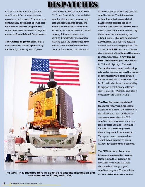
The <strong>GPS</strong> <strong>II</strong>F is pictured here in <strong>Boeing</strong>’s’s satellite integration and<br />
test complex in El Segundo, CA,<br />
which computes extremely precise<br />
satellite orbits. The information<br />
is then formatted into updated<br />
navigation messages for each<br />
satellite. The updated information is<br />
transmitted to each satellite through<br />
the ground antennas, using an<br />
S-band signal. The ground antennas<br />
also transmit and receive satellite<br />
control and monitoring signals. The<br />
current Block <strong>II</strong>F contract includes<br />
development of the Control Segment.<br />
In December 2003, a new <strong>Boeing</strong><br />
<strong>GPS</strong> Center (BGC) was dedicated<br />
in Colorado Springs, Colorado.<br />
The center was created to develop,<br />
integrate, test and sustain the control<br />
segment hardware and software<br />
for the latest <strong>GPS</strong> <strong>II</strong>F satellites. This<br />
facility will also have the capability<br />
to support evolutionary software<br />
development for <strong>GPS</strong> <strong>II</strong>F and other<br />
versions of the <strong>GPS</strong> satellite.<br />
The User Segment consists of<br />
the signal receivers/processors,<br />
antennas and control/display units<br />
that allow land, sea, or airborne<br />
operators to receive the <strong>GPS</strong><br />
satellite broadcasts and compute<br />
their precise latitude, longitude,<br />
altitude, velocity and precise<br />
time at any time, in any weather.<br />
The system can accommodate<br />
an unlimited number of users<br />
without revealing their positions.<br />
The <strong>GPS</strong> concept of operation<br />
is based upon satellite ranging.<br />
Users figure their position on<br />
the Earth by measuring their<br />
distance from the group of<br />
satellites in space. The satellites<br />
act as precise reference points.