WATERERSHED DELINEATION EXERCISE 1 Rules of Contours
HS Watershed Delineation 1
HS Watershed Delineation 1

You also want an ePaper? Increase the reach of your titles
YUMPU automatically turns print PDFs into web optimized ePapers that Google loves.
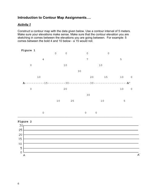
Introduction to Contour Map Assignments….Activity 1Construct a contour map with the data given below. Use a contour interval <strong>of</strong> 5 meters.Make sure your elevations make sense. Make sure that the contour elevation you aresketching in comes between the elevations you are going between. For example: 5comes between the bold 4 and 10 below - a 15 would not.Figure 10 0 0 04 7 50 10 103010 20 15 10 0A-----------15----------30------------30-------------------A'0 20 10 03010 25 10 50 0 0_________________________________________________________________Figure 26