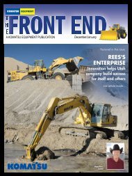
ROCKY MOUNTAIN RECYCLING
a PDF version - KEC The Rock Magazine
a PDF version - KEC The Rock Magazine
- No tags were found...

You also want an ePaper? Increase the reach of your titles
YUMPU automatically turns print PDFs into web optimized ePapers that Google loves.
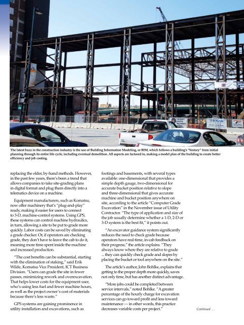
The latest buzz in the construction industry is the use of Building Information Modeling, or BIM, which follows a building’s “history” from initial<br />
planning through its entire life cycle, including eventual demolition. All aspects are factored in, making a model plan of the building to create better<br />
efficiency and job costing.<br />
replacing the older, by-hand methods. However,<br />
in the past few years, there’s been a trend that<br />
allows companies to take site-grading plans<br />
in digital format and plug them directly into a<br />
telematics device on a machine.<br />
Equipment manufacturers, such as Komatsu,<br />
now offer machinery that’s “plug-and-play”<br />
ready, making it easier for users to connect<br />
to 3-D, machine-control systems. Using GPS,<br />
these systems can control machine hydraulics,<br />
in turn, allowing a site to be put to grade more<br />
quickly. Labor costs can be saved by eliminating<br />
a grade checker. Or, if operators are checking<br />
grade, they don’t have to leave the cab to do it,<br />
meaning more time spent inside the machine<br />
and increased production.<br />
“The cost benefits can be substantial, starting<br />
with the elimination of staking,” said Erik<br />
Wilde, Komatsu Vice President, ICT Business<br />
Division. “Users can grade the site in fewer<br />
passes, minimizing rework and overexcavation.<br />
That helps lower costs for the equipment user,<br />
who’s using less fuel and fewer machine hours,<br />
as well as the project owner’s cost of materials<br />
because there’s less waste.”<br />
GPS systems are gaining prominence in<br />
utility installation and excavations, such as<br />
footings and basements, with several types<br />
available: one-dimensional that provides a<br />
simple depth gauge, two-dimensional for<br />
accurate bucket position relative to slope<br />
and three-dimensional that gives accurate<br />
machine and bucket position anywhere on<br />
site, according to the article “Computer Grade<br />
Excavation” in the November issue of Utility<br />
Contractor. “The type of application and size of<br />
the job usually determine whether a 1-D, 2-D or<br />
3-D system is the best fit,” it points out.<br />
“An excavator guidance system significantly<br />
reduces the need to check grade because<br />
operators have real-time, in-cab feedback on<br />
their progress,” the article explains. “They<br />
always know where they are relative to grade<br />
... they can quickly check grade and slopes by<br />
placing the bucket or tool anywhere on the site.”<br />
The article’s author, John Bohlke, explains that<br />
getting to the proper depth more quickly, saves<br />
not only time, but has another distinct advantage.<br />
“More jobs could be completed between<br />
service intervals,” noted Bohlke. “A greater<br />
percentage of the hourly charge for excavation<br />
services can go toward profit and less toward<br />
maintenance — in other words, this practice<br />
decreases variable costs per project.” Continued . . .