

Caribbean Compass Yachting Magazine 2015
Welcome to Caribbean Compass, the most widely-read boating publication in the Caribbean! THE MOST NEWS YOU CAN USE - feature articles on cruising destinations, regattas, environment, events...
Welcome to Caribbean Compass, the most widely-read boating publication in the Caribbean! THE MOST NEWS YOU CAN USE - feature articles on cruising destinations, regattas, environment, events...

You also want an ePaper? Increase the reach of your titles
YUMPU automatically turns print PDFs into web optimized ePapers that Google loves.
— Continued from previous page<br />
…the delight of snorkelers and the dread of boaters<br />
wending their way through minefields of coral. So far<br />
this year alone four boats have met their fate on the<br />
reefs of these San Blas islands. We did not want to be<br />
the fifth!<br />
So arriving in the morning, as the eastern sun rising<br />
behind us would shine light down into these shallow<br />
reef-strewn waters, seemed like a good idea. What we<br />
are so angry and confused there is no clear best angle.<br />
So we slow down and circle through the rolling and<br />
bouncing… like riding a lazy bronco.<br />
Three hours later, with no sun visible, the rain<br />
begins to abate. The storm clouds turn from black to<br />
slate and a low grey cloud cover descends upon the<br />
coast, bringing bands of mist and fog to enshroud the<br />
coastal lowlands. We turn back toward our island destination<br />
and make our way toward shore.<br />
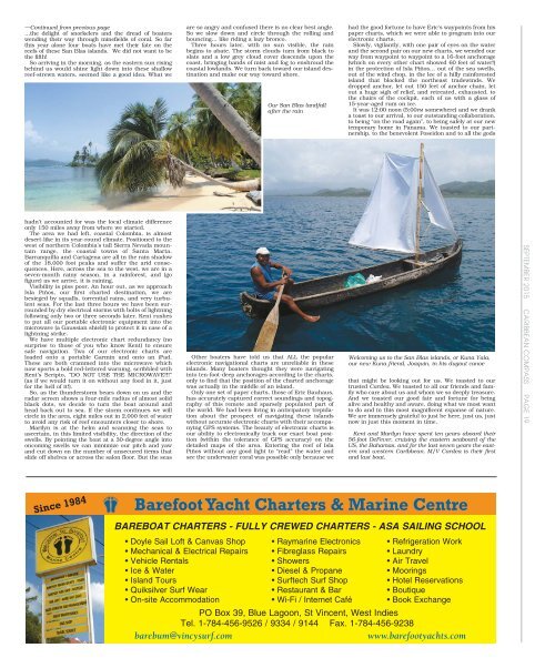
Our San Blas landfall<br />
after the rain<br />
had the good fortune to have Eric’s waypoints from his<br />
paper charts, which we were able to program into our<br />
electronic charts.<br />
Slowly, vigilantly, with one pair of eyes on the water<br />
and the second pair on our new charts, we wended our<br />
way from waypoint to waypoint to a 16-foot anchorage<br />
(which on every other chart showed 60 feet of water!)<br />
in the protection of Isla Piños… out of the sea swells,<br />
out of the wind chop, in the lee of a hilly rainforested<br />
island that blocked the northeast tradewinds. We<br />
dropped anchor, let out 150 feet of anchor chain, let<br />
out a huge sigh of relief, and retreated, exhausted, to<br />
the chairs of the cockpit, each of us with a glass of<br />
15-year-aged rum on ice.<br />
It was 12:00 noon (5:00PM somewhere) and we drank<br />
a toast to our arrival, to our outstanding collaboration,<br />
to being “on the road again”, to being safely at our new<br />
temporary home in Panama. We toasted to our partnership,<br />
to the benevolent Poseidon and to all the gods<br />
hadn’t accounted for was the local climate difference<br />
only 150 miles away from where we started.<br />
The area we had left, coastal Colombia, is almost<br />
desert-like in its year-round climate. Positioned to the<br />
west of northern Colombia’s tall Sierra Nevada mountain<br />
range, the coastal towns of Santa Marta,<br />
Barranquilla and Cartagena are all in the rain shadow<br />
of the 18,000 foot peaks and suffer the arid consequences.<br />
Here, across the sea to the west, we are in a<br />
seven-month rainy season, in a rainforest, and (go<br />
figure) as we arrive, it is raining.<br />
Visibility is piss poor. An hour out, as we approach<br />
Isla Piños, our first charted destination, we are<br />
besieged by squalls, torrential rains, and very turbulent<br />
seas. For the last three hours we have been surrounded<br />
by dry electrical storms with bolts of lightning<br />
following only two or three seconds later. Kent rushes<br />
to put all our portable electronic equipment into the<br />
microwave (a Gaussian shield) to protect it in case of a<br />
lightning strike.<br />
We have multiple electronic chart redundancy (no<br />
surprise to those of you who know Kent) to ensure<br />
safe navigation. Two of our electronic charts are<br />
loaded onto a portable Garmin and onto an iPad.<br />
These are both crammed into the microwave which<br />
now sports a bold red-lettered warning, scribbled with<br />
Kent’s Scripto, “DO NOT USE THE MICROWAVE!!!”<br />
(as if we would turn it on without any food in it, just<br />
for the hell of it!).<br />
So, as the thunderstorm bears down on us and the<br />
radar screen shows a four-mile radius of almost solid<br />
black dots, we decide to turn the boat around and<br />
head back out to sea. If the storm continues we will<br />
circle in the area, eight miles out in 2,000 feet of water<br />
to avoid any risk of reef encounters closer to shore.<br />
Marilyn is at the helm and scanning the seas to<br />
ascertain, in this limited visibility, the direction of the<br />
swells. By pointing the boat at a 30-degree angle into<br />
oncoming swells we can minimize our pitch and yaw<br />
and cut down on the number of unsecured items that<br />
slide off shelves or across the salon floor. But the seas<br />
Other boaters have told us that ALL the popular<br />
electronic navigational charts are unreliable in these<br />
islands. Many boaters thought they were navigating<br />
into ten-foot-deep anchorages according to the charts,<br />
only to find that the position of the charted anchorage<br />
was actually in the middle of an island.<br />
Only one set of paper charts, those of Eric Bauhaus,<br />
has accurately captured correct soundings and topography<br />
of this remote and sparsely populated part of<br />
the world. We had been living in anticipatory trepidation<br />
about the prospect of navigating these islands<br />
without accurate electronic charts with their accompanying<br />
GPS systems. The beauty of electronic charts is<br />
our ability to electronically track our exact boat position<br />
(within the tolerance of GPS accuracy) on the<br />
detailed maps of the area. Entering the reef of Isla<br />
Piños without any good light to “read” the water and<br />
see the underwater coral was possible only because we<br />
Welcoming us to the San Blas islands, or Kuna Yala,<br />
our new Kuna friend, Joaquin, in his dugout canoe<br />
that might be looking out for us. We toasted to our<br />
trusted Cardea. We toasted to all our friends and family<br />
who care about us and whom we so deeply treasure.<br />
And we toasted our good fate and fortune for being<br />
alive and healthy and aware, doing what we most want<br />
to do and in this most magnificent expanse of nature.<br />
We are immensely grateful to just be here, just us, just<br />
now in just this moment in time.<br />
Kent and Marilyn have spent ten years aboard their<br />
56-foot DeFever, cruising the eastern seaboard of the<br />
US, the Bahamas, and for the last seven years the eastern<br />
and western <strong>Caribbean</strong>. M/V Cardea is their first<br />
and last boat.<br />
SEPTEMBER <strong>2015</strong> CARIBBEAN COMPASS PAGE 19<br />
Since 1984<br />
Barefoot Yacht Charters & Marine Centre<br />
BAREBOAT CHARTERS - FULLY CREWED CHARTERS - ASA SAILING SCHOOL<br />
• Doyle Sail Loft & Canvas Shop • Raymarine Electronics • Refrigeration Work<br />
• Mechanical & Electrical Repairs • Fibreglass Repairs • Laundry<br />
• Vehicle Rentals • Showers • Air Travel<br />
• Ice & Water • Diesel & Propane • Moorings<br />
• Island Tours • Surftech Surf Shop • Hotel Reservations<br />
• Quiksilver Surf Wear • Restaurant & Bar • Boutique<br />
• On-site Accommodation • Wi-Fi / Internet Café • Book Exchange<br />
PO Box 39, Blue Lagoon, St Vincent, West Indies<br />
Tel. 1-784-456-9526 / 9334 / 9144 Fax. 1-784-456-9238<br />
barebum@vincysurf.com<br />
www.barefootyachts.com


