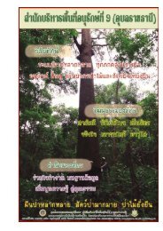
วิà¸à¸µà¸à¸²à¸£à¸ªà¹à¸²à¸£à¸§à¸à¸à¸£à¸±à¸à¸¢à¸²à¸à¸£à¸à¹à¸²à¹à¸¡à¹ - หà¸à¹à¸² หลัà¸
วิà¸à¸µà¸à¸²à¸£à¸ªà¹à¸²à¸£à¸§à¸à¸à¸£à¸±à¸à¸¢à¸²à¸à¸£à¸à¹à¸²à¹à¸¡à¹ - หà¸à¹à¸² หลัà¸
วิà¸à¸µà¸à¸²à¸£à¸ªà¹à¸²à¸£à¸§à¸à¸à¸£à¸±à¸à¸¢à¸²à¸à¸£à¸à¹à¸²à¹à¸¡à¹ - หà¸à¹à¸² หลัà¸

Create successful ePaper yourself
Turn your PDF publications into a flip-book with our unique Google optimized e-Paper software.
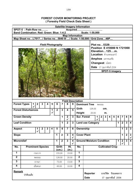
159<br />
FOREST COVER MONITORING PROJECT<br />
( Forestry Field Check Data Sheet )<br />
Satellite Imagery Information<br />
SPOT-5 : Path-Row no……..<br />
Acquired…………………………<br />
Band Combination: Red: Green: Blue: 1:4:2 Scale: 1:50,000<br />
Map Information<br />
Map Sheet no…L7017…/ Series no…5840 III …/ Scale: 1:50,000 / Grid Zone…48P…<br />
Field Photography<br />
Plot no…5329…………<br />
Position E 410000 N 1721000<br />
Elevation…125….m.<br />
Location ต าบลพระเสาร์<br />
Amphoe มหาชนะชัย<br />
Changwat ยโสธร<br />
Date 17 กุมภาพันธ์ 2554<br />
SPOT-5 imagery<br />
Field Description<br />
Forest Types 1 2 3 4 5 6 7 8 9 Dominant Tree พะยอม<br />
<br />
Girth 124.00 cm.<br />
Forest Disturbances 1 2 3 4 5<br />
<br />
Height 20.00 m.<br />
Crown Density 1 2 3 Sur. Forest 1 2 3 4 5 6 7 8 9<br />
<br />
<br />
Leaf Condition 1 2 3 Land use Category 1 2 3 4<br />
Aspect 1 2 3 4 5 6 7 8 Ownership 1 2 3<br />
<br />
Slope 1 2 3 4<br />
<br />
Cover Plant 1 2 3<br />
<br />
Microrelief 1 2 3 4 Ground Moisture Condition 1 2 3 4<br />
<br />
<br />
No. Prominent Species Girth<br />
(cm.)<br />
Ht.<br />
(m.)<br />
No.<br />
Cultivated Crop<br />
1 กระบาก 155.00 19.00 1<br />
2 พะยอม 124.00 20.00 2<br />
3 ยางนา 73.00 13.00 3<br />
4 เลือดนก 49.00 10.00 4<br />
Remark<br />
ป่าดิบแล้ง<br />
Reporter นายวิชิต จิรมงคลการ<br />
Date 17 กุมภาพันธ์ 2554