

Humboldt Bay - U.S. Fish and Wildlife Service
Humboldt Bay - U.S. Fish and Wildlife Service
Humboldt Bay - U.S. Fish and Wildlife Service

You also want an ePaper? Increase the reach of your titles
YUMPU automatically turns print PDFs into web optimized ePapers that Google loves.
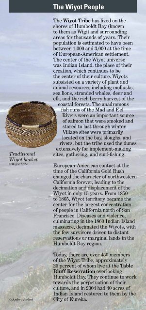
Traditional<br />
Wiyot basket<br />
©Wiyot Tribe<br />
© Andrea Pickart<br />
The Wiyot People<br />
The Wiyot Tribe has lived on the<br />
shores of <strong>Humboldt</strong> <strong>Bay</strong> (known<br />
to them as Wigi) <strong>and</strong> surrounding<br />
areas for thous<strong>and</strong>s of years. Their<br />
population is estimated to have been<br />
between 1,000 <strong>and</strong> 3,000 at the time<br />
of European-American settlement.<br />
The center of the Wiyot universe<br />
was Indian Isl<strong>and</strong>, the place of their<br />
creation, which continues to be<br />
the center of their culture. Wiyots<br />
subsisted on a variety of plant <strong>and</strong><br />
animal resources including mollusks,<br />
sea lions, str<strong>and</strong>ed whales, deer <strong>and</strong><br />
elk, <strong>and</strong> the rich berry harvest of the<br />
coastal forests. The anadromous<br />
fsh runs of the Mad <strong>and</strong> Eel<br />
Rivers were an important source<br />
of salmon that were smoked <strong>and</strong><br />
stored to last through winter.<br />
Village sites were primarily<br />
located on the bay, sloughs, <strong>and</strong><br />
rivers, but the tribe used the dunes<br />
extensively for implement-making<br />
sites, gathering, <strong>and</strong> surf-fshing.<br />
European-American contact at the<br />
time of the California Gold Rush<br />
changed the character of northwestern<br />
California forever, leading to the<br />
decimation <strong>and</strong> displacement of the<br />
Wiyot in only 15 years. From 1850<br />
to 1865, Wiyot territory became the<br />
center for the largest concentration<br />
of people in California north of San<br />
Francisco. Diseases <strong>and</strong> violence,<br />
culminating in the 1860 Indian Isl<strong>and</strong><br />
massacre, decimated the Wiyots, with<br />
the few survivors driven to distant<br />
reservations or marginal l<strong>and</strong>s in the<br />
<strong>Humboldt</strong> <strong>Bay</strong> region.<br />
Today, there are over 450 members<br />
of the Wiyot Tribe, approximately<br />
25 percent of whom live at the Table<br />
Bluff Reservation overlooking<br />
<strong>Humboldt</strong> <strong>Bay</strong>. They continue to work<br />
towards the perpetuation of their<br />
culture, <strong>and</strong> in 2004 had 40 acres of<br />
Indian Isl<strong>and</strong> restored to them by the<br />
City of Eureka.<br />
Because of the<br />
fragile nature<br />
of the dune<br />
habitats, the<br />
Lanphere Dunes<br />
Unit is only<br />
open by guided<br />
tour or special<br />
use permit. Call<br />
(707)444-1397 for<br />
information on<br />
programs <strong>and</strong><br />
tours.<br />
© Don Tuttle<br />
Dune Units<br />
of <strong>Humboldt</strong> <strong>Bay</strong> NWR<br />
<strong>Humboldt</strong> <strong>Bay</strong> NWR<br />
Ma-le’l Dunes<br />
Cooperative<br />
Management Area<br />
PACIFIC<br />
OCEAN<br />
BLM<br />
Manila<br />
Dunes<br />
Lanphere <strong>and</strong> Ma-le’l Dunes<br />
The Lanphere Dunes Unit is located<br />
at the upper end of the North Spit<br />
of <strong>Humboldt</strong> <strong>Bay</strong>, west of Mad River<br />
Slough. The most pristine remaining<br />
dune system in the Pacifc Northwest,<br />
the Lanphere Dunes were protected<br />
by two biology professors from<br />
<strong>Humboldt</strong> State University, William<br />
<strong>and</strong> Hortense Lanphere. They<br />
donated their l<strong>and</strong> to The Nature<br />
Conservancy, which added adjacent<br />
parcels <strong>and</strong>, in 1998, transferred 450<br />
acres to <strong>Humboldt</strong> <strong>Bay</strong> National<br />
<strong>Wildlife</strong> Refuge. In 2005, with funding<br />
from the State Coastal Conservancy<br />
<strong>and</strong> as the result of strong community<br />
support, 160 acres to the south were<br />
added to the refuge <strong>and</strong> the Ma-le’l<br />
Dunes Unit was<br />
created, using a<br />
place name of the<br />
ancestral Wiyot<br />
tribe. The Lanphere<br />
Dunes is the site<br />
of one of the most<br />
successful dune<br />
restoration projects<br />
on the west coast,<br />
accomplished<br />
through the ongoing<br />
removal of invasive, non-native<br />
vegetation. The new Ma-le’l Dunes is<br />
being similarly restored.<br />
Ma-le’l Access Road<br />
Lanphere<br />
Dunes<br />
Unit<br />
Access by<br />
permit or guided<br />
tours only<br />
Call 444-1397.<br />
Ma-le’l<br />
Dunes<br />
Unit<br />
<strong>Humboldt</strong> <strong>Bay</strong><br />
Entrance (Young Lane)<br />
Mad River Slough<br />
255<br />
The Ma-le’l Dunes<br />
Cooperative<br />
Management<br />
Area is open to<br />
the public 7 days a<br />
week during<br />
daylight hours.<br />
Use regulations<br />
differ by area; the<br />
Ma-le’l Dunes Unit<br />
of HBNWR is open<br />
to pedestrians<br />
only (no dogs or<br />
horses).<br />
(not to scale)<br />
ARCATA<br />
101


