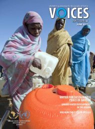
Darfur Dances
Download the magazine (PDF) here. - Unamid
Download the magazine (PDF) here. - Unamid
- No tags were found...

You also want an ePaper? Increase the reach of your titles
YUMPU automatically turns print PDFs into web optimized ePapers that Google loves.
ENVIRONMENT<br />
The Grand River Valleys of <strong>Darfur</strong><br />
Each year during the rainy season, <strong>Darfur</strong>’s valleys flood with rushing water, a highly<br />
valuable but underused resource that could play a key role in fostering economic<br />
development and stability in the region.<br />
By Emadeldin Rijal<br />
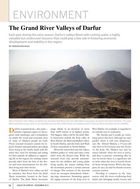
Most of <strong>Darfur</strong>’s river valleys are fed by the rainwater that flows from the Jebel Marra mountains, located in the heart of <strong>Darfur</strong>. The Jebel<br />
Marra mountain range climbs to an elevation of more than 3,000 metres at its highest points. Photo by Albert González Farran, UNAMID.<br />
<strong>Darfur</strong>’s seasonal rivers—the wadis—<br />
remain a signature aspect of the region’s<br />
stark landscape, and a foundation<br />
on which the social and economic lives<br />
of many of <strong>Darfur</strong>’s people are built.<br />
These seasonal resources sustain the region’s<br />
farmers and pastoralists, providing<br />
those living in the nearby lands with the<br />
water they need for farming and caring<br />
for their animals. In addition to supporting<br />
life in this region, the rushing waters<br />
provide relief from the heat of the desert<br />
and even entertainment for the children<br />
living near their shores.<br />
Most of <strong>Darfur</strong>’s river valleys are fed<br />
by rainwater that flows from the Jebel<br />
Marra mountains, located in the heart<br />
of <strong>Darfur</strong>. The Jebel Marra mountain<br />
range climbs to an elevation of more<br />
than 3,000 metres at its highest points.<br />
The biggest valleys fed by the Jebel Marra<br />
rainstorms include the Kaja valley in<br />
West <strong>Darfur</strong>, the Berli and Bulbul valleys<br />
in South <strong>Darfur</strong>, and the Golo and Wadi<br />
Al-Kuo watersheds in North <strong>Darfur</strong>.<br />
When the waters flow into the valleys,<br />
children gather to swim and enjoy some<br />
relief from the desert’s heat. While the<br />
seasonal rivers may provide entertainment<br />
for the children and young adults<br />
living nearby, the waters rushing from<br />
the mountains present a certain amount<br />
of danger. The currents of the seasonal<br />
rivers are strongest immediately following<br />
large rainstorms. Swimming against<br />
the raging currents of the Kaja river in<br />
West <strong>Darfur</strong>, for example, is regarded as<br />
an extreme test of endurance.<br />
“My friends and I usually go swimming<br />
across this river, although we can’t<br />
predict when it will turn dangerous,”<br />
says Mr. Ahmed Madani, a 19-year-old<br />
who lives in El Geneina near the shores<br />
of the Kaja. Mr. Madani says that he<br />
enjoys himself when the river is active,<br />
and likes to practice swimming. But he<br />
says he knows there is a significant risk<br />
to swim when the river is heavily flooded<br />
from strong storms. When this happens,<br />
he says, he and his friends exercise<br />
extreme caution.<br />
Flooding is common in the rainy<br />
season, with the rivers overflowing their<br />
banks and damaging nearby houses and<br />
18 VOICES OF DARFUR • NOVEMBER 2013