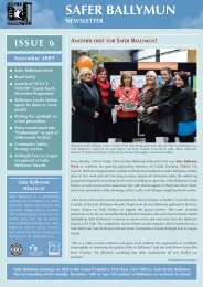
Noel
Final Phase of Civic Buildings Underway - Ballymun Regeneration
Final Phase of Civic Buildings Underway - Ballymun Regeneration
- No tags were found...

Create successful ePaper yourself
Turn your PDF publications into a flip-book with our unique Google optimized e-Paper software.
Ballymun 400 years ago<br />
Extract from Ballymun Community Archive :<br />
The Ballymun flats were built in the late 1960s on<br />
part of Santry Demesne and part of the farmlands of<br />
Albert Agriculture College, now DCU. The first<br />
volume of the Written History (1600-1960) deals<br />
largely with the Barry family, who from the<br />
beginning of the 17 th century until mid-way through<br />
the 20 th century, owned much of Santry Demesne.<br />
was not put on the map - almost literally - until the<br />
arrival of the Barrys."<br />
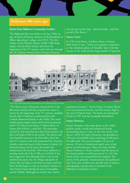
Santry Court<br />
In 1702 Lord Henry, 3rd Baron Barry of Santry,<br />
built Santry Court, "which soon gained a reputation<br />
as 'the miniature palace of Versailles' due to the fine<br />
murals on the walls and the large number of spacious<br />
Santry Court, taken shortly before it’s demolition in 1947 (National Library of Ireland).<br />
"The Barrys were a Protestant branch of the Cork<br />
Barrymore family and they acquired the estate at<br />
Santry by the beginning of the 17 th century, probably<br />
shortly after it had been confiscated from the<br />
Catholic Barnewall family in the 1620s. The estate<br />
would remain largely intact and in their possession<br />
until 1751 when Lord Henry, 4 th Baron Barry of<br />
Santry died without a male heir. The patronage<br />
exerted by this powerful, but short-lived dynasty was<br />
felt in all walks of life in the parish. The Barrys and<br />
their familial successors, the Domvilles, from the<br />
mid-17 th century, built and maintained the churches,<br />
schools, roads and many of the houses in Santry. As<br />
the local justices of the peace the family also<br />
administered the local law. This was in addition to<br />
owning nearly all of the 4,700 acres of land. It has<br />
been suggested, that although Santry was an old<br />
medieval monastic site, the village and parish of<br />
Santry did not begin to develop in earnest until the<br />
Barry family began to take an economic interest in<br />
their Santry Estate during the post-Cromwellian<br />
period (1660s). Although not strictly true, Santry<br />
apartments (rooms)." Santry Court, or Santry House<br />
as it was sometimes known, was four storeys high in<br />
the style of Queen Anne. The house was devastated<br />
by fire in 1947 and was eventually demolished.<br />
Santry Demesne<br />
Santry Demesne is the name given to the walled<br />
gardens, parks, woods and ornamental ponds<br />
surrounding Santry Court. At the time of the Civil<br />
Survey (1654-56) Santry Demesne was described as<br />
250 acres of profitable land, consisting of 200 acres<br />
of arable land, 20 acres of meadow, 14 acres of<br />
pasture, 10 acres of shrubwood and 6 acres of ash<br />
groves. In John Rocque's Map of County Dublin<br />
Santry Demesne is clearly marked and the layout of<br />
the formal gardens is well represented. In 1812 the<br />
Santry Estate was comprehensively mapped. The<br />
extent of the grounds, ornamentation and parkland is<br />
clear from this excellent pen and ink map of which a<br />
photographic reproduction is included in the<br />
Ballymun Community Archive.<br />
6