
You also want an ePaper? Increase the reach of your titles
YUMPU automatically turns print PDFs into web optimized ePapers that Google loves.
stein verloren waren gegaan, zag de uitgever zich genoodzaakt<br />
een geheel nieuwe editie te verzorgen, de<br />
Nieuwe atlas der wereld, die voor het eerst in 1864 verscheen<br />
(Koeman II, Kuy 1, 2a, B, C, Kuy 3).<br />
13. Van de kaart van Nederland uit de eerste uitgave bestaan<br />
twee staten. Op de vroegste staat, gedateerd 1851, waarvan<br />
een los exemplaar in de Coll. Bodel Nijenhuis (Port 4 N18),<br />
ontbreekt de reliëftekening in Utrecht en Gelderland. De latere<br />
staat met het jaar 1852 is in de atlas opgenomen.<br />
14. D. Henze, Enzyklopädie der Entdecker und Erforscher der<br />
Erde. Band 3. Graz, 1993, blz. 10 en 11 met opgave van de<br />
literatuur, waaraan Frijlink de gegevens over Kanes ontdekkingstocht<br />
ontleend kan hebben.<br />
15. Eerste tot en met vijfde uitgaven door Frijlink: Koeman II<br />
(I969), blz. 111-115, Frij 3 tot en met Frij 7; zesde tot en<br />
met achtste uitgaven door Noothoven van Goor: Koeman<br />
II (1969), blz. 115-116, Frij 8 en Frij 9 en Koeman VI<br />
(1985), blz 157, Frij A8.<br />
16. PJ. Veth, Populaire aardrijkskunde in ons vaderland. In:<br />
De Gids 16 (1852), blz. 529-561 en Idem, Nieuwe kaarten<br />
en atlassen. In: De Gids 19 (1855), blz. 158-198. Met dank<br />
aan Paul van den Brink die mij wees op de bespreking in<br />
Vaderlandsche Letteroefeningen. Eerste stuk (1856), blz.<br />
276-283.<br />
SUMMARY<br />
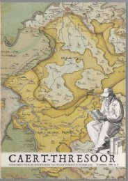
The Nieuwe Hand-atlas der Aarde (1855) by Hendrik<br />
Frijlink: a Dutch Stieler in statu nascendi<br />
About 1710 the great atlas tradition in the Netherlands had<br />
come to an end. Thereafter mainly composite atlases, relying<br />
partly on material inherited from the previous century, were<br />
published. The first half of the 19th century had nothing at all<br />
in this field that deserved mention. Then, about 1850, this<br />
situation changed rapidly through the contribution of three<br />
mapmakers: Jaeger, Frijlink and Kuijper.<br />
The Nieuwe Hand-Atlas der Aarde by the bookseller and publisher<br />
Hendrik Frijlink of Amsterdam, first issued in four instalments<br />
from 1851 to 1855 in 24 maps, occupied a special<br />
position within this development because of its remarkable<br />
high quality of its production as well as with respect to content.<br />
In addition to being publisher Frijlink may also be considered<br />
as editor and even, in the case of some maps, as cartographer.<br />
For the making of the maps which were still<br />
reproduced by copper engraving, he managed to employ the<br />
best engravers of those days: father and three sons Veelwaard,<br />
Zürcher, Tuyn and Van Baarsel.<br />
The atlas ran through eight editions, of which the first five<br />
were published by Frijlink himself from 1851 to 1868. He spared<br />
no pains to emend his maps again and again with a lot of<br />
insets and new data, e.g. railways. His biggest concern was<br />
the constant change of political frontiers especially in Central<br />
Europe, by which every new edition was always out of date.<br />
At the final auction of his stock in 1869 the copperplates came<br />
into the hands of the Leiden publisher Noothoven van Goor,<br />
who took care of still another three editions.<br />
At the time when the eyes of the learned public in the<br />
Netherlands were being gradually opened to what was going<br />
on in the field of the geographical sciences abroad, the atlas<br />
by Frijlink took a remarkable lonely and prominent position<br />
in the slow starting atlas publishing. As an example of a handatlas,<br />
meant for the general cultured public - as a Dutch Stieler<br />
in statu nascendi - this atlas by Frijlink was not succeeded until<br />
far into the 20th century, in contradiction to the dozens of<br />
school atlases, which started to be published from about I860.<br />
Willem/Joan Blaeu (1606) cl640 World<br />
"One of the supreme examples of the mapmaker's art"<br />
RODERICK M. BARRON<br />
Antique Map Specialist<br />
P.O. BOX 67<br />
SEVENOAKS<br />
KENT-TN13 3WW<br />
ENGLAND<br />
Tel & Fax: +44-(0) 1732-742558<br />
e-mail: barron@centrenet.co.uk<br />
website: http://www.barron.co.uk<br />
VAT Reg No GB 602 6465 60<br />
IMAGO<br />
MUNDI<br />
The International Journal for the History of Cartography<br />
i B&-Î&, 'y^ft^jF " J * LT ' r ffl# \Hw^<br />
KS& ; iTV ^Fr%^^<br />
I<br />
rnj Eat 0*>~y^<br />
wfsrjy<br />
iL&MSTrC<br />
IMAGO MUNDI is the only<br />
international scholarly journal<br />
solely concerned with the study<br />
of early maps in all its aspects.<br />
The illustrated articles, in<br />
English with trilingual abstracts,<br />
deal with all facets of the history<br />
and interpretation of maps and<br />
mapmaking in any part of the<br />
world, at any period.<br />
The original IMAGO MUNDI was<br />
Columbus's favourite text. Let its<br />
descendant, founded by Leo Bagrow in<br />
1935, be your window into the subject,<br />
whether you approach it as a historian<br />
of cartography or are interested in how<br />
maps fitinto the historical aspects of<br />
an, ideas, literature or the sciences.<br />
Contents<br />
Current issues comprise approximately 250 pages (30 x 21cm), with illustrations. Each<br />
annual volume includes:<br />
• Articles (about ten per issue)<br />
• Book reviews; and notices of books received<br />
• Bibliography (with indexes of authors, places and subjects)<br />
• Chronicle (personal and institutional news, conferences, exhibitions, map sales and<br />
acquisitions)<br />
• Reports, notices and obituaries<br />
All articles are refereed. IMAGO MUNDI is published each summer.<br />
Subscribing to IMAGO MUNDI<br />
vep°0.<br />
The cost of the annual volumes to personal subscribers is as follows:<br />
Vols 43 (1991) onwards f 30 (US$60)<br />
Vols 27-42<br />
f 25 (US$50)<br />
Prices are inclusive of surface postage.<br />
Some of the first 26 volumes remain in print. For details please write to the Honorary<br />
Treasurer at the address below.<br />
To order send £30 (US$60) to the Secretary/Treasurer, IMAGO MUNDI, do The Map<br />
Library, The British Library, 96 Euston Road, St Paneras, London NW1 2DB.<br />
For more details of IMAGO MUNDI see: http: //www.ihrinfo.ac.uk/maps/imago/html<br />
44<br />
THRE;<br />
19de jaargang 2000 nr. 2