

Piedras Blancas and San Simeon Quadrangles California
report
report
- No tags were found...

Create successful ePaper yourself
Turn your PDF publications into a flip-book with our unique Google optimized e-Paper software.
GEOPHYSICAL FIELD INVESTIGATIONS<br />
COMPLETE BOUGUER GRAVITY AND GENERAL GEOLOGT<br />
OF THE CAPE SAN MARTIN, BRYSON, PIEDRAS BLANCAS,<br />
AND SAN SIMEON QUADRANGLES, CALIFORNIA<br />
By STEPHEN H. BURGH<br />
ABSTRACT<br />
Complete Bouguer gravity coverage of 390 stations <strong>and</strong> general<br />
geologic mapping were compiled for the Cape <strong>San</strong> Martin,<br />
Bryson, <strong>Piedras</strong> <strong>Blancas</strong>, <strong>and</strong> <strong>San</strong> <strong>Simeon</strong> quadrangles, <strong>California</strong>.<br />
These quadrangles constitute a 30- by 30-minute rectangle<br />
covering approximately 600 square miles of l<strong>and</strong> area, most<br />
of which is in the rugged <strong>San</strong>ta Lucia Range.<br />
Two distinct basement units underlie the map area. In the<br />
northeast part, the granitic-metamorphic Salinian block constitutes<br />
the basement. The eugeosynclinal Franciscan Formation,<br />
however, underlies most of the map area <strong>and</strong> here constitutes<br />
all but a small part of the <strong>San</strong>ta Lucia Range. The<br />
Nacimiento fault is commonly believed to separate these major<br />
basement blocks. Overlying both basement units is a sequence<br />
of Cretaceous <strong>and</strong> Tertiary marine deposits <strong>and</strong> the nonmarine<br />
Paso Robles Formation.<br />
Detailed gravity data indicate that the unserpentinized core<br />
of the Burro Mountain ultramafic body has a subsurface volume<br />
no greater than 1 to 2 cubic kilometers <strong>and</strong> extends no deeper<br />
than 2,000 to 3,000 feet. Aeromagnetic data seem to preclude<br />
a large volume of subsurface serpentinite.<br />
The major features defined by regional gravity data include:<br />
(1) a rather even gradient of 3 milligals per mile in the<br />
entire southern half of the area which probably reflects deep<br />
structure of the continental margin, (2) a 10-milligal high<br />
coincident with the topographic mass of the <strong>San</strong>ta Lucia Range<br />
which suggests a density of over 2.8 grams per cubic centimeter<br />
for this mass, (3) a broad gravity low associated with<br />
Lockwood Valley which suggests that the valley is underlain<br />
by as much as 7,000 feet of low density sediments, <strong>and</strong> (4) a<br />
conspicuous gravity gradient of up to 20 milligals per mile<br />
which cuts diagonally across the entire Bryson quadrangle <strong>and</strong><br />
represents a fault which vertically displaces the basement surface<br />
5,000 to 10,000 feet. The most significant structural feature<br />
of the map area, the contact between the Franciscan <strong>and</strong><br />
Salinian basement blocks, shows little or no gravity expression.<br />
obtained for the Burro Mountain ultramafic body,<br />
the regional coverage was collected as part of a broader<br />
survey of the <strong>San</strong> Luis Obispo 1:250,000 Army M&p<br />
Service gravity sheet. The gravity map is overprinted<br />
on a generalized geologic map compiled from sever*!<br />
sources.<br />
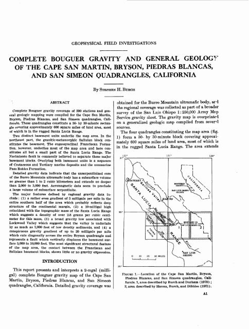
The four quadrangles constituting the map area (fig.<br />
1) form a 30- by 30-minute block covering approximately<br />
600 square miles of l<strong>and</strong> area, most of which is<br />
in the rugged <strong>San</strong>ta Lucia Eange. The area extends<br />
INTRODUCTION<br />
This report presents <strong>and</strong> interprets a 2-mgal (milligal)<br />
complete Bouguer gravity map of the Cape <strong>San</strong><br />
Martin, Bryson, <strong>Piedras</strong> <strong>Blancas</strong>, <strong>and</strong> <strong>San</strong> <strong>Simeon</strong><br />
quadrangles, <strong>California</strong>. Detailed gravity coverage was<br />
FIGURE 1. Location of the Cape <strong>San</strong> Martin, Bryson,<br />
<strong>Piedras</strong> <strong>Blancas</strong>, <strong>and</strong> <strong>San</strong> <strong>Simeon</strong> quadrangles, <strong>California</strong>.<br />
1, area described by Burch <strong>and</strong> Durham (1970) ;<br />
2, area described by Hanna, Burch, <strong>and</strong> Dibblee (1971).<br />
Al