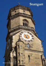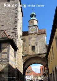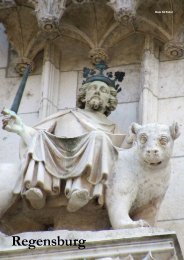
Raven Guides: Germany - Cologne
- No tags were found...

Create successful ePaper yourself
Turn your PDF publications into a flip-book with our unique Google optimized e-Paper software.
European economic unity and security that<br />
started his country on the road to the European<br />
Union.<br />
Altstadt<br />
The medieval and Roman city centres were<br />
closely associated. Beginning a walk at the<br />
cathedral is to begin at the site of an ancient<br />
temple. Roncalliplatz to the south of the<br />
cathedral is the address of the Römisch-<br />
Germanisches Museum and stretches to<br />
Am Hof, which leads toward the Rhine and<br />
Bechergasse. Just to the south is Alter Markt,<br />
the medieval market square, but in Roman<br />
times the Rhine’s course was different and this<br />
area was a harbour sheltered by a long island<br />
stretching from north of Hohenzollernbrücke<br />
almost to today’s Severinsbrücke.<br />
The old city centre suffered grievously<br />
under World War II bombing, but the<br />
restored buildings of the east side of Alter<br />
Markt, down Lintgasse and at Fischmarkt<br />
on today’s Rhine bank retain some German<br />
old-town feel. The church of Groß St Martin<br />
was a Roman warehouse site on the Rhine<br />
island. The Rathaus tower dominates Alter<br />
Markt’s west side and steps beside it lead<br />
up to Rathausplatz, where the Praetorium or<br />
Roman governor’s headquarters stood and the<br />
Renaissance Rathaus portico survives above<br />
what was its south wing. Judengasse marks<br />
where the medieval mikvah baths stood, an<br />
ongoing archaeological dig. At the south end<br />
Obenmarspforten labels the place where a<br />
Roman gate dedicated to Mars led east to what<br />
Hohe Straße, now the main shopping<br />
street, was a Roman main road.<br />
was the Roman bridge over the Rhine.<br />
West along Obenmarspforten runs Hohe<br />
Straße, now a pedestrian street and the city’s<br />
shopping hub, but formerly the main Roman<br />
north-south road. About 80m to the south it ran<br />
through the forum, the Roman public centre.<br />
Hohe Straße leads back north toward<br />
the cathedral district. Directly opposite the<br />
cathedral main portal stands a remnant of the<br />
Roman north-south gate, where the Rhine road<br />
north.<br />
RAVEN QUICK GUIDE<br />
Tourist information: Kardinal-Höffner-Platz 1 (tel 0221-346430, M-Sa 9-20, Su 10-17).<br />
Accommodation service: tel 0221-346430, email info@koelntourismus.de (M-F 9-18,<br />
Sa 9-15).<br />
Money: ReiseBank, Hauptbahnhof main hall (M-Su 7-22); Deutsche Bank, An der<br />
Dominikanern 11 (M & Th 9-18, Tu-W 9-16, F 9-15.30); Sparkasse, An den Dominikanern<br />
6 (M-W 9-16, Th 9-18, F 9-14); Sparda-Bank, Johannisstraße 64 (M & Th 9-18, Tu-W<br />
9-16, F 9-13); Sparkasse, Hahnenstraße 57 (M-W & F 9-16, Th 9-18); Commerzbank,<br />
Hohenzollernring 74 (M & W 9-16, Tu & Th 9-18, F 9-14).<br />
Lockers: Hauptbahnhof main hall (Th-M €6 per day, Tu-W €4 per day).<br />
Transit information: Neumarkt U-Bahn station (M-F 8-20, Sa 8.30-18); Karolingerring<br />
10 (M-F 8-18.30, Sa 8.30-14); Wienerplatz U-Bahn station (M-F 7.30-19, Sa 8.30-14);<br />
Ehrenfeldgürtel 14 (M-F 8-18.30, Sa 8.30-14); Schweidtweilerstraße 38 (M-F 9-18).<br />
Post: Breite Straße 6 (M-F 9-19, Sa 9-14); Hohe Pforte 4 (M-F 9-18, Sa 9-14);<br />
Sudermanplatz 1A (M-F 9-18, Sa 9-13); Kaiser-Wilhelm-Ring 28 (M-F 9-13, 14-18, Sa 9-12);<br />
Kartäuserwall 7 (M-F 9-18, Sa 9-13); Venloer Straße 241 (M-F 9-19, Sa 9-14).<br />
Internet: Starbucks, Hauptbahnhof main hall (M-F 5.30-23, Sa-Su 6-23); Breite Straße 135<br />
(M-F 7-20.30, Sa 8-21.30, Su 10.30-19); Hohenzollernring 70 (M-Th 7-21.30, F 7-1, Sa 8-1,<br />
Su 8-22).<br />
Laundry: Eco-Express Waschsalon, Friedrichstraße 12 (M-Sa 6-23); Eco-Express<br />
Waschsalon, Gutenberg Straße 73 (M-Sa 6-23); Eco-Express Waschsalon, Ubierring 21<br />
(M-Sa 6-23); Waschsalon Korkani, Severinstr 74 (M-Sa 6-23); Eco-Express Waschsalon,<br />
Richard-Wagner-Straße 2 (M-Sa 6-23); Eco-Express Waschsalon, Hansaring 68 (M-Sa<br />
6-23); Kölns Schneller Waschsalon, Matthiasstraße 24 (M-Sa 6-23).<br />
Police: tel 110; Bundespolizei, Hauptbahnhof passage (tel 0221-160930); Stolkgasse 47<br />
(tel 0221-2294130); Walter-Pauli-Ring 2 (tel 0221-2290).<br />
Pharmacy: Apotheke im Hauptbahnhof, Hauptbahnhof Breslauer Platz exit (M-F 6-22, Sa<br />
8-22, Su 10-18); Dom Apotheke, Bahnhofsvorplatz 1 (M-F 8-20, Sa 9-20); Hansa Apotheke,<br />
Ebertplatz 7 (M-F 8-19, Sa 9-18); Behring-Apotheke, Kaiser-Wilhelm-Ring 6 (M-F 8-18, Sa<br />
9-13); Reh-Apotheke, Barbarossaplatz 6 (M-F 8.15-19, Sa 9.30-16); Colonia-Apotheke,<br />
Ubierring 17 (M-F 8.30-18.30, Sa 9-14).<br />
Ambulance: tel 112.<br />
Hospital: Uniklinik Köln, Kerpener Straße 91 (tel 0221-4780); St Antonius Krankenhaus,<br />
Schillerstraße 23 (tel 0221-379364055); Kliniken der Stadt Köln, Neufelder Straße 34,<br />
(tel 0221-89070); Krankenhaus der Augustinerinnen, Jakobstraße 27 (tel 0221-33080);<br />
Krankenhaus Porz am Rhein, Urbacher Weg 1, Porz (tel 02203-5661293).<br />
The Roman wall<br />
The near-trapezoid plan of the Roman city<br />
is clear in the modern street plan and it is<br />
relatively easy to walk the line of Roman<br />
wall (although city maps may not label all<br />
streets). For the detailed guide to all remains,<br />
use the handbook Roman-Germanic <strong>Cologne</strong>,<br />
(see the Information section below). The<br />
north-east tower was under the south-east<br />
wall of the Hauptbahnhof and the north<br />
wall ran parallel with Trankgasse along the<br />
main north facade of the cathedral (it would<br />
have bisected the cathedral treasury), to the<br />
north gate that remains visible. Here the gate<br />
would have accommodated the main northsouth<br />
street, today’s Hohe Straße. Walkers<br />
heading west should divert slightly south off<br />
Komödienstraße to Burgmauer (the wall ran<br />
between) and find a round tower at No 14<br />
using the old foundation.<br />
Where Mariengartengasse bends south,<br />
follow the handful of steps down to the<br />
intersection of Komödienstraße and Tunisstraße,<br />
where another tower foundation<br />
is visible on the traffic island at the top.<br />
Burgmauer resumes across Tunisstraße and<br />
at Appellhofplatz another tower foundation is<br />
marked by a fountain area. The rear wall of<br />
the Zeughaus (now Kölnisches Stadtmuseum)<br />
used the wall foundation and beyond a<br />
section of standing wall is preserved. Here<br />
Burgmauer and Zeughausstraße converge. At<br />
Am Römerturm the tower for which it was<br />
named (the only one fully preserved) comes<br />
into view, actually forming the corner at St-<br />
Apern-Straße. The wall turns south here, part<br />
of the so-called Helenenturm being visible on<br />
the north side of Helenenstraße.<br />
Further south the wall paralleled the<br />
curve of St-Apern-Straße near the corner<br />
of Breite Straße. From here it is best to use<br />
Gertrudenstraße to continue south behind the<br />
church of St Aposteln, where at the west end<br />
of Neumarkt the foundations of the main west<br />
city gate were found and parts of the wall<br />
stood until the 18th century. Further south<br />
across the U-Bahn lines of Hahnenstraße on<br />
Im Laach and Clemenstraße and under the<br />
parking garage between Lungengasse and<br />
Spinnmühlengasse, the foundations of two<br />
Gallo-Roman temples were excavated.<br />
From Bobstraße use Reinholdstraße to<br />
head further south, then use Alexianstraße to<br />
retrace a few steps west to Mauritiussteinweg.<br />
After No 44, between the housing blocks at<br />
right angles to the street wall, sections can be<br />
glimpsed in two small green areas (and behind<br />
garages further on). At Griechenpforte, just to<br />
the left, more tower footings are visible at the<br />
point where the wall swung east along the line<br />
followed today by Alte Mauer am Bach. Past<br />
the spiral footbridge ramp at Poststraße it is<br />
easy to divert around the blocking building (a<br />
tower remains beneath). From Bachemstraße<br />
use Blaubach to trace the wall line, which is<br />
to the rear of the present buildings, across<br />
Neuköllner Straße. The main south city gate<br />
was at Hohe Pforte. About 50m east along<br />
Mühlenbach wall segments are visible behind<br />
the bus stop. At An der Malzmühle is the<br />
Ubiermonument, the square south-east city<br />
tower that is one of the oldest parts of the<br />
Roman fortifications: its museum is closed but<br />
the nearby wall can be glimpsed through the<br />
gateway to a private residential car park.<br />
Here the wall line tracks directly north and<br />
is harder to follow on the street plan. Using<br />
<strong>Cologne</strong> 2 - RAVEN TRAVEL GUIDES GERMANY