


You also want an ePaper? Increase the reach of your titles
YUMPU automatically turns print PDFs into web optimized ePapers that Google loves.
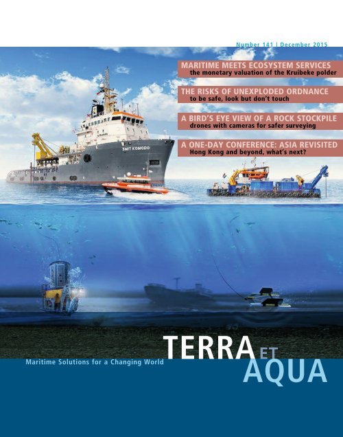
Number 141 | December 2015<br />
MARITIME MEETS ECOSYSTEM SERVICES<br />
the monetary valuation of the Kruibeke polder<br />
THE RISKS OF UNEXPLODED ORDNANCE<br />
to be safe, look but don’t touch<br />
A BIRD’S EYE VIEW OF A ROCK STOCKPILE<br />
drones with cameras for safer surveying<br />
A ONE-DAY CONFERENCE: ASIA REVISITED<br />
Hong Kong and beyond, what’s next?<br />
<strong>TERRA</strong> ET<br />
Maritime Solutions for a Changing World<br />
<strong>AQUA</strong>
Editor<br />
Marsha R. Cohen<br />
Guidelines for Authors<br />
<strong>TERRA</strong> ET<br />
<strong>AQUA</strong><br />
Associate Editor<br />
Priya de Langen<br />
Editorial Advisory Committee<br />
Robert de Bruin, Chair<br />
René Kolman<br />
Heleen Schellinck<br />
Arno Schikker<br />
Ann Wittemans<br />
IADC Board of Directors<br />
P. de Ridder, President<br />
Y. Kakimoto, Vice President<br />
E. Verbraecken, Treasurer<br />
Th. Baartmans<br />
P. Catteau<br />
M. Fordeyn<br />
N. Haworth<br />
P. Verheul<br />
IADC Secretariat<br />
René Kolman, Secretary General<br />
Alexanderveld 84<br />
2585 DB The Hague<br />
Mailing address:<br />
P.O. Box 80521<br />
2508 GM The Hague<br />
The Netherlands<br />
T +31 (0)70 352 3334<br />
F +31 (0)70 351 2654<br />
E info@iadc-dredging.com<br />
I www.iadc-dredging.com<br />
I www.terra-et-aqua.com<br />
Please address enquiries to the editor.<br />
E terra@iadc-dredging.com<br />
Articles in Terra et Aqua do not necessarily<br />
reflect the opinion of the IADC Board or<br />
of individual members.<br />
Terra et Aqua is a quarterly publication of the International Association of Dredging Companies,<br />
emphasising “maritime solutions for a changing world”. It covers the fields of civil, hydraulic<br />
and mechanical engineering including the technical, economic and environmental aspects<br />
of dredging. Developments in the state of the art of the industry and other topics from the<br />
industry with actual news value will be highlighted.<br />
• As Terra et Aqua is an English language journal, articles must be submitted in English.<br />
• Contributions will be considered primarily from authors who represent the various disciplines<br />
of the dredging industry or professions, which are associated with dredging.<br />
• Students and young professionals are encouraged to submit articles based on their research.<br />
• Articles should be approximately 10-12 A4s (4000 to 6000 words). Photographs, graphics<br />
and illustrations are encouraged. High quality, original photographs are acceptable. Digital<br />
photographs should be of the highest resolution (300 dpi and at least 1 Mb, preferably<br />
more).<br />
• Articles should be original and should not have appeared in other magazines or publications.<br />
An exception is made for the proceedings of conferences which have a limited reading public.<br />
• In the case of articles that have previously appeared in conference proceedings, permission<br />
to reprint in Terra et Aqua will be requested by the editor.<br />
• Authors are requested to provide in the “Introduction” an insight into the economic,<br />
social and/or environmental drivers behind the dredging project by the editor.<br />
• An emphasis is placed on articles which highlight innovative techniques and applications.<br />
• By submitting an article, authors grant the IADC permission to publish said article in both<br />
the printed and digital versions of Terra et Aqua without limitations and remuneration.<br />
• For the digital version, authors are requested to provide extra material such as additional<br />
photos, links to reports from which articles have been excerpted or short videos.<br />
These can be embedded in the digital version under the same provisions as above.<br />
• The digital version will contain a link to the LinkedIn page of the author.<br />
In case the author does not agree, please inform IADC (rauwerda@iadc-dredging.com).<br />
• All articles will be reviewed by the Editorial Advisory Committee (EAC). Publication of an<br />
article is subject to approval by the EAC and no article will be published without approval<br />
of the EAC.<br />
For further information or to subscribe free of charge,<br />
visit our website at www.terra-et-aqua.com.<br />
Download the new interactive digital Terra et Aqua.<br />
COVER<br />
UXO (unexploded ordnance) present a safety risk to dredging vessels.<br />
Experts use various specialised tools to locate and salvage munitions.<br />
Shown here from left to right, a Heavy-Duty Work Class Remotely<br />
Operated Vehicle (HD-WROV), a towfish with gradiometer and an<br />
electromagnet for salvaging (page 15).
Case-Specific Policy Analysis<br />
Contents 3<br />
CONTENTS<br />
EDITORIAL 4<br />
ECOSYSTEM SERVICES: TOWARDS INTEGRATED 5<br />
MARITIME INFRASTRUCTURE PROJECT ASSESSMENTS<br />
ANNELIES BOEREMA, KATRIEN VAN DER BIEST AND PATRICK MEIRE<br />
A case study of a tidal marsh restoration project at the Polders<br />
of Kruibeke in Belgium shows how an Ecosystem Services<br />
assessment can reveal otherwise hidden benefits.<br />
DEALING WITH UXO (UNEXPLODED ORDNANCE): 15<br />
DETECTION, IDENTIFICATION, DISPOSAL AND AWARENESS<br />
JAN KÖLBEL AND FRANK SEUBRING<br />
UXOs underwater are everywhere and present an “invisible” threat.<br />
Discovering, removing and dismantling them is risky and should always<br />
be performed by specially trained professionals.<br />
AERIAL SURVEY TECHNIQUES APPLIED FOR STOCKPILE 20<br />
PROGRESS MEASUREMENTS<br />
FRANK SMOLDERS<br />
Multicopters, unmanned aerial surveyors, can fly and take pictures in<br />
difficult-to-reach or potentially dangerous areas, improving the speed<br />
and safety of acquiring data.<br />
50 TH ANNIVERSARY CONFERENCE 26<br />
FROM BIRTH TO BOOM: ASIAN MARITIME MEGASTRUCTURES<br />
To celebrate its 50 th anniversary, the IADC returned to the site of one of<br />
the dredging industry’s most notable triumphs – Hong Kong. An exciting<br />
one-day conference considered the future of Asian development.<br />
BOOKS/PERIODICALS REVIEWED 30<br />
Read about “The Impact of Mega-Ships”, view the illustrated book<br />
on “The New Suez Canal”, and download a new Facts about Underwater<br />
Surveys. Plus the IADC jubilee book, Beyond Sand & Sea is now online<br />
free of charge as well as for sale in print.<br />
The Impact of Mega-Ships<br />
SEMINARS/CONFERENCES/EVENTS 32<br />
A variety of conferences and events are coming up in 2016 from London<br />
and Moscow to Antwerp and Rio de Janiero, highlighted by the upcoming<br />
triennial WODCON XXI to be held in June in Miami, Florida.
4 Terra et Aqua | Number 141 | December 2015<br />
EDITORIAL<br />
As 2015 comes to a close, the celebrations commemorating the 50 th anniversary of the founding<br />
of the International Association of Dredging Companies are winding down. But not without one<br />
final event: Held in Hong Kong in late October, the one-day conference “From Birth to Boom:<br />
Asian Maritime Megastructures” stimulated and challenged an audience comprising some<br />
130 top-level executives and sponsors.<br />
With its rich dredging history, Hong Kong was the obvious choice for the conference. Starting in<br />
the mid-1990s, the engineering skills of the international dredging contractors were on display:<br />
at the enormous Chek Lap Kok land reclamation for the new airport, as well as at the land<br />
reclamations in Central district and expansion of the port’s Container Terminals. All these<br />
operations changed the face of Hong Kong and transformed it into the bustling business centre<br />
that it is today.<br />
Peter de Ridder<br />
President, IADC<br />
Essential to the excitement of the conference was keynote speaker Robert D. Kaplan, wellknown<br />
author and foreign policy expert, who elaborated on “the maritime future of<br />
geopolitics”. In his opinion, the future focal point will be the countries near the Indian Ocean.<br />
Their need for open sea lanes, growing ports and canals, and the expansion of narrow<br />
passageways is already shaping the global balance-of-power in the 21st century (see page 26).<br />
For Terra et Aqua Hong Kong was also an important occasion: A moment to acknowledge the<br />
work of Marsha Cohen. After almost 25 years as Editor of Terra, Marsha is stepping down. Since<br />
some of the earliest articles under her leadership were focused on Hong Kong, it was also an<br />
appropriate place to recognise her contributions – her efforts to communicate to the “outside”<br />
world just what dredging is and how it supports socio-economic progress.<br />
Her mission was to publish articles in Terra that share state-of-the-art knowledge with clients<br />
and stakeholders, who must plan and implement dredging operations. Her goal was to make<br />
dredging comprehensible to a wider audience, to build trust through information. Under her<br />
editorial guidance Terra has successfully helped pave the way to better understanding and<br />
cooperation amongst contractors, clients and communities. Her guiding hand has been behind<br />
each and every issue of Terra since 1991. As we literally turn the page, starting in 2016, we<br />
welcome Terra’s new editor, Priya de Langen, who is presently working alongside Marsha, and<br />
will soon take full command of “the ship”.<br />
As always, this issue of Terra features a number of articles that clearly demonstrate the broad<br />
scope of the dredging industry – starting with a piece describing the application of Ecosystems<br />
Services to the maritime industry, moving on to the latest aerial surveying techniques utilising<br />
unmanned multicopters, and rounding out the issue with a focus on safety concerns during the<br />
discovery and removal of unexploded ordnance or UXO. A diversity of subjects as diverse as the<br />
industry.<br />
Looking back at Hong Kong and IADC’s jubilee year and at the many Terras that have been<br />
published, one realises the wide range of accomplishments of the dredging industry in the last<br />
half century: Bigger ports, widened canals, more international shipping routes. Storm-surge<br />
barriers and coastal protection. Larger airports in the water as gateways for tourism. Offshore<br />
shore projects for energy. An amazing array of areas demonstrating that the dredging industry is<br />
clearly an instrument for change and progress.
Ecosystem Services: Towards Integrated Maritime Infrastructure Project Assessments 5<br />
ANNELIES BOEREMA, KATRIEN VAN DER BIEST AND PATRICK MEIRE<br />
ECOSYSTEM SERVICES:<br />
TOWARDS INTEGRATED MARITIME<br />
INFRASTRUCTURE PROJECT ASSESSMENTS<br />
ABSTRACT<br />
Ecosystem services (ES) are defined as the<br />
benefits that humans derive from nature.<br />
These services represent different benefits for<br />
human well-being. The ES framework helps<br />
to analyse the impacts humans have on<br />
ecosystems and the feed-back effects these<br />
changes have for the ecosystem benefits to<br />
humans. Today many industries, including<br />
those in the maritime sector, are in the process<br />
of applying ES to evaluating their processes of<br />
manufacturing and delivering products.<br />
To that end, the Ecosystem Management<br />
Research Group (ECOBE), Department of<br />
Biology, University of Antwerp, Belgium and<br />
the International Association of Dredging<br />
Companies (IADC) have joined forces to explore<br />
the subject as regards dredging. This article is<br />
the first result of that research. The aim of this<br />
joint effort is to show that with the use of ES a<br />
more integrated evaluation of the consequences<br />
of maritime infrastructure projects can be<br />
achieved. The presented method of ES<br />
evaluation is applied to a dredging-related case<br />
study: tidal marsh restoration in the Polders of<br />
Kruibeke, located in the Zeeschelde, the Belgian<br />
part of the tidal River Scheldt.<br />
The authors would like to acknowledge<br />
Stefaan Nollet, project engineer of the Polders<br />
of Kruibeke (Waterwegen en Zeekanaal NV –<br />
W&Z) and Tom Maris, researcher at the<br />
University of Antwerp, for providing data and<br />
photographs of the project.<br />
INTRODUCTION<br />
Ecosystem services (ES) are the benefits that<br />
humans derive from nature (MEA 2005, TEEB<br />
2010). There are different types of ES which<br />
result in different benefits for human wellbeing,<br />
such as security, basic materials for a<br />
good life, health and good social relations<br />
(Figure 1). The different types of ES are:<br />
- provisioning services (e.g., food, wood),<br />
- regulating services (e.g., air quality<br />
regulation, water quality regulation) and<br />
- cultural services (e.g., opportunities for<br />
recreation, cultural heritage).<br />
Furthermore, biodiversity and supporting<br />
services are an underlying group of ecosystem<br />
Above: One benefit of Ecosystem Services is addressing<br />
the challenges of flooding. At the Polders of Kruibeke in<br />
Belgium, a new dike will be built land inwards (the<br />
horizontal line in the middle going from the River<br />
Scheldt to the right). This new ring dike should protect<br />
the houses just outside the site when the flood area fills<br />
during storm tide.<br />
functions (e.g., nutrient cycling, primary<br />
production), which are important for the<br />
delivery of the other three categories of<br />
services. The ES framework forms the bridge<br />
between ecosystems and human well-being<br />
(socio-cultural context) and explains the<br />
relationship between both “worlds”<br />
(Figure 2). In addition, this framework helps<br />
to analyse the impacts humans have on<br />
ecosystems and the feed-back effects these<br />
changes have for the ecosystem benefits to<br />
humans.<br />
To illustrate the significance of the application<br />
of ES evaluation to the maritime sector, a<br />
dredging-related case study – tidal marsh<br />
restoration in the Polders of Kruibeke, located<br />
in the Zeeschelde, the Belgian part of the tidal<br />
River Scheldt – is presented.<br />
ECOSYSTEM SERVICE EVALUATION<br />
FOR INTEGRATED PROJECT<br />
ASSESSMENT<br />
Ecosystem service evaluation could be used as<br />
a method for an integrated assessment of<br />
specific maritime and dredging projects. The<br />
method consists of four basic steps (Table I):<br />
- In step 1, the different habitat types that<br />
are affected by the project are identified.<br />
- In step 2, all ES delivered by those habitat<br />
types are identified and the relevant ES for<br />
the specific project selected.
6 Terra et Aqua | Number 141 | December 2015<br />
Supporting<br />
Nutrient cycling<br />
Sol formation<br />
Primary production<br />
…<br />
ECOSYSTEMS SERVICES<br />
Provisioning<br />
Food<br />
Fresh water<br />
Wood and fiber<br />
Fuel<br />
…<br />
Regulating<br />
Climate regulation<br />
Flood regulation<br />
Disease regulation<br />
Water purification<br />
…<br />
Clultural<br />
Aesthetic<br />
Spiritual<br />
Educational<br />
Recreational<br />
…<br />
LIFE ON EARTH - BIODIVERSITY<br />
ARROW'S COLOR: Potential for mediation by socioeconomic<br />
factors<br />
Low Medium High<br />
Security<br />
personal safety<br />
secure resource access<br />
security from disasters<br />
Basis material foor good life<br />
Adequate livelyhoods<br />
Sufficient nutricious food<br />
Shelter<br />
Access to goods<br />
Health<br />
Strength<br />
Feeling well<br />
Access to clean air and water<br />
Good social relations<br />
Social cohesion<br />
Mutual respect<br />
Ability to help others<br />
CONSTITUENTS OF WELL-BEING<br />
Freedom of choice<br />
and action<br />
Opportunity to be<br />
able to achieve what<br />
an individual values<br />
doing and being<br />
Source: Millennium Ecosystem Assessment<br />
ARROW'S WIDTH: Intensity of linkages between ecosystem services and human<br />
well-being<br />
Weak Medium Strong<br />
Figure 1. Links between ecosystem services and human well-being (MEA 2005).<br />
Ecosystems & Biodiversity<br />
Biophysical<br />
Structure of<br />
process<br />
(eg. vegetation<br />
cover or Net<br />
Primary<br />
Productivity)<br />
Function*<br />
(eg. slow<br />
water passage,<br />
biomass)<br />
Service<br />
(eg. flood<br />
protection<br />
products)<br />
Human well-being<br />
(socio-cultural context)<br />
Benefit(s)<br />
(contribution to<br />
health, safety,<br />
etc)<br />
(econ) Value<br />
(eg. WTP for<br />
protection or<br />
products)<br />
* subset of biophysical structure or process providing the service<br />
Figure 2. Ecosystem services cascade: From ecosystem to human well-being (TEEB 2010).<br />
- In step 3, each ES as well as the underlying<br />
mechanisms driving the delivery are<br />
described.<br />
- Finally, in step 4, the impact on all relevant<br />
ES are calculated in a quantitative and<br />
monetary way as much as possible.<br />
For the quantitative assessment, each ES has<br />
its own unit which is most relevant for that<br />
service. Carbon sequestration (that is the<br />
long-term storage of carbon dioxide or other<br />
forms of carbon), for example, is expressed in<br />
tonnes of carbon per hectare per year; wood<br />
production is expressed in m³ wood volume<br />
increase per hectare per year.<br />
For the quantification, methods differ<br />
between intertidal systems and terrestrial<br />
systems owing to differences in the processes<br />
that are relevant for ES delivery (e.g.,<br />
sedimentation in intertidal systems or<br />
groundwater in terrestrial systems). For the<br />
monetary valuation, each of the quantitative
Ecosystem Services: Towards Integrated Maritime Infrastructure Project Assessments 7<br />
ANNELIES BOEREMA<br />
is a doctoral student in environmental<br />
science at the Research Group Ecosystem<br />
Management of the University of Antwerp,<br />
Belgium. Her research focusses on<br />
biophysical and economic evaluation of<br />
ecosystem services to assess the impact of<br />
ecosystem management, with an emphasis<br />
on estuaries. She obtained her Master’s<br />
degree in commercial engineering and a<br />
Master’s degree in environmental science<br />
at the University of Antwerp.<br />
KATRIEN VAN DER BIEST<br />
is a doctoral student at the Research Group<br />
Ecosystem Management of the University<br />
of Antwerp, Belgium. She obtained her<br />
Master’s degree in Physical Geography at<br />
the University of Ghent and her Master’s<br />
degree in Oceanography at the University<br />
of Liège, both in Belgium. Her current<br />
research focusses on quantifying and<br />
mapping ecosystem services as a<br />
supportive tool in environmental<br />
management, both in terrestrial and in<br />
marine ecosystems.<br />
PATRICK MEIRE<br />
is professor in biology and head of the<br />
research group Ecosystem Management<br />
(ECOBE) at the University of Antwerp,<br />
Belgium. His research focusses on the<br />
environmental impact of human activities<br />
on aquatic and wetland systems and these<br />
insights are used to develop concepts for<br />
integrated water management and<br />
ecosystem management. In the Scheldt<br />
estuary he coordinates the OMES project<br />
that studies the environmental impact of<br />
the Sigma Plan (management plan for the<br />
Flemish part of the Scheldt estuary with a<br />
focus on safety, navigation and nature). He<br />
obtained his PhD in biology from the<br />
University of Ghent, Belgium.<br />
Table I. ES evaluation in four steps.<br />
Step 1 Changes in habitat and land use/land cover (before vs after)<br />
Step 2<br />
Step 3<br />
Step 4<br />
ES analysis per habitat type<br />
• International literature: to select potential ES<br />
• Project specific literature (e.g., Environmental Impact Assessment):<br />
to select project relevant ES<br />
Description of relevant ES and important underlying mechanisms<br />
Quantitative and/or monetary assessment (depending on available data)<br />
units is translated into euros (€) per hectare<br />
per year to form a basis for comparison of<br />
scenarios or project alternatives.<br />
CASE STUDY: POLDERS OF KRUIBEKE<br />
The presented method of ES evaluation is<br />
applied on a dredging-related case study: tidal<br />
marsh restoration in the Polders of Kruibeke,<br />
located in the Zeeschelde, the Belgian part of<br />
the tidal River Scheldt (Figure 3A). The main<br />
development targets of this project are flood<br />
prevention and nature development linked to<br />
the European habitat and bird directives. This<br />
is one of the projects of the Sigma Plan, the<br />
Flemish management agreement for the<br />
Scheldt estuary which focusses on safety,<br />
navigation and nature.<br />
Within this project two techniques are used to<br />
create an area for flood safety and nature<br />
development. Both techniques (Flood Control<br />
Area [FCA] and Flood Control Area with<br />
Controlled Reduced Tide [FCA-CRT]) are<br />
illustrated in Figure 4. The project – expected to<br />
be finished by the end of 2015 – uses a<br />
combination of both techniques and the result is<br />
mixed habitat configuration of wetland, bird area,<br />
alder brook forest and tidal marsh (Figure 3B).<br />
To assess the beneficial value of the project,<br />
a comparison is made with the situation<br />
(agricultural area) before the project. For the<br />
first scenario – the agricultural area without<br />
the project – only maintenance costs are<br />
taken into consideration (no further<br />
investment costs). The maintenance cost<br />
amounts to € 140,000 per year (or € 3.5<br />
million for 100 years with 4% annuity rate).<br />
For the second scenario, the investment cost<br />
for the project consists of a construction cost<br />
of about € 75 million and an expropriation<br />
cost of about € 25 million. Furthermore an<br />
annual maintenance cost (e.g., for mowing of<br />
dikes) is accounted for (€ 170,000 per year, or<br />
€ 4 million for 100 years). This gives a total<br />
investment over 100 years of € 3.5 million<br />
without the project and € 104 million with<br />
the project (Stabo, 1998; Triple E Trust &<br />
Natuur en Economie, 2015; W&Z, 2015;<br />
Polderbestuur, 2015).<br />
ES EVALUATION OF THE POLDERS OF<br />
KRUIBEKE<br />
For terrestrial systems, advanced biophysical<br />
methods are being developed. The biophysical<br />
models take into account the multiple biotic<br />
Table II. Schematic overview the required data from the different biophysical maps<br />
are combined. For each raster cell of 5x5m data from the different layers are<br />
combined and used to estimate the different ecosystem services.
8 Terra et Aqua | Number 141 | December 2015<br />
A<br />
B<br />
Figure 3. A) Study area the Polders of Kruibeke in the Zeeschelde, the Belgian part of the tidal River Scheldt. B) Integrated Plan for the Flood Control Area (FCA) Polders of<br />
Kruibeke with four different zones: (1) bird area, (2) alder brook forest, (3) tidal marsh combined with bird area (FCA-CRT), (4) tidal marsh (FCA-CRT).<br />
(living) and abiotic (non-living, physical)<br />
parameters that affect ES delivery and<br />
potential interactions between different<br />
parameters. All of the data are made spatially<br />
explicit in a Geographical Information Systems<br />
(GIS) environment and the results can be<br />
visualised in maps. The aerial photographs in<br />
Figures 5 and 6 show the northern and<br />
southern parts of the project site. Figure 5<br />
was taken before the project; Figure 6 after<br />
the project.<br />
In other words, for each area (in the form of a<br />
raster cell of 5 m x 5 m) a calculation is made<br />
for the delivery of each service, based on the<br />
parameters characteristic for that area (Table II).<br />
A short overview of all of the input<br />
parameters needed to assess the different<br />
services is provided:<br />
- Land use: before and after realisation of the<br />
Integrated Plan Version 3 for the Polders of<br />
Kruibeke (INBO) (Instituut voor Natuur en<br />
Bos Onderzoek/Institute for Nature and<br />
Forest Research) (Figure 3B)<br />
- Soil texture: Soil map of Flanders (AGIV,<br />
2001)<br />
- Soil profile development: Soil map of<br />
Flanders (AGIV, 2001)<br />
- Groundwater depth (cm): modelled<br />
groundwater levels for Flanders (ECOPLAN<br />
project, 2015)<br />
- Elevation (cm TAW): digital elevation model<br />
Flanders (AGIV, 2011). TAW (Tweede<br />
Algemene Waterpassing) is the reference<br />
height used to express elevation measures<br />
in Belgium. This is similar to the Dutch<br />
Normaal Amsterdams Peil (NAP), which is<br />
2.33 metre higher than TAW and the<br />
average sea level in Marseille (used in<br />
France), which is 1.82 metre higher than<br />
TAW.<br />
- Groundwater supply (l/day): modelled data<br />
for Flanders (ECOPLAN Project, 2015)<br />
- Nitrate concentration in groundwater<br />
(mg/l): modelled data for Flanders<br />
(ECOPLAN Project, 2015)<br />
Wood provisioning<br />
Wood production depends on biophysical<br />
suitability of the soil and on land use and<br />
related management practices. Biophysical<br />
potential of the soil was modelled based on a<br />
suitability scoring approach, carried out for all<br />
frequently occurring tree species in Flanders<br />
(De Vos, 2000). The species-specific suitability<br />
scores, dependent on soil texture, soil<br />
moisture content and profile development,<br />
were devised by experts, who based their<br />
knowledge on existing literature and field<br />
studies on forest productivity (Landuyt et al.,<br />
2015).<br />
These suitability scores were used to derive<br />
expected productivity rates (m³/ha/year) for<br />
each tree species. To account for the effect of<br />
management, harvest factors were used to<br />
differentiate between state-owned forests and<br />
private forests, where state-owned forests are<br />
more frequently harvested than private<br />
forests. Based on species-specific market<br />
prices, derived from a statistical analysis on a<br />
database of actual selling prices in Flanders<br />
(Demey et al., 2013), production rates were<br />
converted into monetary values (€/ha/year).
Ecosystem Services: Towards Integrated Maritime Infrastructure Project Assessments 9<br />
Food production (crops and livestock<br />
grazing)<br />
Agricultural production depends on land use<br />
and biophysical suitability of the soil. Four<br />
different types of agricultural land use are<br />
accounted for:<br />
- conventional cropland (with use of fertilizers),<br />
- conventional grassland (intensively grazed<br />
pastures with use of fertilizers),<br />
- grassland with extensive grazing (such as<br />
grazing to maintain dikes without input of<br />
additional fertilizers) and<br />
- natural grassland with very extensive<br />
grazing (pastures in areas with nature<br />
protection where no input of additional<br />
fertilizers is allowed).<br />
Biophysical suitability for agriculture depends<br />
on soil type, soil moisture content and profile<br />
development. Agricultural productivity is<br />
highest under the most optimal soil conditions<br />
(loamy, organic soils with average<br />
groundwater depth) and lower on less fertile<br />
soils (dry, sandy soils).<br />
harbours or busy roads, and should be<br />
evaluated per case study. From the average<br />
daily concentration of fine particles (PM2.5<br />
and PM10) in Belgium (website ATMOSYS,<br />
March 2015), the area of Kruibeke clearly<br />
receives large amounts of fine dust particles,<br />
caused by the presence of a busy highway<br />
and industrial activity on the other side of the<br />
Scheldt estuary.<br />
The quantitative values used for the<br />
evaluation of air quality in this study are based<br />
on the values used in the Nature Value<br />
Explorer (digital and continuously updated<br />
version, March 2015), which are derived from<br />
Oosterbaan et al. (2006). The monetary value<br />
of air quality regulation (fine dust removal) is<br />
calculated as the avoided damage to human<br />
health caused by fine dust emission (€/kg<br />
PM10) (Liekens et al. 2013).<br />
Climate regulation (carbon<br />
sequestration)<br />
Climate regulation through carbon<br />
sequestration can be realised by burial of<br />
organic matter during sedimentation and by<br />
anoxic accumulation of organic matter both in<br />
above and below ground biomass and in the<br />
soil. As only the soil component can be seen<br />
as permanent storage, the focus here is on<br />
this type of organic carbon storage (soil<br />
organic carbon or SOC). Storage by burial<br />
only occurs in case of regular flooding, such<br />
as on marshes and mudflats. Storage through<br />
accumulation of organic matter can only<br />
occur in the presence of vegetation, either on<br />
terrestrial land or on transitional grounds such<br />
as vegetated marshes.<br />
In estuaries, carbon regulation consists of<br />
sequestration through litter accumulation<br />
(vegetated marshes) and burial through<br />
sedimentation (subtidal habitat, seagrass, tidal<br />
flats, marshes). Annual carbon burial (ton C/ha/y,<br />
or ton CO 2<br />
-eq./ha/y) is calculated based on:<br />
- the annual sediment volume increase (with<br />
annual sedimentation rates being lower for<br />
high marshes compared to mudflats and<br />
Based on recent data on agricultural<br />
productivity in Flanders, the potential<br />
productivity of conventional cropland and<br />
grassland (expected value, expressed in €/ha/<br />
year, and standard deviation) (Van<br />
Broekhoven et al., 2012) were derived. The<br />
expected production for the more extensive<br />
grasslands is estimated based on values of<br />
livestock density in head per hectare (Wint<br />
and Robinson, 2007; Nolte et al., 2013) and<br />
taking into account a higher meat price for<br />
organic meat compared to regular meat. For<br />
each combination of soil characteristics, a<br />
certain reduction of the maximum productivity<br />
is determined based on data used by the<br />
Flemish government (Bollen, 2012).<br />
Air quality regulation (fine dust<br />
removal)<br />
Plants are capable of reducing the amount of<br />
fine dust (PM2.5 and PM10) in the air<br />
originating from urban and industrial<br />
activities. Fine dust particles precipitate on<br />
leaves, stems and branches and are then<br />
washed away by rain to accumulate on the<br />
soil. The type of vegetation and the presence<br />
of understories are major factors determining<br />
the capacity of an ecosystem to improve air<br />
quality. This service is only relevant in a region<br />
with air pollution, for example close to cities,<br />
Figure 4. Concept of a Flood Control Area (FCA) and Controlled Reduced Tide (CRT). References for more details on<br />
the FCA-CRT technique: Meire et al., 2005; Cox et al., 2006; Maris et al., 2007.
10 Terra et Aqua | Number 141 | December 2015<br />
Left, Figure 5. Before: Aerial photograph of the northern part of the project site along the River Scheldt shows the situation with agricultural land before the start of the project.<br />
This part is being converted into a tidal marsh by the creation of a Flood Control Area with a Controlled Reduced Tide (FCA-CRT) (see Zone 4 in Figure 3B and Figure 4<br />
for more details about the FCA-CRT concept). Right, Figure 6. After: Aerial photograph of the southern part of the project site along the River Scheldt: wetland as bird area<br />
(Zone 1 in Figure 3B) and alder brook forest (Zone 2 in Figure 3B).<br />
low marshes),<br />
- bulk density of the sediment and<br />
- particulate organic carbon content in the<br />
river water.<br />
Marshes and mudflats are furthermore<br />
characterised by important amounts of<br />
greenhouse gas emissions (CO 2<br />
, CH 4<br />
and<br />
N 2<br />
O). These emissions were taken into<br />
account by subtracting them from the<br />
estimated amount of carbon burial. Data for<br />
the three greenhouse gas emissions are<br />
derived from measurements in the intertidal<br />
sediment at Doel near the Polders of Kruibeke<br />
(Middelburg et al.,1995a,b).<br />
Terrestrial SOC sequestration by accumulation<br />
of plant material in soils was estimated using<br />
an existing multiple regression model for<br />
carbon storage in soils in Flanders (Meersmans<br />
et al., 2011). This model predicts the total<br />
SOC stock based on soil texture, soil moisture<br />
content and land use (grassland, heathland,<br />
cropland and forest). The thus predicted SOC<br />
is divided by 100, assuming that soils reach<br />
their equilibrium SOC concentration after a<br />
period of 100 years. For more detailed<br />
information on the modelling methodology<br />
applied for terrestrial habitats see Meersmans<br />
et al. (2011) and Broekx et al. (2014).<br />
The monetary value of climate regulation<br />
(carbon sequestration) is calculated as the<br />
avoided reduction cost, i.e., the costs for<br />
emission reduction measures that can be<br />
avoided in other areas to reach the<br />
environmental targets, which are related to<br />
the worldwide max. 2°C temperature increase<br />
relative to the pre-industrial level of 1780.<br />
Data is based on a meta-analysis of several<br />
climate model studies (Kuik et al. 2009).<br />
Water quality regulation<br />
Water quality regulation refers to the removal<br />
of excessive nutrients (nitrate and phosphate)<br />
from water bodies (soil pore water,<br />
groundwater, surface water and sea). This<br />
service is especially important close to<br />
agricultural areas regarding the use of<br />
fertilizers or in coastal areas with a high<br />
discharge of nutrient rich freshwater.<br />
Denitrification is one of the main processes by<br />
which nutrients are permanently removed<br />
from an ecosystem. Nutrients can additionally<br />
be removed through transfer of primary<br />
production to higher trophic levels (nutrient<br />
cycling) and burial through sedimentation of<br />
organic material (especially in estuaries). While<br />
nutrients form the basis of marine life (primary<br />
production) and increase ES delivery such as<br />
fish production, an excessive supply leads to<br />
eutrophication and may cause proliferation of<br />
(toxic) algae, oxygen depletion, light<br />
limitation, mortality of fish and benthic<br />
organisms and reduced recreation amenity<br />
value (O’Higgins and Gilbert, 2014).<br />
A healthy marine ecosystem requires a<br />
balance between primary production and<br />
consumption by higher trophic levels (bivalves,<br />
fish, …). Marine ecosystems with high<br />
nutrient loads and intensive fishing, such as<br />
the coastal zone of the North Sea, may thus<br />
benefit from developments that increase<br />
habitat surface or quality for higher trophic<br />
levels feeding on excessive algae growth.<br />
Amongst the main benefits of the removal of<br />
excessive nutrients by plants and natural<br />
ecosystems are:<br />
- reduction of the costs for mechanical<br />
purification of drinking water,<br />
- increase of biodiversity,<br />
- prevention of fish mortality and<br />
- decrease in recreational amenity value.<br />
Only the benefits from denitrification and<br />
nutrient burial (nitrogen and phosphorous)<br />
have been taken into account here as these<br />
processes have long-term storage capacities.<br />
Removal by transfer to higher trophic levels is
Ecosystem Services: Towards Integrated Maritime Infrastructure Project Assessments 11<br />
Figure 7. Close up view of the sluice system in the northern part of the project connects the project site with the River Scheldt. The sluice will reduce the tidal range that comes<br />
into the area, thus creating a Controlled Reduced Tide. Making the sluices, lowering the dike next to the river and building the new ring dike land inwards are the main dredging<br />
operations in this project.<br />
temporary, except if biomass is harvested<br />
(e.g., through fishing), and is therefore not<br />
considered in this research.<br />
i. Denitrification<br />
Denitrification is the biochemical process in<br />
which bacteria convert biologically available<br />
nitrogen into nitrogen gas. Denitrification can<br />
occur in all ecosystem types, natural and<br />
equilibrated as well as more disturbed and<br />
eutrophic systems, but it only becomes an ES<br />
when it prevents leakage of nitrogen to<br />
ground- and surface water reserves or when<br />
it removes excessive nitrogen from water<br />
reserves. Denitrification typically occurs in<br />
water saturated soils (wetlands, rivers, river<br />
banks, …) where oxygen-poor groundwater<br />
meets oxygen-rich conditions. Denitrification<br />
is thus rather marginally influenced by<br />
vegetation.<br />
For denitrification in estuaries, the focus here<br />
has been on measurements in flood areas in<br />
the Scheldt estuary (Middelburg et al., 1995a;<br />
Broekx et al., 2011). A distinction is made<br />
between frequently and occasionally flooded<br />
areas, with denitrification being higher in<br />
frequently inundated zones and hence in<br />
frequently alternating oxic/anoxic conditions.<br />
Denitrification in terrestrial habitats is<br />
especially important under conditions of high<br />
nutrient supply such as in the vicinity of<br />
agricultural sites that apply fertilizers.<br />
A scenario with a large amount of agricultural<br />
fields may thus have higher denitrification<br />
rates than marshes and mudflats, because of<br />
the higher input of nitrates through fertilizing<br />
compared to the concentration of nitrates in<br />
the Scheldt water. The high denitrification<br />
rates result from the addition of fertilizer on<br />
fields. As fertilizers cause leakage of nutrients<br />
to water reserves, the negative impacts of the<br />
use of synthetic fertilizer on water quality is<br />
taken into account.<br />
When animal manure is being used as<br />
fertilizer, nutrient uptake by crops and<br />
denitrification could be considered as an<br />
additional benefit (avoiding expensive animal<br />
manure treatment). This is not included in the<br />
analysis since no information is available on<br />
the proportion of animal manure used and<br />
the cost of animal manure treatment.<br />
For the monetary value, the shadow price for<br />
nitrogen removal (€/kg N) is used which is the<br />
cost for an equal removal of nitrogen using<br />
technical investments. An average value based<br />
on a literature review is used (Liekens et al.<br />
2013).<br />
ii. Nitrogen burial<br />
Nitrogen burial in estuaries was calculated by<br />
taking into account the annual sediment<br />
volume increase (idem as for carbon burial)<br />
and the particulate nitrogen content of river<br />
water. For the monetary valuation, the same<br />
method as for denitrification is used.
12 Terra et Aqua | Number 141 | December 2015<br />
based on a literature review is used (Liekens et<br />
al. 2013).<br />
Flood protection<br />
Flood control areas contribute to flood safety<br />
through water storage during storm surges<br />
(Figure 7). The monetary value of the ES flood<br />
protection is usually calculated as the avoided<br />
damage costs and/or casualties. This method<br />
requires the use of hydrodynamic models to<br />
predict water flow and flood levels. In the<br />
frame of the Sigma Plan, the safety benefit of<br />
the different projects is estimated using such<br />
hydrodynamic models (Gauderis et al. 2005).<br />
Figure 8. Annual benefits per ES and total sum for both scenarios: without or with the project (million €/year).<br />
iii. Phosphorous burial<br />
The calculation of phosphorous burial in<br />
estuaries is equal to carbon and nitrogen<br />
burial: the annual sediment volume increase<br />
multiplied with the total phosphorous content<br />
of river water. No consideration was given to<br />
the fact that in the first years (after converting<br />
agricultural land into a flood control area),<br />
phosphorous is being released instead of<br />
buried (based on field measurements and<br />
mass balance calculations for the pilot project<br />
Lippenbroek in the Scheldt estuary, Maris et<br />
al. 2010).<br />
For the monetary value, the shadow price for<br />
phosphorus removal (€/kg P) is used, which is<br />
the cost for an equal removal of phosphorus<br />
using technical investments. An average value<br />
Figure 9. The total costs and benefits and the total sum are given for the situation without and with the project<br />
(million €, for 100 years with 4% annuity rate). The benefits of the situation without the project consist of benefits<br />
from food production and additional ES benefits. The benefits of the project consist of safety benefits and additional<br />
ES benefits. For both, the total sum is presented with and without the additional ES benefits to see the difference of<br />
a full ES evaluation.<br />
Recreation<br />
Benefits from recreation resulting from new<br />
projects are difficult to assess for two reasons:<br />
First, it is difficult to distinguish between the<br />
effects of changes in the ecosystem and the<br />
effects resulting from additional efforts to<br />
stimulate recreation (walking trails, promotion<br />
campaigns, …). Second, it is difficult to<br />
estimate differences between habitat types,<br />
where in some cases agricultural sites may<br />
attract a similar amount of visitors as natural<br />
habitat types. The monetary value is estimated<br />
as the amount all visitors spend during their<br />
visits. Therefore data is needed on the number<br />
of visitors before and after the project.<br />
For the Polders of Kruibeke the number of<br />
visitors was estimated in a study about the<br />
tourist and recreational potential of the<br />
project (ANTEA group and IDEA Consult,<br />
2012). However, recreational benefits were<br />
not included in the ES evaluation, because the<br />
added value of the landscape changes is not<br />
clear (difference between before and after the<br />
project, both in number of visitors and in<br />
added value to the recreants).<br />
Biodiversity<br />
An important objective of the Polders of<br />
Kruibeke project is the contribution to the<br />
European Habitat and Bird Directive targets<br />
(e.g., creation of estuarine nature and bird<br />
area). Biodiversity is not considered an ES in<br />
itself but for several ES there is a strong<br />
positive feedback mechanism between<br />
biodiversity and service delivery. Biodiversity<br />
for example will be higher under good water<br />
quality conditions. A higher biodiversity in its<br />
turn may increase removal of excessive<br />
nutrients as a result of niche partitioning<br />
within a certain habitat. Other services
Ecosystem Services: Towards Integrated Maritime Infrastructure Project Assessments 13<br />
however may have negative feedback<br />
mechanisms with biodiversity. Recreation for<br />
example may result in a decline of species<br />
richness caused by trampling or repeated<br />
disturbance. Recreational attractiveness on the<br />
other hand may be higher if a higher diversity<br />
of species is present.<br />
Although the relationships between<br />
biodiversity and ES are complex and service<br />
dependent, it is believed that the creation of<br />
more natural habitat increases both<br />
biodiversity and service delivery. Biodiversity is<br />
relevant in each of the habitat types.<br />
Monetary valuation: Societal benefits from<br />
habitat creation and an increase/shift in<br />
biodiversity are not included in the monetary<br />
assessment because of a lack of scientifically<br />
sound measurement methods. Furthermore,<br />
biodiversity has an intrinsic rather than a<br />
monetary value. Only a qualitative or<br />
quantitative (e.g., number of different species)<br />
assessment could be used to specify the<br />
contribution of the project. Habitat types that<br />
are created are estuary (tidal habitat),<br />
meadows and alder brook forest. Relevant<br />
species groups are macrobenthos, nematode<br />
communities, fish, shellfish, tidal marsh<br />
vegetation and birds.<br />
OVERALL NET BENEFIT FOR BOTH<br />
SCENARIOS: WITH OR WITHOUT THE<br />
PROJECT<br />
With the ES evaluation the external effects of<br />
the alternatives without or with the project<br />
and its relevance for society have been<br />
investigated and compared. The project gives<br />
much higher annual benefits compared to the<br />
situation without the project (Figure 8). The<br />
situation without the project provides the ES<br />
food production but creates negative effects<br />
for water quality (nitrogen leaching).<br />
On the other hand, the project provides not<br />
only safety benefits (flood prevention) but also<br />
positive effects for air quality and water<br />
quality regulation. In addition, the benefits are<br />
compared with the investment and<br />
maintenance costs.<br />
To understand the impact of including an ES<br />
evaluation, the sum with and without the<br />
additional ES benefits is shown in Figure 9.<br />
Without the ES evaluation, only the benefit of<br />
food production (without project) and of<br />
flood safety (with project) would be<br />
compared. As a result of the high investment<br />
cost for the project, the conclusion would be<br />
a negative result for the project compared to<br />
the situation without the project.<br />
However, by taking into consideration the ES<br />
evaluation and including additional ES<br />
CONCLUSIONS<br />
An ES evaluation enables an integrated and<br />
balanced comparison of human actions or<br />
project alternatives. This will help to assess<br />
whether one human action has more or<br />
less positive effects for the ecosystem, for<br />
different stakeholders and the broad<br />
society. Monetary valuation of ES is useful<br />
to make a full environmental cost-benefit<br />
analysis and weigh the investment costs<br />
with environmental and socio-economic<br />
benefits. This has been applied to a<br />
maritime project at the Polders of Kruibeke<br />
in Belgium.<br />
The ES evaluation of the Polders of<br />
Kruibeke project shows that the project is<br />
more beneficial for society than the<br />
situation without the project. What is<br />
remarkable is that this conclusion is the<br />
opposite of what would have been decided<br />
had the additional ES benefits not been<br />
included. Without ES, the project gave an<br />
overall negative effect for society.<br />
Interpreting this result in the wider context<br />
is important, for example by looking at the<br />
ES that are actually needed in the area<br />
REFERENCES<br />
AGIV (2001). Vector Version of the Soil Map of<br />
Flanders (Vectoriële versie van de Bodemkaart<br />
Vlaanderen). AGIV, IWT, Laboratory for Soil<br />
Science, University of Ghent.<br />
AGIV (2011). Digital Elevation Model Flanders<br />
25m. Flemish Government Ministry of<br />
Environment, Nature and Energy. AWZ<br />
Administration and AMINAL Administration<br />
Water Division.<br />
benefits, the situation with the project turns<br />
out to be more beneficial to society than<br />
without the project.<br />
The difference with and without additional ES<br />
benefits is minimal for the situation without<br />
the project, but highly important for the<br />
project to show its overall societal benefit.<br />
(e.g., is there a local demand for the ES<br />
benefits?). Furthermore an assessment is<br />
also useful as to which ES are really<br />
dependent on the project or the location<br />
(e.g., flood prevention at a flood control<br />
area along the estuary river) and which ES<br />
could also be delivered elsewhere (e.g., fine<br />
dust capture by vegetation or food<br />
production). Lastly, making a full ES<br />
evaluation is rather impossible since<br />
knowledge gaps and data availability limit<br />
the inclusion of all effects.<br />
Ecosystem services that are not included in<br />
the assessment of the Polders of Kruibeke<br />
are, for example, the contribution to the<br />
silica cycling, turbidity reduction in the<br />
River Scheldt (linked to primary<br />
production), nursery function and the<br />
contribution to the bird communities as<br />
feeding or resting areas.<br />
Nevertheless, the ES evaluation is a useful<br />
tool to include external effects – as much<br />
as possible – in the decision-making<br />
process and can hence contribute towards<br />
more integrated maritime infrastructure<br />
project assessments.<br />
ANTEA group and IDEA Consult (2012).<br />
Polders van Kruibeke, toeristisch-recreatieve<br />
basispositionering. in opdracht van Waterwegen<br />
en Zeekanaal nv. Antwerpen. 18pp.<br />
Bollen, B. (2012). Optimalisation of Soil<br />
Suitability Map Based on Soil Texture and<br />
Hydrology (Optimalisatie van de<br />
bodemgeschiktheidskaart op basis van de<br />
drainage en textuurklasse). Agriculture and<br />
Fisheries Department, Sustainable Agricultural<br />
Development Division, Flemish Government.
14 Terra et Aqua | Number 141 | December 2015<br />
Broekx, S., Smets, S., Liekens, I., Bulckaen, D.<br />
and De Nocker, L. (2011). “Designing a longterm<br />
flood risk management plan for the<br />
Scheldt estuary using a risk-based approach”.<br />
Natural hazards 57:245-266.<br />
Broekx, S., De Nocker, L., Liekens, I.,<br />
Poelmans, L., Sates, J., Van der Biest, K.,<br />
Meire P. and Verheyen, K. (2014). “Estimate<br />
of the Benefits Delivered by the Flemish<br />
Natura 2000 Network. Flemish Government<br />
Nature and Forestry Agency”, p. 217.<br />
Cox, T., Maris, T., De Vleeschauwer, P., De<br />
Mulder, T., Soetaert, K. and Meire, P. (2006).<br />
“Flood control areas as an opportunity to<br />
restore estuarine habitat”. Ecological<br />
Engineering 28:55-63<br />
De Vos, B. (2000). Achtergrondsinformatie bij<br />
het bodemgeschiktheidsprogramma voor<br />
boomsoorten BoBo, edited by I. v. B. e. W.<br />
IBW.<br />
Demey, A., Baeten, L. and Verheyen, K.<br />
(2013). Opbouw Methodiek Prijsbepaling<br />
Hout. ‘KOBE-rapport van het Agentschap voor<br />
Natuur en Bos en Inverde.<br />
ECOPLAN Project (2015). ECOPLAN Monitor.<br />
Continuously updated. http://<br />
ecosysteemdiensten.be/cms/<br />
Gauderis, J., De Nocker, L. and Bulckaen, D.<br />
(2005). Maatschappelijke kosten-baten studie<br />
Sigmaplan, Syntheserapport.<br />
Projectconsortium MKBA Sigmaplan in<br />
opdracht van Waterwegen en Zeekanaal NV<br />
Afdeling Zeeschelde.<br />
Kuik, O., Brander, L. and Tol, R S.J. (2009).<br />
“Marginal abatement costs of greenhouse gas<br />
emissions: A meta-analysis”. Energy policy<br />
37:1395-1403.<br />
Landuyt, D., Van der Biest, K., Broekx, S.,<br />
Staes, J., Meire, P. and Goethals, P. (2015).<br />
“A GIS plug-in for Bayesian belief networks:<br />
Towards a transparent software framework to<br />
assess and visualise uncertainties in ecosystem<br />
service mapping”. Environmental Modelling &<br />
Software 71:30-38.<br />
Liekens, I., Broekx, S. and De Nocker, L.<br />
(2013). Manual for valuation of ecosystem<br />
services in estuaries. Study report in the<br />
framework of the Interreg IVB project TIDE.<br />
Flemish Institute for Technological<br />
Development (VITO), commissioned by<br />
Antwerp Port Authority (APA), Mol, Belgium.<br />
Maris, T., Cox, T., Temmerman, S., de<br />
Vleeschauwer, P., van Damme, S., de Mulder,<br />
T., van den Bergh, E. and Meire, P. (2007).<br />
“Tuning the tide: creating ecological<br />
conditions for tidal marsh development<br />
in a flood control area”. Hydrobiologia<br />
588:31-43.<br />
Maris, T., T. Cox, Van Damme, S. and Meire,<br />
P. (2010). Onderzoek naar de gevolgen van<br />
het Sigmaplan, baggeractiviteiten en<br />
havenuitbreiding in de Zeeschelde op het<br />
milieu. Geïntegreerd eindverslag van het<br />
onderzoek verricht in 2008-2009. ECOBE 010-<br />
R124. University of Antwerp, Belgium.<br />
MEA (2005). “Ecosystems and Human wellbeing:<br />
current state and trends”. Millenium<br />
Ecosystem Assessment. Page 155. Island Press,<br />
Washington.<br />
Meersmans, J., van Wesemael, B., Goidts, E.,<br />
van Molle, M., De Baets, S. and De Ridder, F.<br />
(2011). “Spatial analysis of soil organic carbon<br />
evolution in Belgian croplands and<br />
grasslands”, 1960-2006. Glob. Change Biol.<br />
17:466-479.<br />
Meire, P., Ysebaert, T., Van Damme, S., Van<br />
den Bergh, E., Maris, T. and Struyf, E.<br />
(2005).”The Scheldt estuary: a description of a<br />
changing ecosystem”. Hydrobiologia 540:1-11.<br />
Middelburg, J., Klaver, G., Nieuwenhuize, J.,<br />
Markusse, R., Vlug, T. and Nat, F.J.A. (1995a).<br />
“Nitrous oxide emissions from estuarine<br />
intertidal sediment”. Hydrobiologia 311:43-55.<br />
Middelburg, J., Klaver, G., Nieuwenhuize, J.<br />
and Vlug, T. (1995b). “Carbon and nitrogen<br />
cycling in intertidal sediments near Doel,<br />
Scheldt Estuary”. Hydrobiologia 311:57-69.<br />
Nolte S., Müller, F., Schuerch, M., Wanner, A.,<br />
Esselink, P., Bakker, J.P. and Jensen, K. (2013).<br />
“Does livestock grazing affect sediment<br />
deposition and accretion rates in salt<br />
marshes?” Estuarine, Coastal and Shelf<br />
Science 135 (2013) 296-305.<br />
O’Higgins T.G. and Gilbert, H.J. (2014).<br />
“Embedding ecosystem services into the<br />
Marine Strategy Framework Directive:<br />
Illustrated by eutrophication in the North<br />
Sea”. Estuarine, Coastal and Shelf Science<br />
140, 146-152.<br />
Oosterbaan, A., Tonneijck, A.E.G. and de<br />
Vries, E.A. (2006). Kleine landschapselementen<br />
als invangers van fijn stof en<br />
ammoniak. Alterra Rapport. Alterra<br />
Wageningen Universiteit, Wageningen,<br />
Nederland. onderzoeksrapport<br />
LUWPUBRD_00350279_A502.<br />
Polderbestuur (2015). Communication.<br />
Uitgaven Polderbestuur 9150 Kruibeke<br />
periode 1990 – 2003.<br />
Stabo (1998). Sociaal-economische gevolgen<br />
voor de land- en tuinbouw van het<br />
gecontroleerd overstromingsgebied Kruibeke-<br />
Bazel-Rupelmonde. Projectnummer 12410.<br />
Studiebureau c.v Stabo v.o.d., in opdracht van<br />
Administratie Land- en Tuinbouw. Leuven.<br />
59pp.<br />
TEEB (2010). The Economics of Ecosystems<br />
and Biodiversity: The Ecological and Economic<br />
Foundations.<br />
Triple E Trust & Natuur en Economie (2015).<br />
Nieuwe natuur, nieuwe kansen. Duurzame<br />
financiering als basis voor natuurbeheer in de<br />
Polders Van Kruibeke. 32pp.<br />
Van Broekhoven E., Somers L. and Tacquenier,<br />
B. (2012) Overzicht van de boekhoudkundige<br />
resultaten van 749 land- en<br />
tuinbouwbedrijven Boekjaar 2010<br />
Landbouwmonitoringsnetwerk, Beleidsdomein<br />
Landbouw en Visserij, afdeling Monitoring en<br />
Studie, Brussel.<br />
W&Z (Waterwegen en Zeekanaal NV). (2015).<br />
Communication. Data overview for the<br />
maintenance cost for the pumping system in<br />
Kruibeke, 2003-2012.<br />
Wint, G.R.W. and Robinson, T.P. (2007).<br />
Gridded livestock of the world 2007. Rome,<br />
pp 131.
Dealing with UXO (Unexploded Ordnance): Detection, Identification, Disposal and Awareness 15<br />
JAN KÖLBEL AND FRANK SEUBRING<br />
DEALING WITH UXO (UNEXPLODED<br />
ORDNANCE): DETECTION, IDENTIFICATION,<br />
DISPOSAL AND AWARENESS<br />
ABSTRACT<br />
UXO are munitions that did not explode when<br />
they were employed and still pose a risk of<br />
detonation. All over the world dredgers have<br />
encountered UXO during their operations.<br />
Consequently, awareness has been increasing<br />
about the prevalence of the presence of UXO<br />
and the extreme safety risk they cause which<br />
should and must be taken into account during<br />
the preparations of dredging operations.<br />
Detection, identification and disposal are the<br />
three key words here.<br />
Although the majority of incidents only lead<br />
to delays, in some cases major damage to<br />
property has indeed occurred. Sometimes the<br />
presence of UXO comes as a genuine,<br />
unpleasant surprise and the impact on the<br />
safety and security of the crew is significant.<br />
To avoid unexpected encounters with UXO a<br />
thorough and professional investigation of the<br />
given area is recommended. This can involve<br />
historical research of maps and archives,<br />
followed by detection and identification on<br />
site with specialised equipment.<br />
All in all, to reduce risks and achieve the<br />
higher levels of safety, the detection and<br />
removal of UXO should be performed by<br />
professionals, who have been specially trained<br />
to handle and dispose of UXO. Should crew<br />
members discover UXO, expert help should<br />
immediately be sought.<br />
INTRODUCTION<br />
UXO (unexploded ordnance) present a<br />
tremendous risk during day-to-day seabed<br />
intervention operations all over the world.<br />
Warfare, military exercises and dumping of<br />
munitions on a large scale have left us with<br />
an incredibly large number of unexploded<br />
bombs, shells, naval mines, torpedoes and<br />
grenades, dating back to the 1800s.<br />
Dredging and other seabed interventions such<br />
as cable and pipeline installations and piling<br />
works often encounter UXO. When pumping<br />
sand, for instance, munitions can get stuck in<br />
the pump. The majority of incidents only lead<br />
to delays. However, in some cases major<br />
damage to property has indeed been incurred.<br />
In any event, the impact is always significant:<br />
Above: Dredging vessels work all over the world and<br />
wherever they work UXO (unexploded ordnance)<br />
present a safety risk to dredging operations. To prevent<br />
unnecessary accidents, detection, followed by<br />
identification and disposal by EOD (explosive ordnance<br />
disposal) professionals are imperative.<br />
Consider the feelings of insecurity amongst<br />
the crew.<br />
Amongst people in the maritime sector<br />
awareness is growing that the risk of<br />
encountering UXO in their daily work is no<br />
longer acceptable. More and more the<br />
possible prevalence of UXO is part of the<br />
preparation and risk assessment of dredging<br />
projects. To avoid unexpected encounters with<br />
UXO, a thorough and professional<br />
investigation of the given area is<br />
recommended. This can involve historical<br />
research of maps and archives, followed by<br />
detection and identification on site with<br />
specialised equipment. The final step is<br />
disposal.<br />
The detection, identification and disposal of<br />
UXO are carried out with high-tech equipment,<br />
surrounded by safety regulations for the people<br />
involved and protective measures for the<br />
environment. But still, surprises can lurk. This is<br />
why caution and awareness remain the highest<br />
priority. Think about it: All munitions are<br />
designed to kill people and/or destroy assets. If<br />
there is an explosion, no one is an exception.<br />
No one is safe.<br />
WHAT IS UXO?<br />
UXO is short-hand for “unexploded<br />
ordnance”, which are explosive devices
16 Terra et Aqua | Number 141 | December 2015<br />
(military munitions such as bombs, rockets,<br />
missiles, naval warfare, grenades, and sea and<br />
land mines) that were deployed but did not<br />
detonate as intended. These munitions were<br />
prepared for action – primed, fused or armed<br />
– and deployed in a manner to pose a risk to<br />
operations, installations or people, yet they<br />
remain unexploded. They can be unexploded<br />
for various reasons such as a malfunction or<br />
design. Even after decades of dormancy, UXO<br />
present a tremendous risk to day-to-day<br />
operations in a given area.<br />
UXO exist worldwide and poses a potentially<br />
lethal threat in any area in which they are<br />
present. The inherent dangers associated with<br />
UXO can largely be attributed to the<br />
deterioration of the detonator and main<br />
charge, which makes these already volatile<br />
components more sensitive to disturbance<br />
such as heat, shock and/or friction. Munitions<br />
that were once deemed “duds” (unexploded<br />
ordnance with all safeties off) and discarded<br />
can pose a potent threat because of their<br />
volatile natures.<br />
PREVALENCE<br />
The risk presented by UXO is rivaled only by<br />
its prevalence. Dating as far back as the late<br />
1800s, UXO are encountered domestically and<br />
abroad in nearly every industrialised country,<br />
in former combat areas or former defense<br />
sites such as coastal defense firing ranges and<br />
testing sites.<br />
Particularly heavy concentrations of UXO exist<br />
in regions that have encountered substantial<br />
bombing during past wars, such as Germany,<br />
France, Belgium, the Netherlands, the<br />
United Kingdom, the Middle East, Japan and<br />
Laos. The imminent threat of UXO-related<br />
casualties or property damage is however not<br />
restricted to heavily-bombed or war-torn<br />
countries; coastal waters of the United<br />
States and Canada are also heavily affected<br />
(Figure 1).<br />
CAUSES<br />
Besides actual warfare, other causes have led<br />
to the presence of UXO. The most important<br />
one is the dumping of munition. Take for<br />
instance the Second World War: After the end<br />
of the war in 1945 large amounts of<br />
ammunition were dumped at sea. In general<br />
these were not primed and therefore not as<br />
dangerous as “duds” – munitions that did not<br />
explode. The quantity of discarded munitions<br />
was, however, enormous – more than<br />
1.3 million tonnes (1,300,000,000 kg) of<br />
conventional ammunition was dumped in the<br />
German sector of the North Sea alone.<br />
In addition, enormous numbers of English and<br />
German mines had been laid in both the<br />
North Sea and the Baltic Sea during the war.<br />
And that is only in European waters. Military<br />
exercises in many parts of the world are a root<br />
cause of the presence of munition in<br />
expected, and unexpected, places.<br />
RISKS<br />
The risk of any UXO is that it will explode<br />
when being disturbed. The corrosive effects of<br />
seawater over the course of years and<br />
decades are unpredictable. This makes<br />
Explosive Ordnance Disposal (EOD) work<br />
complex, but it is precisely why the role of<br />
EOD professionals is so vital. Sometimes shells<br />
are found that explode as soon as they come<br />
into contact with air. Lives really are at risk.<br />
Over the years, a great number of incidents<br />
have been reported regarding munitions being<br />
discovered. The majority of incidents only lead<br />
to delays, but major damage to property has<br />
indeed occurred. In any event, the impact is<br />
always significant: Consider for example the<br />
feelings of insecurity amongst the crew. When<br />
munitions are present, the situation is never<br />
entirely safe. But the sooner – and more<br />
effectively – the crew are made aware of<br />
potential risks, the smaller the chance of<br />
unpleasant surprises. For that reason it is<br />
important for management and crews to ask,<br />
“Could there be UXO in the area where we<br />
will be working?”<br />
This question should be part of the preparation<br />
for every dredging and offshore project.<br />
Inexperienced people should not handle UXO.<br />
Professionals should be called in at the earliest<br />
possible stage, preferably as early as the (pre)<br />
tendering phase, so they have time to provide<br />
a thorough advice on the local situation and to<br />
Figure 1. A few examples of ordnance that was found<br />
on the seabed.
Dealing with UXO (Unexploded Ordnance): Detection, Identification, Disposal and Awareness 17<br />
JAN KÖLBEL<br />
is Technical Director of Boskalis Hirdes EOD<br />
(Explosive Ordnance Disposal) Services, a<br />
company based in Germany and active<br />
worldwide in the detection, identification<br />
and disposal of ordnance. With over 25<br />
years in the worldwide execution of UXO<br />
clearance operations, he is specialised in<br />
historical warfare archives research and<br />
has developed a tool to minimise the risks<br />
of encounters with UXOs based on real<br />
information. He is currently writing his PhD<br />
on this subject at the University of Leipzig,<br />
Germany.<br />
FRANK SEUBRING<br />
is Operations Manager at Boskalis Hirdes<br />
EOD (Explosive Ordnance Disposal)<br />
Services and has over 20 years of<br />
experience within the Boskalis Group of<br />
companies. In his role he brings together<br />
assets from the entire Group to execute<br />
UXO surveys and clearance projects.<br />
address the presence of UXO if necessary.<br />
This approach also has commercial benefits: If<br />
a contractor can present a customer with an<br />
overview of possible UXO, the issue has been<br />
turned into a shared problem.<br />
HISTORICAL RESEARCH<br />
EOD work often starts in (inter)national<br />
archives. As military actions at sea, like battle<br />
activities, military practice and the placement<br />
of mines are often documented, a great deal<br />
of information can be found here.<br />
In the Second World War bombing raids were<br />
meticulously administered. After air raids,<br />
photographs were taken to show where<br />
bombs had landed, making it possible to<br />
determine the number of duds. However,<br />
sometimes the execution of an air strike went<br />
differently than had been planned. For<br />
example, a ship that was ordered to dump<br />
ammunition sometimes started doing this<br />
before reaching the actual dumpsite. To get a<br />
complete picture of the location of the<br />
ordnance, the logbooks of the fleet and<br />
particular ships have to be consulted.<br />
Using the systems available now, EOD experts<br />
have been able to locate and map out quite a<br />
number of UXO at sea and on land (Figure 2).<br />
For instance, by comparing archival<br />
photographs from the Imperial War Museum<br />
in London with photographs of newly built<br />
houses and offices, one can determine where<br />
ordnance was dropped. With this information<br />
and the development of advanced detection<br />
systems, unexploded bombs have been<br />
successfully removed from residential areas.<br />
DETECTION & IDENTIFICATION<br />
Detecting, identifying and disposing of<br />
munitions at sea requires specialised high-tech<br />
equipment that can easily detect a crown cap<br />
at large depth under the seabed.<br />
In many cases, the seabed is mapped out<br />
using magnetometers installed on survey<br />
vessels working in both deep and shallow<br />
waters. The magnetometers can also be used in<br />
combination with Remotely Operated Vehicles<br />
(ROVs). This is a reliable, but expensive,<br />
approach because it requires Dynamic<br />
Positioned (DP) vessels. In waters down to<br />
Figure 2. An overview of UXO in the coastal area of the Netherlands and Germany.
Heavy-Duty Work Class Remotely<br />
Operated Vehicle (HD-WROV) Towfish with gradiometer Electromagnet<br />
Figure 3. Left, a Heavy-Duty Work Class Remotely Operated Vehicle (HD-WROV) used to locate and salvage ammunition. Middle, a towfish with gradiometer to locate<br />
ammunition. Right, an electromagnet for salvaging ammunition.<br />
depths of 100 metres, Remotely Operated<br />
Towed Vehicles (ROTVs) are often deployed. An<br />
ROTV is towed over the seabed behind a survey<br />
vessel. Gradiometers can also be used in deeper<br />
waters. These are precise measuring<br />
instruments in an arrow-shaped structure,<br />
which is towed by a survey boat (Figure 3).<br />
One of the latest detection methods uses an<br />
Autonomous Underwater Vehicle (AUV). This<br />
can be described as a “robotic fish” that<br />
scans the seabed by itself using sonar<br />
technology. Anything it finds is literally<br />
mapped out using special software.<br />
In any given area, thousands of UXOsuspected<br />
anomalies may be present, but it is<br />
not always possible to see the difference<br />
between a gas bottle and a bomb dropped by<br />
a plane. So the next phase involves identifying<br />
all UXO-suspected finds. In the past this work<br />
was executed by divers, but ROVs are much<br />
safer and more cost efficient. Nowadays UXO<br />
can be identified even in zero-visibility<br />
conditions, using acoustic camera systems.<br />
DISPOSAL<br />
After the identification phase, the next<br />
question is: Can the ordnance be (re)moved<br />
safely? Most duds like ground mines, naval<br />
mines and torpedoes must never be moved;<br />
they have to be rendered harmless on location.<br />
One of the methods used to detonate a bomb<br />
is a Cobra-type shape charge, which is put<br />
into place immediately alongside the dud<br />
using an ROV. The Cobra is aimed at the<br />
detonator mechanism of the dud by laser.<br />
Experts then set off the Cobra from a safe<br />
distance, rendering the dud harmless.<br />
Ordnance that is deemed safe to transport is<br />
then picked up using specially developed<br />
electromagnets or robotic arms (manipulators)<br />
on an ROV that can bring bombs weighing up<br />
to 300 kilograms to the surface (Figure 4).<br />
Subsea cranes are used for heavier ordnance.<br />
The munitions are then passed on to the<br />
relevant government authority for final<br />
disposal.<br />
THE ENVIRONMENT<br />
Countries can have strict environmental and<br />
other regulations regarding the detonation of<br />
duds at sea. A primary environmental concern<br />
is the protection of marine life and various<br />
methods have been developed to ensure their<br />
safety.<br />
Before exploding any ordnance, a range of<br />
approaches are used to keep marine life at a<br />
distance. Technologies such as electronic seal<br />
scarers and pingers, acoustic devices for<br />
chasing seals and other marine mammals<br />
away can be uitilised.<br />
Immediately prior to the actual detonation, all<br />
fish in the area are chased away by a series of<br />
small explosions. Also, to reduce the impact<br />
of the actual explosion, an air bubble curtain<br />
can be installed: This is an ingenious system<br />
that uses pumps and perforated air hoses to<br />
produce large amounts of bubbles. Bubble<br />
curtains were originally developed to reduce<br />
sound waves generated by piling work below<br />
the surface, but they also damp down the<br />
pressure wave generated by an underwater<br />
explosion.<br />
The procedures mentioned above are time<br />
consuming and labour intensive, which makes<br />
detonating a single bomb an expensive
Dealing with UXO (Unexploded Ordnance): Detection, Identification, Disposal and Awareness 19<br />
operation. To reduce some of these costs,<br />
specialists are presently investigating<br />
possibilities to tailor the bubble curtain<br />
technology specifically to ordnance<br />
detonation.<br />
SAFETY OF EOD PROFESSIONALS<br />
Ensuring the safety of EOD professionals<br />
themselves is, of course, another important<br />
subject. Being aware of the risks of UXO, as<br />
well as being well informed, is crucial.<br />
Working safely in the detection and disposal<br />
of UXO all comes down to good preparation<br />
and careful implementation. Only trained<br />
personnel with an understanding of munitions<br />
should be allowed to work out the data for a<br />
magnetometer survey, because based on<br />
certain characteristics they are able to indicate<br />
a strong suspicion on whether or not an<br />
object is likely to be an UXO.<br />
Time is a major factor for being able to work<br />
carefully, both in terms of safety for crews,<br />
vessels and the environment. This can include<br />
the placement of blast screens to break<br />
pressure waves and protect against fragments<br />
on board dredging vessels. Various procedures<br />
and technical solutions have been developed<br />
to ensure safety of the people at work. For<br />
instance, when munitions are discovered, they<br />
are temporarily stored in a specially designed<br />
subsea basket, which is then marked so that it<br />
can easily be found again later with a<br />
transponder. In this way the UXO can be<br />
brought on board the vessel at the last<br />
moment, thus minimising the risks.<br />
And finally, the use of divers should be<br />
minimised because of the risks involved in the<br />
processes of detection and disposal. Working<br />
with ROVs is far safer and should be done as<br />
much as possible during the identification and<br />
clean-up of objects.<br />
AWARENESS AND KNOWLEDGE<br />
Locating and removing UXO yourself was<br />
once considered simply to be part of being a<br />
professional dredger. Nowadays contractors<br />
realise the risks this entails and no longer<br />
accept those risks.<br />
The growing awareness about the dangers of<br />
UXO has manifested itself in the attention<br />
spent to the prevalence of UXO in any given<br />
area during tenders and preparations of<br />
dredging operations. Sometimes an UXO<br />
survey is handed out together with the<br />
tender. However, people do not always have<br />
the knowledge to judge the information they<br />
have received at its true value.<br />
For instance, if a mine field has been swept,<br />
one could assume that the area is clean and<br />
safe. In fact, minesweeping simply means that<br />
the anchor chain has been cut and the mines<br />
have been detonated by shooting at them.<br />
Unfortunately, this process only results in the<br />
detonation of about 10% of the mines and<br />
consequently most of them drop to the<br />
seabed. Although an area that has been<br />
mine-swept in this way may be safe for<br />
shipping vessels, it is not safe for anyone like<br />
dredging crews working on the seabed to<br />
In addition, different types of munitions<br />
require different types of approaches.<br />
Sometimes detection and disposal measures<br />
are being taken, but they are not adapted to<br />
the actual risks. This creates a false sense of<br />
security and is perhaps even more dangerous<br />
than the risk itself. To avoid taking<br />
unnecessary risks, all plans should be checked<br />
by EOD experts.<br />
Finally, despite precautions and preparations,<br />
surprises can still lurk beneath the waters,<br />
even in known “bomb areas”. Incidents<br />
involving plastic anti-tank mines and<br />
aluminium sea-mines have occurred.<br />
These are undetectable with standard<br />
magnetometers, with grenades found in<br />
mine-swept areas and with unexpected<br />
ordnance in supposedly safe sand. This is why<br />
caution remains the main focus and standing<br />
orders like “no personnel in the pump room<br />
when dredging” are imperative. All munitions<br />
are designed to kill people – if there is an<br />
explosion, no one is an exception, no one is<br />
immune to injury.<br />
CONCLUSIONS<br />
The continued presence of UXO in<br />
various parts of the world cannot be<br />
underestimated. These can and do<br />
present a threat to the safety of the<br />
dredging projects, including crews and<br />
other workers as well as vessels.<br />
Therefore, taking proper precautions<br />
before a project starts is crucial.<br />
Professionals should be called in at the<br />
earliest possible stage, preferably as<br />
early as the (pre)tendering phase.<br />
The overwhelming majority of UXOrelated<br />
incidents can be avoided if<br />
handled by properly trained EOD<br />
professionals working with modern<br />
inspection and disposal technologies.<br />
Figure 4. A grenade picked up by an ROV manipulator.<br />
For this reason, the universal<br />
recommendation is that UXO should<br />
never be touched or handled by<br />
unqualified persons. Only properly<br />
trained professionals can assess the risks<br />
and safely neutralise the threat posed<br />
by discarded munitions.
20 Terra et Aqua | Number 141 | December 2015<br />
FRANK SMOLDERS<br />
AERIAL SURVEY TECHNIQUES APPLIED FOR<br />
STOCKPILE PROGRESS MEASUREMENTS<br />
ABSTRACT<br />
At the Jurong Island Westward Extension<br />
(JIWE) project in Singapore, a large stockpile<br />
of rock was accumulated. The stockpile was<br />
built with steep slopes that did not allow safe<br />
access. For a proper follow up of the<br />
production, regular progress surveys and<br />
matching volume calculations are required.<br />
Completing the biweekly surveys in such tight<br />
areas safely and in a timely manner was a<br />
challenge for the team. After having studied<br />
various options, aerial surveying techniques by<br />
using drones with cameras were considered<br />
the best option for the project.<br />
A special word of thanks goes to Daryll<br />
Enano, Joseph Enriquez, Von Allen Ross<br />
Medina, Pio Enano and Abegail Reyes, who<br />
are alternating members of the survey team<br />
performing the aerial surveys at the JIWE<br />
project in Singapore.<br />
INTRODUCTION<br />
The Joint Venture of DIAP (Dredging<br />
International Asia Pacific) and SHAP (Star High<br />
Asia Pacific) was awarded the Jurong Island<br />
Westward Extension (JIWE) Contract on<br />
Jurong Island in Singapore. The project<br />
consists of dredging works, design and build<br />
of reclamation sites, soil improvement works,<br />
and civil construction of roads, drains and<br />
sewers, and the supply of aggregate materials.<br />
Part of the contract involves the removal of a<br />
60-metre high stockpile of materials –<br />
measuring about 450 metres by 250 metres<br />
at its base and containing about four million<br />
cubic metres of rock, the transport of the<br />
material to a rock sorting area, the screeding<br />
of the material into various gradings and the<br />
storage of the sorted rock in numerous<br />
smaller stockpiles. The stockpiles have been<br />
built with steep slopes that do not allow safe<br />
access during times of operation. Only the<br />
bottom and top contours of the stockpiles<br />
were safely accessible at the start of the<br />
project. As a result of the limitation in space<br />
in the rock sorting and storage area, the<br />
stockpiles had been placed with minimal<br />
space in between.<br />
For a proper follow up of the production,<br />
regular progress surveys and matching volume<br />
Above: A view of the stockpile area of rocks taken from<br />
the Jurong Island Westward Extension (JIWE) project in<br />
Singapore. The stockpile was built with steep slopes<br />
making it inaccessible and unsafe to be surveyed with<br />
traditional techniques. Aerial surveying provided an<br />
optimal solution.<br />
calculations are required. Completing the<br />
biweekly surveys in such tight areas safely and<br />
in a timely manner was a challenge for the<br />
team. After having studied various options,<br />
aerial surveying techniques by using drones<br />
with cameras were considered the best option<br />
for the project.<br />
GENERAL GUIDELINES<br />
Progress in technology of working with radiocontrolled<br />
planes and multicopters carrying<br />
camera platforms that are gyroscopically<br />
stabilised, have made it possible to conduct<br />
low altitude aerial photography. The use of<br />
radio-controlled aircraft provided easier access<br />
to previously inaccessible or dangerous areas.<br />
Mobilisation of the aircraft is quick and takeoff<br />
and landing can take place in virtually any<br />
area. The use of Wi-Fi allows live streaming of<br />
the aircraft camera’s data through the<br />
operator’s control unit. Surveying with radiocontrolled<br />
aircraft is filling the gap between<br />
traditional topographic surveys and manned<br />
aircraft surveys (Figure 1).<br />
Surveys are being done at a fraction of the<br />
cost compared to surveys by manned aircrafts.<br />
Nowadays, aerial surveys provide levels of<br />
accuracy and detail that were never possible<br />
before; they also complement topographic<br />
surveys. Large areas can be surveyed in a<br />
fraction of the time compared to traditional
Aerial Survey Techniques Applied for Stockpile Progress Measurements 21<br />
topographic surveys. However, it should be<br />
noted that local legislation might limit or even<br />
prohibit the use of multicopters or radiocontrolled<br />
planes for recreational or<br />
professional use.<br />
Aerial survey mapping is based on<br />
photogrammetry, whereby photographs are<br />
used to extract measurements from the<br />
compiled ground surface. Overlapping photos<br />
show objects from a different perspective,<br />
allowing calculation of measurements. By<br />
flying at low altitudes (60-100 metres), high<br />
resolution overlapping photos can be taken.<br />
These are processed into accurate georeferenced<br />
models. An overlap of pictures<br />
needs to be taken into account, both in the<br />
Figure 1. A multi copter<br />
surveyor with camera,<br />
equipped for live<br />
streaming of data.<br />
direction of flight as well as sideways to<br />
guarantee overlap with the next flight path.<br />
The level of overlap is determined by the<br />
required accuracy and terrain variation.<br />
Results are more accurate with more overlaps.<br />
That means that more pictures need to be<br />
taken, making the flight path denser and the<br />
flight time longer. GPS is used to control the<br />
flight path and the image capturing. Camera<br />
movements are compensated for by a<br />
gyroscope.<br />
As a general guideline, the whole process<br />
consists of the following steps:<br />
1. Establishment of benchmarks and base<br />
surface and drawing<br />
2. Preparation of the aerial survey equipment,<br />
mainly camera and drone<br />
3. Pre-aerial flight preparation<br />
4. Actual aerial survey<br />
5. Post-flight quality check of the data<br />
6. Post-processing of the data, which involves<br />
the compilation of photos to create a 3D<br />
digital surface. This surface will be used for<br />
volumetric calculations for generating<br />
reports and/or for preparation of<br />
presentations<br />
ESTABLISHMENT OF BENCHMARKS<br />
AND BASE SURFACE AND DRAWING<br />
Aerial surveying starts with the installation<br />
and topographic survey of permanent and<br />
temporary benchmarks known as GCPs<br />
(Ground Control Points).<br />
- Permanent reference points can be parts of<br />
existing structures such as culverts, bridges,<br />
and manholes.<br />
- Temporary GCPs can be square plates of 50<br />
by 50 cm that are divided into four equal<br />
parts and are painted alternately black and<br />
white for easy recognition (Figure 2).<br />
The GCPs preferably need to be evenly<br />
distributed around the working area to be<br />
surveyed. Within the actual working area,<br />
temporary GCPs need to be placed to create a<br />
denser grid of reference points. The more<br />
reference points, the higher the accuracy. GCPs<br />
need to be measured by RTK GPS backpack.<br />
For areas, with existing stockpiles, a base<br />
surface needs to be created by performing<br />
Figure 2. Left, temporary Ground Control Points (GCPs) made of 50 x 50 cm black and white plates that are easily<br />
recognisable from the air. Right, the aerial survey team.
22 Terra et Aqua | Number 141 | December 2015<br />
Figure 3. GCPs and boundaries, plotted on drawing.<br />
RTK GPS measurements around the boundary<br />
of its base. The surveyed boundary (closed<br />
loop) will be used as base surface. If the area<br />
is one upon which stockpiles will be placed, a<br />
surface bigger than the limits of the actual<br />
future stockpiles needs to be surveyed. The<br />
points gathered can be processed and<br />
converted into a TIN (Triangulated Irregular<br />
Network) or mesh for future processing.<br />
Based on the initial topographic survey a<br />
drawing can be compiled, containing the<br />
boundaries, GCPs and other essential<br />
information. The drawing will be used as a base<br />
reference and will be updated during each<br />
consecutive progress measurement (Figure 3).<br />
PREPARATION OF THE AERIAL<br />
SURVEY EQUIPMENT<br />
The aerial survey equipment comprises the<br />
camera and the drone which need to meet<br />
certain criteria and be properly installed.<br />
Camera<br />
The camera should fulfil certain criteria such<br />
as the use of a fixed lens, maximum camera<br />
resolution and sensor size. Using a fixed lens<br />
camera will assist in eliminating any problem<br />
with the focus depth. Also, the higher the<br />
resolution of the camera, the larger and more<br />
detailed the photos. This will help reduce the<br />
number of photos to be taken and help cover<br />
the subject area with the required overlap. In<br />
addition, better image quality can be obtained<br />
with the right-sized sensor, since larger pixels<br />
can collect more light than smaller pixels.<br />
Ideal camera settings are: Use TIFF files,<br />
setting the resolution as high as possible and<br />
apply low ISO values. Raw data converted to<br />
TIFF files is better since JPG compression<br />
might induce unwanted ‘noise’ to the images.<br />
Pictures should be taken at maximum possible<br />
resolution. ISO values should be low to<br />
minimise additional ‘noise’ to the images.<br />
Blurry photos can be avoided by setting a high<br />
aperture value and by applying a shutter<br />
speed that is not too slow.<br />
Drone<br />
To decide on a good flying platform,<br />
important points to examine are:<br />
- good stability,<br />
- a high lifting capacity,<br />
- maximum flight time,<br />
- minimal vibration, and<br />
- a gimbal attachment.<br />
A flying drone should be stable enough to fly<br />
and manoeuvre through windy conditions. In<br />
principle, more rotors should provide more<br />
stability but this still depends on other factors<br />
like stabilising algorithms (flight controllers).<br />
For aerial survey purposes, a hexacopter drone<br />
is standard but an octocopter would be more<br />
stable. A higher lifting capacity is ideal so that<br />
the drone can focus more of its power on<br />
stability while lifting a load.<br />
Furthermore, good quality batteries are<br />
important since they allow an increase in<br />
flight time, reducing unproductive take-offs<br />
and landings that would result in a shorter<br />
time frame to finish the job. Good quality<br />
drones should have minimal vibration so that<br />
this will not affect the quality of the images<br />
taken by the camera unit. A decent 3-axis<br />
gimbal is a must so that the camera unit will<br />
stay on the desired relative angle from the<br />
ground regardless of the movement of the<br />
drone.<br />
PRE-AERIAL FLIGHT PREPARATION<br />
Pre-aerial flight preparation consists of the<br />
topographic survey of the permanent, semipermanent<br />
and temporary benchmarks, the<br />
survey of the base surface and the processing<br />
of the data into a base drawing (Figure 4).<br />
The survey of the benchmarks can be done<br />
one day ahead of the planned aerial survey. In<br />
addition, a last minute survey of temporary<br />
added benchmarks can be done in the case of<br />
disturbed benchmarks or in order to increase<br />
the density of the GCP network. The more<br />
evenly distributed the GCP network, the<br />
higher the accuracy of the results. The survey<br />
of the stockpile boundary can preferably be<br />
done just prior to the aerial survey to get the<br />
most up-to-date boundary of the described<br />
working area.<br />
Figure 4. Stockpile boundaries, superimposed on aerial pictures.<br />
ACTUAL AERIAL SURVEY<br />
Preflight preparation<br />
- Safety: Special care should be taken so that
Aerial Survey Techniques Applied for Stockpile Progress Measurements 23<br />
FRANK SMOLDERS<br />
has worked overseas for more than twenty<br />
years for DEME (Dredging, Environmental<br />
& Marine Engineering) in various survey<br />
and operational roles and has spent<br />
numerous years primarily in the Far East,<br />
Africa, the Middle East and the Indian<br />
subcontinent. After having created land for<br />
the future in Abu Dhabi waters, he is<br />
currently employed as Survey Manager for<br />
DIAP-SHAPJV on JIWE project in Singapore.<br />
the drone can take off and land in a<br />
secured area, which is off-limits to all<br />
personnel. Reports indicate that when an<br />
accident happens with a drone, it will most<br />
likely occur during take-off or landing – at<br />
the moment when the drone is hovering<br />
just above the ground, a sudden gust of<br />
wind might bring the drone out of balance<br />
whereby the propellers might touch the<br />
ground resulting in the drone getting into<br />
an unwanted spin (Figure 5).<br />
- Flight height calculation: Depending on the<br />
camera specifications, the flight height<br />
should be calculated for optimal Ground<br />
Sampling Distance (GSD). The GSD is the<br />
distance between pixel centres that are<br />
measured on the ground. The bigger the<br />
value of the GSD image, the lower the<br />
spatial resolution of the image and the<br />
fewer details visible. The GSD is related to<br />
the flight height. The higher the altitude of<br />
the images, the bigger the GSD value. To<br />
calculate the GSD, following camera<br />
specifications are needed: sensor width (in<br />
mm), focal length (in mm) and image width<br />
in pixels. Using a GSD calculator, the flight<br />
height will be calculated and adjusted to<br />
result in a preferred value of GSD, being<br />
2cm/pixel or less. (Figure 6).<br />
- Flight path preparation: Depending on the<br />
location where the drone will be doing a<br />
survey, a flight plan should be prepared.<br />
The flight plan should be based on various<br />
factors including the calculated flight height<br />
(while taking into consideration local<br />
legislation with regards to flight ceiling,<br />
timing and availability of necessary permits)<br />
and overlap requirements. Enough overlap<br />
Figure 5. Special care must be taken during take-off and landing of a multicopter, preferably in a secured area offlimits<br />
to personnel.<br />
needs to be predicted in both forward as<br />
well as lateral directions. Flight plans should<br />
be revised depending on the actual<br />
requirements and progress within the<br />
working areas. The preparation of the flight<br />
path should be done by the pilot, based on<br />
map of GCPs, flying altitude and overlap<br />
requirements. Corrections to the flight path<br />
will be done, based on a test run (Figure 7).<br />
- Battery level check: Before the flight, all<br />
batteries including drone battery, camera<br />
battery and remote control unit battery,<br />
need to be checked if they are fully charged.<br />
If a battery is going to get drained during<br />
flight, the operator gets a warning and the<br />
drone will return to its base location.<br />
- Camera and gimbal check: Test shots need<br />
to be taken prior to take off to ensure that<br />
Figure 6. Sample Ground Sampling Distance (GSD) calculator for determining the flight height of a multicopter.
24 Terra et Aqua | Number 141 | December 2015<br />
Figure 7. Sample flight plan<br />
based on calculated flight<br />
height, overlap<br />
requirements as well as<br />
local legislation about<br />
timing and permitting.<br />
all settings are correct. Gimbal movements<br />
and controls should be checked to see if<br />
the roll and pitch are always compensated.<br />
- Test flight: A short test flight should be<br />
done to double check if all parameters are<br />
set correctly and if all systems are working<br />
as needed.<br />
The flight<br />
- As per the flight plan, the drone should<br />
carry the camera and follow the flight path<br />
till the whole area is covered. During this<br />
flight, the camera must remain orthogonal<br />
to the subject area. To improve the quality<br />
and accuracy of the data, a second flight<br />
following the same flight path but with the<br />
camera in an oblique angle horizontal to<br />
the subject area, should be conducted.<br />
- Although the drone is fully automated, the<br />
telemetry needs to be monitored closely<br />
(especially the battery level) during the<br />
flight. Currently, the average flying time of<br />
the drones used on the project is about<br />
twenty to twenty-five minutes. If a First-<br />
Person-View (FPV) device is available, it<br />
should be monitored so that deviations in<br />
camera angles can be detected and<br />
adjusted right away.<br />
- The team should always be on the look-out<br />
for sudden weather changes, especially on<br />
large areas where the drone will take more<br />
time to return to its base location.<br />
- Flight paths can be repeated for consecutive<br />
surveys. However, changes in the size of the<br />
working area must be taken into account,<br />
potentially leading to an adjusted flight plan.<br />
POST FLIGHT QUALITY CHECK OF<br />
DATA<br />
After completing the flight, a quick field<br />
quality check is required to ensure all<br />
gathered data is of suitable quality. During<br />
the check, the following points should be<br />
addressed:<br />
- Are the photos orthogonal and gimbal<br />
compensated on the first flight?<br />
- Are the photos properly tilted as per desired<br />
angle on the second flight?<br />
- Is the whole subject area covered?<br />
- Is the number of photos sufficient?<br />
- Are the photos sharp enough and not<br />
overexposed or blurry?<br />
- Are the GCPs clearly visible?<br />
- Do the photos show enough overlap?<br />
- Are the photos in the correct format (TIFF)?<br />
POST-PROCESSING THE DATA<br />
After the field check has shown that all data<br />
is sound, one can start the post-processing.<br />
This consists of updating the boundary<br />
drawing in a CAD programme of choice,<br />
analysing and processing the data into output<br />
files with specialised software, and finally,<br />
exporting the results in a desired format for<br />
further processing into volumes, a report or<br />
presentation.<br />
- Updating the boundary drawing: Newly<br />
measured data should be used to update<br />
older data, new boundaries will replace old<br />
boundaries. Based on the new drawing,<br />
updated GCP data should be extracted and<br />
exported in a P, E, N, Z format. This data<br />
will be used in the specialised software to<br />
ultimately create a TIN of the surveyed area.<br />
- Specialised software will create a TIN or<br />
mesh out of the pictures taken during the<br />
flights. The procedure comprises:<br />
• Inspection and selection of suitable<br />
photos for further processing. Working<br />
with the optimal amount of photos is the<br />
most efficient. There should be enough<br />
photos with sufficient area coverage and<br />
overlap but not excess. Excessive photos<br />
will only cause the processing time to<br />
become longer without a noticeable<br />
increase in the quality of the results. Low<br />
quality pictures (overexposed, blurred) are<br />
to be excluded. Pictures taken during<br />
take-off and landing are also to be<br />
removed from the data set.<br />
• Uploading of the photos in the software.<br />
• Aligning of the photos in the software.<br />
While aligning the photos, a sparse point<br />
cloud will be generated and displayed.<br />
Passing through a sparse point cloud first<br />
is recommended to allow removal of<br />
unwanted ambiguities prior generating a<br />
dense point cloud.<br />
• Cleaning of the sparse point cloud. In
Aerial Survey Techniques Applied for Stockpile Progress Measurements 25<br />
Figure 8. Two<br />
pictures of threedimensional<br />
views of the<br />
stockpile site<br />
from different<br />
angles,<br />
generated from<br />
processed aerial<br />
photos.<br />
different software with a different approach,<br />
thus increasing reliability and quality of the<br />
results.<br />
Any of the formerly proposed exported files<br />
can be used to generate reports for follow-up<br />
of progress, future operational planning or for<br />
promotional purposes.<br />
To allow optimum results, it is recommended<br />
to follow the step by step process given above.<br />
However, the process can be shortened by<br />
automating some steps once one is confident<br />
with the various software parameters.<br />
DEVELOPMENTS<br />
At the time of writing, further developments<br />
have been taking place in the field of aerial<br />
surveying. One of the developments involves<br />
incorporating RTK accuracy into the drone’s<br />
GPS.<br />
By doing an aerial survey with a RTK-GPS<br />
drone, one can more confidently omit the<br />
topographic survey of the area boundaries<br />
during the preparation stage and reduce the<br />
number of GCPs, resulting in less preparation<br />
time.<br />
case of outliers and bad points, these<br />
points will be deleted during this part of<br />
the process. Additional unwanted points<br />
can also be removed in this stage prior<br />
final processing.<br />
• Creating of a rough mesh, based on the<br />
sparse point cloud. This mesh is being<br />
used for placement of the markers.<br />
• Detection of the markers.<br />
• Renaming of the markers.<br />
• Importing of the ground control point<br />
text file to assign coordinates to each<br />
GCP in the model.<br />
• Marking and adjusting of the markers in<br />
case needed.<br />
• Optimisation of cameras. In this phase,<br />
all photos are aligned properly, matching<br />
with the GCP assigned coordinates.<br />
All pictures are georeferenced by now.<br />
• Building of a dense point cloud. After<br />
georeferencing of the photos, the final<br />
dense point cloud can be generated.<br />
• Rebuilding of the mesh, based on the<br />
dense point cloud.<br />
• Building of texture. The building of<br />
texture assists in showing the mesh with<br />
an enhanced 3D view, by allocating<br />
heights to all the pixels of the orthogonal<br />
photo. This view is preferred for<br />
presentation purposes (Figure 8).<br />
- Exporting of the processed files: The last<br />
step in the processing is the exporting of<br />
the files required to perform volume<br />
calculations and to prepare the final<br />
reports. The three files currently exported<br />
are the model, the points file and the<br />
orthogonal photo.<br />
The model file would be used in specialised<br />
software, e.g., to calculate volumes of the<br />
subject surveyed area. Similar to the model<br />
file, a points file is exported, which would also<br />
be used to carry out, e.g., volume calculations<br />
in any CAD or modelling software of choice.<br />
The orthogonal photo is extracted as a TIFF<br />
format. Currently, the orthogonal photo is<br />
used as a quality check on the accuracy of the<br />
surveyed areas boundaries. While not all of<br />
the above files are necessarily needed, the<br />
files can be used to verify calculations through<br />
CONCLUSIONS<br />
The application of aerial survey<br />
techniques has given the JIWE survey<br />
team a big advantage in terms of speed<br />
of data acquisition. Requests to survey<br />
the progress of the excavation of the<br />
stockpiles and the progress of the buildup<br />
of new stockpiles can be<br />
accommodated more easily and faster.<br />
The fact that people working at the site<br />
are exposed less often to risky<br />
conditions has been a big step forward<br />
in terms of HSE (Health-Safety-<br />
Environmental) recommendations.<br />
Any surveyor using this technology will<br />
soon be convinced that aerial survey is a<br />
revolutionary improvement to the<br />
traditional topography and brings the<br />
surveying of difficult-to-reach or<br />
potentially dangerous areas within<br />
reach.
26 Terra et Aqua | Number 141 | December 2015<br />
50 TH ANNIVERSARY CONFERENCE<br />
FROM BIRTH TO BOOM:<br />
ASIAN MARITIME MEGASTRUCTURES<br />
It was not accidental that Hong Kong was<br />
chosen as the site for the final event in the<br />
year-long celebration of the 50th anniversary<br />
of the International Association of Dredging<br />
Companies. For many people in the dredging<br />
industry Hong Kong is considered the<br />
birthplace of the so-called “Mega-projects”.<br />
It is the place where the roots of the modern<br />
dredging and maritime construction industry<br />
are to be found, where in the mid-1990s the<br />
largest and newest vessels assembled from all<br />
over the world to build the new airport Chek<br />
Lap Kok, to expand the container terminals at<br />
Hong Kong’s Port, to win land for Hong Kong<br />
Disneyland and to extend the Central district<br />
of downtown Kowloon (Figure 1). These<br />
projects mark a turning point that led to the<br />
enormous land reclamations in the Middle<br />
East and Singapore and recently delivered port<br />
in Brazil. They led to the mega-dredgers that<br />
have rebuilt the Panama and Suez canals.<br />
Developments that could hardly have been<br />
imagined previously.<br />
“From Birth to Boom: Asian Maritime<br />
Megastructures,” held at the Island Shangri-La<br />
Hotel, Hong Kong on October 23, 2015<br />
commemorated these developments – not by<br />
looking back, but rather by looking forward.<br />
CONFERENCE FOR THINKERS<br />
The conference was kicked off by a welcome<br />
word from the president of the IADC, Peter<br />
Above: Hong Kong’s airport has not stopped growing<br />
since its opening in 1998.<br />
de Ridder, who himself had been on hand at<br />
the “birth” of the era of megaprojects. He<br />
then passed the baton on to the moderator,<br />
Julius Sen, Associate Director and Programme<br />
Advisor of LSE Enterprise and a member of<br />
the International Trade Policy Unit of the<br />
Department of International Relations at the<br />
London School of Economics. Sen’s<br />
professional focus is on the current global<br />
financial and economic crises and their<br />
impacts, trade and energy debates including<br />
climate changes, and trade policies in<br />
developing countries. A perfect mix of<br />
subjects to introduce the speakers and<br />
challenge the audience (Figure 2).<br />
First off the mark was Robert D. Kaplan,<br />
keynote speaker, and author of fifteen books<br />
on foreign affairs – such as Monsoon and<br />
Figure 1. Hong Kong during the burst of activities: The Central District business area extended the waterfront area; new container terminals were essential to the growth of<br />
Hong Kong as a major port city; and Chek Lap Kok , Hong Kong's airport being built.
50 th Anniversary Conference from Birth to Boom: Asian Maritime Megastructures 27<br />
Figure 2. The speakers: from left to right, Robert Kaplan (keynoter), Kevin Poole, Elvis Au Wai Kwong, Tyrell Duncan and Peter Scott Caldwell; the Moderator, Julius Sen and IADC<br />
President Peter de Ridder.<br />
Balkan Ghosts. He is a senior fellow at the<br />
Center for New American Security,<br />
contributing editor at The Atlantic magazine<br />
and has been named by Foreign Policy<br />
magazine as one of the world’s “Top 100<br />
Global Thinkers”.<br />
“90 PERCENT OF WORLD TRADE IS<br />
DONE BY SEA”<br />
Tracing the world’s maritime past, from Vasco<br />
da Gama to the Dutch and later British<br />
voyages and empires in the Far East, which<br />
then gave way to the dominance of the<br />
United States at present, Kaplan’s emphasised<br />
that today’s geopolitical configurations are<br />
changing. His aim is to explore “the Maritime<br />
Future of Geopolitics”.<br />
His first observation was that we are prisoners<br />
of Mercator and of the Cold War. This proved<br />
to be a unique explanation of the past and a<br />
stepping stone to the future. Gerardus<br />
Mercator, who lived in the 16th century, was<br />
a Belgian cartographer, philosopher and<br />
mathematician. His world maps shaped how<br />
we view the world – primarily from our own<br />
perspective depending on where we happen<br />
to live. The end of World War II and the start<br />
of the Cold War accentuated the Atlantic-<br />
Pacific view of the world. Then the collapse<br />
of the Berlin Wall ignited a new geopolitical<br />
reality.<br />
According to Kaplan this event gave rise to<br />
“a fluid, organic geographic continuum of<br />
economics and culture”. And it is the<br />
maritime presence that links it all.<br />
Showing a different map than most in the<br />
audience are used to seeing, he views the<br />
21st century through an unusual lens: the<br />
center of the globe is now the Indian Ocean<br />
(Figure 3). To zero in on the map of the Indian<br />
Ocean presents the observer with the whole<br />
world and requires understanding of some<br />
new realities: the emergence of the<br />
indigenous states. The American age is fading<br />
and is yielding power to China and India,<br />
whose burgeoning populations are leading to<br />
the global search for energy and spheres of<br />
influence.<br />
Maritime access to ports and pipelines<br />
stretching across countries and seas are<br />
primary. Despite the occasional headlines<br />
about piracy, the vast oceans are peaceful and<br />
areas of conflict are limited. Transportation of<br />
goods by sea is far greater than any other<br />
means: “90 percent of world trade is done by<br />
sea” according to Kaplan. With energy<br />
demands in both China and India on the rise,<br />
the push across the ocean and continents will<br />
result in demands for more maritime access<br />
and connections – imagine building a canal<br />
across the Kra Isthmus in southern Thailand,<br />
or land bridges that use rail and roads to take<br />
cargo from the Bay of Bengal side of the<br />
Malay Peninsula to the South China Sea or<br />
widening the Straits of Malacca. A great deal<br />
of food for thought for those in the maritime<br />
industries.<br />
THE THIRD RUNWAY AT HONG KONG<br />
INTERNATIONAL AIRPORT<br />
The future also holds some very concrete<br />
developments that are already underway<br />
as Acting Executive Director, Third Runway<br />
Airport Authority Hong Kong, Kevin Poole,<br />
and his counterpart at the Environmental<br />
Protection Department, Hong Kong SAR<br />
Government, Elvis Au Wai Kwong, were<br />
happy to explain.<br />
Since its opening in 1998 Hong Kong<br />
International Airport (HKIA) has fulfilled all its<br />
expectations and more. In 2014 the airport<br />
served more than 63 million passengers and<br />
handled almost 4.5 million tonnes of cargo.<br />
Looking forward, to continue to compete on<br />
a world stage means continuing to expand<br />
the airport.<br />
The third runway is the single largest<br />
development planned for the airport since its<br />
opening and the scale of the works is quite<br />
similar to the original airport project. As Poole<br />
recalled, the removal of mud and its disposal<br />
plus the transportation of mountains of sand<br />
brought in from borrow areas required the<br />
deployment of half the world’s trailing suction<br />
hopper dredgers to Hong Kong.<br />
The challenges this time around however<br />
are different. One is the presence of<br />
contaminated mud which cannot be<br />
removed and will demand extensive ground<br />
improvements. The other is that the sand<br />
must come from elsewhere, outside of Hong<br />
Kong’s own waters.<br />
These statements were confirmed by Elvis Au.<br />
“There have been significant changes in the<br />
environmental approach since the airport in<br />
the 1990s,” he told the audience. Many parks<br />
have been built and the protection of the<br />
Chinese white dolphin is a symbol of this<br />
environmental consciousness. The environmental<br />
impact assessments are sharper,<br />
confined marine disposal of contaminated<br />
mud is a necessity and increased public
28 Terra et Aqua | Number 141 | December 2015<br />
Figure 3. The Kaplan map showing the Indian Ocean has the center of the world. If “geography matters” and the American-European century is dwindling what consequences<br />
will this have?<br />
participation is the new reality.<br />
“Enhancements such as marine parks,<br />
sustainable development and a clear<br />
biodiversity strategy are priorities”.<br />
While optimistic and excited by this new<br />
expansion, Poole is also realistic: “Securing<br />
the sand source is going to be a huge<br />
challenge”. And as Elvis Au indicated,<br />
“environmental restraints have a price tag”.<br />
They demand working more slowly, but this is<br />
“money well spent – an investment in the<br />
future and in the long run a better choice”.<br />
RULES, REGULATIONS AND BASIC<br />
LAW IN HONG KONG<br />
Clearly some things in Hong Kong have<br />
changed. But not everything according to<br />
Peter Scott Caldwell, Director of Caldwell<br />
Limited and a civil engineer. As a Chartered<br />
Arbitrator, a Fellow of the Institution of Civil<br />
Engineers and of the Hong Kong Institute of<br />
Engineers, he is an expert on construction<br />
management, contractual claims and dispute<br />
resolution. He currently acts as a Dispute<br />
Resolution Advisor on major construction<br />
projects in Hong Kong and in other countries<br />
in Asia. A singularly difficult occupation as<br />
many contractors involved in megaprojects<br />
can attest to.<br />
Having worked in Hong Kong before and<br />
after the change of sovereignty in 1997,<br />
Caldwell has experienced infrastructure<br />
projects under both regimes. He pointed out<br />
that at the change of sovereignty, China<br />
agreed to the so-called Basic Law that would<br />
be in effect for 50 years till 2047. Of course,<br />
almost two decades have since passed, but<br />
according to Caldwell, the Hong Kong legal<br />
system remains virtually intact and has not<br />
changed since the era of mega infrastructure<br />
construction in the 1990s.<br />
Hong Kong Basic Law is founded on the rule<br />
of law and the independence of the judiciary.<br />
Under the principle of ‘one country, two<br />
systems’, Hong Kong’s legal framework<br />
continues to follow English common law,<br />
supplemented by local legislation. Such<br />
subjects as minimum wage and environmental<br />
restrictions, competition laws and the security<br />
of payment legislation have been adapted,<br />
but these are not major issues.<br />
In general Caldwell’s conclusion is that Hong<br />
Kong is “not an unnecessarily difficult place<br />
to do business”. That definitely signals that<br />
the time is coming to get ready for tenders<br />
for the third runway.<br />
FINANCING LARGE INFRASTRUCTURE<br />
PROJECTS<br />
Speaking of tenders: Tyrrell Duncan, Technical<br />
Advisor for Transport at the Asian Development<br />
Bank brought a breath of financial<br />
encouragement into the room. Duncan leads<br />
the bank’s work on transport which accounts<br />
for about a third of ADB lending. He is chair of<br />
the multilateral development banks’ Working<br />
Group on Sustainable Transport overseeing<br />
implementation of their $175 billion<br />
commitment to sustainable transport. And he is<br />
acutely aware that “Asia’s needs are<br />
enormous”.
50 th Anniversary Conference from Birth to Boom: Asian Maritime Megastructures 29<br />
The Asian Development Bank (ADB) is owned<br />
by 67 nations and is headquartered in Manila,<br />
the Philippines. It is primarily devoted to<br />
sovereign lending, that is to countries, with<br />
some very specific private (non-sovereign)<br />
loans. Since its founding in 1966, ADB has<br />
targeted its investments in Asia and the<br />
Pacific, in partnership with our developing<br />
member countries and other stakeholders, in<br />
an effort to alleviate poverty.<br />
Mentioning a few projects such as the Jamuna<br />
Bridge project in Bangladesh in 1998 and<br />
Colombo Port Expansion in Sri Lanka in 2013,<br />
he honed in on the importance of these<br />
maritime infrastructure projects to raising<br />
economic growth. And economic growth<br />
leads to social progress. The scale of financial<br />
needs, he estimates, will be US$ 6 billion per<br />
annum for projects involving climate change<br />
such as coastal protection until 2020.<br />
Under the present ADB strategy, the bank’s<br />
focus will be aimed at five core operations:<br />
infrastructure, environment, regional<br />
cooperation and integration (RCI), finance<br />
sector development, and education. But he<br />
also indicated that there is “a shortage of<br />
bankable projects”. Considering the drivers<br />
that shape the Asian markets as Duncan<br />
defined them – “trade, urban development,<br />
energy, coastal defence and tourism” – the<br />
maritime sector is certain to recognise the<br />
need for their expertise.<br />
TWO-WAY COMMUNICATION<br />
The beauty of this conference was not only<br />
the high level of speakers. It was the high<br />
level of the attendees. Some 130 top-level<br />
executives and sponsors including ABB, ABN-<br />
AMRO Bank, Ben Line Agencies, CGNMB LLP,<br />
DAMEN, Royal IHC, ING Commercial Banking,<br />
Offshore Independents B.V. and Royal<br />
HaskoningDHV were present. That resulted in<br />
an atmosphere during the conference – and<br />
the pre-meeting networking event – that was<br />
electric (Figure 4).<br />
As the conference resumed after lunch, a<br />
panel comprised of the speakers and Mr. De<br />
Ridder, moderated by Julius Sen, took the<br />
podium. The ensuing question-and-answer<br />
session was sharp. The audience seized the<br />
opportunity to probe more deeply into the<br />
proposals for the construction of the third<br />
runway at Hong Kong airport, as well as<br />
investment information on financing<br />
infrastructure for developing nations through<br />
the ADB and the global need and search for<br />
energy, which continue to shape the policies<br />
of China and the Russian Far East. Kaplan was<br />
not pessimistic about China’s future<br />
government. He suggested that China’s<br />
economic decisions will be made in the<br />
future by political types and the Chinese<br />
leaders are very aware and sensitive to public<br />
opinion.<br />
In summation, Sen observed that there are<br />
“tectonic shifts in geopolitical relations” going<br />
on and how the United States and China<br />
react to these remains to be seen. Still, while<br />
geopolitically the world may sometimes seem<br />
unstable, Kaplan emphasised the era of<br />
claustrophobic land wars is gone.<br />
“Technology has made the world smaller…<br />
the increasing number of ports has created an<br />
interconnected world…” Looking at these<br />
developments one can only say “This is a<br />
great age in history to be a civil engineer”.<br />
Figure 4. The high-level speakers plus an executive audience equaled an atmosphere of creativity.
30 Terra et Aqua | Number 141 | December 2015<br />
Overdredging: What Are You Paying For? 30<br />
BOOKS / PERIODICALS REVIEWED<br />
these ports: the costs, the time and the long-term feasibility. It also<br />
gives policy recommendations to make more balanced decisions on<br />
accommodating mega-ships. For these reasons, both contractors and<br />
their port clients should consider and weigh the validity and<br />
consequences of the propositions put forth here.<br />
The Impact of Mega-Ships<br />
Case-Specific Policy Analysis<br />
THE IMPACT OF<br />
MEGA-SHIPS<br />
BY OLAF MERK, BÉNÉDICTE<br />
BUSQUET AND RAIMONDS<br />
ARONIETIS<br />
OECD/ International Transport<br />
Forum. 2015. 108 pp. charts and<br />
photos.<br />
For more information:<br />
www.internationaltransportforum.org<br />
As shipping lines have continually searched for economies of scale over<br />
recent decades, container ships have continued to grow incessantly. In<br />
the past, this has contributed to decreasing maritime transport costs<br />
that facilitated global trade. However, the increase in container ship<br />
sizes and the speed with which that happens has consequences for the<br />
rest of the transport chain. These mega-ships require infrastructure<br />
adaptations and productivity levels that increase costs for port<br />
operators, port authorities and other stakeholders in the supply chain.<br />
The costs of maintenance dredging and dredging for port expansion<br />
needs to be considered – is this cost-effective and how can these costs<br />
be recouped?<br />
Moreover, mega-ships cause peaks in ports and put a strain on<br />
hinterland transports. Has a tipping point been reached, where further<br />
increases in ship size result in disproportionally higher port and<br />
hinterland costs? What are the impacts of mega-ships for the whole<br />
transport chain, including dredging for maintenance and for expansion,<br />
and what could be done to optimise the use of mega-ships and<br />
mitigate negative impacts.<br />
The Impact of Mega-Ships gives a thorough insight into mega-ships<br />
and related issues such as maritime transport costs of container ships,<br />
port and infrastructure adaptions, mega-ships and peaks, and the<br />
transport chain that includes a discussion of regulation of mega-ship<br />
development.<br />
This report is part of the International Transport Forum’s (ITF) Case-<br />
Specific Policy Analysis series. These are topical studies on specific<br />
issues carried out by the ITF in agreement with local institutions. The<br />
report has also made use of datasets provided by port terminal<br />
operators, ports such as Hamburg and Gothenburg, Lloyds Intelligence<br />
Unit and ISL, as well as OECD/ITF datasets.<br />
Whilst the cost of building the ships is not increasing linearly and fuel<br />
costs are reduced by using fewer but bigger ships, the costs of<br />
accommodating them in harbours may not show the same benefits.<br />
The book covers a wide range of impacts of mega-ships on ports, but<br />
substantial consideration is also given to the impact on the dredging of<br />
THE NEW SUEZ CANAL:<br />
A CHALLENGE IN TIME<br />
Photography: Luuk Kramer<br />
(landscapes), Ringel Goslinga<br />
(portraits) & other images as<br />
listed. Published by Paradox,<br />
commissioned by Challenge<br />
Consortium (NMDC, Boskalis,<br />
Van Oord, Jan de Nul). 184 pp.<br />
The New Suez Canal is a large photo book that shows the journey of<br />
the new Suez Canal project that was commissioned on the 5 August,<br />
2014 by Egyptian President, Abdel Fattah el-Sisi, with the provision that<br />
it be finished within one year. An immense logistic challenge.<br />
The project saw the creation of a new canal, parallel to the existing<br />
one, and a deepening of its by-passes to maximise the benefit from the<br />
present Canal and double the longest possible parts of the waterway.<br />
The extra lane is between 147 m and 177 m wide across the bottom<br />
and 24 m deep. Existing western by-passes of 37 km total length have<br />
also been deepened to a depth of 24 m, allowing ships with 66-ft draft<br />
to transit freely throughout the canal. This facilitates traffic in two<br />
directions and minimises the waiting time for transiting ships. The aim<br />
is to reduce the time needed for the trip from one end of the Canal to<br />
the other and to increase the numerical capacity of the waterway.<br />
The project was completed on time and the inauguration took place on<br />
6 August, 2015, as planned, exactly a year after it was announced. The<br />
book was presented at this occasion.<br />
An international consortium of companies named the ‘Challenge<br />
Consortium’ signed the contract for the dredging work. This<br />
consortium consisted of National Marine Dredging Company (NMDC),<br />
Royal Boskalis, Van Oord, and Jan De Nul. The project was worth<br />
$1.5 billion with each of the four partners entitled to an equal share<br />
of $375 million.<br />
The book gives a visual image of this monumental project including a
Above: A fully equipped survey vessel with an overview of<br />
measurement equipment including a frame for an ADCP. Highly<br />
trained scientists are responsible for conducting surveys.<br />
31 Terra et Aqua | Number 141 | December 2015<br />
Books / Periodicals reviewed 31<br />
key plan of the New Suez Canal and pictures of engineers and workers<br />
who worked on the project. There is also a technical section that shows<br />
the different dredging equipment that was used and chronological<br />
chart of the Suez Canal. The book also draws an interesting<br />
comparison between the current works and past works, using historical<br />
images from the initial Suez Canal project in the 1800s.<br />
The contents have been divided into different work areas from Port<br />
Said to Lots 2 through 5 and Ismailia. It also includes nuggets of<br />
information for the reader such as comparing the amount of sand<br />
removed from the whole dredging works (239,200,000 m 3 ) to the<br />
amount of sand that was removed from the Great Pyramid of Giza<br />
(2,600,000 m 3 ). The New Suez Canal is a visual journey into one of the<br />
finest achievements in dredging in recent times.<br />
For more information:<br />
http://www.vanoord.com/contact<br />
FACTS ABOUT<br />
An Information Update from the IADC<br />
UNDERWATER SURVEYS<br />
WHAT IS SURVEYING?<br />
Surveying is the science of accurately determining the area of<br />
any portion of the Earth’s surface, be it on land or underwater.<br />
The general aim of surveying is to measure and fix a position<br />
in three dimensions. Underwater or hydrographic surveys are<br />
part of the data collection process used during dredging and<br />
maritime infrastructure works to establish the seafloor and<br />
subsea conditions and monitor dredging accuracies.<br />
Surveying is an essential element and a prerequisite in the<br />
planning and execution of nearly every form of construction<br />
project including maritime and dredging projects. Nowadays<br />
data can be stored on computers and shared, providing crucial<br />
information to dredging contractors and their clients.<br />
WHY ARE SURVEYS NECESSARY FOR DREDGING?<br />
Surveying is indispensable in the modern dredging industry.<br />
Surveys are used to collect data about navigable waters –<br />
including oceans, seas, lakes and rivers – in order to ensure<br />
navigational safety. Port authorities, for instance, are charged<br />
with guaranteeing safe and accurate navigational depths so<br />
surveying the port and access channels is crucial. Surveys are<br />
used to gather data for capital (new projects) as well as<br />
maintenance dredging where they help determine the total<br />
amount of soil which must be removed. Surveys are used to<br />
check if the design depth is reached over the entire area.<br />
Surveys are also used in the offshore industry from the initial<br />
design to follow-up inspections of the completed subsea gas or<br />
oilfield infrastructure. For instance, whilst trenching and<br />
backfilling operations for pipeline laying the trenches can be<br />
measured to ensure the proper profile has been made in which<br />
to lay the pipe. Afterwards the accuracy of backfilling with<br />
rock can be monitored.<br />
WHAT IS A HYDROGRAPHIC SURVEY?<br />
A hydrographic survey is a scientific process for describing<br />
and analysing the physical conditions, shoreline boundaries,<br />
tides, waves, currents, wind, submerged obstructions and<br />
related characteristics of a body of water. These<br />
measurements describe features which affect maritime<br />
navigation, marine construction, dredging, offshore oil<br />
exploration and drilling and related activities. During<br />
dredging, hydrographic surveys are used to verify dredging<br />
accuracies and to measure the production performance and<br />
efficiency of dredging equipment.<br />
WHAT IS A BATHYMETRIC SURVEY?<br />
Part of hydrographic surveying is bathymetry, which is a<br />
topographical survey of the seabed. Whilst land surveys are<br />
relatively static, bathymetric measurements are dynamic as<br />
the surveying vessel is moving through the water. Bathymetric<br />
surveys use acoustic sounding to measure water depth by<br />
bouncing a sound wave from a transducer (a transmitting and<br />
listening device) mounted on a ship to the seafloor and then<br />
back to a receiver. The depth of the seabed can then be<br />
calculated. The data derived from such bathymetric<br />
measurements are often compiled in a topographic map or<br />
chart that shows the underwater terrain or seafloor relief as<br />
contour lines. The accuracy of bathymetric data is dependent<br />
on the quality of the acoustic sounding and the acoustic wave<br />
velocity, the position and motion of the ship and the reference<br />
level and tide corrections.<br />
WHAT TOOLS ARE USED FOR SURVEYING?<br />
Hydrographic or underwater surveying technologies for<br />
dredging activities include many techniques such as echosounding,<br />
in-situ density profilers and satellite positioning<br />
systems. Echo-sounding systems are the most usual technique<br />
used for surveying. They are used for maritime safety as well<br />
as for scientific or engineering bathymetric charts. Other<br />
information can then be extracted for specific applications.<br />
WHAT IS ECHO-SOUNDING?<br />
Echo-sounding is a type of sonar which transmits sound<br />
pulses into water. The time interval between emission and<br />
INTERNATIONAL ASSOCIATION OF DREDGING COMPANIES<br />
ONLINE AND<br />
INTERACTIVE:<br />
FACTS ABOUT<br />
UNDERWATER<br />
SURVEYS<br />
Surveying is the science of accurately determining the area of any<br />
portion of the Earth’s surface, be it on land or underwater. The<br />
general aim of surveying is to measure and fix a position in three<br />
dimensions. Underwater or hydrographic surveys are part of the<br />
data collection process used during dredging and maritime<br />
infrastructure works to establish the seafloor and subsea<br />
conditions and monitor dredging accuracies.<br />
BEYOND SAND & SEA:<br />
50 YEARS OF MARITIME<br />
MASTERPIECES<br />
Published by the International<br />
Association of Dredging<br />
Companies., 2015. Format 25x 25 cm. Softcover. Full colour. 204pp.<br />
€24.95. Digital edition available online.<br />
To celebrate the 50th anniversary of the founding of the International<br />
Association of Dredging Companies (IADC), Beyond Sand & Sea,<br />
a limited edition book was released. It shows the last 50 years of<br />
dredging achievements as depicted through 50 iconic projects.<br />
This newest Facts About outlines some of the methods used to<br />
conduct underwater surveys including echo-sounding by single<br />
beam or multi-beam echo-sounders, in-situ density profilers,<br />
acoustic doppler current profilers (ADCPs), satellite positioning<br />
systems and LiDAR (light detection and ranging systems).<br />
Although often such systems are installed on dedicated survey<br />
boats, survey equipment can also be installed on inflatable craft,<br />
such as Zodiacs, small craft, autonomous underwater vehicles<br />
(AUVs), unmanned underwater vehicles (UUVs) or large<br />
(dredging) ships.<br />
Surveying is an essential element and a prerequisite in the<br />
planning and execution of nearly every maritime and dredging<br />
projects. Nowadays data can be stored on computers and shared,<br />
providing crucial information to both the contractors and their<br />
clients.<br />
The book is a visual treat and projects are shown through an impressive<br />
array of photographs and satellite images. Spanning the globe, the<br />
projects represent gigantic land reclamations for airports and new ports<br />
and port expansions. They are also witness to the development of the<br />
offshore oil and gas sectors as well as the emergence of sustainable<br />
energy sources such as offshore windmills.<br />
As of December 2015, readers can download the digital edition of<br />
Beyond Sand & Sea at IADC’s website free of charge.<br />
To order a hard copy and for further information:<br />
www.iadc-dredging.com<br />
info@iadc-dredging.com<br />
Facts About is a series of concise, easy-to-read online brochures<br />
which give an effective overview of essential facts about specific<br />
dredging and maritime construction subjects. Each brochure<br />
provides a 'management summary' for stakeholders seeking basic<br />
knowledge of a particular issue. These brochures are part of the<br />
IADC's on-going efforts to support clients, consultants and<br />
others in understanding the fundamental principles of dredging<br />
and maritime construction.<br />
TO DOWNLOAD FACTS ABOUT OR SUBSCRIBE:<br />
http://www.iadc-dredging.com/en/84/dredging/facts-about/
32 Terra et Aqua | Number 141 | December 2015<br />
Overdredging: What Are You Paying For? 32<br />
SEMINARS / CONFERENCES / EVENTS<br />
ICE ALTERNATIVE DISPUTE RESOLUTION<br />
WORKSHOP<br />
JANUARY 20, 2016<br />
INSTITUTION OF CIVIL ENGINEERS, LONDON, UK<br />
This seminar will give an insight into dispute resolution and attendees<br />
will learn what is new in the law for the adjudicator and an update<br />
from the Institution of Civil Engineers (ICE) Dispute Resolution Service.<br />
The morning session will be devoted to several high-level<br />
presentations by well-respected experts on various topics such as<br />
“Assessing evidence and witnesses, analysing legal submissions,<br />
drafting decisions: dos and don’ts” and “Getting the best and worst<br />
out of the Adjudicator”. In the afternoon delegates can choose from<br />
two out of three workshops offered that day. The workshops are:<br />
“Adjudication: Closing out the adjudication process”, “Adjudication:<br />
Decision Drafting” and “Dispute Boards: Getting the Best out of them<br />
for Dispute Avoidance”.<br />
These workshops are useful for different groups of professionals<br />
including people who have an interest in, or work in, the area of<br />
dispute resolution and those who would like to be updated on<br />
engineering dispute resolution. There will also be opportunities for<br />
networking during breaks and lunch. The venue for the event is<br />
Institution of Civil Engineers, One Great George Street, Westminster,<br />
SW1P 3AA, United Kingdom.<br />
• Far East port projects.<br />
• Port Bronka. The terminal is launched, the dredging is in progress.<br />
• Dredging operations under the project on building Vostochny Port’s<br />
Phase 3.<br />
• Development prospects of Crimea port complex.<br />
• Construction of port Taman dry cargo area<br />
• New projects in construction of dredging facilities<br />
• Ensuring safety during dredging operations<br />
• Conjunction of environment protection measures and dredging<br />
activities.<br />
• Construction of new Suez Canal.<br />
• Dredging at the Port of Rotterdam.<br />
For further information and to register:<br />
• Email: snitko@portnews.ru<br />
WORLD WATER WORKS<br />
MARCH 23-24, 2016<br />
ANTWERP, BELGIUM<br />
The two-day World Water Works event will be held at Antwerp Expo<br />
in the coming year. It is a major international hydraulic engineering<br />
conference and exhibition and will give an understanding of industry<br />
practices and trends related to various subjects including hydraulic<br />
engineering, coastline projects, and infrastructural works.<br />
For more information and to register online:<br />
https://www.ice.org.uk/events/ice-alternative-dispute-resolutionworkshop<br />
THE THIRD INTERNATIONAL FORUM OF DREDGING<br />
COMPANIES<br />
FEBRUARY 25, 2016<br />
MOSCOW, RUSSIA<br />
Media-Group PortNews supported by the Ministry of Transport of the<br />
Russian Federation and in association with the FSUE Rosmorport is<br />
holding the Third International Forum of Dredging Companies in<br />
Moscow in February 2016. The Forum, which is to be held in Moscow<br />
for the third time, is becoming a traditionally convenient platform for<br />
interaction of those who order and implement dredging operations.<br />
The Forum involves the heads and owners of leading Russian and<br />
international dredging companies, key figures in a Government of<br />
Russian Federation (Ministry of Transport, FSUE Rosmorport),<br />
stevedoring companies and investors. General partners of the Forum<br />
are Rosmorport and IADC and general sponsor is Mordraga (DEME).<br />
Other sponsors include Jan De Nul Group, Nonius Engineering,<br />
Boskalis, Damen, Idreco, Fertoing, Hydromec.<br />
Main topics of the Forum include:<br />
• Adjusted plans for development of Russia’s seaports.<br />
• A year before Sabetta launch.<br />
Chaired by Prof. J.K. Vrijling (TU Delft), high-profile speakers at the<br />
World Water Works conference will be shining the spotlight on a<br />
number of impressive international hydraulic engineering projects.<br />
They will contribute to a varied two-day programme for anyone<br />
involved in the maintenance or construction of ports, waterways, wet<br />
or dry infrastructural facilities, protection of the hinterland or maritime<br />
safety and the construction of bridges, locks or tunnels.<br />
Some of the presentations that will be discussed in detail include the<br />
Seine-North Europe Canal (speaker: B. Reeskamp, Royal Haskoning<br />
DHV), the Mekong Delta Plan in Vietnam (speaker: M. Tonneijck,<br />
Haskoning Singapore Pte Ltd) and the dredging of the Panama,<br />
Suez and Nicaragua Canals (speaker: Mr. Jan Fordeyn, Jan de Nul<br />
Group).<br />
Parallel with the conference, a trade show will be held in Hall 2 of<br />
Antwerp Expo with approximately 115 exhibitors from Belgium and<br />
the Netherlands, providing a balanced cross-section of Belgian and<br />
Dutch hydraulic engineering firms, the contracting industry and service<br />
providers in the areas of wet and dry infrastructure. Throughout the<br />
two days, the exhibition hall will also form the backdrop to the<br />
networking sessions where conference delegates, speakers, exhibitors,<br />
visitors and members of the press can meet.<br />
For more information and to register for event:<br />
• Email: info@worldwaterworks.nl<br />
http://www.worldwaterworks.eu/
33 Terra et Aqua | Number 141 | December 2015<br />
Seminars / Conferences tekst nog plaatsen / Events 33<br />
PORTS® '16<br />
JUNE 12-15, 2016<br />
NEW ORLEANS, LA<br />
The next PIANC USA and COPRI Ports & Harbors Committee<br />
Conference, PORTS '16, will be held in cooperation with the American<br />
Association of Civil Engineers (ASCE). It will address "Critical<br />
Infrastructure Needs: Water and the Environment". Robert Ballard, PhD<br />
will be the keynote speaker. One of the most accomplished and well<br />
known of the world's deep-sea explorers, Ballard is best known for his<br />
historic discoveries of hydrothermal vents, the sunken R.M.S. Titanic, the<br />
German battleship Bismarck, and numerous other contemporary and<br />
ancient shipwrecks around the world.<br />
Conference topics include: Environmental Issues, Port Planning &<br />
Operations; Terminal Planning & Design; Port Engineering &<br />
Infrastructure; Security and Project Development.<br />
For further information:<br />
Tel: +1 800 548-2723 / International +1 (703) 295-6300<br />
• Email: registrations@asce.org<br />
http://www.portsconference.org<br />
IADC SEMINAR ON DREDGING AND RECLAMATION<br />
JUNE 2016<br />
UNESCO-IHE, DELFT, THE NETHERLANDS<br />
Aimed at (future) decision makers and their advisors in<br />
governments, port and harbour authorities, off-shore companies<br />
and other organisations that have to execute dredging projects, the<br />
International Seminar on Dredging and Reclamation has been<br />
organised by the International Association of Dredging Companies<br />
(IADC) in various locations since 1993.<br />
Often presented in co-operation with local technical universities, the<br />
IADC Seminar provides a week-long Seminar especially developed for<br />
professionals in dredging-related industries. In the past this intensive<br />
course has been successfully presented in The Netherlands, Singapore,<br />
Indonesia, Dubai, Argentina, Abu Dhabi, Bahrain and Brazil.<br />
This Seminar will take place at UNESCO-IHE in Delft, where it has<br />
been an annual event for many years. As is appropriate, however, to<br />
a dynamic industry, the Seminar programme is continually updated<br />
and renewed. In addition to basic dredging methods, new<br />
equipment and state-of-the-art techniques are explained. The<br />
Seminars reflect IADC’s commitment to education, to encouraging<br />
young people to enter the field of dredging, and to improving<br />
knowledge about dredging throughout the world.<br />
Highlights of the programme<br />
To optimise the chances of the successful completion of a project,<br />
contracting parties should, from the start, fully understand the<br />
requirements of a dredging project. This five-day course strives to<br />
provide an understanding through lectures by experts in the field<br />
and workshops, partly conducted on-site in order to give the<br />
“students” hands-on experience. Subjects include:<br />
• overview of the dredging market and the development of new<br />
ports and maintenance of existing ports;<br />
• project phasing (identification, investigation, feasibility studies,<br />
design, construction, and maintenance);<br />
• descriptions of types of dredging equipment and boundary<br />
conditions for their use;<br />
• state-of-the-art dredging and reclamation techniques including<br />
environmental measures;<br />
• site and soil investigations, designing and estimating from the<br />
contractor’s view;<br />
• costing of projects and types of contracts such as charter, unit<br />
rates, lump sum and risk-sharing agreements;<br />
• design and measurement of dredging and reclamation works; and<br />
• Early Contractor Involvement.<br />
An important feature of the Seminars is a trip to visit a dredging<br />
project being executed in the given geographical area. This gives the<br />
participants the opportunity to see dredging equipment in action<br />
and to gain a better feeling of the extent of a dredging operation.<br />
Each participant receives a set of comprehensive proceedings with<br />
an extensive reference list of relevant literature and, at the end of<br />
the week, a Certificate of Achievement in recognition of the<br />
completion of the coursework. The Seminar starts Monday at 8:45<br />
hrs and ends Friday, at 17:30 hrs. Please note that full attendance is<br />
required for obtaining the Certificate of Achievement.<br />
Costs<br />
The fee for the week-long seminar is € 3,100.- (inclusive VAT). The<br />
fee includes all tuition, seminar proceedings, workshops and a<br />
special participants’ dinner, but excludes travel costs and<br />
accommodations. Assistance with finding hotel accommodation in<br />
Delft can be given.<br />
For further information contact:<br />
Mr. Jurgen Dhollander<br />
PR & Project Manager<br />
International Association of Dredging Companies<br />
• Email: dhollander@iadc-dredging.com<br />
Tel: + 31 70 352 33 34
34 Terra et Aqua | Number 141 | December 2015<br />
WODCON XXI<br />
JUNE 13-17, 2016<br />
HYATT REGENCY HOTEL<br />
MIAMI, FLORIDA, USA<br />
World Dredging Congresses (WODCONs) are organised once every<br />
three years by WODA, the World Organization of Dredging<br />
Associations, which is comprised of the Central Dredging Associaition<br />
(CEDA), Eastern Dredging Association (EADA) and Western Dredging<br />
Association (WEDA), each representing the dredging industry in their<br />
respective regions. First organised in 1967 in New York and held<br />
throughout the world since, this series of congresses has become the<br />
most important event for dredging professionals worldwide.<br />
WODCON XXI with the theme “Innovation in Dredging” will showcase<br />
some 120 technical papers over three days covering all aspects of<br />
dredging and maritime construction. All WODCON XXI papers are peer<br />
reviewed and provide up to date, relevant and high quality information.<br />
The International Association of Dredging Companies will also present<br />
its Young Author Award to an author under the age of 35 for an<br />
outstanding contribution to the literature. The purpose of the IADC<br />
Award is “to stimulate the promotion of new ideas and encourage<br />
younger men and women in the dredging industry”. The winner<br />
receives € 1,000 and a certificate of recognition and the paper may<br />
then be published in Terra et Aqua, IADC’s quarterly journal.<br />
The Congress will also feature a technical exhibition and technical<br />
visits. These technical programme elements will ensure a complete<br />
learning process, while various social events will allow participants to<br />
meet fellow professionals from all over the world in a friendly and<br />
inspiring atmosphere.<br />
For further information contact:<br />
• Email: info@westerndredging.org<br />
www.westerndredging.org<br />
INTERNATIONAL SYMPOSIUM ON RIVER<br />
SEDIMENTATION<br />
SEPTEMBER 19-22, 2016<br />
STUTTGART, GERMANY<br />
The 13th International Symposium on River Sedimentation (ISRS 2016)<br />
will be held at the Vaihingen campus of the University of Stuttgart,<br />
Germany. Held triennially since 1980 under the auspices of the<br />
International Research & Training Center on Erosion and<br />
Sedimentation (IRTCES), the symposium series provides an important<br />
forum for scientists, engineers and policy-makers to share information,<br />
exchange ideas and collaborate in the field of erosion and<br />
sedimentation processes.<br />
Sediment dynamics in fluvial systems is of high ecological, economic and<br />
human-health-related significance worldwide. Appropriate management<br />
strategies are needed to limit maintenance costs as well as minimise<br />
potential hazards to the aquatic and adjacent environments. Human<br />
intervention, ranging from nutrient / pollutant release to physical<br />
modifications, has a large impact on sediment quantity and quality and<br />
thus on river morphology as well as ecological functioning. Truly<br />
understanding sediment dynamics requires multidisciplinary approaches.<br />
But how do we transfer new insights on complex interactions in fine<br />
sediments into sustainable management strategies? Can we win new<br />
partners by integrating biota? Can we do more with less?<br />
Participants of the symposium will have the choice between two<br />
different one-day technical tours on Wednesday, September 21, 2016.<br />
For further information:<br />
Institute for Modelling Hydraulic and Environmental Systems, University<br />
of Stuttgart, Pfaffenwaldring 61, D-70569 Stuttgart, Germany<br />
Karolin Weber<br />
• Email: isrs2016@iws.uni-stuttgart.de<br />
Tel: +49 711 685 - 64777<br />
Fax: +49 711 685 - 64746<br />
PIANC-COPEDEC IX CONFERENCE<br />
OCTOBER 16-21, 2016<br />
RIO DE JANEIRO, BRAZIL<br />
The PIANC-COPEDEC IX is a result of the merger between the World<br />
Association for Waterborne Transport Infrastructure (PIANC) and<br />
COPEDEC. It offers an excellent opportunity for professionals in the<br />
coastal, port and navigation businesses to meet. The quadrennial<br />
Conference on Coastal and Port Engineering in Developing Countries<br />
(COPEDEC) is in its 9th edition and is being hosted by ANTAQ –<br />
National Waterway Transportation Agency. This is the second time<br />
that COPEDEC will be held in Rio de Janeiro, Brazil; the first time was<br />
in September 1995.<br />
As the coast of Rio de Janeiro is the third longest in the country and<br />
hosts ports facilities and private use terminals that together ensure a<br />
notable competitive advantage to its economy on the national<br />
scenario, this venue contributes to making COPEDEC in Rio an<br />
attractive event.<br />
The overall theme for the Conference is “Enhancing Waterborne<br />
Transport and Coastal Development – The challenge of reaching<br />
integrated solutions”. The subjects to be covered on proposals<br />
include: Port Engineering, Port Planning and Management, Port,<br />
harbour and marina planning and layout, Inland Navigation, Short Sea<br />
Shipping and Coastal Navigation, Coastal Engineering, Coastal Zone<br />
and Coastal Risk Management, Port and Coastal Environmental Issues<br />
and Climate Change and Port and Waterborne Transport Logistics<br />
and Multi Modal Transport.<br />
For more information about the conference:<br />
http://www.pianc-copedec2016.com.br/
MEMBERSHIP LIST IADC 2015<br />
Through their regional branches or through representatives, members of IADC operate directly at all locations worldwide<br />
AFRICA<br />
BKI Egypt for Marine Contracting Works S.A.E., Cairo, Egypt<br />
Dredging and Reclamation Jan De Nul Ltd., Lagos, Nigeria<br />
Dredging International Services Nigeria Ltd., Ikoyi Lagos, Nigeria<br />
Nigerian Westminster Dredging and Marine Ltd., Lagos, Nigeria<br />
Van Oord Dredging and Marine Contractors B.V., Representation office, Luanda, Angola<br />
Van Oord Nigeria Ltd., Victoria Island, Nigeria<br />
ASIA<br />
Beijing Boskalis Dredging Technology Co. Ltd., Beijing, PR China<br />
Boskalis International (S) Pte. Ltd., Singapore<br />
Boskalis Smit India LLP, Mumbai, India<br />
Dredging International Asia Pacific (Pte) Ltd., Singapore<br />
Hyundai Engineering & Construction Co. Ltd., Seoul, Korea<br />
International Seaport Dredging Private Ltd., New Delhi, India<br />
Jan De Nul Dredging India Pvt. Ltd., India<br />
Jan De Nul Singapore Pte. Ltd., Singapore<br />
P.T. Boskalis International Indonesia, Jakarta, Indonesia<br />
Penta-Ocean Construction Co. Ltd., Tokyo, Japan<br />
PT Van Oord Indonesia, Jakarta, Indonesia<br />
Toa Corporation, Tokyo, Japan<br />
Van Oord (Malaysia) Sdn Bhd, Selangor, Malaysia<br />
Van Oord (Shanghai) Dredging Co. Ltd., Shanghai, PR China<br />
Van Oord Dredging and Marine Contractors B.V., Baku, Azerbaijan<br />
Van Oord Dredging and Marine Contractors B.V., Representation office, Hanoi, Vietnam<br />
Van Oord Dredging and Marine Contractors B.V., Branch office, Hong Kong, PR China<br />
Van Oord Dredging and Marine Contractors B.V., Branch office, Busan, Republic of Korea<br />
Van Oord Dredging and Marine Contractors B.V., Branch office, Manigistaur, Kazakhstan<br />
Van Oord Dredging and Marine Contractors B.V., Branch office, Manilla, Philippines<br />
Van Oord Dredging and Marine Contractors B.V., Branch office, Singapore<br />
Van Oord India Pte Ltd., Mumbai, India<br />
Van Oord Thai Ltd., Bangkok, Thailand<br />
Zinkcon Marine Singapore Pte. Ltd., Singapore<br />
AUSTRALIA + NEW ZEALAND<br />
Boskalis Australia Pty, Ltd., Sydney, Australia<br />
Dredging International (Australia) Pty. Ltd., Brisbane, QLD, Australia<br />
Jan De Nul Australia Ltd., Australia<br />
NZ Dredging & General Works Ltd., Maunganui, New Zealand<br />
Van Oord Australia Pty Ltd., Brisbane, QLD, Australia<br />
WA Shell Sands Pty Ltd., Perth, Australia<br />
EUROPE<br />
Atlantique Dragage Sarl, St. Germain en Laye, France<br />
Baggermaatschappij Boskalis B.V., Papendrecht, Netherlands<br />
Baggerwerken Decloedt & Zoon NV, Oostende, Belgium<br />
Ballast Ham Dredging, St. Petersburg, Russia<br />
Baltic Marine Contractors SIA, Riga, Latvia<br />
BKW Dredging & Contracting Ltd., Cyprus<br />
Boskalis International B.V., Papendrecht, Netherlands<br />
Boskalis Italia Srl., Rome, Italy<br />
Boskalis Nederland B.V., Rotterdam, Netherlands<br />
Boskalis Offshore Subsea Contracting B.V., Papendrecht, Netherlands<br />
Boskalis Sweden AB, Gothenburg, Sweden<br />
Boskalis Westminster Ltd., Fareham, UK<br />
Boskalis Westminster Middle East Ltd., Limassol, Cyprus<br />
Boskalis Westminster Shipping BV, Papendrecht, Netherlands<br />
BW Marine (Cyprus) Ltd., Limassol, Cyprus<br />
DEME Building Materials NV (DBM), Zwijndrecht, Belgium<br />
Dragapor Dragagens de Portugal S.A., Alcochete, Portugal<br />
Dravo SA, Italia, Amelia (TR), Italy<br />
Dravo SA, Lisbon, Portugal<br />
Dravo SA, Madrid, Spain<br />
Dredging and Contracting Rotterdam b.v., Bergen op Zoom, Netherlands<br />
Dredging and Maritime Management S.A., Capellen, Luxembourg<br />
Dredging International (Luxembourg) SA, Luxembourg, Luxembourg<br />
Dredging International (UK) Ltd., East Grinstead, UK<br />
Dredging International N.V., Zwijndrecht, Belgium<br />
Heinrich Hirdes G.m.b.H., Hamburg, Germany<br />
Irish Dredging Company Ltd., Cork, Ireland<br />
Jan De Nul (UK) Ltd., Ascot, UK<br />
Jan De Nul n.v., Hofstade/Aalst, Belgium<br />
Jan De Nul Group (Sofidra S.A.), Capellen, Luxembourg<br />
Mijnster Zand- en Grinthandel bv, Gorinchem, Netherlands<br />
Nordsee Nassbagger-und Tiefbau GmbH, Bremen, Germany<br />
Paans Van Oord B.V., Gorinchem, Netherlands<br />
Rock Fall Company Ltd., Aberdeen, UK<br />
Rohde Nielsen, Copenhagen, Denmark<br />
Sociedade Española de Dragados S.A., Madrid, Spain<br />
Societa Italiana Dragaggi SpA ‘SIDRA’, Rome, Italy<br />
Société de Dragage International ‘SDI’ SA, Lambersart, France<br />
Sodraco International S.A.S., Armentières, France<br />
Sodranord SARL, Le Blanc-Mesnil Cédex, France<br />
Terramare Eesti OU, Tallinn, Estonia<br />
Terramare Oy, Helsinki, Finland<br />
Tideway B.V., Breda, Netherlands<br />
TOA (LUX) S.A., Luxembourg, Luxembourg<br />
Van Oord (Gibraltar) Ltd., Gibraltar<br />
Van Oord ACZ Marine Contractors bv, Rotterdam, Netherlands<br />
Van Oord België BVBA, Zele, Belgium<br />
Van Oord Deutschland GmbH, Bremen, Germany<br />
Van Oord Ireland Ltd., Dublin, Ireland<br />
Van Oord Middle East Ltd., Nicosia, Cyprus<br />
Van Oord Nederland bv, Gorinchem, Netherlands<br />
Van Oord nv, Rotterdam, Netherlands<br />
Van Oord Norway AS, Oslo, Norway<br />
Van Oord Offshore bv, Gorinchem, Netherlands<br />
Van Oord UK Ltd., Newbury, UK<br />
MIDDLE EAST<br />
Boskalis Westminster (Oman) LLC, Muscat, Oman<br />
Boskalis Westminster Al Rushaid Co. Ltd., Al Khobar, Saudi Arabia<br />
Boskalis Westminster Middle East Ltd., Abu Dhabi, UAE<br />
Boskalis Westminster Middle East Ltd., Manama, Bahrain<br />
Gulf Cobla (Limited Liability Company), Dubai, UAE<br />
Jan De Nul Dredging Ltd. (Dubai Branch), Dubai, UAE<br />
Middle East Dredging Company (MEDCO), Doha, Qatar<br />
National Marine Dredging Company, Abu Dhabi, UAE<br />
Van Oord Bahrain SPC, Manama, Bahrain<br />
Van Oord Gulf FZE, Dubai, UAE<br />
THE AMERICAS<br />
Boskalis International bv Sucural Argentina, Buenos Aires, Argentina<br />
Boskalis International Uruguay S.A., Montevideo, Uruguay<br />
Boskalis Panama SA, Panama City, Panama<br />
Compañía Sud Americana de Dragados S.A., Buenos Aires, Argentina<br />
Dragabras Servicos de Dragagem Ltda., Brazil<br />
Dragamex SA de CV, Mexcio City, Mexico<br />
Dravensa C.A., Caracas, Venezuela<br />
Dredging International de Panama SA, Panama<br />
Dredging International Mexico SA de CV, Veracruz, Mexico<br />
Jan De Nul do Brasil Dragagem Ltda., Brazil<br />
Mexicana de Dragados S.A. de C.V., Mexico City, Mexico<br />
Van Oord Canada Ltd., Calgary, Canada<br />
Van Oord Curaçao nv, Willemstad, Curaçao<br />
Van Oord de México, S.A. de C.V., Mexico City, Mexico<br />
Van Oord Dragagens do Brasil Ltd., Rio de Janeiro, Brazil<br />
Van Oord Marine Contractors Canada Ltd., Ontario, Canada<br />
Van Oord Offshore (USA) LLC, Houston, Texas, USA<br />
Van Oord Panama SA, Panama City, Panama<br />
Westminster Dredging (Overseas) Ltd., Trinidad<br />
Terra et Aqua is published quarterly by the IADC, The International Association<br />
of Dredging Companies. The journal is available on request to individuals or<br />
organisations with a professional interest in dredging and maritime infrastructure<br />
projects including the development of ports and waterways, coastal protection,<br />
land reclamation, offshore works, environmental remediation and habitat restoration.<br />
The name Terra et Aqua is a registered trademark.<br />
For a free subscription register at www.terra-et-aqua.com<br />
© 2015 IADC, The Netherlands<br />
All rights reserved. Electronic storage, reprinting or<br />
abstracting of the contents is allowed for non-commercial<br />
purposes with permission of the publisher.<br />
ISSN 0376-6411<br />
Typesetting and printing by ECC B.V. | Tuijtel B.V.,<br />
Hardinxveld-Giessendam, The Netherlands.<br />
carbon neutral<br />
natureOffice.com | NL-215-892776<br />
print production