HIGHLANDS

You also want an ePaper? Increase the reach of your titles
YUMPU automatically turns print PDFs into web optimized ePapers that Google loves.
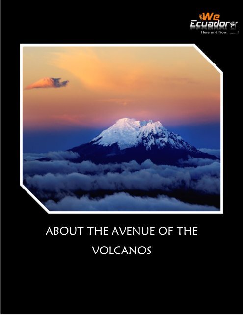
ABOUT THE AVENUE OF THE<br />
VOLCANOS
Ecuador is located in South America<br />
on the equator (which owes its<br />
name), so that its territory is in<br />
both hemispheres (north and<br />
south). It bordered on the north by<br />
Colombia, and east and south with<br />
Peru. To the west, the Pacific<br />
Ocean washes its 640 kilometers of<br />
coastline. The coastline accident<br />
outstanding exhibits as the Gulf of<br />
Guayaquil, where the island of<br />
Puna is located. Almost 1000 km<br />
away are the main Ecuadorian<br />
islands of the archipelago of<br />
Columbus or Galapagos,<br />
comprising 13 major islands and<br />
dozens of islets.<br />
The Andes crosses the country from<br />
which the product is its mega<br />
diversity. Its equatorial situation<br />
benefits because it has a permanent<br />
sunlight that makes it warm all<br />
year. Its main cities are the capital<br />
Quito, Guayaquil, Cuenca,<br />
Riobamba and Manta. Traversing<br />
the Ecuadorian Andes is difficult<br />
and can be exciting when the<br />
traveler zigzag down the old<br />
railway line that runs from.<br />
Ecuador is the country of the<br />
Quechua and Tagaeri peoples,<br />
volcanoes and giant tortoises of the<br />
Galapagos Islands; and famous for<br />
its handicrafts: shigras (handbags),<br />
hammocks, straw hats, blankets<br />
(shawls) and brightly colored<br />
ponchos made of cotton. Almost<br />
3000 meters Quito is located in an<br />
Andean valley. It is one of the<br />
oldest cities on the continent, in<br />
addition to political and financial<br />
center of Ecuador. The most<br />
populous city is Guayaquil, the<br />
main seaport and the economic<br />
capital of the country. Both cities<br />
over one million and a half<br />
inhabitants. The country is divided<br />
politically into 24 provinces which<br />
are divided into four natural<br />
regions: 6 on the coast, 11 in the<br />
mountains, 6 in the Amazon region<br />
and the Galapagos Islands.<br />
Quito to the south: a good stretch<br />
is excavated in rock, known as<br />
'Devil's Nose' ...
DISCOVER THE ANDES<br />
TRAVELING<br />
SOUTH OF ECUADOR<br />
DAILY TOURS<br />
COTOBIKES<br />
Warm clothes, gloves, scarves, hats,<br />
glasses, Extra water, walking shoes,<br />
camera, Extra Snacks, Long socks,<br />
Sunscreen, cotton pants,<br />
waterproof jacket<br />
The tour to Cotopaxi National Park<br />
is an exciting day you can enjoy the<br />
amazing Andean landscapes,<br />
observe some of the mountains and<br />
volcanoes that make up our avenue<br />
of volcanoes.<br />
To reach the National Park will<br />
walk around the lagoon<br />
Limpiopungo enjoying a<br />
magnificent view of the colossus.<br />
We continue with a bike path 16<br />
Km optional national park or it can<br />
be done by car. This tour reaches<br />
3200 m high, is very important<br />
that you are prepared to such<br />
height. We recommend<br />
acclimatizing at least two days<br />
around 3000m. Cotopaxi has its<br />
own climate and for this reason is<br />
unpredictable therefore necessary<br />
warm clothes.<br />
Package includes: bilingual guide,<br />
transportation from Quito, bike,<br />
helmet.<br />
Equipment Needed:
QUILOTOA LAGOON<br />
This wonderful cultural tour of a<br />
day, begins with a visit to the<br />
Indian market Saquisilí (Thursday)<br />
or Pujilí (Sunday).<br />
On the way to the Laguna<br />
Quilotoa we can see beautiful<br />
landscapes of the Andes, crossing<br />
the old Toachi Canyon in the<br />
Valley Zumbahua.<br />
Finally we reached the viewpoint<br />
of the Laguna which is 3800 meters<br />
where we will begin the descent,<br />
after about 45 minutes of walking<br />
we reach the level of the lagoon.<br />
After making fabulous photographs<br />
and explore the surroundings of the<br />
lagoon again we climb to the<br />
viewpoint where we have lunch<br />
and then start our way back to<br />
Quito.<br />
Package Includes: Guide,<br />
transportation and food.<br />
Equipment needed:<br />
Glasses, Agua.extra, waterproof<br />
Chompa, comfortable shoes,<br />
camera, sunscreen<br />
Shopping bag
PASOCHOA<br />
The Pasochoa volcano is an extinct<br />
volcano 4199 meters high, this<br />
being par excellence one of the best<br />
places to see and appreciate the<br />
Andean Condor.<br />
The hike offers beautiful views of<br />
paramo ecosystem and the majestic<br />
mountains of this part of the<br />
Andes, while inside the crater you<br />
can see one of the last remnants of<br />
Andean forests.<br />
This hike is most recommended for<br />
people who are starting a process<br />
of acclimatization, which takes<br />
between 3-5 and a maximum<br />
height of 4199 m is reached.<br />
It is very important that they are<br />
prepared for this type of height so<br />
it is recommended to have<br />
remained at least a day at an<br />
average altitude of 3,000 meters<br />
Necessary equipment not included:<br />
warm, gloves and hat, scarf,<br />
sunglasses, raincoat, sunscreen,<br />
camera, small backpack, additional<br />
snacks, energy drinks, hiking shoes,<br />
extra water, cotton pants clothes
CORAZON<br />
Corazon is an extinct volcano that<br />
is part of the Ecological Reserve of<br />
Illinizas, located south of Quito.<br />
This hike offers views and<br />
landscapes of much of the Avenue<br />
of the Volcanoes. In the eastern<br />
part of the lift are various crops<br />
and fertile land as well as part of<br />
the cloud forest. The first time the<br />
volcano was explored Heart was in<br />
the nineteenth century by Edward<br />
Whymper, at which time the<br />
mountain was still covered by a<br />
glacier. Today, the glacier has<br />
disappeared. The name comes from<br />
the formation Heart produced by<br />
two cracks that can be seen from<br />
the southern part of the city of<br />
Quito. Escalating the Heart takes<br />
about 5 to 7 hours, reaching a<br />
height of 4788 meters, a very good<br />
recommendation is to have been<br />
an average of 3000 meters at least<br />
two days before.<br />
Not included in the package:<br />
transportation to and from Quito,<br />
breakfast, tips to guides<br />
Equipment not included<br />
warm clothing, gloves, scarf,<br />
sunglasses, waterproof jacket,<br />
sunscreen, camera - backpack,<br />
snacks, hiking boots extra water,<br />
polar pants, towel, wool cap.<br />
Included in the package:<br />
professional bilingual guide,<br />
transportation - Heart, box lunch<br />
(two sandwiches, a bottle of water,<br />
paquete de galletas dulces y una<br />
fruta)
ILLINIZAS NORTH<br />
Illinizas are part of an ancient<br />
volcano, which was divided into<br />
two peaks more than 5000 years<br />
ago. This tour includes the ascent<br />
to the summit of North Illiniza,<br />
which is located at an altitude of<br />
5126 m. The trekking to the North<br />
Iliniza is moderate, exciting and<br />
easy to complete level. This tour<br />
offers excellent views of the<br />
volcano Cotopaxi and the<br />
surrounding volcanoes. Climbing is<br />
perfect for acclimatization,<br />
especially for those wishing to<br />
climb after the Cotopaxi. The<br />
ascent lasts about 6 hours and the<br />
descent 2.<br />
Not included: breakfast, gratuities<br />
for guides, transportation from / to<br />
Quito<br />
Necessary equipment not included:<br />
warm clothing, extra water, gloves,<br />
cotton pants, glasses, scarf,<br />
Waterproof sweater, towel,<br />
camera, sunscreen, a small<br />
backpack, wool hat, hiking boots,<br />
Energizing drink and snacks<br />
It is important that you are<br />
prepared for this kind of altitude, it<br />
is recommended to acclimate for at<br />
least two days before at a height of<br />
3000 m. The weather is very<br />
unpredictable so it is advisable to<br />
be prepared with the necessary<br />
Included in the price: guide<br />
bilingual professional, box lunch<br />
(two sandwiches, a bottle of water,<br />
a pack of cookies and fruit), helmet<br />
and harness, transportation to<br />
North Illiniza
RUMIÑAHUI<br />
The Rumiñahui volcano is located<br />
in the Cotopaxi National Park,<br />
south of Quito. This volcano is<br />
formed by three rock formations<br />
that are Rumiñahui Norte (4712<br />
m), the Central Rumiñahui (4631<br />
m) and Rumiñahui Sur (4696 m),<br />
however unlike Illinizas, the<br />
Rumiñahui it is not considered as<br />
separate mountains.<br />
wool hat, camera, small backpack,<br />
snacks, treking boots, extra water,<br />
sunscreen.<br />
This tour is an excellent<br />
acclimatization and from its summit<br />
offers points of epic view of the<br />
heart, Illinizas, Sincholagua, and the<br />
majestic Cotopaxi.<br />
Climb to Rumiñahui takes<br />
approximately 3 to 4 hours,<br />
reaching a height of 4712 meters.<br />
One recommendation is to have<br />
been an average of 3000 meters at<br />
least two days before.<br />
Included in the package:<br />
professional bilingual guide, box<br />
lunch (two sandwiches, a bottle of<br />
water, a pack of sweet biscuits and<br />
fruit)<br />
Not included in the package:<br />
transportation to / Quito Breakfast.<br />
Necessary equipment not included:<br />
Warm clothes, gloves, scarf,<br />
sunglasses, waterproof jacket -
CLIMBING 2 DAYS<br />
COTOPAXI<br />
With a height of 5897 m Cotopaxi<br />
is the most impressive of<br />
continental Ecuador volcano, being<br />
one of the highest active volcanoes<br />
in the world, making sure that the<br />
rise this will be a completely<br />
memorable experience. The climb<br />
to the top is given overnight<br />
allowing you to see the sunrise<br />
from the summit, resulting in a<br />
perfect opportunity where you can<br />
enjoy the spectacular scenic<br />
landscapes of Quito, northern and<br />
southern Chimborazo Tungurahua.<br />
From the top you can see the snow<br />
covered crater in full swing. The<br />
last eruptions were in 1877 and<br />
1904.<br />
people), transportation from and<br />
return Hotel inCotopaxi, 1st day<br />
lunch, dinner and breakfast at the<br />
shelter, a night at the Refugio del<br />
Parque, special equipment<br />
mountain<br />
Not included: Transportation from<br />
/ to Quito, tips for guides,<br />
optional: celebration lunch ($ 10).<br />
We also offer our Climbing and<br />
Glacier Course in Ecuador for<br />
people who have no experience in<br />
glacier.<br />
Acclimatization recommend<br />
Packages before attempting to<br />
climb the highest volcanoes of<br />
Ecuador.<br />
The ascent starts from the refuge at<br />
4800 m, climbing through a<br />
mixture of volcanic sand, snow and<br />
glaciers to reach the summit.<br />
Despite not be classified as<br />
technical, the ascent requires<br />
professional guides and equipment<br />
glaciers acclimatization program<br />
will offer a greater chance for a<br />
successful ascent to Cotopaxi.<br />
Included in the package:<br />
professional guide (1 guide every 2
CLIMBING 2 DAYS<br />
CHIMBORAZO<br />
With a height of 6310 m<br />
Chimborazo is the highest<br />
mountain in Ecuador. It is located<br />
in the western Andes central<br />
Ecuador, 150km (93 miles)<br />
southwest of the capital Quito.<br />
The majestic summit of<br />
Chimborazo rises to 2500 m above<br />
the surrounding highlands (3500-<br />
4000 m), which is the closest point<br />
to outer space, because the Earth's<br />
diameter is greater in the equatorial<br />
latitude. In addition, measured<br />
from the center of the earth,<br />
Chimborazo is the highest<br />
mountain in the world, beating by<br />
2 kilometers to Mount Everest.El<br />
itinerary is similar to that of<br />
Cotopaxi, Chimborazo but involves<br />
a longer rise of approximately 11<br />
hours ( 7-9 hours to the summit<br />
and 2-3 hours back to camp). It<br />
includes an education session for<br />
the glacier, dinner and a night at<br />
the shelter at 4800 m. The rise is a<br />
real challenge and offers climbers a<br />
chance to break the barrier of 6000<br />
m.<br />
what is well prepared.<br />
acclimatization is recommended at<br />
least six nights above 3000 m and<br />
climb twice around 5000 m in the<br />
same week.<br />
Included in the package:<br />
professional guide (1 guide every 2<br />
people), transportation from and<br />
return Papagayo Chimborazo, 1st<br />
day lunch, dinner and breakfast at<br />
the shelter, a night at the Refugio<br />
del Parque, special equipment<br />
mountain<br />
Not included: Transportation<br />
Quito - Hotel, tips for guides,<br />
optional: celebration lunch ($ 10)<br />
We also offer our Climbing and<br />
Glacier Course in Ecuador for<br />
people who have no experience in<br />
glacier.<br />
Acclimatization recommend<br />
Packages before attempting to<br />
climb the highest volcanoes of<br />
Ecuador.<br />
Climb to this height can be very<br />
difficult, so please be sure usted of
CLIMBING 2 DAYS<br />
ALTAR<br />
Altar is a breathtakingly beautiful<br />
volcano 5319 meters above sea<br />
level making it the fifth highest<br />
volcano of Ecuador. It is located<br />
within the Sangay National Park in<br />
the province of Chimborazo. The<br />
volcano is named because of its<br />
distinct peaks, resembling the altar<br />
of a colonial church. The ascent<br />
takes 6-8 hours, while the decline<br />
will be around 3. As mentioned at<br />
the end of the itinerary, necessary<br />
equipment professional ice as well<br />
as the presence of a certified guide.<br />
Climb to this height can be very<br />
difficult, so please make sure you<br />
are well prepared. acclimatization<br />
is recommended at least six nights<br />
above 3000 m and climb twice<br />
around 5000 m in the same week.<br />
This can be achieved through an<br />
acclimatization program with<br />
Gulliver Expeditions, where you<br />
can choose itineraries 5 to 14 days.<br />
Culminating an acclimatization<br />
program will be offered a<br />
probabilidad mayor para conseguir<br />
un ascenso exitoso al Altar.<br />
people), transportation from and<br />
return to the Altar to your Hotel ,<br />
meals mentioned, a night at the<br />
Refugio del Parque, special<br />
equipment mountain<br />
Not included: Transportation from<br />
/ to Quito, tips for guides,<br />
optional: celebration lunch ($ 10)<br />
We also offer our Climbing and<br />
Glacier Course in Ecuador for<br />
people who have no experience in<br />
glacier.<br />
Acclimatization recommend<br />
Packages before attempting to<br />
climb the highest volcanoes of<br />
Ecuador.<br />
Included in the package:<br />
professional guide (1 guide every 2
CLIMBING 2 DAYS<br />
SUR ILINIZAS<br />
Illinizas are part of an ancient<br />
volcano, which was divided into<br />
two peaks more than 5000 years<br />
ago. This tour includes the ascent<br />
to the summit of South Illiniza,<br />
representing a higher level of<br />
difficulty Illiniza comparison of<br />
North due to the presence of<br />
glacier. From the top you can<br />
enjoy a spectacular landscape of<br />
the volcano Cotopaxi and the<br />
surrounding volcanoes. This<br />
promotion is perfect for<br />
acclimatization and for applicants<br />
who want to reach the summit of<br />
Cotopaxi. The ascent lasts about 5<br />
to 6 hours and can reach an<br />
altitude of 5245 m. For the descent<br />
takes 2 to 3 hours.<br />
It is very important that you<br />
are prepared to climb to this<br />
altitude, we recommend<br />
acclimatize for at least 2 nights at a<br />
height of 3000 meters.<br />
The climate in this area is very<br />
unpredictable and you better be<br />
prepared with warm clothing and<br />
necessary.<br />
Included in the package:<br />
professional guide (1 guide every 2<br />
people), transfer from Hostería<br />
Papagayo and return to Iliniza, 1st<br />
day lunch, dinner and breakfast at<br />
the shelter, one night in the refuge,<br />
special equipment mountain<br />
Not included: Transportation<br />
from / to Quito, tips for guides,<br />
sleeping bag<br />
We also offer our Climbing<br />
and Glacier Course in Ecuador for<br />
people who have no experience in<br />
glacier<br />
Acclimatization recommend<br />
Packages before attempting to<br />
climb the highest volcanoes of<br />
Ecuador.
DISCOVER THE ANDES<br />
TRAVELING<br />
NORTH OF ECUADOR<br />
Precio excluye: desayuno, propinas<br />
para el guía, transporte desde/hacia<br />
Quito<br />
FUYA FUYA<br />
Fuya Fuya goes up to and have a<br />
magnificent view of two of the<br />
three sparkling Mojanda lakes<br />
(Caricocha, Huarmicocha and<br />
Yanacocha) at an altitude of 4275<br />
m. If it is a clear day, you can also<br />
see the snow-capped peaks of<br />
Cotopaxi, Cayambe and Antisana,<br />
the craters of Cotacachi and<br />
Imbabura, and you will be able to<br />
detect Quito and Otavalo. Fuya<br />
Fuya rise is a perfect preparation<br />
for climbing Andean peaks like<br />
Cotopaxi. The climb takes approx.<br />
3 hours and the descent about 1.<br />
The climate in the area is very<br />
unpredictable and should be<br />
prepared with warm clothing. The<br />
rise is approx. 3-4 hours to reach a<br />
height of 4,275m. It is important<br />
that you are prepared for this kind<br />
of altitude, acclimatization of at<br />
least two days around 3000 meters<br />
is recommended.Precio incluye:<br />
professional bilingual guide, lunch,<br />
transportation to and from your<br />
hotel.
Mojanda<br />
Mojanda is an inactive volcano in<br />
the Eastern Andes in northern<br />
Ecuador.<br />
A caldera at the summit, which was<br />
produced by an eruption marked<br />
the end of Mojanda activity<br />
200,000 years ago.<br />
It is occupied by three lakes in the<br />
crater: Karikucha (the largest),<br />
Yanakucha, and Warmikucha.<br />
They received protected status in<br />
2002, are a popular tourist<br />
destination and is 20 minutes by<br />
taxi from the indigenous town of<br />
Otavalo.<br />
Mojanda is the perfect beginning of<br />
a nice acclimatization program with<br />
a beautiful view of the lagoon of<br />
Mojanda and volcanoes around.<br />
Price includes: Professional bilingual<br />
guide, lunch, transportation<br />
Price excludes: Breakfast, gratuities<br />
for guides, transportation to / from<br />
Quito
IMBABURA<br />
The extinct volcano Imbabura is 8<br />
km south of Otavalo is a province<br />
of the same name and lies on the<br />
stunning lagoon of San Pablo that<br />
leads to the waterfalls of Peguche.<br />
Imbabura has two craters, the<br />
"Huarmi" in the West and the "Taita<br />
Imbabura", which is its highest<br />
peak.<br />
"Taita Imbabura" is the Kichwa for<br />
"Father" and has a sacred status in<br />
Indian mythology.<br />
The climb is done through tall<br />
grasses on rocky outcrops, followed<br />
by lush vegetation on the mountain<br />
high<br />
Price Includes: Professional bilingual<br />
guide, lunch, transportation to and<br />
from the Inn North Papagayo<br />
Prices Exclude: Breakfast, gratuity<br />
for guides, transportation from and<br />
to Quito.
CLIMBING 2 DAYS<br />
ANTISANA<br />
Antisana is a volcano which is 5704<br />
meters above sea level and is the<br />
fourth highest volcano in Ecuador.<br />
It is located in the Antisana<br />
Ecological Reserve along the<br />
western margin of the Cordillera<br />
Real, 50 kilometers to the southeast<br />
of Quito. The mountain has four<br />
peaks and massive ice formations.<br />
The climb is considered very<br />
technical and requires knowledge<br />
and experience in mountaineering.<br />
The ascent takes 6 to 8<br />
hours, while the drop will be about<br />
3 hours. Professional ice equipment<br />
necessary, besides the presence of a<br />
professional guide. At this altitude<br />
mountain climbing it can be very<br />
difficult, so we asked for adequate<br />
preparation. We recommend for<br />
acclimatization have spent at least<br />
6 nights above 3000 m and having<br />
risen twice around 5000 m in the<br />
same week.<br />
Included in the package:<br />
professional guide (1 guide every<br />
2personas), transport from<br />
Papagayo to Antisana and return, a<br />
night at the camp, lunch on the first<br />
day, dinner and breakfast at the<br />
refuge, special equipment mountain<br />
We also offer our Climbing and<br />
Glacier Course in Ecuador for<br />
people who have no experience in<br />
glacier.<br />
Acclimatization recommend<br />
Packages before attempting to<br />
climb the highest volcanoes of<br />
Ecuador.<br />
Not included: transportation to /<br />
from Quito, tips for guides.<br />
Celebration lunch ($ 10)
CLIMBING 2 DAYS<br />
CAYAMBE<br />
The Cayambe is the third highest<br />
volcano in Ecuador with a height of<br />
5790 m above sea level. It is<br />
located in the Cayambe - Coca<br />
Ecological Reserve in the Andes<br />
Mountains, northeast of Quito.<br />
On the south side, at an altitude of<br />
4960 m it is the highest point in the<br />
world and the only covered by<br />
snow where it crosses the equator.<br />
The ascent takes between 5 and 7<br />
hours, while the decrease will be<br />
about 2 hours. The total ascent is in<br />
2 days, necessary equipment<br />
professional ice as well as the<br />
presence of a certified guide.<br />
Incluido en el paquete: guía<br />
profesional (1 guía cada 2 people),<br />
transportation from Quito to<br />
Cayambe and return 1st day lunch,<br />
dinner and breakfast at the shelter,<br />
accommodation at the shelter,<br />
special equipment mountain<br />
Not included: Transportation from<br />
/ to Quito, tips for guides.<br />
We also offer our Climbing and<br />
Glacier Course in Ecuador for<br />
people who have no experience in<br />
glacier<br />
Acclimatization recommend<br />
Packages before attempting to<br />
climb the highest volcanoes of<br />
Ecuador.<br />
Climb to this height can be very<br />
difficult, so please make sure you<br />
are well prepared. acclimatization<br />
is recommended at least 6 nights<br />
above 3000 m and climb 2 times<br />
around 5000 m in the same week.<br />
This can be achieved through an<br />
acclimatization program with We<br />
Ecuador, where you can choose<br />
itineraries 5 to 14 days. The<br />
completion of a program<br />
aclimatación le ofrecerá una<br />
probabilidad mayor para conseguir<br />
un ascenso exitoso al Cayambe.