

Beryllium Exploration Project
Tule_Valley_Lithium_Project_(1)-ID-036410ce-ac07-4e97-ccff-5d552c98d223
Tule_Valley_Lithium_Project_(1)-ID-036410ce-ac07-4e97-ccff-5d552c98d223

You also want an ePaper? Increase the reach of your titles
YUMPU automatically turns print PDFs into web optimized ePapers that Google loves.
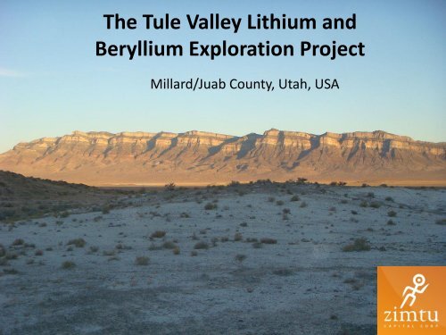
The Tule Valley Lithium and<br />
<strong>Beryllium</strong> <strong>Exploration</strong> <strong>Project</strong><br />
Millard/Juab County, Utah, USA
Location/access<br />
• The Tule Valley <strong>Project</strong> is located approximately 190km south west<br />
of Salt Lake City, Utah<br />
• Crosses over the Juab and Millard county's<br />
• Access is by a all weather, hard surface highway from Delta, Utah<br />
and from Wendover, Nevada or by a paved road to the south<br />
• Further access is by gravel roads in fair condition<br />
• The terrain is readily amenable to the construction of the necessary<br />
infrastructure related to mining operations. This includes, but is not<br />
limited to, potential tailings storage sites, potential waste disposal<br />
areas, heap leach pad areas and potential processing plant sites It<br />
would be necessary to access electrical power from Gold Hill or<br />
Callao (Lee, 2003).
Infrastructure<br />
• Surrounding area is sparsely populated, with ranching<br />
and livestock being the primary economic activities<br />
• Located 20 km south of Redhill Resources Honey Comb<br />
<strong>Beryllium</strong>-Rubidium, Lithium and REE project<br />
• Approximately 60km to the northwest of the Crystal<br />
Peak potash, lithium and magnesium project<br />
• 30 Km to the south west of Matererions, Spor<br />
Mountain <strong>Beryllium</strong> Mine
Climate<br />
• The basins in this area are defined as arid,<br />
generally receiving less than 8” of<br />
precipitation per year.<br />
• Evaporation exceeds precipitation. Hot dry<br />
summers and cold dry winters
Artesian style aquifer to the west of the property
Closed Basin<br />
• Tule valley is a endorheic basin, which means<br />
that it retains water but does not allow any<br />
external outflow<br />
• This means that any element that mobilizes<br />
into the basin, can enter but never leave<br />
• The poses the hypothesis that over millions of<br />
years the aquifer may have upgraded into a<br />
extremely mineralized brine
Tule Valley<br />
Red arrows outline possible fluid mobilization<br />
from hard rock Lithium sources
Structure<br />
• Similar to that of Clayton Valley, Tule valley is a<br />
closed basin and has what is called a horst and<br />
graben structure<br />
• The valley is down faulted by normal faults on<br />
both sides of the valley<br />
• This is a key characteristic for confining brines<br />
so mineralization cannot escape
Blue represents the volcanic rocks that could be the<br />
possible source of lithium build up in the valley
Geology/Source<br />
• The area to the north contains volcanic rocks such as rhyolite flows<br />
and tuffs ranging is age from 3.4-4.7 Ma and are known to contain<br />
significant values of lithium, beryllium, rubidium and REE’s<br />
• Chemical and mineralogical studies of samples from shallow<br />
excavations and drill holes revealed abnormal quantities of cesium,<br />
rubidium and lithium in the beryllium-bearing tuffs. (Stonehouse,<br />
1985)<br />
• Results from the soil grid suggest that lithium (Li), beryllium (Be),<br />
rubidium (Rb) and TREO (total rare earth oxides, including<br />
lanthanum to lutetium plus yttrium) mineralization may be present<br />
under shallow cover to the east flank of the Big Honey Comb Hill
Honeycomb Hills are two domelike bodies of rhyolite with a total volume<br />
of 0.5 km3, contained within an area approximately 1.5 km in diameter.<br />
Basaltic lava flows surround the area (Hogg, 1972), and tuffs adjacent to<br />
the rhyolite contain high concentrations of Cs, Rb, Li, Be, and F<br />
(McAnulty and Levinson, 1964).
Stratigraphy to the north of Tule Valley. Tuffs and<br />
Rhyolites are host to the Lithium.
Assay Results<br />
• In 2009, the underlying vendors have completed detailed geological mapping,<br />
prospecting and collected 146 total samples (including blanks) with significant<br />
values of beryllium returned, along with anomalous values of lithium and uranium<br />
• Initial surface sampling (146 samples) have reported assays of up to 1,043 ppm<br />
total rare earth oxides (TREO), 1,690 ppm lithium (Li), average of 1,010 ppm<br />
beryllium (Be) and 1,270 ppm rubidium (Rb).<br />
• Detailed mapping has shown an anomalous area of roughly 500 by 1,000 m with<br />
another neighboring anomalous area of 500 by 500 m. In addition, both anomalies<br />
are flanked by quaternary alluvium and could extend substantially under shallow<br />
cover<br />
• In addition, sampling and mapping of a decline excavated in rhyolite breccias show<br />
highly anomalous Li, Rb and weakly anomalous TREO assays from 460-1050 ppm,<br />
471-1035 ppm, and 392-461 ppm respectively
Lithium Concentration of the Honey Comb Prospect
From Honey Comb hard rock project to the north
From Honey Comb Hard rock deposit to<br />
the north
Erosional History<br />
• During the 130,000 to 10,000 year period of<br />
pronounced glaciations and inter-glacial flooding,<br />
erosion of the Deep Creek granitic highlands,<br />
west and adjacent to the paleo-shorelines,<br />
provided detrital feed for the paleo-beaches of<br />
Bonneville Lake basin. Granite grit, containing<br />
magnetite and associated heavy minerals,<br />
including rare earth-bearing minerals, became<br />
feed for the beaches. This erosional debris was<br />
distributed, worked and re-worked as the<br />
shorelines advanced and receded.
Volcanics surrounding Tule Valley
<strong>Exploration</strong> Plan<br />
• Stage 1- Soil/surface sampling, shallow<br />
groundwater fluid analysis<br />
• Stage 2- High resolution gravity survey of the Tule<br />
Basin<br />
• Stage 3- Data Compilation to allocate drill targets<br />
• Estimated duration: 8 – 12 months
Staking plan<br />
14,000 acres in total<br />
BLM fees are $155.00 per 20 acres<br />
BLM Fee= $108,000 USD due by September 1st
Conclusion<br />
• A combined analysis of geophysical,<br />
geochemical and geological data suggests the<br />
possibility of anomalous Li/Be/Rb/k values<br />
could be located in the brines of the Tule<br />
Valley Playa<br />
• The Tule Valley playa merits further<br />
exploration, including geophysics and drilling<br />
to evaluate potential for a mass brine deposit