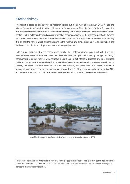
8 Methodology This report is based on qualitative field research carried out in late April and early May 2016 in Juba and Maban (South Sudan), and SPLM-N held southern Kurmuk County, Blue Nile State (Sudan). The intention was to explore the views of civilians displaced from or living within Blue Nile State on the causes of the current conflict, and to better understand ways in which they are responding to it. The research specifically focused on civilians' views on the causes of the conflict and the core issues that need to be resolved in order to bring it to an end; the ways in which civilians respond to the violence and tensions in Blue Nile and in Maban; and the impact of violence and displacement on community dynamics. Field research was carried out in collaboration with NHRMO. Interviews were carried out with 36 civilians from different areas in Blue Nile State, and from different, though predominantly “indigenous” Funj, 3 communities. Most interviewees were refugees in South Sudan, but internally displaced and non-displaced civilians in Sudan were also interviewed. Most interviews were conducted in Arabic, a few were conducted in English, and some were also conducted in Uduk and Jumjum, with translation into English. In addition, interviews were also carried out with individuals affiliated with NGOs working in South Sudan or Blue Nile, and with some SPLM-N officials. Desk research was carried out in order to contextualise the findings. Yusuf Batil refugee camp, South Sudan (© 2016 anonymous photographer/IRRI). 3 While recognising that the word “indigenous” risks reinforcing essentialised categories that have dominated the war in Sudan, it is used in this report to refer to those who are perceived – and who see themselves – to be the first peoples to have settled in what is now Blue Nile. SEPTEMBER 2016
9 Background Blue Nile State is located in south-east Sudan, with South Sudan to the south-west, Ethiopia to the southeast and Sudan’s Sennar State to the north. The state is divided into the six counties of Damazin, Tadamon, Bau, Roseires, Geissan and Kurmuk, and is mostly a flat plain, with hills and escarpment along the Ethiopian frontier and in the centre of the state (the Ingessana Hills). The Blue Nile River crosses the state, flowing from Ethiopia’s Lake Tana, via Damazin, to the north. The total area of the state is slightly over 40,000 km², and its capital Damazin lies 550km south of Khartoum. 4 In the disputed census of 2008 Blue Nile State was estimated to have a population of 832,112, but some have argued that the number is higher. 5 In recent decades, a considerable population of immigrants has settled in Blue Nile State, and distinctions have been made between those who are seen to be “indigenous” to the territory and those who are seen as “non-indigenous” or “newcomers”. The “indigenous” groups of Blue Nile include, among others, the Ingessana (Gamk) people, from the centre of the state and the Ingessana Hills, the Berta and the Gumuz peoples, from the state’s north and close to the border with Ethiopia (with many living in Ethiopia as well), and the Uduk, the Jumjum and the Koma peoples, living in the southern part of Blue Nile, closer to South Sudan. 6 Each group has its own distinct language. The “indigenous” people in Blue Nile were, and many still are, agro-pastoralists, meaning that their livelihoods are based on animal herding and cultivation, the latter including sorghum, sesame, cotton and okra. 7 The “non-indigenous” populations of Blue Nile include members of Sudanese Arab (or “Arabised”) and non- Arab communities, as well as West Africans that migrated to the area. Members of northern Sudanese Arab communities often came to Blue Nile as traders, business owners or administrators. 8 Arab (in particular, Rufa’a Al-Hoi), 9 as well as West African (mostly Fulani, or “Fellata”, in Arabic) nomadic groups have increasingly settled in Blue Nile State during the second half of the 20 th century. 10 To a large extent their 4 UNDP, “Blue Nile State: Situation Analysis,” March 2010, 8 (UNDP, 2010). 5 Population size estimation according to the 2008 census, see Republic of Sudan: Central Bureau of Statistics, “Census 2008 results - Blue Nile State,” 10 October 2013. The census was highly controversial. According to the CPA, 60% of the seats in the national assembly were to be allocated according to the population of the states as estimated in the census. The SPLM rejected the results, and according to some analysts, the census undercounted southern Sudanese living in northern states. See Joshua Craze, “Counting a Divided Nation,” Anthropology News 51(5) (2010), 14-15. 6 International <strong>Crisis</strong> Group, “Sudan’s Spreading Conflict (II): War in Blue Nile,” 2013, 4, available at: https://www.crisisgroup.org/africa/horn-africa/sudan/sudan-s-spreading-conflict-ii-war-blue-nile, (ICG, 2013), Claudio Gramizzi, At an Impasse: The Conflict in Blue Nile, Small Arms Survey, 2013, 11-12, available at: http://www.smallarmssurveysudan.org/fileadmin/docs/working-papers/HSBA-WP31-Blue-Nile.pdf, (Gramizzi, 2013), (both accessed 23 August 2016). On the Gumuz and Berta in Ethiopia see also John Young, “Along Ethiopia's western frontier: Gambella and Benishangul in transition,” The Journal of Modern African Studies, 37(2), 1999, 321-346. 7 Mey Eltayeb Ahmed, “Blue Nile: National and indigenous conflict management – competing or complementary systems?,” New Routes 2 (2012), 22-23. 8 ICG, 2013, 4. 9 Abdel Ghaffar M. Ahmed, “Transforming Pastoralism: The Case Study of the Rufa’a Al-Hoi Ethnic Group in the Blue Nile,” Nomadic Peoples, 13(1), (2009), 113-133 (Ahmed, 2009). 10 C. Miller & A.A. Abu-Manga, “The West African (Fallata) Communities in Gedaref State: Process of settlement and local integration,” in Catherine Miller (ed.), Land, ethnicity and political legitimacy in Eastern Sudan (University of Khartoum, Le Caire, Centre d'etudes et de documentation economique, juridique et social (CEDEJ) & Development Studies and SEPTEMBER 2016