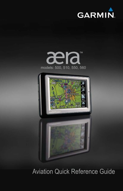
Garmin aera 560 - Aviation Quick Reference Guide
Garmin aera 560 - Aviation Quick Reference Guide
Garmin aera 560 - Aviation Quick Reference Guide

You also want an ePaper? Increase the reach of your titles
YUMPU automatically turns print PDFs into web optimized ePapers that Google loves.
models: 500, 510, 550, <strong>560</strong><br />
<strong>Aviation</strong> <strong>Quick</strong> <strong>Reference</strong> <strong>Guide</strong>
OVERVIEW<br />
GPS NAVIGATION<br />
FLIGHT PLANNING<br />
HAZARD AVOIDANCE<br />
UTILITIES<br />
APPENDIX<br />
INDEX
Copyright © 2009, 2012 <strong>Garmin</strong> Ltd. or its subsidiaries. All rights reserved.<br />
This manual reflects the operation of System Software version 4.00 or later. Some differences<br />
in operation may be observed when comparing the information in this manual to earlier or later<br />
software versions.<br />
<strong>Garmin</strong> International, Inc., 1200 East 151st Street, Olathe, Kansas 66062, U.S.A.<br />
Tel: 913/397.8200 Fax: 913/397.8282<br />
<strong>Garmin</strong> AT, Inc., 2345 Turner Road SE, Salem, OR 97302, U.S.A.<br />
Tel: 503/391.3411 Fax 503/364.2138<br />
<strong>Garmin</strong> (Europe) Ltd, Liberty House, Bulls Copse Road, Hounsdown Business Park,<br />
Southampton, SO40 9RB, U.K.<br />
Tel: 44/0870.8501241 Fax: 44/0870.8501251<br />
<strong>Garmin</strong> Corporation, No. 68, Jangshu 2nd Road, Shijr, Taipei County, Taiwan<br />
Tel: 886/02.2642.9199 Fax: 886/02.2642.9099<br />
Web Site Address: www.garmin.com<br />
Except as expressly provided herein, no part of this manual may be reproduced, copied, transmitted,<br />
disseminated, downloaded or stored in any storage medium, for any purpose without the express<br />
written permission of <strong>Garmin</strong>. <strong>Garmin</strong> hereby grants permission to download a single copy of this<br />
manual and of any revision to this manual onto a hard drive or other electronic storage medium to<br />
be viewed for personal use, provided that such electronic or printed copy of this manual or revision<br />
must contain the complete text of this copyright notice and provided further that any unauthorized<br />
commercial distribution of this manual or any revision hereto is strictly prohibited.<br />
<strong>Garmin</strong> ® and SafeTaxi ® are registered trademarks of <strong>Garmin</strong> Ltd. or its subsidiaries. <strong>aera</strong> is<br />
a trademark of <strong>Garmin</strong> Ltd. or its subsidiaries. These trademarks may not be used without the<br />
express permission of <strong>Garmin</strong>.<br />
Jeppesen ® is a registered trademark of Jeppesen, Inc.<br />
XM ® is a registered trademark of XM Satellite Radio, Inc.<br />
AC-U-KWIK ® is a registered trademark of Penton Business Media, Inc.<br />
August, 2012 190-01117-03 Rev. B Printed in the United States or Taiwan
Part Number<br />
190-01194-00 Initial release<br />
Change Summary<br />
Rev Date Description<br />
A October, 2009 Production Release<br />
B August, 2012 Added GDL 39 Support
Table of Contents<br />
SECTION 1 OVERVIEW...................................................................................... 1<br />
1.1 UNIT OVERVIEW..........................................................................................................1<br />
1.2 GETTING STARTED......................................................................................................2<br />
Battery Installation................................................................................................................ 2<br />
Charging the Battery............................................................................................................. 3<br />
Changing Modes................................................................................................................... 3<br />
GPS Receiver Status.............................................................................................................. 3<br />
1.3 OPERATION.................................................................................................................4<br />
Basic Navigation Controls...................................................................................................... 4<br />
‘Home’ Screen....................................................................................................................... 5<br />
Selecting a Function.............................................................................................................. 9<br />
Scrolling................................................................................................................................ 9<br />
1.4 ACCESSING SYSTEM FUNCTIONALITY.....................................................................10<br />
Option Menus..................................................................................................................... 10<br />
Data Entry........................................................................................................................... 10<br />
1.5 USING MAP DISPLAYS..............................................................................................11<br />
Map Panning...................................................................................................................... 11<br />
Map Range......................................................................................................................... 12<br />
Map Overlays...................................................................................................................... 13<br />
SECTION 2 GPS NAVIGATION........................................................................ 15<br />
2.1 FLIGHT DATA.............................................................................................................15<br />
Data Fields.......................................................................................................................... 15<br />
Numeric Flight Data............................................................................................................ 15<br />
2.2 HSI/PANEL.................................................................................................................16<br />
Changing the CDI Scale....................................................................................................... 16<br />
Setting the Bug Indicator..................................................................................................... 16<br />
Manually Setting a Course................................................................................................... 16<br />
2.3 VERTICAL NAVIGATION (VNAV)................................................................................17<br />
Using the VNAV Feature...................................................................................................... 17<br />
2.4 WAYPOINTS...............................................................................................................18<br />
Nearest Information............................................................................................................ 19<br />
Weather and NOTAM Information........................................................................................ 19<br />
User Waypoints................................................................................................................... 20<br />
2.5 DIRECT-TO NAVIGATION...........................................................................................22<br />
SECTION 3 FLIGHT PLANNING....................................................................... 25<br />
3.1 FLIGHT PLAN DATA FIELDS.......................................................................................25<br />
3.2 FLIGHT PLAN CREATION...........................................................................................25<br />
3.3 ADDING FLIGHT PLAN WAYPOINTS.........................................................................27<br />
3.4 FLIGHT PLAN STORAGE............................................................................................27<br />
3.5 FLIGHT PLAN ACTIVATION........................................................................................28<br />
3.6 FLIGHT PLAN DELETION............................................................................................28<br />
3.7 APPROACHES............................................................................................................29<br />
i<br />
190-01117-03 Rev. B<br />
<strong>Garmin</strong> <strong>aera</strong> 500 Series <strong>Quick</strong> <strong>Reference</strong> <strong>Guide</strong>
Table of Contents<br />
SECTION 4 HAZARD AVOIDANCE................................................................... 31<br />
4.1 WEATHER ..................................................................................................................31<br />
XM Weather (<strong>aera</strong> 510 & <strong>560</strong>)............................................................................................ 31<br />
Data Link Weather (FIS-B) (all models)................................................................................. 31<br />
4.2 TERRAIN.....................................................................................................................32<br />
4.3 TRAFFIC ....................................................................................................................33<br />
Traffic Information Service (TIS-A)........................................................................................ 33<br />
Data Link Traffic (GDL 39).................................................................................................... 34<br />
SECTION 5 UTILITIES....................................................................................... 37<br />
5.1 FLIGHT LOG...............................................................................................................37<br />
5.2 TRACK LOG................................................................................................................37<br />
5.3 E6B CALCULATOR......................................................................................................38<br />
5.4 AIRCRAFT PROFILE....................................................................................................39<br />
5.5 WEIGHT & BALANCE.................................................................................................40<br />
SECTION 6 APPENDIX.................................................................................... 41<br />
Miscellaneous Message Advisories....................................................................................... 41<br />
Airspace Messages.............................................................................................................. 42<br />
Data Field & Numeric Data Options..................................................................................... 43<br />
Aural Alerts......................................................................................................................... 45<br />
Loss of GPS Position............................................................................................................ 45<br />
Hazard Display with Loss of GPS Position............................................................................. 45<br />
INDEX.....................................................................................................................INDEX-1<br />
ii<br />
<strong>Garmin</strong> <strong>aera</strong> 500 Series <strong>Quick</strong> <strong>Reference</strong> <strong>Guide</strong><br />
190-01117-03 Rev. B
Overview<br />
SECTION 1 OVERVIEW<br />
1.1 UNIT OVERVIEW<br />
The purpose of this document is to provide a resource with which to find operating<br />
instructions on the major features of the <strong>aera</strong> more easily. This <strong>Quick</strong> <strong>Reference</strong> <strong>Guide</strong><br />
is not intended to be a comprehensive operating guide. Refer to the <strong>aera</strong> 500 Series<br />
Pilot’s <strong>Guide</strong> for complete operating procedures and warnings.<br />
190-01117-03 Rev. B<br />
Headphone/audio-out Jack<br />
(Under Weather Cap)<br />
External Antenna Connector<br />
(Under Weather Cap)<br />
Mini-USB Connector<br />
MicroSD Slot<br />
Battery Contacts<br />
Release Key:<br />
Slide and<br />
Release to Open<br />
the Battery<br />
Cover<br />
Unit Overview<br />
Power Button<br />
<strong>Garmin</strong> <strong>aera</strong> 500 Series <strong>Quick</strong> <strong>Reference</strong> <strong>Guide</strong><br />
Microphone<br />
GPS Antenna<br />
Speaker<br />
Serial Number (Under<br />
the Battery)<br />
1<br />
Overview GPS Navigation Flight Planning Hazard Avoidance Utilities Appendix Index
Overview<br />
Overview<br />
GPS Navigation<br />
Flight Planning<br />
1.2 GETTING STARTED<br />
BATTERY INSTALLATION<br />
Installing the battery:<br />
1) Locate the lithium-ion battery that came in the product box.<br />
2) Slide the release key until the battery cover on the back of the <strong>aera</strong> opens<br />
up.<br />
3) Remove the battery cover.<br />
4) Locate the metal contacts on the end of the lithium-ion battery.<br />
5) Insert the battery so that the metal contacts on the battery line-up with the<br />
metal contacts inside the battery compartment.<br />
6) Slide the top of the battery cover into the groove on the inside of the<br />
battery compartment, and press down.<br />
Index<br />
Utilities<br />
Appendix<br />
Hazard Avoidance<br />
Installing the Battery<br />
2<br />
<strong>Garmin</strong> <strong>aera</strong> 500 Series <strong>Quick</strong> <strong>Reference</strong> <strong>Guide</strong><br />
190-01117-03 Rev. B
Overview<br />
CHARGING THE BATTERY<br />
NOTE: While in Charge Mode, the unit draws a current from the aircraft. To<br />
avoid discharging the aircraft’s battery, disconnect the external power cable<br />
from the unit when not in use for several days.<br />
Charging the unit’s battery using the aircraft's power outlet:<br />
1) Mount the <strong>aera</strong> in the aircraft (refer to Appendix D of the <strong>aera</strong> 500 Series<br />
Pilot's <strong>Guide</strong>), and connect the power cable to the aircraft power outlet<br />
(cigarette lighter receptacle).<br />
2) Route the power cable so that it does not interfere with aircraft operation.<br />
The unit begins charging as soon as external power is applied.<br />
CHANGING MODES<br />
The <strong>aera</strong> offers two modes for transportation: automotive and aviation.<br />
Changing modes:<br />
1) Touch the automotive or aviation icon at the top of the 'Home' Screen.<br />
2) Touch Yes.<br />
Or:<br />
<strong>Aviation</strong><br />
Automotive<br />
1) From the 'Home' Screen, touch Tools > Automotive or <strong>Aviation</strong> (from<br />
automotive mode).<br />
2) Touch Yes.<br />
GPS RECEIVER STATUS<br />
The<br />
bars on the 'Home' Screen indicate the GPS signal strength.<br />
Viewing the GPS status:<br />
From the 'Home' Screen, touch Tools > GPS Status.<br />
Overview GPS Navigation Flight Planning Hazard Avoidance Utilities Appendix Index<br />
190-01117-03 Rev. B<br />
<strong>Garmin</strong> <strong>aera</strong> 500 Series <strong>Quick</strong> <strong>Reference</strong> <strong>Guide</strong><br />
3
Overview<br />
Appendix<br />
Utilities Hazard Avoidance Flight Planning GPS Navigation Overview<br />
1.3 OPERATION<br />
BASIC NAVIGATION CONTROLS<br />
The controls on the touchscreen change dynamically depending on the function<br />
displayed.<br />
Touch the following icons to perform the associated function:<br />
Home<br />
Back<br />
OK<br />
Menu<br />
Menu/<br />
Up<br />
Down<br />
Direct-to<br />
Out<br />
In<br />
Returns to the ‘Home’ screen.<br />
Displays the previous page; Returns ‘Home’ (touch and hold).<br />
Commits a value edited or selected.<br />
Displays the context sensitive option menu.<br />
Displays the menu; Displays the Direct-to function (touch and hold).<br />
Scrolls up.<br />
Scrolls down.<br />
Displays the Direct-to function.<br />
Zooms out.<br />
Zooms in.<br />
KEYPAD CONTROLS<br />
OK<br />
BKSP<br />
Numeric<br />
Alpha<br />
Cancel<br />
Exits the keypad function and accepts the changes.<br />
Erases the current data.<br />
Displays the numeric only keypad.<br />
Displays the alpha and numeric keypads.<br />
Cancels a value that has been edited.<br />
Index<br />
4<br />
<strong>Garmin</strong> <strong>aera</strong> 500 Series <strong>Quick</strong> <strong>Reference</strong> <strong>Guide</strong><br />
190-01117-03 Rev. B
Overview<br />
‘HOME’ SCREEN<br />
Touch the<br />
‘HOME’ SCREEN ICONS<br />
icon at any time to access the ‘Home’ Screen.<br />
Touch the following icons to perform the associated function:<br />
Map<br />
Terrain<br />
HSI/Panel<br />
Nearest<br />
Traffic<br />
Active FPL<br />
WPT Info<br />
Direct To<br />
Position<br />
Displays the Navigation Map.<br />
Displays the Terrain Map.<br />
Displays the Panel Mode.<br />
Displays the second-level Nearest Icons.<br />
Displays Traffic Page.<br />
Displays the Active Flight Plan.<br />
Displays the Waypoint Information.<br />
Displays the 'Direct To' function.<br />
Displays the aircraft's Present Position.<br />
Weather Displays second-level Weather Icons (<strong>aera</strong> 510 & <strong>560</strong>) or All models<br />
with a GDL 39.<br />
XM Radio Displays XM Radio (<strong>aera</strong> 510 & <strong>560</strong>).<br />
Tools<br />
NEAREST ICONS<br />
Displays second-level Tools Icons.<br />
From the ‘Home‘ Screen, touch the Nearest Icon to access the second-level<br />
Nearest Icons.<br />
Touch the following icons to perform the associated function:<br />
Airport<br />
Airport WX<br />
VOR<br />
Displays nearest airports.<br />
Displays nearest airport weather.<br />
Displays nearest VORs.<br />
Overview GPS Navigation Flight Planning Hazard Avoidance Utilities Appendix Index<br />
190-01117-03 Rev. B<br />
<strong>Garmin</strong> <strong>aera</strong> 500 Series <strong>Quick</strong> <strong>Reference</strong> <strong>Guide</strong><br />
5
Overview<br />
Index<br />
Appendix<br />
Utilities Hazard Avoidance Flight Planning GPS Navigation Overview<br />
NDB<br />
Displays nearest NDBs.<br />
Intersection Displays nearest intersections.<br />
VRP<br />
User WPT<br />
City<br />
ARTCC<br />
FSS<br />
Airspace<br />
Displays nearest Visual Reporting Point (VRP) (Atlantic).<br />
Displays nearest user waypoints.<br />
Displays nearest cities.<br />
Displays nearest ARTCCs.<br />
Displays nearest Flight Service Stations (FSS).<br />
Displays nearest airspace.<br />
WEATHER ICONS (<strong>aera</strong> 510 & <strong>560</strong>) (ALL MODELS WITH A<br />
GDL 39)<br />
From the ‘Home‘ Screen, touch the Weather Icon to access the second-level<br />
Weather Icons.<br />
Touch the following second-level Icons to display the weather product on the<br />
Weather Map:<br />
NEXRAD Displays NEXRAD (NEXt-generation RADar) (XM or GDL 39).<br />
Satellite<br />
Echo Tops<br />
Displays Satellite Mosaic cloud cover (XM only).<br />
Displays Echo Tops (XM only).<br />
Winds Displays Winds Aloft. (XM or GDL 39).<br />
Lightning<br />
Storm Cells<br />
Displays Lightning (XM only).<br />
Displays Storm Cells (XM only).<br />
METAR Displays METARs. (XM or GDL 39).<br />
AIRMET Displays AIRMETs. (XM or GDL 39).<br />
SIGMET Displays SIGMETs. (XM or GDL 39).<br />
6<br />
<strong>Garmin</strong> <strong>aera</strong> 500 Series <strong>Quick</strong> <strong>Reference</strong> <strong>Guide</strong><br />
190-01117-03 Rev. B
Overview<br />
TFR Displays TFRs (XM or GDL 39).<br />
PIREP Displays PIREPs. (XM or GDL 39).<br />
Freeze Lvl<br />
Turb Fcst<br />
Icing Fcst<br />
Displays Freezing Levels (XM only)<br />
Displays the Turbulence Forecast (XM only)<br />
Displays the Icing Forecast (XM only)<br />
WX Frst Displays Forecast Information (current, 12, 24, 36, & 48).<br />
Pressure<br />
Temps<br />
TOOLS<br />
Displays Surface Pressure (XM only)<br />
Displays Temperatures Aloft (GDL 39 only).<br />
From the ‘Home‘ Screen, touch the Tools Icon to access the second-level Tools<br />
Icons.<br />
Touch the following second-level icons to perform the associated function:<br />
Setup<br />
User WPT<br />
Flight Log<br />
Track Log<br />
FPL List<br />
VNAV<br />
Profile<br />
E6B Calc<br />
Weight/Bal<br />
Data Link<br />
Database<br />
Numbers<br />
Displays third-level Setup Icons.<br />
Displays User Waypoints and Proximity Waypoints.<br />
Displays Flight Logs.<br />
Displays Track Logs.<br />
Displays the Flight Plan List.<br />
Displays Vertical Navigation.<br />
Displays Aircraft Profiles.<br />
Displays the E6B Calculator.<br />
Displays the Weight & Balance.<br />
Displays Data Link Information.<br />
Displays database and software version information.<br />
Displays flight data.<br />
Overview GPS Navigation Flight Planning Hazard Avoidance Utilities Appendix Index<br />
190-01117-03 Rev. B<br />
<strong>Garmin</strong> <strong>aera</strong> 500 Series <strong>Quick</strong> <strong>Reference</strong> <strong>Guide</strong><br />
7
Overview<br />
Overview<br />
Automotive<br />
GPS Status<br />
MP3<br />
Audible<br />
Activates automotive mode.<br />
Displays GPS status information.<br />
Displays Music Player.<br />
Displays Audible Books.<br />
Appendix<br />
Utilities Hazard Avoidance Flight Planning GPS Navigation<br />
Setup Icons<br />
From the ‘Home‘ Screen, touch the Tools > Setup to access the third-level Setup<br />
Icons.<br />
Touch the following third-level icons to perform the associated function:<br />
Display<br />
Sound<br />
Units<br />
Date/Time<br />
Map<br />
Position<br />
Interface<br />
Alarms<br />
SUA Alarms<br />
Data Link<br />
Weather<br />
Power<br />
Displays backlight intensity/timeout and color mode settings.<br />
Displays sound settings.<br />
Displays unit settings.<br />
Displays date & time settings.<br />
Displays Navigation Map settings.<br />
Displays position settings.<br />
Displays interface settings.<br />
Displays alarm settings.<br />
Displays Special Use Airspace alarm settings.<br />
Displays Data Link setup information.<br />
Displays Weather setup information (510 and <strong>560</strong> Models only).<br />
Displays power settings<br />
Index<br />
8<br />
<strong>Garmin</strong> <strong>aera</strong> 500 Series <strong>Quick</strong> <strong>Reference</strong> <strong>Guide</strong><br />
190-01117-03 Rev. B
Overview<br />
SELECTING A FUNCTION<br />
Touch the desired icon. The icon will momentarily turn blue when selected.<br />
Terrain Icon Selected (‘Home’ Screen)<br />
SCROLLING<br />
Scrolling up/down on the touchscreen:<br />
Touch the Up or Down Arrow Icons (if available).<br />
Or:<br />
If the arrow icons are present, touch and drag your finger up or down.<br />
Scrolling (Weather Icons)<br />
Overview GPS Navigation Flight Planning Hazard Avoidance Utilities Appendix Index<br />
190-01117-03 Rev. B<br />
<strong>Garmin</strong> <strong>aera</strong> 500 Series <strong>Quick</strong> <strong>Reference</strong> <strong>Guide</strong><br />
9
Overview<br />
Appendix<br />
Utilities Hazard Avoidance Flight Planning GPS Navigation Overview<br />
1.4 ACCESSING SYSTEM FUNCTIONALITY<br />
OPTION MENUS<br />
The <strong>aera</strong> has a dedicated Menu Icon that displays a context-sensitive list of options<br />
for the function displayed.<br />
Navigating the option menu:<br />
➊ If available, touch the Menu or Menu/ Icon<br />
➋ Touch the Up/Down Icons if necessary to scroll through the Option Menu.<br />
➌ Touch the desired menu option.<br />
DATA ENTRY<br />
➊<br />
Entering alphanumeric data:<br />
➊ When alphanumeric data can be entered, a keypad will appear after<br />
touching the desired button.<br />
➋ Touch the keypad to enter the desired data.<br />
➌ Touch OK.<br />
➊<br />
➋<br />
➌<br />
➌<br />
➋<br />
Index<br />
Numeric data may also be entered using<br />
applicable).<br />
or '+/-' buttons (if<br />
10<br />
<strong>Garmin</strong> <strong>aera</strong> 500 Series <strong>Quick</strong> <strong>Reference</strong> <strong>Guide</strong><br />
190-01117-03 Rev. B
Overview<br />
Entering predetermined data options:<br />
➊ Touch the Data Option Button to display a vertical list of data options (if<br />
applicable), or to toggle two data options (i.e., On/Off).<br />
Or:<br />
Touch the buttons to cycle through a horizontal list (if more than two<br />
data options are available).<br />
➋ If using the vertical list, touch the desired data option from the list.<br />
➊<br />
1.5 USING MAP DISPLAYS<br />
MAP PANNING<br />
Activating the map pointer:<br />
While viewing a Map Display, touch anywhere on the map to activate the<br />
map pointer. Touch the Cancel Icon to remove the map pointer.<br />
Panning the map:<br />
While viewing a Map Display, touch anywhere on the map and drag. Touch<br />
the Cancel icon to remove the map pointer.<br />
Reviewing information for a map feature:<br />
➊ While viewing a Map Display, touch anywhere on the map to activate the<br />
map pointer. When the Map Pointer is over a map feature, the map feature<br />
is highlighted, an information box appears on the map, and the highlighted<br />
map feature is displayed on the Map Feature Button at the bottom of the<br />
screen. If multiple features are present at the Map Pointer position, green<br />
arrows will appear on the Map Feature Button.<br />
➋ If necessary, touch the buttons to cycle through the list of map<br />
features present at that position.<br />
➋<br />
Overview GPS Navigation Flight Planning Hazard Avoidance Utilities Appendix Index<br />
190-01117-03 Rev. B<br />
<strong>Garmin</strong> <strong>aera</strong> 500 Series <strong>Quick</strong> <strong>Reference</strong> <strong>Guide</strong><br />
11
Overview<br />
Overview<br />
➌ Touch the Map Feature Button to review information for the Map Feature.<br />
➍ Touch the Back Icon to return to the map or touch and hold the Menu/<br />
Icon to navigate to the map feature. Touch the Cancel Icon to remove the<br />
map pointer.<br />
GPS Navigation<br />
➊<br />
➋<br />
Flight Planning<br />
Hazard Avoidance<br />
Utilities<br />
➌<br />
MAP RANGE<br />
There are 23 different map ranges available, from 200 feet to 800 nm. The current<br />
map range is indicated in the lower right. The scale bar represents the map scale. To<br />
change the map range on any map, use the Out or In Icons to zoom ‘out’ (increasing),<br />
or zoom ‘in‘ (decreasing).<br />
➍<br />
Index<br />
Appendix<br />
12<br />
<strong>Garmin</strong> <strong>aera</strong> 500 Series <strong>Quick</strong> <strong>Reference</strong> <strong>Guide</strong><br />
190-01117-03 Rev. B
Overview<br />
MAP OVERLAYS<br />
The ➊Weather, ➋Topography, ➌Terrain, and ➍Satellite Imagery map overlays<br />
can be displayed or removed.<br />
➊<br />
➌<br />
➋<br />
➍<br />
Displaying/removing map overlays:<br />
1) From the 'Home' Screen, touch Map > Menu > Show/Hide.<br />
2) Touch the 'Show/Hide' Data Option Button for the desired overlay.<br />
Satellite View only displays satellite imagery at and above the 20nm range. Below<br />
the 20nm range, 'no sat view' is displayed below the map range.<br />
Overview GPS Navigation Flight Planning Hazard Avoidance Utilities Appendix Index<br />
190-01117-03 Rev. B<br />
<strong>Garmin</strong> <strong>aera</strong> 500 Series <strong>Quick</strong> <strong>Reference</strong> <strong>Guide</strong><br />
13
Overview<br />
Flight Planning<br />
GPS Navigation<br />
Hazard Avoidance<br />
Overview<br />
Blank Page<br />
Index<br />
Appendix<br />
Utilities<br />
14<br />
<strong>Garmin</strong> <strong>aera</strong> 500 Series <strong>Quick</strong> <strong>Reference</strong> <strong>Guide</strong><br />
190-01117-03 Rev. B
GPS Navigation<br />
SECTION 2 GPS NAVIGATION<br />
2.1 FLIGHT DATA<br />
DATA FIELDS<br />
Changing the information shown in the data fields:<br />
1) From the ‘Home’ Screen, touch the Map Icon.<br />
2) Touch the Menu Icon.<br />
3) Touch the 'Change Data Fields' menu option.<br />
4) Touch the desired Data Field to change. A list of available Data Field<br />
Options is displayed.<br />
5) Touch the desired Data Field Option.<br />
6) Touch the OK Icon.<br />
NUMERIC FLIGHT DATA<br />
The numeric flight data can be independently configured by the user.<br />
Accessing numeric flight data:<br />
From the 'Home' Screen, touch Numbers.<br />
Changing numeric flight data fields:<br />
1) From the 'Home' Screen, touch Numbers.<br />
2) Touch the desired data field to change. The available data fields are<br />
displayed.<br />
3) Touch the desired data field.<br />
4) Touch OK.<br />
Restoring default numeric flight data:<br />
From the 'Home' Screen, touch Numbers > Menu > Restore Default.<br />
Overview GPS Navigation Flight Planning Hazard Avoidance Utilities Appendix Index<br />
190-01117-03 Rev. B<br />
<strong>Garmin</strong> <strong>aera</strong> 500 Series <strong>Quick</strong> <strong>Reference</strong> <strong>Guide</strong><br />
15
GPS Navigation<br />
2.2 HSI/PANEL<br />
Hazard Avoidance Flight Planning GPS Navigation Overview<br />
CHANGING THE CDI SCALE<br />
The CDI scale can be set by touching the In or Out Icons from the HSI/Panel Screen<br />
(if the CDI scale is NOT set to 'Automatic') or from the HSI/Panel option menu.<br />
Changing the CDI scale:<br />
1) From the 'Home' Screen, touch HSI/Panel > Menu > Set CDI Scale.<br />
2) Touch the desired CDI Scale (' Automatic', ' 0.25 nm', ' 1.25 nm', or<br />
'5.00 nm').<br />
SETTING THE BUG INDICATOR<br />
The Bug Indicator can be set from the HSI/Panel option menu.<br />
Setting the Bug Indicator:<br />
1) From the 'Home' Screen, touch HSI/Panel > Menu > Set Bug<br />
Indicator.<br />
2) Touch the desired menu option ('User Selected', 'Bearing', 'Course to<br />
Steer', or 'Off').<br />
MANUALLY SETTING A COURSE<br />
Utilities<br />
Appendix<br />
Index<br />
Use the ‘Set OBS and Hold’ menu option to manually set your course to the<br />
destination.<br />
Manually setting a course to the destination waypoint:<br />
1) From the ‘Home’ Screen, touch the HSI/Panel or the Active FPL Icon.<br />
2) Touch the Menu Icon<br />
3) Touch the ' Set OBS and Hold' menu option (only available when<br />
navigating a Direct To or Flight Plan).<br />
4) Touch the '+' or '-' Buttons to increase/decrease the value<br />
Or:<br />
16<br />
<strong>Garmin</strong> <strong>aera</strong> 500 Series <strong>Quick</strong> <strong>Reference</strong> <strong>Guide</strong><br />
190-01117-03 Rev. B
GPS Navigation<br />
Touch the Radial Button to enter the desired radial using the keypad and<br />
touch the OK Icon.<br />
Returning to automatic sequencing of route waypoints:<br />
1) From the ‘Home’ Screen, touch the HSI/Panel or the Active FPL Icon.<br />
2) Touch the Menu Icon<br />
3) Touch the 'Release Hold' menu option (only available when navigating a<br />
Direct To or Flight Plan).<br />
2.3 VERTICAL NAVIGATION (VNAV)<br />
USING THE VNAV FEATURE<br />
Enabling/disabling the VNAV indicator:<br />
1) From the ‘Home’ Screen, touch the HSI/Panel Icon.<br />
2) Touch the Menu Icon<br />
3) Touch the 'Enable VNAV Indicator' or 'Disable VNAV Indicator' menu<br />
option (only available when navigating a Direct To or Flight Plan).<br />
Capturing/cancelling VNAV profile:<br />
1) Enter a valid VNAV profile (see 'Configuring a VNAV Profile' below) and<br />
begin navigation.<br />
2) From the ‘Home’ Screen, touch the HSI/Panel Icon.<br />
3) Touch the 'Capture VNAV Profile' or 'Cancel Capture' menu option<br />
(only available when navigating a Direct To or Flight Plan).<br />
Configuring a VNAV profile:<br />
1) From the 'Home' Screen, touch Tools > VNAV<br />
2) Touch the desired fields ('Profile', 'Altitude', etc) to enter the VNAV<br />
profile.<br />
3) Touch and hold the Back Icon to return to the ‘Home’ Screen.<br />
Overview GPS Navigation Flight Planning Hazard Avoidance Utilities Appendix Index<br />
190-01117-03 Rev. B<br />
<strong>Garmin</strong> <strong>aera</strong> 500 Series <strong>Quick</strong> <strong>Reference</strong> <strong>Guide</strong><br />
17
GPS Navigation<br />
2.4 WAYPOINTS<br />
Index<br />
Appendix<br />
Utilities Hazard Avoidance Flight Planning GPS Navigation Overview<br />
Selecting an airport for review by identifier, facility name, or city:<br />
1) From the 'Home' Screen, touch WPT Info > Info Tab (if necessary).<br />
2) Touch the Waypoint Identifier Button.<br />
3) Enter the desired waypoint:<br />
a) Touch the buttons to 'Search by Identifier', 'Search by<br />
Facility Name', or 'Search by City' using the keypad.<br />
b) Enter the desired waypoint.<br />
c) Touch the OK Icon.<br />
Or:<br />
a) Touch the buttons to cycle through the waypoint categories<br />
('Flight Plan Waypoints', 'Nearest Airports', or 'Recent<br />
Waypoints'.)<br />
b) Touch the desired waypoint from the list.<br />
4) If duplicate entries exist for the entered facility name or location, duplicate<br />
waypoints are displayed. Touch the desired waypoint from the list.<br />
Selecting a runway:<br />
1) From the 'Home' Screen, touch WPT Info > Runway Tab.<br />
2) Touch the Waypoint Identifier Button.<br />
3) Enter the desired waypoint:<br />
a) Touch the buttons to 'Search by Identifier', 'Search by<br />
Facility Name', or 'Search by City' using the keypad.<br />
b) Enter the desired waypoint.<br />
c) Touch the OK Icon.<br />
Or:<br />
a) Touch the buttons to cycle through the waypoint categories<br />
('Flight Plan Waypoints', 'Nearest Airports', or 'Recent<br />
Waypoints'.)<br />
b) Touch the desired waypoint from the list.<br />
4) If duplicate entries exist for the entered facility name or location, duplicate<br />
waypoints are displayed. Touch the desired waypoint from the list.<br />
18<br />
<strong>Garmin</strong> <strong>aera</strong> 500 Series <strong>Quick</strong> <strong>Reference</strong> <strong>Guide</strong><br />
190-01117-03 Rev. B
GPS Navigation<br />
5) If multiple runways exist, touch the Runway Button, and touch the desired<br />
runway from the vertical list.<br />
Or:<br />
Touch the<br />
buttons to cycle through the runways.<br />
Selecting additional information for a frequency:<br />
1) From the 'Home' Screen, touch WPT Info > Freq Tab.<br />
2) Touch the frequency denoted with an *.<br />
NEAREST INFORMATION<br />
Viewing nearest information:<br />
1) From the ‘Home’ Screen, touch the Nearest Icon to display the second<br />
level Nearest Icons.<br />
2) Touch the desired Nearest Icon (Airport, Airport WX, VOR, NDB,<br />
Intersection, User WPT, City, ARTCC, FSS, or Airspace).<br />
3) Touch the desired nearest option from the list for additional information.<br />
Or:<br />
If viewing Nearest ARTCCs or FSSs, touch the<br />
the list.<br />
buttons to cycle through<br />
4) If desired, touch Menu > Show Map (except for ARTCC, FSS, or Airspace).<br />
5) Touch the Back Icon to return to the second level Nearest Icons.<br />
Or:<br />
Touch the Direct Icon (if applicable), then the Activate Button to navigate<br />
Direct-to the selected waypoint.<br />
WEATHER AND NOTAM INFORMATION<br />
Viewing airport weather/NOTAM information:<br />
1) From the ‘Home’ Screen, touch the WPT Info Icon.<br />
2) Enter the desired waypoint identifier.<br />
3) Touch the WX/NOTAM Tab.<br />
Or:<br />
1) From the ‘Home’ Screen, touch the Nearest > Airport WX.<br />
2) Touch the desired Nearest Airport Weather from the list.<br />
Overview GPS Navigation Flight Planning Hazard Avoidance Utilities Appendix Index<br />
190-01117-03 Rev. B<br />
<strong>Garmin</strong> <strong>aera</strong> 500 Series <strong>Quick</strong> <strong>Reference</strong> <strong>Guide</strong><br />
19
GPS Navigation<br />
Index<br />
Appendix<br />
Utilities Hazard Avoidance Flight Planning GPS Navigation Overview<br />
Or:<br />
1) From the ‘Home’ Screen, touch the Weather > METAR.<br />
2) Touch the desired METAR flag.<br />
3) Touch the Map Feature Button with the desired identifier displayed (refer to<br />
'Map Panning' in the Overview Section for more information). The weather<br />
information is displayed.<br />
Or:<br />
1) From the ‘Home’ Screen, touch the Map Icon.<br />
2) Touch the desired METAR Flag (If the METAR flags are not displayed, adjust<br />
the settings from the 'Set Up Map' menu option).<br />
3) Touch the Map Feature Button with the desired identifier displayed (refer to<br />
'Map Panning' in the Overview Section for more information). The weather<br />
information is displayed.<br />
USER WAYPOINTS<br />
Creating user waypoints:<br />
1) To create a new user waypoint at the current location or using the Map<br />
Pointer:<br />
a) From the ‘Home’ Screen, touch Tools > User WPT > Menu.<br />
b) Touch 'Create Waypoint'.<br />
Or:<br />
a) With a map displayed, touch an empty area without any map features.<br />
b) Touch the Map Feature Button.<br />
c) Touch 'Save'.<br />
Or:<br />
a) With a map displayed, touch a map feature.<br />
b) Touch the Menu Icon.<br />
c) Touch 'Create Waypoint'.<br />
Or:<br />
a) From the ‘Home’ Screen, touch the Position Icon.<br />
b) Touch the Mark Waypoint Button.<br />
20<br />
<strong>Garmin</strong> <strong>aera</strong> 500 Series <strong>Quick</strong> <strong>Reference</strong> <strong>Guide</strong><br />
190-01117-03 Rev. B
GPS Navigation<br />
2) Enter the desired user waypoint name (up to 10 characters). Refer to the<br />
Overview Section on 'Data Entry' for more information.<br />
3) Touch the OK Icon. If changing the User Waypoint settings (symbol,<br />
altitude, location, or reference waypoints) continue with Step 4.<br />
4) If desired, touch the Symbol Field to change the symbol that will appear<br />
on the map.<br />
a) Touch the desired symbol.<br />
b) Touch the OK Icon.<br />
5) If desired, touch the Altitude Field<br />
a) Enter the desired altitude using the keypad or the +/- buttons. Refer to<br />
the Overview Section on 'Data Entry' for more information.<br />
b) Touch the OK Icon.<br />
6) If desired, touch the Location Field.<br />
a) Enter the desired latitude and longitude by touching the left/right<br />
arrows to move the cursor, and the up/down arrows to change the<br />
value.<br />
b) Touch the OK Icon.<br />
7) If desired, touch the Menu Icon and touch '<strong>Reference</strong> Waypoints' to enter a<br />
bearing and distance from another waypoint or the bearing from two other<br />
waypoint to define a new waypoint location.<br />
a) Touch the Waypoint Field(s) to enter the desired waypoint.<br />
b) Touch the Bearing and/or Distance Fields to enter the desired values.<br />
c) Touch the OK Icon.<br />
8) Touch and hold the Back Icon to return to the 'Home' Screen.<br />
Overview GPS Navigation Flight Planning Hazard Avoidance Utilities Appendix Index<br />
190-01117-03 Rev. B<br />
<strong>Garmin</strong> <strong>aera</strong> 500 Series <strong>Quick</strong> <strong>Reference</strong> <strong>Guide</strong><br />
21
GPS Navigation<br />
2.5 DIRECT-TO NAVIGATION<br />
Index<br />
Appendix<br />
Utilities Hazard Avoidance Flight Planning GPS Navigation Overview<br />
Entering a waypoint identifier, facility name, or city as a direct-to<br />
destination:<br />
1) From the ‘Home’ Screen, touch the Direct To Icon.<br />
Or:<br />
Touch and hold the Menu/ Icon (when available).<br />
2) Touch Menu > Resume Navigation.<br />
Or:<br />
a) Touch the 'Search by Identifier', 'Search by Facility Name', or<br />
'Search by City' fields.'.<br />
b) Enter the desired Identifier, Facility Name, or City using the keypad.<br />
Refer to the Overview Section on 'Data Entry' for more information.<br />
c) Touch the OK Icon.<br />
Or:<br />
a) Touch 'More...'.<br />
b) Touch the buttons to view 'Flight Plan Waypoints', 'Nearest<br />
Airports', or 'Recent Waypoints'.<br />
c) Touch the desired waypoint from the list.<br />
4) Touch the Activate Icon (if necessary).<br />
Selecting a nearby airport as a direct-to destination:<br />
1) From the 'Home' Screen, touch Nearest > Airport.<br />
2) Touch the desired nearest airport.<br />
3) Touch and hold the Menu/ Icon.<br />
4) Touch the Activate Icon.<br />
Selecting a waypoint as a direct-to destination using the pointer:<br />
1) With a map displayed, activate the map pointer by touching the desired<br />
waypoint. If no airport, NAVAID, or User Waypoint exists at the desired<br />
location, a temporary waypoint named 'MAP' is automatically created at<br />
the location of the map pointer.<br />
2) Touch and hold the Direct Icon.<br />
22<br />
<strong>Garmin</strong> <strong>aera</strong> 500 Series <strong>Quick</strong> <strong>Reference</strong> <strong>Guide</strong><br />
190-01117-03 Rev. B
GPS Navigation<br />
3) Touch the Activate Icon.<br />
Cancelling a direct-to:<br />
1) From the ‘Home’ Screen, touch the Direct To Icon.<br />
Or:<br />
From the ‘Home’ Screen, touch the Active FPL Icon.<br />
Or:<br />
Touch and hold the Menu/ Icon (when available).<br />
2) Touch the Menu Icon.<br />
3) Touch 'Stop Navigation'.<br />
Overview GPS Navigation Flight Planning Hazard Avoidance Utilities Appendix Index<br />
190-01117-03 Rev. B<br />
<strong>Garmin</strong> <strong>aera</strong> 500 Series <strong>Quick</strong> <strong>Reference</strong> <strong>Guide</strong><br />
23
GPS Navigation<br />
Flight Planning<br />
GPS Navigation<br />
Hazard Avoidance<br />
Overview<br />
Blank Page<br />
Index<br />
Appendix<br />
Utilities<br />
24<br />
<strong>Garmin</strong> <strong>aera</strong> 500 Series <strong>Quick</strong> <strong>Reference</strong> <strong>Guide</strong><br />
190-01117-03 Rev. B
Flight Planning<br />
SECTION 3 FLIGHT PLANNING<br />
3.1 FLIGHT PLAN DATA FIELDS<br />
The Active and Saved Flight Plan Data Fields can be changed by touching the to Data<br />
Field Buttons at the top of the flight plan.<br />
Changing the information shown in the flight plan data fields:<br />
1) From the ‘Home’ Screen, touch the Active FPL Icon.<br />
Or:<br />
a) From the ‘Home’ Screen, touch Tools > FPL List.<br />
b) Touch the desired Saved Flight Plan from the list. An option menu<br />
appears.<br />
c) Touch the 'Review Flight Plan' menu option.<br />
2) Touch the desired Data Field Button at the top of the Flight Plan.<br />
3) Touch the desired Data Field. The currently selected Data Field is outlined<br />
blue.<br />
4) Touch the OK Icon.<br />
5) If desired, repeat Steps 2-4 for the remaining Data Field.<br />
3.2 FLIGHT PLAN CREATION<br />
The active flight plan is the flight plan to which the <strong>aera</strong> is currently providing<br />
guidance, and is shown on the navigation maps. Stored flight plans are flight plans<br />
available for activation (becomes the active flight plan).<br />
Creating an active flight plan:<br />
1) From the ‘Home’ Screen, touch the Active FPL Icon.<br />
2) Touch the 'Touch to add Waypoint' Button.<br />
3) Enter the desired waypoint:<br />
a) Touch the buttons to 'Search by Identifier', 'Search by<br />
Facility Name', or 'Search by City' using the keypad.<br />
b) Enter the desired waypoint.<br />
Overview GPS Navigation Flight Planning Hazard Avoidance Utilities Appendix Index<br />
190-01117-03 Rev. B<br />
<strong>Garmin</strong> <strong>aera</strong> 500 Series <strong>Quick</strong> <strong>Reference</strong> <strong>Guide</strong><br />
25
Flight Planning<br />
Appendix<br />
Utilities Hazard Avoidance Flight Planning GPS Navigation Overview<br />
c) Touch the OK Icon.<br />
Or:<br />
a) Touch the buttons to cycle through the waypoint categories<br />
('Flight Plan Waypoints', 'Nearest Airports', or 'Recent<br />
Waypoints'.)<br />
b) Touch the desired waypoint from the list.<br />
4) If duplicate entries exist for the entered facility name or location, duplicate<br />
waypoints are displayed. Touch the desired waypoint from the list.<br />
5) Repeat Steps 2-5 to enter each additional waypoint.<br />
Creating a stored flight plan:<br />
1) From the ‘Home’ Screen, touch Tools > FPL List > Menu > New Flight<br />
Plan.<br />
2) Touch the 'Touch to add Waypoint' Button.<br />
3) Enter the desired waypoint:<br />
a) Touch the buttons to 'Search by Identifier', 'Search by<br />
Facility Name', or 'Search by City' using the keypad.<br />
b) Enter the desired waypoint.<br />
c) Touch the OK Icon.<br />
Or:<br />
a) Touch the buttons to cycle through the waypoint categories<br />
('Flight Plan Waypoints', 'Nearest Airports', or 'Recent<br />
Waypoints'.)<br />
b) Touch the desired waypoint from the list.<br />
4) If duplicate entries exist for the entered facility name or location, duplicate<br />
waypoints are displayed. Touch the desired waypoint from the list.<br />
5) Repeat Steps 2-5 to enter each additional waypoint.<br />
Index<br />
26<br />
<strong>Garmin</strong> <strong>aera</strong> 500 Series <strong>Quick</strong> <strong>Reference</strong> <strong>Guide</strong><br />
190-01117-03 Rev. B
Flight Planning<br />
3.3 ADDING FLIGHT PLAN WAYPOINTS<br />
Adding a waypoint to an active or stored flight plan:<br />
1) With an active or saved flight plan displayed, touch the desired point<br />
of insertion. The new waypoint will be added in front of the selected<br />
waypoint. An option menu will appear.<br />
2) Touch the 'Insert Waypoint' menu option.<br />
3) Enter the desired waypoint:<br />
a) Touch the buttons to 'Search by Identifier', 'Search by<br />
Facility Name', or 'Search by City' using the keypad.<br />
b) Enter the desired waypoint.<br />
c) Touch the OK Icon.<br />
Or:<br />
a) Touch the buttons to cycle through the waypoint categories<br />
('Flight Plan Waypoints', 'Nearest Airports', or 'Recent<br />
Waypoints'.)<br />
b) Touch the desired waypoint from the list.<br />
4) If duplicate entries exist for the entered facility name or location, duplicate<br />
waypoints are displayed. Touch the desired waypoint from the list.<br />
Loading an approach procedure into a stored flight plan:<br />
1) With an active or saved flight plan displayed, touch the Menu Icon<br />
2) Touch the 'Select Approach' menu option. A vertical list of available<br />
approaches is displayed.<br />
3) Touch the desired approach. The designated transition waypoints are<br />
added to the flight plan.<br />
3.4 FLIGHT PLAN STORAGE<br />
Viewing information about a stored flight plan:<br />
1) From the ‘Home’ Screen, touch Tools > FPL List<br />
2) Touch the desired saved flight plan. An option menu is displayed.<br />
3) Touch the 'Review Flight Plan' menu option.<br />
Overview GPS Navigation Flight Planning Hazard Avoidance Utilities Appendix Index<br />
190-01117-03 Rev. B<br />
<strong>Garmin</strong> <strong>aera</strong> 500 Series <strong>Quick</strong> <strong>Reference</strong> <strong>Guide</strong><br />
27
Flight Planning<br />
Utilities Hazard Avoidance Flight Planning GPS Navigation Overview<br />
Storing an active flight plan:<br />
1) With the Active Flight Plan displayed, touch the Menu Icon.<br />
2) Touch the 'Save Flight Plan' menu option. A confirmation window<br />
appears.<br />
3) Touch Yes. A copy of the flight plan is stored in the next available position<br />
in the Flight Plan List.<br />
3.5 FLIGHT PLAN ACTIVATION<br />
Activating a stored flight plan:<br />
1) From the ‘Home’ Screen, touch Tools > FPL List<br />
2) Touch the desired saved flight plan. An option menu is displayed.<br />
3) Touch the 'Activate Flight Plan' menu option. A confirmation window<br />
appears.<br />
4) Touch Yes.<br />
Activating a Flight Plan Leg:<br />
1) From the ‘Home’ Screen, touch the Active FPL Icon.<br />
2) While navigating an active flight plan, touch the desired leg to be activated.<br />
An option menu automatically appears.<br />
3) Touch the 'Activate Leg' menu option.<br />
4) Touch Yes.<br />
3.6 FLIGHT PLAN DELETION<br />
Appendix<br />
Index<br />
28<br />
Deleting a stored flight plan:<br />
With the desired Stored Flight Plan displayed, touch the Menu > Delete<br />
Flight Plan > Yes<br />
Or:<br />
With the Flight Plan List displayed, touch the desired flight plan to delete,<br />
and touch Delete Flight Plan > Yes.<br />
Deleting all stored flight plans:<br />
From the ‘Home’ Screen, touch Tools > FPL List > Menu > Delete All ><br />
Yes.<br />
<strong>Garmin</strong> <strong>aera</strong> 500 Series <strong>Quick</strong> <strong>Reference</strong> <strong>Guide</strong><br />
190-01117-03 Rev. B
Flight Planning<br />
3.7 APPROACHES<br />
WARNING: Do not rely solely upon the <strong>aera</strong> for flight into instrument<br />
meteorological conditions (IMC). The approaches provided are for monitoring<br />
purposes only. Only the final course segment (final approach fix (FAF) to missed<br />
approach point (MAP)) of the published approach is available for monitoring.<br />
An approach can be selected using the Direct-to, Active Flight Plan, and the Saved<br />
Flight Plan functions.<br />
Selecting an approach from the active or saved flight plan:<br />
1) From the ‘Home’ Screen, touch the Active FPL Icon.<br />
Or:<br />
190-01117-03 Rev. B<br />
a) From the ‘Home’ Screen, touch the Tools Icon.<br />
b) Touch the FPL List Icon.<br />
c) Touch the desired Saved Flight Plan from the list. An option menu<br />
appears.<br />
d) Touch the 'Review Flight Plan' menu option.<br />
2) With the flight plan displayed, touch the Menu Icon.<br />
3) Touch the 'Select Approach' menu option (only available if the<br />
destination airport has a published approach). A vertical list of available<br />
approaches is displayed.<br />
4) Touch the desired approach. The 'Vectors to Final?' window appears.<br />
5) Touch 'Yes' or 'No'. The procedure is added to the end of the flight plan.<br />
If activating an approach from the Active Flight Plan, the <strong>aera</strong> immediately<br />
begins to provide guidance to the first waypoint in the approach.<br />
Selecting an approach using the Direct To function:<br />
1) From the ‘Home’ Screen, touch the Direct To Icon.<br />
2) Touch the Menu Icon.<br />
3) Touch the 'Select Approach' menu option (only available when<br />
navigating a flight plan. A vertical list of available approaches is displayed.<br />
4) Touch the desired approach. The 'Vectors to Final?' window appears.<br />
5) Touch 'Yes' or 'No'. The procedure is added to the end of the flight plan.<br />
If activating an approach from the Active Flight Plan, the <strong>aera</strong> immediately<br />
begins to provide guidance to the first waypoint in the approach.<br />
<strong>Garmin</strong> <strong>aera</strong> 500 Series <strong>Quick</strong> <strong>Reference</strong> <strong>Guide</strong><br />
29<br />
Overview GPS Navigation Flight Planning Hazard Avoidance Utilities Appendix Index
Flight Planning<br />
Index<br />
Appendix<br />
Utilities Hazard Avoidance Flight Planning GPS Navigation Overview<br />
Resuming the Flight Plan after selecting an approach:<br />
Whenever an approach is selected the <strong>aera</strong> automatically activates the approach.<br />
The procedure is added to the end of the flight plan and immediately begins to provide<br />
guidance to the first waypoint in the approach. Follow the steps below to resume the<br />
flight plan after activating the approach.<br />
1) From the ‘Home’ Screen, touch the Active FPL Icon.<br />
Or:<br />
From the 'Home' Screen, touch the Direct To Icon.<br />
Or:<br />
Touch and hold the Menu/ Icon (when available).<br />
2) With a flight plan and an approach loaded, touch the Menu Icon.<br />
3) Touch the 'Resume Flight Plan' menu option.<br />
Removing an approach:<br />
1) From the ‘Home’ Screen, touch the Active FPL Icon.<br />
Or:<br />
a) From the ‘Home’ Screen, touch the Tools Icon.<br />
b) Touch the FPL List Icon.<br />
c) Touch the desired Saved Flight Plan from the list. An option menu<br />
appears.<br />
d) Touch the 'Review Flight Plan' menu option.<br />
2) Press the Menu Icon.<br />
3) Touch the 'Remove Approach' menu option (only available if an<br />
approach is loaded).<br />
Activating/Cancelling Vectors-to-Final:<br />
1) From the ‘Home’ Screen, touch the Active FPL Icon.<br />
2) While navigating an Active Flight Plan (with an approach activated), touch<br />
the Menu Icon.<br />
3) Touch the 'Activate Vectors-to-Final' or 'Cancel Vectors-to-Final'<br />
menu option.<br />
30<br />
<strong>Garmin</strong> <strong>aera</strong> 500 Series <strong>Quick</strong> <strong>Reference</strong> <strong>Guide</strong><br />
190-01117-03 Rev. B
Hazard Avoidance<br />
SECTION 4 HAZARD AVOIDANCE<br />
4.1 WEATHER<br />
Switching Weather Sources:<br />
1) Touch the Weather > Menu > Set Up Weather.<br />
2) Use the buttons to cycle through the available weather sources<br />
(AUTO, XM, or GDL FIS-B).<br />
XM WEATHER (<strong>aera</strong> 510 & <strong>560</strong>)<br />
Viewing XM Weather products on the Navigation Map:<br />
1) From the ‘Home’ Screen touch the Map Icon.<br />
2) Touch the Menu Icon.<br />
3) Touch the 'Show/Hide...' menu option.<br />
4) Touch the Weather 'Show/Hide' Button.<br />
Viewing XM Weather products on the Weather Map:<br />
1) From the ‘Home’ Screen touch the Weather Icon.<br />
2) Touch the desired second-level Weather Icon.<br />
3) If necessary, touch the buttons to scroll through the list of available<br />
altitudes, AIRMET types, or forecast times.<br />
4) Touch the desired weather product to get abbreviated information about<br />
the selected weather product (if available).<br />
5) With the desired weather product highlighted, touch the Map Feature<br />
Button to get detailed information (if available).<br />
DATA LINK WEATHER (FIS-B) (ALL MODELS)<br />
Viewing FIS-B Weather product Status:<br />
1) From the Main Menu touch the Tools Icon.<br />
2) Touch Data Link > Menu > FIS-B Weather.<br />
Or:<br />
Overview GPS Navigation Flight Planning Hazard Avoidance Utilities Appendix Index<br />
190-01117-03 Rev. B<br />
<strong>Garmin</strong> <strong>aera</strong> 500 Series <strong>Quick</strong> <strong>Reference</strong> <strong>Guide</strong><br />
31
Hazard Avoidance<br />
Appendix<br />
Utilities Hazard Avoidance Flight Planning GPS Navigation Overview<br />
1) From the Main Menu touch the Weather Icon.<br />
2) Touch Menu > Information.<br />
Viewing Ground Station Status:<br />
1) From the Main Menu touch the Tools Icon.<br />
2) Touch Data Link Menu > Ground Stations.<br />
Or:<br />
1) From the Main Menu touch the Weather Icon.<br />
2) Touch Menu > Information.<br />
3) Touch Menu > Ground Stations.<br />
Viewing FIS-B Weather products on the Navigation Map:<br />
1) From the Main Menu touch the Map Icon.<br />
2) Touch the Menu Icon.<br />
3) Touch the 'Show/Hide...' menu option.<br />
4) Touch the Weather 'Show/Hide' Button.<br />
Viewing FIS-B Weather products on the Weather Map:<br />
1) From the Main Menu touch the Weather Icon.<br />
2) Touch the desired second-level Weather Icon.<br />
3) If necessary, touch the buttons to scroll through the list of available<br />
altitudes, or AIRMET types.<br />
4) Touch the desired weather product to get abbreviated information about<br />
the selected weather product (if available).<br />
5) With the desired weather product highlighted, touch the Map Feature<br />
Button to get detailed information (if available).<br />
4.2 TERRAIN<br />
Index<br />
32<br />
Enabling/Disabling Terrain Shading on the Navigation Map:<br />
1) From the ‘Home’ Screen touch the Map Icon.<br />
2) Touch the Menu Icon.<br />
a) Touch the 'Show/Hide...' menu option.<br />
b) Touch the Terrain 'Show/Hide' Button to toggle the terrain overlay<br />
on/off.<br />
<strong>Garmin</strong> <strong>aera</strong> 500 Series <strong>Quick</strong> <strong>Reference</strong> <strong>Guide</strong><br />
190-01117-03 Rev. B
Hazard Avoidance<br />
Or:<br />
a) Touch the 'Set Up Map' menu option.<br />
b) Touch the buttons until the 'Map' Category is displayed.<br />
c) Touch the Terrain Shading Field.<br />
d) Touch the On/Off Button.<br />
Enabling/Disabling terrain alerts:<br />
1) From the ‘Home’ Screen touch the Terrain Icon.<br />
2) Touch the Menu Icon.<br />
3) Touch the 'Enable Alerts' or 'Disable Alerts' menu option.<br />
4.3 TRAFFIC<br />
TRAFFIC INFORMATION SERVICE (TIS-A)<br />
Adjusting TIS audio:<br />
1) From the ‘Home’ Screen, touch Tools > Setup > Sound.<br />
2) Touch the TIS Audio On/Off Button to toggle the terrain audio on/off, or<br />
touch the Alerts<br />
Or:<br />
Icon to mute both TIS and Terrain alerts.<br />
Touch the Alerts buttons to select an alert volume (0-10).<br />
Adjusting TIS settings on the navigation map:<br />
1) From the ‘Home’ Screen, touch Map > Menu > Set Up Map.<br />
2) Touch the buttons to select the Map Category.<br />
3) Touch TIS Traffic.<br />
4) Touch the buttons to select the desired settings ('Off', 'Auto', or<br />
range settings).<br />
Displaying TIS information using the map pointer:<br />
With traffic displayed on the Navigation Map, touch the desired TIS symbol<br />
on the map. The traffic range and altitude separation is displayed.<br />
Overview GPS Navigation Flight Planning Hazard Avoidance Utilities Appendix Index<br />
190-01117-03 Rev. B<br />
<strong>Garmin</strong> <strong>aera</strong> 500 Series <strong>Quick</strong> <strong>Reference</strong> <strong>Guide</strong><br />
33
Hazard Avoidance<br />
TRAFFIC WARNING WINDOW<br />
Index<br />
Appendix<br />
Utilities Hazard Avoidance Flight Planning GPS Navigation Overview<br />
When a traffic threat is imminent, the Traffic Warning Window is shown. The Traffic<br />
Warning Window shows a small pop-up thumbnail map in the lower left corner. The<br />
Range Rings on the pop-up alert are spaced every whole mile/kilometer/nautical mile.<br />
Touch the Traffic Warning Window to acknowledge and remove it.<br />
DATA LINK TRAFFIC (GDL 39)<br />
Viewing GDL 39 Traffic and Weather Status:<br />
1) From the Main Menu touch the Tools Icon.<br />
2) Touch Data Link > Menu > FIS-B Weather.<br />
Or<br />
1) From the Main Menu touch the Weather Icon.<br />
2) Touch Menu > Information.<br />
Or<br />
1) From the Main Menu touch the Traffic Icon.<br />
2) Touch Menu > Info.<br />
Configuring the GDL 39 for a Pressurized or Non-Pressurized<br />
Aircraft:<br />
1) From the Main Menu touch the Tools Icon.<br />
2) From the Tools menu touch Data Link.<br />
3) Touch Menu > Set Up Data Link.<br />
4) Touch Aircraft Type (Pressurized or Not Pressurized)<br />
Or:<br />
1) From the Main Menu touch the Traffic Icon.<br />
2) Touch Menu > Info > Menu > Set Up Data Link.<br />
3) Touch Aircraft Type (Pressurized or Not Pressurized)<br />
Enabling/disabling traffic data on the Map Page:<br />
1) From the Main Menu touch the Map Icon.<br />
2) Touch the Menu Icon.<br />
3) Touch the 'Set Up Map' menu option.<br />
34<br />
<strong>Garmin</strong> <strong>aera</strong> 500 Series <strong>Quick</strong> <strong>Reference</strong> <strong>Guide</strong><br />
190-01117-03 Rev. B
Hazard Avoidance<br />
4) Touch the buttons to select the Map Category.<br />
5) Touch Traffic, touch the buttons to select the desired settings ('Off',<br />
'Auto', or range settings).<br />
Displaying Traffic information using the map pointer:<br />
With traffic displayed on the Navigation Map, touch the desired Traffic<br />
symbol on the map. The traffic range and altitude separation is displayed.<br />
DEDICATED TRAFFIC PAGE (TRF)<br />
Viewing the Traffic Page:<br />
1) From the Main Menu touch the Traffic Icon.<br />
Changing the altitude range:<br />
1) On the Traffic Page, select the Menu > Altitude Filter.<br />
2) Select one of the following:<br />
• Unrestricted: All traffic is displayed.<br />
• Normal: Displays non-threat and proximity traffic from 2700 feet<br />
above the aircraft to 2700 feet below the aircraft. Typically used during<br />
enroute phase of flight.<br />
• Above: Displays non-threat and proximity traffic from 9000 feet<br />
above the aircraft to 2700 feet below the aircraft. Typically used during<br />
climb phase of flight.<br />
• Below: Displays non-threat and proximity traffic from 2700 feet<br />
above the aircraft to 9000 feet below the aircraft. Typically used during<br />
descent phase of flight.<br />
TRAFFIC WARNING WINDOW<br />
The Traffic Warning Window is shown, when the GDL 39 issues a traffic advisory (TA).<br />
The Traffic Warning Window shows a small pop-up thumbnail map in the lower left<br />
corner. The Range Rings on the pop-up alert are spaced every whole mile/kilometer/<br />
nautical mile. Touch the Traffic Warning Window to acknowledge and remove it.<br />
Overview GPS Navigation Flight Planning Hazard Avoidance Utilities Appendix Index<br />
190-01117-03 Rev. B<br />
<strong>Garmin</strong> <strong>aera</strong> 500 Series <strong>Quick</strong> <strong>Reference</strong> <strong>Guide</strong><br />
35
Hazard Avoidance<br />
Flight Planning<br />
GPS Navigation<br />
Hazard Avoidance<br />
Overview<br />
Blank Page<br />
Index<br />
Appendix<br />
Utilities<br />
36<br />
<strong>Garmin</strong> <strong>aera</strong> 500 Series <strong>Quick</strong> <strong>Reference</strong> <strong>Guide</strong><br />
190-01117-03 Rev. B
Utilities<br />
SECTION 5 UTILITIES<br />
5.1 FLIGHT LOG<br />
Viewing details for a flight:<br />
1) From the 'Home' Screen, touch Tools > Flight Log.<br />
2) Touch the desired flight log. Route, date, hours, distance, and the flight<br />
path are displayed.<br />
Deleting flight records:<br />
1) From the 'Home' Screen, touch Tools > Flight Log.<br />
2) Touch the desired flight log (if applicable).<br />
3) Touch Menu.<br />
4) Touch 'Delete Flight' or 'Delete All'.<br />
5) Touch Yes.<br />
5.2 TRACK LOG<br />
Showing/hiding the track log on the Navigation Map:<br />
1) From the 'Home' Screen, touch Map > Menu > Set Up Map.<br />
2) Touch the buttons to display the 'Line' Category.<br />
3) Touch Track Log.<br />
4) Touch the Show/Hide Button.<br />
Changing track log settings:<br />
1) From the 'Home' Screen, touch Map > Menu > Set Up Map.<br />
2) Touch the buttons to display the 'Line' Category.<br />
3) Touch Track Record Mode, Track Interval, or Track Color.<br />
4) Touch the buttons to select the desired setting.<br />
Overview GPS Navigation Flight Planning Hazard Avoidance Utilities Appendix Index<br />
190-01117-03 Rev. B<br />
<strong>Garmin</strong> <strong>aera</strong> 500 Series <strong>Quick</strong> <strong>Reference</strong> <strong>Guide</strong><br />
37
Utilities<br />
Index<br />
Appendix<br />
Utilities Hazard Avoidance Flight Planning GPS Navigation Overview<br />
Clearing the track log:<br />
1) From the 'Home' Screen, touch Tools > Track Log.<br />
2) Touch the desired track log (if applicable).<br />
3) Touch Menu.<br />
4) Touch 'Delete Saved Track' or 'Delete All Saved Tracks'.<br />
5) Touch Yes.<br />
Saving a track log:<br />
1) From the 'Home' Screen, touch Tools > Track Log > Menu > Save<br />
Active Track.<br />
2) Touch the buttons to select 'Entire Active Track', 'Past 24 Hours',<br />
'Past 7 Days', or 'Specific Dates'.<br />
3) Touch OK.<br />
Editing a track log:<br />
1) From the 'Home' Screen, touch Tools > Track Log.<br />
2) Touch the desired track log.<br />
3) Touch desired field to edit (Track Name, Show On Map, or Color).<br />
5.3 E6B CALCULATOR<br />
The E6B Calculator calculates Density Altitude, True Airspeed, Tail Wind, Wind From,<br />
and Wind Speed, based on information you enter.<br />
Accessing the E6B calculator:<br />
From the 'Home' Screen, touch Tools > E6B Calc.<br />
Calculating true airspeed and density altitude:<br />
1) From the 'Home' Screen, touch Tools > E6B Calc, enter the altitude<br />
shown on the altimeter into the ‘Indicated Altitude’ field.<br />
2) Repeat for ‘Calibrated Airspeed’, ‘Baro Pressure’, and ‘Total Air Temperature’ fields.<br />
(For Calibrated Airspeed, use the speed shown on the airspeed indicator. Use the<br />
current altimeter setting for Baro Pressure. Total Air Temperature is the temperature<br />
of the outside air including the heating effect caused by speed. For most aircraft,<br />
this is the temperature reading on a standard outside air temperature gauge.)<br />
The calculated figures for True Airspeed and Density Altitude are shown in the<br />
designated fields.<br />
38<br />
<strong>Garmin</strong> <strong>aera</strong> 500 Series <strong>Quick</strong> <strong>Reference</strong> <strong>Guide</strong><br />
190-01117-03 Rev. B
Utilities<br />
Calculating winds aloft:<br />
1) From the 'Home' Screen, touch Tools > E6B Calc, calculate or enter the<br />
true airspeed into the ‘True Airspeed’ field.<br />
2) Enter the aircraft heading shown on the directional gyro or compass into<br />
the ‘Heading’ field. Tail Wind, Wind From, and Wind Speed are calculated.<br />
NOTE: If True North is selected as the heading reference, a heading referenced<br />
to True North must be used to calculate winds accurately.<br />
Restoring E6B calculator defaults:<br />
From the 'Home' Screen, touch Tools > E6B Calc > Menu > Restore<br />
Default.<br />
5.4 AIRCRAFT PROFILE<br />
Accessing the aircraft profile:<br />
From the 'Home' Screen, touch Tools > Profile<br />
Entering an aircraft profile:<br />
1) From the 'Home' Screen, touch Tools > Profile > Menu > New<br />
2) Enter the Aircraft Name using the keypad, and touch OK.<br />
3) Enter the Cruise Speed, Maximum Speed, or Fuel Flow using the +/-<br />
buttons or the keypad.<br />
4) Touch Map Symbol.<br />
a) Touch the buttons to cycle through the available symbols.<br />
b) Touch OK.<br />
Selecting a saved aircraft profile:<br />
1) From the 'Home' Screen, touch Tools > Profile<br />
2) Touch the Aircraft Name Button to access a vertical list of saved profiles.<br />
3) Touch the desired profile from the list.<br />
Overview GPS Navigation Flight Planning Hazard Avoidance Utilities Appendix Index<br />
190-01117-03 Rev. B<br />
<strong>Garmin</strong> <strong>aera</strong> 500 Series <strong>Quick</strong> <strong>Reference</strong> <strong>Guide</strong><br />
39
Utilities<br />
Utilities Hazard Avoidance Flight Planning GPS Navigation Overview<br />
Renaming a saved aircraft profile:<br />
1) From the 'Home' Screen, touch Tools > Profile<br />
2) Touch the Aircraft Name Button to access a vertical list of saved profiles.<br />
3) Touch the desired profile from the list.<br />
4) Touch Menu > Rename<br />
5) Enter the new Aircraft Name using the keypad, and touch OK.<br />
Deleting a saved aircraft profile:<br />
1) From the 'Home' Screen, touch Tools > Profile<br />
2) Touch the Aircraft Name Button to access a vertical list of saved profiles.<br />
3) Touch the desired profile from the list.<br />
4) Touch Menu > Delete<br />
5) Touch Yes.<br />
5.5 WEIGHT & BALANCE<br />
To perform weight and balance calculations:<br />
1) From the 'Home' Screen, touch Tools > Weight/Bal<br />
2) Touch the fields to enter the desired weights and arms (or “stations”). The<br />
calculated moment, weight, and CG figures appear at the bottom of the<br />
screen. Keep in mind that the “Aircraft” (empty weight/arm) figures must<br />
be entered as a reference to calculate a valid moment, weight, and CG.<br />
3) To empty the aircraft, touch Menu > Empty Aircraft.<br />
Appendix<br />
NOTE: This information is only for flight planning purposes. Consult the<br />
aircraft’s pilot operating handbook for the official weight and balance data.<br />
Index<br />
40<br />
<strong>Garmin</strong> <strong>aera</strong> 500 Series <strong>Quick</strong> <strong>Reference</strong> <strong>Guide</strong><br />
190-01117-03 Rev. B
Appendix<br />
SECTION 6 APPENDIX<br />
MISCELLANEOUS MESSAGE ADVISORIES<br />
Message<br />
Approaching Target Altitude<br />
Approaching VNAV Profile<br />
Arriving at XXX<br />
Battery Low<br />
Can’t Unlock Maps<br />
Check XM Antenna<br />
Database Error<br />
Fuel Tank<br />
Lost Satellite Reception<br />
Memory Full<br />
Near Proximity Point<br />
Next DTK XXX<br />
Proximity Memory Full<br />
Proximity Radius Overlaps<br />
Route Already Exists<br />
Route Memory Full<br />
Comments<br />
Within 200 feet of final VNAV target altitude.<br />
The aircraft is within one minute of reaching the<br />
initial VNAV decent point.<br />
The aircraft is nearing the destination.<br />
The battery needs to be recharged.<br />
No applicable unlock code for one or more maps<br />
was found. All MapSource maps are not accessible.<br />
Internal problem with the GXM antenna. Contact<br />
<strong>Garmin</strong> Product Support.<br />
Internal problem with the system. Contact your<br />
dealer or <strong>Garmin</strong> Product Support to have the unit<br />
repaired.<br />
A reminder for switching fuel tanks. The reminder<br />
message repeats at the specified interval after the<br />
beginning of each trip.<br />
The system is unable to receive satellite signals.<br />
System memory is full, no further data can be saved.<br />
You have reached the distance set for a proximity<br />
waypoint.<br />
The aircraft is nearing a turn in a route.<br />
No additional proximity waypoints can be saved.<br />
The radius of two proximity waypoints overlap.<br />
A route name that already exists has been entered.<br />
No additional routes can be saved.<br />
Overview GPS Navigation Flight Planning Hazard Avoidance Utilities Appendix Index<br />
190-01117-03 Rev. B<br />
<strong>Garmin</strong> <strong>aera</strong> 500 Series <strong>Quick</strong> <strong>Reference</strong> <strong>Guide</strong><br />
41
Appendix<br />
Utilities Hazard Avoidance Flight Planning GPS Navigation Overview<br />
MISCELLANEOUS MESSAGE ADVISORIES (CONT.)<br />
Route Truncated<br />
Message<br />
Route Waypoint Memory Full<br />
Steep Turn Ahead<br />
Track Already Exists<br />
Track Log Full<br />
Track Memory Full<br />
Track Truncated<br />
VNAV Cancelled<br />
Waypoint Already Exists<br />
Waypoint Memory Full<br />
Comments<br />
Uploaded route from another device has more<br />
than 300 waypoints.<br />
No additional route waypoints can be saved.<br />
Approaching a turn that requires a bank angle<br />
in excess of 25 degrees to stay on course.<br />
A saved track with the same name already<br />
exists.<br />
The track log is full and track recording was<br />
turned off. To record more track points, you<br />
need to clear the track log and turn track<br />
recording on.<br />
No more track data can be stored. Delete the<br />
old track data to store the new data.<br />
A complete uploaded track will not fit in<br />
memory. The oldest track log points have been<br />
deleted.<br />
VNAV function has been cancelled due to a<br />
change in the active route.<br />
A waypoint with the same name already exists.<br />
The unit has stored the maximum number of<br />
waypoints.<br />
Appendix<br />
Index<br />
AIRSPACE MESSAGES<br />
Message<br />
Inside Airspace<br />
Airspace Near and Ahead<br />
Airspace Ahead, Within 10<br />
Minutes<br />
Airspace Near, Within 2 nm<br />
Comments<br />
Inside the boundaries of the airspace.<br />
Within two nautical miles of an airspace and your<br />
current course takes you inside the airspace.<br />
The projected course takes you inside an airspace<br />
within the next 10 minutes or less.<br />
Within two nautical miles of an airspace but not<br />
projected to enter it.<br />
42<br />
<strong>Garmin</strong> <strong>aera</strong> 500 Series <strong>Quick</strong> <strong>Reference</strong> <strong>Guide</strong><br />
190-01117-03 Rev. B
Appendix<br />
DATA FIELD & NUMERIC DATA OPTIONS<br />
Data Field/Numeric Data<br />
Accuracy<br />
Altitude<br />
Bearing<br />
Course to Steer<br />
Crosstrack Error<br />
Desired Track<br />
Distance (Destination)<br />
Distance (Next)<br />
En Route Safe Altitude<br />
Flight Timer<br />
Fuel Timer<br />
Glide Ratio<br />
Ground Speed<br />
Ground Track<br />
Definition<br />
The current accuracy of the GPS determined<br />
location.<br />
The current altitude in geometric height above<br />
Mean Sea Level (MSL).<br />
The compass direction from the present position<br />
to a destination waypoint.<br />
The recommended direction to steer in order<br />
to reduce cross-track error and return to the<br />
course line.<br />
The distance the aircraft is off a desired course<br />
in either direction, left or right.<br />
The desired course between the active “from”<br />
and “to” waypoints.<br />
The distance to the destination waypoint in the<br />
Active Flight Plan<br />
The distance to the next waypoint in the Active<br />
Flight Plan.<br />
The recommended minimum altitude within ten<br />
miles left or right of the desired course on a<br />
active flight plan or direct-to.<br />
Total time in-flight (HH:MM).<br />
Elapsed time since the Fuel Tank Reminder<br />
Alarm was last issued (HH:MM).<br />
The estimated distance an aircraft will move<br />
forward for any given amount of lost altitude.<br />
The velocity that the aircraft is traveling relative<br />
to a ground position.<br />
The direction of aircraft movement relative to a<br />
ground position.<br />
Overview GPS Navigation Flight Planning Hazard Avoidance Utilities Appendix Index<br />
190-01117-03 Rev. B<br />
<strong>Garmin</strong> <strong>aera</strong> 500 Series <strong>Quick</strong> <strong>Reference</strong> <strong>Guide</strong><br />
43
Appendix<br />
Index<br />
Appendix<br />
Utilities Hazard Avoidance Flight Planning GPS Navigation Overview<br />
DATA FIELD & NUMERIC DATA OPTIONS (CONT.)<br />
Data Field/Numeric Data<br />
Minimum Safe Altitude<br />
Next Waypoint<br />
Sunrise<br />
Sunset<br />
Estimated Time En Route<br />
(Destination)<br />
Estimated Time En Route<br />
(Next)<br />
Estimated Time of Arrival<br />
(Destination)<br />
Estimated Time of Arrival<br />
(Next)<br />
Estimated Time to VNAV<br />
Time of Day (Local)<br />
Time (UTC)<br />
Vertical Speed<br />
Vertical Speed Required<br />
Definition<br />
Uses Grid MORAs to determine a safe altitude<br />
within ten miles of the aircraft’s present position.<br />
The next waypoint in the flight plan or direct-to<br />
route.<br />
The time at which the sun rises on this day (current<br />
location).<br />
The time at which the sun sets on this day (current<br />
location).<br />
The estimated time it takes to reach the destination<br />
waypoint from the present position, based upon<br />
current ground speed.<br />
The estimated time it takes to reach the next<br />
waypoint form the present position, based upon<br />
current ground speed.<br />
The estimated time at which the aircraft should<br />
reach the destination waypoint, based upon current<br />
speed and track.<br />
The estimated time at which the aircraft should<br />
reach the next waypoint, based upon current speed<br />
and track.<br />
The estimated time it takes to reach the VNAV<br />
waypoint form the present position, based upon<br />
current ground speed.<br />
The current time and date in 12-hour or 24-hour<br />
format.<br />
The current time and date in Universal (UTC) time.<br />
The rate of climb or descent (GPS-derived).<br />
The vertical speed necessary to decend/climb from<br />
a current position and altitude to the previously<br />
selected VNAV position and altitude, based upon<br />
current groundspeed.<br />
44<br />
<strong>Garmin</strong> <strong>aera</strong> 500 Series <strong>Quick</strong> <strong>Reference</strong> <strong>Guide</strong><br />
190-01117-03 Rev. B
Appendix<br />
DATA FIELD & NUMERIC DATA OPTIONS (CONT.)<br />
Data Field/Numeric Data<br />
Weather (Altimeter)<br />
Weather (Dew Point)<br />
Weather (Rel. Humidity)<br />
Weather (Temperature)<br />
Weather (Wind)<br />
AURAL ALERTS<br />
Refer to Hazard Avoidance Section.<br />
LOSS OF GPS POSITION<br />
Definition<br />
The altimeter setting at the nearest METAR<br />
reporting station.<br />
The dew point at the nearest weather reporting<br />
station.<br />
The relative humidity at the nearest weather<br />
reporting station.<br />
The temperature at the nearest weather<br />
reporting station.<br />
The wind speed and direction at the nearest<br />
weather reporting station.<br />
When the <strong>aera</strong> loses the GPS signal for any reason, the following will occur:<br />
• A blinking red question mark will appear over the airplane icon on the map.<br />
• The ‘Lost Satellite Reception’ message will display.<br />
• Any GPS dependent data fields will not be available.<br />
HAZARD DISPLAY WITH LOSS OF GPS POSITION<br />
If the Terrain function doesn’t have at least a 3D fix (i.e. altitude unknown),<br />
a Red X will be displayed.<br />
Overview GPS Navigation Flight Planning Hazard Avoidance Utilities Appendix Index<br />
190-01117-03 Rev. B<br />
<strong>Garmin</strong> <strong>aera</strong> 500 Series <strong>Quick</strong> <strong>Reference</strong> <strong>Guide</strong><br />
45
Appendix<br />
Flight Planning<br />
GPS Navigation<br />
Hazard Avoidance<br />
Overview<br />
Blank Page<br />
Index<br />
Appendix<br />
Utilities<br />
46<br />
<strong>Garmin</strong> <strong>aera</strong> 500 Series <strong>Quick</strong> <strong>Reference</strong> <strong>Guide</strong><br />
190-01117-03 Rev. B
Index<br />
A<br />
Airspace Messages 42<br />
Approaches 29<br />
Aural Alerts 45<br />
B<br />
Battery<br />
Charging 3<br />
Installation 2<br />
BKSP 4<br />
Bug Indicator 16<br />
C<br />
CDI Scale 16<br />
Charging, the battery 3<br />
Course, setting 16<br />
D<br />
Data Entry 10<br />
Alphanumeric Data 10<br />
Predetermined Data Option 11<br />
Data Fields 15, 43<br />
Direct-to 4, 22<br />
Cancelling 23<br />
E<br />
E6B Calculator 38<br />
F<br />
Flight Plan<br />
Activation 28<br />
Adding Waypoints 27<br />
Creation 25<br />
Data Fields 25<br />
Deletion 28<br />
Storage 27<br />
G<br />
GPS Navigation 15<br />
GPS Receiver Status 3<br />
H<br />
Hazard Display 45<br />
‘Home’ Screen 5<br />
HSI/Panel 16<br />
K<br />
Keypad 4<br />
L<br />
Loss of GPS Position 45<br />
M<br />
Map<br />
Overlays 13<br />
Panning 11<br />
Range 12<br />
Map Feature<br />
Information 11<br />
Message Advisories 41<br />
Modes<br />
Changing 3<br />
N<br />
Navigation Controls 4<br />
Nearest 5, 19<br />
Numeric Data Options 43<br />
Numeric Flight Data 15<br />
O<br />
Option Menu 10<br />
Overlay<br />
Overview GPS Navigation Flight Planning Hazard Avoidance Utilities Appendix Index<br />
190-01117-03 Rev. B<br />
<strong>Garmin</strong> <strong>aera</strong> 500 Series <strong>Quick</strong> <strong>Reference</strong> <strong>Guide</strong><br />
Index-1
Index<br />
Index<br />
Appendix<br />
Utilities Hazard Avoidance Flight Planning GPS Navigation Overview<br />
Satellite Imagery 13<br />
Terrain 13<br />
Topography 13<br />
Weather 13<br />
Overlays<br />
Displaying/removing 13<br />
P<br />
Panel 16<br />
R<br />
Red X 45<br />
Runways 18<br />
S<br />
Scrolling 9<br />
T<br />
Terrain 32<br />
Tools 7<br />
Track Log 37<br />
Traffic Information Service (TIS) 33<br />
Symbology 33<br />
U<br />
User Waypoints<br />
Creating 20<br />
V<br />
Vectors-to-Final 30<br />
Vertical Navigation (VNAV) 17<br />
Profile 17<br />
W<br />
Waypoints 18<br />
Weather 19<br />
Weight & Balance 40<br />
X<br />
XM<br />
Weather 37, 38, 39, 40<br />
Index-2<br />
<strong>Garmin</strong> <strong>aera</strong> 500 Series <strong>Quick</strong> <strong>Reference</strong> <strong>Guide</strong><br />
190-01117-03 Rev. B
Index<br />
Overview GPS Navigation Flight Planning Hazard Avoidance Utilities Appendix Index<br />
190-01117-03 Rev. B<br />
<strong>Garmin</strong> <strong>aera</strong> 500 Series <strong>Quick</strong> <strong>Reference</strong> <strong>Guide</strong><br />
Index-3
<strong>Garmin</strong> International, Inc.<br />
1200 East 151st Street<br />
Olathe, KS 66062, U.S.A.<br />
Toll free: 800.800.1020 or<br />
866.739.5687<br />
p: 913.397.8200<br />
f: 913.397.8282<br />
<strong>Garmin</strong> AT, Inc.<br />
2345 Turner Road SE<br />
Salem, OR 97302, U.S.A.<br />
Toll free: 800.525.6726<br />
p: 503.391.3411<br />
f: 503.364.2138<br />
<strong>Garmin</strong> (Europe) Ltd<br />
Liberty House, Bulls Copse Road<br />
Hounsdown Business Park<br />
Southampton, SO40 9RB, U.K.<br />
Toll free (within U.K.) 0808.2380000<br />
p: 44/0870.8501241<br />
f: 44/0870.8501251<br />
<strong>Garmin</strong> Corporation<br />
No. 68, Jangshu 2nd Road<br />
Shijr, Taipei County, Taiwan<br />
p: 886/2.2642.9199<br />
f: 886/2.2642.9099<br />
www.garmin.com<br />
© 2009, 2012 <strong>Garmin</strong> Ltd. or its subsidiaries<br />
190-01117-03 Rev. B