
Create successful ePaper yourself
Turn your PDF publications into a flip-book with our unique Google optimized e-Paper software.
Hiik iing<br />
hiking is a great way to explore the area<br />
<strong>Summer</strong> is finally here and what<br />
better way to enjoy the outdoors<br />
than taking a hike. Maine has many<br />
trails from low impact such as a<br />
walk down a nature trail, to Moxie<br />
Falls or in the woods on some moderate<br />
climbs in the western mountains<br />
of Carrabassett Valley.<br />
Not far from your doorsteps<br />
around Franklin and surrounding<br />
Counties, are splendid inland hiking<br />
trails and mountains to explore,<br />
where you can leave the crowds<br />
behind. It’s great exercise for the<br />
entire family. Let’s begin our journey...<br />
Baldpate <strong>Mountain</strong> —<br />
Andover<br />
This is a great day hike following<br />
Appalachian Trail footpath through<br />
woods. This is a strenuous hike<br />
with some climbing involved.<br />
You’ll pass by several spectacular<br />
falls along the way to the 2,900<br />
foot summit. When you reach the<br />
top you may notice the smoke coming<br />
out of the Cog railway climbing<br />
Mount Washington to the south.<br />
Awesome views of Old Speck and<br />
Sunday River Ski Resort and on a<br />
clear day, you’ll be able to pick out<br />
Sugarloaf/ USA towards the north.<br />
Be quiet and go slow through the<br />
low bushes near the summit<br />
because you may spot a deer or two<br />
grazing on berry bushes.<br />
Bigelow<br />
<strong>Mountain</strong> Range —<br />
Carrabassett Valley<br />
This impressive mountain range<br />
covers 17 miles and four peaks that<br />
can be accessed by several networks<br />
of trails. One of the trails<br />
begins in Stratton along the<br />
Bigelow Range Trail to Cranberry<br />
Peak, elevation at 3,213 feet.<br />
Another trek takes you up the<br />
Appalachian Trail crossing Route<br />
27, where the trail gets steep to<br />
Cranberry Peak, where you’ll find<br />
a picturesque pond. <strong>The</strong> trail continues<br />
to Horns Pond, and a lean-to<br />
for overnight camping. Follow the<br />
trail to West Peak at 4,150 feet.<br />
Another trail begins at Stratton<br />
Brook Pond called the Fire<br />
Warden’s trail. <strong>The</strong> ascent is steep<br />
as you climb up into the ‘neck’ of<br />
the trail to West Peak and to Myron<br />
H. Avery Peak. <strong>The</strong> old Fire<br />
Warden’s tower still stands. Here,<br />
you find picturesque views of both<br />
Saddleback to the south and<br />
Flagstaff Lake to the north. Locals<br />
have called the silhouette of this<br />
impressive range “<strong>The</strong> Sleeping<br />
Indian lady.”<br />
Burnt Hill —<br />
Carrabassett Valley<br />
It’s called a “hill” but “locals”<br />
refer to it as Burnt <strong>Mountain</strong>.<br />
Skiers and riders at nearby<br />
Sugarloaf/USA can see the trail to<br />
the summit of Burnt. It’s a great<br />
place for either summer or winter<br />
hikes. Access the trail by driving<br />
up the Sugarloaf access road and<br />
pass by the Sugarloaf Inn. Follow<br />
the road to the end and park near a<br />
small bridge.<br />
<strong>The</strong> trail follows Snow Brook<br />
and gently rises to a somewhat flat<br />
summit, above tree-line. <strong>The</strong>re are<br />
scenic views of Sugarloaf/s east<br />
side and Bigelow <strong>Mountain</strong> range<br />
from the 3,595 foot summit.<br />
Another trail to the summit can be<br />
accessed from the Sugarloaf Ski<br />
Touring Center; however this trail<br />
is much longer.<br />
Crocker <strong>Mountain</strong> —<br />
Carrabassett Valley<br />
This hike takes you north and<br />
south along the Appalachian Trail<br />
for about six miles. It can be easily<br />
accessed from Route 27 on the<br />
Caribou Pond Road. Many hikers<br />
either ride a bike to the trail head,<br />
leaving their vehicle in the AT<br />
parking lot.<br />
Although there are a few steep<br />
climbs, the trail is mostly gradual<br />
in ascents to the summit at 4,168<br />
feet. <strong>The</strong> trail connects with sister<br />
peak around the Crocker Cirque,<br />
and although long, it offers picturesque<br />
views of the Bigelow<br />
Range to the north and<br />
Sugarloaf/USA to the east.<br />
Mount Blue — Weld<br />
This is a somewhat strenuous<br />
climb through mixed hard and soft<br />
woods. <strong>The</strong>re are several vantage<br />
points on the ledges to view the<br />
western mountains. Follow the<br />
well traveled trail to the 1,800 foot<br />
summit.<br />
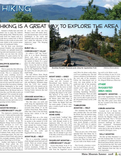
Reaching Mosquito <strong>Mountain</strong> peak, along the Appalachian Trail. (Melissa Howes photo)<br />
Mount Kineo — Kineo<br />
This is a great day hike for the<br />
young and old. Located on<br />
Moosehead Lake, families can<br />
enjoy the trek either by boat or<br />
land. From the fire tower on bald<br />
summit, you’ll take in pristine<br />
views of the Lake and mountains<br />
including Big Squaw to the south,<br />
Big Spencer to the north, and<br />
impressive Mount Katahdin and<br />
the Baxter State Park range of<br />
mountains. Elevation is only 800<br />
feet. Follow the Bridal Trail that<br />
has easier grades. If there’s time,<br />
play a round of golf on the ninehole<br />
course.<br />
Moxie Falls —<br />
Moxie Gore<br />
A great family “walking” hike.<br />
<strong>The</strong> trail leaves the road for the<br />
easy walk through woods to the<br />
impressive falls. It’s one of the<br />
highest falls in Maine with a drop<br />
of 30 yards. Be careful, as the steps<br />
and descent down to the pools can<br />
be very slippery due to airborne<br />
spray. Do not attempt to get close<br />
to the falls, as the force of the water<br />
may carry you over.<br />
Sugarloaf <strong>Mountain</strong> —<br />
Carrabassett Valley<br />
Access from Route 16 & 27 via<br />
the Caribou Pond Road about a<br />
mile from the Sugarloaf access<br />
road. Drive for about a mile where<br />
you’ll see a parking area. <strong>The</strong> trail<br />
crosses a stream as you head east to<br />
the west side of the mountain.<br />
Follow the blue-blazed trail to<br />
some very steep pitches on the<br />
south-west side of the mountain.<br />
<strong>The</strong> trail crosses the AT. At the<br />
summit you’ll enjoy spectacular<br />
views of the near-by ranges,<br />
including Spaulding <strong>Mountain</strong>,<br />
Crocker <strong>Mountain</strong>. <strong>The</strong>re are radio<br />
towtowers at the summit and you<br />
may even be able to gain access to<br />
the old gondola house on the 2,500<br />
foot summit.<br />
Tumbledown<br />
<strong>Mountain</strong> — Weld<br />
This mountain has three peaks<br />
and a pristine lake. You can climb<br />
the Brook Trail, the shortest route,<br />
approximately a mile and a half,<br />
passes a brook. <strong>The</strong> trail is well<br />
marked, but be prepared for a very<br />
steep ascent through a rock-like<br />
cave that you’ll have to squeeze<br />
yourself through. An easier loop<br />
road leads to the 1,400 foot summit.<br />
<strong>The</strong>se are just a few of the many<br />
splendid hikes that Maine has to<br />
offer. Check out local guides when<br />
you’re passing by a tourist information<br />
area. Have fun and be safe<br />
on your walk in the Maine woods.<br />
Dan Cassidy, a freelance writer,<br />
may be found hiking trails and<br />
mountains or riding off-road bik-<br />
ing trails in the Maine woods.<br />
When not hiking, he may be in his<br />
canoe on a remote stream or lake<br />
in the North Maine Woods along<br />
the Allagash Wilderness Waterway.<br />
Other<br />
Suggested<br />
Area Hikes<br />
Mosquito <strong>Mountain</strong> - a<br />
part of the Appalachian Trail, this<br />
is a moderate to strenuous 1.9 mile<br />
hike that offers great views from<br />
the top. Located in the Forks, east<br />
of Route 201.<br />
Coburn <strong>Mountain</strong><br />
Located west of Route 201<br />
between the Forks and Jackman,<br />
Coburn is the tallest mountain<br />
between the Bigelow Range and<br />
Baxter Sate Park, This 3, 718 foot<br />
tall mountain presents a rather<br />
strenuous challenge for hikers.<br />
Also nicknamed “Enchanted<br />
<strong>Mountain</strong>”, Coburn has an observation<br />
deck at the top for taking in<br />
wonderful 260-degree views.<br />
Sally <strong>Mountain</strong><br />
<strong>The</strong> hike up Sally <strong>Mountain</strong> is a<br />
4.8 mile moderate hike. It is located<br />
southwest of Jackman between<br />
Wood and Attean Ponds, which can<br />
be viewed from the trail. <strong>The</strong> word<br />
is that blueberries are abundant on<br />
Sally <strong>Mountain</strong> from late July to<br />
early September.<br />
Maine <strong>Mountain</strong> <strong>Summer</strong> <strong>2008</strong> 27