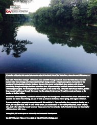
Howell County Digital Magazine
Howell County Missouri
Howell County Missouri

You also want an ePaper? Increase the reach of your titles
YUMPU automatically turns print PDFs into web optimized ePapers that Google loves.
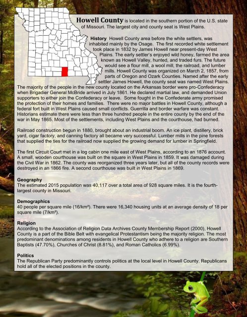
<strong>Howell</strong> <strong>County</strong> is located in the southern portion of the U.S. state<br />
of Missouri. The largest city and county seat is West Plains.<br />
History <strong>Howell</strong> <strong>County</strong> area before the white settlers, was<br />
inhabited mainly by the Osage. The first recorded white settlement<br />
took place in 1832 by James <strong>Howell</strong> near present-day West<br />
Plains. The early settler’s enjoyed wild honey, farmed the area<br />
known as <strong>Howell</strong> Valley, hunted, and traded furs. The future<br />
would see a flour mill, a wool mill, the railroad, and lumber<br />
mills. <strong>Howell</strong> <strong>County</strong> was organized on March 2, 1857, from<br />
parts of Oregon and Ozark Counties. Named after the early<br />
settler James <strong>Howell</strong>, the county seat was named West Plains.<br />
The majority of the people in the new county located on the Arkansas border were pro-Confederacy<br />
when Brigadier General McBride arrived in July 1861. He declared martial law, and demanded Union<br />
supporters to either join the Confederacy or leave. Some fought in the Confederate army promised<br />
the protection of their homes and families. There were no major battles in <strong>Howell</strong> <strong>County</strong>, although a<br />
federal fort built in West Plains caused small conflicts. Guerrilla and border warfare was constant.<br />
Historians estimate there were less than three hundred people in the entire county by the end of the<br />
war in May 1865. Most of the settlements, including West Plains and the courthouse, had burned.<br />
Railroad construction begun in 1880, brought about an industrial boom. An ice plant, distillery, brick<br />
yard, cigar factory, and canning factory all became very successful. Lumber mills in the pine forests<br />
that supplied the ties for the railroad now supplied the growing demand for lumber in Springfield.<br />
The first Circuit Court met in a log cabin one mile east of West Plains, according to an 1876 account.<br />
A small, wooden courthouse was built on the square in West Plains in 1859. It was damaged during<br />
the Civil War in 1862. The county was reorganized three years later, but all of the county records were<br />
destroyed in an 1866 fire. A second courthouse was built in West Plains in 1869.<br />
Geography<br />
The estimated 2015 population was 40,117 over a total area of 928 square miles. It is the fourthlargest<br />
county in Missouri.<br />
Demographics<br />
40 people per square mile (16/km²). There were 16,340 housing units at an average density of 18 per<br />
square mile (7/km²).<br />
Religion<br />
According to the Association of Religion Data Archives <strong>County</strong> Membership Report (2000), <strong>Howell</strong><br />
<strong>County</strong> is a part of the Bible Belt with evangelical Protestantism being the majority religion. The most<br />
predominant denominations among residents in <strong>Howell</strong> <strong>County</strong> who adhere to a religion are Southern<br />
Baptists (47.70%), Churches of Christ (8.81%), and Roman Catholics (6.99%).<br />
Politics<br />
The Republican Party predominantly controls politics at the local level in <strong>Howell</strong> <strong>County</strong>. Republicans<br />
hold all of the elected positions in the county.