
You also want an ePaper? Increase the reach of your titles
YUMPU automatically turns print PDFs into web optimized ePapers that Google loves.
Page 10 The <strong>Montana</strong> <strong>Steward</strong>: <strong>Anaconda</strong> <strong>Edition</strong> The <strong>Montana</strong> <strong>Steward</strong>: <strong>Anaconda</strong> <strong>Edition</strong><br />
Page 11<br />
Mounta Haggin Waste Management Area<br />
Pedro Marques<br />
Somewhere between an<br />
opportunity and wisdom, there<br />
is a place for innovation to spark<br />
and for transformative projects<br />
to take root. In one quiet corner<br />
of Southwest <strong>Montana</strong>, along the<br />
highway between Opportunity<br />
and Wisdom, 120 years separates<br />
two such transformative projects.<br />
This is the story of the degradation<br />
and restoration of the headwaters<br />
tributaries of the Mount Haggin<br />
Wildlife Management Area.<br />
In 1864 the first gold in the Big<br />
Hole watershed was hit in French<br />
Gulch, a cold, wet, headwater<br />
tributary of French Creek/Deep<br />
Creek, due north of the apex of<br />
the Big Hole River’s long U-turn<br />
between the southern Pintler<br />
(<strong>Anaconda</strong>) and northern Pioneer<br />
ranges. Gold panning and sluicing<br />
for the easiest available gold, which<br />
yielded as much as $5/pan (in<br />
1860s dollars!), was completely<br />
exhausted by 1877, at which point<br />
more intensive hydraulic mining<br />
operations began. Large dredgers<br />
were later brought to the French<br />
Gulch mining claims in 1895.<br />
Typical of mining towns of the era,<br />
the town of French Gulch was built,<br />
boomed and busted in less than<br />
40 years. Streams and floodplains<br />
targeted by mining operations<br />
were completely uplifted, materials<br />
sifted through, channels relocated,<br />
and massive piles of cobble left<br />
behind. Streams were often left in<br />
strengthened, incised channels.<br />
Around 1904, with placer mining<br />
waning, W. R. Allen, who was born<br />
in French Gulch in 1871 and later<br />
became Lieutenant Governor of<br />
<strong>Montana</strong>, had purchased many of<br />
the local claims and his namesake<br />
company established large-scale<br />
logging activities for the booming<br />
towns of <strong>Anaconda</strong> and Butte.<br />
Timber became the new resource<br />
of interest on Mount Haggin.<br />
From 1906 to 1909, a massive sale<br />
removed 79 million board feet of<br />
timber. The productivity of the<br />
landscape and the totality of its<br />
extraction cannot be understated.<br />
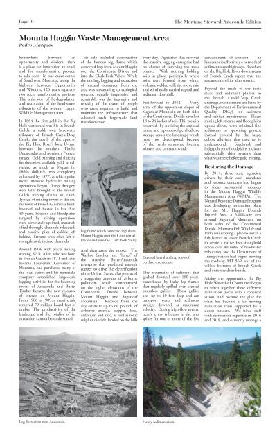
Log Extraction near <strong>Anaconda</strong>.<br />
This sale included construction<br />
of the famous log flume which<br />
conveyed logs from Mount Haggin<br />
over the Continental Divide and<br />
into the Clark Fork Valley. While<br />
the mining, logging and extraction<br />
of natural resources from the<br />
area was devastating to ecological<br />
systems, equally impressive and<br />
admirable was the ingenuity and<br />
tenacity of the teams of people<br />
who came together to build and<br />
maintain the infrastructure that<br />
achieved such large-scale land<br />
transformation.<br />
Log flume which conveyed logs from<br />
Mount Haggin over the Continental<br />
Divide and into the Clark Fork Valley<br />
And then came the smoke. The<br />
Washoe Smelter, the “lungs” of<br />
the massive Butte-<strong>Anaconda</strong><br />
enterprise that produced enough<br />
copper to drive the electrification<br />
of the United States, also produced<br />
a staggering amount of airborne<br />
pollution, which concentrated<br />
on the higher elevations of the<br />
Continental Divide between<br />
Mount Haggin and Sugarloaf<br />
Mountain. Records from the<br />
day estimate up to 60 pounds of<br />
airborne arsenic, copper, lead,<br />
cadmium and zinc, as well as toxic<br />
sulphur dioxide, landed on the hills<br />
every day. Vegetation that survived<br />
the massive logging enterprise had<br />
no chance of surviving the toxic<br />
plume. With nothing holding<br />
soils in place, particularly where<br />
soils were formed from white,<br />
volcanic welded tuff, the snow, rain<br />
and wind easily carried topsoil and<br />
sediment downhill.<br />
Fast-forward to 2012. Many<br />
acres of the uppermost slopes of<br />
Sugarloaf Mountain on both sides<br />
of the Continental Divide have lost<br />
18 to 24 inches of soil. This is easily<br />
observed by noticing the exposed<br />
lateral and tap roots of perched tree<br />
stumps across the landscape which<br />
have not decomposed because<br />
of the harsh summers, freezing<br />
winters and constant wind.<br />
Exposed lateral and tap roots of<br />
perched tree stumps.<br />
The mountains of sediment that<br />
gushed downhill over 100 years,<br />
exacerbated by leaky log flumes<br />
that regularly spilled over, created<br />
countless gullies. These gullies<br />
are up to 40 feet deep and can<br />
transport water and sediment<br />
straight downhill at maximum<br />
velocity. During high-flow events,<br />
nearly every tributary in the area<br />
spikes for one or more of the five<br />
Heavy sedimentation.<br />
contaminants of concern. The<br />
landscape is effectively a network of<br />
sediment superhighways. Ranchers<br />
on the Big Hole River downstream<br />
of French Creek report that the<br />
streams run white after storms.<br />
Beyond the reach of the toxic<br />
stack and sediment plumes in<br />
the French Creek/Deep Creek<br />
drainage, most streams are listed by<br />
the Department of Environmental<br />
Quality (DEQ) for sediment<br />
and habitat impairments. Placer<br />
mining left streams and floodplains<br />
upside down, with minimal fine<br />
sediments or spawning gravels,<br />
instead covered by the large,<br />
cobble alluvium that used to lie<br />
underground. Sagebrush and<br />
lodgepole pine floodplains indicate<br />
substantially drier systems than<br />
what was there before gold mining.<br />
Restoring the Damage<br />
By 2014, three state agencies,<br />
driven by their own mandates<br />
and resource concerns had begun<br />
to focus substantial resources<br />
in the Mount Haggin Wildlife<br />
Management Area (WMA). The<br />
Natural Resource Damage Program<br />
was developing restoration plans<br />
for the Mt. Haggin Uplands<br />
Injured Area, a 5,000-acre area<br />
around Sugarloaf Mountain on<br />
both sides of the Continental<br />
Divide. <strong>Montana</strong> Fish Wildlife and<br />
Parks was scoping a plan to install a<br />
fish barrier in lower French Creek<br />
to create a native fish stronghold<br />
across over 40 miles of headwater<br />
tributaries, and the Department of<br />
Transportation had begun moving<br />
the roadway, MT 569, out of the<br />
willow bottoms of French Creek<br />
and onto the drier bench.<br />
Seizing the opportunity, the Big<br />
Hole Watershed Committee began<br />
to stitch together these different<br />
restoration pieces into a coherent<br />
vision, and became the glue for<br />
what has become a fast-moving<br />
restoration train supported by a<br />
dozen funders. We hired staff<br />
with restoration expertise in 20<strong>16</strong><br />
and 2018, and currently manage a<br />
portfolio of projects in the WMA<br />
valued at nearly $1.2 million. These<br />
projects include the drainages of<br />
Joyner Gulch, Muddy Gulch and<br />
upper Willow Creek to the north,<br />
and California Creek, French<br />
Creek, Oregon Creek and French<br />
Gulch in the Big Hole watershed.<br />
Across these projects, we have<br />
fostered a cooperative spirit<br />
with our agency partners by<br />
understanding their resource<br />
objectives and fitting our onthe-ground<br />
solutions to advance<br />
those goals. Coupled with highlytalented<br />
design engineers, we’ve<br />
been able to design projects that<br />
remove the primary impairments<br />
to the system and give natural<br />
systems the kick-start they need to<br />
heal on their own.<br />
We have consistently found<br />
that controlling the movement<br />
of sediment by water is key.<br />
Reference sites across the WMA<br />
are dominated by beaver ponds<br />
and stream systems that regularly<br />
overtop their banks and saturate<br />
floodplains. When we increase the<br />
landscape’s ability to capture and<br />
hold sediment by getting perennial<br />
channels up and out of their banks,<br />
multiple resource objectives come<br />
together:<br />
-Floodplain soils get charged up<br />
with water. Water moving through<br />
soil underground moves slower and<br />
stays cooler, so there is more cold<br />
water available later in the season.<br />
-Fine sediments move out of<br />
surface waters and stay out of<br />
spawning gravels, improving future<br />
fish habitat.<br />
-More water on the floodplain<br />
encourages more riparian plants<br />
like willows and aspen. Once local<br />
beaver have enough of their favorite<br />
foods in a given location, they’ll<br />
set up shop and ramp up their<br />
ponding and wetland creation. As<br />
a keystone species, the benefits of<br />
beavers to all other species is well<br />
documented.<br />
Across the WMA, we’ve sought to<br />
mimic natural recovery processes<br />
to achieve what are predominantly<br />
sediment-related impairments.<br />
Beaver Mimicry<br />
Across our projects, the dried up<br />
floodplains of former beaver pond<br />
meadows are great for growing<br />
lodgepole pine. And lodgepole<br />
pine make great material for<br />
installing leaky dams known as<br />
beaver mimicry structures or beaver<br />
dam analogues (BDAs). We have<br />
installed over 600 BDAs across the<br />
Injured Area of the Superfund site<br />
along California Creek and Muddy<br />
Gulch, small tributaries that emerge<br />
from groundwater seeps along<br />
the Continental Divide. Each<br />
structure builds up sediments and<br />
raises the height of the stream bed.<br />
Now, during high water events,<br />
instead of rushing downstream,<br />
these streams spill out onto the<br />
floodplain and saturate previously<br />
bone-dry soils. With the long-<br />
term focus of the beaver dam<br />
analogue project, we’ve been able<br />
to install three generations of these<br />
structures in some locations. We<br />
are using drone surveys to estimate<br />
the amount of sediment we are<br />
catching with each structure. In<br />
20<strong>16</strong>, we measured that about half<br />
a ton (500 pounds) of sediments<br />
were captured by each structure.<br />
After the third generation, we<br />
estimate that between 3 to 10 tons<br />
of sediment are captured behind<br />
each structure. More important,<br />
we’re seeing upland grasses<br />
converting to sedges and rushes,<br />
and willow and aspen groves<br />
thriving nearby.<br />
Floodplain connection<br />
In French Gulch and Moose Creek,<br />
where placer piles covered most<br />
functional floodplains and the<br />
stream was relegated to a straight,<br />
narrow chute, we removed 30,000<br />
cubic yards of material. We also<br />
designed a new stream channel<br />
to regularly spill out of its banks,<br />
creating 17 acres of new wetlands<br />
along 3 miles of channel in the<br />
process. We estimated that after<br />
one year, we are reducing 448 tons<br />
of sediment/year from that system.<br />
More important, we’ve set the<br />
conditions for natural processes to<br />
develop the wet willow bottoms<br />
that are found in our reference<br />
A new stream channel designed to regularly spill out of its banks.<br />
Vegetation growth with slow release organic fertilizer.<br />
areas (unimpacted areas).<br />
Slope and gully erosion<br />
control<br />
In the highly-eroded uplands of<br />
the Mt. Haggin Injured Area, we<br />
learned through investigations and<br />
small-scale demonstration projects<br />
that the bare soils are not toxic to<br />
plants, unlike the slickens (tailings)<br />
in the riparian corridors of the<br />
Clark Fork River. On those bare<br />
slopes, the addition of slow-release<br />
organic fertilizer has jump-started<br />
vegetation growth. With each new<br />
clump of grass or forb, we make it<br />
harder for sediment to find its way<br />
downhill.<br />
In large gullies, we use locally<br />
available lodgepole to create<br />
gully plugs to capture sediment<br />
and create locations for the local<br />
seed bank to germinate, further<br />
slowing erosion. Over six years we<br />
have installed hundreds of check<br />
structures of all shapes and sizes.<br />
In 2018, we punched a temporary<br />
road into the Continental Divide,<br />
and using heavy equipment<br />
installed over 2,500 dozer basins<br />
on the slopes and installed gully<br />
dams and check structures –<br />
enough to capture nearly 3,000<br />
tons of sediment.<br />
Together these projects are having<br />
a transformative impact in the Mt.<br />
Haggin WMA and all our partners<br />
are seeing resource benefits. More<br />
important, by setting the stage for<br />
nature to heal itself, our projects<br />
are decreasing the long-term<br />
ecological maintenance needs of<br />
the area, setting the stage for the<br />
successful reintroduction of the<br />
second largest native fish project in<br />
<strong>Montana</strong>, and greatly improving<br />
the quality of the landscape for<br />
the recreationists that enjoy this<br />
spectacular public land of ours.