Predicting and preventing the spread of lantana into the Blue ...
Predicting and preventing the spread of lantana into the Blue ...
Predicting and preventing the spread of lantana into the Blue ...
Create successful ePaper yourself
Turn your PDF publications into a flip-book with our unique Google optimized e-Paper software.
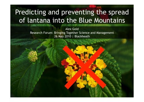
<strong>Predicting</strong> <strong>and</strong> <strong>preventing</strong> <strong>the</strong> <strong>spread</strong><br />
<strong>of</strong> <strong>lantana</strong> <strong>into</strong> <strong>the</strong> <strong>Blue</strong> Mountains<br />
Alex Gold<br />
Research Forum: Bringing Toge<strong>the</strong>r Science <strong>and</strong> Management<br />
26 May 2010 | Blackheath
Project overview<br />
� Masters study (August 2008 – July 2009)<br />
� Wanted to apply GIS <strong>and</strong> predictive modelling techniques<br />
to a current environmental issue<br />
� Used BMCC presence/absence data, my own fieldwork<br />
<strong>Blue</strong>Space <strong>lantana</strong>
Aims <strong>of</strong> <strong>the</strong> study<br />
� Invasion, establishment <strong>and</strong> <strong>spread</strong> <strong>of</strong> Lantana camara is a key<br />
threatening process in NSW<br />
� DECCW has a threat abatement plan with priority actions<br />
� This research directly addresses two <strong>of</strong> <strong>the</strong>se actions, <strong>and</strong> <strong>the</strong><br />
presentation will follow to describe how <strong>the</strong> research relates to<br />
<strong>the</strong>m:<br />
PRIORITY ACTION 1: SURVEY/MAPPING AND HABITAT ASSESSMENT<br />
PRIORITY ACTION 2: DEVELOP AND USE MODEL TO RANK<br />
BIODIVERSITY THREATENED BY LANTANA
PRIORITY ACTION 1: SURVEY/MAPPING AND HABITAT ASSESSMENT<br />
� Developed a habitat suitability model based on BMCC weed surveys<br />
� Predicted suitability for parts <strong>of</strong> <strong>Blue</strong> Mountains National Park <strong>and</strong><br />
intervening townships<br />
� Looked at how suitability may change with warmer climates<br />
� Environmental data<br />
(from DECCW)<br />
sampled at each point<br />
� Helps determine<br />
what environmental<br />
factors may contribute<br />
to <strong>lantana</strong> persistence
PRIORITY ACTION 1: SURVEY/MAPPING AND HABITAT ASSESSMENT<br />
� So…what kind <strong>of</strong> habitat does <strong>lantana</strong> prefer?<br />
PERCENTAGE EXPLANATION<br />
100<br />
90<br />
80<br />
70<br />
60<br />
50<br />
40<br />
30<br />
20<br />
10<br />
0<br />
� Differences in minimum temperatures are important…<br />
88.59<br />
MINIMUM<br />
TEMP<br />
� But HOW are <strong>the</strong>y important?<br />
The chance <strong>of</strong><br />
finding <strong>lantana</strong><br />
increases<br />
3.08<br />
4.8<br />
As minimum temperatures increase…<br />
1.29<br />
CANOPY COVER TERRAIN SOLAR<br />
RADIATION<br />
2.25<br />
FIRE
PRIORITY ACTION 1: SURVEY/MAPPING AND HABITAT ASSESSMENT<br />
� Established <strong>lantana</strong>’s rela4onship with <strong>the</strong>se environmental factors<br />
RAW LANTANA DATA<br />
ENVIRONMENTAL<br />
RELATIONSHIP<br />
PREDICTIVE MAPPING<br />
� Now can develop a habitat suitability assessment <strong>of</strong> <strong>the</strong> l<strong>and</strong>scape<br />
� Probability <strong>of</strong> <strong>lantana</strong> persis_ng, given environmental factors
PRIORITY ACTION 1: SURVEY/MAPPING AND HABITAT ASSESSMENT<br />
� Generate map under current condi_ons…iden_fy pathways
PRIORITY ACTION 1: SURVEY/MAPPING AND HABITAT ASSESSMENT<br />
� In <strong>the</strong> <strong>Blue</strong><br />
Mountains<br />
region, <strong>lantana</strong><br />
has an strong<br />
correla_on with<br />
temperature<br />
� so climate<br />
change<br />
becomes an<br />
important<br />
considera_on<br />
+0.5°C +1.0°C<br />
+0.5°C +1.0°C<br />
+1.5°C +2.0°C<br />
+1.5°C +2.0°C
PRIORITY ACTION 1: SURVEY/MAPPING AND HABITAT ASSESSMENT<br />
� Iden_fied minimum<br />
temperature as an important<br />
predictor <strong>of</strong> <strong>lantana</strong> presence<br />
in <strong>the</strong> area<br />
� Able to iden_fy pathways <strong>of</strong><br />
suitable habitat<br />
� Importance <strong>of</strong> climate<br />
change<br />
� Especially warmer<br />
winters<br />
� Integra_on with na_onal<br />
remote sensing data<br />
PRIORITY ACTION 2<br />
USE MODEL TO RANK BIODIVERSITY THREATENED BY LANTANA
PRIORITY ACTION 2: USE MODEL TO RANK THREATENED BIODIVERSITY<br />
� Coastal regions have received most <strong>of</strong> <strong>the</strong> acen_on<br />
� NSW North Coast, Sydney Basin, South East Corner Bioregions<br />
� Time to turn to <strong>the</strong> mountains, especially with increasing threat
PRIORITY ACTION 2: USE MODEL TO RANK THREATENED BIODIVERSITY<br />
� Integrated habitat suitability model with vegeta_on communi_es<br />
� Sydney Turpen_ne-‐Ironbark Forest within townships
PRIORITY ACTION 2: USE MODEL TO RANK THREATENED BIODIVERSITY<br />
� Endangered ecological communi_es most under threat:<br />
� Sydney Turpen_ne-‐Ironbark Forest<br />
� Shale/S<strong>and</strong>stone Transi_on Forest<br />
� Sun Valley Cabbage Gum Forest<br />
� <strong>Blue</strong> Gum Riverflat Forest<br />
� Casuarina cunninghamiana River Oak Forest<br />
� <strong>Blue</strong> Mountains Shale Cap Forest (longer-‐term)<br />
� Only Sydney Turpen_ne-‐Ironbark Forest is listed within <strong>the</strong> KTP<br />
� Also iden_fied 27 endangered species at fur<strong>the</strong>r risk:<br />
� Even more vulnerable species…<br />
� Shrubs <strong>and</strong> o<strong>the</strong>r flora<br />
� e.g Acacia gordonii<br />
� Lantana threatens<br />
adults, juveniles, <strong>and</strong><br />
seed germina_on<br />
� Endemic fauna<br />
� e.g. <strong>Blue</strong> Mountains Water Skink<br />
� Weeds degrade habitat
Two priority ac_ons within <strong>the</strong> DECCW Threat Abatement Plan for <strong>lantana</strong> are:<br />
SURVEY/MAPPING AND HABITAT ASSESSMENT<br />
� Iden_fied important environmental predictors for <strong>lantana</strong> presence<br />
� Minimum temperatures key<br />
� Habitat suitability model iden_fied pathways <strong>of</strong> poten_al ingress<br />
� Riparian areas as secondary dispersal mechanism?<br />
� Climate change cri_cally important<br />
� Warmer winters may lead to outbreaks<br />
� Combined with na_onal remote sensing data for targeted planning<br />
USE MODEL TO RANK THREATENED BIODIVERSITY<br />
� Model allowed for specific assessment <strong>of</strong> threat to mountains<br />
vegeta4on communi4es<br />
� Present <strong>and</strong> longer-‐term considera_ons<br />
� Contributed to lists <strong>of</strong> threatened species <strong>and</strong> ecological communi_es<br />
within key threatening process informa_on<br />
� Western containment line for <strong>the</strong> na_onal strategy?
Acknowledgements<br />
� Shawn Laffan<br />
� Dan Ramp<br />
� Richard Kingsford<br />
� Frank Gar<strong>of</strong>alow<br />
� Matt Chambers<br />
� Derek Tan<br />
� Chris Dewhurst<br />
� Eric Mahony<br />
� Melissa Giese<br />
� Peter Stathis<br />
� Tanya Strevens<br />
� Ge<strong>of</strong>f Luscombe<br />
� Glenn Meade<br />
� Pete Turner<br />
� Rosalie Chapple<br />
� John Merson<br />
� Haydn Washington<br />
Australian Weeds Research Centre


