

Presentation: Luckey Site Public Information Session ... - U.S. Army
Presentation: Luckey Site Public Information Session ... - U.S. Army
Presentation: Luckey Site Public Information Session ... - U.S. Army

You also want an ePaper? Increase the reach of your titles
YUMPU automatically turns print PDFs into web optimized ePapers that Google loves.
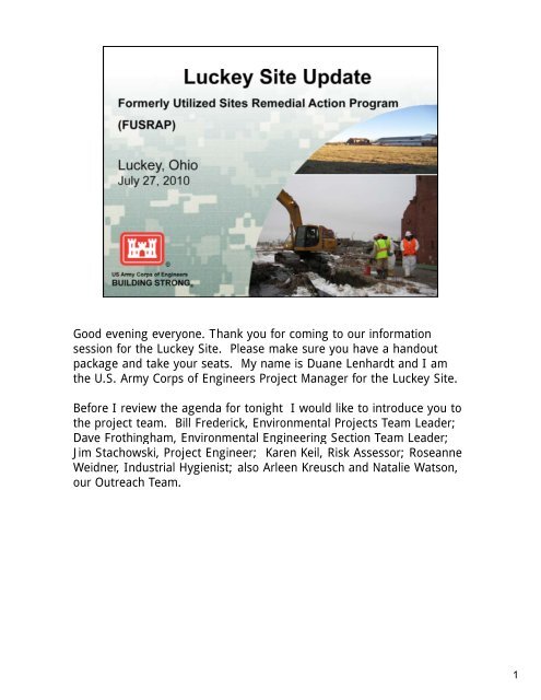
Good evening everyone. Thank you for coming to our information<br />
session for the <strong>Luckey</strong> <strong>Site</strong> <strong>Site</strong>. Please make sure you have a handout<br />
package and take your seats. My name is Duane Lenhardt and I am<br />
the U.S. <strong>Army</strong> Corps of Engineers Project Manager for the <strong>Luckey</strong> <strong>Site</strong>.<br />
Before I review the agenda for tonight I would like to introduce you to<br />
the project team. Bill Frederick, Environmental Projects Team Leader;<br />
DDave FFrothingham, thi h Environmental E i t l Engineering E i i Section S ti Team T Leader; L d<br />
Jim Stachowski, Project Engineer; Karen Keil, Risk Assessor; Roseanne<br />
Weidner, Industrial Hygienist; also Arleen Kreusch and Natalie Watson,<br />
our Outreach Team.<br />
1
Tonight’s presentation will provide you with information about the<br />
activities that we have been performing on the <strong>Luckey</strong> <strong>Site</strong>. After the<br />
presentation presentation, we welcome your questions questions, or if you would rather speak<br />
with team members individually, we will be available at the end of the<br />
meeting.<br />
I will now turn the presentation over to the <strong>Luckey</strong> <strong>Site</strong> project<br />
engineer, Jim Stachowski.<br />
2
The <strong>Luckey</strong> <strong>Site</strong> is located at 21200 <strong>Luckey</strong> Road, just north of the<br />
Village of <strong>Luckey</strong> approximately 22 miles southeast of Toledo. The site<br />
encompasses approximately 40 acres and is currently vacant. vacant Some of<br />
the original buildings have been demolished, including the production<br />
annex building. The site is surrounded by farm land and private<br />
residences.<br />
3
• The site was owned by the Atomic Energy Commission and operated by Brush Beryllium Company<br />
from 1949 to 1960 for the production of beryllium. Radiologically contaminated scrap steel was<br />
brought to the site in 1952 to be used in magnesium production, which never occurred.<br />
• The <strong>Luckey</strong> <strong>Site</strong> was utilized by the Federal Government to support the wartime efforts of the<br />
Atomic Energy Commission in support of the nation’s early atomic energy program. The site was<br />
decommissioned in 1960 when the government determined that beryllium processing efforts were<br />
no longer necessary.<br />
• The Formerly Utilized <strong>Site</strong>s Remedial Action Program (FUSRAP) was authorized by Congress in<br />
1974 to clean up sites throughout the country that participated in Atomic Energy Commission<br />
activities.<br />
• The U.S. <strong>Army</strong> Corps of Engineers (Corps) became the lead Federal agency for remediating<br />
FUSRAP sites in 1997 when Congress transferred the authority to the Corps from the Department<br />
of Energy. The process that we are required to follow for FUSRAP is specified in the<br />
Comprehensive Environmental Response, Compensation, and Liability Act of 1980.<br />
• The Corps signed the Record of Decision for <strong>Luckey</strong> <strong>Site</strong> soils in 2006, and the Record of Decision<br />
for groundwater in 2008.<br />
• The Record of Decision for soils determined that soils would be cleaned up to agricultural levels,<br />
which are the most stringent of the land-use scenarios used to develop cleanup goals. The<br />
contaminants of concern in soil consist of beryllium and radiological elements (radium, thorium,<br />
and d uranium). i ) Soil S il remediation di ti will ill be b accomplished li h d by b excavating ti contaminated t i t d soils il from f the th<br />
site and disposing of them in an appropriate off-site disposal facility.<br />
• The Record of Decision for groundwater established beryllium and uranium as contaminants of<br />
concern in localized areas of the <strong>Luckey</strong> <strong>Site</strong>. Once the contaminated soil is removed from the site,<br />
concentrations of these contaminants in groundwater will decrease naturally in the subsurface.<br />
Currently, groundwater is sampled annually. Sampling frequency will increase when remediation<br />
begins to ensure that our actions remain protective of human health and the environment<br />
4
� This is the process that the Corps is required to follow when<br />
investigating and cleaning up FUSRAP sites.<br />
� The CERCLA process consists of a series of steps that build upon one<br />
another. The process starts with a preliminary assessment followed, if<br />
necessary, by further investigation and studies leading to a remedial<br />
design and cleanup. The <strong>Luckey</strong> <strong>Site</strong> is currently in the Remedial<br />
Design phase phase, which is annotated on the slide by the two two-toned toned<br />
design on that task. Once Remedial Design is complete, the next step<br />
is the Remedial Action with the excavation of contaminated soils from<br />
the <strong>Luckey</strong> <strong>Site</strong>.<br />
� Remedial action is currently scheduled to begin in 2014. 2014 FUSRAP is a<br />
national program, and priority is given to sites already in remedial<br />
action. There are currently three sites in remedial action in the Great<br />
Lakes Region and <strong>Luckey</strong> is currently the next site to begin<br />
remediation.<br />
5
This figure identifies the locations of the features on the <strong>Luckey</strong> <strong>Site</strong>.<br />
You can find this figure in full-size view in your handout package.<br />
The main features of the site where FUSRAP-related contamination has<br />
been discovered are Lagoon Areas A, B, and C, the northeast disposal<br />
area, and trenches to the north and east of the main production<br />
building. These were operational areas used before, during, and after<br />
FUSRAP-related work occurred.<br />
The slide also shows buildings on the <strong>Luckey</strong> <strong>Site</strong>, all of which are in<br />
deteriorating condition. The production and employee activity buildings<br />
appear the most structurally sound. This figure still shows the annex<br />
attached to the main production building; that annex was torn down in<br />
2007 by y the pproperty p y owner. This demolition work was ordered<br />
terminated by the State of Ohio due to beryllium hazards.<br />
6
• This figure shows where the Corps’ previously identified site<br />
contamination and the reasoning used to target locations for<br />
additional sampling, sampling which occurred on the <strong>Luckey</strong> <strong>Site</strong> during late<br />
2009 and early 2010. Funding for this additional investigation was<br />
obtained through the American Recovery and Reinvestment Act of<br />
2009.<br />
• The intent was to bound some of our information gaps and provide<br />
the Corps with a greater understanding of the site contamination so<br />
accurate contaminated soil volumes can be estimated for cost<br />
determinations.<br />
• Additional testing was performed to determine if the field detecting<br />
equipment could adequately identify contamination levels in soil. We<br />
are currently assessing using these detectors when remediating the<br />
site.<br />
7
• <strong>Site</strong> clearing operations and the subsequent topographic survey were<br />
performed to allow better access to the site and to specifically identify<br />
and delineate known areas of concern, concern such as soil mounds located<br />
throughout the site.<br />
• A geophysical survey was completed to map subsurface utilities and<br />
other subsurface features, including sludge disposal trenches.<br />
• A gamma walkover survey was performed to identify elevated<br />
radiological surface contamination in areas that were not addressed in<br />
previous field investigations.<br />
• Results obtained from the geophysical investigation and gamma<br />
walkover survey were used to determine the locations where surface<br />
and subsurface soil sampling were performed.<br />
• The following slides will go into further detail about how we gathered<br />
information.<br />
8
The picture to your left shows clearing of brush on the site to allow for<br />
surveys and sampling. The picture on your right illustrates a<br />
topographic survey being performed by one of our contractors contractors. The<br />
purpose of the topographic survey is to provide a map with detailed<br />
surface elevations (or what we call a contour map) for the calculation of<br />
soil excavation volumes and to locate features of interest.<br />
9
• Gamma walkover surveys, as shown in the photo on your upper left,<br />
measure radiation in surface soils. A gamma walkover survey was<br />
conducted this past fall on the <strong>Luckey</strong> <strong>Site</strong> <strong>Site</strong>. The survey was conducted<br />
in areas where additional information was needed. The survey was<br />
performed within and around the drainage ditch leading to Toussaint<br />
Creek, the boundary of the sludge disposal area, and railroad<br />
embankment on the eastern side of the site.<br />
• Geophysical surveys, as shown in the photograph on your right, were<br />
performed to locate subsurface utilities and objects that could<br />
potentially interfere with soil sampling activities or future remedial<br />
actions and to identify the limits of waste disposal activities in the<br />
northeast section of the site. The surveys were performed near or at:<br />
• the northeast disposal area;<br />
• north of the former production buildings and waste water<br />
treatment facility;<br />
• suspected utility lines; and<br />
• an area that had no vegetation.<br />
10
• As we mentioned in the last slide, gamma walkover surveys measure<br />
radiation in surface soils. Gamma walkover results are shown on this<br />
figure. g This is also a full size handout in your y package. p g<br />
• The upper left inset map shows the gamma walkover survey prepared<br />
for the Remedial Investigation in 2000. We can see both areas not<br />
covered by the survey, as well as areas covered but in a less dense<br />
manner. Consequently, the Corps performed a expanded survey to<br />
cover those areas more thoroughly. thoroughly<br />
• Green shaded areas represent locations where the survey results were<br />
comparable to naturally occurring radiation levels for the area.<br />
• Orange and red colored areas represent locations where the survey<br />
measurements were 3 to greater than 5 times above natural levels,<br />
indicating elevated surface radiation. As shown on this figure, the<br />
primary areas of elevated gamma readings are located east and west<br />
of the former northeast disposal area.<br />
• Soil borings were taken to confirm the gamma scan data and better<br />
define the area of contamination. We will talk further about soil<br />
borings on a later slide.<br />
11
• This slide is provided in full-size version in your handout package and<br />
shows terrain conductivity measurements, which was a geophysical<br />
survey method. method<br />
• Terrain conductivity measures the ability of the soil to conduct<br />
electricity. Different soils and materials conduct electricity differently.<br />
Elevated terrain conductivity measurements are shown on the above<br />
figure as orange and purple colored areas areas. Areas that produce these<br />
elevated responses may contain fill materials, underground utilities, or<br />
objects on the surface which may coincide, confirm, or show potential<br />
for contamination.<br />
• The elevated areas have been labeled (A (A, BB, CC, etc etc.) ) on the figure figure.<br />
12
• This picture shows a contractor drilling soil borings. The purpose of<br />
the borings was to collect soil samples for laboratory analysis and to<br />
identify potentially contaminated fill materials materials. Soil borings were also<br />
drilled to enable the installation of new monitoring wells.<br />
• The soil borings were drilled using truck-mounted drilling equipment.<br />
The method provided continuous undisturbed soil core samples that<br />
were inspected by a geologist geologist.<br />
• Field gamma survey measurements were also taken from the soil<br />
cores to identify potential “hotspots”. Some of these samples were<br />
sent to an off-site laboratory for radiological testing for radium,<br />
thorium thorium, and uranium. uranium<br />
• The soil core samples were also analyzed on site for beryllium. Some<br />
of these samples were also sent to an off-site laboratory for beryllium<br />
analysis.<br />
13
• Soil boring and sample locations are shown on this figure, which is<br />
also full-size in your handout package:<br />
• Fi Five bbackground k d soil il bborings i are located l t d northwest th t of f th the site, it<br />
near <strong>Luckey</strong> Road, and are identified with a gray triangularshaped<br />
symbol.<br />
• Soil borings located to evaluate areas of elevated gamma<br />
walkover survey results are labeled “7a” and identified with a<br />
yellow square. square<br />
• Soil borings located to evaluate the former sludge lagoons are<br />
identified as “7b” with a blue hexagonal-shaped symbol.<br />
• Soil borings located to evaluate data gaps from the RI are<br />
identified as “7c” with a green triangular-shaped symbol.<br />
• Additionally Additionally, discretionary borings are identified as “7g” with a<br />
purple circular-shaped symbol. These locations were chosen on<br />
the basis of field survey and sample analytical results.<br />
14
• The figure on this slide depicts results from beryllium sampling that<br />
was performed recently and historically on the <strong>Luckey</strong> <strong>Site</strong>. The green<br />
symbols indicate beryllium concentrations that are below cleanup<br />
levels.<br />
• The red symbols indicate locations of soil contamination above the<br />
cleanup levels.<br />
• The most important item to note is that the red locations are bounded<br />
or surrounded by green locations, which indicates the extent of<br />
contamination is understood and better defined.<br />
• Note that we are still finalizing our interpretation of the data, and the<br />
determination is not completed.<br />
• Another very important item to note is that we do not see significant<br />
off-site contamination, although dredge material from the ditch<br />
through the northern field has some impacts and will require remedial<br />
action.<br />
15
• The figure on this slide depicts results from radiological sampling that<br />
was performed recently and historically on the <strong>Luckey</strong> <strong>Site</strong>. The green<br />
symbols indicate radiological concentrations that are below cleanup<br />
levels.<br />
• The red symbols indicate locations of radiological contamination above<br />
the cleanup goals.<br />
• As noted on the previous slide, the most important item to note is that<br />
the red locations are bounded or surrounded by green locations, thus<br />
indicating the extent of contamination is understood and better<br />
defined.<br />
• Note that we are still finalizing our interpretation of the data, and the<br />
determination is not completed.<br />
16
• The figure on this slide depicts beryllium sampling results that were<br />
obtained from the vicinity of the subsurface utilities (labeled with blue<br />
lines) on the <strong>Luckey</strong> <strong>Site</strong> <strong>Site</strong>. The triangular symbols represent soil<br />
samples from borings drilled near the utilities and the cross-shaped<br />
symbols represent soil samples from trenches that were excavated<br />
near the utilities. Sediment samples taken from inside manholes are<br />
shown with the circular-shaped symbols.<br />
• The green circles indicate locations where beryllium was not detected<br />
or was below the cleanup goal.<br />
• The red circles indicate locations where beryllium was detected above<br />
the cleanup goals. goals These samples represent soil from 3 locations<br />
immediately north of the former lagoons and sediment from 2<br />
manholes north of the production buildings.<br />
17
• The figure on this slide depicts radiological sampling results that were<br />
obtained in the vicinity of subsurface utilities on the <strong>Luckey</strong> <strong>Site</strong>.<br />
Consistent with the previous figure figure, the triangular-shaped triangular shaped symbols<br />
represent soil boring samples and the cross-shaped symbols represent<br />
soil samples from trenches. Sediment samples taken from inside<br />
manholes are shown with the circular-shaped symbols.<br />
• The green circles indicate locations where radiological results were<br />
either not detected or below the cleanup goals.<br />
• The red circles indicate locations where the radiological results were<br />
above the cleanup goals. These samples represent soil from 3<br />
locations immediately north of the former lagoons lagoons, which are the<br />
same locations shown on the previous slide where beryllium was<br />
detected above the cleanup goals.<br />
18
• This slide is also a full-size handout in your packet.<br />
• The Corps monitors groundwater to provide data that can be used to<br />
assess contaminant movement.<br />
• During the recent field investigation, the Corps installed additional<br />
wells to get a more complete groundwater monitoring network. The<br />
Corps also cleaned and fixed existing wells to ensure continued quality<br />
of ggroundwater o nd ate being collected. collected<br />
• We have been monitoring the extent of groundwater contamination<br />
since the remedial investigation was completed in 2000 and we do not<br />
see any changes in the extent of contamination; it is holding steady<br />
and behaving just as we anticipated when we developed our<br />
groundwater model. model<br />
• FUSRAP substances in groundwater greater than drinking water<br />
standards only occur onsite in isolated areas.<br />
• Groundwater sampling for 2010 is currently ongoing.<br />
• Results from off-site well sampling activities indicate compliance with<br />
national safe drinking water standards. standards These results are available on<br />
the Corps’ website.<br />
19
• Please feel free to visit our website or contact us via e-mail at the<br />
address on the slide. You can also reach us by mail or by telephone.<br />
• This concludes our slide presentation on the <strong>Luckey</strong> <strong>Site</strong>. Do you<br />
have any questions?<br />
21