Memòria de l'IDAPA 2010 - Institut per al Desenvolupament i la ...
Memòria de l'IDAPA 2010 - Institut per al Desenvolupament i la ...
Memòria de l'IDAPA 2010 - Institut per al Desenvolupament i la ...

You also want an ePaper? Increase the reach of your titles
YUMPU automatically turns print PDFs into web optimized ePapers that Google loves.
Actuacions i activitats re<strong>al</strong>itza<strong>de</strong>s<br />
Programa <strong>de</strong> suport a iniciatives <strong>de</strong> reforç <strong>de</strong> <strong>la</strong> i<strong>de</strong>ntitat pirinenca<br />
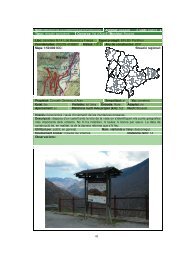
■ Edició <strong>de</strong> <strong>la</strong> cartografia bàsica <strong>de</strong> l’Alt Pirineu i Aran, mapes <strong>per</strong> a<br />
ús esco<strong>la</strong>r<br />
Amb l’objectiu <strong>de</strong> divulgar <strong>la</strong> i<strong>de</strong>ntitat geogràfica i territori<strong>al</strong> <strong>de</strong> l’Alt<br />
Pirineu i Aran entre els seus habitants més joves, l’IDAPA va editar<br />
un qua<strong>de</strong>rn <strong>per</strong> a ús esco<strong>la</strong>r que ofereix 32 mapes <strong>de</strong> base comarc<strong>al</strong><br />
i region<strong>al</strong> sobre <strong>la</strong> seva estructura física i politicoadministrativa,<br />
acompanyats d’un seguit <strong>de</strong> taules estadístiques <strong>de</strong>ls princip<strong>al</strong>s<br />
indicadors socioeconòmics. L’edició d’aquest materi<strong>al</strong>, que es completa<br />
amb una versió en suport digit<strong>al</strong> <strong>per</strong> facilitar-ne <strong>la</strong> aplicació a l’au<strong>la</strong><br />
<strong>al</strong>s docents, ha comptat amb <strong>la</strong> col·<strong>la</strong>boració <strong>de</strong> l’<strong>Institut</strong> Cartogràfic<br />
<strong>de</strong> Cat<strong>al</strong>unya i s’ha distribuït a tots els centres esco<strong>la</strong>rs, biblioteques i<br />
arxius <strong>de</strong> l’Alt Pirineu i Aran. Atesa <strong>la</strong> bona acollida <strong>de</strong> <strong>la</strong> publicació entre<br />
<strong>la</strong> comunitat educativa i aprofitant el marc <strong>de</strong> coo<strong>per</strong>ació amb l’<strong>Institut</strong><br />
Geològic <strong>de</strong> Cat<strong>al</strong>unya, s’ha començat a treb<strong>al</strong><strong>la</strong>r en nous mapes que<br />
expliquin l’origen i l’estructura geològica <strong>de</strong>l Pirineu.<br />
Els mapes <strong>per</strong> a ús esco<strong>la</strong>r<br />
editats <strong>per</strong>metran <strong>al</strong>s joves<br />
estudiants i<strong>de</strong>ntificar amb<br />
c<strong>la</strong>redat i precisió els territoris<br />
pirinencs<br />
Gener<strong>al</strong>itat <strong>de</strong> Cat<strong>al</strong>unya, <strong>Institut</strong> <strong>per</strong> <strong>al</strong> <strong>Desenvolupament</strong> i <strong>la</strong> Promoció <strong>de</strong> l’Alt Pirineu i Aran, memòria <strong>2010</strong> 37