Prólogo - índice - Instituto Oceanográfico de la Armada
Prólogo - índice - Instituto Oceanográfico de la Armada
Prólogo - índice - Instituto Oceanográfico de la Armada

You also want an ePaper? Increase the reach of your titles
YUMPU automatically turns print PDFs into web optimized ePapers that Google loves.
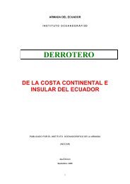
PRÓLOGO<br />
La sexta edición <strong>de</strong>l Derrotero <strong>de</strong> <strong>la</strong> Costa Continental e Insu<strong>la</strong>r <strong>de</strong>l Ecuador ha sido e<strong>la</strong>borada por el<br />
Departamento <strong>de</strong> Ayudas a <strong>la</strong> Navegación en coordinación con los <strong>de</strong>partamentos técnicos <strong>de</strong>l <strong>Instituto</strong><br />
<strong>Oceanográfico</strong> <strong>de</strong> <strong>la</strong> <strong>Armada</strong>; es un compendio <strong>de</strong> <strong>la</strong>s características y generalida<strong>de</strong>s <strong>de</strong>l perfil<br />
costanero ecuatoriano y está <strong>de</strong>sarrol<strong>la</strong>do en base a un cúmulo <strong>de</strong> experiencias e investigaciones <strong>de</strong><br />
varias generaciones <strong>de</strong> hidrógrafos y marinos que han navegado en nuestro mar a través <strong>de</strong> los años.<br />
La presente obra tiene como finalidad informar al navegante <strong>de</strong> una manera c<strong>la</strong>ra y objetiva aspectos<br />
<strong>de</strong> importancia, para que los buques y embarcaciones que surcan el mar ecuatoriano lo hagan con<br />
seguridad siguiendo con lo establecido en <strong>la</strong>s normas y convenios internacionales.<br />
DTH/JTO/W. BTH/JTO/W. Apráez<br />
Rafael Cabello Peñafiel<br />
Capitán <strong>de</strong> Navío-EM<br />
DIRECTOR DEL INSTITUTO OCEANOGRÁFICO DE LA FUERZA NAVAL
ABREVIATURAS<br />
Las siguientes abreviaturas se emplean en el contenido <strong>de</strong> este Derrotero:<br />
INOCAR: <strong>Instituto</strong> <strong>Oceanográfico</strong> <strong>de</strong> <strong>la</strong> <strong>Armada</strong><br />
Mv: Marcación verda<strong>de</strong>ra<br />
MN: mil<strong>la</strong>s náuticas<br />
Km: kilómetros<br />
m: metros<br />
Rv: Rumbo verda<strong>de</strong>ro<br />
Mw: Megavatios<br />
Kwh: Kilovatio hora<br />
Kw: Kilovatios<br />
m.s.n.m: metros sobre el nivel <strong>de</strong>l mar<br />
GPS: Sistema <strong>de</strong> posicionamiento Global<br />
H: Hora<br />
HP: Caballo <strong>de</strong> potencia<br />
AISM: Asociación Internacional <strong>de</strong> Señalización Marítima<br />
Mb: Milibares<br />
Khz: Kiloherzio<br />
Mhz: Megaherzio<br />
mm: milímetro<br />
°C: Grado centígrado<br />
OHI/IHO: Organización Hidrográfica Internacional<br />
OMI: Organización Marítima Internacional<br />
N: Norte<br />
S: Sur<br />
E: Este<br />
W: Oeste<br />
NE: Noreste<br />
SE: Sureste<br />
NW: Noroeste<br />
SW: Suroeste
ÍNDICE<br />
Capítulo I: Información general <strong>de</strong> <strong>la</strong> República <strong>de</strong>l Ecuador<br />
1.1 Situación geográfica 13<br />
1.2 Límites marítimos 13<br />
1.3 Extensión 13<br />
1.4 Regiones geográficas 13<br />
1.4.1 Región Litoral o Costa 14<br />
1.4.2 Región Interandina o Sierra 14<br />
1.4.3 Región Oriental o Amazónica 14<br />
1.4.4 Región Insu<strong>la</strong>r o Galápagos 14<br />
1.4.5 Territorio Antártico 14<br />
1.5 Hidrografía 15<br />
1.5.1 Ríos occi<strong>de</strong>ntales 15<br />
1.5.2 Lagos y <strong>la</strong>gunas 16<br />
1.6 Clima 16<br />
1.6.1 Clima <strong>de</strong> <strong>la</strong> Costa 17<br />
1.6.2 Clima <strong>de</strong> Galápagos 17<br />
1.7 Corrientes frente a <strong>la</strong>s costas <strong>de</strong>l Ecuador 18<br />
1.7.1 Corriente Norecuatorial 18<br />
1.7.2 Contracorriente Ecuatorial 18<br />
1.7.3 Corriente cálida <strong>de</strong> Panamá 18<br />
1.7.4 Corriente Surecuatorial 19<br />
1.7.5 Corriente <strong>de</strong> Humboldt 18<br />
1.7.6 Subcorriente Ecuatorial 19<br />
1.8. Pesca 19<br />
1.9 División política 20<br />
1.9.1 Región Litoral o Costa <strong>de</strong> Norte a Sur 20<br />
1.9.2 Región Interandina o Sierra <strong>de</strong> Norte a Sur 20<br />
1.9.3 Región Oriental o Amazónica <strong>de</strong> Norte a Sur 20<br />
1.9.4 Región Insu<strong>la</strong>r o Galápagos 21<br />
1.10 Sistema <strong>de</strong> gobierno 21<br />
1.11 Entida<strong>de</strong>s portuarias 21<br />
1.12 Ciuda<strong>de</strong>s principales 22<br />
1.13 Pesos y medidas 24<br />
1.14 Régimen monetario 24<br />
1.15 La hora oficial 24<br />
Capítulo II: De Río Mataje a Cabo San Francisco<br />
2.1 Ubicación geográfica y cartas náuticas en el Ecuador 25<br />
2.2 Ubicación geográfica y cartas náuticas <strong>de</strong> <strong>la</strong> Provincia <strong>de</strong><br />
26<br />
Esmeraldas<br />
2.3 Descripción <strong>de</strong> <strong>la</strong> costa 27<br />
2.3.1 De Río Mataje a Río Santiago 27<br />
2.3.2 De Punta Lucero a Punta Ver<strong>de</strong> 27<br />
2.3.3 De Punta Ver<strong>de</strong> a Río Esmeraldas 28<br />
2.3.4 De Punta Gorda a Río Atacames 28<br />
pág.<br />
pág.
2.3.5 De Río Atacames a Río Súa 28<br />
2.3.6 De Río Súa a Punta Same 29<br />
2.3.7 De Punta Same a Punta Galera 29<br />
2.3.8 De Punta Galera a Cabo San Francisco 29<br />
2.4 Peligros a <strong>la</strong> navegación 29<br />
2.5 Mareas, vientos y corrientes 30<br />
2.6 Ayudas a <strong>la</strong> navegación 30<br />
2.6.1 San Lorenzo, Canal <strong>de</strong> Bolívar 30<br />
2.6.2 Canal <strong>de</strong> Limones y Río Ver<strong>de</strong> 31<br />
2.6.3 Puerto Comercial <strong>de</strong> Esmeraldas 31<br />
2.6.3.1 Puerto Pesquero <strong>de</strong> Esmeraldas 32<br />
2.6.4 Ensenada <strong>de</strong> Atacames 32<br />
2.6.5 Ensenada <strong>de</strong> Monpiche 32<br />
2.7 Puertos 33<br />
2.7.1 San Lorenzo Lat. 01 o 18’N. Long. 78 o 51’ W 33<br />
2.7.1.1 Ubicación geográfica y características 33<br />
2.7.1.2 Características hidrográficas y oceanográficas 33<br />
2.7.1.3 Profundida<strong>de</strong>s y veriles 33<br />
2.7.1.4 Gradientes y tipo <strong>de</strong> fondo 33<br />
2.7.1.5 Aproximación 33<br />
2.7.1.6 Fon<strong>de</strong>a<strong>de</strong>ro 34<br />
2.7.1.7 Recomendaciones <strong>de</strong> seguridad 34<br />
2.7.1.8 Ayudas a <strong>la</strong> navegación 34<br />
2.7.2 Limones Lat. 01 o 15’ N. Long. 79 o 00’ W. 34<br />
2.7.2.1 Ubicación geográfica y características 34<br />
2.7.2.2 Características hidrográficas y oceanográficas 34<br />
2.7.2.3 Profundida<strong>de</strong>s y veriles 35<br />
2.7.2.4 Gradientes y tipo <strong>de</strong> fondo 35<br />
2.7.2.5 Aproximación 35<br />
2.7.2.6 Fon<strong>de</strong>a<strong>de</strong>ro 35<br />
2.7.2.7 Recomendaciones <strong>de</strong> seguridad 35<br />
2.7.2.8 Ayudas a <strong>la</strong> navegación 35<br />
2.7.3 Puerto Comercial <strong>de</strong> Esmeraldas Lat. 01 o 00’ N. Long. 79 o 31’ W. 36<br />
2.7.3.1 Ubicación geográfica y características 36<br />
2.7.3.2 Características hidrográficas y oceanográficas 37<br />
2.7.3.3 Profundida<strong>de</strong>s y veriles 37<br />
2.7.3.4 Gradientes y tipo <strong>de</strong> fondo 38<br />
2.7.3.5 Aproximación 38<br />
2.7.3.6 Fon<strong>de</strong>a<strong>de</strong>ro 38<br />
2.7.3.7 Recomendaciones <strong>de</strong> seguridad 39<br />
2.7.3.8 Ayudas a <strong>la</strong> navegación 39<br />
2.7.3.9 Área <strong>de</strong> propósitos especiales 39<br />
2.7.3.10 Facilida<strong>de</strong>s portuarias 39<br />
2.7.3.11 Misceláneas 41<br />
2.7.4 Terminal Petrolero <strong>de</strong> Ba<strong>la</strong>o Lat. 00°58’.60 N. Long. 079°40’.80 W. 42<br />
2.7.4.1 Ubicación geográfica y características 42<br />
2.7.4.2 Características hidrográficas y oceanográficas 43<br />
2.7.4.3 Profundida<strong>de</strong>s y veriles 43<br />
2.7.4.4 Gradientes y tipo <strong>de</strong> fondo 44<br />
2.7.4.5 Aproximación 44
2.7.4.6 Fon<strong>de</strong>a<strong>de</strong>ro 44<br />
2.7.4.7 Recomendaciones <strong>de</strong> seguridad 44<br />
2.7.4.8 Ayudas a <strong>la</strong> navegación 45<br />
2.7.4.9 Áreas <strong>de</strong> propósitos generales 45<br />
2.7.4.10 Regu<strong>la</strong>ciones portuarias 46<br />
2.7.4.11 Monoboyas 47<br />
2.7.5 Tonsupa, Atacames y Súa 48<br />
2.7.5.1 Ubicación geográfica y características 48<br />
2.7.5.2 Características hidrográficas y oceanográficas 48<br />
2.7.5.3 Profundida<strong>de</strong>s y veriles 48<br />
2.7.5.4 Gradientes y tipo <strong>de</strong> fondo 48<br />
2.7.5.5 Aproximación 49<br />
2.7.5.6 Fon<strong>de</strong>a<strong>de</strong>ro 49<br />
2.7.5.7 Recomendaciones <strong>de</strong> seguridad 49<br />
2.7.5.8 Ayudas a <strong>la</strong> navegación 49<br />
2.7.5.9 Turismo 49<br />
Capítulo III: De Cabo San Francisco a Cabo San Lorenzo<br />
3.1 Ubicación geográfica y cartas <strong>de</strong>l área 50<br />
3.2 Descripción <strong>de</strong> <strong>la</strong> costa e is<strong>la</strong>s cercanas 51<br />
3.2.1 Cabo San Francisco 51<br />
3.2.2 Punta Portete 51<br />
3.2.3 Boca <strong>de</strong>l Río Cojimíes 51<br />
3.2.4 Punta Pe<strong>de</strong>rnales 52<br />
3.2.5 Punta Ballena 52<br />
3.2.6 Punta Cabo Pasado 52<br />
3.2.7 Punta Bel<strong>la</strong>ca 53<br />
3.2.8 Punta Jaramijó. 53<br />
3.2.9 Cabo San Mateo 53<br />
3.2.10 Cabo San Lorenzo 54<br />
3.3 Ayudas a <strong>la</strong> navegación 54<br />
3.4 Mareas 55<br />
3.5 Vientos 55<br />
3.6 Corrientes 55<br />
3.7 Condiciones <strong>de</strong> tiempo local 56<br />
3.8 Puertos 56<br />
3.8.1 Muisne (Lat. 00 o 36.7’ N. Long. 080 o 01.2’ W.) (WGS84) 56<br />
3.8.1.1 Ubicación geográfica y características 56<br />
3.8.1.2 Características hidrográficas y oceanográficas 57<br />
3.8.1.3 Profundida<strong>de</strong>s y veriles 57<br />
3.8.1.4 Gradientes y tipos <strong>de</strong> Fondo 57<br />
3.8.1.5 Aproximación 57<br />
3.8.1.6 Fon<strong>de</strong>a<strong>de</strong>ro 57<br />
3.8.1.7 Recomendaciones <strong>de</strong> seguridad 57<br />
3.8.1.8 Ayudas a <strong>la</strong> navegación 57<br />
3.8.2 Cojimíes (Lat. 00 o 22.1’ N. Long. 080 o 02.2’ W.) (WGS84) 58<br />
3.8.2.1 Ubicación geográfica y características 58<br />
3.8.2.2. Características hidrográficas y oceanográficas 58<br />
3.8.2.3 Profundida<strong>de</strong>s y veriles 58<br />
pág.
3.8.2.4 Gradientes y tipo <strong>de</strong> Fondo 58<br />
3.8.2.5 Aproximación 58<br />
3.8.2.6 Fon<strong>de</strong>a<strong>de</strong>ro 58<br />
3.8.2.7 Recomendaciones <strong>de</strong> seguridad 58<br />
3.8.2.8 Ayudas a <strong>la</strong> navegación 59<br />
3.8.3 Pe<strong>de</strong>rnales (Lat. 00°04.2’ N; Long. 080°03.2’ W.) (WGS84) 59<br />
3.8.3.1 Ubicación geográfica características 59<br />
3.8.3.2 Características hidrográficas y oceanográficas 59<br />
3.8.3.3 Profundida<strong>de</strong>s y veriles 59<br />
3.8.3.4 Gradientes y tipo <strong>de</strong> fondo 59<br />
3.8.3.5 Aproximación 59<br />
3.8.3.6 Fon<strong>de</strong>a<strong>de</strong>ro 59<br />
3.8.3.7 Recomendaciones <strong>de</strong> seguridad 60<br />
3.8.3.8 Ayudas a <strong>la</strong> navegación 60<br />
3.8.4 Bahía <strong>de</strong> Caráquez (Lat. 00 o 36.1’ N. Long. 080 o 25.5’ W.) (WGS84) 60<br />
3.8.4.1 Ubicación geográfica y características 60<br />
3.8.4.2 Características hidrográficas y oceanográficas 60<br />
3.8.4.3 Profundida<strong>de</strong>s y veriles 61<br />
3.8.4.4 Gradientes y tipo <strong>de</strong> fondo 61<br />
3.8.4.5 Aproximación 61<br />
3.8.4.6 Fon<strong>de</strong>a<strong>de</strong>ro 62<br />
3.8.4.7 Recomendaciones <strong>de</strong> seguridad 62<br />
3.8.4.8 Ayudas a <strong>la</strong> navegación 62<br />
3.8.4.9 Regu<strong>la</strong>ciones portuarias 62<br />
3.8.4.10 Servicios portuarios 62<br />
3.8.4.11 Misceláneas 62<br />
3.8.5 Crucita (Lat. 00 o 52.6’ S. Long. 080 o 32.4’ W.) (WGS84) 63<br />
3.8.5.1 Ubicación geográfica y características 63<br />
3.8.5.2 Características hidrográficas y oceanográficas 63<br />
3.8.5.3 Profundida<strong>de</strong>s y veriles 63<br />
3.8.5.4 Gradiente y tipo <strong>de</strong> fondo 63<br />
3.8.5.5 Aproximación 63<br />
3.8.5.6 Fon<strong>de</strong>a<strong>de</strong>ro 63<br />
3.8.5.7 Recomendaciones <strong>de</strong> seguridad 64<br />
3.8.5.8 Ayudas a <strong>la</strong> navegación 64<br />
3.8.6 Jaramijó (Lat. 00 o 56.7’ N. Long. 080 o 38.3’ W.) (WGS84) 64<br />
3.8.6.1 Ubicación geográfica y características 64<br />
3.8.6.2 Características hidrográficas y oceanográficas 64<br />
3.8.6.3 Profundida<strong>de</strong>s y veriles. 64<br />
3.8.6.4 Gradientes y tipo <strong>de</strong> fondo 65<br />
3.8.6.5 Aproximación 65<br />
3.8.6.6 Fon<strong>de</strong>a<strong>de</strong>ro 65<br />
3.8.6.7 Recomendaciones <strong>de</strong> seguridad 65<br />
3.8.6.8 Ayudas a <strong>la</strong> navegación 65<br />
3.8.7 Puerto <strong>de</strong> Manta (Lat. 00 o 56.6’ N. Long. 080 o 43.5’ W.) (WGS84) 66<br />
3.8.7.1 Ubicación geográfica y características 66<br />
3.8.7.2 Características hidrográficas y oceanográficas 66<br />
3.8.7.3 Profundida<strong>de</strong>s y veriles 67<br />
3.8.7.4 Gradientes y tipo <strong>de</strong> fondo 67<br />
3.8.7.5 Aproximación 68
3.8.7.6 Fon<strong>de</strong>a<strong>de</strong>ro 68<br />
3.8.7.7 Recomendaciones <strong>de</strong> seguridad 68<br />
3.8.7.8 Ayudas a <strong>la</strong> navegación 68<br />
3.8.7.9 Servicios portuarios 69<br />
3.8.7.10 Regu<strong>la</strong>ciones portuarias 69<br />
3.8.7.11 Muelle Internacional No. 1 70<br />
3.8.7.12 Muelles marginales 70<br />
3.8.7.13 Misceláneas 70<br />
Capítulo IV: De Cabo San Lorenzo a Puntil<strong>la</strong> <strong>de</strong> Santa Elena<br />
4.1 Ubicación geográfica y cartas <strong>de</strong>l área 72<br />
4.2 Descripción <strong>de</strong> <strong>la</strong> costa e is<strong>la</strong>s cercanas 73<br />
4.2.1 Del Cabo San Lorenzo a Punta Cerro Viejo (Punta Pe<strong>de</strong>rnales) 73<br />
4.2.1.1 Ensenada <strong>de</strong> Puerto Cayo 73<br />
4.2.1.2 Is<strong>la</strong> <strong>de</strong> <strong>la</strong> P<strong>la</strong>ta 73<br />
4.2.2 De Punta Cerro Viejo (Punta Pe<strong>de</strong>rnales) a Punta Bálsamo 74<br />
4.2.2.1 Punta Canoa 74<br />
4.2.2.2 Ensenada <strong>de</strong> Machalil<strong>la</strong> 74<br />
4.2.2.3 Punta Lloradora 74<br />
4.2.2.4 Punta Bálsamo 75<br />
4.2.3 De Puerto López a Punta Piedra Ver<strong>de</strong> (Punta Michugo)<br />
75<br />
4.2.3.1 Punta Mirador 75<br />
4.2.3.2 Punta Ma<strong>la</strong> 76<br />
4.2.3.3 Ensenada <strong>de</strong> Sa<strong>la</strong>ngo 76<br />
4.2.3.4 Is<strong>la</strong> Sa<strong>la</strong>ngo 76<br />
4.2.3.5 Punta Piedra Ver<strong>de</strong> (Punta Michugo) 77<br />
4.2.4 De Punta Piedra Ver<strong>de</strong> a Punta Brava 77<br />
4.2.4.1 Punta <strong>de</strong>l Teco y Punta Ayangue 77<br />
4.2.5 De Punta Ayangue a Punta B<strong>la</strong>nca 78<br />
4.2.5.1 Punta Gruesa y Punta Palmar 78<br />
4.2.5.2 Punta Palmar 78<br />
4.2.5.3 Punta B<strong>la</strong>nca 79<br />
4.2.6 De Punta B<strong>la</strong>nca a Puntil<strong>la</strong> <strong>de</strong> Santa Elena 79<br />
4.2.6.1 Bahía <strong>de</strong> Santa Elena 79<br />
4.2.6.2 Puntil<strong>la</strong> <strong>de</strong> Santa Elena 79<br />
4.2.6.3 De Puntil<strong>la</strong> <strong>de</strong> Santa Elena a Punta Ancón 80<br />
4.3 Peligros a <strong>la</strong> navegación 80<br />
4.4 Mareas, vientos y corrientes 81<br />
4.5 Ayudas a <strong>la</strong> navegación 81<br />
4.5.1 Ayangue 81<br />
4.5.2 La Libertad 81<br />
4.5.3 Puerto Lucía 82<br />
4.5.4 Rada <strong>de</strong> Salinas 82<br />
4.6 Puertos 83<br />
4.6.1 Puerto Cayo (Lat. 01° 19.0’ S. Long. 080o 50.0’ W.) 83<br />
4.6.1.1 Ubicación geográfica y característica 83<br />
4.6.1.2 Características hidrográficas y oceanográficas 83<br />
4.6.1.3 Profundida<strong>de</strong>s y veriles 84<br />
4.6.1.4 Gradientes y tipo <strong>de</strong> fondo 84<br />
pág.
4.6.1.5 Aproximación 84<br />
4.6.1.6 Fon<strong>de</strong>a<strong>de</strong>ro 84<br />
4.6.1.7 Recomendaciones <strong>de</strong> seguridad 84<br />
4.6.1.8 Ayudas a <strong>la</strong> navegación 84<br />
4.6.2 Machalil<strong>la</strong> (Lat. 01 o 25´.70 S. yLong. 080 o 52´.43 W.) 84<br />
4.6.2.1 Ubicación geográfica y características 84<br />
4.6.2.2 Características hidrográficas y oceanográficas 85<br />
4.6.2.3 Profundida<strong>de</strong>s y veriles 85<br />
4.6.2.4 Gradientes y tipo <strong>de</strong> fondo 85<br />
4.6.2.5 Aproximación 85<br />
4.6.2.6 Fon<strong>de</strong>a<strong>de</strong>ro 85<br />
4.6.2.7 Recomendaciones <strong>de</strong> seguridad 85<br />
4.6.2.8 Ayudas a <strong>la</strong> navegación 86<br />
4.6.3 Puerto López (Lat. 00 o 32’.69 S. Long. 080 o 47’.36 W.) 86<br />
4.6.3.1 Ubicación geográfica y características 86<br />
4.6.3.2 Características hidrográficas y oceanográficas 86<br />
4.6.3.3 Profundida<strong>de</strong>s y veriles 86<br />
4.6.3.4 Gradientes y tipo <strong>de</strong> fondo 86<br />
4.6.3.5 Aproximación 86<br />
4.6.3.6 Fon<strong>de</strong>a<strong>de</strong>ro 87<br />
4.6.3.7 Recomendaciones <strong>de</strong> seguridad 87<br />
4.6.3.8 Ayudas a <strong>la</strong> navegación 87<br />
4.6.4 Sa<strong>la</strong>ngo (Lat. 01 o 35’.40 S. y Long. 080 o 50’.50 W.) 87<br />
4.6.4.1 Ubicación geográfica y características 87<br />
4.6.4.2 Características hidrográficas y oceanográficas 87<br />
4.6.4.3 Profundida<strong>de</strong>s y veriles 88<br />
4.6.4.4 Gradientes y tipo <strong>de</strong> fondo 88<br />
4.6.4.5 Aproximación 88<br />
4.6.4.6 Fon<strong>de</strong>a<strong>de</strong>ro 88<br />
4.6.4.7 Recomendaciones <strong>de</strong> seguridad 88<br />
4.6.4.8 Ayudas a <strong>la</strong> navegación 88<br />
4.6.5 Montañita (Lat. 01 o 44’.70 S. Long. 080 o 46’.43 W.) 88<br />
4.6.5.1 Ubicación geográfica y características 89<br />
4.6.5.2 Características hidrográficas y oceanográficas 89<br />
4.6.5.3 Profundida<strong>de</strong>s y veriles 89<br />
4.6.5.4 Gradientes y tipo <strong>de</strong> fondo 89<br />
4.6.5.5 Aproximación 89<br />
4.6.5.6 Fon<strong>de</strong>a<strong>de</strong>ro 89<br />
4.6.5.7 Recomendaciones <strong>de</strong> seguridad 89<br />
4.6.5.8 Ayudas a <strong>la</strong> navegación 89<br />
4.6.6 Is<strong>la</strong> <strong>de</strong> <strong>la</strong> P<strong>la</strong>ta (Lat. 01 o 14’.50 S. y Long. 081 o 05’.53 W.) 89<br />
4.6.6.1 Ubicación geográfica y características 89<br />
4.6.6.2 Características hidrográficas y oceanográficas 90<br />
4.6.6.3 Profundida<strong>de</strong>s y veriles 90<br />
4.6.6.4 Gradientes y tipo <strong>de</strong> fondo 90<br />
4.6.6.5 Aproximación 90<br />
4.6.6.6 Fon<strong>de</strong>a<strong>de</strong>ro 91<br />
4.6.6.7 Recomendaciones <strong>de</strong> seguridad 91<br />
4.6.6.8 Ayudas a <strong>la</strong> navegación 91<br />
4.6.7 Valdivia (Lat. 01 o 56’.48 S. y Long. 080 o 43’.43 W.) 91
4.6.7.1 Ubicación geográfica Y características 91<br />
4.6.7.2 Características hidrográficas y oceanográficas 91<br />
4.6.7.3 Profundida<strong>de</strong>s y veriles 92<br />
4.6.7.4 Gradientes y tipo <strong>de</strong> fondo 92<br />
4.6.7.5 Aproximación 92<br />
4.6.7.6 Fon<strong>de</strong>a<strong>de</strong>ro 92<br />
4.6.7.7 Recomendaciones <strong>de</strong> seguridad 93<br />
4.6.7.8 Ayudas a <strong>la</strong> navegación 93<br />
4.6.8 Ayangue (Lat. 01°59’.20 S. y Long. 080 o 45´.13 W.) 93<br />
4.6.8.1 Ubicación geográfica y características 93<br />
4.6.8.2 Características hidrográficas y oceanográficas 93<br />
4.6.8.3 Profundida<strong>de</strong>s y veriles 93<br />
4.6.8.4 Gradientes y tipos <strong>de</strong> fondo 93<br />
4.6.8.5 Aproximación 93<br />
4.6.8.6 Fon<strong>de</strong>a<strong>de</strong>ro 94<br />
4.6.8.7 Ayudas a <strong>la</strong> navegación 94<br />
4.6.9 El Palmar (Lat. 02 o 02’25 S. y Long. 080 o 44’.13 W.) 94<br />
4.6.9.1 Ubicación geográfica y características 94<br />
4.6.9.2 Características hidrográficas y oceanográficas 94<br />
4.6.9.3 Profundida<strong>de</strong>s y veriles 95<br />
4.6.9.4 Gradientes y tipo <strong>de</strong> fondo 95<br />
4.6.9.5 Aproximación 95<br />
4.6.9.6 Fon<strong>de</strong>a<strong>de</strong>ro 95<br />
4.6.9.7 Recomendaciones <strong>de</strong> seguridad 95<br />
4.6.9.8 Ayudas a <strong>la</strong> navegación 95<br />
4.6.10 Montever<strong>de</strong> (Lat. 02 o 03’00” S. y Long. 080 o 44’00” W.) 95<br />
4.6.10.1 Ubicación geográfica y características 95<br />
4.6.10.2 Características hidrográficas y oceanográficas 96<br />
4.6.10.3 Profundida<strong>de</strong>s y veriles 96<br />
4.6.10.4 Gradientes y tipo <strong>de</strong> fondo 96<br />
4.6.10.5 Aproximación 96<br />
4.6.10.6 Fon<strong>de</strong>a<strong>de</strong>ro 96<br />
4.6.10.7 Recomendaciones <strong>de</strong> seguridad 97<br />
4.6.10.8 Ayudas a <strong>la</strong> navegación 97<br />
4.6.11 La Libertad (Lat. 02°13’.50 S. y 080°54’.50 W.) 97<br />
4.6.11.1 Ubicación geográfica y características 97<br />
4.6.11.2 Características hidrográficas y oceanográficas 97<br />
4.6.11.3 Profundida<strong>de</strong>s y veriles 98<br />
4.6.11.4 Gradientes y tipo <strong>de</strong> fondo 98<br />
4.6.11.5 Aproximación 98<br />
4.6.11.6 Fon<strong>de</strong>a<strong>de</strong>ro 98<br />
4.6.11.7 Recomendaciones <strong>de</strong> seguridad 98<br />
4.6.11.8 Ayudas a <strong>la</strong> navegación 98<br />
4.6.11.9 Áreas <strong>de</strong> propósitos especiales 98<br />
4.6.11.10 Facilida<strong>de</strong>s Portuarias <strong>de</strong>l Terminal Petrolero 99<br />
4.6.12 Salinas (Lat. 02°12’24” S. y Long. 080°57´30” W.) 100<br />
4.6.12.1 Ubicación geográfica y características 100<br />
4.6.12.2 Características hidrográficas y oceanográficas 100<br />
4.6.12.3 Profundida<strong>de</strong>s y veriles 100<br />
4.6.12.4 Gradiente y tipo <strong>de</strong> fondo 106
4.6.12.5 Aproximación 106<br />
4.6.12.6 Fon<strong>de</strong>a<strong>de</strong>ro 107<br />
4.6.12.7 Recomendaciones <strong>de</strong> seguridad 107<br />
4.6.12.8 Ayudas a <strong>la</strong> navegación 107<br />
4.6.12.9 Misceláneas 107<br />
Capítulo V: De Puntil<strong>la</strong> <strong>de</strong> Santa Elena a Punta Capones<br />
5.1 Ubicación geográfica y cartas <strong>de</strong>l área 108<br />
5.2 Descripción <strong>de</strong> <strong>la</strong> costa e is<strong>la</strong>s cercanas 109<br />
5.2.1 De Puntil<strong>la</strong> <strong>de</strong> Santa Elena a Punta <strong>de</strong>l Morro 109<br />
5.2.1.1 Punta Ancón 109<br />
5.2.1.2 Punta Chanduy 109<br />
5.2.1.3 Punta Chapoya 110<br />
5.2.1.4 Punta <strong>de</strong>l Morro 110<br />
5.2.2 De Punta <strong>de</strong>l Morro a Boca Capones 110<br />
5.2.2.1 Canal <strong>de</strong>l Morro 110<br />
5.2.2.2 Is<strong>la</strong> Puná 111<br />
5.2.2.3 Canal Jambelí - Río Guayas 111<br />
5.2.2.4 Archipié<strong>la</strong>go y Punta Jambelí 112<br />
5.2.2.5 Is<strong>la</strong> Santa C<strong>la</strong>ra 112<br />
5.3 Peligros a <strong>la</strong> navegación 112<br />
5.4 Ayudas a <strong>la</strong> navegación 113<br />
5.5 Corrientes, vientos y mareas 123<br />
5.6 Condiciones <strong>de</strong> tiempo local 124<br />
5.7 Puertos 124<br />
5.7.1 Anconcito (Lat. 02°19’30’’ S y Long. 080°51’.00 W) 124<br />
5.7.1.1 Ubicación geográfica y características 124<br />
5.7.1.2 Características hidrográficas y oceanográficas 125<br />
5.7.1.3 Profundida<strong>de</strong>s y veriles 125<br />
5.7.1.4 Gradientes y tipo <strong>de</strong> fondo 125<br />
5.7.1.5 Aproximación 125<br />
5.7.1.6 Fon<strong>de</strong>a<strong>de</strong>ro 125<br />
5.7.1.7 Recomendaciones <strong>de</strong> seguridad 125<br />
5.7.1.8 Ayudas a <strong>la</strong> navegación 126<br />
5.7.2 Chanduy (Lat.02 o 24.02’ S. Long 080 o 41.04’ W.) 126<br />
5.7.2.1 Ubicación geográfica y características 126<br />
5.7.2.2 Características hidrográficas y oceanográficas 126<br />
5.7.2.3 Profundida<strong>de</strong>s y veriles 126<br />
5.7.2.4 Gradientes y tipo <strong>de</strong> fondo 126<br />
5.7.2.5 Aproximación 126<br />
5.7.2.6 Fon<strong>de</strong>a<strong>de</strong>ro 127<br />
5.7.2.7 Recomendaciones <strong>de</strong> seguridad 127<br />
5.7.2.8 Ayudas a <strong>la</strong> navegación 127<br />
5.7.2.9 Facilida<strong>de</strong>s portuarias 127<br />
5.7.3 P<strong>la</strong>yas (Lat. 02°38’.00 S y Long. 080°23’.25 W) 127<br />
5.7.3.1 Ubicación geográfica y características 127<br />
5.7.3.2 Características hidrográficas y oceanográficas 128<br />
5.7.3.3 Profundida<strong>de</strong>s y veriles 128<br />
5.7.3.4 Gradientes y tipo <strong>de</strong> fondo 128<br />
pág.
5.7.3.5 Aproximación 128<br />
5.7.3.6 Fon<strong>de</strong>a<strong>de</strong>ro 128<br />
5.7.3.7 Recomendaciones <strong>de</strong> seguridad 128<br />
5.7.3.8 Ayudas a <strong>la</strong> navegación 128<br />
5.7.4 Puerto Marítimo <strong>de</strong> Guayaquil (Lat.02 o 16’30’’ S. Long. 079 o 54’12’’ W.) 128<br />
5.7.4.1 Ubicación geográfica y características. 128<br />
5.7.4.2 Características hidrográficas y oceanográficas 129<br />
5.7.4.3 Profundida<strong>de</strong>s y veriles 130<br />
5.7.4.4 Gradientes y tipo <strong>de</strong> fondo 130<br />
5.7.4.5 Aproximación 130<br />
5.7.4.6 Fon<strong>de</strong>a<strong>de</strong>ro 131<br />
5.7.4.7 Recomendaciones <strong>de</strong> seguridad 132<br />
5.7.4.8 Ayudas a <strong>la</strong> navegación 132<br />
5.7.4.9 Facilida<strong>de</strong>s portuarias 133<br />
5.7.5 Puerto Fluvial <strong>de</strong> Guayaquil (Lat. 02°12’00’’ S. yLong. 079°53’00’’ W.) 141<br />
5.7.5.1 Ubicación geográfica y características 141<br />
5.7.5.2 Características hidrográficas y oceanográficas 142<br />
5.7.5.3 Profundida<strong>de</strong>s y veriles 143<br />
5.7.5.4 Gradientes y tipo <strong>de</strong> fondo 143<br />
5.7.5.5 Aproximación 143<br />
5.7.5.6 Fon<strong>de</strong>a<strong>de</strong>ro 144<br />
5.7.5.7 Recomendaciones <strong>de</strong> seguridad 144<br />
5.7.5.8 Ayudas a <strong>la</strong> navegación 145<br />
5.7.5.9 Muelles y facilida<strong>de</strong>s portuarias 145<br />
5.7.5.10 Regu<strong>la</strong>ciones 146<br />
5.7.5.11 Misceláneas 148<br />
5.7.6 Is<strong>la</strong> Puná (Lat. 02°50’00’’ S. y Long. 80°05’00’’ W.) 148<br />
5.7.6.1 Ubicación geográfica y características 148<br />
5.7.6.2 Características hidrográficas y oceanográficas 148<br />
5.7.6.3 Profundida<strong>de</strong>s y veriles 150<br />
5.7.6.4 Gradientes y tipo <strong>de</strong> fondo 150<br />
5.7.6.5 Aproximación 150<br />
5.7.6.6 Fon<strong>de</strong>a<strong>de</strong>ro 150<br />
5.7.6.7 Recomendaciones <strong>de</strong> seguridad 150<br />
5.7.6.8 Ayudas a <strong>la</strong> navegación 150<br />
5.7.7 Is<strong>la</strong> Santa C<strong>la</strong>ra (Lat. 03°10.2’ S. y Long. 080°26.2’ W.) 150<br />
5.7.7.1 Ubicación geográfica y características 150<br />
5.7.7.2 Características hidrográficas y oceanográficas 151<br />
5.7.7.3 Profundida<strong>de</strong>s y veriles 151<br />
5.7.7.4 Gradientes y tipo <strong>de</strong> fondo 151<br />
5.7.7.5 Aproximación 151<br />
5.7.7.6 Fon<strong>de</strong>a<strong>de</strong>ro 151<br />
5.7.7.7 Recomendaciones <strong>de</strong> seguridad 151<br />
5.7.7.8 Ayudas a <strong>la</strong> navegación 151<br />
5.7.8 Puerto Bolívar (Lat. 03°15’00’’s y Long. 079°59’30’’w) 152<br />
5.7.8.1 Ubicación geográfica y características 152<br />
5.7.8.2 Características hidrográficas y oceanográficas 152<br />
5.7.8.3 Profundida<strong>de</strong>s y veriles 153<br />
5.7.8.4 Gradientes y tipo <strong>de</strong> fondo 153<br />
5.7.8.5 Aproximación 153
5.7.8.6 Fon<strong>de</strong>a<strong>de</strong>ro 154<br />
5.7.8.7 Recomendaciones <strong>de</strong> seguridad 154<br />
5.7.8.8 Ayudas a <strong>la</strong> navegación 154<br />
5.7.8.9 Áreas <strong>de</strong> propósitos especiales 154<br />
5.7.8.10 Facilida<strong>de</strong>s portuarias 155<br />
5.7.8.11 Misceláneas<br />
156<br />
Capítulo VI: Is<strong>la</strong>s Galápagos<br />
6.1 Ubicación geográfica y aspectos generales 158<br />
6.1.2 Breves aspectos históricos <strong>de</strong> <strong>la</strong>s is<strong>la</strong>s 158<br />
6.1.3 Origen <strong>de</strong> <strong>la</strong>s is<strong>la</strong>s 160<br />
6.2 Características <strong>de</strong> mareas, vientos y corrientes 161<br />
6.3 Clima <strong>de</strong> <strong>la</strong> región insu<strong>la</strong>r 162<br />
6.4 Cartas náuticas y ayudas a <strong>la</strong> navegación 162<br />
6.4.1. Cartas náuticas 164<br />
6.4.1.1. Esca<strong>la</strong>s cartográficas 164<br />
6.4.2. Ayudas a <strong>la</strong> navegación 166<br />
6.5 Is<strong>la</strong>s, Puertos principales y sitios <strong>de</strong> visita 170<br />
6.5.1 Is<strong>la</strong> San Cristóbal (Chatham) 170<br />
6.5.1.1 Información geográfica 170<br />
6.5.1.2 Bahía Naufragio 172<br />
6.5.1.2.1 Características hidrográficas, oceanográficas y meteorológicas 172<br />
6.5.1.2.2. Ayudas a <strong>la</strong> Navegación 173<br />
6.5.1.2.3. Aproximaciones y sitios <strong>de</strong> fon<strong>de</strong>o 174<br />
6.5.1.2.4. Recomendaciones <strong>de</strong> seguridad 174<br />
6.5.1.3. Principales acci<strong>de</strong>ntes geográficos existentes en San Cristóbal 175<br />
6.5.2. Is<strong>la</strong> Santa Cruz (In<strong>de</strong>fatigable) 176<br />
6.5.2.1. Información geográfica 176<br />
6.5.2.2 Bahía Aca<strong>de</strong>mia 177<br />
6.5.2.2.1. Características hidrográficas, oceanográficas y meteorológicas 177<br />
6.5.2.2.2. Ayudas a <strong>la</strong> navegación 179<br />
6.5.2.2.3. Aproximaciones y sitios <strong>de</strong> fon<strong>de</strong>o 179<br />
6.5.2.2.4. Recomendaciones <strong>de</strong> seguridad 180<br />
6.5.2.2.5. Facilida<strong>de</strong>s portuarias 180<br />
6.5.2.2.6. Principales sitios existentes en Santa Cruz 181<br />
6.5.2.2.7. Misceláneas 182<br />
6.5.3. Is<strong>la</strong> Baltra, Caleta Aeolián 183<br />
6.5.3.1 Información geográfica 183<br />
6.5.3.2. Principales sitios existentes en Baltra 184<br />
6.5.3.3. Características hidrográficas y oceanográficas 185<br />
6.5.3.4 Profundida<strong>de</strong>s y veriles 186<br />
6.5.3.5 Aproximación 186<br />
6.5.3.6. Recomendaciones <strong>de</strong> seguridad 186<br />
6.5.3.7. Ayudas a <strong>la</strong> navegación 186<br />
6.5.3.8. Facilida<strong>de</strong>s portuarias 187<br />
6.5.3.9. Misceláneas 187<br />
6.5.4. Is<strong>la</strong> Isabe<strong>la</strong> (Albemarle) 187<br />
6.5.4.1. Información geográfica Y características 187<br />
pág.
6.5.4.2. Misceláneas 189<br />
6.5.4.3. Puerto Vil<strong>la</strong>mil 189<br />
6.5.4.4. Características hidrográficas y oceanográficas 189<br />
6.5.4.5. Profundida<strong>de</strong>s y veriles 190<br />
6.5.4.6. Gradientes y tipo <strong>de</strong> fondo 191<br />
6.5.4.7. Aproximación 191<br />
6.5.4.8. Fon<strong>de</strong>a<strong>de</strong>ro 191<br />
6.5.4.9. Recomendaciones <strong>de</strong> seguridad 192<br />
6.5.4.10. Ayudas a <strong>la</strong> navegación 192<br />
6.5.4.11. Misceláneas 192<br />
6.5.5. Is<strong>la</strong> Santa María (Floreana) 193<br />
6.5.5.1 Ubicación geográfica y características 193<br />
6.5.5.2. Características hidrográficas y oceanográficas 194<br />
6.5.5.3. Profundida<strong>de</strong>s y veriles 195<br />
6.5.5.4. Gradientes y tipo <strong>de</strong> fondo 195<br />
6.5.5.5. Aproximación 195<br />
6.5.5.6. Fon<strong>de</strong>a<strong>de</strong>ro 195<br />
6.5.5.7. Recomendaciones <strong>de</strong> seguridad 196<br />
6.5.5.8. Ayudas a <strong>la</strong> navegación 196<br />
6.5.5.9. Facilida<strong>de</strong>s portuarias 197<br />
6.5.6 Is<strong>la</strong> Darwin (Culpepper) 197<br />
6.5.6.1. Ubicación geográfica y características 197<br />
6.5.7. Is<strong>la</strong> Wolf (Wenman) 198<br />
6.5.7.2. Ubicación geográfica y características 198<br />
6.5.7.3. Ayudas a <strong>la</strong> navegación 198<br />
6.5.8. Is<strong>la</strong> Pinta (Abingdon) 198<br />
6.5.8.1. Ubicación geográfica y características 198<br />
6.5.8.2. Ayudas a <strong>la</strong> navegación 199<br />
6.5.9. Is<strong>la</strong> Marchena (Bindloe) 199<br />
6.5.9.1. Ubicación geográfica y características 199<br />
6.5.9.2. Ayudas a <strong>la</strong> navegación 200<br />
6.5.10 Is<strong>la</strong> Genovesa (Tower) 200<br />
6.5.10.1. Ubicación geográfica y características 200<br />
6.5.10.2. Ayudas a <strong>la</strong> navegación 201<br />
6.5.11. Is<strong>la</strong> Españo<strong>la</strong> (Hood) 201<br />
6.5.11.1. Ubicación geográfica y características 201<br />
6.5.11.2. Ayudas a <strong>la</strong> navegación 203<br />
6.5.12. Is<strong>la</strong> Santa Fé (Barrington) 204<br />
6.5.12.1. Ayudas a <strong>la</strong> navegación 204<br />
6.5.13. Is<strong>la</strong> Pinzón (Duncan) 204<br />
6.5.13.1. Ubicación geográfica y características 204<br />
6.5.13.2. Ayudas a <strong>la</strong> navegación 205<br />
6.5.14. Is<strong>la</strong> San Salvador (James) 205<br />
6.5.14.1 Ubicación Geográfica y Características 205<br />
6.5.15. Is<strong>la</strong> Rábida (Jervis) 208<br />
6.5.15.2. Ayudas a <strong>la</strong> Navegación 208<br />
6.5.16. Is<strong>la</strong> Fernandina (Narborough) 208<br />
6.5.16.1. Ayudas a <strong>la</strong> navegación 209