plan regional sur de lucha contra la desertificación y sequía ... - UCSM
plan regional sur de lucha contra la desertificación y sequía ... - UCSM
plan regional sur de lucha contra la desertificación y sequía ... - UCSM

You also want an ePaper? Increase the reach of your titles
YUMPU automatically turns print PDFs into web optimized ePapers that Google loves.
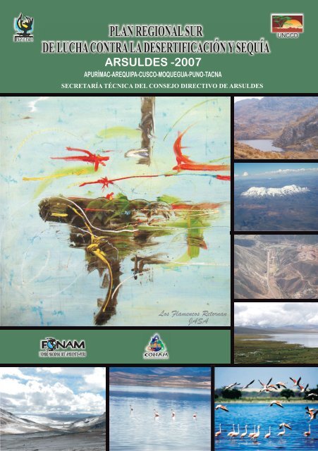
PLAN REGIONAL SUR<br />
DE LUCHA CONTRA LA DESERTIFICACIÓN Y SEQUÍA<br />
ARSULDES -2007<br />
APURÍMAC-AREQUIPA-CUSCO-MOQUEGUA-PUNO-TACNA<br />
SECRETARÍA TÉCNICA DEL CONSEJO DIRECTIVO DE ARSULDES<br />
Los F<strong>la</strong>mencos Retornan<br />
JASA<br />
UNCCD
PLAN REGIONAL SUR<br />
DE LUCHA CONTRA LA DESERTIFICACIÓN Y SEQUÍA<br />
ARSULDES -2007<br />
APURÍMAC-AREQUIPA-CUSCO-MOQUEGUA-PUNO-TACNA<br />
SECRETARÍA TÉCNICA DEL CONSEJO DIRECTIVO DE ARSULDES
Participantes en el Consejo Directivo - Arsul<strong>de</strong>s<br />
DEPARTAMENTO INSTITUCIÓN NOMBRES<br />
Arequipa<br />
Moquegua<br />
Tacna<br />
Cusco<br />
Apurímac<br />
Puno<br />
Sec. Téc. ARSULDES - CONAM Eduardo Ta<strong>la</strong>vera Ampuero<br />
INRENA - RNSAB Arturo Cornejo Farfán<br />
Direción Regional Agraria Percy Velásquez Arpasi<br />
Direción Regional Agraria Pedro López Vargas<br />
Gobierno Regional Pablo Herrera Rosales<br />
Asociasión Civil Labor Anthony Jo Noles<br />
Direción Regional Agraria Fernando Cassana Torres<br />
Direción Regional Agraria Pame<strong>la</strong> Vega A<strong>la</strong>y<br />
Direción Regional Agraria Jorge Luis Zea Alvarado<br />
CAR Cusco Rosa Urrunaga Soria<br />
ATFFS - INRENA Hernán Mormontoy Santan<strong>de</strong>r<br />
Gobierno Regional Cusco Elvio Quispe Cal<strong>de</strong>rón<br />
ATFFS - INRENA Gregorio Inca Roca Concha<br />
Gobierno Regional Apurímac Felio Cal<strong>de</strong>rón De La Torre<br />
Gobierno Regional Apurímac Ismael Zanabria Huamaní<br />
Gobierno Regional Apurímac José Antonio Del Risco Eggart<br />
Soluciones Prácticas - ITDG Jaime Pérez Salinas<br />
CAR Puno Rvdo. Juan Valero Gallegos<br />
ATFFS - INRENA Juan Carlos Barahona<br />
INRENA Ing. Delia Arana Chávez<br />
SER Cusco-Puno-Apurímac<br />
Ing. Carlos Sa<strong>la</strong>zar Herrera<br />
Ing. Eliana Grajeda Puelles
ÍNDICE<br />
Página<br />
1. Presentación 5<br />
2. Antece<strong>de</strong>ntes 6<br />
3. Resumen ejecutivo 8<br />
4. Diagnósticos Departamentales 9<br />
4.1 Apurímac 9<br />
4.2 Arequipa 19<br />
4.3 Cusco 29<br />
4.4 Moquegua 39<br />
4.5 Puno 49<br />
4.6 Tacna 61<br />
5. Matriz <strong>de</strong>l P<strong>la</strong>n Regional Sur <strong>de</strong> Lucha <strong>contra</strong> <strong>la</strong> Desertificación y Sequía 73<br />
6. Bibliografía 74<br />
7. Anexos 74<br />
7.1 Acta <strong>de</strong> conformación <strong>de</strong> <strong>la</strong> ARSULDES 75<br />
7.2 Glosario <strong>de</strong> términos 76<br />
7.3 Lista <strong>de</strong> acrónimos 78<br />
PLAN REGIONAL SUR DE LUCHA CONTRA LA DESERTIFICACIÓN Y SEQUÍA<br />
03
1. Presentación<br />
El presente documento constituye un gran esfuerzo por consolidar un frente conjunto y<br />
organizado para <strong>lucha</strong>r eficaz y eficientemente <strong>contra</strong> el avance <strong>de</strong> <strong>la</strong> <strong>de</strong>sertificación y los<br />
efectos negativos <strong>de</strong> <strong>la</strong> <strong>sequía</strong>, y permite comprobar que <strong>la</strong> constancia, <strong>la</strong> suma <strong>de</strong> capacida<strong>de</strong>s<br />
y conocimientos logran avances progresivos que se van constituyendo en instrumentos base<br />
que orientan <strong>la</strong> acción <strong>p<strong>la</strong>n</strong>ificada.<br />
Consi<strong>de</strong>ramos que un problema prioritario para el país, en particu<strong>la</strong>r para los <strong>de</strong>partamentos<br />
que integran <strong>la</strong> ARSULDES, es <strong>la</strong> pérdida progresiva <strong>de</strong> suelo y <strong>de</strong> los recursos naturales<br />
asociados y que muy difícilmente se pue<strong>de</strong> pensar en un <strong>de</strong>sarrollo sostenible, si no se articu<strong>la</strong><br />
con <strong>la</strong>s políticas <strong>de</strong> <strong>de</strong>sarrollo económico y social.<br />
Somos conscientes que este es un primer paso en un <strong>la</strong>rgo camino, sin embargo el reto es<br />
conseguir que se sigan dando pasos consistentes, alejando <strong>la</strong> improvisación en <strong>la</strong> toma <strong>de</strong><br />
<strong>de</strong>cisiones; somos optimistas al pensar que es posible cumplir con el principio <strong>de</strong> <strong>p<strong>la</strong>n</strong>ificar <strong>de</strong><br />
abajo hacia arriba, establecido en <strong>la</strong> Convención <strong>de</strong> <strong>la</strong>s Naciones Unidas <strong>de</strong> Lucha <strong>contra</strong> <strong>la</strong><br />
Desertificación y Sequía. En el presente documento se p<strong>la</strong>sma un avance importante, ya que<br />
representa el esfuerzo <strong>de</strong> varias organizaciones a través <strong>de</strong> sus representantes, que han podido<br />
consensuar objetivos comunes y transversales a los 6 <strong>de</strong>partamentos que integran <strong>la</strong><br />
ARSULDES: Apurímac, Arequipa, Moquegua, Cusco, Puno y Tacna.<br />
Un eje importante para el <strong>de</strong>sarrollo <strong>de</strong>l proceso, ha sido el tener como sustento, en primer<br />
lugar, <strong>la</strong> Convención <strong>de</strong> Lucha <strong>contra</strong> <strong>la</strong> Desertificación y Sequía <strong>de</strong> <strong>la</strong>s Naciones Unidas, y<br />
luego en el ámbito nacional, el Programa <strong>de</strong> Acción Nacional <strong>de</strong> Lucha <strong>contra</strong> <strong>la</strong><br />
Desertificación y Sequía, que ha permitido mantener <strong>la</strong> coherencia y articu<strong>la</strong>ción necesarias.<br />
En los párrafos siguientes, p<strong>la</strong>smamos algunas referencias sobre <strong>la</strong> realidad <strong>de</strong> los <strong>de</strong>siertos y<br />
sus características, que esperamos permitan valorarlos en su justa dimensión.<br />
Los <strong>de</strong>siertos se extien<strong>de</strong>n en nuestro <strong>p<strong>la</strong>n</strong>eta a lo <strong>la</strong>rgo <strong>de</strong> dos franjas parale<strong>la</strong>s al ecuador, entre<br />
los 25º y los 35º <strong>de</strong> <strong>la</strong>titud, tanto en el hemisferio norte como en el hemisferio <strong>sur</strong>.<br />
El bioma <strong>de</strong> <strong>de</strong>sierto pue<strong>de</strong> <strong>de</strong>finirse climatológicamente como <strong>la</strong> suma <strong>de</strong> todas <strong>la</strong>s zonas<br />
áridas e hiperáridas <strong>de</strong>l mundo, biológicamente se consi<strong>de</strong>ran como <strong>la</strong>s ecorregiones que<br />
contienen <strong>p<strong>la</strong>n</strong>tas y animales adaptados para sobrevivir en medios áridos, y, físicamente, como<br />
amplias zonas contiguas con gran<strong>de</strong>s extensiones <strong>de</strong> suelo <strong>de</strong>snudo y escasa vegetación. Al<br />
sobreponer <strong>la</strong>s zonas en estas tres categorías se produce un mapa que muestra una <strong>de</strong>finición<br />
compuesta <strong>de</strong> los <strong>de</strong>siertos <strong>de</strong>l mundo, los cuales ocupan casi una cuarta parte <strong>de</strong> <strong>la</strong> superficie<br />
2<br />
terrestre, es <strong>de</strong>cir, alre<strong>de</strong>dor <strong>de</strong> 33,7 millones <strong>de</strong> km .<br />
Las precipitaciones no llegan a los 250 mm por año, mientras que <strong>la</strong> temperatura media anual es<br />
<strong>de</strong> 30 ºC. Los <strong>de</strong>siertos no son regiones muertas, conservan una pob<strong>la</strong>ción <strong>de</strong> flora y fauna que<br />
se ha adaptado a estas condiciones extremas, y que mantienen pueblos enteros, a<strong>de</strong>más,<br />
<strong>de</strong>spués <strong>de</strong> una lluvia repentina, una superficie <strong>de</strong>sértica pue<strong>de</strong> ver crecer <strong>la</strong> presencia <strong>de</strong><br />
<strong>p<strong>la</strong>n</strong>tas, flores y pequeños animales.<br />
Aportan sequedad <strong>la</strong>s corrientes marinas frías que pasan por <strong>la</strong>s costas <strong>de</strong> algunos continentes,<br />
formando <strong>de</strong>siertos <strong>de</strong> franja, como el <strong>de</strong> Atacama, en Chile y Perú. En los <strong>de</strong>siertos tropicales<br />
cálidos, cuyo ejemplo típico es el Sahara, <strong>la</strong> escasez <strong>de</strong> vapor <strong>de</strong> agua en <strong>la</strong> atmósfera hace que<br />
un 90% <strong>de</strong>l calor <strong>de</strong>l sol llegue hasta el suelo.<br />
Algunos <strong>de</strong>siertos reciben más precipitaciones en invierno; en otros, pue<strong>de</strong> no llover durante<br />
varios años. Las semil<strong>la</strong>s sobreviven protegidas por sus duras cortezas; cuando llueve,<br />
germinan con rapi<strong>de</strong>z. Rápidamente <strong>la</strong>s <strong>p<strong>la</strong>n</strong>tas crecen, florecen y generan nuevas semil<strong>la</strong>s. Las<br />
que no mueren enseguida <strong>de</strong>ben resistir el clima seco y, por un mecanismo <strong>de</strong> adaptación a <strong>la</strong><br />
<strong>sequía</strong>, absorben y conservan agua.<br />
PLAN REGIONAL SUR DE LUCHA CONTRA LA DESERTIFICACIÓN Y SEQUÍA<br />
05
Actualmente unos 500 millones <strong>de</strong> personas viven en <strong>de</strong>siertos y márgenes <strong>de</strong><br />
<strong>de</strong>siertos, totalizando el 8% <strong>de</strong> <strong>la</strong> pob<strong>la</strong>ción mundial.<br />
2. Antece<strong>de</strong>ntes<br />
A lo <strong>la</strong>rgo <strong>de</strong> <strong>la</strong> costa <strong>de</strong>l Pacífico, <strong>de</strong>s<strong>de</strong> el norte <strong>de</strong>l Perú hasta el norte <strong>de</strong> Chile se<br />
extien<strong>de</strong> uno <strong>de</strong> los <strong>de</strong>siertos más áridos <strong>de</strong>l mundo, conocido como el <strong>de</strong>sierto<br />
<strong>de</strong>l Pacífico. A pesar <strong>de</strong> <strong>la</strong>s extremas condiciones <strong>de</strong> ari<strong>de</strong>z, presenta una<br />
interesante variedad <strong>de</strong> ecosistemas y una biodiversidad especial.<br />
La principal causa para que sea uno <strong>de</strong> los <strong>de</strong>siertos más secos <strong>de</strong>l mundo, son los<br />
Anticiclones <strong>de</strong>l Pacífico, por otra parte <strong>la</strong> Corriente <strong>de</strong> Humboldt transporta agua<br />
fría <strong>de</strong>s<strong>de</strong> <strong>la</strong> Antártica hacia el norte a lo <strong>la</strong>rgo <strong>de</strong> <strong>la</strong> costa chilena, el último factor<br />
es <strong>la</strong> Cordillera <strong>de</strong> los An<strong>de</strong>s, creando ecosistemas costeros compuestos por<br />
cactus, suculentas y otras especies xerofíticas.<br />
El avance <strong>de</strong> <strong>la</strong> <strong>de</strong>sertificación y <strong>la</strong> <strong>sequía</strong> es uno <strong>de</strong> los problemas ambientales<br />
que ha causado y causa mayores repercusiones en <strong>la</strong> pob<strong>la</strong>ción, especialmente<br />
afectada se ve <strong>la</strong> zona Sur Occi<strong>de</strong>ntal <strong>de</strong>l Perú, ya que una parte importante <strong>de</strong> su<br />
territorio se ubica en áreas áridas, semiáridas y subhúmedas secas; a nivel<br />
nacional estas áreas constituyen <strong>la</strong> tercera parte <strong>de</strong>l territorio (38 %), en <strong>la</strong> que se<br />
asienta alre<strong>de</strong>dor <strong>de</strong>l 90 % <strong>de</strong> nuestra pob<strong>la</strong>ción, y concentra gran parte <strong>de</strong> <strong>la</strong>s<br />
activida<strong>de</strong>s económicas <strong>de</strong>l país.<br />
“La Convención <strong>de</strong> <strong>la</strong>s Naciones Unidas <strong>de</strong> Lucha Contra <strong>la</strong> Desertificación <strong>de</strong><br />
los países afectados por Sequía Grave o Desertificación, en particu<strong>la</strong>r en África”,<br />
fue resultado <strong>de</strong> un l<strong>la</strong>mamiento realizado por <strong>la</strong> Conferencia <strong>de</strong> <strong>la</strong>s Naciones<br />
Unidas sobre el Medio Ambiente y el Desarrollo, conocida como <strong>la</strong> Cumbre para<br />
<strong>la</strong> Tierra que se llevo a cabo en junio <strong>de</strong> 1992 en Río <strong>de</strong> Janeiro, Brasil. Después <strong>de</strong><br />
06 PLAN REGIONAL SUR DE LUCHA CONTRA LA DESERTIFICACIÓN Y SEQUÍA
un año <strong>de</strong> negociaciones con más <strong>de</strong> 100 países.<br />
La Convención fue adoptada en París, el 17 <strong>de</strong> junio <strong>de</strong> 1 994, suscrita por el Perú<br />
el 15 <strong>de</strong> octubre <strong>de</strong> 1 994 y aprobada por el Congreso <strong>de</strong> <strong>la</strong> República <strong>de</strong>l Perú<br />
mediante Resolución Legis<strong>la</strong>tiva NE26536, <strong>de</strong> fecha 02 <strong>de</strong> octubre <strong>de</strong> 1 995,<br />
estableciéndose como punto focal al Instituto Nacional <strong>de</strong> Recursos Naturales-<br />
INRENA.<br />
La convención establece un marco para que los programas nacionales,<br />
sub<strong>regional</strong>es y <strong>regional</strong>es combatan <strong>la</strong> <strong>de</strong>gradación <strong>de</strong> <strong>la</strong>s tierras secas, que<br />
incluyen <strong>la</strong>s pra<strong>de</strong>ras semiáridas y los <strong>de</strong>siertos. Se diferencia <strong>de</strong> los esfuerzos<br />
anteriores porque compromete a los gobiernos en una política <strong>de</strong> abajo hacia<br />
arriba en <strong>la</strong> que participan <strong>la</strong>s pob<strong>la</strong>ciones locales, <strong>la</strong>s autorida<strong>de</strong>s <strong>de</strong> todos los<br />
niveles y <strong>la</strong> comunidad internacional.<br />
Dada <strong>la</strong> trascen<strong>de</strong>ncia que tiene este problema ambiental para el país, mediante<br />
resolución ministerial NE 0535-93/RE se conformó el Grupo <strong>de</strong> Trabajo<br />
encargado <strong>de</strong> e<strong>la</strong>borar <strong>la</strong> posición nacional <strong>de</strong>l Perú sobre <strong>de</strong>sertificación y<br />
<strong>sequía</strong>, para su inclusión en <strong>la</strong> Convención <strong>de</strong> <strong>la</strong>s Naciones Unidas <strong>de</strong> Lucha<br />
Contra <strong>la</strong> Desertificación <strong>de</strong> los países afectados por Sequía Grave o<br />
Desertificación, en particu<strong>la</strong>r en África.<br />
Con el apoyo <strong>de</strong> <strong>la</strong> FAO, se realizó un Taller Nacional, para e<strong>la</strong>borar el documento<br />
final <strong>de</strong>l Programa <strong>de</strong> Acción Nacional sobre <strong>la</strong> Lucha <strong>contra</strong> <strong>la</strong> Desertificación<br />
en el Perú-PAN-Perú, documento proceso, que evoluciona con los nuevos<br />
<strong>p<strong>la</strong>n</strong>teamientos emanados <strong>de</strong> <strong>la</strong> convención, requerimientos <strong>de</strong>l país y <strong>de</strong> los<br />
<strong>de</strong>partamentos. En ese contexto es que el Perú presenta cada dos años informes<br />
nacionales <strong>de</strong> avances <strong>de</strong>l PAN-Perú, los que son e<strong>la</strong>borados a través <strong>de</strong> talleres<br />
en <strong>la</strong>s zonas norte, centro y <strong>sur</strong>.<br />
El PAN-Perú consi<strong>de</strong>ra para su implementación, <strong>la</strong> organización <strong>de</strong> tres<br />
asociaciones <strong>regional</strong>es: <strong>la</strong> Norte, <strong>la</strong> Centro y <strong>la</strong> Sur y <strong>de</strong> una Comisión Nacional.<br />
En el año 2001, <strong>la</strong> Comisión Ambiental Regional Arequipa-CAR Arequipa, en el<br />
marco <strong>de</strong>l P<strong>la</strong>n <strong>de</strong> Acción Ambiental Regional <strong>de</strong> Arequipa, don<strong>de</strong> se consi<strong>de</strong>ra<br />
como uno <strong>de</strong> los objetivos <strong>de</strong> <strong>la</strong> Agenda Ambiental Regional Arequipa, <strong>p<strong>la</strong>n</strong>tear<br />
acciones que conlleven a <strong>la</strong> disminución <strong>de</strong>l acelerado proceso <strong>de</strong> <strong>de</strong>sertificación<br />
en el territorio <strong>de</strong>partamental y teniendo en cuenta que ambientalmente Arequipa<br />
forma parte <strong>de</strong>l <strong>de</strong>sierto <strong>de</strong>l Pacífico (o gran <strong>de</strong>sierto costero peruano-chileno);<br />
luego <strong>de</strong> un proceso participativo, don<strong>de</strong> se trató <strong>la</strong> <strong>de</strong>sertificación en Arequipa;<br />
<strong>la</strong> CAR Arequipa solicitó al Consejo Directivo <strong>de</strong>l CONAM, <strong>la</strong> creación <strong>de</strong> un<br />
Grupo Técnico Regional con el fin <strong>de</strong> e<strong>la</strong>borar el P<strong>la</strong>n <strong>de</strong> Lucha Contra <strong>la</strong><br />
Desertificación <strong>de</strong>l <strong>de</strong>partamento <strong>de</strong> Arequipa.<br />
El Grupo Técnico, termina <strong>de</strong> e<strong>la</strong>borar el indicado P<strong>la</strong>n, en el año 2 004, el mismo<br />
que es ampliamente difundido empezando con una presentación pública.<br />
El 2 006 se crea a través <strong>de</strong>l Decreto Supremo 022-2006-AG, <strong>la</strong> Comisión<br />
PLAN REGIONAL SUR DE LUCHA CONTRA LA DESERTIFICACIÓN Y SEQUÍA<br />
07
Nacional <strong>de</strong> Lucha <strong>contra</strong> <strong>la</strong> Desertificación y Sequía-CONALDES, bajo <strong>la</strong><br />
presi<strong>de</strong>ncia <strong>de</strong>l INRENA; <strong>la</strong> que tiene <strong>la</strong> responsabilidad <strong>de</strong> <strong>de</strong>terminar <strong>la</strong> Política<br />
Nacional <strong>de</strong> Lucha <strong>contra</strong> <strong>la</strong> Desertificación y Mitigación <strong>de</strong> los efectos <strong>de</strong> <strong>la</strong><br />
Sequía, y articu<strong>la</strong>r los esfuerzos <strong>de</strong>l Estado en todos sus niveles <strong>de</strong> Gobierno, <strong>de</strong><br />
<strong>la</strong>s comunida<strong>de</strong>s afectadas, <strong>la</strong>s organizaciones no gubernamentales, el sector<br />
privado y pob<strong>la</strong>ción en general, para <strong>la</strong> implementación <strong>de</strong> <strong>la</strong> Convención.<br />
El mismo año, en el mes <strong>de</strong> mayo, <strong>la</strong> Secretaría Ejecutiva Regional Arequipa-<br />
Moquegua-Tacna <strong>de</strong>l Consejo Nacional <strong>de</strong>l Ambiente, en coordinación con el<br />
INRENA y con el apoyo <strong>de</strong>l FONAM y <strong>de</strong>l Grupo Técnico <strong>de</strong> Lucha <strong>contra</strong> <strong>la</strong><br />
Desertificación y Sequía <strong>de</strong> Arequipa, organiza un taller en Arequipa, para <strong>la</strong><br />
conformación <strong>de</strong> <strong>la</strong> Asociación Regional Sur <strong>de</strong> Lucha <strong>contra</strong> <strong>la</strong> Desertificación y<br />
Sequía-ARSULDES; para lo cual se convocó a través <strong>de</strong> <strong>la</strong>s respectivas<br />
Comisiones Ambientales Regionales a representantes <strong>de</strong> organizaciones <strong>de</strong> seis<br />
<strong>de</strong>partamentos: Apurímac, Arequipa, Cusco, Moquegua, Puno y Tacna. Dando<br />
como resultado <strong>la</strong> <strong>de</strong>terminación <strong>de</strong> <strong>la</strong>s funciones <strong>de</strong> ARSULDES, <strong>la</strong><br />
conformación <strong>de</strong> su Consejo Directivo, el que está integrado por representantes<br />
<strong>de</strong> los seis <strong>de</strong>partamentos y <strong>la</strong> elección <strong>de</strong> <strong>la</strong> Secretaría Técnica <strong>de</strong>l Consejo<br />
Directivo que recayó en el representante <strong>de</strong> Arequipa, Secretario Ejecutivo<br />
Regional Arequipa-Moquegua-Tacna <strong>de</strong>l CONAM; y que en consecuencia pasa a<br />
integrar <strong>la</strong> Comisión Nacional <strong>de</strong> Lucha <strong>contra</strong> <strong>la</strong> Desertificación y Sequía-<br />
CONALDES, en su calidad <strong>de</strong> representante <strong>de</strong> ARSULDES.<br />
El 27 <strong>de</strong> octubre <strong>de</strong>l 2 006, se lleva a cabo <strong>la</strong> sesión <strong>de</strong> insta<strong>la</strong>ción <strong>de</strong>l Consejo<br />
Directivo <strong>de</strong> ARSULDES en Moquegua, don<strong>de</strong> se aprueba el <strong>p<strong>la</strong>n</strong> <strong>de</strong> trabajo y se<br />
<strong>de</strong>fine que <strong>de</strong>ben e<strong>la</strong>borarse los diagnósticos <strong>de</strong> cada <strong>de</strong>partamento integrante,<br />
para luego continuar con el proceso <strong>de</strong> e<strong>la</strong>boración <strong>de</strong>l P<strong>la</strong>n Regional Sur <strong>de</strong><br />
Lucha <strong>contra</strong> <strong>la</strong> Desertificación y Sequía a través <strong>de</strong> talleres.<br />
Finalmente, en el año 2 007 se realizan 2 talleres <strong>de</strong> <strong>p<strong>la</strong>n</strong>ificación, el primero en<br />
Tacna el 06 <strong>de</strong> julio y el segundo en Arequipa el 14 <strong>de</strong> diciembre, ambos talleres<br />
contaron con <strong>la</strong> participación <strong>de</strong> representantes <strong>de</strong> los seis <strong>de</strong>partamentos<br />
integrantes <strong>de</strong> ARSULDES.<br />
El resultado <strong>de</strong> este proceso es el que se p<strong>la</strong>sma en el presente documento, que se<br />
insume <strong>de</strong>l trabajo realizado en los seis <strong>de</strong>partamentos a través <strong>de</strong> Grupos<br />
Técnicos <strong>de</strong> Lucha <strong>contra</strong> <strong>la</strong> <strong>de</strong>sertificación y Sequía en unos casos y <strong>de</strong> Gestión<br />
<strong>de</strong> Cuencas en otros.<br />
3. Resumen Ejecutivo<br />
La realidad común respecto al problema <strong>de</strong> avance <strong>de</strong> <strong>la</strong> <strong>de</strong>sertificación, en los 6<br />
<strong>de</strong>partamentos que integran <strong>la</strong> ARSULDES, se pue<strong>de</strong> observar en <strong>la</strong> revisión <strong>de</strong> sus<br />
diagnósticos; fundamentalmente respecto a <strong>la</strong> pérdida <strong>de</strong> suelo como resultado <strong>de</strong><br />
procesos <strong>de</strong> erosión y uso ineficiente <strong>de</strong>l agua, así como <strong>la</strong> inci<strong>de</strong>ncia <strong>de</strong> <strong>la</strong><br />
08 PLAN REGIONAL SUR DE LUCHA CONTRA LA DESERTIFICACIÓN Y SEQUÍA
variabilidad climática en procesos <strong>de</strong> <strong>sequía</strong> recurrentes, asimismo le dan una<br />
importancia significativa a <strong>la</strong> actividad agraria.<br />
Se evi<strong>de</strong>ncia que los <strong>de</strong>partamentos <strong>de</strong> Arequipa, Moquegua y Tacna presentan una<br />
pob<strong>la</strong>ción mayormente urbana, siendo el caso más significativo el <strong>de</strong> Tacna que<br />
tiene un 91 % <strong>de</strong> pob<strong>la</strong>ción urbana; a diferencia <strong>de</strong> los <strong>de</strong>partamentos <strong>de</strong> Apurímac,<br />
Cusco y Puno, don<strong>de</strong> se presenta una menor pob<strong>la</strong>ción urbana, siendo Apurímac el<br />
<strong>de</strong>partamento con <strong>la</strong> mas baja pob<strong>la</strong>ción urbana, con un 38 %.<br />
Las precipitaciones son mayores en los <strong>de</strong>partamentos <strong>de</strong> Apurímac, Cusco y Puno;<br />
siendo particu<strong>la</strong>rmente escasas en los <strong>de</strong>partamentos <strong>de</strong> Arequipa, Moquegua y<br />
Tacna, los que tienen áreas extensas costeras.<br />
La tasa <strong>de</strong> analfabetismo es significativa en los seis <strong>de</strong>partamentos, sobre todo en <strong>la</strong>s<br />
zonas rurales y en particu<strong>la</strong>r en <strong>la</strong>s mujeres; por otro <strong>la</strong>do se observa una distribución<br />
asimétrica <strong>de</strong> <strong>la</strong> pob<strong>la</strong>ción y calidad <strong>de</strong> vida limitada en zonas <strong>de</strong> cabecera <strong>de</strong> cuenca.<br />
En lo que respecta a fuentes <strong>de</strong> energía, se observa un uso importante <strong>de</strong> leña, lo que<br />
contribuye a <strong>la</strong> pérdida <strong>de</strong> vegetación exponiendo los suelos a <strong>la</strong> erosión, problema<br />
que se <strong>de</strong>sarrol<strong>la</strong> principalmente en <strong>la</strong> sierra por su elevada pendiente.<br />
Por otro <strong>la</strong>do, <strong>la</strong>s activida<strong>de</strong>s mineras, que incluye gran minería y minería artesanal,<br />
se vienen incrementando en los <strong>de</strong>partamentos que integran <strong>la</strong> ARSULDES.<br />
Entre los problemas comunes en los seis <strong>de</strong>partamentos y que contribuyen al avance<br />
<strong>de</strong> <strong>la</strong> <strong>de</strong>sertificación, se encuentran: <strong>la</strong> contaminación por residuos sólidos, <strong>la</strong><br />
contaminación por aguas servidas y efluentes sin tratar y <strong>la</strong> pérdida <strong>de</strong> vegetación en<br />
cabeceras <strong>de</strong> cuencas, entre <strong>la</strong>s causas <strong>de</strong> este último, está el sobrepastoreo y <strong>la</strong><br />
<strong>de</strong>forestación.<br />
Es necesario seña<strong>la</strong>r que en el proceso <strong>de</strong> <strong>p<strong>la</strong>n</strong>ificación han participado<br />
representantes <strong>de</strong> los seis <strong>de</strong>partamentos y que han hecho un esfuerzo importante<br />
para priorizar objetivos comunes, que son los siguientes: Educación Ambiental<br />
consolidada, ARSULDES fortalecida, Or<strong>de</strong>namiento Territorial en proceso,<br />
Gestión Integral <strong>de</strong>l recurso hídrico y finalmente Información Meteorológica<br />
histórica generada y difundida; estos 5 objetivos se encuentran <strong>de</strong>sarrol<strong>la</strong>dos en una<br />
matriz, que <strong>de</strong>be permitir pasar a una etapa <strong>de</strong> <strong>p<strong>la</strong>n</strong>ificación más fina que pueda<br />
concretarse en proyectos ejecutados y que nos permitan consolidar una estructura y<br />
acciones para revertir el problema <strong>de</strong> avance <strong>de</strong> <strong>la</strong> <strong>de</strong>sertificación y estar preparados<br />
para enfrentar los periodos <strong>de</strong> <strong>sequía</strong>.<br />
4. Diagnósticos Departamentales:<br />
4.1 Apurímac<br />
Aspectos generales<br />
El <strong>de</strong>partamento <strong>de</strong> Apurímac es andino por excelencia, se encuentra ubicado en el<br />
<strong>sur</strong> oriente <strong>de</strong>l territorio peruano, su capital es <strong>la</strong> ciudad <strong>de</strong> Abancay con una altitud<br />
PLAN REGIONAL SUR DE LUCHA CONTRA LA DESERTIFICACIÓN Y SEQUÍA<br />
09
<strong>de</strong> 2 378 m.s.n.m, limita con Cusco, Arequipa y Ayacucho. Posee una acci<strong>de</strong>ntada<br />
geografía montañosa, con altas cumbres y profundo valles. Por estar ubicado en <strong>la</strong><br />
sierra, <strong>la</strong> mayor parte <strong>de</strong>l año su clima es dominado por lluvias y bajas temperaturas.<br />
Tiene una extensión <strong>de</strong> 20 895 kilómetros cuadrados y esta dividido en 7 provincias y<br />
80 distritos.<br />
Demografía<br />
Pob<strong>la</strong>ción (total) (Censo Pob<strong>la</strong>ción 2005):<br />
418 882 habitantes<br />
<br />
Urbana (porcentaje <strong>de</strong>l total) (Proyección INEI 2005):<br />
38%<br />
Rural (porcentaje <strong>de</strong>l total) (Proyección INEI 2005):<br />
62%<br />
Crecimiento <strong>de</strong>mográfico (porcentaje anual) 2005:<br />
Tasa <strong>de</strong> crecimiento anual 2000 – 2005 (INEI): 1%<br />
Esperanza media <strong>de</strong> vida (años) (total Proyecciones):<br />
Esperanza <strong>de</strong> vida al nacer 2000 – 2005 (INEI):<br />
Promedio: 63,7; mujeres: 66,1; hombres: 61,3<br />
Tasa <strong>de</strong> mortalidad infantil (por 1 000 nacidos vivos) (ENDES): 71<br />
Educación<br />
Tasa <strong>de</strong> conclusión <strong>de</strong> primaria (%) (12-14 años <strong>de</strong> edad): 63,0<br />
Tasa <strong>de</strong> conclusión <strong>de</strong> primaria (%) (15-17 años <strong>de</strong> edad): 90,0<br />
Tasa total <strong>de</strong> analfabetismo:<br />
Pob<strong>la</strong>ción Analfabeta y Tasa <strong>de</strong> Analfabetismo<br />
2005<br />
Total Hombres Mujeres<br />
Pob<strong>la</strong>ción <strong>de</strong> 15 años a más 294 844 146 479<br />
Pob<strong>la</strong>ción Analfabeta 75 775 17 870<br />
Tasa <strong>de</strong> Analfabetismo<br />
25,7 12,2<br />
148 365<br />
58 307<br />
39,3<br />
Fuente: Instituto Nacional <strong>de</strong> Estadística e Informática (INEI) X <strong>de</strong> Pob<strong>la</strong>ción y V <strong>de</strong> Vivienda.<br />
INDICADORES BIOFÍSICOS<br />
Clima<br />
Índice <strong>de</strong> ari<strong>de</strong>z:<br />
El Índice <strong>de</strong> Ari<strong>de</strong>z fue calcu<strong>la</strong>do a partir <strong>de</strong> los datos climáticos disponibles para el<br />
valle <strong>de</strong>l Pachachaka (provincias <strong>de</strong> Aymaraes y Abancay), altura <strong>de</strong> 2 000 – 2 500<br />
msnm, lo cual correspon<strong>de</strong> a <strong>la</strong> zona medio andina y al piso yunga.<br />
10 PLAN REGIONAL SUR DE LUCHA CONTRA LA DESERTIFICACIÓN Y SEQUÍA
Julio<br />
Agosto<br />
Septiembre<br />
Octubre<br />
Noviembre<br />
Diciembre<br />
Enero<br />
Febrero<br />
Marzo<br />
Abril<br />
Mayo<br />
Junio<br />
Promedio anual<br />
Pluviometría (mm)<br />
5,10<br />
11,70<br />
18,70<br />
39,3<br />
49,80<br />
65,30<br />
112,20<br />
98,40<br />
89,70<br />
35,10<br />
9,30<br />
6,80<br />
541,40<br />
Fuente: P<strong>la</strong>n Meriss 1998, SENAMHI<br />
ETP (mm)<br />
122,60<br />
134,70<br />
146,90<br />
171,70<br />
162,90<br />
146,90<br />
138,30<br />
128,10<br />
137,20<br />
135,70<br />
130,30<br />
114,50<br />
1669,80<br />
Índice <strong>de</strong> Ari<strong>de</strong>z<br />
0,04<br />
0,09<br />
0,13<br />
0,23<br />
0,31<br />
0,44<br />
0,81<br />
0,77<br />
0,65<br />
0,26<br />
0,07<br />
0,06<br />
0,32<br />
Unida<strong>de</strong>s climáticas<br />
Tasa normal <strong>de</strong> lluvias<br />
Para <strong>de</strong>finir <strong>la</strong> tasa normal y <strong>la</strong> <strong>de</strong>sviación típica <strong>de</strong> lluvias, se han utilizado los datos <strong>de</strong><br />
<strong>la</strong> estación meteorológica <strong>de</strong> Curahuasi (Provincia <strong>de</strong> Abancay, altura <strong>de</strong> 2 700<br />
msnm), lo cual correspon<strong>de</strong> a <strong>la</strong> zona medio andina y al piso quechua con una serie <strong>de</strong><br />
datos <strong>de</strong> 1993 a 2002.<br />
Tasa normal <strong>de</strong> lluvias: 730 mm/año<br />
Desviación típica <strong>de</strong> lluvias: 56 mm<br />
Zonas sub<strong>de</strong>partamentales Precipitación Anual<br />
1. Zona inferior andina (1000 – 2000 msnm)<br />
1 730 mm<br />
2. Zona meso andina (2000 4000 msnm)<br />
716 mm<br />
3. Zona alto andina (4000 5000 msnm) 900 1 000 mm<br />
Fuentes: P<strong>la</strong>n Regional <strong>de</strong> Prevención y atención <strong>de</strong> <strong>de</strong>sastres <strong>de</strong> Apurímac,<br />
P<strong>la</strong>nes estratégicos <strong>de</strong> <strong>de</strong>sarrollo distritales<br />
Albedo <strong>de</strong> <strong>la</strong> superficie<br />
El albedo promedio <strong>de</strong> <strong>la</strong> región Apurímac fue calcu<strong>la</strong>do a partir <strong>de</strong> los datos<br />
siguientes (Proyecto “Sequía y Desertificación” ITDG – Soluciones Prácticas):<br />
- Repartición <strong>de</strong> <strong>la</strong> ocupación <strong>de</strong> los suelos según <strong>la</strong>s nueve categorías <strong>de</strong>terminadas<br />
(estudio Map GeoSolutions)<br />
PLAN REGIONAL SUR DE LUCHA CONTRA LA DESERTIFICACIÓN Y SEQUÍA<br />
11
- Albedo promedio por categoría <strong>de</strong>terminado a partir <strong>de</strong> un estudio bibliográfico<br />
(http://epi.univparis1.fr/servlet/com.univ.col<strong>la</strong>boratif.utils.LectureFichiergw?ID_FICHE=1861&<br />
OBJET=0008&ID_FICHIER=3749,www.educnet.education.fr/obter/principe/albe<br />
do/albedo2.htm, http://horizon.documentation.ird.fr/exldoc/pleins_textes/cahiers/PTP/18278.PDF)<br />
Categoría <strong>de</strong> ocupación <strong>de</strong> los suelos<br />
Agricultura<br />
Bofedales<br />
Bosque / Vegetación Natural<br />
Centros pob<strong>la</strong>dos<br />
Cuerpos <strong>de</strong> agua<br />
Nieve / hielo<br />
Pastos altoandinos<br />
Suelo <strong>de</strong>snudo<br />
Vegetación dispersa<br />
ha<br />
153 073<br />
74 320<br />
75 670<br />
1 106<br />
9 690<br />
9 931<br />
942 057<br />
142 022<br />
628 619<br />
Albedo promedio<br />
(%)<br />
Así, se obtiene un albedo promedio <strong>de</strong> 23% para <strong>la</strong> región Apurímac<br />
Zonas <strong>de</strong> vida<br />
Descripción<br />
Bosque húmedo montano Bajo Suptropical<br />
Bosque húmedo montano Suptropical<br />
Bosque muy húmedo Subaltino Suptropical<br />
Bosque muy húmedo Montano Suptropical<br />
Bosque seco Suptropical<br />
Bosque seco Montano Bajo Suptropical<br />
Estepa Montano Suptropical<br />
Estepa espinosa Montano Bajo Suptropical<br />
Monte espinoso Suptropical<br />
Nivel Suptropical<br />
Páramo húmedo Subaltino Suptropical<br />
Páramo muy húmedo Subaltino Suptropical<br />
Páramo pluvial Subaltino Suptropical<br />
Tundra muy húmeda Alptino S uptropical<br />
Tundra pluvial Alptino Suptropical<br />
Fuente: TOTAL Dirección Regional Agraria Apurímac<br />
20<br />
10<br />
15<br />
10<br />
10<br />
65<br />
25<br />
30<br />
22<br />
24 849<br />
620 794<br />
12 818<br />
31 340<br />
45 349<br />
198 722<br />
5 411<br />
25 544<br />
27 968<br />
15 670<br />
28 538<br />
665 141<br />
20 873<br />
3 972<br />
370 449<br />
2 097 438<br />
ha %<br />
12 PLAN REGIONAL SUR DE LUCHA CONTRA LA DESERTIFICACIÓN Y SEQUÍA<br />
1,2%<br />
29,6%<br />
0,6%<br />
1,5%<br />
2,2%<br />
9,5%<br />
0,3%<br />
1,2%<br />
1,3%<br />
0,7%<br />
1,4%<br />
31,7%<br />
1,0%<br />
0,2%<br />
17,7%<br />
100,0%
Recursos naturales<br />
Apurímac es eminentemente agríco<strong>la</strong>, con presencia <strong>de</strong> pastos naturales (979 000 ha),<br />
aptos para <strong>la</strong> crianza <strong>de</strong> vicuñas, asimismo cuenta con tierras que tienen aptitud<br />
forestal.<br />
Flora<br />
P<strong>la</strong>ntas Medicinales: Huamanripa, l<strong>la</strong>ntén, Ajenjo, Co<strong>la</strong> <strong>de</strong> Caballo, Ortiga, Matico o<br />
Moccomocco, Ruda, Chyllor, Salvia, cofre.<br />
P<strong>la</strong>ntas industriales: Cabuya, Carrizo, aliso, Eucalipto, Molle, Tuna (Cochinil<strong>la</strong>),<br />
Huarango, Ichu, Tara<br />
P<strong>la</strong>ntas Nativas: Queñua, Chachacomo, Tasta, Intimpa, Pisonay, Retama, Nogal.<br />
P<strong>la</strong>ntas Alimenticias: Tuna, Sauco, Ciraca, Fresas silvestres<br />
Fauna<br />
Camélidos Sudamericanos: L<strong>la</strong>ma (Lama G<strong>la</strong>ma Linnaeus), Alpaca (Vicugna Pacos<br />
Linnaeus), Vicuña (Vicugna Vicugna Molina), Puma, Cóndor Andino (Vutur<br />
Gryphus), Oso <strong>de</strong> Anteojos (Tremarctos), Cernícalo, Lechuza, Picaflor, Gavilán.<br />
Recursos Hídricos<br />
Superficie <strong>de</strong> <strong>la</strong>s distintas zonas y los valores <strong>de</strong> reserva <strong>de</strong> agua por zona:<br />
Chincheros<br />
Abancay<br />
Andahuay<strong>la</strong>s<br />
Antabamba<br />
Cotabambas<br />
Grau<br />
Aymaraes<br />
Apurímac-Total<br />
Fuente: INEI, Map GeoSolutions<br />
Superficie (ha)<br />
zonas inferior y<br />
meso andina<br />
97 102<br />
152 203<br />
144 182<br />
23 852<br />
52 905<br />
47 333<br />
95 845<br />
613 422<br />
Superficie<br />
(ha)<br />
zona alto andina<br />
53 659<br />
193 709<br />
259 556<br />
298 429<br />
209 568<br />
165 770<br />
317 030<br />
1 497 721<br />
Recursos disponibles<br />
<strong>de</strong> agua dulce<br />
(millones m³)<br />
303<br />
924<br />
1 187<br />
1 244<br />
904<br />
720<br />
1 381<br />
6 663<br />
3<br />
Los recursos disponibles <strong>de</strong> agua dulce (millones <strong>de</strong> m ) son <strong>de</strong> 6 662 millones <strong>de</strong><br />
m³/año, no obstante, hay que seña<strong>la</strong>r que no se pue<strong>de</strong> utilizar <strong>la</strong> totalidad <strong>de</strong> <strong>la</strong> reserva<br />
hídrica, <strong>de</strong>bido a pérdidas por infiltración.<br />
3 3<br />
Recursos <strong>de</strong> agua dulce per cápita (m ): m /hab/año:<br />
Consi<strong>de</strong>rando una pob<strong>la</strong>ción <strong>de</strong> 418 882 habitantes (INEI – Censo pob<strong>la</strong>cional 2005),<br />
3<br />
los recursos <strong>de</strong> agua dulce per cápita son <strong>de</strong> 15 904 m /hab/año<br />
PLAN REGIONAL SUR DE LUCHA CONTRA LA DESERTIFICACIÓN Y SEQUÍA<br />
13
3<br />
Uso <strong>de</strong>l agua para fines agríco<strong>la</strong>s (millones <strong>de</strong> m ):<br />
Se ha caracterizado los usos domésticos y agropecuarios por distrito, consi<strong>de</strong>rando <strong>la</strong><br />
pob<strong>la</strong>ción actual (Estimación <strong>de</strong>l censo <strong>de</strong> pob<strong>la</strong>ción – INEI, 2005), el número <strong>de</strong><br />
cabezas <strong>de</strong> ganado (Censo Nacional Agropecuario – 1993) y <strong>la</strong> cantidad <strong>de</strong> tierras<br />
cultivadas (Estudio <strong>de</strong> Map GeoSolutions – 2006) y los parámetros siguientes:<br />
- Consumo diario <strong>de</strong> agua para domésticos: 50 L/habitante<br />
- Consumo diario para usos pecuarios: 25 L/cabeza <strong>de</strong> ganado<br />
- Consumo anual para usos agríco<strong>la</strong>s: 7 000 m³ / ha<br />
Abancay<br />
Andahuay<strong>la</strong>s<br />
Antabamba<br />
Aymaraes<br />
Chincheros<br />
Cotabambas<br />
Grau<br />
Apurímac-Total<br />
Usos agríco<strong>la</strong>s<br />
218,42<br />
351,95<br />
39,35<br />
117,58<br />
179,53<br />
87,84<br />
76,84<br />
1 071,51<br />
Fuente: INEI, Map GeoSolutions<br />
Usos pecuarios Usos domésticos Total<br />
1,28<br />
2,97<br />
1,04<br />
0,95<br />
0,89<br />
1,42<br />
1,08<br />
9,63<br />
Superficie agríco<strong>la</strong> sin y con riego según <strong>la</strong>s provincias<br />
Provincia<br />
Abancay<br />
Andahuay<strong>la</strong>s<br />
Antabamba<br />
Aymaraes<br />
Chincheros<br />
Cotabambas<br />
Grau<br />
Total<br />
Total<br />
ha<br />
20 328<br />
51 943<br />
7 045<br />
9 690<br />
14 315<br />
13 599<br />
7 999<br />
124 919<br />
Con riego<br />
ha<br />
10 349<br />
20 421<br />
2 466<br />
5 920<br />
6 441<br />
1 533<br />
2 367<br />
49 497<br />
Sin riego<br />
ha<br />
9 979<br />
31 522<br />
4 579<br />
3 770<br />
7 874<br />
12 066<br />
5 632<br />
75 421<br />
3<br />
Uso <strong>de</strong>l agua para fines industriales (millones <strong>de</strong> m ):<br />
1,85<br />
2,67<br />
0,24<br />
0,59<br />
0,95<br />
0,84<br />
0,49<br />
7,64<br />
Sin riego<br />
%<br />
49<br />
61<br />
65<br />
39<br />
55<br />
89<br />
70<br />
60<br />
221,55<br />
357,58<br />
40,63<br />
119,12<br />
181,38<br />
90,11<br />
78,41<br />
1 088,78<br />
Los usos para fines industriales en Apurímac son poco importantes, dado que el sector<br />
es poco <strong>de</strong>sarrol<strong>la</strong>do en <strong>la</strong> región.<br />
Energía<br />
Recursos hidroenergéticos<br />
14 PLAN REGIONAL SUR DE LUCHA CONTRA LA DESERTIFICACIÓN Y SEQUÍA
Consumo<br />
INEI<br />
CPV 2005<br />
Categorías<br />
Electricidad<br />
Gas<br />
Kerosene<br />
Carbón<br />
Leña<br />
Otro tipo <strong>de</strong> combustible<br />
No cocinan<br />
Total<br />
Casos<br />
391<br />
12 609<br />
1 039<br />
49<br />
80 394<br />
5 074<br />
2 288<br />
101 844<br />
Sector Consumo final –<br />
energía neta (TJ)<br />
Resi<strong>de</strong>ncial<br />
Comercio y servicio<br />
Público<br />
Agropecuario y agroindustrial<br />
Pesca e industria pesquera<br />
Minero metalúrgico<br />
Industrial<br />
Total<br />
Uso <strong>de</strong> energía per cápita:<br />
Fuente <strong>de</strong> energía<br />
Diesel<br />
Kerosene<br />
Gasolina motor<br />
Gas licuado <strong>de</strong> petróleo<br />
Leña<br />
Bosta<br />
Yareta<br />
Electricidad<br />
3 181,4<br />
12,6<br />
1,7<br />
4,2<br />
0<br />
28,8<br />
3<br />
3 231,7<br />
Consumo final –<br />
energía neta (TJ)<br />
22,8<br />
274,0<br />
2,4<br />
59,1<br />
2 748,1<br />
29,8<br />
3,9<br />
91,7<br />
%<br />
0,38%<br />
12,38%<br />
1,02%<br />
0,05%<br />
78,94%<br />
4,98%<br />
2,25%<br />
100,00%<br />
% Energía<br />
neta<br />
98,4<br />
0,4<br />
0,1<br />
0,1<br />
0,0<br />
0,9<br />
0,1<br />
% Energía neta<br />
0,7<br />
8,5<br />
0,1<br />
1,8<br />
85,0<br />
0,9<br />
0,1<br />
2,8<br />
Acumu<strong>la</strong>do %<br />
0,38%<br />
12,76%<br />
13,78%<br />
13,83%<br />
92,77%<br />
97,75%<br />
100,00%<br />
100,00%<br />
Consumo final -<br />
energía útil (TJ)<br />
438,1<br />
5,6<br />
0,7<br />
0,5<br />
0,0<br />
17,4<br />
1,6<br />
Consumo final -<br />
energía útil (TJ)<br />
12,4<br />
64,0<br />
0,3<br />
26,6<br />
302,8<br />
3,2<br />
0,4<br />
54,2<br />
%<br />
Energía útil<br />
2,7<br />
13,8<br />
0,1<br />
5,7<br />
65,3<br />
0,7<br />
0,1<br />
11,7<br />
% Energía<br />
útil<br />
94,4<br />
1,2<br />
0,2<br />
0,1<br />
0,0<br />
3,8<br />
0,3<br />
Consi<strong>de</strong>rando una pob<strong>la</strong>ción <strong>de</strong> 418 882 habitantes (INEI – Censo pob<strong>la</strong>cional 2005),<br />
el uso <strong>de</strong> energía por capita es <strong>de</strong> 0,00771506 TJ/Hab.<br />
Uso <strong>de</strong> energía para fines agríco<strong>la</strong>s por hectárea:<br />
Consi<strong>de</strong>rando 153 073 ha <strong>de</strong> cultivos (Map GeoSolutions), el uso <strong>de</strong> energía para<br />
fines agríco<strong>la</strong>s por hectárea es <strong>de</strong> 2,74379E-05 TJ/ha.<br />
Producción<br />
Fuente: Ministerio <strong>de</strong> Energía y Minas – Oficina técnica <strong>de</strong> Energía - Datos <strong>de</strong>l BNEUTIL 1998<br />
PLAN REGIONAL SUR DE LUCHA CONTRA LA DESERTIFICACIÓN Y SEQUÍA<br />
15
Uso <strong>de</strong> <strong>la</strong>s tierras<br />
NDVI (índice normalizado <strong>de</strong> vegetación):<br />
Los datos <strong>de</strong> NDVI y <strong>la</strong> ocupación <strong>de</strong>l suelo provienen <strong>de</strong> un estudio <strong>regional</strong> <strong>de</strong><br />
tele<strong>de</strong>tección realizado a partir <strong>de</strong> imágenes raster <strong>de</strong> resolución 15 x 15 m y <strong>de</strong> los<br />
años 2004 – 2005 por <strong>la</strong> empresa Map GeoSolutions (proyecto “Fortalecimiento <strong>de</strong><br />
capacida<strong>de</strong>s <strong>de</strong> comunida<strong>de</strong>s campesinas pobres para reducir su vulnerabilidad<br />
frente a problemas <strong>de</strong> <strong>sequía</strong> y <strong>de</strong>sertificación”)<br />
Cubierta vegetal (porcentaje <strong>de</strong> <strong>la</strong> superficie total):<br />
Grau<br />
Cotabambas<br />
Chincheros<br />
Aymaraes<br />
Antabamba<br />
Andahuay<strong>la</strong>s<br />
Abancay<br />
Apurímac<br />
Bosque (bosques naturales y<br />
reforestación <strong>de</strong> eucaliptos)<br />
3 706<br />
4 934<br />
13 506<br />
9 166<br />
2 508<br />
15 320<br />
26 530<br />
75 670<br />
Pastos altoandinos<br />
ha % ha %<br />
1,7<br />
1,9<br />
9,0<br />
2,2<br />
0,8<br />
3,8<br />
7,7<br />
3,6<br />
118 422<br />
148 218<br />
21 770<br />
209 016<br />
194 948<br />
138 417<br />
111 267<br />
942 057<br />
55,6<br />
56,5<br />
14,5<br />
50,6<br />
60,5<br />
34,3<br />
32,2<br />
44,7<br />
Fuente: Map Geosolutions, Proyecto “Sequía y Desertificación” ITDG – Soluciones Prácticas<br />
Uso <strong>de</strong> <strong>la</strong>s tierras (porcentaje <strong>de</strong> <strong>la</strong> superficie total):<br />
Uso <strong>de</strong> <strong>la</strong> tierra<br />
(ha)<br />
Superficie Agríco<strong>la</strong><br />
Pastizales<br />
De regadío<br />
De secano<br />
Bosques y tierras arbo<strong>la</strong>das<br />
Otras tierras<br />
1994**<br />
124 918,81<br />
49 497,42<br />
75 421,39<br />
892 992,00<br />
130 616,00<br />
941 053,00<br />
Último año con<br />
información disponible*<br />
2004 2006<br />
153 073<br />
16 PLAN REGIONAL SUR DE LUCHA CONTRA LA DESERTIFICACIÓN Y SEQUÍA<br />
-<br />
-<br />
942 057<br />
75 670<br />
918 780<br />
* Fuente: Map Geosolutions, Proyecto “Sequía y Desertificación” ITDG – Soluciones Prácticas<br />
** INEI, Censo nacional Agropecuario, 1994<br />
Economía<br />
PBI (dó<strong>la</strong>res <strong>de</strong> los EE.UU.):<br />
Producto Bruto Interno estimación 2001 (Instituto Nacional <strong>de</strong> Estadística e<br />
Informática-Dirección Nacional <strong>de</strong> Cuentas Nacionales.): 896 millones <strong>de</strong> soles
Producción agríco<strong>la</strong> (en tone<strong>la</strong>das métricas):<br />
Producción agríco<strong>la</strong> 1 998 (Ministerio <strong>de</strong> Agricultura - Oficina Sectorial <strong>de</strong><br />
Estadística): 218 734 t<br />
Producción gana<strong>de</strong>ra (en tone<strong>la</strong>das métricas):<br />
Producción gana<strong>de</strong>ra – carne <strong>de</strong> vacuno y ovino -1 998 (Ministerio <strong>de</strong> Agricultura -<br />
Oficina Sectorial <strong>de</strong> Estadística): 4 472 t<br />
Ingreso Per cápita mensual<br />
137,5 Nuevos Soles<br />
Pob<strong>la</strong>ción Económicamente Activa-PEA<br />
1,27 % (96 558 habitantes) <strong>de</strong> <strong>la</strong> PEA Nacional<br />
Tasa <strong>de</strong> <strong>de</strong>sempleo juvenil (entre 14 y 24 años): 2005<br />
% Pob<strong>la</strong>ción en edad <strong>de</strong> trabajar - PET (15 a más años <strong>de</strong> edad)<br />
Pob<strong>la</strong>ción económicamente activa - PEA (Como % <strong>de</strong> <strong>la</strong> PET)<br />
Subempleo Visible<br />
Subempleo Invisible<br />
A<strong>de</strong>cuadamente empleados<br />
Desempleo<br />
56,5<br />
79,9<br />
7,7<br />
38,6<br />
53,7<br />
1,4<br />
Fuente: MEF-INEI-ENAHO IV trim.2001.ENDES 2000.<br />
Proyecciones <strong>de</strong>partamentales <strong>de</strong> <strong>la</strong> pob<strong>la</strong>ción 1995-2015 (1 999). Compendio Estadístico<br />
Socio<strong>de</strong>mográfico 2 000<br />
Producción gana<strong>de</strong>ra<br />
Producción Pecuaria 2005<br />
Vacuno<br />
Ovino<br />
Alpaca<br />
L<strong>la</strong>ma<br />
Porcino<br />
Caprino<br />
Especie Unidad Meta total programada<br />
Cabezas<br />
Unidad<br />
Unidad<br />
Unidad<br />
Unidad<br />
Unidad<br />
Fuente: Dirección Regional Agraria<br />
190 590<br />
236 870<br />
154 500<br />
37 400<br />
42 720<br />
42 910<br />
PLAN REGIONAL SUR DE LUCHA CONTRA LA DESERTIFICACIÓN Y SEQUÍA<br />
17
Pobreza<br />
Principales variables macro sociales<br />
Provincia<br />
IDH<br />
Esperanza <strong>de</strong> vida<br />
al nacer<br />
Analfabetismo<br />
Logro<br />
educativo<br />
Ingreso familiar<br />
per cápita<br />
Apurímac 0,448<br />
Años<br />
63,0<br />
%<br />
32,2<br />
%<br />
68,0<br />
N.S./mes<br />
133,3<br />
Abancay<br />
Antabamba<br />
0,509<br />
0,459<br />
67,6<br />
61,5<br />
17,0<br />
32,7<br />
75,5<br />
72,8<br />
161,9<br />
142,3<br />
Aimaraes 0,449 61,0<br />
34,8 72,0 130,9<br />
Andahuay<strong>la</strong>s 0,444 63,7<br />
32,6 65,9 133,2<br />
Grau 0,438 60,8<br />
31,3 69,0 130,2<br />
Chincheros 0,438 63,4<br />
32,5 66,1 116,3<br />
Cotabambas 0,400 63,1 44,8 54,9 118,6<br />
Fuente: PNUD<br />
Degradación <strong>de</strong> tierras<br />
Tipos <strong>de</strong> <strong>de</strong>gradación <strong>de</strong> <strong>la</strong>s tierras<br />
Tipo <strong>de</strong> <strong>de</strong>gradación – Zonas en riesgo<br />
Erosión y <strong>de</strong>sertificación: Zonas <strong>de</strong> Agricultura con pendientes superiores a 10% 0,9<br />
Erosión y <strong>de</strong>sertificación: Zonas <strong>de</strong> Agricultura con uso abusivo <strong>de</strong> químicos 3,7<br />
Erosión y <strong>de</strong>sertificación: Zonas <strong>de</strong> Agricultura con pendientes superiores a 10% y uso abusivo<br />
<strong>de</strong> químicos<br />
Erosión y <strong>de</strong>sertificación: Zonas <strong>de</strong> Vegetación dispersa con pendientes superiores a 10%<br />
Erosión y Desertificación: Zonas <strong>de</strong> Pastos altoandinos con riesgo <strong>de</strong> quema y sobrepastoreo<br />
Salinización<br />
Sobresaturación<br />
Fuente: Map Geosolutions, Proyecto “Sequía y Desertificación” ITDG - Soluciones Prácticas”<br />
Ciencia y tecnología<br />
Superficie Total (%) ha<br />
1,4<br />
14,3<br />
45,0<br />
-<br />
-<br />
19 016<br />
77 470<br />
29 659<br />
302 185<br />
942 057<br />
Instituciones científicas que participan en <strong>la</strong> <strong>la</strong>bor re<strong>la</strong>cionada con <strong>la</strong><br />
<strong>de</strong>sertificación en el <strong>de</strong>partamento (número total y nombres)<br />
Aunque existen 3 universida<strong>de</strong>s en el ámbito <strong>regional</strong>: Universidad Nacional Micae<strong>la</strong><br />
Bastidas y <strong>la</strong> Universidad Tecnológica <strong>de</strong> los An<strong>de</strong>s en Abancay, Universidad José<br />
María Arguedas en Andahuay<strong>la</strong>s, no existen en <strong>la</strong> actualidad proyectos <strong>de</strong><br />
investigación en los temas re<strong>la</strong>cionados con <strong>la</strong> <strong>de</strong>sertificación.<br />
Cabe <strong>de</strong>stacar <strong>la</strong> ausencia <strong>de</strong>l INIA en <strong>la</strong> región<br />
18 PLAN REGIONAL SUR DE LUCHA CONTRA LA DESERTIFICACIÓN Y SEQUÍA<br />
-<br />
-
Rehabilitación<br />
Para cuantificar <strong>la</strong>s tierras en proceso <strong>de</strong> rehabilitación, se han consi<strong>de</strong>rado los<br />
proyectos <strong>de</strong>sarrol<strong>la</strong>dos por <strong>la</strong>s instituciones siguientes: Gobierno <strong>regional</strong>,<br />
MARENASS y PRONAMACHCS, aunque existen proyectos <strong>de</strong> menor importancia<br />
ejecutados por <strong>la</strong>s ONG <strong>de</strong>l <strong>de</strong>partamento<br />
Tierras en proceso <strong>de</strong> rehabilitación Institución Zona Periodo<br />
Rehabilitación <strong>de</strong> tierras <strong>de</strong> cultivo<br />
PRONAMACHCS Región (2 949 ha) 2001 – 2003<br />
<strong>de</strong>gradadas<br />
Región (1 232 ha) 2005 - 2006<br />
MARENASS Región (apoyo a <strong>la</strong>s<br />
Terrazas<br />
comunida<strong>de</strong>s)<br />
Rehabilitación <strong>de</strong> pastizales <strong>de</strong>gradados MARENASS Región (apoyo a <strong>la</strong>s<br />
comunida<strong>de</strong>s)<br />
Rehabilitación <strong>de</strong> bosques <strong>de</strong>gradados Gobierno Regional Abancay, Aymaraes,<br />
Antabamba (2 500 ha)<br />
2007 - 2008<br />
Proyectos <strong>de</strong> reforestación<br />
Gobierno Regional Andahuay<strong>la</strong>s, Inicio 2008<br />
Gobierno Regional<br />
Chincheros (4 500 ha)<br />
Grau (10 000 ha),<br />
Cotabambas (10 000<br />
ha)<br />
Inicio 2008 - 2009<br />
PRONAMACHCS Región (2 184 ha)<br />
Región (1 862 ha)<br />
2001 – 2003<br />
2005 - 2006<br />
MARENASS<br />
Fuentes en que se basan los datos<br />
Región (apoyo a <strong>la</strong>s<br />
comunida<strong>de</strong>s)<br />
Fuente: LA SEQUÍA Y LA DESERTIFICACIÓN EN APURÍMAC –<br />
DIAGNÓSTICO (Documento <strong>de</strong>l proyecto “Fortalecimiento <strong>de</strong> capacida<strong>de</strong>s <strong>de</strong><br />
comunida<strong>de</strong>s campesinas pobres para reducir su vulnerabilidad frente a problemas <strong>de</strong><br />
<strong>sequía</strong> y <strong>de</strong>sertificación” ejecutado por <strong>la</strong> ONG ITDG – Soluciones Prácticas en<br />
convenio con el Gobierno Regional <strong>de</strong> Apurímac a través <strong>de</strong> <strong>la</strong> Gerencia <strong>de</strong> Recursos<br />
Naturales y Gestión <strong>de</strong>l Medio Ambiente)<br />
4.2 Arequipa:<br />
Aspectos generales<br />
Demografía<br />
Pob<strong>la</strong>ción (total) 1 140 810 (Censo Pob<strong>la</strong>ción 2005)<br />
Urbana (porcentaje <strong>de</strong>l total) 90,39 % (Proyección INEI 2005)<br />
Rural (porcentaje <strong>de</strong>l total) 9,61 % (Proyección INEI 2005)<br />
PLAN REGIONAL SUR DE LUCHA CONTRA LA DESERTIFICACIÓN Y SEQUÍA<br />
19
Crecimiento <strong>de</strong>mográfico (porcentaje anual) 1,84 % 2005<br />
Esperanza <strong>de</strong> vida al nacer (años) 72,4<br />
Tasa <strong>de</strong> mortalidad infantil (por 1 000 nacidos vivos) 39,9 Total<br />
Salud<br />
2<br />
Educación<br />
Tasa total <strong>de</strong> analfabetismo (porcentaje <strong>de</strong> <strong>la</strong> pob<strong>la</strong>ción <strong>de</strong> 15 o más años <strong>de</strong> edad)<br />
(ENAHO 2004) 9,43 %<br />
INDICADORES BIOFÍSICOS<br />
Clima<br />
3<br />
En <strong>la</strong> región se pue<strong>de</strong>n en<strong>contra</strong>r 5 tipos <strong>de</strong> clima <strong>de</strong>pendiendo <strong>de</strong> <strong>la</strong> altitud y<br />
fisiografía y principalmente <strong>de</strong> <strong>la</strong> temperatura ambiental y <strong>la</strong> precipitación.<br />
Predominan el clima temp<strong>la</strong>do cálido en <strong>la</strong> costa y el frío muy seco con fuertes<br />
variaciones <strong>de</strong> temperatura entre el día y <strong>la</strong> noche en <strong>la</strong> sierra.<br />
Índice <strong>de</strong> ari<strong>de</strong>z : 0,138<br />
Tasa normal <strong>de</strong> lluvias:<br />
1<br />
ESTACIÓN<br />
Imata<br />
Pañe<br />
Fraile<br />
Córpac<br />
Characato<br />
La Pampil<strong>la</strong><br />
La Joya<br />
Vítor<br />
PRECIPITACIONES PROMEDIO ANUAL EN LA CUENCA DE<br />
GESTIÓN QUILCA - CHILI<br />
ALTITUD [msnm] PRECIPITACIÓN PROMEDIO anual [mm]<br />
4 000 519<br />
4 524 710<br />
4 015<br />
5 525<br />
2 451<br />
2 410<br />
1 255<br />
1 552<br />
Zonas sub<strong>de</strong>partamentales<br />
1. COSTA (La Joya)<br />
2. SIERRA (Imata)<br />
309<br />
75<br />
173<br />
63<br />
1,8<br />
17<br />
Precipitación Anual<br />
(mm/mes)<br />
3<br />
520<br />
Zonas <strong>de</strong> vida<br />
Dada <strong>la</strong> configuración fisiográfica y topográfica, <strong>la</strong> región posee una variedad <strong>de</strong><br />
zonas ecológicas o zonas <strong>de</strong> vida, se han i<strong>de</strong>ntificado 27 zonas <strong>de</strong> vida <strong>de</strong> <strong>la</strong>s 104 que<br />
existen en el mundo (ver cuadro). El <strong>de</strong>sierto <strong>de</strong>secado Subtropical y <strong>la</strong> Tundra muy<br />
húmeda alpino subtropical representan el 33,04%, el resto <strong>de</strong> <strong>la</strong>s zonas <strong>de</strong> vida están<br />
asociadas directamente a <strong>la</strong>s condiciones <strong>de</strong> <strong>de</strong>sierto o <strong>de</strong> matorral <strong>de</strong>sértico,<br />
únicamente el 0,17% representa al bosque húmedo montano subtropical<br />
Encuesta Demográfica y <strong>de</strong> Salud Familiar – ENDES: 2000<br />
Encuesta Nacional <strong>de</strong> Hogares ENAHO 2004<br />
El índice <strong>de</strong> ari<strong>de</strong>z representa <strong>la</strong> re<strong>la</strong>ción P/EP, don<strong>de</strong> P = precipitación y PET = evapotranspiración potencial.<br />
2<br />
3<br />
20 PLAN REGIONAL SUR DE LUCHA CONTRA LA DESERTIFICACIÓN Y SEQUÍA<br />
1
DESCRIPCIÓN<br />
1<br />
2<br />
Desierto <strong>de</strong>secado Subtropical<br />
Desierto <strong>de</strong>secado Montano Bajo Subtropical<br />
3 Desierto <strong>de</strong>secado Te mp<strong>la</strong>do Cálido<br />
4 Desierto superárido Subtropical<br />
5 Desierto superárido Montano Bajo Subtropical<br />
6 Desierto superárido Temp<strong>la</strong>do Cálido<br />
7 Desierto perárido Subtropical<br />
8 Desierto perárido Montano Bajo Subtropical<br />
9 Desierto perárido Temp<strong>la</strong>do Cálido<br />
10 Desierto perárido Montano Subtropical<br />
11 Montano <strong>de</strong>sértico Subtropical<br />
12 Matorral <strong>de</strong>sértico Montano Bajo Subtropical<br />
13 Matorral <strong>de</strong>sértico Temp<strong>la</strong>do Cálido<br />
14 Desierto árido Montano Subtropical<br />
15 Estepa espinoso Montano Bajo Subtropical<br />
16 Matorral <strong>de</strong>sértico Montano Subtropical<br />
17 Desierto semiárido subalpino subtropical<br />
18 Estepa Montano Subtropical<br />
19 Matorral <strong>de</strong>sértico Subalpino Subtropical<br />
20 Bosque húmedo Montano Subtropical<br />
21 Páramo húmedo Subalpino Subtropical<br />
22 Tundra húmedo Alpino Subtropical<br />
23 Bosque muy húmedo Montano Subtropical<br />
24 Páramo muy húmedo Subalpino Subtropical<br />
25 Tundra muy húmedo Alpino Subtropical<br />
26 Tundra pluvial Alpino Subtropical<br />
27<br />
Total<br />
Nival Subtropical<br />
Fuente: INRENA, Diagnóstico <strong>de</strong> los recursos naturales<br />
Recursos Naturales<br />
SUPERFICIE<br />
ha<br />
%<br />
1 006 802,33 15,89<br />
181 273,37 2,86<br />
56 955,64 0,90<br />
414 936,58 6,55<br />
228 409,38 3,60<br />
325 216,59 5,13<br />
61 407,66 0,97<br />
217 287,58 3,43<br />
224 194,78 3,54<br />
17 774,73 0,28<br />
18 628,45 0,29<br />
159 800,02 2,52<br />
216 503,28 3,42<br />
170 921,17 2,70<br />
59 872,33 0,94<br />
361 144,33 5,70<br />
4 288,76 0,07<br />
167 027,44 2,64<br />
376 731,36 5,94<br />
10 529,90 0,17<br />
338 346,64 5,34<br />
114 798,17 1,81<br />
934,15 0,01<br />
220 132,45 3,47<br />
1 086 738,88 17,15<br />
112 490,78 1,77<br />
184 376,25 2,91<br />
6 334 523,00 100,00<br />
Arequipa cuenta con numerosas especies y ecosistemas, que <strong>la</strong> han convertido en un<br />
<strong>de</strong>partamento <strong>de</strong> gran atractivo turístico. Para po<strong>de</strong>r conservar su biodiversidad se han<br />
creado tres Áreas Naturales Protegidas.<br />
Las alturas <strong>de</strong> Arequipa cuentan con valiosa fauna, como los cóndores, tarucas,<br />
tropil<strong>la</strong>s <strong>de</strong> vicuñas y algunos guanacos, también cuenta con flora como los yaretales<br />
y to<strong>la</strong>res.<br />
En los valles y cañones habitan aves semilleras y fruteras que tiene su alimento en <strong>la</strong><br />
producción agríco<strong>la</strong> <strong>de</strong> papa, maíz, habas, cebada, tunas. El <strong>de</strong>partamento <strong>de</strong><br />
Arequipa tiene <strong>la</strong> costa mas extensa <strong>de</strong>spob<strong>la</strong>da y <strong>de</strong>sconocida <strong>de</strong>l litoral peruano con<br />
abundantes arenales y acanti<strong>la</strong>dos, que confluyen en fértiles valles y en sus oril<strong>la</strong>s hay<br />
variedad <strong>de</strong> especies marinas (peces y mariscos), reconocido por <strong>la</strong>s colonias <strong>de</strong> lobos<br />
marinos y aves guaneras<br />
PLAN REGIONAL SUR DE LUCHA CONTRA LA DESERTIFICACIÓN Y SEQUÍA<br />
21
Recursos Hídricos:<br />
Recursos disponibles <strong>de</strong> agua dulce (represas):<br />
3<br />
272 134 828 m<br />
Uso <strong>de</strong>l agua para fines agríco<strong>la</strong>s:<br />
3<br />
172,9 millones <strong>de</strong> m /mes<br />
Uso <strong>de</strong>l agua para fines industriales:<br />
3<br />
1,3 millones <strong>de</strong> m /mes<br />
La región tiene 9 cuencas que aportan sus aguas al océano Pacifico (vertiente <strong>de</strong>l<br />
Pacífico) y 1 cuenca drena sus aguas al sistema Ucayali – Amazonas y a <strong>la</strong> vertiente<br />
oriental o vertiente <strong>de</strong>l Atlántico (río Apurímac), todas estas cuencas son estacionales,<br />
es <strong>de</strong>cir que sus mayores <strong>de</strong>scargas se dan en los meses <strong>de</strong> lluvias (diciembre a marzo),<br />
quedando el resto <strong>de</strong>l año con un caudal mínimo o en algunos casos sin él.<br />
Aguas Subterráneas<br />
Se ha en<strong>contra</strong>do fuentes <strong>de</strong> agua subterráneas provenientes <strong>de</strong> infiltraciones <strong>de</strong><br />
precipitaciones fluviales y <strong>de</strong> subsuelos <strong>de</strong> los f<strong>la</strong>ncos <strong>de</strong> los nevados Pichu Pichu y<br />
Misti; asimismo recursos hídricos <strong>de</strong> infiltración en cauces <strong>de</strong> los valles que<br />
actualmente son aprovechados para riego <strong>de</strong> los distritos inmersos en <strong>la</strong>s sub cuencas<br />
En <strong>la</strong> sub cuenca Oriental <strong>la</strong>s aguas subterráneas son <strong>de</strong>l or<strong>de</strong>n <strong>de</strong> 75,42 MMC<br />
anuales. No se incluye a <strong>la</strong> cuenca cerrada <strong>de</strong> <strong>la</strong> Laguna <strong>de</strong> Salinas, zona <strong>de</strong> Tasata<br />
(Tambo) y el manantial Tingo (que aflora en <strong>la</strong> cuenca Chili a <strong>la</strong> altura <strong>de</strong>l balneario <strong>de</strong><br />
Tingo).<br />
En <strong>la</strong> sub cuenca Yura, los volúmenes <strong>de</strong> agua subterránea ascien<strong>de</strong>n a 4,05 MMC<br />
anuales.<br />
En <strong>la</strong> sub cuenca Chili, <strong>la</strong>s aguas subterráneas aparecen y/o se explotan en caudales<br />
variables, distribuidos espacialmente en forma radial y altitudinal con orientación<br />
NE-SW, y NW-SE entre <strong>la</strong>s cotas 2 138 y 3 400 msnm principalmente. Los caudales<br />
menores a 5 L/s representan el 90 % y 10 % son mayores a 50 L/s.<br />
Los pozos se encuentran ocupando <strong>la</strong>s partes bajas, son <strong>de</strong> tipo tajo abierto y tubu<strong>la</strong>res,<br />
cuya explotación está <strong>de</strong>stinada a uso industrial principalmente, doméstico y agríco<strong>la</strong>,<br />
con caudales que varían entre 0,01 L/s a 60 L/s, cuyo rendimiento <strong>de</strong> masa hídrica<br />
anual se estima en 6,00 MMC anuales.<br />
N° <strong>de</strong><br />
Fuentes<br />
N° <strong>de</strong><br />
Manantiales<br />
Caudal<br />
(L/s)<br />
Vol Anual<br />
(m3) Las Salinas<br />
11<br />
54<br />
Andamayo<br />
53<br />
121<br />
652,5<br />
1862,93<br />
20 577 240<br />
58 749 360<br />
Mollebaya<br />
22<br />
46 111,06 3 502 388<br />
Yarabamba<br />
40<br />
66 417,56 13 168 172<br />
Arequipa<br />
1<br />
1 620 19 552 320<br />
Tambo 6 11 8,1 255 442<br />
Total 133 299 3672,15 115 804 922<br />
Total Cuenca Oriental<br />
Fuente: AUTODEMA<br />
115 233 2391,55 75 419 921<br />
22 PLAN REGIONAL SUR DE LUCHA CONTRA LA DESERTIFICACIÓN Y SEQUÍA
En <strong>la</strong> cuenca Camaná-Majes-Colca, existen probados recursos <strong>de</strong> aguas<br />
subterráneas, en <strong>la</strong> actualidad se tiene numerosos pozos <strong>de</strong> los cuales varios son<br />
tubu<strong>la</strong>res y otros a tajo abierto, <strong>la</strong> profundidad varía <strong>de</strong>s<strong>de</strong> 3 a 40 m. Debido a <strong>la</strong>s<br />
excelentes condiciones hídricas que caracterizan al río Camaná, <strong>la</strong> extracción actual<br />
<strong>de</strong> agua subterránea no se <strong>de</strong>stina a cubrir <strong>la</strong>s <strong>de</strong>mandas <strong>de</strong>l sector agríco<strong>la</strong>,<br />
empleándose básicamente para cubrir <strong>la</strong>s <strong>de</strong> uso doméstico <strong>de</strong> <strong>la</strong>s localida<strong>de</strong>s <strong>de</strong><br />
Camaná y Ap<strong>la</strong>o.<br />
Un recurso <strong>de</strong> aguas subterráneas (filtraciones y puquios) <strong>de</strong> regu<strong>la</strong>r magnitud, lo<br />
3<br />
constituyen los ubicados en <strong>la</strong> zona <strong>de</strong> Huambo, en <strong>la</strong> que alre<strong>de</strong>dor <strong>de</strong> 1,5 m /s son<br />
usados para irrigar terrenos <strong>de</strong> cultivo y consumo doméstico.<br />
DEMANDA DE AGUA POR SECTORES DE LA PROVINCIA D E AREQUIPA 2004<br />
SECTOR VOLUMEN DE AGUA DEMANDADA (m 3 /s)<br />
Minero<br />
Energético<br />
Industrial<br />
Agríco<strong>la</strong><br />
0,10<br />
20,00<br />
0,40<br />
10,50<br />
Fuente: GEO Arequipa<br />
ANALISIS DE LABORATORIOS DE LAS AGUAS DE LAS REPRESAS DE AREQUIPA<br />
AGUADA<br />
COMPONENTE<br />
Ph <strong>la</strong>boratorio<br />
Turbiedad NTU<br />
Cloruros mg/L<br />
Sulfatos mg/L<br />
RIO<br />
SUMBAY<br />
6,74<br />
180<br />
16,66<br />
19,898<br />
RIO BLANCO<br />
DESC ARGA<br />
FRAYLE<br />
-<br />
92 000<br />
323,46<br />
260,04<br />
AGUADA<br />
BLANCA<br />
SALIDA<br />
7,71<br />
20<br />
53,9<br />
69,49<br />
BLANCA<br />
PUENTE<br />
CHANCADORA<br />
7,75<br />
60<br />
55,86<br />
70,069<br />
INGRESO<br />
PUENTE<br />
SINCEL<br />
7,71<br />
3 600<br />
58,8<br />
68,80<br />
LIMITE<br />
MAXIMO<br />
PERMISIBLE<br />
6,5-8,5<br />
5<br />
2,5<br />
250<br />
Nitratos mg/L NO3<br />
4,4278<br />
4,0427 3,6097 3,8869 5,8919 Hierro Total mg/L<br />
2,1864<br />
0,2711 0,8965<br />
3,1064<br />
50<br />
2,8844<br />
Magnesio Soluble mg/L 0,06732<br />
2,2462 0,3617<br />
0,388<br />
0,3<br />
0,6225<br />
Aluminio mg/L<br />
0,0194<br />
0,0238 0,037<br />
0,0274<br />
-<br />
0,1<br />
0,2<br />
Dureza total mg/l CaCO3 45,09<br />
440 131,37<br />
131,37 133,34<br />
500<br />
Color UC/Pt/Co<br />
40<br />
40<br />
30<br />
30<br />
30<br />
15<br />
Conductividad uS/cm<br />
Fuente: Sedapar<br />
167 1 052 427 448 501 1 500<br />
CANTIDAD DE AGUA PARA CONSUMO AGROPECUARIO EN EL DEPARTAMENTO DE AREQUIPA – 2005<br />
PROVINCIA<br />
AREQUIPA<br />
CAMANA<br />
CONDESUYOS<br />
LA UNION<br />
CASTILLA<br />
CAYLLOMA<br />
ISLAY<br />
CARAVELI<br />
TOTAL REGIONAL<br />
Fuente: Dirección Regional Agraria<br />
ÁREA BAJO RIEGO<br />
(ha)<br />
MODULO DE RIEGO<br />
(L/s/año)<br />
TOTAL (L/s)<br />
TOTAL<br />
MMC/mes<br />
27 776 0,55 15 277 39,6<br />
8 695 1,20 10 434 27,0<br />
5 048 0,40 2 019 5,2<br />
5 706 0,45 2 568 6,7<br />
16 050 0,55 8 828 22,9<br />
24 015 0,60 14 409 37,3<br />
9 828 0,90 8 845 22,9<br />
10 799 0,40 4 320 11,2<br />
107 917 0,63 66 699 172,9<br />
PLAN REGIONAL SUR DE LUCHA CONTRA LA DESERTIFICACIÓN Y SEQUÍA<br />
23
Uso <strong>de</strong> <strong>la</strong>s tierras<br />
(Porcentaje <strong>de</strong> <strong>la</strong> superficie total): 21,48<br />
Uso <strong>de</strong> <strong>la</strong> tierra<br />
(Ha)<br />
Superficie Agríco<strong>la</strong><br />
De regadío<br />
De secano<br />
Pastizales<br />
Bosques y tierras arbo<strong>la</strong>das<br />
1994<br />
117 344<br />
112 164<br />
5 180<br />
Último año con información<br />
disponible-2000<br />
130 488,50<br />
847 261<br />
15 325,37<br />
Otras tierras 3 467 446,73<br />
Suelos<br />
Correspon<strong>de</strong>n al f<strong>la</strong>nco occi<strong>de</strong>ntal <strong>de</strong> <strong>la</strong> cordillera <strong>de</strong> los An<strong>de</strong>s que son superficiales<br />
y <strong>de</strong> naturaleza básica, <strong>la</strong> zona costera <strong>de</strong>staca por suelos salinos y <strong>la</strong> zona alto andina<br />
presenta suelos <strong>de</strong> fertilidad media a alta <strong>de</strong>sarrol<strong>la</strong>dos sobre materiales volcánicos.<br />
Las tierras se caracterizan por ser unida<strong>de</strong>s con riesgo, así <strong>la</strong>s tierras con mo<strong>de</strong>rado<br />
riesgo y alto riesgo representan el 54,15% <strong>de</strong>l territorio, mientras que <strong>la</strong>s tierras con<br />
leve riesgo a riesgo ligero representan el 45,57% y en el<strong>la</strong>s se pue<strong>de</strong>n realizar<br />
activida<strong>de</strong>s <strong>de</strong> <strong>de</strong>sarrollo pero que atenúen el riesgo <strong>de</strong> vulnerabilidad.<br />
En cuanto a <strong>la</strong> capacidad <strong>de</strong> uso mayor <strong>de</strong> <strong>la</strong>s tierras en <strong>la</strong> región Arequipa el 28,41%<br />
<strong>de</strong> <strong>la</strong>s tierras son unida<strong>de</strong>s no asociadas <strong>de</strong>stinadas básicamente a <strong>la</strong> protección; en <strong>la</strong>s<br />
unida<strong>de</strong>s asociadas el 3,31% tiene condiciones agríco<strong>la</strong>s altas y medias, el resto solo<br />
pue<strong>de</strong> <strong>de</strong>sarrol<strong>la</strong>r activida<strong>de</strong>s <strong>de</strong> agricultura y pastoreo con calidad media con<br />
limitaciones con requerimientos <strong>de</strong> riego y <strong>de</strong> protección. La región <strong>de</strong> manera<br />
general dispone <strong>de</strong> una reducida extensión <strong>de</strong> tierras apropiadas para fines agríco<strong>la</strong>s.<br />
Tierras bajo riego tecnificado y tradicional<br />
Superficie agríco<strong>la</strong><br />
bajo riego<br />
ha<br />
112 154,46<br />
Superficie<br />
agríco<strong>la</strong> bajo<br />
riego<br />
tecnificado<br />
ha<br />
16 196,99<br />
Superficie<br />
Agríco<strong>la</strong> con<br />
problemas <strong>de</strong><br />
salinización<br />
Nº <strong>de</strong> cabezas año<br />
2000<br />
24 PLAN REGIONAL SUR DE LUCHA CONTRA LA DESERTIFICACIÓN Y SEQUÍA<br />
ha<br />
18 000<br />
Fuente: Gerencia Regional Agraria Arequipa<br />
Inventario <strong>de</strong><br />
fuentes <strong>de</strong> agua<br />
subterráneas<br />
Sin información<br />
Ovino<br />
260 000<br />
Caprino<br />
Nº agricultores<br />
capacitados en los<br />
últimos 20 años<br />
10 000 No <strong>de</strong>terminado
DESCRIPCIÓN (%) SIMBOLO<br />
SUPERFICIE<br />
ha %<br />
UNIDADES NO ASOCIADAS<br />
Protección (formación lítica) Xle 1 332 218,72 21,03<br />
Protección ( formación asociativa lítica - arena) Xld 24 578,56 0,39<br />
Protección ( formación dunosa y medanos) 100 Xd 78 056,03 1,23<br />
Protección ( formación <strong>de</strong> nivales) Xse** 152 168,80 2,40<br />
Protección (Tierra <strong>de</strong>nudadas)<br />
Xdd 103 686,88 1,64<br />
UNIDADES ASOCIADAS<br />
Cultivos en Limpio, Calidad, Agrológica Alta –<br />
Cultivos Permanentes Calidad Agrológica Media.<br />
Limitación por suelo, requieren riego<br />
75-25 A1s( r) =C2s( r) 84 789, 64 1,34<br />
Cultivos en Limpio, Calidad, Agrológica Media<br />
Cultivos Permanentes, Calidad Agrológica Baja<br />
Limitación por suelo, requieren riego.<br />
A2s( r) =C3s( r) 124 469,50 1,97<br />
Cultivos en Limpio - Pastoreo - Protección, Calidad 60 -20 -20 A2s( r) = P2se- 3 140, 47 0,05<br />
Agrológica Media, Limitación por suelo y erosión,<br />
requieren riego.<br />
Xse<br />
Pastoreo <strong>de</strong> páramo, Calidad Agrológica Media -<br />
Protección Limitación por suelo, erosión y clima<br />
Pastoreo <strong>de</strong> páramo, Calidad Agrológica Media.<br />
80-20 P2sec-Xse 26 174,71 0,41<br />
Protección Limitación por suelo, erosión y clima<br />
Pastoreo <strong>de</strong> páramo, Calidad Agrológica Baja -<br />
70-30 P2sc- Xse 99 369,70 1,57<br />
Protección. Limitación por suelo y erosión.<br />
Pastoreo Calidad Agrológica Baja - Protección<br />
80-20 P3sec-Xse 536 594,46 8,47<br />
Limitación por suelo y erosión<br />
Pastoreo temporal Calida Agrológica Baja – Protección<br />
P3se-Xse 386 862,74 6,11<br />
Limitación por suelo y erosión.<br />
Protección - Pastoreo - Cultivos en Limpio, Calidad<br />
Agrológica Baja. Uso temporal limitación por suelo,<br />
70-30 P3se(t)-Xse 98 735,01 1,56<br />
requieren riego<br />
Protección - Pastoreo- Cultivos en limpio, Calidad<br />
Agrológica Media y Baja. Limitación por suelo y<br />
60- 30 -10 Xs-P3s(t)-A3s(r ) 79 808.08 1,26<br />
erosión<br />
Protección Pastoreo - Cultivos en Limpio Calidad<br />
60- 20- 20 Xse-P2se-A3se 136 912,28 2,16<br />
Agrológica Baja , Limitación por suelo y erosión<br />
Protección Pastoreo- Cultivos en limpio Calidad<br />
Agrológica Baja, Limitación por suelo , erosión y clima<br />
80- 15- 05 Xse-P3se-A3se 175 010,55 2,76<br />
( he<strong>la</strong>das)<br />
Protección - Pastoreo Calidad Agrológica Baja,<br />
Xse-P3se-A3sec 175 126,83 2,76<br />
Limitación por suelo y erosión<br />
Protección -Pastoreo <strong>de</strong> páramo, Calidad Agrológica<br />
80-20 Xse-P3se 225 239,10 3,56<br />
Baja Limitación por suelo y clima<br />
Protección Pastoreo temporal Calidad Agrológica Baja.<br />
70-30 Xs-P3sc 336 390,30 5,31<br />
Limitación por suelo<br />
Protección Pastoreo Calidad Agrológica Baja<br />
60-40 Xs-P3s(t) 1 027 043,30 16,21<br />
Limitación por suelo y erosión uso temporal<br />
Protección -Pastoreo <strong>de</strong> tundra Calidad Agrológica<br />
70-30 Xse-P3se(t) 124 410,0l 1,96<br />
Baja. Limitación por suelo, erosión y clima 80-20 Xse-P3sec 954 811,98 15,07<br />
OTRAS ÁREAS<br />
Centro Pob<strong>la</strong>dos<br />
4 275,27 0,07<br />
Ríos y Lagunas<br />
14 238,02 0,23<br />
Nevados 30 412,06 0,48<br />
TOTAL 6 334 523,00 100,00<br />
Fuente: INRENA, Diagnóstico <strong>de</strong> los recursos naturales<br />
PLAN REGIONAL SUR DE LUCHA CONTRA LA DESERTIFICACIÓN Y SEQUÍA<br />
25
Cobertura y uso <strong>de</strong> <strong>la</strong> tierra<br />
DESCRIPCIÓN<br />
SUPERFICIE<br />
ha<br />
%<br />
A. TIERRAS CON BOSQUES<br />
Queñual<br />
B. TIERRAS CON MATORRALES<br />
15 325,37 0,24<br />
Matorrales<br />
C. TIERRAS CON HERBAZALES<br />
1 025 668,61 16,19<br />
Pajonal /Césped <strong>de</strong> puna<br />
847 261,63 13,38<br />
Bofedal<br />
103 460,04 1,63<br />
Herbazal <strong>de</strong> Tundra<br />
D. TIERRAS CON AGRICULTURA<br />
730 622,14 11,54<br />
Cultivos agropecuarios<br />
E. OTRAS TIERRAS<br />
130 478,49 2,06<br />
P<strong>la</strong>nicies costeras y estribaciones andinas sin vegetación<br />
2 728 520,16 43,07<br />
Tierras altoandinas sin vegetación<br />
397 404,78 6,27<br />
Tierras altoandinas con escasa y sin vegetación<br />
306 856,43 4,84<br />
Centros Pob<strong>la</strong>dos<br />
4 275,27 0,07<br />
Nevados<br />
F. CUERPOS DE AGUA<br />
30 412,06 0,48<br />
Lagunas 14 238,02 0,23<br />
TOTAL 6 334 523,00 100,00<br />
Cubierta vegetal (porcentaje <strong>de</strong> <strong>la</strong> superficie total): 45,03 %<br />
Economía<br />
PBI (dó<strong>la</strong>res <strong>de</strong> los EE.UU. actuales) 4 246 (2004)<br />
Producción agríco<strong>la</strong> (en tone<strong>la</strong>das métricas) 4 259 358 (2006)<br />
Producción gana<strong>de</strong>ra (en tone<strong>la</strong>das métricas) 495 000 (2006)<br />
Desempleo (porcentaje <strong>de</strong>l total) 2005: 12,70 %<br />
26 PLAN REGIONAL SUR DE LUCHA CONTRA LA DESERTIFICACIÓN Y SEQUÍA
Energía<br />
Energía proce<strong>de</strong>nte <strong>de</strong> fuentes renovables, están excluidos los biocarburantes y<br />
<strong>de</strong>sechos (porcentaje <strong>de</strong>l suministro total):<br />
86,13 % (hidráulica-2005)<br />
Categorías<br />
Electricidad<br />
Gas<br />
Kerosene<br />
Carbón<br />
Leña<br />
Otro tipo <strong>de</strong> combustible<br />
No cocinan<br />
Total<br />
INEI<br />
CPV 2005<br />
Degradación <strong>de</strong> tierras<br />
(a nivel <strong>de</strong> costa y sierra)<br />
Tipo <strong>de</strong><br />
<strong>de</strong>gradación<br />
Millones <strong>de</strong> ha<br />
Casos<br />
3 260<br />
%<br />
1%<br />
Acumu<strong>la</strong>do %<br />
1%<br />
171 742<br />
51 211<br />
59%<br />
18%<br />
61%<br />
78%<br />
138 0%<br />
78%<br />
45 339 16%<br />
94%<br />
3 576 1%<br />
95%<br />
13 453 5% 100%<br />
288 719 100% 100%<br />
1990-1999 2000-2006<br />
Porcentaje <strong>de</strong> <strong>la</strong><br />
superficie total<br />
Millones <strong>de</strong> ha<br />
Porcentaje <strong>de</strong> <strong>la</strong><br />
superficie total<br />
Erosión 1,98 31<br />
Vulnerabilidad <strong>de</strong> <strong>la</strong>s Tierras en <strong>la</strong> Región Arequipa<br />
UNIDADES DE<br />
VULNERABILIDAD<br />
TIERRAS CON LEVE<br />
RIESGO<br />
LEVE RIESGO<br />
LIGERO RIESGO<br />
TIERRAS CON<br />
MODERADO RIESGO<br />
TIERRAS CON<br />
ALTO RIESGO<br />
DESCRIPCIÓN<br />
Tierras que por sus características físicas (litología, pendiente), ecológicas y <strong>de</strong> uso,<br />
permiten realizar activida<strong>de</strong>s <strong>de</strong> <strong>de</strong>sarrollo, sin ocasionar el <strong>de</strong>terioro <strong>de</strong> su capacidad<br />
productiva. Las activida<strong>de</strong>s tienen leves probabilida<strong>de</strong>s <strong>de</strong> riego económico por<br />
causas naturales. Se <strong>de</strong>be efectuar activida<strong>de</strong>s para mantener <strong>la</strong> estabilidad <strong>de</strong>l<br />
ecosistema.<br />
Tierras que por sus características ecológicas físicas (litología, pendiente) y <strong>de</strong> uso,<br />
presentan ciertas limitaci ones <strong>de</strong> uso <strong>de</strong> su capacidad productiva. Pendiente<br />
mo<strong>de</strong>radamente inclinada. La estabilidad <strong>de</strong> estas tierras es alterada por <strong>la</strong> actividad<br />
antrópica. Tienen bajas probabilida<strong>de</strong>s <strong>de</strong> riesgo económico por causas naturales. Se<br />
<strong>de</strong>be efectuar activida<strong>de</strong>s para atenuar el ligero riesgo <strong>de</strong> vulnerabilidad.<br />
Tierras con relieve disectado. La estabilidad geológica es variable, presenta<br />
procesos morfodinámicos activos (erosión en <strong>sur</strong>cos, cárcavas, <strong>de</strong>slizamientos) clima<br />
variado, vegetación natural variable. Su uso esta supeditado a <strong>la</strong> ejecución <strong>de</strong><br />
prácticas <strong>de</strong> conservación <strong>de</strong> suelos. Compren<strong>de</strong> tierras que tienen mo<strong>de</strong>radas<br />
probabilida<strong>de</strong>s <strong>de</strong> risego económico por causas naturales<br />
Tierras que presentan gran<strong>de</strong>s posibilida<strong>de</strong>s <strong>de</strong> <strong>de</strong>terioro <strong>de</strong> suelos, relieve<br />
fuertemente disectado, altas precipitaciones y pendientes empinadas a escarpadas<br />
Geológicamente son muy inestables con procesos morfodinámicos activos. (Erosión<br />
en <strong>sur</strong>cos, cárcavas, <strong>de</strong>slizamientos), vegetación <strong>de</strong> tipo variable. La actividad<br />
antrópica incrementa <strong>la</strong> inestabilidad, haciéndo<strong>la</strong>s altamente vulnerables. Deben<br />
utilizarse con fines <strong>de</strong> protección <strong>de</strong> cuencas y <strong>p<strong>la</strong>n</strong>ificar medidas, protección <strong>de</strong><br />
cuencas infraestructura y mitigación <strong>de</strong> <strong>de</strong>sastres.<br />
SUPERFICIE<br />
ha %<br />
1 440 790,73 22,74<br />
1 446 330,15 22,83<br />
1 864 171,16 29,43<br />
1 534 305,61 24,22<br />
Centros Pob<strong>la</strong>dos 4 275,27 0,07<br />
Lagunas 14 238,02 0,23<br />
Nevados 30 412,06 0,48<br />
TOTAL 6 334 523,00 100,00<br />
Fuente: INRENA, Diagnóstico <strong>de</strong> los recursos naturales<br />
PLAN REGIONAL SUR DE LUCHA CONTRA LA DESERTIFICACIÓN Y SEQUÍA<br />
27
Costa<br />
Componente<br />
ambiental<br />
Clima<br />
Agua<br />
Suelos<br />
Vegetación<br />
Fauna<br />
Problemas<br />
Unidad<br />
<strong>de</strong><br />
medida<br />
Cuantificación<br />
ha<br />
Causas<br />
28 PLAN REGIONAL SUR DE LUCHA CONTRA LA DESERTIFICACIÓN Y SEQUÍA<br />
Áreas <strong>de</strong> mayor<br />
vulnerabilidad<br />
Inundaciones SI Inestabilidad climática Río Tambo<br />
Sequías<br />
Drenaje y<br />
salinidad<br />
Inundaciones<br />
Pérdida <strong>de</strong> suelos<br />
agríco<strong>la</strong>s<br />
Pérdida <strong>de</strong><br />
humedales<br />
Fragmentación <strong>de</strong><br />
lomas<br />
Pérdida <strong>de</strong><br />
diversidad<br />
biológica<br />
Destrucción <strong>de</strong><br />
hábitat<br />
Medio humano Crecimiento<br />
urbano<br />
Sierra<br />
Componente<br />
ambiental<br />
Clima<br />
Agua<br />
Suelos<br />
Vegetación<br />
Fauna<br />
Medio humano<br />
ha<br />
SI<br />
SI<br />
Inestabilidad climática, evento el<br />
Niño<br />
Filtraciones <strong>de</strong> agua<br />
Inestabilidad climática, evento el<br />
Niño<br />
Salinización, erosión hídrica, uso<br />
<strong>de</strong> agroquímicos, expansión<br />
urbana, contaminación por<br />
re<strong>la</strong>ves mineros<br />
Expansión urbana y agríco<strong>la</strong><br />
Deforestación, sobrepastoreo, ta<strong>la</strong><br />
indiscriminada<br />
Fragmentación <strong>de</strong> hábitat, sobre<br />
explotación<br />
Fragmentación <strong>de</strong> hábitat,<br />
introducción <strong>de</strong> especies exóticas,<br />
reducción <strong>de</strong> distribución<br />
Cacería furtiva Deporte ilegal, sobre explotación<br />
Sobrepob<strong>la</strong>ción Pobreza extrema<br />
Problemas<br />
Unidad<br />
<strong>de</strong><br />
medida<br />
He<strong>la</strong>das ha Inestabilidad climática<br />
irrigaciones, <strong>la</strong> Joya,<br />
Majes<br />
Parte baja <strong>de</strong> <strong>la</strong> cuenca<br />
irrigaciones, riberas <strong>de</strong><br />
ríos<br />
Irrigaciones, áreas<br />
agríco<strong>la</strong>s urbanas,<br />
SNLM, Pucchun, Punta<br />
<strong>de</strong> Bombón<br />
Atiquipa, Mejía,<br />
Matarani, Cha<strong>la</strong><br />
SNLM, Pucchun, Punta<br />
<strong>de</strong> Bombón, Atiquipa<br />
SNLM, <strong>de</strong>sembocadura<br />
río Tambo, Atiquipa,<br />
Matarani<br />
Punta <strong>de</strong> Bombón, río<br />
Tambo<br />
Urbanización <strong>de</strong> suelos agríco<strong>la</strong>s Arequipa<br />
Causas<br />
Sequías ha Inestabilidad climática, evento el Niño<br />
Compactación <strong>de</strong>l<br />
suelo<br />
Pérdida <strong>de</strong> vegetación<br />
Pérdida <strong>de</strong> suelos<br />
agríco<strong>la</strong>s<br />
Perdida <strong>de</strong> tierras <strong>de</strong><br />
protección<br />
Fragmentación <strong>de</strong><br />
tierras<br />
Perdida <strong>de</strong> humedales<br />
Destrucción <strong>de</strong><br />
bosques relictos <strong>de</strong><br />
queñua<br />
Pérdida <strong>de</strong> diversidad<br />
biológica<br />
Perdida <strong>de</strong> pasturas<br />
naturales<br />
ha<br />
ha<br />
ha<br />
ha<br />
ha<br />
ha<br />
ha<br />
ha<br />
Destrucción <strong>de</strong> habitat ha<br />
Impi<strong>de</strong> infiltración <strong>de</strong> agua<br />
Erosión hídrica, erosión eólica, expansión urbana,<br />
contaminación por re<strong>la</strong>ves mineros, contaminación<br />
por aguas servidas, abandono <strong>de</strong> an<strong>de</strong>nería, por<br />
uso <strong>de</strong> aguas salinas, por características<br />
topográficas, fisiográficas y tipo <strong>de</strong> cultivos<br />
Erosión eólica, erosión hídrica, ta<strong>la</strong><br />
indiscriminada, contaminación por re<strong>la</strong>ves<br />
mineros<br />
Sucesión familiar<br />
Uso no sostenible<br />
<strong>de</strong>forestación, sobre pastoreo, ta<strong>la</strong> indiscriminada<br />
Fragmentación <strong>de</strong> hábitat, sobre explotación<br />
Fragmentación <strong>de</strong> hábitat, introducción <strong>de</strong><br />
especies exóticas, reducción <strong>de</strong> distribución<br />
Áreas <strong>de</strong> mayor<br />
vulnerabilidad<br />
SJ Tarucani, S.A. <strong>de</strong><br />
Chuca, RNSAB,<br />
Corredor alpaquero<br />
Zona climática semi<br />
árida Arequipa<br />
Parte alta <strong>de</strong> <strong>la</strong>s cuencas<br />
Parte alta<br />
Arequipa, RNSAB,<br />
partebaja <strong>de</strong> <strong>la</strong> cuenca<br />
Colca, Majes-Camaná<br />
RNSAB<br />
Parte alta <strong>de</strong> <strong>la</strong> cuenca<br />
Bofedales <strong>de</strong> RNSAB<br />
Pichupichu, Huambo,<br />
RNSAB<br />
RNSAB, Arequipa<br />
RNSAB, Arequipa<br />
Cacería furtiva Deporte ilegal, sobre explotación RNSAB, Arequipa<br />
Sobrepob<strong>la</strong>ción pobreza extrema Arequipa<br />
Crecimiento urbano ha Urbanización <strong>de</strong> suelos agríco<strong>la</strong>s Arequipa<br />
Servicios turísticos y<br />
activida<strong>de</strong>s recreativas<br />
no <strong>p<strong>la</strong>n</strong>ificados<br />
Fuente: Grupo Técnico <strong>de</strong> Lucha <strong>contra</strong> <strong>la</strong> Desertificación <strong>de</strong> Arequipa<br />
SI = Sin información<br />
P<strong>la</strong>nificación <strong>de</strong>ficiente, crecimiento <strong>de</strong>sor<strong>de</strong>nado<br />
<strong>de</strong> <strong>la</strong> infraestructura <strong>de</strong> servicios, mal manejo <strong>de</strong><br />
los operadores, sobrecarga humana,<br />
Valle <strong>de</strong>l Colca, Chivay<br />
Mirador <strong>de</strong> <strong>la</strong> Cruz <strong>de</strong>l<br />
Cóndor (entre otros).
Rehabilitación<br />
ACCIONES DE CONSERVACIÓN DE SUELOS REALIZADAS POR PRONAMACHCS 2002 - 2004<br />
TERRAZAS DE ABSORCIÓN<br />
TERRAZAS DE FORMACIÓN LENTA<br />
ZANJAS DE INFILTRACIÓN<br />
AÑO<br />
Hectáreas<br />
2002 455<br />
Ciencia y tecnología<br />
Instituciones científicas que participan en <strong>la</strong> <strong>la</strong>bor re<strong>la</strong>cionada con <strong>la</strong> <strong>de</strong>sertificación<br />
en el <strong>de</strong>partamento<br />
2003<br />
2004<br />
2002<br />
2003<br />
2004<br />
2002<br />
2003<br />
2004<br />
Jefatura <strong>de</strong> <strong>la</strong> Reserva Nacional <strong>de</strong> Salinas y Aguada B<strong>la</strong>nca-INRENA<br />
Universidad Católica <strong>de</strong> Santa María<br />
Universidad Nacional <strong>de</strong> San Agustín-IRECA<br />
SENAMHI<br />
Fuentes en que se basan los datos<br />
Instituto Nacional <strong>de</strong> Estadística e Informática – INEI<br />
Ministerio <strong>de</strong> Economía y Finanzas - MEF<br />
Oficina <strong>de</strong> Agrometeorología <strong>de</strong>l Servicio Nacional <strong>de</strong> Meteorología e<br />
Hidrología – SENAMHI<br />
Unidad <strong>de</strong> Estadística Educativa <strong>de</strong>l Ministerio <strong>de</strong> Educación -<br />
Instituto Nacional <strong>de</strong> Recursos Naturales INRENA<br />
Ministerio <strong>de</strong> Salud<br />
Consejo Nacional <strong>de</strong>l Ambiente<br />
Municipalidad Provincial <strong>de</strong> Arequipa-GEO<br />
Gobierno Regional Arequipa<br />
P<strong>la</strong>n <strong>de</strong> Lucha <strong>contra</strong> <strong>la</strong> Desertificación Arequipa<br />
4.3 Cusco<br />
Aspectos generales<br />
El <strong>de</strong>partamento <strong>de</strong>l Cusco, territorio ubicado al <strong>sur</strong> oriente <strong>de</strong>l Perú con una<br />
superficie territorial <strong>de</strong> 72 364,00 km²(4) políticamente está divido en 13 provincias y<br />
108 distritos, <strong>la</strong> capital <strong>de</strong>partamental es <strong>la</strong> provincia <strong>de</strong> Cusco (3 360 m.s.n.m.) que<br />
tiene 8 distritos, conocida como <strong>la</strong> “Capital Arqueológica <strong>de</strong> América”. Abarca zonas<br />
4<br />
Cifra ajustada por el IMA <strong>de</strong> acuerdo con <strong>la</strong> información cartográfica procesada en el SIG – IMA, Estudio <strong>de</strong><br />
ZEE <strong>de</strong> <strong>la</strong> Región Cusco<br />
PLAN REGIONAL SUR DE LUCHA CONTRA LA DESERTIFICACIÓN Y SEQUÍA<br />
669<br />
422<br />
216<br />
547<br />
286<br />
287<br />
276<br />
119<br />
29
<strong>de</strong> sierra y selva, entre <strong>la</strong>s coor<strong>de</strong>nadas geográficas 11°13'19” y 15°20'25” <strong>de</strong> Latitud<br />
Sur y 70°21'41” y 73°57'45” <strong>de</strong> Longitud Oeste. Limita al Norte con los<br />
<strong>de</strong>partamentos <strong>de</strong> Ucayali y Junín; al Sur con Puno y Arequipa, al Este con Madre <strong>de</strong><br />
Dios y al Oeste con Apurímac y Ayacucho.<br />
En este período pese a <strong>la</strong> notable pob<strong>la</strong>ción que tuvo <strong>la</strong> sociedad Inka, por el uso <strong>de</strong><br />
prácticas <strong>de</strong> intervención y ocupación <strong>de</strong>l territorio compatibles con el ambiente, no<br />
se generaron mayores problemas ambientales, muy por el <strong>contra</strong>rio en este período se<br />
mejoró y aumentó <strong>la</strong> oferta ambiental. Es durante los subsiguientes períodos: <strong>de</strong> <strong>la</strong><br />
conquista, <strong>la</strong> colonia y casi buena parte <strong>de</strong>l período republicano que se abandonan<br />
muchas prácticas <strong>de</strong> producción y <strong>de</strong> uso sostenible <strong>de</strong>l territorio <strong>regional</strong>; se<br />
introducen, nuevas especies <strong>de</strong> <strong>p<strong>la</strong>n</strong>tas y <strong>de</strong> animales domésticos en <strong>de</strong>trimento <strong>de</strong> los<br />
nativos, marginándose y <strong>de</strong>spoblándose el territorio <strong>regional</strong> andino. Es a partir <strong>de</strong> 1<br />
950 <strong>de</strong>spués <strong>de</strong>l terremoto ocurrido en <strong>la</strong> ciudad <strong>de</strong>l Cusco que se genera una<br />
dinámica <strong>de</strong> incremento acelerado <strong>de</strong> <strong>la</strong> pob<strong>la</strong>ción <strong>regional</strong> y con él un proceso <strong>de</strong><br />
ocupación informal, no <strong>p<strong>la</strong>n</strong>ificado y <strong>de</strong>sor<strong>de</strong>nado con <strong>la</strong> consecuencias <strong>de</strong> un<br />
<strong>de</strong>terioro y pérdida creciente <strong>de</strong> <strong>la</strong> capacidad <strong>de</strong> carga <strong>de</strong> los ecosistemas y <strong>de</strong> los<br />
distintos recursos naturales.<br />
Producto <strong>de</strong> ello, en este espacio, se observan cambios profundos en el paisaje con<br />
zonas <strong>de</strong>gradadas y en camino a <strong>la</strong> <strong>de</strong>sertificación como consecuencia <strong>de</strong> procesos<br />
erosivos severos, se observan también importantes espacios <strong>de</strong>forestados y<br />
numerosos ríos contaminados. Sin embargo se pue<strong>de</strong> también observar, zonas <strong>de</strong>l<br />
territorio <strong>regional</strong> que mantienen aún sus características naturales constituyendo,<br />
para el <strong>de</strong>partamento un importante potencial natural.<br />
Demografía<br />
Pob<strong>la</strong>ción (total)<br />
1 171 503 (Censo Pob<strong>la</strong>ción 2005)<br />
Urbana (porcentaje <strong>de</strong>l total)<br />
52 % (INEI 2005)<br />
Rural (porcentaje <strong>de</strong>l total)<br />
48 % (INEI 2005)<br />
Crecimiento <strong>de</strong>mográfico intercensal (porcentaje anual) 1,3% (1993-2005)<br />
Esperanza media <strong>de</strong> vida (años) 61,3 (total Proyecciones)<br />
Tasa <strong>de</strong> mortalidad infantil (por 1 000 nacidos vivos) 71,2 (Total)<br />
Educación<br />
Tasa total <strong>de</strong> analfabetismo al 2005: 15,7%<br />
Tasa <strong>de</strong> analfabetismo, varones a 1993: 14,3%<br />
30 PLAN REGIONAL SUR DE LUCHA CONTRA LA DESERTIFICACIÓN Y SEQUÍA
Tasa <strong>de</strong> analfabetismo, mujeres a 1993: 36,4%<br />
Fuente: INEI- Censos nacionales <strong>de</strong> pob<strong>la</strong>ción.<br />
INDICADORES BIOFÍSICOS<br />
Clima<br />
Según <strong>la</strong> c<strong>la</strong>sificación climática <strong>de</strong> Thornthwaite (1 931) y <strong>de</strong>l SENAMHI (1 988), <strong>la</strong><br />
Region presenta 22 tipos climáticos los cuales se muestran en el cuadro siguiente:<br />
UNIDADES CLIMATICAS DEL DEPARTAMENTO DEL CUSCO<br />
TIPO CLIMATICO km 2<br />
Lluvioso Frígido con Precipitación abundante en todas <strong>la</strong> estaciones <strong>de</strong>l año 190,85 0,26<br />
Lluvioso Frío con Invierno seco 10 147,20 14,03<br />
Lluvioso Frío con Precipitación abundante en todas <strong>la</strong>s estaciones <strong>de</strong>l año<br />
1 334,02 1,84<br />
Lluvioso Po<strong>la</strong>r con Invierno seco<br />
550,67 0,76<br />
Lluvioso Po<strong>la</strong>r con Precipitación abundante en todas <strong>la</strong>s estaciones <strong>de</strong>l año<br />
126,36 0,17<br />
Lluvioso Semicálido con Invierno seco<br />
4 820,20 6,66<br />
Lluvioso Semicálido con Precipitación abundante en todas <strong>la</strong>s estaciones <strong>de</strong>l año<br />
12 965,12 17,92<br />
Lluvioso Semifrígido con Invierno seco<br />
5 384,99 7,44<br />
Muy lluvioso Cálido con Precipitación abundante en todas <strong>la</strong>s estaciones <strong>de</strong>l año<br />
2 350,54 3,25<br />
Muy lluvioso Semicálido con Precipitación abundante en todas <strong>la</strong>s estaciones <strong>de</strong>l año 4 791,44 6,63<br />
Muy lluvioso Semifrío con Invierno seco<br />
Muy lluvioso Semifrío con Precipitación abundante en todas <strong>la</strong>s estaciones <strong>de</strong>l año<br />
Muy lluvioso Temp<strong>la</strong>do con Precipitación abundante en todas l as estaciones <strong>de</strong>l año<br />
290,01<br />
5 449,67<br />
425,19<br />
0,40<br />
7,53<br />
0,59<br />
Muy lluviosos Po<strong>la</strong>r con Precipitación abundante en todas <strong>la</strong>s estaciones <strong>de</strong>l año<br />
Semiarido Cálido con Invierno seco<br />
85,21<br />
103,21<br />
0,12<br />
0,14<br />
Semiarido Semifrígido con Invierno seco<br />
175,43 0,24<br />
Semiarido Temp<strong>la</strong>do con Invie rno seco<br />
58,26 0,08<br />
Semiseco Po<strong>la</strong>r con Invierno seco<br />
130,87 0,18<br />
Semiseco Semicálido con Invierno seco<br />
1 306,09 1,80<br />
Semiseco Semifrígido con Invierno seco<br />
5 895,12 8,15<br />
Semiseco Semifrío con Invierno seco<br />
14 247,19 19,69<br />
Semiseco Temp<strong>la</strong>do con Inviern o seco<br />
884,87 1,22<br />
Is<strong>la</strong>s 79,57 0,11<br />
Ríos 348,10 0,48<br />
Lagos 223,82 0,31<br />
TOTAL 72 364,00 100,00<br />
Tasa normal <strong>de</strong> lluvias: 500- 1500 mm<br />
El régimen pluviométrico <strong>de</strong>l <strong>de</strong>partamento es <strong>de</strong> tipo monomodal, con<br />
precipitaciones máximas durante el año entre los meses <strong>de</strong> diciembre y marzo, y<br />
precipitaciones pequeñas entre mayo a septiembre.<br />
El período lluvioso en el <strong>de</strong>partamento varía entre 5 y 7 meses: El inicio <strong>de</strong>l período<br />
lluvioso en <strong>la</strong> selva y ceja <strong>de</strong> selva fluctúa entre los meses <strong>de</strong> octubre y diciembre y el<br />
final entre los meses <strong>de</strong> marzo y abril. La precipitación porcentual acumu<strong>la</strong>da <strong>de</strong> estos<br />
periodos alcanza valores entre 58,06 % (Pilcopata) y 81,09 % (Echarati) <strong>de</strong>l total <strong>de</strong> <strong>la</strong><br />
PLAN REGIONAL SUR DE LUCHA CONTRA LA DESERTIFICACIÓN Y SEQUÍA<br />
%<br />
31
precipitación. En <strong>la</strong> mayor parte <strong>de</strong> <strong>la</strong> sierra <strong>la</strong> estación lluviosa es <strong>de</strong> noviembre a<br />
marzo y <strong>la</strong> precipitación porcentual acumu<strong>la</strong>da <strong>de</strong> estos períodos alcanzan valores<br />
entre 66,88 % (Paucartambo) y 86,96% (Paruro) <strong>de</strong>l total <strong>de</strong> <strong>la</strong> precipitación anual.<br />
Recursos Hídricos<br />
En <strong>la</strong> Región Cusco existen 4 cuencas hidrográficas: Apurímac, Urubamba, Pilcopata<br />
y Marcapata. Estas están formadas por 25 ríos importantes que recorren el territorio<br />
cusqueño y es aprovechado para riego, generación <strong>de</strong> energía eléctrica (Central<br />
Hidroeléctrica <strong>de</strong> Machu Picchu), para <strong>la</strong> pesca, el transporte fluvial y últimamente<br />
para el turismo mediante <strong>la</strong> recreación (canotaje). De otro <strong>la</strong>do problema <strong>de</strong> <strong>la</strong><br />
contaminación hídrica, que viene cobrando cada vez mayor importancia, tiene su<br />
origen principal en el crecimiento <strong>de</strong> los centros pob<strong>la</strong>dos urbanos. El río más<br />
contaminado <strong>de</strong>l Departamento es el Urubamba, principalmente en su parte alta<br />
don<strong>de</strong> se <strong>de</strong>nomina Vilcanota.<br />
VOLUMEN DE AGUA SUPERFICIAL DISPONIBLE<br />
LOCALIDAD<br />
V O L U M E N A C U M U L A D O (m 3 )<br />
2001<br />
2002<br />
2003<br />
2004<br />
Laguna <strong>de</strong> Piuray<br />
9 943 366,71 9 858 496 10 330 910 6 250 932<br />
P<strong>la</strong>nta Aux. Santa Ana<br />
0<br />
0<br />
126 067<br />
0<br />
Línea Auxiliar Picchu<br />
Korkor<br />
379 007,5<br />
700 430,29<br />
779 085<br />
430 331<br />
313 815<br />
573 558<br />
0<br />
424 996<br />
Jaquita<br />
Salkantay<br />
297 025,46<br />
627 397,28<br />
260 855<br />
614 173<br />
354 117<br />
641 093<br />
237 354<br />
314 353<br />
Hatun Huayl<strong>la</strong> 115 125,98<br />
107 839<br />
358 975<br />
334 166<br />
Sistema Vilcanota<br />
6 549 488,66 6 702 609 6 372 810 3 492 919<br />
TOTAL 18 611 841,90 18 753 388 19 071 345 11 054 720<br />
FUENTE: E.P.S. SEDA CUSCO<br />
Energía<br />
Electricidad<br />
Gas<br />
Kerosene<br />
Carbón<br />
Leña<br />
Categorías<br />
Otro tipo <strong>de</strong> combustible<br />
No cocinan<br />
Total<br />
INEI, CPV 2005<br />
Consumo<br />
Pob<strong>la</strong>ción<br />
Casos %<br />
1 932<br />
71 295<br />
13 959<br />
0,68%<br />
25,10%<br />
4,91%<br />
Acumu<strong>la</strong>do %<br />
32 PLAN REGIONAL SUR DE LUCHA CONTRA LA DESERTIFICACIÓN Y SEQUÍA<br />
419<br />
146 951<br />
39 227<br />
10 240<br />
284 023<br />
0,15%<br />
51,74%<br />
13,81%<br />
3,61%<br />
100,00%<br />
CONSUMO DE ENERGÍA ELÉCTRICA (MVH)<br />
Consumo <strong>de</strong> Energía<br />
Eléctrica (GW.h)<br />
Consumo <strong>de</strong> energía Eléctrica per<br />
capita<br />
(Kw.h/hab)<br />
0,68%<br />
25,78%<br />
30,70%<br />
30,84%<br />
82,58%<br />
96,39%<br />
100,00%<br />
100,00%<br />
Grado <strong>de</strong><br />
electrificación<br />
(%)<br />
1 219 300 661,99 542,9 68,2<br />
Fuente: Dirección Ejecutiva <strong>de</strong> Proyectos, Ministerio <strong>de</strong> Energía y Minas - 2005
Uso <strong>de</strong> energía para fines agríco<strong>la</strong>s por hectárea<br />
ACTIVIDAD<br />
Agricultura y Gana<strong>de</strong>ría<br />
Producción<br />
(GW.h) Superficie Agríco<strong>la</strong> Uso <strong>de</strong> energía<br />
(km²) ( Kw.h/ Km²)<br />
0,35 2 474,85 141,42<br />
La generación <strong>de</strong> energía eléctrica en <strong>la</strong> región para el año 2 005 fue <strong>de</strong> 807,92 GW.h,<br />
registrada por todo tipo <strong>de</strong> fuente por el Ministerio <strong>de</strong> Energía y Minas, <strong>de</strong>bido al<br />
aumento en <strong>la</strong> generación <strong>de</strong> EGEMSA.<br />
Respecto al Proyecto Camisea como generador <strong>de</strong> recurso energético ha<br />
transformado todas <strong>la</strong>s perspectivas <strong>de</strong> <strong>de</strong>sarrollo <strong>regional</strong>, por cuanto no solo será un<br />
insumo químico, sino un insumo para <strong>la</strong> producción <strong>de</strong> energía eléctrica.<br />
PRODUCCIÓN DE ENERGÍA ELECTRICA (GW.h)<br />
MERCADO ELÉCTRICO<br />
Hidráulica Térmica<br />
774,35 0,14<br />
Eólica<br />
-<br />
Total<br />
774,48<br />
USO PROPIO TOTAL POR ORIGEN EN LA<br />
REGIÓN<br />
Hidráulica Térmica Total Hidráulica Térmica Eólica Total<br />
2,47 30,96 31,10 776,82 31,10 - 807,92<br />
CONSUMO /VENTA DE ENERGÍA ELECTRICA POR ACTIVIDAD CIIU (GW.h)<br />
Manufactura<br />
Minería<br />
Resi<strong>de</strong>ncial<br />
Comercio<br />
Alumbrado público<br />
Inmobiliarias<br />
Suministros <strong>de</strong> electricidad gas y agua<br />
Transportes y telecomunicaciones<br />
Act. Comunitarias y esparcimiento<br />
Agricultura y gana<strong>de</strong>ría<br />
Administración pública<br />
Enseñanza<br />
Pesca<br />
Hoteles y restaurantes<br />
Servicio social y <strong>de</strong> salud<br />
Intermediación financiera<br />
ACTIVIDAD (GW.h)<br />
185,89<br />
253,54<br />
111,47<br />
16,41<br />
16,85<br />
0,84<br />
13,01<br />
3,76<br />
3,73<br />
0,35<br />
3,35<br />
3,95<br />
0,01<br />
10,04<br />
PORCENTAJE<br />
28,08<br />
38,30<br />
16,84<br />
Construcción 0,02 0,00<br />
Organizaciones extraterritoriales 0,10 0,02<br />
Act. No especificada 33,17 5,01<br />
Total 661,99 100,00<br />
4,14<br />
1,36<br />
2,48<br />
2,55<br />
0,13<br />
1,97<br />
0,57<br />
0,56<br />
0,05<br />
0,51<br />
0,60<br />
0,00<br />
1,52<br />
0,63<br />
0,21<br />
PLAN REGIONAL SUR DE LUCHA CONTRA LA DESERTIFICACIÓN Y SEQUÍA<br />
33
Uso <strong>de</strong> <strong>la</strong>s tierras<br />
Los suelos <strong>de</strong> aptitud agríco<strong>la</strong> ya sea para cultivo en limpio o permanente en conjunto<br />
son apenas el 2,07 % <strong>de</strong> <strong>la</strong> superficie <strong>regional</strong> (1 498,55 km²), y <strong>de</strong> estos suelos su<br />
calidad agrológica esta entre media a baja; existe un potencial asociado entre cultivos<br />
y pastos que agrega al potencial agríco<strong>la</strong> <strong>de</strong>l Departamento un 1,34 % mas que hacen<br />
un total <strong>de</strong> 2 474,85 km².<br />
SÍMBOLO<br />
DESCRIPCIO<br />
N<br />
SUPERFICIE km² %<br />
A2se Cultivo en limpio calidad agrológica media con limitaciones <strong>de</strong> suelo y<br />
erosión<br />
477,55 0,66<br />
A2sec Cultivo en limpio calidad agrológica media con limitaciones <strong>de</strong> suelo,<br />
erosión y clima<br />
626,29 0,87<br />
A2sec - P1sec Cultivo en limpio calidad agrológica media con limitaciones <strong>de</strong> suelo,<br />
erosión y clima asociado a Pastos calidad agrológica alta con limitaciones<br />
<strong>de</strong> suelo, erosión y clima<br />
46,43 0,06<br />
A3sec - P1sec Cultivo en limpio calidad agrológica baja con limitaciones <strong>de</strong> suelo, erosión<br />
y clima asociado a Pastos calidad agrológica alta con limitaciones <strong>de</strong> suelo,<br />
erosión y clima<br />
317,49 0,44<br />
A3sec - P2sec Cultivo en limpio calidad agrológica baja con limitaciones <strong>de</strong> suelo, erosión<br />
y clima asociado a Pastos calidad agrológica media con limitaciones <strong>de</strong><br />
suelo, erosión y clima<br />
607,22 0,84<br />
C2se - A2se Cultivo permanente calidad agrológica media con limitaciones <strong>de</strong> suelo y<br />
erosión asociado a Cultivo en limpio calidad agrológica media con<br />
limitaciones <strong>de</strong> suelos y erosión<br />
394,72 0,55<br />
F1se Forestal calidad agrológica alta con limitaciones <strong>de</strong> suelo y erosión<br />
690,19 0,95<br />
F1se - P2se Forestal calidad agrológica alta con limitaciones <strong>de</strong> suelo y erosión<br />
asociado a Pastos calidad agrológica media con limitaciones <strong>de</strong> suelo y<br />
erosión<br />
855,39 1,18<br />
F2se – Xse Forestal calidad agrológica media con limitaciones <strong>de</strong> suelo y erosión<br />
asociado a protección<br />
3 884,65 5,37<br />
F3se - C3se Forestal calidad agrológica baja con limitaciones <strong>de</strong> suelo y erosión<br />
asociado a Cultivo permanente calidad agrológica baja con limitaciones <strong>de</strong><br />
suelo y erosión<br />
475,32 0,66<br />
F3se – Xse Forestal calidad agrológica baja con limitaciones <strong>de</strong> suelo y erosión<br />
asociado a protección<br />
3 937,68 5,44<br />
Nevados Formación nival<br />
1 139,84 1,58<br />
P1sew Pastos calidad agrológica alta con limitaciones <strong>de</strong> suelo, erosión y drenaje 1 377,76 1,90<br />
P2sec - A3sec Pastos calidad agrológica media con limitaciones <strong>de</strong> suelo, erosión y clima<br />
asociado a Cultivo en limpio calidad agrológica baja con limitaciones <strong>de</strong><br />
suelo, erosión y clima.<br />
3 717,25 5,14<br />
P3sec – Xse Pasto calidad agrológica baja con limitaciones <strong>de</strong> suelo, erosión y clima<br />
asociado a protección.<br />
6 429,42 8,88<br />
Xn Protección bosque nub<strong>la</strong>do<br />
21 654,95 29,93<br />
Xse Protección por suelo y erosión 12 175,37 16,83<br />
Xse – F3se Protección por suelo y erosión asociado a Forestal calidad agrológica baja<br />
con limitaciones <strong>de</strong> suelo y erosión<br />
2 345,58 3,24<br />
Xse – F3sec Protección por suelo y erosión asociado a Forestal calidad agrológica<br />
bajacon limitaciones <strong>de</strong> suelo, erosión y clima<br />
3 179,08 4,39<br />
Xse – P3sec Protección por suelo y erosión asociado a Pastos calidad agrológica baja<br />
con limitaciones <strong>de</strong> suelo, erosión y clima<br />
7 380,39 10,20<br />
Is<strong>la</strong>s 79,57 0,11<br />
Ríos 348,10 0,48<br />
Lagos 223,82 0,31<br />
TOTAL 72 364,0 100,0<br />
34 PLAN REGIONAL SUR DE LUCHA CONTRA LA DESERTIFICACIÓN Y SEQUÍA
El mayor potencial <strong>de</strong> suelos esta referido a los <strong>de</strong> pastoreo, que en sus diferentes<br />
calida<strong>de</strong>s y asociaciones representa el 15,93 % <strong>de</strong> <strong>la</strong> superficie <strong>regional</strong>, <strong>de</strong> este total<br />
el mayor porcentaje correspon<strong>de</strong> a los pastos <strong>de</strong> calidad agrológica baja.<br />
Otro potencial importante es el referido al forestal, en conjunto representa el 13,60 %<br />
<strong>de</strong> <strong>la</strong> superficie <strong>regional</strong>, aunque su calidad agrológica es mayormente baja y<br />
asociado a protección, por lo que el <strong>de</strong>sarrollo <strong>de</strong> activida<strong>de</strong>s forestales extractivas<br />
esta fuertemente limitados, <strong>de</strong>biendo ser <strong>de</strong>dicada al <strong>contra</strong>rio al manejo sostenible<br />
<strong>de</strong> bosques.<br />
Suelos<br />
FUENTE: Estudio <strong>de</strong> Zonificación Ecológica Económica <strong>de</strong>l Departamento Cusco –<br />
PER IMA<br />
Uso <strong>de</strong> <strong>la</strong> tierra<br />
2 005<br />
(km²)<br />
Porcentaje<br />
(%)<br />
Último año con<br />
información<br />
disponible<br />
2 005<br />
Superficie Agríco<strong>la</strong><br />
2 474,85<br />
3,42<br />
De regadío<br />
De secano<br />
Pastizales<br />
11 527 15,93<br />
2 005<br />
Bosques y tierras arbo<strong>la</strong>das<br />
9 841 13,60<br />
2 005<br />
Otras tierras 48 520 67,05 2 005<br />
Cobertura y uso <strong>de</strong> <strong>la</strong> tierra<br />
DESCRIPCIÓN ha %<br />
Áreas con intervención antrópica 1 410 271 19,49<br />
Áreas <strong>de</strong>snudas o con escasa vegetación 283 618 3,92<br />
Bosque húmedo <strong>de</strong> colinas 256 717 3,55<br />
Bosque húmedo <strong>de</strong> terraza aluvial<br />
24 131 0,33<br />
Bosque húmedo <strong>de</strong> terraza inundable<br />
21 148 0,29<br />
Bosque húmedo <strong>de</strong> tierra firme<br />
24 054 0,33<br />
Bosque húmedo <strong>de</strong> valles interandinos<br />
16 520 0,23<br />
Bosque húmedo montañoso<br />
2 100 592 29,03<br />
Bosque seco <strong>de</strong> valles interandinos<br />
20 437 0,28<br />
Bosques macizos exóticos<br />
5 119 0,07<br />
Humedales andinos 157 403 2,18<br />
Matorral arbo<strong>la</strong>do <strong>de</strong> valles interandinos<br />
27 530 0,38<br />
Matorral seco <strong>de</strong> valles interandinos<br />
8 362 0,12<br />
Matorral sub humedo <strong>de</strong> valles interandinos<br />
134 943 1,86<br />
Nevados 121 067 1,67<br />
Pacal puro 382 736 5,29<br />
Pacal mixto 294 722 4,07<br />
Pastizal y Cesped <strong>de</strong> puna<br />
1 848 671 25,55<br />
Sabana tipo pluvifolia 33 210 0,46<br />
Is<strong>la</strong>s 7 957 0,11<br />
Ríos 34 810 0,48<br />
Lagos 22 382 0,31<br />
TOTAL 72 364 100%<br />
PLAN REGIONAL SUR DE LUCHA CONTRA LA DESERTIFICACIÓN Y SEQUÍA<br />
35
Economía<br />
PBI (dó<strong>la</strong>res <strong>de</strong> los EE.UU. actuales/mes): S/. 194,6 $ 60,81 (2 003)<br />
Desempleo (porcentaje <strong>de</strong>l total): 6,9%<br />
PBI DEPARTAMENTO DEL CUSCO POR ACTIVIDAD ECONÓMICA<br />
ACTIVIDAD ECONÓMICA<br />
(%)<br />
Agricultura<br />
25,4<br />
Explotación <strong>de</strong> Minas y Canteras<br />
8,8<br />
Industria Manufacturera<br />
10,5<br />
Construcción<br />
8,8<br />
Comercio, Restaurantes y Hoteles<br />
16,4<br />
Alquiler <strong>de</strong> Vivienda<br />
1,8<br />
Producción <strong>de</strong> Servicios Gubernamentales<br />
7,4<br />
Otros Servicios<br />
20,9<br />
Total 100,0<br />
Fuente: INEI Dirección Nacional <strong>de</strong> Cuentas Nacionales<br />
Problemas ambientales<br />
Degradación <strong>de</strong> tierras<br />
El relieve montañoso y abrupto <strong>de</strong>l Departamento se <strong>de</strong>muestra en el hecho que el 30<br />
% <strong>de</strong> <strong>la</strong> superficie <strong>regional</strong> esta constituida por vertientes <strong>de</strong> montaña empinada, con<br />
pendientes entre 25 y 50 %, otro importante porcentaje <strong>de</strong>l territorio presenta<br />
condiciones aún más abruptas, el 28 % constituye vertientes <strong>de</strong> montaña disectada<br />
empinada a escarpada con pendientes superiores al 50 %. Si esto se <strong>contra</strong>sta con el<br />
porcentaje <strong>de</strong> áreas <strong>de</strong> relieve <strong>p<strong>la</strong>n</strong>o, apenas constituye el 18 % <strong>de</strong> <strong>la</strong> superficie<br />
<strong>regional</strong>.<br />
Tipo <strong>de</strong> <strong>de</strong>gradación<br />
1 990-1 999 2 000-2 006<br />
ha Porcentaje <strong>de</strong> <strong>la</strong><br />
superficie total<br />
ha Porcentaje <strong>de</strong> <strong>la</strong><br />
superficie total<br />
Erosión, en procesos<br />
<strong>de</strong> <strong>de</strong>terioro<br />
1 290 809,10<br />
18% 3 329 522,82<br />
46 %<br />
En proceso <strong>de</strong><br />
<strong>de</strong>sertificación<br />
1 988 562,72 27,48%<br />
Salinización<br />
-<br />
-<br />
Sobresaturación 50 151 0,69%<br />
Rehabilitación<br />
Prácticas conservacionistas <strong>de</strong> suelos<br />
Las prácticas mas utilizadas son: Zanjas <strong>de</strong> infiltración, Terrazas <strong>de</strong> formación lenta,<br />
reforestación, forestación, sistemas <strong>de</strong> agrosforesteria; para estas tres últimas se han<br />
utilizado especies forestales como: Spartium junceum (retama), Telima<br />
monspeluzanus (ceticio), Buddleja coriacea (Qolle), Buddleja incana (kiswar),<br />
Polylepis racemosa (queuña), Prunus serotina (capuli), Agave americana (pacpa),<br />
36 PLAN REGIONAL SUR DE LUCHA CONTRA LA DESERTIFICACIÓN Y SEQUÍA
Eucalyptus globulus (eucalipto), Salyx humboltianum (sauce), Sambucus<br />
peruvianus (sauco), Escallonia resinosa (chachacomo).<br />
BOSQUES MACIZOS EXOTICOS (BmE2III)<br />
Estos bosques forman macizos forestales cubiertos en su mayor parte por<br />
<strong>p<strong>la</strong>n</strong>taciones <strong>de</strong> Eucaliptus globulus (eucalipto), estos son el resultado <strong>de</strong> diferentes<br />
programas <strong>de</strong> reforestación realizadas por los pob<strong>la</strong>dores <strong>de</strong> <strong>la</strong>s diferentes<br />
comunida<strong>de</strong>s campesinas, con el apoyo <strong>de</strong> organizaciones internacionales,<br />
gubernamentales y no gubernamentales (CENFOR, CONVENIO, PERÚ-<br />
HOLANDA, PRONAMACHCS). Ocupa una superficie <strong>de</strong> 51,93 km² que<br />
representan el 0,07 % <strong>de</strong>l área total en estudio, se extien<strong>de</strong> sobre <strong>la</strong>s <strong>p<strong>la</strong>n</strong>icies y<br />
lugares empinados <strong>de</strong> los valles interandinos y mesoandinos <strong>de</strong>l Departamento.<br />
TIERRAS EN PROCESO DE<br />
REHABILITACIÓN<br />
Rehabilitación <strong>de</strong> tierras <strong>de</strong> cultivo<br />
<strong>de</strong>gradadas<br />
(km 2 )<br />
Rehabilitación <strong>de</strong> bosques<br />
<strong>de</strong>gradados (km 2 )<br />
1994-1999<br />
2 942,08 km 2 (*)<br />
2000-2006<br />
102 582,00 (2 002)<br />
(*) Fuente: Datos Gerencia <strong>de</strong> P<strong>la</strong>neamiento PRONAMACHCS, correspondiente al periodo1981 -2004<br />
Ciencia y tecnología<br />
Instituciones científicas que participan en <strong>la</strong> <strong>la</strong>bor re<strong>la</strong>cionada con <strong>la</strong><br />
<strong>de</strong>sertificación en el <strong>de</strong>partamento (número total y nombres)<br />
N° INSTITUCIÓN<br />
1 Universidad Nacional San Antonio Abad <strong>de</strong>l Cusco (UNSAC)<br />
2 Universidad Particu<strong>la</strong>r Andina Cusco (UPAC)<br />
3 Instituto <strong>de</strong> Investigación Universidad y Ruralidad (IIUR)<br />
4 Instituto Nacional <strong>de</strong> Experimentación e Investigación Agraria (INEIA)<br />
5 Instituto Nacional <strong>de</strong> Recursos Naturales (INRENA)<br />
6 Consejo Nacional <strong>de</strong>l Ambiente (CONAM)<br />
7 Asociación para Conservación Amazónica (ACA)<br />
8 Asociación ANDES<br />
9 Asociación Ecosistemas Andinos (ECOAN)<br />
10 Asociación ARARIWA<br />
11 Proyecto Nacional <strong>de</strong> Manejo <strong>de</strong> Cuencas Hidrográficas y Conservación <strong>de</strong> Suelos (PRONAMACHCS)<br />
12 Instituto <strong>de</strong> Manejo <strong>de</strong>l Agua y el medio Ambiente (IMA)<br />
13 CADEP Centro <strong>de</strong> Ayuda para el Desarrollo <strong>de</strong> los Pueblos “José María Arguedas”<br />
14 ITDG Soluciones Prácticas<br />
15 IAAC Instituto <strong>de</strong> Animación y Acción Campesina<br />
PLAN REGIONAL SUR DE LUCHA CONTRA LA DESERTIFICACIÓN Y SEQUÍA<br />
37
Fuentes en que se basan los datos<br />
N° FUENTE<br />
1 Instituto Nacional <strong>de</strong> Estadística e<br />
Informática – INEI<br />
2 Ministerio <strong>de</strong> Economía y Finanzas - MEF<br />
3 Servicio Nacional <strong>de</strong> Meteorología e<br />
Hidrología – SENAMHI<br />
4 Instituto Nacional <strong>de</strong> Re<br />
INRENA<br />
cursos Naturales<br />
5 Zonificación Ecológica Económica (IMA -<br />
Gobierno Regional Cusco)<br />
6 Instituto Nacional <strong>de</strong> Recursos Naturales<br />
INRENA<br />
7 Consejo Nacional <strong>de</strong>l Ambiente CONAM<br />
SER-CUSCO<br />
8 Proyecto Nacional <strong>de</strong> Manejo <strong>de</strong> Cuencas<br />
Hidrográficas y Conservación <strong>de</strong> Suelos<br />
PRONAMACHCS<br />
DATOS<br />
Pob<strong>la</strong>ción, Índice <strong>de</strong> Analfabetismo, Índice <strong>de</strong> pobreza<br />
PBI<br />
Precipitación Pluvial, Evapotranspiración, Temperatura,<br />
Radiación So<strong>la</strong>r, Humedad<br />
C<strong>la</strong>sificación <strong>de</strong> Suelos por su Capacidad <strong>de</strong> Uso Mayor<br />
Uso Actual <strong>de</strong> los Suelos<br />
Ecología o Zona <strong>de</strong> Vida<br />
Unida<strong>de</strong>s Climáticas<br />
Unida<strong>de</strong>s Geomorfologícas<br />
Geología<br />
Hidrografía, Cuencas<br />
Suelos, Capacidad <strong>de</strong> Uso Mayor<br />
Cobertura Vegetal<br />
Aptitud y Limitaciones <strong>de</strong>l Territorio y <strong>de</strong> sus Recursos<br />
Naturales<br />
Vulnerabilidad, Conflictos Ambientales<br />
Zonas Ecológicas Económicas, Zonas Productivas, Zonas <strong>de</strong><br />
Uso Agropecuario, Zonas <strong>de</strong> Culti vo en Limpio, Zonas para<br />
Cultivo Permanente, Zonas para Pastos, Zonas <strong>de</strong> Producción<br />
Forestal, Zonas para Producción Pesquera, Zonas para<br />
Producción Minera, Zonas <strong>de</strong> Aptitud Turística, Zonas <strong>de</strong><br />
Recuperación, Zonas <strong>de</strong> Protección Ecológica, Zonas <strong>de</strong><br />
Vocación Urbano Industrial.<br />
C<strong>la</strong>sificación <strong>de</strong> Suelos por su Capacidad <strong>de</strong> Uso Mayor<br />
Uso Actual <strong>de</strong> los Suelos<br />
Reforestación y Deforestación<br />
Áreas Naturales Protegidas<br />
Conflictos Ambientales, Instrumentos <strong>de</strong> Gestión Ambiental<br />
Regional (P<strong>la</strong>nes y Agenda Ambiental, P<strong>la</strong>n a Limpiar el Aire,<br />
PIGARS).<br />
Áreas <strong>de</strong> Conservación <strong>de</strong> Suelos co n Prácticas Físico<br />
Mecánicas y Silviculturales, forestación y reforestación.<br />
38 PLAN REGIONAL SUR DE LUCHA CONTRA LA DESERTIFICACIÓN Y SEQUÍA
4.4 Moquegua<br />
Aspectos Generales<br />
En términos generales <strong>la</strong> Región Moquegua presenta un relieve bastante acci<strong>de</strong>ntado,<br />
clima variado, igualmente <strong>la</strong> producción agropecuaria es variada. Los sectores<br />
económicos que presentan mayor producción son: <strong>la</strong> minería, pesquería y agricultura.<br />
Políticamente se encuentra dividido en tres provincias: Mariscal Nieto, Ilo y General<br />
Sánchez Cerro, correspondiendo <strong>la</strong> distribución en cifras re<strong>la</strong>tivas <strong>de</strong>l 55%, 9% y 36%<br />
<strong>de</strong> <strong>la</strong> superficie respectivamente y que en conjunto agrupan a 20 distritos.<br />
Ubicación: Moquegua se ubica en <strong>la</strong> parte Sur Occi<strong>de</strong>ntal <strong>de</strong>l territorio peruano<br />
entre <strong>la</strong>s coor<strong>de</strong>nadas geográficas 15°57´ y 17°53” <strong>de</strong> Latitud Sur y los 70°00´ y<br />
71°23´ <strong>de</strong> Longitud <strong>de</strong> Oeste.<br />
Limites:<br />
Norte : Arequipa y Puno<br />
Sur : Tacna<br />
Este : Puno y Tacna<br />
Oeste : Océano Pacífico y Arequipa.<br />
Altitud: Abarca zonas <strong>de</strong> costa y región andina, <strong>de</strong>s<strong>de</strong> alturas que varían <strong>de</strong>s<strong>de</strong><br />
los 0 metros hasta los 6 000 m.s.n.m.<br />
Las capitales <strong>de</strong> provincias se encuentran a diferentes alturas sobre el nivel <strong>de</strong><br />
mar:<br />
Moquegua : 1 412 m.s.n.m.<br />
Omate : 2 860 m.s.n.m.<br />
Ilo : 5 m.s.n.m.<br />
Topografía: Las zonas inmediatas al mar fluctúan entre 0 metros y los 1 500<br />
m.s.n.m, presenta acanti<strong>la</strong>dos <strong>de</strong> rocas en <strong>la</strong> p<strong>la</strong>ya y es circundado por lomas y<br />
pampas eriazas sin vegetación, que correspon<strong>de</strong>n al extremo norte <strong>de</strong>l <strong>de</strong>sierto <strong>de</strong><br />
Atacama, en este sector se <strong>de</strong>sarrol<strong>la</strong>n <strong>la</strong>s ciuda<strong>de</strong>s <strong>de</strong> Moquegua e Ilo. Por<br />
encima <strong>de</strong> este nivel, <strong>la</strong> topografía <strong>de</strong>l suelo se torna acci<strong>de</strong>ntada y correspon<strong>de</strong> a<br />
áreas <strong>de</strong> <strong>la</strong> cordillera Occi<strong>de</strong>ntal, zona volcánica y altiplánica <strong>la</strong> topografía es<br />
muy acci<strong>de</strong>ntada, con alturas superiores a los 5 500 m.s.n.m, profundos cañones<br />
y valles interandinos. En el <strong>de</strong>partamento se pue<strong>de</strong>n distinguir <strong>la</strong>s siguientes<br />
zonas:<br />
La zona <strong>de</strong> costa.<br />
Se caracteriza por poseer un piso altitudinal bajo.<br />
PLAN REGIONAL SUR DE LUCHA CONTRA LA DESERTIFICACIÓN Y SEQUÍA<br />
39
La zona <strong>de</strong> sierra.<br />
La cordillera <strong>de</strong> los an<strong>de</strong>s presenta una topografía bastante acci<strong>de</strong>ntada con bruscas<br />
elevaciones en <strong>la</strong> parte occi<strong>de</strong>ntal <strong>de</strong> <strong>la</strong> sierra, en <strong>la</strong> que se encuentra enc<strong>la</strong>vado el<br />
valle <strong>de</strong> Moquegua.<br />
Demografía<br />
CENSOS NACIONALES 2005: X DE POBLACIÓN y V DE VIVIENDA<br />
DEPARTAMENTO DE MOQUEGUA: POBLACIÓN ECONÓMICAMENTE ACTIVA DE 14 AÑOS A MÁS,<br />
POR PROVINCIAS ,AÑO: 2005<br />
(Resultados Definitivos)<br />
PROVINCIA / DISTRITO<br />
Pob<strong>la</strong>ción<br />
Total<br />
Pob<strong>la</strong>ción<br />
Económicamente Activa<br />
REGION 159 306 120 975 75,94<br />
PROVINCIA DE MARISCAL NIETO<br />
PROVINCIA DE GENERAL SANCHEZ CERRO<br />
70 460<br />
25 809<br />
%<br />
53 811 76,37<br />
19 992 77,46<br />
PROVINCIA DE ILO 63 037 47 172 74,83<br />
FUENTE: Instituto Nacional <strong>de</strong> Estadística e Informática (INEI)-Moquegua-Censos Nacionales: X <strong>de</strong> Pob<strong>la</strong>ción y V<br />
<strong>de</strong> Vivienda<br />
INDICADORES BIOFÍSICOS<br />
Clima<br />
Se caracteriza por presentar condiciones térmicas variables, presentando<br />
características cálidas en los sectores inferiores <strong>de</strong> <strong>la</strong>s cuencas y <strong>de</strong> carácter<br />
gélido en <strong>la</strong>s cumbres <strong>de</strong> <strong>la</strong> cordillera, don<strong>de</strong> se observa en algunos lugares <strong>de</strong><br />
nieb<strong>la</strong>s condiciones <strong>de</strong> humedad predominante fluctúa entre <strong>de</strong>secadas y sub –<br />
húmedos y en una menor área húmedas y per – húmedas.<br />
Dentro <strong>de</strong> <strong>la</strong>s cuencas <strong>de</strong> los ríos <strong>de</strong> Moquegua y Alto-Tambo, se ha podido<br />
diferenciar 3 tipos <strong>de</strong> clima, en base a los criterios <strong>de</strong> Koppen,:<br />
Clima semicálido muy seco (Desértico o árido subtropical), clima temp<strong>la</strong>do sub<br />
– húmedo (Estepa y valles interandinos bajos) y clima frío o Boreal (Valles<br />
mesoandinos).<br />
- Precipitación.-<br />
La precipitación en <strong>la</strong> región Moquegua varía <strong>de</strong>s<strong>de</strong> escasos milímetros en <strong>la</strong><br />
costa árida y <strong>de</strong>sértica, hasta un promedio estimado <strong>de</strong> 500 mm en el sector más<br />
alto, correspondiente a <strong>la</strong> zona <strong>de</strong> Puna. (Nevados)<br />
40 PLAN REGIONAL SUR DE LUCHA CONTRA LA DESERTIFICACIÓN Y SEQUÍA
El sector menos lluvioso se encuentra comprendido entre el litoral marino y <strong>la</strong> costa<br />
altitudinal <strong>de</strong> los 2500 m.s.n.m.; con un promedio anual <strong>de</strong> 60mm (Punta <strong>de</strong> Coles –<br />
38,6 mm, Ilo – 47,7 mm, Moquegua – 15,3 mm, Yacango – 61,4 mm; entre los 2000 y<br />
2500 m.s.n.m se consi<strong>de</strong>ra unos 100mm)<br />
Entre los 2500 y 3500 m.s.n.m el promedio anual se consi<strong>de</strong>ra <strong>de</strong> 100 mm (Coscore –<br />
83,8 mm, Otora – 55,0 mm, Cuajone – 131,0 mm.)<br />
Entre los 3500 y 3900 m.s.n.m se estima un promedio <strong>de</strong> precipitación anual <strong>de</strong> 200<br />
mm. en el sector andino comprendido entre los 3900 y 4800 m.s.n.m., si bien <strong>la</strong>s<br />
lluvias no se incrementan mayormente, esto se ve compensado por una mejor<br />
distribución mensual. La precipitación anual es <strong>de</strong> 400 mm (Qda. Honda – 263,6 mm,<br />
Humalso – 406,0 mm, Suches – 365,0 mm,Taca<strong>la</strong>ya – 458,7 mm, Titijones – 315,9<br />
mm, Pasto Gran<strong>de</strong> – 534,1 mm) Arriba <strong>de</strong> los 4800 m.s.n.m se asume que <strong>la</strong><br />
precipitación se ubicaría alre<strong>de</strong>dor <strong>de</strong> los 500 mm anuales y esta compuesta en gran<br />
proporción por nieve y granizo. Ver cuadro N° 08 <strong>de</strong>l anexo .<br />
- Temperatura<br />
La temperatura varía en promedio, <strong>de</strong>s<strong>de</strong> los 19,2 °C en <strong>la</strong> costa hasta los 3,3 °C en el<br />
sector <strong>de</strong> puna, <strong>de</strong>s<strong>de</strong> el nivel <strong>de</strong>l mar hasta los 1800 m.s.n.m se presentan valores<br />
altos entre enero y marzo (21,0° C) y bajos entre junio y agosto (17,0 °C), con registros<br />
<strong>de</strong> niveles mensuales máximos <strong>de</strong> 28,7 °C y mínimo extremo <strong>de</strong> 7,5 °C.<br />
Entre los 1800 y 3000 m.s.n.m se estima una temperatura promedio anual <strong>de</strong> 15°C<br />
con temperaturas extremas máximas y mínimas mensuales <strong>de</strong> 10,7 °C y 5,9 °C<br />
respectivamente.<br />
De los 3000 a los 3900 m.s.n.m se estima un promedio anual <strong>de</strong> 10,0 °C y hasta los<br />
4500 m.s.n.m, <strong>la</strong> temperatura promedio anual es <strong>de</strong> 5°C.<br />
En el sector <strong>de</strong> los 4500 y 4800 m.s.n.m se presenta un promedio anual <strong>de</strong> 2,4 °C con<br />
gran<strong>de</strong>s variaciones entre el día y <strong>la</strong> noche, con mínimas mensuales por <strong>de</strong>bajo <strong>de</strong> los<br />
0°C, a lo <strong>la</strong>rgo <strong>de</strong>l año.<br />
- Humedad re<strong>la</strong>tiva.<br />
La humedad re<strong>la</strong>tiva registra un promedio anual <strong>de</strong> 52% presentando en los meses <strong>de</strong><br />
invierno una humedad <strong>de</strong> alre<strong>de</strong>dor <strong>de</strong> 31% y <strong>de</strong> 56% en verano; <strong>la</strong> osci<strong>la</strong>ción entre los<br />
valores extremos es <strong>de</strong> aproximadamente <strong>de</strong> 90%.<br />
En <strong>la</strong> estación <strong>de</strong> Pasto Gran<strong>de</strong> <strong>la</strong> humedad re<strong>la</strong>tiva registra un promedio anual <strong>de</strong><br />
57%, <strong>la</strong> máxima promedio anual es <strong>de</strong> 62% y <strong>la</strong> mínima promedio anual <strong>de</strong> 54%.<br />
- Evaporación.<br />
En el litoral se estima una evaporación <strong>de</strong> 800 mm <strong>de</strong> promedio anual, en <strong>la</strong> zona<br />
central alre<strong>de</strong>dor <strong>de</strong> los 1500 m.s.n.m los valores alcanzan los 2300 mm en promedio<br />
anual, con mayores registros entre los meses <strong>de</strong> mayo a diciembre (190,0mm en<br />
promedio mensual) y los menores entre enero y abril (84,5 mm).<br />
Arriba <strong>de</strong> los 4000 m.s.n.m se presentan mayores valores mensuales entre setiembre y<br />
enero y los menores entre junio y julio. El promedio anual se consi<strong>de</strong>ra alre<strong>de</strong>dor <strong>de</strong><br />
los 1600 mm.<br />
PLAN REGIONAL SUR DE LUCHA CONTRA LA DESERTIFICACIÓN Y SEQUÍA<br />
41
- Vientos<br />
Se cuenta con información <strong>de</strong> velocidad <strong>de</strong> viento en <strong>la</strong> estación Punta Coles,<br />
cuyo promedio anual es <strong>de</strong> 6,09 Mil<strong>la</strong>/h.<br />
En <strong>la</strong> parte alta alre<strong>de</strong>dor <strong>de</strong> los 4000 m.s.n.m se estima una velocidad promedio<br />
anual <strong>de</strong> 10 km por hora alcanzado los valores máximos en junio <strong>de</strong><br />
aproximadamente 16 km/h.<br />
- Horas sol.<br />
De acuerdo a los datos obtenidos por el observatorio <strong>de</strong> Moquegua, hacia el<br />
interior, <strong>la</strong> inso<strong>la</strong>ción se hace menor, registrándose un promedio <strong>de</strong> 9 horas <strong>de</strong> sol<br />
al año, siendo menor los meses <strong>de</strong> abril a diciembre y mayor los meses <strong>de</strong> enero a<br />
marzo.<br />
La información referencial <strong>de</strong> Punta <strong>de</strong> Coles, estima que en el sector <strong>de</strong>l litoral, el<br />
número <strong>de</strong> horas sol, es mayor en <strong>la</strong> época <strong>de</strong> verano (diciembre-abril) 10 horas <strong>de</strong><br />
sol al día y es menor durante el resto <strong>de</strong>l año 7 horas <strong>de</strong> sol (promedio).<br />
Zonas <strong>de</strong> vida<br />
- Desierto Tropical (0-1 900 m.s.n.m.)<br />
- Desértico o Montano Bajo, entre los 1 900 – 2 300 m.s.n.m., en ésta formación se<br />
encuentran los valles <strong>de</strong> Torata y Omate.<br />
- Matorral Desértico Montano Bajo, entre los 2 300 – 3 100 m.s.n.m., se ubican<br />
los valles <strong>de</strong>: Carumas, San Cristóbal, Coa<strong>la</strong>que y Mata<strong>la</strong>que.<br />
- Estepa Montañosa, entre los 3 100 a 3 900 m.s.n.m. se encuentran los valles <strong>de</strong>:<br />
Cuchumbaya, Chojata, Ichuña, Lloque, Puquina, Ubinas y Yunga.<br />
- Tundra muy Húmeda Alpina, pasa los 4 500 m.s.n.m, se encuentran los nevados:<br />
Cerca Cerca, Arundane, Quinyere, Hipocapac, Coa<strong>la</strong>que, Misigua, y los volcanes<br />
Ticsani (5 408 m.s.n.m.), Huaynaputina (6 175 m.s.n.m.), Ubinas (5 075 m.s.n.m).<br />
Recursos Naturales<br />
El recurso flora, esta representado por los pastos naturales. En <strong>la</strong> región<br />
Moquegua hay una extensión <strong>de</strong> 414 901 ha, que se encuentran mayormente en el<br />
sector sierra.<br />
La costa presenta escasa vegetación a excepción <strong>de</strong> <strong>la</strong>s Lomas estacionales<br />
compuesta por bromeláceas (Til<strong>la</strong>nsias spp) cactáceas y herbáceas <strong>de</strong> hojas<br />
carnosas.<br />
En <strong>la</strong>s lomas abundan <strong>la</strong>s especies <strong>de</strong> Zephyranthes albicans, Malvastrum<br />
peruvianum, Pa<strong>la</strong>na geraminoi<strong>de</strong>, No<strong>la</strong>na, Latipes cactáceos y arbustos <strong>de</strong>l<br />
género grin<strong>de</strong>lia como montes ribereños <strong>de</strong> “Chilco” (Baeharis sp), “Toñaz<br />
(Pluchez ohinhoyo), Sauce (Salix sp) y “Molle” (Sahinus molle), que correspon<strong>de</strong><br />
a <strong>la</strong> formaci6n ecológica <strong>de</strong>l <strong>de</strong>sierto sub – tropical y parte <strong>de</strong>l montano bajo,<br />
La sierra compren<strong>de</strong> <strong>de</strong>s<strong>de</strong> <strong>la</strong> formación ecológica, <strong>de</strong>sierto montano bajo (una<br />
parte) hasta <strong>la</strong> formación tundra muy húmeda alpina, Entre <strong>la</strong> formación ecologica<br />
(<strong>de</strong>sierto montano bajo y matorral <strong>de</strong>sértico montano), se encuentran diversas<br />
especies naturales como <strong>la</strong> típica cactácea (curis), arbustos espinosos y maleza<br />
42 PLAN REGIONAL SUR DE LUCHA CONTRA LA DESERTIFICACIÓN Y SEQUÍA
leñosa como “Chilligua” con <strong>la</strong>s lluvias estacionales crecen herbáceos y<br />
gramíneas como <strong>la</strong> “Cebadil<strong>la</strong>”.<br />
En los cauces secos <strong>de</strong> <strong>la</strong>s quebradas se observa <strong>p<strong>la</strong>n</strong>tas <strong>de</strong> molles,<br />
<strong>de</strong>sarrollándose con <strong>la</strong>s ocasionales escorrentías y húmeda <strong>de</strong>l subsuelo.<br />
En <strong>la</strong> formación <strong>de</strong> estepa montano y páramo sub - arbustiva como los “to<strong>la</strong>res”<br />
predominan en los suelos l<strong>la</strong>nos poco profundos; a<strong>de</strong>más <strong>de</strong> <strong>la</strong> “Paja Brava”,<br />
“Yareta”, Verbena, Junipera fabiana, <strong>de</strong>nsa, etc., existen también especies<br />
gramíneas como el Ichu y Cactús,<br />
En <strong>la</strong> formación Tundra muy húmeda alpina por <strong>la</strong> condición térmica, solo<br />
permite el <strong>de</strong>sarrollo <strong>de</strong> especies vegetales muy resistentes, generalmente <strong>de</strong><br />
forma almohadil<strong>la</strong> a arresotada, entre mezc<strong>la</strong>das con gramíneas <strong>de</strong> <strong>de</strong>sarrollo<br />
muy reducido.<br />
En cuanto al recurso fauna; esta constituido por <strong>la</strong>s siguientes especies: venados,<br />
vicuñas, ñandús, vizcachas, patos, zorrinos, zorros, hual<strong>la</strong>tas, perdiz, condor,<br />
águi<strong>la</strong>, palomas, etc. La mayoría <strong>de</strong> estas especies se ubican en <strong>la</strong> zona <strong>de</strong> sierra<br />
<strong>de</strong> <strong>la</strong> Región y estan en proceso <strong>de</strong> extinsión como: <strong>la</strong> vicuña, venado,<br />
vizcachas, ñandús, etc, por <strong>la</strong> caza indiscriminada.<br />
Recurso Forestal<br />
El recurso forestal en <strong>la</strong> región, esta reducido a pequeñas áreas, alre<strong>de</strong>dor <strong>de</strong><br />
acequias y lin<strong>de</strong>ros <strong>de</strong> chacras; se registra una superficie insta<strong>la</strong>da <strong>de</strong> forestales<br />
<strong>de</strong> 315 ha, correspondiendo <strong>la</strong> mayor área cultivada a <strong>la</strong> especie eucaliptus 29%,<br />
molle 21%, sauce 20% y otras especies como: keñua, yareta, Quishuar, el 30%,<br />
que se utilizan como leña y para hacer carbón.<br />
De acuerdo al estudio <strong>de</strong> uso mayor y potencial <strong>de</strong> tierras efectuado por <strong>la</strong> ONERN en<br />
<strong>la</strong> región Moquegua, se establece que no es recomendable <strong>de</strong>sarrol<strong>la</strong>r <strong>la</strong> actividad<br />
forestal en forma intensiva, <strong>de</strong>be hacerse con fines <strong>de</strong> protección.<br />
Recursos Hídricos<br />
2<br />
Las cuencas hidrográficas <strong>de</strong> Moquegua tienen una extensión <strong>de</strong> 3 480 km que<br />
vienen a ser el 1,24% <strong>de</strong> <strong>la</strong> vertiente <strong>de</strong>l pacífico.<br />
En el siguiente cuadro se muestra <strong>la</strong> producción <strong>de</strong>l recurso hídrico por<br />
subcuencas <strong>de</strong>l río Moquegua.<br />
APORTES HIDRICOS AL 75% DE PERSISTENCIA DE LAS SUBCUENCAS DE<br />
MOQUEGUA<br />
CUENCA<br />
MOQUEGUA<br />
TOTAL<br />
SUBCUENCA AREA km2 DESCARGAS m3/s<br />
Tumi<strong>la</strong>ca 255 0,683<br />
Torata 342 0,538<br />
Huaracane 479 0,128<br />
1076<br />
1,349<br />
El potencial embalsado en <strong>la</strong> <strong>la</strong>guna artificial <strong>de</strong> Pasto Gran<strong>de</strong>, en época <strong>de</strong><br />
máxima reserva es <strong>de</strong> 200 millones <strong>de</strong> metros cúbicos.<br />
PLAN REGIONAL SUR DE LUCHA CONTRA LA DESERTIFICACIÓN Y SEQUÍA<br />
43
Energía<br />
Fuentes <strong>de</strong> agua<br />
FUENTES SUPERFICIALES APORTE MM 3<br />
Río Tumi<strong>la</strong>ca<br />
Río Torata<br />
Río Huaracane<br />
Represa Pasto Gran<strong>de</strong> 200<br />
TOTAL<br />
Lagunas<br />
Se han registrado 59 Lagunas distribuidas a lo <strong>la</strong>rgo territorio. La única que<br />
pertenece a <strong>la</strong> cuenca <strong>de</strong> Moquegua es <strong>la</strong> <strong>la</strong>guna <strong>de</strong> Limani ubicada en el<br />
distrito <strong>de</strong> Torata a una altitud <strong>de</strong> 4 890 m.s.n.m. calificada como <strong>de</strong> cuenca<br />
pequeña.<br />
Electricidad<br />
Gas<br />
Kerosene<br />
Carbón<br />
Leña<br />
Categorías<br />
Otro tipo <strong>de</strong> combustible<br />
No cocinan<br />
Total<br />
INEI, CPV 2005<br />
Uso <strong>de</strong> <strong>la</strong>s tierras<br />
Zonas <strong>de</strong> pasturas.<br />
Casos<br />
1 006<br />
%<br />
34<br />
26<br />
6<br />
266<br />
2,22%<br />
Acumu<strong>la</strong>do %<br />
2,22%<br />
18 966 41,76% 43,98%<br />
7 344 16,17% 60,15%<br />
20 0,04% 60,19%<br />
14 629 32,21% 92,41%<br />
256 0,56% 92,97%<br />
3 193<br />
45 414<br />
7,03%<br />
100,00%<br />
100,00%<br />
100,00%<br />
Las pasturas son: Ichu, Malva, cebadil<strong>la</strong>, can<strong>de</strong>lil<strong>la</strong> y arbustos leñosos como:<br />
<strong>la</strong> queñua, el lloque, etc. (se usa como combustible). En los sectores sobre los 4<br />
000 m.s.n.m. están <strong>la</strong>s áreas <strong>de</strong> yaretas que también sirven como combustible.<br />
Zona (BR) <strong>de</strong> Bosques Naturales y Residuales<br />
Los bosques residuales están conformados por: <strong>p<strong>la</strong>n</strong>tas arbóreas <strong>de</strong> queñuales<br />
y quishuares. Y <strong>de</strong>bido a <strong>la</strong> ta<strong>la</strong> indiscriminada (extracción <strong>de</strong> ma<strong>de</strong>ra y<br />
e<strong>la</strong>boración <strong>de</strong> carbón) es necesario <strong>la</strong> reforestación y un buen manejo <strong>de</strong> los<br />
rodales.<br />
Los lugares con bosques naturales son: <strong>la</strong>s alturas <strong>de</strong> Capillune, río Asana, río<br />
44 PLAN REGIONAL SUR DE LUCHA CONTRA LA DESERTIFICACIÓN Y SEQUÍA
Torata, río Chuju<strong>la</strong>y, quebrada <strong>de</strong> Sajena, Río Otora; con bosques residuales<br />
tenemos: norte <strong>de</strong> Puquina, norte <strong>de</strong> Ya<strong>la</strong>que, norte <strong>de</strong>l volcán Huaynaputina.<br />
Zona (L) <strong>de</strong> Lomas<br />
Estas áreas se encuentran ubicadas básicamente en <strong>la</strong> costa, al <strong>sur</strong> <strong>de</strong> Ilo, hasta<br />
<strong>la</strong> Punta Icuy (Limite <strong>regional</strong>). Son suelos residuales y aluviales, <strong>de</strong> relieve<br />
<strong>p<strong>la</strong>n</strong>o a ondu<strong>la</strong>do con vegetación herbácea estacional, sus recursos <strong>de</strong><br />
vegetales y edáficos, son aprovechados para el pastoreo extensivo <strong>de</strong><br />
vacunos, <strong>la</strong>nares y caprinos. Las lomas más conocidas son: Chambal,<br />
Mostazal, Cerro Redondo, Huacaluna y Tacahuay.<br />
Tierras eriazas<br />
Moquegua ha experimentado un cambio en los 3 últimos años, en el valle <strong>de</strong><br />
Moquegua se han incorporado 90 ha en Estuquiña y 828 ha en <strong>la</strong>s Pampas <strong>de</strong><br />
San Antonio, haciendo un total <strong>de</strong> 888 ha como producto <strong>de</strong> <strong>la</strong> venta <strong>de</strong> tierras<br />
eriazas <strong>de</strong>l Proyecto Pasto Gran<strong>de</strong>.<br />
Actualmente esta prevista <strong>la</strong> venta <strong>de</strong> 1 800 ha <strong>de</strong> tierras eriazas en <strong>la</strong>s Pampas<br />
<strong>de</strong> Jaguay-Rinconada, incorporadas por el Proyecto Pasto Gran<strong>de</strong> como parte<br />
<strong>de</strong> <strong>la</strong> ampliación <strong>de</strong> <strong>la</strong> frontera agríco<strong>la</strong>.<br />
Las tierras eriazas con aptitud agríco<strong>la</strong>:<br />
Agricultura<br />
Pampas <strong>de</strong> <strong>la</strong> Clemesí 30 000 ha<br />
Lomas <strong>de</strong> Ilo 9 350 ha<br />
Pampas <strong>de</strong> Hospicio 2 460 ha<br />
Jaguay - Rinconada<br />
3 200 ha<br />
Pampas Jaguay Chinchare 1 200 ha<br />
TOTAL<br />
46 210 ha<br />
Estructura Agropecuaria Superficie (ha) (*) %<br />
Total<br />
1 573 397 100<br />
Superficie Agríco<strong>la</strong> 53 554 3<br />
Superficie Cultivable 35 829<br />
2<br />
Superficie Con cultivos 17 725 1<br />
Superficie no Agríco<strong>la</strong> 1 519 843 97<br />
Pastos Naturales 414 902<br />
27<br />
Otra c<strong>la</strong>se <strong>de</strong> tierras 1 104 941 70<br />
PLAN REGIONAL SUR DE LUCHA CONTRA LA DESERTIFICACIÓN Y SEQUÍA<br />
45
Suelos<br />
Superficie y Porcentaje <strong>de</strong> <strong>la</strong>s Unida<strong>de</strong>s Cartográficas en el Mapa<br />
APTITUD DE LAS TIERRAS PROPOR SíMBOLO SUPERFICIE<br />
Unida<strong>de</strong>s No Asociadas<br />
Protección en La<strong>de</strong>ras <strong>de</strong> montaña con flotamientos líticos<br />
Protección , en zonas <strong>de</strong> colinas con afloramientos líticos y<br />
mantos <strong>de</strong> arena eolíca<br />
Protección, en <strong>la</strong><strong>de</strong>ras <strong>de</strong> montaña g<strong>la</strong>ciar<br />
Protección, en zonas <strong>de</strong> <strong>de</strong>nudadas o con muy pobre<br />
cobertura vegetal<br />
Unida<strong>de</strong>s Asociadas<br />
Cultivo en Limpio- Cultivo Permanente, <strong>de</strong> calidad<br />
agrológica Alta y Media, respectivamente, requieren riego<br />
continuo<br />
Cultivo en Limpio- Cultivo Permanente, <strong>de</strong> calidad<br />
agrológica Media y Baja, respectivamente, requieren riego<br />
continuo<br />
Pastos <strong>de</strong> calidad Agrológica Media - Protección<br />
Pastos <strong>de</strong> calidad Agrológica Media con riesgo <strong>de</strong> erosión<br />
- Protección<br />
Pastos , <strong>de</strong> calidad agrológica Baja - Protección<br />
Protección - Cultivo Permanente- Cultivo en Limpio,<br />
ambas <strong>de</strong> calidad agrológica Baja, requieren riego continuo<br />
Protección - Cultivo Permanente- Cultivo en Limpio,<br />
ambas <strong>de</strong> calidad agrológica Baja, requieren riego<br />
suplementario<br />
Protección - Pastos temporales -Cultivo en Limpio, ambas<br />
<strong>de</strong> calidad agrológica Baja, los cultivos requieren riego<br />
suplementario<br />
Protección - Pastos , <strong>de</strong> calidad agrológica Media<br />
Protección - Pastos, <strong>de</strong> Calidad agrológicas Baja<br />
Protección - Pastos temporales <strong>de</strong> "Lomas", <strong>de</strong> calidad<br />
agrológica Baja<br />
Protección - Pastos temporales, <strong>de</strong> calidad agrológica Baja<br />
Protección - Pastos, <strong>de</strong> calidad agrológicas Baja, riesgo <strong>de</strong><br />
erosión<br />
protección - pastos temporales en zonas con características<br />
<strong>de</strong> páramo, <strong>de</strong> calidad agrológica Baja<br />
Nevados<br />
Rios y Lagunas<br />
% HA %<br />
100<br />
75-25<br />
80-20<br />
70-30<br />
Xse(le)<br />
Xse (ld)<br />
Xse(g)<br />
Xse(dd)<br />
A1s (r) -C2s(r)<br />
A2s(r)-C3s(r)<br />
P2sc-Xse<br />
P2sec-Xse<br />
P3sec-Xse<br />
463,132,39<br />
6,011,88<br />
35,065,40<br />
93,093,28<br />
6,824,01<br />
24,351,86<br />
3,156,62<br />
2,895,47<br />
183,080,18<br />
60-30-10 Xse-C3s(r)- A3s(r) 201,986,91<br />
75-15-10<br />
70-30<br />
75-25<br />
80-20<br />
Xse-C3se(r*)-A3se(r*)<br />
Xse-P3se(t)-A3se(r*)<br />
Xse-P2sec<br />
Xse-P3sc<br />
Xse-P3se(t*)<br />
Xse-P3se(t)<br />
Xse-P3sec<br />
Xse-P3sec(t)<br />
11,651,27<br />
28,374,31<br />
142,239,51<br />
13,622,30<br />
16,012,18<br />
189,406,53<br />
143,966,83<br />
2,835,38<br />
6,163,54<br />
1,997,95<br />
Reservorios 5,226,29 0,33<br />
Centros Pob<strong>la</strong>dos 251,91 0,02<br />
TOTAL 1,581,346,00 100,00<br />
fuente: Capacidad <strong>de</strong> Uso Mayor <strong>de</strong> <strong>la</strong>s Tierras<br />
Economía<br />
Activida<strong>de</strong>s Agropecuarias<br />
La provincia Mariscal Nieto es apropiada para el <strong>de</strong>sarrollo agríco<strong>la</strong>:<br />
prosperan bien los frutales como: palto, vid, chirimoyo, manzano, lúcuma,<br />
tuna, y cultivos transitorios como: maíz amiláceo, papa, trigo, fríjol, vainita,<br />
páprika y otras hortalizas.<br />
La gana<strong>de</strong>ría es una <strong>de</strong> <strong>la</strong>s principales activida<strong>de</strong>s en el valle <strong>de</strong> Moquegua, por<br />
<strong>la</strong> existencia <strong>de</strong>l cultivo <strong>de</strong> alfalfa. La producción se orienta a vacunos, ovinos,<br />
46 PLAN REGIONAL SUR DE LUCHA CONTRA LA DESERTIFICACIÓN Y SEQUÍA<br />
29,28<br />
0,38<br />
2,22<br />
5,89<br />
0,43<br />
1,54<br />
0,20<br />
0,18<br />
11,58<br />
12,77<br />
0,74<br />
1,79<br />
8,99<br />
0,87<br />
1,01<br />
11,98<br />
9,09<br />
0,18<br />
0,40<br />
0,13
porcinos, cuyes a nivel familiar. También es importante <strong>la</strong> producción <strong>de</strong> pollo<br />
parrillero en granjas especializadas.<br />
En <strong>la</strong> provincia General Sánchez Cerro, existen valles interandinos don<strong>de</strong> los<br />
cultivos transitorios prepon<strong>de</strong>rantes son: maíz amiláceo, papa, haba, cebada y<br />
cultivos permanentes como: palto, vid, tuna.<br />
También es importante el <strong>de</strong>sarrollo <strong>de</strong> <strong>la</strong> gana<strong>de</strong>ría lechera en el distrito <strong>de</strong><br />
Puquina, alcanzando un promedio <strong>de</strong> producción <strong>de</strong> hasta 12 litros por<br />
vaca/día, entregando a Gloria S.A. 10 000 litros <strong>de</strong> leche fresca diarios. En <strong>la</strong><br />
parte alta es importante <strong>la</strong> producción <strong>de</strong> ovinos y camélidos.<br />
Los valles <strong>de</strong> Omate y Quinistaquil<strong>la</strong>s son zonas eminentemente frutíco<strong>la</strong>s,<br />
con exitosos resultados en el cultivo <strong>de</strong>: palto , vid (vinos y piscos), lima <strong>de</strong><br />
ombligo, chirimoyo, tuna, manzano.<br />
La provincia <strong>de</strong> Ilo, cultiva Olivos en 350 ha con 23 322 <strong>p<strong>la</strong>n</strong>tas, logrando<br />
una producción promedio anual <strong>de</strong> 420 TM. ( 225 kg/ha), <strong>la</strong> producción esta<br />
<strong>de</strong>stinada al consumo local, nacional y extranjero (Brasil). En el aspecto<br />
pecuario, es importante <strong>la</strong> crianza <strong>de</strong> porcinos en pequeñas granjas, orientado<br />
al consumo local.<br />
REGION MOQUEGUA:<br />
NUMERO DE UNIDADES AGROPECUARIAS Y PRODUCTORES , CON SUPERFICIE AGRICOLA<br />
PROVINCIA<br />
Dpto: Moquegua<br />
Mariscal Nieto<br />
Gral. Sánchez Cerro<br />
UNIDADE S<br />
AGROPECUARIAS<br />
Nº<br />
8 553<br />
3 629<br />
4 821<br />
103<br />
%<br />
100<br />
42,43<br />
PRODUCTORES<br />
N°<br />
9 605<br />
4 151<br />
56,37 5 240<br />
1,2 214<br />
Fuente: INEI - III Censo Nacional Agropecuario 1994.<br />
%<br />
100<br />
43,2<br />
54,6<br />
2,2<br />
SUPERFICIE AGRICOLA<br />
BAJO RIEGO<br />
ha %<br />
17 725,31<br />
7 376,45<br />
9 833,22<br />
515,64<br />
100<br />
41,61<br />
55,48<br />
La producción pecuaria en el <strong>de</strong>partamento <strong>de</strong> Moquegua esta conformada por:<br />
99 234 aves, 96 856 cuyes, 77 455 alpacas, 49 893 ovinos, 41 063 l<strong>la</strong>mas, 30 748<br />
vacunos, 12 168 caprinos, 11 028 porcinos, 8 057 equinos.<br />
La crianza <strong>de</strong> alpacas y l<strong>la</strong>mas en <strong>la</strong> región altoandina se realiza con el fin <strong>de</strong><br />
obtener y comercializar su fibra.<br />
De igual forma <strong>la</strong> crianza <strong>de</strong>l cuy se ha estimu<strong>la</strong>do por el turismo y el hábito <strong>de</strong><br />
consumo <strong>de</strong> <strong>la</strong> pob<strong>la</strong>ción local.<br />
En el valle <strong>de</strong> Moquegua comercializan 15 000 L/día <strong>de</strong> leche.<br />
El sector pecuario, toma importancia en los últimos años como consecuencia <strong>de</strong>l<br />
cambio en el uso <strong>de</strong> <strong>la</strong>s tierras <strong>de</strong> cultivo, <strong>de</strong>dicándose en <strong>la</strong> actualidad más <strong>de</strong>l 60<br />
% al cultivo <strong>de</strong> alfalfa, generando un proceso <strong>de</strong> <strong>de</strong>sp<strong>la</strong>zamiento <strong>de</strong> <strong>la</strong><br />
fruticultura y los productos <strong>de</strong> pan llevar, en favor <strong>de</strong> <strong>la</strong> producción lechera.<br />
2,91<br />
PLAN REGIONAL SUR DE LUCHA CONTRA LA DESERTIFICACIÓN Y SEQUÍA<br />
47
Problemas ambientales<br />
Degradación <strong>de</strong> tierras<br />
Erosión Hídrica <strong>de</strong> los Suelos<br />
Las áreas afectadas se ubican entre los 1 800 y 3 800 m.s.n.m. con los suelos<br />
litosólicos, coluvio – aluviales <strong>de</strong> profundidad variable, conformado colinas y<br />
<strong>la</strong><strong>de</strong>ras sin vegetación hasta los 1800 m.s.n.m. y con vestigios <strong>de</strong> vegetación<br />
cactáceos, cepha<strong>la</strong>cereus; entre los 1800 y 3800 m.s.n.m., se presentan suelos<br />
aluviales, coluviales y residuales <strong>de</strong> profundidad variables formando colinas,<br />
quebradas y montañas con vegetación arbustiva nativa, asociándose <strong>de</strong><br />
gramíneas, malezas y pajonales.<br />
La precipitación media anual varía <strong>de</strong> 100 a 300 mm, produciendo una erosión<br />
leve a mo<strong>de</strong>rada.<br />
Por otro <strong>la</strong>do el estudio <strong>de</strong> complementación y actualización <strong>de</strong>l Estudio <strong>de</strong><br />
Factibilidad <strong>de</strong>l Proyecto Agroenergético Pasto Gran<strong>de</strong>, <strong>de</strong>termina que el aporte<br />
<strong>de</strong> sólidos para colmatar el embalse, Pasto Gran<strong>de</strong> y Humajalso es <strong>de</strong> 2,93<br />
t/ha/año; este resultado es re<strong>la</strong>tivamente bajo si se compara con otras cuencas <strong>de</strong><br />
<strong>la</strong> vertiente <strong>de</strong> Pacifico.<br />
Drenaje y Salinidad<br />
La evaluación <strong>de</strong> los suelos afectados por salinidad y drenaje en los valles<br />
Moquegua e Ilo realizado por <strong>la</strong> ONERN, <strong>la</strong> c<strong>la</strong>sifica en 2 grupos: Suelos <strong>de</strong><br />
salinidad incipiente y Suelos <strong>de</strong> Salinidad evi<strong>de</strong>nte.<br />
En el valle <strong>de</strong> Moquegua, se han <strong>de</strong>terminando alre<strong>de</strong>dor <strong>de</strong> 216 ha afectadas<br />
por <strong>la</strong> salinidad, el contenido <strong>de</strong> sales <strong>de</strong> estos suelos es generalmente ligero<br />
<strong>de</strong>ntro <strong>de</strong> un rango promedio <strong>de</strong> 4 a 8 mmhos/cm a 25 °C.<br />
Las otras 81 ha afectadas, correspon<strong>de</strong>n a suelos <strong>de</strong> salinidad evi<strong>de</strong>nte, que a su<br />
vez se subdivi<strong>de</strong>n en suelos <strong>de</strong> salinidad muy fuerte y drenaje bueno (40 ha) con<br />
salinidad que osci<strong>la</strong> entre 5,2 a 44,6 mmhos/cm a 25°C. La otra subdivisión<br />
correspon<strong>de</strong> a suelos <strong>de</strong> salinidad muy fuerte y drenaje imperfecto (41 ha) con<br />
salinidad que varia entre 4,5 a 47,5 mmhos/cm a 25°C.<br />
En el subgrupo <strong>de</strong> suelos <strong>de</strong> salinidad evi<strong>de</strong>nte se ha consi<strong>de</strong>rado 4 741 ha con<br />
salinida<strong>de</strong>s que varían entre 4 a 110 mmhos/cm a 25°C, <strong>la</strong>s condiciones <strong>de</strong><br />
drenaje muy pobre. La salinidad es originada obviamente por los problemas <strong>de</strong><br />
drenaje. El nivel freático se encuentra a una profundidad variable entre 0,70 y<br />
1,30 m variando <strong>de</strong> acuerdo a <strong>la</strong> época <strong>de</strong>l año.<br />
Ciencia y tecnología<br />
Proyecto Pasto Gran<strong>de</strong><br />
El proyecto Pasto Gran<strong>de</strong> trasvasa <strong>la</strong>s aguas <strong>de</strong>l río Vizcachas hacia <strong>la</strong> cuenca<br />
<strong>de</strong>l río Moquegua.<br />
48 PLAN REGIONAL SUR DE LUCHA CONTRA LA DESERTIFICACIÓN Y SEQUÍA
Proyecto Cuajone.<br />
Esta a cargo <strong>de</strong> Empresa minera Southern Perú (SPCC), el cual explota <strong>la</strong>s aguas<br />
subterráneas <strong>de</strong> <strong>la</strong> Pampa <strong>de</strong> Titijones, en <strong>la</strong> cabecera <strong>de</strong>l río Torata, trasvasa <strong>la</strong>s<br />
aguas <strong>de</strong> <strong>la</strong> Laguna Suches – Vizcachas al asiento minero <strong>de</strong> Cuajone.<br />
Proyecto Santa Rosa.<br />
Esta a cargo <strong>de</strong> <strong>la</strong> empresa minera ARUNTANI SAC, <strong>la</strong> cual explota <strong>la</strong>s<br />
aguas superficiales <strong>de</strong>l río Cacachara, afluente <strong>de</strong>l río Patara, <strong>de</strong>l embalse<br />
Pasto Gran<strong>de</strong>, para su uso en el asiento minero <strong>de</strong> Santa Rosa.<br />
Proyecto Subsectorial <strong>de</strong> Irrigación (PSI)<br />
Es un programa que participa en el financiamiento <strong>de</strong> sistema <strong>de</strong> riego<br />
pre<strong>sur</strong>izado. En <strong>la</strong> ampliación agríco<strong>la</strong> <strong>de</strong> <strong>la</strong> Pampa San Antonio.<br />
Proyecto Quel<strong>la</strong>veco.<br />
Empresa minera Quel<strong>la</strong>veco S.A..<br />
PRONAMACHS.<br />
El programa nacional <strong>de</strong> cuencas hidrográficas se encuentra ubicado en Carumas y<br />
General Sánchez Cerro<br />
Fuentes en que se basan los datos<br />
Diagnóstico sobre Desertificación <strong>de</strong>l <strong>de</strong>partamento <strong>de</strong> Moquegua, Grupo Técnico<br />
sobre Desertificación<br />
Diagnóstico Ambiental <strong>de</strong>l <strong>de</strong>partamento <strong>de</strong> Moquegua, Comisión Ambiental<br />
Regional Moquegua.<br />
4.5 Puno<br />
Aspectos generales<br />
La región Puno, se ubica en el extremo Sureste <strong>de</strong> <strong>la</strong> República <strong>de</strong>l Perú, abarca una<br />
2 2<br />
extensión <strong>de</strong> 71 999 km (5,6% <strong>de</strong>l territorio nacional), que incluye 4 996,28 km que<br />
2<br />
correspon<strong>de</strong>n a <strong>la</strong> parte peruana <strong>de</strong>l <strong>la</strong>go Titicaca y 14,50 km <strong>de</strong> superficie insu<strong>la</strong>r<br />
(is<strong>la</strong>s <strong>de</strong>l <strong>la</strong>go Titicaca). Políticamente esta conformada por 13 provincias y 109<br />
distritos.<br />
El <strong>de</strong>partamento <strong>de</strong> Puno se ubica en el extremo Sur Oeste <strong>de</strong>l territorio peruano,<br />
aproximadamente entre <strong>la</strong>s coor<strong>de</strong>nadas geográficas 13º 00'00' y 17º 18º Latitud <strong>sur</strong><br />
y; 68º 48º 46º y 71º 29º 18º Longitud Oeste <strong>de</strong>l Meridiano <strong>de</strong> Greenwich.<br />
Por el Norte limita con los <strong>de</strong>partamentos <strong>de</strong> Cusco y Madre <strong>de</strong> Dios, por el Sur con el<br />
<strong>de</strong>partamento <strong>de</strong> Tacna, por el Este con <strong>la</strong> República <strong>de</strong> Bolivia y, por el Oeste con los<br />
<strong>de</strong>partamentos <strong>de</strong> Moquegua, Arequipa y Cusco.<br />
Demografía<br />
Puno es el quinto <strong>de</strong>partamento más pob<strong>la</strong>do <strong>de</strong>l país, <strong>de</strong> los cuales el 60 % se<br />
encuentra en el área rural, con una tasa <strong>de</strong> crecimiento <strong>de</strong> 1,3 % anual a nivel<br />
PLAN REGIONAL SUR DE LUCHA CONTRA LA DESERTIFICACIÓN Y SEQUÍA<br />
49
<strong>de</strong>partamental y 0,72 % en el ámbito rural por el elevado flujo migratorio <strong>de</strong>l campo<br />
hacia <strong>la</strong> ciudad. Las comunida<strong>de</strong>s registran un 52 % <strong>de</strong> <strong>de</strong>snutrición crónica en niños<br />
<strong>de</strong> 6 a 9 años y una mortalidad infantil <strong>de</strong> 89,9 por mil.<br />
Pob<strong>la</strong>ción (total) 1 313 571 (Censo Pob<strong>la</strong>ción 2005)<br />
Urbana (porcentaje <strong>de</strong>l total) 47,3 (Proyección INEI 2005)<br />
Rural (porcentaje <strong>de</strong>l total) 52,7 (Proyección INEI 2005)<br />
Crecimiento <strong>de</strong>mográfico (porcentaje anual) 1,3 2005<br />
Esperanza media <strong>de</strong> vida (años) (total Proyecciones)<br />
Esperanza <strong>de</strong> vida al nacer<br />
MUJER 62,9<br />
HOMBRE 58,4<br />
Tasa <strong>de</strong> mortalidad infantil (por 1 000 nacidos vivos) Total 59,0 al 2001<br />
Es <strong>de</strong> seña<strong>la</strong>r, que el año 1972, <strong>la</strong> región Puno, era <strong>de</strong> predominancia rural, que<br />
representaba el 76% <strong>de</strong>l total, pero esta cifra en el transcurso <strong>de</strong> los años, se ha<br />
venido modificando, hasta llegar a 52,7% (2005); pero, ocurre lo <strong>contra</strong>rio con <strong>la</strong><br />
pob<strong>la</strong>ción urbana <strong>de</strong> 24% (1972), alcanzó a ocupar el 47,3% (2005).<br />
POBLACION URBANA y RURAL, SEGÚN PROVINCIAS. 2005<br />
PROVINCIA<br />
Puno<br />
Azángaro<br />
Carabaya<br />
Chucuito<br />
El Col<strong>la</strong>o<br />
Huancané<br />
Lampa<br />
Melgar<br />
Moho<br />
S.A. Putina<br />
San Román<br />
Yunguyo<br />
Sandia<br />
TOTAL<br />
%<br />
NUMERO POBLACION<br />
DISTRITOS TOTAL URBANA RURAL<br />
15 222 897 131 281 91 616<br />
15 136 523 35 414 101 109<br />
10<br />
66 316 26 123 40 193<br />
7 110 083 25 872 84 211<br />
5<br />
76 749 21 533 55 216<br />
8<br />
74 542 13 184 61 358<br />
10<br />
48 239 17 327 30 912<br />
9<br />
84 739 40 135 44 604<br />
4<br />
28 149 5 588 22 561<br />
5<br />
44 853 26 683 18 170<br />
4 236 315 212 572 23 743<br />
10<br />
65 431 16 172 49 259<br />
7<br />
50 672 16 917 33 755<br />
109 1 245 508 588 801 656 707<br />
100<br />
47, 3 52, 7 52,7<br />
Fuente: Censo Nacional <strong>de</strong> Pob<strong>la</strong>ción y Vivienda 2005.<br />
5 Encuesta Demográfica y <strong>de</strong> Salud Familiar – ENDES: 2000<br />
50 PLAN REGIONAL SUR DE LUCHA CONTRA LA DESERTIFICACIÓN Y SEQUÍA<br />
5
Superficie y Pob<strong>la</strong>ción por Región Natural, 2005<br />
Sierra Selva Total Urbana Rural<br />
Pob<strong>la</strong>ción (miles) 1 214,4 31,1 1 246 588 801 656 707<br />
Superficie (km 2 ) 62 647,0 9 352 71 999 - -<br />
Fuente: Instituto Nacional <strong>de</strong> Estadística e Informática (INEI) - X <strong>de</strong> Pob<strong>la</strong>ción y V <strong>de</strong> Vivienda.<br />
Salud<br />
En <strong>la</strong> región Puno <strong>la</strong> mortalidad infantil alcanza a 46 por 1000 niños nacidos vivos<br />
(2004), esta cifra comparado a nivel nacional, resulta ampliamente superior que es <strong>de</strong><br />
33,0 por 1000 niños nacidos vivos, para el mismo año. La causa <strong>de</strong> <strong>la</strong> mortalidad<br />
infantil son <strong>la</strong>s infecciones respiratorias agudas, siendo el 48%, en segundo or<strong>de</strong>n<br />
están otras afecciones <strong>de</strong> <strong>la</strong>s vías respiratorias, en tercer lugar <strong>la</strong>s enfermeda<strong>de</strong>s<br />
digestivas y en cuarto lugar tenemos como causa a <strong>la</strong> <strong>de</strong>snutrición.<br />
Estas condiciones <strong>de</strong> vida, hacen que <strong>la</strong> esperanza <strong>de</strong> vida alcance un promedio <strong>de</strong><br />
62,7 años, que comparado a nivel nacional, resulta inferior, que es <strong>de</strong> 69,8 años.<br />
Educación<br />
La tasa <strong>de</strong> analfabetismo a nivel <strong>regional</strong> es <strong>de</strong> 19,7% según los datos <strong>de</strong>l Censo<br />
Nacional <strong>de</strong> Pob<strong>la</strong>ción y Vivienda <strong>de</strong> 2005, esta cifra es ampliamente superior al<br />
promedio nacional que es <strong>de</strong> 11,1% para el mismo año. El mayor porcentaje <strong>de</strong><br />
pob<strong>la</strong>ción analfabeta correspon<strong>de</strong> a <strong>la</strong>s mujeres en un 32,8%, y menor porcentaje<br />
correspon<strong>de</strong> a los hombres, que es <strong>de</strong> 7,4%.<br />
La tasa <strong>de</strong> asistencia <strong>de</strong> <strong>la</strong> pob<strong>la</strong>ción en edad esco<strong>la</strong>r registrada en <strong>la</strong> región Puno,<br />
en educación inicial (3 a 5 años), educación primaria (6 a 11 años) y secundaria (12<br />
a 16 años), es <strong>de</strong> 90,7, 74,7 y 47,6 %, respectivamente; estas cifras son inferiores al<br />
nivel nacional que es <strong>de</strong> 92,1, 69,9 y 55,3% en educación inicial, primaria y<br />
secundaria. La tasa <strong>de</strong> asistencia esco<strong>la</strong>r más baja correspon<strong>de</strong> a <strong>la</strong> pob<strong>la</strong>ción <strong>de</strong> 12<br />
a 16 años.<br />
Educación Rural<br />
El 59% <strong>de</strong> los productores tienen un nivel <strong>de</strong> educación primaria y sólo el 4% tiene un<br />
nivel superior. En el ámbito rural, <strong>la</strong>s mujeres registran el mayor nivel <strong>de</strong><br />
analfabetismo con 42% y los hombres el 20%.<br />
INDICADORES BIOFÍSICOS<br />
Clima<br />
Tasa normal <strong>de</strong> lluvias:<br />
700 a 800 mm/año<br />
PLAN REGIONAL SUR DE LUCHA CONTRA LA DESERTIFICACIÓN Y SEQUÍA<br />
51
Indicadores Climatológicos, según estación, 2005<br />
Puno - Estación Juliaca<br />
Temperatura<br />
Máxima °C<br />
Temp. Mínima<br />
°C<br />
Precipitación (mm)<br />
Enero<br />
Febrero<br />
Marzo<br />
Abril<br />
Mayo<br />
2007<br />
16,6<br />
16,5<br />
16,3<br />
2006<br />
16,6<br />
16,5<br />
16,3<br />
16,7<br />
16,3<br />
2005 2007 2006 2007 2006<br />
16,6 3,2 3,2 3,2 118,8 118,8<br />
16,5 3,4 3,4 3,4 104,0 104,0<br />
16,3 2,7 2,7 2,7 98,7 98,7<br />
16,7 -0,2 -0,2 30,0<br />
16,3 -4,2 -4,2 8,8<br />
2005<br />
118,8<br />
104,0<br />
98,7<br />
30,0<br />
8,8<br />
Junio<br />
15,9 15,9 -7,6 -7,6 1,1 1,1<br />
Julio<br />
15,8 15,8 -7,8 -7,8 1,8 1,8<br />
Agosto<br />
16,7 15,8 -6,0 -7,8 5,1 1,8<br />
Septiembre<br />
17,4 17,4 -1,9 -1,9 22,5 22,5<br />
Octubre<br />
18,6 18,6 -0,4 -0,4 42,8 42,8<br />
Noviembre<br />
18,8 18,8 -0,1 -0,1 49,6 49,6<br />
Diciembre<br />
17,5 17,5 2,6 2,6 90,0 90,0<br />
Fuente: Ministerio <strong>de</strong> Agricultura "Boletín Estadístico Mensual <strong>de</strong>l Sector Agrario", marzo 2007.<br />
Puno - Estación Puno<br />
Temperatura<br />
Máxima °C<br />
Temp. Mínima<br />
°C<br />
Precipitación (mm)<br />
2006 2005 2006 2005 2006<br />
Enero<br />
…<br />
2005<br />
… 14,6 … …<br />
Febrero 14,4 14,4 14,4 5,2 5,2<br />
5,1<br />
5,2<br />
…<br />
128,6<br />
…<br />
128,6<br />
142,4<br />
128,6<br />
Marzo 14,3 14,3 14,1 4,9 4,9 4,9 140,5 140,5 140,5<br />
Abril<br />
14,4 14,4 3,3 3,3 36,5 36,5<br />
Mayo<br />
13,7 13,7 0,9 0,9 9,9 9,9<br />
Junio<br />
13,3 13,3 -0,6 ... 1,1 1,1<br />
Julio<br />
13,0 13,0 -1,0 -1,0 2,3 2,3<br />
Agosto<br />
13,9 13,0 13,9 -1,0 13,9 2,3<br />
Septiembre<br />
14,5 14,5 2,0 2,0 28,8 28,8<br />
Octubre<br />
15,6 15,6 3,3 3,3 33,2 33,2<br />
Noviembre<br />
16,0 16,0 4,1 4,1 45,3 45,3<br />
Diciembre<br />
15,2 15,2 4,7 4,7 97,8 97,8<br />
Fuente: Ministerio <strong>de</strong> Agricultura - "Boletín Estadístico Mensual <strong>de</strong>l Sector Agrario", marzo 2007.<br />
52 PLAN REGIONAL SUR DE LUCHA CONTRA LA DESERTIFICACIÓN Y SEQUÍA
Zonas <strong>de</strong> vida<br />
Bosque húmedo-Montano Subtropical (bh-MS), 90 888 ha (26,0 %)<br />
Páramo muy Húmedo-Subandino Subtropical transicional a bosque húmedo-<br />
Montano Subtropical /pmh-SaS-bh-Ms) 47 635 ha (13,6 %)<br />
Páramo muy húmedo-Subandino Subtropical (pmh-SaS), 118 721 ha (33,9%)<br />
Páramo Húmedo-Subandino Subtropical (ph-SaS9, 24 462 ha (7,0%)<br />
Tundra pluvial-Andina Subtropical (tp-AS) 39 821 ha (11,4%)<br />
Tundra muy húmeda-Andina Subtropical (tmh-AS), 16 682 ha (4,7%)<br />
Piso nival (N), 11 791 ha (3,4%).<br />
Recursos naturales<br />
- Región Puno, a nivel nacional es el primer productor <strong>de</strong> quinua, cañihua, alpaca,<br />
ovino y l<strong>la</strong>ma, segundo productor <strong>de</strong> cebada grano y haba y tercer productor <strong>de</strong><br />
ganado vacuno.<br />
- Recursos hidrobiológicos (peces) <strong>de</strong>l <strong>la</strong>go Titicaca, <strong>la</strong>guna <strong>de</strong> Arapa y <strong>la</strong>guna <strong>de</strong><br />
Umayo<br />
- Biodiversidad en fauna y flora en Parque Nacional Bahuaja Sonene, Reserva<br />
Nacional <strong>de</strong>l Titicaca y Zona Reservada Aymara Lupaca.<br />
- Reserva <strong>de</strong> vicuñas en Ca<strong>la</strong> Ca<strong>la</strong> (Pedro Vilca Apaza).<br />
- Los nevados <strong>de</strong> Allin Capac, Huayna Capac y Chichi Capac en Macusani y<br />
Kunurana en Santa Rosa, para el <strong>de</strong>sarrollo <strong>de</strong> turismo <strong>de</strong> aventura.<br />
- Aguas termales <strong>de</strong> Ayaviri, Putina, Ol<strong>la</strong>chea, Cuyo Cuyo y La Raya.<br />
- Reserva <strong>de</strong> uranio en Corani.<br />
- Cañón <strong>de</strong> Tinajani en Ayaviri y Atún Pausa en Santa Lucia.<br />
- El yacimiento aurífero <strong>de</strong> San Antonio <strong>de</strong> Poto, con reservas probadas <strong>de</strong> 214,8<br />
3 3<br />
MMC <strong>de</strong> grava aurífera con tenor <strong>de</strong> 258 mg/m para una ley <strong>de</strong> corte <strong>de</strong> 100 mg/m .<br />
- Bosques forestales en <strong>la</strong> selva <strong>de</strong> Carabaya y Sandia, aproximadamente 261 000<br />
ha.<br />
Recursos Hídricos<br />
3<br />
Recursos disponibles <strong>de</strong> agua dulce (millones <strong>de</strong> m ): Lago Titicaca 9 000 MMC<br />
3<br />
Recursos <strong>de</strong> agua dulce per cápita (m3): 8,13 m /hab/año<br />
Uso <strong>de</strong>l agua para fines agríco<strong>la</strong>s (millones <strong>de</strong> m3): 919,93<br />
Administración Técnica <strong>de</strong> Distrito <strong>de</strong> Riego JULIACA<br />
Disponibilidad <strong>de</strong> Recurso Hídrico y PCR<br />
Disponibilidad <strong>de</strong> Recurso Hídrico (*): 500,00 MMC<br />
Demanda según PCR: 3,81 MMC<br />
PLAN REGIONAL SUR DE LUCHA CONTRA LA DESERTIFICACIÓN Y SEQUÍA<br />
53
Administración Técnica <strong>de</strong> Distrito <strong>de</strong> Riego HUANCANÉ<br />
Disponibilidad <strong>de</strong> Recurso Hídrico y PCR<br />
Disponibilidad <strong>de</strong> Recurso Hídrico: 226,48 MMC<br />
Demanda según PCR: 112,63 MMC<br />
Administración Técnica <strong>de</strong> Distrito <strong>de</strong> Riego RAMIS<br />
Disponibilidad <strong>de</strong> Recurso Hídrico y PCR<br />
Disponibilidad <strong>de</strong> Recurso Hídrico: 193,45 MMC<br />
Demanda según PCR: 37,45 MMC<br />
Recursos Hídricos:<br />
El caudal <strong>de</strong> agua que circu<strong>la</strong> por el sistema, proviene principalmente <strong>de</strong> aguas<br />
superficiales <strong>de</strong> <strong>la</strong>s precipitaciones pluviales, <strong>de</strong>shielos <strong>de</strong> g<strong>la</strong>ciares y nevados que<br />
forman y dan origen a los ríos con caudales permanentes constituyéndose en afluentes<br />
<strong>de</strong> <strong>la</strong>s hoyas <strong>de</strong>l Titicaca y Atlántico.<br />
El Sistema Hidrográfico <strong>de</strong>l Titicaca, esta conformado por 8 cuencas hidrográficas<br />
que vienen a constituir afluentes <strong>de</strong>l <strong>la</strong>go Titicaca, registran una mayor <strong>de</strong>scarga en los<br />
meses <strong>de</strong> enero a abril, disminuyendo su caudal en el resto <strong>de</strong>l año por ausencia <strong>de</strong><br />
lluvias.<br />
Cuenca <strong>de</strong>l Ramis, constituye una red <strong>de</strong> mayor extensión a nivel <strong>regional</strong>, con una<br />
2<br />
extensión <strong>de</strong> 15 572,4 km ; cuyos afluentes son los ríos Azángaro y Ayaviri.<br />
2<br />
Cuenca <strong>de</strong>l I<strong>la</strong>ve, segunda en importancia, abarca una superficie <strong>de</strong> 9 230,8 km , sus<br />
afluentes son el río Huenque y el Aguas Calientes que nacen <strong>de</strong> los nevados <strong>de</strong> <strong>la</strong><br />
cordillera occi<strong>de</strong>ntal.<br />
Cuenca <strong>de</strong>l Coata, conformada por <strong>la</strong>s subcuencas <strong>de</strong>l Cabanil<strong>la</strong>s y Lampa, abarca<br />
2<br />
una superficie <strong>de</strong> 5 003,2 km .<br />
Cuenca <strong>de</strong>l Huancané, conformado por el río <strong>de</strong>l mismo nombre, abarca una<br />
2<br />
superficie <strong>de</strong> 3 689 km .<br />
Cuenca <strong>de</strong>l Suches, que tiene como afluentes a los ríos Inchupal<strong>la</strong> y Muñani, abarca<br />
2<br />
una superficie <strong>de</strong> 1 859 km .<br />
2<br />
Cuenca <strong>de</strong>l río Illpa, abarca una superficie <strong>de</strong> 1 238,9 km .<br />
2<br />
Cuenca <strong>de</strong>l río Zapatil<strong>la</strong>, con un área <strong>de</strong> 540 km .<br />
Cuenca <strong>de</strong>l río Cal<strong>la</strong>cami, Maure y Maure Chico, compren<strong>de</strong> una superficie<br />
2<br />
aproximada <strong>de</strong> 4 150 km .<br />
El sistema Hidrográfico <strong>de</strong>l Atlántico, compren<strong>de</strong> <strong>la</strong>s cuencas <strong>de</strong>l Inambari,<br />
Tambopata y Heath; siendo <strong>de</strong> mayor importancia el Inambari que abarca una<br />
superficie <strong>de</strong> 12 000 km, seguido <strong>de</strong> Tambopata que tiene como afluente al río<br />
2<br />
Candamo, compren<strong>de</strong> una superficie <strong>de</strong> 7 000 km y finalmente <strong>la</strong> cuenca <strong>de</strong>l Heath,<br />
54 PLAN REGIONAL SUR DE LUCHA CONTRA LA DESERTIFICACIÓN Y SEQUÍA
que tiene importancia porque el río <strong>de</strong>l mismo nombre constituye el límite<br />
internacional con <strong>la</strong> república <strong>de</strong> Bolivia.<br />
El sistema hídrico <strong>de</strong> <strong>la</strong> región Puno, está compuesta <strong>de</strong> 316 ríos, complementado con<br />
354 <strong>la</strong>gunas, siendo el principal y <strong>de</strong> mayor importancia el <strong>la</strong>go Titicaca que cuenta<br />
2<br />
con una superficie total <strong>de</strong> 8 685 km , <strong>de</strong> los cuales al Perú le correspon<strong>de</strong> 4 996,28<br />
2<br />
km , seguido <strong>de</strong> <strong>la</strong>guna <strong>de</strong> Arapa, Lagunil<strong>la</strong>s, Loriscota, Umayo, Ananta y Saracocha,<br />
entre<br />
los principales.<br />
Energía<br />
Consumo<br />
Consumo <strong>de</strong> energía eléctrica per cápita kw.h/hab<br />
Departamento<br />
Consumo Percápita<br />
Var. %<br />
2002 2003<br />
PUNO 166,8<br />
Fuente: Minem E<strong>la</strong>boración: CIE - PERUCÁMARAS<br />
172,6 3,5<br />
Producción<br />
Categorías Casos % Acumu<strong>la</strong>do %<br />
Electricidad 993 0,31% 0,31%<br />
Gas 74 736 22,97% 23,28%<br />
Kerosene 25 383 7,80% 31,08%<br />
Carbón 135 0,04% 31,12%<br />
Leña 80 944 24,88% 56,01%<br />
Otro tipo <strong>de</strong> combustible<br />
No cocinan<br />
Total<br />
INEI, CPV 2005<br />
Recursos hidroenergéticos<br />
- San Gabán I 110,0 Mw.<br />
- San Gabán III 105,0 Mw<br />
- San Gabán IV 130,0 Mw<br />
- Huenque 5,5 Mw.<br />
- Lagunil<strong>la</strong>s 24,0 Mw.<br />
- Macusani 31,0 Mw.<br />
134 282<br />
8 825<br />
325 298<br />
41,28%<br />
2,71%<br />
100,00%<br />
97,29%<br />
100,00%<br />
100,00%<br />
PLAN REGIONAL SUR DE LUCHA CONTRA LA DESERTIFICACIÓN Y SEQUÍA<br />
55
- San Antón 12,0 Mw.<br />
- Corani 12,3 Mw.<br />
- Inambari 1250,0 Mw.<br />
Uso <strong>de</strong> <strong>la</strong>s tierras<br />
La superficie <strong>de</strong> <strong>la</strong>s c<strong>la</strong>ses <strong>de</strong> tierras <strong>de</strong> capacidad <strong>de</strong> uso <strong>de</strong> <strong>la</strong> región Puno, es <strong>de</strong> 6 697<br />
649 (INRENA: 1998), <strong>de</strong> <strong>la</strong>s cuales el 70,15% (4 768 250,28 ha.) es ocupada por<br />
tierras <strong>de</strong> protección y otros, seguido <strong>de</strong> <strong>la</strong> superficie <strong>de</strong> pastos naturales con 21,32%<br />
(1 506 815,85 ha.), superficie <strong>de</strong> <strong>la</strong>branza con 6,27% (270151,64 ha.) y <strong>de</strong> menor<br />
extensión correspon<strong>de</strong> a tierras <strong>de</strong> vocación forestal, que ocupa el 2,24% (152 431,23<br />
ha).<br />
La superficie total <strong>de</strong> <strong>la</strong> región <strong>de</strong> Puno es <strong>de</strong> 6 698 822 hectáreas. De este total, sólo<br />
aproximadamente 332 630 hectáreas (5%) tienen capacidad para cultivos agríco<strong>la</strong>s<br />
(transitorios y permanentes); <strong>de</strong> <strong>la</strong>s cuales aún el 43% permanecen en <strong>de</strong>scanso (141<br />
470 hectáreas). Asimismo, 3 492 410 hectáreas (52%) correspon<strong>de</strong> a pastos naturales<br />
con aptitud pecuaria; 1 387 141 hectáreas son tierras <strong>de</strong> aptitud forestal (21%) y el<br />
resto correspon<strong>de</strong> a otras tierras 1 486 641 hectáreas (22%).<br />
Suelos<br />
Cobertura y uso <strong>de</strong> <strong>la</strong> tierra<br />
Cubierta vegetal (porcentaje <strong>de</strong> <strong>la</strong> superficie total): 49,65<br />
Uso <strong>de</strong> <strong>la</strong> tierra (ha)<br />
Superficie Agríco<strong>la</strong> 389 053,7<br />
De regadío<br />
14 313,0<br />
Pastizales<br />
Bosques y tierras arbo<strong>la</strong>das<br />
Otras tierras<br />
De secano<br />
Estructura y Tenencia <strong>de</strong> <strong>la</strong> Propiedad Agraria<br />
56 PLAN REGIONAL SUR DE LUCHA CONTRA LA DESERTIFICACIÓN Y SEQUÍA<br />
374 740,7<br />
3 485 810,7<br />
89 008,7<br />
421 032,2<br />
Existe una alta fragmentación <strong>de</strong> <strong>la</strong>s unida<strong>de</strong>s agropecuarias, así el 54% correspon<strong>de</strong>n<br />
a superficies menores <strong>de</strong> 3 ha; 27% correspon<strong>de</strong>n a superficies entre 3 a 9,9 ha; 13% a<br />
superficies entre 10 a 49,9 ha y sólo 6% a superficies mayores <strong>de</strong> 50 ha. Si sumamos<br />
los dos primeros rangos, po<strong>de</strong>mos concluir que el 81% <strong>de</strong> unida<strong>de</strong>s agropecuarias,<br />
poseen menos <strong>de</strong> 10 ha.
Economía<br />
En los últimos 26 años, <strong>la</strong> economía <strong>regional</strong> muestra un limitado crecimiento<br />
económico <strong>de</strong> 1,6% y aporta a PBI nacional con 2,3% (precios constantes <strong>de</strong> 2004),<br />
caracterizado por <strong>la</strong> preeminencia <strong>de</strong> activida<strong>de</strong>s primarias y terciarias en <strong>de</strong>trimento<br />
<strong>de</strong> <strong>la</strong> actividad secundaria.<br />
La pob<strong>la</strong>ción económicamente activa <strong>de</strong> 15 años a más en <strong>la</strong> región <strong>de</strong> Puno, alcanza a<br />
319 917 habitantes, <strong>de</strong> <strong>la</strong>s cuales <strong>la</strong> actividad agraria absorbe al 44% (141 656 hab.).<br />
Indicadores <strong>de</strong> Empleo al 2 004<br />
Puno Perú<br />
PEA* 653 705 11 327 549<br />
Empleo 642 986 10 720 877<br />
Tasa <strong>de</strong> <strong>de</strong>sempleo urbana**, % 4,45 7,87<br />
Tasa <strong>de</strong> empleo***, % 67,1 56,4<br />
Ingreso <strong>la</strong>boral mensual 270 567<br />
* La PEA compren<strong>de</strong> a <strong>la</strong> pob<strong>la</strong> ción ocupada y <strong>de</strong>sempleada <strong>de</strong> 14 o más años<br />
** Total <strong>de</strong>sempleados/Pob<strong>la</strong>ción Económicamente Activa<br />
*** Total ocupados/Pob<strong>la</strong>ción en edad <strong>de</strong> trabajar (>=14 años)<br />
Fuente: Bases trimestrales <strong>de</strong> <strong>la</strong> ENAHO -INEI 2 004<br />
Dirección General <strong>de</strong> Asuntos Económicos y S ociales<br />
Actividad agropecuaria<br />
En términos <strong>de</strong> formación <strong>de</strong> valor bruto <strong>de</strong> <strong>la</strong> producción, <strong>la</strong> región Puno, aporta a<br />
nivel nacional con 5,2% a <strong>la</strong> formación <strong>de</strong> VBP nacional y ubicándose en el octavo<br />
lugar; en cambio, en <strong>la</strong> formación <strong>de</strong> Valor bruto <strong>de</strong> <strong>la</strong> producción pecuaria, ocupa el<br />
cuarto lugar a nivel nacional, con un aporte <strong>de</strong> 5,6%.<br />
Es necesario seña<strong>la</strong>r, que <strong>la</strong> región Puno, se constituye a nivel nacional en el primer<br />
productor <strong>de</strong> quinua, cañihua, oca, ovino, alpaca y l<strong>la</strong>ma; segundo productor <strong>de</strong><br />
cebada grano y haba y; tercer productor <strong>de</strong> naranja, y vacuno.<br />
POBLACION DE LAS PRINCIPALES ESPECIES PECUARIAS.2006<br />
PUESTO<br />
ESPECIE POBLACION<br />
NACIONAL<br />
Vacuno<br />
608 200 Tercero<br />
Ovino 3 932 070 Primero<br />
Alpaca 1 986 790 Primero<br />
L<strong>la</strong>ma 436 910 Primero<br />
Fuente: Dirección <strong>regional</strong> Agraria Puno.<br />
PLAN REGIONAL SUR DE LUCHA CONTRA LA DESERTIFICACIÓN Y SEQUÍA<br />
57
Producción agríco<strong>la</strong> (en tone<strong>la</strong>das métricas)<br />
CULTIVO Superficie Cosechada (Ha) Producción (Tone<strong>la</strong>da)<br />
2005 2006 2007* 2005 2006 2007<br />
Papa<br />
Cebada grano<br />
48 354<br />
24 871<br />
48 701<br />
24 972<br />
5 801 503 857 481 402 59 297<br />
355<br />
Quinua<br />
Naranja<br />
23 343<br />
-<br />
23 821<br />
-<br />
1 759<br />
-<br />
27 976<br />
27 719<br />
24 565<br />
28 462<br />
24 652<br />
398<br />
1 824<br />
-<br />
Haba grano<br />
7 855 7 555 - 9 514 9 370<br />
-<br />
-<br />
Fuente: Ministerio <strong>de</strong> Agricultura. Estadística Agraria Mensual, marzo 2007.<br />
Desarrollo humano<br />
Tasa <strong>de</strong> conclusión <strong>de</strong> <strong>la</strong> enseñanza primaria (porcentaje por grupo <strong>de</strong> edad):<br />
(11-13 años); (14-16 años) 90,4<br />
Desempleo (porcentaje <strong>de</strong>l total): 4,45<br />
Tasa total <strong>de</strong> analfabetismo (porcentaje <strong>de</strong> <strong>la</strong> pob<strong>la</strong>ción <strong>de</strong> 15 o más años <strong>de</strong> edad)<br />
(ENAHO 2004) 6 : 24,8<br />
Pob<strong>la</strong>ción Analfabeta y Tasa <strong>de</strong> Analfabetismo por Sexo, 2005- PUNO<br />
Total Hombres Mujeres<br />
Pob<strong>la</strong>ción <strong>de</strong> 15 años a más<br />
Pob<strong>la</strong>ción Analfabeta<br />
861 737<br />
218 019<br />
417 380<br />
54 677<br />
444 357<br />
165 301<br />
Tasa <strong>de</strong> Analf abetismo (1)<br />
25,3 13,1 37,2<br />
Fuente: Instituto Nacional <strong>de</strong> Estadística e Informática (INEI) X <strong>de</strong> - Pob<strong>la</strong>ción y V <strong>de</strong> Vivienda<br />
Producción<br />
La actividad industrial, generó en 2001 un valor agregado que representa el 3,3% <strong>de</strong>l<br />
valor agregado <strong>de</strong>l sector industrial generado a nivel <strong>de</strong>l país y participa con 22,2 % en<br />
<strong>la</strong> formación <strong>de</strong> valor agregado <strong>regional</strong>, <strong>la</strong> región es proveedora <strong>de</strong> materias primas<br />
hacia otras regiones.<br />
La actividad industrial, que capta mayor número <strong>de</strong> personas, es <strong>la</strong> fabricación <strong>de</strong><br />
tejidos (24%), prendas <strong>de</strong> vestir (22%), e<strong>la</strong>boración <strong>de</strong> muebles (6%) y e<strong>la</strong>boración <strong>de</strong><br />
pan (17%). La industria más importante <strong>de</strong>ntro <strong>de</strong>l ámbito <strong>regional</strong> es <strong>la</strong> fábrica <strong>de</strong><br />
Cemento Sur S.A., <strong>la</strong>s otras industrias son <strong>de</strong> menor importancia; como son: fábrica<br />
<strong>de</strong> <strong>la</strong>drillos, gaseosas, metal mecánica, tejidos y producción <strong>de</strong> alimentos.<br />
La actividad pesquera aporta el 0,4% a <strong>la</strong> formación <strong>de</strong> PBI <strong>de</strong> <strong>la</strong> actividad pesquera a<br />
nivel nacional, <strong>de</strong>bido que <strong>la</strong> extracción <strong>de</strong> <strong>la</strong>s especies nativas, se <strong>de</strong>stinan para el<br />
autoconsumo; sin embargo, <strong>de</strong>bemos seña<strong>la</strong>r, que <strong>la</strong> extracción <strong>de</strong> especies en 2006,<br />
aumentó en 35 por ciento respecto al 2005, por el incremento <strong>de</strong> 19 por ciento en <strong>la</strong><br />
6 Encuesta Nacional <strong>de</strong> Hogares ENAHO 2004<br />
58 PLAN REGIONAL SUR DE LUCHA CONTRA LA DESERTIFICACIÓN Y SEQUÍA
extracción <strong>de</strong> <strong>la</strong>s diferentes especies <strong>de</strong> <strong>la</strong> zona, <strong>de</strong>stacando el mauri (147%), seguido<br />
<strong>de</strong>l 93% <strong>de</strong> trucha natural, 76% <strong>de</strong> pejerrey, 38% por ciento <strong>de</strong> trucha criada en jau<strong>la</strong>s<br />
flotantes y 3% <strong>de</strong> carachi; pero <strong>la</strong> extracción <strong>de</strong> ispi disminuyó en 89%.<br />
Recursos mineros<br />
En el 2001 ocupó el tercer lugar <strong>de</strong>spués <strong>de</strong> manufactura y agricultura, con un aporte<br />
que representa el 11,6% <strong>de</strong>l total <strong>regional</strong>; <strong>de</strong>staca <strong>la</strong> explotación <strong>de</strong> estaño <strong>de</strong> <strong>la</strong> mina<br />
San Rafael, con una producción <strong>de</strong> 42 000 TMF (2005), que constituye en primer<br />
productor <strong>de</strong> estaño a nivel nacional y tercero a nivel mundial.<br />
La región es una zona polimetálica y aurífera por excelencia. Los recursos mineros<br />
metálicos más importantes son el estaño, plomo, zinc, p<strong>la</strong>ta, oro, tungsteno, magnesio<br />
y uranio.<br />
La mayor reserva aurífera se encuentra en San Antonio <strong>de</strong> Poto (distrito <strong>de</strong> Ananea),<br />
que compren<strong>de</strong> 24 concesiones en un área total <strong>de</strong> 10 120 ha.<br />
Problemas ambientales:<br />
Degradación <strong>de</strong> tierras<br />
Los principales procesos <strong>de</strong> <strong>de</strong>gradación <strong>de</strong> los suelos <strong>de</strong>l espacio <strong>regional</strong>; son: <strong>la</strong><br />
erosión, <strong>la</strong> compactación y <strong>la</strong> pérdida <strong>de</strong> fertilidad.<br />
En el tema <strong>de</strong> Desertificación y Sequía se seña<strong>la</strong> <strong>la</strong> erosión <strong>de</strong> <strong>la</strong>s tierras,<br />
especialmente en cuanto a <strong>la</strong> pérdida <strong>de</strong> <strong>la</strong> tierra fértil y, en general el proceso <strong>de</strong><br />
<strong>de</strong>gradación <strong>de</strong> los suelos en el <strong>de</strong>partamento <strong>de</strong> Puno, es con toda seguridad el<br />
problema ambiental más grave.<br />
Vulnerabilidad<br />
La presencia continua y variada <strong>de</strong> fenómenos climáticos adversos, en el alti<strong>p<strong>la</strong>n</strong>o,<br />
como son <strong>sequía</strong>s, veranillos, he<strong>la</strong>das, nevadas, granizadas e inundaciones, limitan <strong>la</strong><br />
producción agropecuaria.<br />
Erosión <strong>de</strong> suelos<br />
La erosión hídrica superficial es el proceso predominante en <strong>la</strong> región, cubre una<br />
2<br />
superficie <strong>de</strong> 33 433 km generada, a consecuencia <strong>de</strong> <strong>la</strong> sobreexplotación <strong>de</strong>l suelo en<br />
activida<strong>de</strong>s agrosilvopastoriles, minería y <strong>de</strong> otras acciones antrópicas, y por <strong>la</strong><br />
acción <strong>de</strong> los agentes naturales (<strong>la</strong> lluvia, <strong>sequía</strong>, el viento).<br />
La erosión mo<strong>de</strong>rada afecta un total <strong>de</strong> 19 366 km2, se caracteriza por procesos <strong>de</strong><br />
escurrimiento difuso intenso y erosión <strong>la</strong>minar generalizado, con algunas cárcavas,<br />
en especial en <strong>la</strong><strong>de</strong>ras. Este nivel <strong>de</strong> erosión afecta particu<strong>la</strong>rmente a <strong>la</strong>s cuencas <strong>de</strong>l<br />
2 2 2 2<br />
Ramis (9 121 km ), I<strong>la</strong>ve (3 723 km ), Huancané (2 306 km ), Coata (2 249 km ) y<br />
2<br />
Suchez (1 967 km ).<br />
2<br />
La erosión severa, afecta cerca <strong>de</strong> 8 682 km , caracterizada por procesos <strong>de</strong><br />
escurrimiento difuso intenso con una alta frecuencia <strong>de</strong> escurrimiento concentrado en<br />
2<br />
<strong>sur</strong>cos y cárcavas, siendo <strong>la</strong>s cuencas más afectadas <strong>la</strong>s <strong>de</strong> I<strong>la</strong>ve (3 688 km ), Ramis<br />
2 2 2 2<br />
(2 438 km ), Coata (1 646 km ), Huancané (578 km ), y Suches (332 km ).<br />
La erosión muy severa se concentra en <strong>la</strong> cuenca <strong>de</strong>l Ramis, afecta una superficie <strong>de</strong><br />
PLAN REGIONAL SUR DE LUCHA CONTRA LA DESERTIFICACIÓN Y SEQUÍA<br />
59
2<br />
82 km , adicionalmente <strong>la</strong>s tierras con erosión ligera a nu<strong>la</strong> ocupan un total <strong>de</strong> 5 503<br />
2<br />
km ; que se presentan en <strong>la</strong>s tierras <strong>p<strong>la</strong>n</strong>as <strong>de</strong> <strong>la</strong>s l<strong>la</strong>nuras y terrazas <strong>la</strong>custres <strong>de</strong> Ramis<br />
2 2 2 2<br />
(3 100 km ), I<strong>la</strong>ve (380 km ), Huancané (689 km ), Coata (620 km ) y Suches (514<br />
2<br />
km ).<br />
Contaminación por aguas servidas sin tratar<br />
Esta contaminación, es producida <strong>de</strong> los vertidos <strong>de</strong> los centros urbanos; entre el<strong>la</strong>s,<br />
<strong>la</strong>s ciuda<strong>de</strong>s <strong>la</strong>s ciuda<strong>de</strong>s <strong>de</strong> Puno, Ayaviri, Azángaro, Juliaca, I<strong>la</strong>ve, Juli, Huancané,<br />
Yunguyo y Desagua<strong>de</strong>ro.<br />
El área <strong>de</strong> contaminación crítica, está localizada en <strong>la</strong> bahía interior <strong>de</strong> Puno, don<strong>de</strong> se<br />
presentan concentraciones elevadas <strong>de</strong> materia orgánica y patógenos, <strong>de</strong>rivadas <strong>de</strong> <strong>la</strong>s<br />
<strong>de</strong>scargas <strong>de</strong> <strong>la</strong>s aguas servidas <strong>de</strong> <strong>la</strong> ciudad.<br />
Disminución <strong>de</strong> <strong>la</strong> flora y fauna silvestre<br />
Debido principalmente a <strong>la</strong> caza furtiva, <strong>la</strong> contaminación y <strong>de</strong>strucción y/o<br />
modificación física <strong>de</strong> su hábitat, <strong>la</strong>s especies como vicuña, <strong>sur</strong>i, parihuana y otros<br />
vienen sufriendo una intensa caza con fines <strong>de</strong> subsistencia y/o comercialización. En<br />
<strong>la</strong> selva, también se produce una pérdida <strong>de</strong> los bosques, <strong>de</strong>bido a <strong>la</strong> ta<strong>la</strong><br />
indiscriminada <strong>de</strong> árboles.<br />
Algunas organizaciones como el CIED Puno, vienen realizado esfuerzos para<br />
conservar <strong>la</strong>s varieda<strong>de</strong>s nativas <strong>de</strong> papa, quinua, habas, olluco, ocas; promoviendo <strong>la</strong><br />
formación <strong>de</strong> <strong>la</strong> Asociación <strong>de</strong> Conservacionistas <strong>de</strong> Cultivos Andinos.<br />
Deterioro <strong>de</strong> <strong>la</strong> calidad <strong>de</strong>l aire<br />
Tiene su origen en <strong>la</strong> emisión <strong>de</strong> gases, producto <strong>de</strong> <strong>la</strong>s quemas e incendios <strong>de</strong> pasturas<br />
y forestales, el crecimiento <strong>de</strong>l parque automotor, con <strong>la</strong> diferencia que en esta región<br />
se suma <strong>la</strong> actividad industrial proveniente <strong>de</strong> <strong>la</strong> actividad minera no metalúrgica.<br />
Contaminación por Residuos Sólidos<br />
La disposición <strong>de</strong> los residuos sólidos en Puno se realiza a cielo abierto, <strong>de</strong> tal modo<br />
que se esparcen en el terreno, contaminando los suelos, el subsuelo y los mantos<br />
acuíferos.<br />
Rehabilitación<br />
Tierras en proceso <strong>de</strong><br />
rehabilitación<br />
Rehabilitación <strong>de</strong> tierras <strong>de</strong><br />
cultivo <strong>de</strong>gradadas (km2)<br />
Rehabilitación <strong>de</strong> pastizales<br />
<strong>de</strong>gradados (km2)<br />
Rehabilitación <strong>de</strong> bosques<br />
<strong>de</strong>gradados (km2)<br />
Fuente: PRONAMACHCS PUNO<br />
1981-2004 Junio<br />
125,24<br />
130,65<br />
Acondicionamiento. Áreas Agríco<strong>la</strong>s<br />
(An<strong>de</strong>nes-Terrazas)<br />
Acondicionamiento. Areas<br />
Silvopastoriles (Zanjas Infiltración.)<br />
123,35 Áreas Reforestadas<br />
60 PLAN REGIONAL SUR DE LUCHA CONTRA LA DESERTIFICACIÓN Y SEQUÍA
Ciencia y Tecnología<br />
La investigación y transferencia <strong>de</strong> tecnología ha sido encargada al INIA y sus<br />
estaciones experimentales; sin embargo <strong>la</strong> mayoría <strong>de</strong> ellos no respon<strong>de</strong> a <strong>la</strong>s<br />
oportunida<strong>de</strong>s y competitividad <strong>de</strong> <strong>la</strong> actividad agropecuaria, sobre todo <strong>la</strong>s acciones<br />
<strong>de</strong> transferencia <strong>de</strong> tecnología y asistencia técnica, que no llegó en forma efectiva a<br />
los productores.<br />
El inicio <strong>de</strong>l Proyecto Investigación y Extensión Agríco<strong>la</strong> (INCAGRO), con recursos<br />
<strong>de</strong> en<strong>de</strong>udamiento externo y tesoro público por US$ 14 millones en una primera etapa<br />
(2001-2003); permitirá que los productores y organizaciones agropecuarias reciban<br />
beneficios con instituciones que realizan investigación adaptativa y accedan a los<br />
servicios <strong>de</strong> asistencia técnica, gestión empresarial, información y comercialización.<br />
Fuentes en que se basan los datos<br />
Instituto Nacional <strong>de</strong> Estadística e Informática – INEI<br />
Ministerio <strong>de</strong> Economía y Finanzas - MEF<br />
Oficina <strong>de</strong> Agrometeorología <strong>de</strong>l Servicio Nacional <strong>de</strong> Meteorología e<br />
Hidrología – SENAMHI<br />
Oficina General <strong>de</strong> P<strong>la</strong>neamiento, Presupuesto, Estadística e Informática<br />
Ministerio <strong>de</strong> Energía y Minas - MEM<br />
Unidad <strong>de</strong> Estadística Educativa <strong>de</strong>l Ministerio <strong>de</strong> Educación -<br />
Instituto Nacional <strong>de</strong> Recursos Naturales INRENA<br />
4.6 Tacna<br />
Aspectos generales<br />
La Región Tacna se encuentra ubicada en <strong>la</strong> vertiente <strong>de</strong>l Pacifico en el <strong>sur</strong> <strong>de</strong>l País<br />
2<br />
con una extensión territorial <strong>de</strong> 16 017 km que correspon<strong>de</strong> al 1,15% <strong>de</strong>l territorio<br />
nacional, integrado por dos espacios geográficos mayores: <strong>la</strong> costa y <strong>la</strong> sierra. La<br />
altura varia entre el nivel <strong>de</strong>l mar (0 m.s.n.m.) y los 6 000 m.s.n.m. (nevados y<br />
cordilleras <strong>de</strong>l Barroso) tiene una altitud promedio <strong>de</strong> 552 msnm. Por el norte<br />
limita con el Moquegua, por el <strong>sur</strong> con Chile, por el este con Puno y Bolivia y por<br />
el Oeste con el Océano Pacífico. Su temperatura osci<strong>la</strong> entre los 10°C y 22°C.<br />
Tiene 4 provincias y 26 distritos.<br />
Ecológicamente Tacna se ubica en 3 gran<strong>de</strong>s paisajes o regiones ecológicas: El<br />
Desierto Costero, <strong>la</strong> Serranía Esteparia y <strong>la</strong> Puna, todas el<strong>la</strong>s caracterizadas por <strong>la</strong>s<br />
condiciones <strong>de</strong> ari<strong>de</strong>z y baja o intermedia pluviosidad, haciendo <strong>de</strong> esta zona una<br />
región árida, semiárida y sub húmeda seca. A pesar <strong>de</strong> estas condiciones, <strong>la</strong><br />
variada topografía, formaciones geológicas y clima han permitido <strong>la</strong> evolución y<br />
adaptación <strong>de</strong> una rica biodiversidad<br />
PLAN REGIONAL SUR DE LUCHA CONTRA LA DESERTIFICACIÓN Y SEQUÍA<br />
61
UBICACIÓN DE LA REGIÓN TACNA<br />
ORIENTACION NORTE ESTE SUR OESTE<br />
LATITUD SUR 16º44’00’’ 17º27’42’’ 18º20’52’’ 17º49’04’’<br />
LONGITUD OESTE 70º16’00’’ 69º28’00’’ 70º22’31,5’’ 71º06’16’’<br />
FUENTE : INEI TACNA<br />
Demografía<br />
Pob<strong>la</strong>ción (total) 274 496 (Censo Pob<strong>la</strong>ción 2005)<br />
Urbana (porcentaje <strong>de</strong>l total) 91 % (Proyección INEI 2005)<br />
Rural (porcentaje <strong>de</strong>l total) 9 % (Proyección INEI 2005)<br />
Crecimiento <strong>de</strong>mográfico (porcentaje anual) 2,7 2005<br />
Esperanza media <strong>de</strong> vida (años) 74 (total Proyecciones)<br />
Tasa <strong>de</strong> mortalidad infantil (por 1 000 nacidos vivos) 14,13 Total 7<br />
Pob<strong>la</strong>ción<br />
Candarave 8 543 3,11%<br />
Jorge Basadre 8 814 3,21%<br />
Tacna 250 509 91,26%<br />
Tarata 6 630 2,42%<br />
TOTAL 274 496 100,00%<br />
Salud<br />
El 21% <strong>de</strong> los procesos <strong>de</strong> gestación no fueron atendidos por personal <strong>de</strong> salud. Sin<br />
embargo <strong>la</strong>s tasa <strong>de</strong> mortalidad infantil han incrementado <strong>de</strong> 12,92 por mil nacidos<br />
vivos en el 2000 a 18,86 en el 2003 (esto es un incremento <strong>de</strong> hasta<br />
13,44% anual), casi <strong>la</strong> mitad (45,45%) <strong>de</strong> <strong>la</strong>s muertes en <strong>la</strong> primera infancia se<br />
originan a partir <strong>de</strong>l <strong>de</strong>sarrollo <strong>de</strong> ciertas afecciones originadas en el período<br />
perinatal.<br />
Una enorme proporción <strong>de</strong> niños mayores a 1 año (47,83% <strong>de</strong> <strong>la</strong> morbilidad etárea)<br />
pa<strong>de</strong>cen por año enfermeda<strong>de</strong>s explicadas por factores respiratorios.<br />
La tasa <strong>de</strong> mortandad materna, prácticamente se ha duplicado en menos <strong>de</strong> un lustro<br />
hasta alcanzar un valor <strong>de</strong> 97,96 por cada 100 mil nacimientos vivos.<br />
58% <strong>de</strong> <strong>la</strong> pob<strong>la</strong>ción <strong>regional</strong> expresa que en su comunidad es frecuente que<br />
adolescentes consuman bebidas alcohólicas en <strong>la</strong>s festivida<strong>de</strong>s.<br />
7 Encuesta Demográfica y <strong>de</strong> Salud Familiar – ENDES: 2000<br />
62 PLAN REGIONAL SUR DE LUCHA CONTRA LA DESERTIFICACIÓN Y SEQUÍA
Educación<br />
Categorías Casos % Acumu<strong>la</strong>do %<br />
Sin nivel 22 042 8,4% 8,4%<br />
Educación Inicial 6 297 2,4% 10,8%<br />
Primaria incompleta 45 678 17,5% 28,3%<br />
Primaria completa 22 207 8,5% 36,8%<br />
Secundaria Incompleta 41 036 15,7% 52,5%<br />
Secundaria Completa 62 841 24,0% 76,6%<br />
Superior no Univ. Incompleta 7 338 2,8% 79,4%<br />
Superior no Univ. Completa 16 591 6,3% 85,7%<br />
Superior Univ. Incompleta 14 437 5,5% 91,3%<br />
Superior Univ. Completa 22 846 8,7% 100,0%<br />
Total 261 313 100,0% 100,0%<br />
INEI, CPV 2005<br />
Tasa <strong>de</strong> conclusión <strong>de</strong> <strong>la</strong> enseñanza primaria (porcentaje por grupo <strong>de</strong> edad):<br />
98,6 (11-13 años); 95,7 (14-16 años)<br />
Tasa total <strong>de</strong> analfabetismo<br />
4,4 (porcentaje <strong>de</strong> <strong>la</strong> pob<strong>la</strong>ción <strong>de</strong> 15 o más años <strong>de</strong> edad) (ENAHO 2004)<br />
INDICADORES BIOFÍSICOS<br />
Clima<br />
9<br />
Índice <strong>de</strong> ari<strong>de</strong>z : Costa: 0,14 Sierra: 0,80 (e<strong>la</strong>boración propia)<br />
Tasa normal <strong>de</strong> lluvias: 20,98/año (Zona costa <strong>de</strong> Tacna)<br />
Desviación típica <strong>de</strong> lluvias: 27,33<br />
Precipitación Anual<br />
Zonas sub<strong>de</strong>partamentales<br />
(mm/mes)<br />
1. COSTA: <strong>de</strong> 53 a 900 m.s.n.m. * Promedio: 20,1<br />
Máxima Promedio: 155,2<br />
Mínima Promedio: 0,00<br />
2. SIERRA: <strong>de</strong> 1 150 a 4 600 m.s.n.m. * Promedio: 159,3<br />
Máxima Promedio: 718,3<br />
Mínima Promedio: 1,1<br />
Nota (*) ubicación <strong>de</strong> estaciones meteorológicas, estadísticas <strong>de</strong> 50 años COSTA<br />
8 Encuesta Nacional <strong>de</strong> Hogares ENAHO 2004<br />
9 El índice <strong>de</strong> ari<strong>de</strong>z representa <strong>la</strong> re<strong>la</strong>ción P/EP, don<strong>de</strong> P = precipitación y PET = evapotranspiración potencial.<br />
PLAN REGIONAL SUR DE LUCHA CONTRA LA DESERTIFICACIÓN Y SEQUÍA<br />
8<br />
63
Las temperaturas durante los meses <strong>de</strong> invierno (junio, julio y agosto) osci<strong>la</strong>n entre<br />
13,7 ºC (Ca<strong>la</strong>na), 14,4 ºC (Jorge<br />
Basadre) y 17,3 ºC (Magollo).<br />
Los valores más altos <strong>de</strong> <strong>la</strong> temperatura media se manifiestan durante los meses <strong>de</strong>l<br />
verano (enero, febrero y marzo), osci<strong>la</strong>ndo entre 20,5 ºC (Ca<strong>la</strong>na), 22,6 ºC (Sama) y<br />
22,9 ºC (Locumba).<br />
Las temperaturas máximas extremas, generalmente presentan sus valores más altos<br />
durante los meses <strong>de</strong> enero y marzo, es <strong>de</strong>cir durante el verano, registrando valores <strong>de</strong><br />
27,2 ºC (Ca<strong>la</strong>na), 28,1 ºC (Jorge Basadre) y 29,7 ºC (Locumba).<br />
Mientras que los valores más bajos <strong>de</strong> <strong>la</strong>s temperaturas máximas extremas osci<strong>la</strong>n<br />
entre 19,8 ºC (Jorge Basadre), 20,1 ºC (Magollo) y 21,4 ºC (Sama), <strong>la</strong>s cuales son<br />
registrados mayormente, durante los meses <strong>de</strong> invierno (junio a agosto).<br />
Los promedios más altos <strong>de</strong> <strong>la</strong>s temperaturas mínimas extremas se dan entre los meses<br />
<strong>de</strong> enero y marzo, osci<strong>la</strong>ndo entre 16,6 ºC (Locumba), 17,1 ºC (Jorge Basadre) y 17,5<br />
ºC (La Yarada).<br />
Los valores más bajos <strong>de</strong> <strong>la</strong>s temperaturas mínimas se presentan durante los meses <strong>de</strong><br />
invierno, en junio a agosto, osci<strong>la</strong>ndo entre 7,8 ºC (Ca<strong>la</strong>na), 8,4 ºC (Locumba) y 10,2<br />
ºC (Basadre).<br />
SIERRA<br />
Las temperaturas durante los meses <strong>de</strong> invierno (junio, julio y agosto) osci<strong>la</strong>n entre<br />
7,2 ºC (Qda. Honda), 8,3 ºC (Candarave) y 11,9 ºC (Tarata).<br />
Los valores más altos <strong>de</strong> <strong>la</strong> temperatura media se manifiestan durante los meses <strong>de</strong><br />
diciembre a marzo, osci<strong>la</strong>ndo entre 8,1 ºC (Qda. Honda), 10,3 ºC (Candarave) y 12,6<br />
ºC (Tarata). Se pue<strong>de</strong> observar que <strong>la</strong>s amplitu<strong>de</strong>s <strong>de</strong> <strong>la</strong> temperatura media durante los<br />
meses son mínimas.<br />
Las temperaturas máximas extremas, generalmente presentan sus valores más altos a<br />
partir <strong>de</strong>l mes <strong>de</strong> noviembre hasta el mes <strong>de</strong> marzo, se pue<strong>de</strong> observar que <strong>la</strong>s<br />
osci<strong>la</strong>ciones durante los meses no son significativas; registrando valores <strong>de</strong> 16,5 ºC<br />
(Taca<strong>la</strong>ya), 16,9 ºC (Candarave) y 22,3 ºC (Tarata).<br />
Mientras que los valores más bajos <strong>de</strong> <strong>la</strong>s temperaturas máximas extremas osci<strong>la</strong>n<br />
entre 11,7 ºC (Suches), 14,7 ºC (Candarave) y 20,7 ºC (Tarata), <strong>la</strong>s cuales son<br />
registrados mayormente, durante los meses <strong>de</strong> invierno (junio y julio).<br />
Las temperaturas mínimas en esta zona si son <strong>de</strong> importancia, <strong>de</strong>bido a <strong>la</strong> presencia <strong>de</strong><br />
he<strong>la</strong>das durante los meses <strong>de</strong> invierno, Don<strong>de</strong> se registran temperaturas por <strong>de</strong>bajo <strong>de</strong><br />
cero grados, causando daños a <strong>la</strong> pob<strong>la</strong>ción, animales y cultivos.<br />
64 PLAN REGIONAL SUR DE LUCHA CONTRA LA DESERTIFICACIÓN Y SEQUÍA
Los promedios más altos <strong>de</strong> <strong>la</strong>s temperaturas mínimas extremas se dan entre los<br />
meses <strong>de</strong> enero a marzo, osci<strong>la</strong>ndo entre -0,9 ºC (Qda. Honda), 4,9 ºC (Candarave) y<br />
6,9 ºC (Tarata).<br />
Los valores más bajos <strong>de</strong> <strong>la</strong>s temperaturas mínimas se presentan durante los meses <strong>de</strong><br />
invierno, en junio a agosto, osci<strong>la</strong>ndo entre – 2,8º C (Suches), 1,9 ºC (Candarave) y<br />
3,5 ºC (Tarata).<br />
Vegetación y uso <strong>de</strong> <strong>la</strong> tierra<br />
Cubierta vegetal (porcentaje <strong>de</strong> <strong>la</strong> superficie total): 9,82<br />
Uso <strong>de</strong> <strong>la</strong>s tierras (porcentaje <strong>de</strong> <strong>la</strong> superficie total): 1,80<br />
Uso <strong>de</strong> <strong>la</strong> tierra<br />
(ha)<br />
Superficie Agríco<strong>la</strong><br />
Pastizales<br />
De regadío<br />
De secano<br />
Bosques y tierras arbo<strong>la</strong>das<br />
Otras tierras<br />
Nota (**) INEI, Tercer Censo N. Agropecuario<br />
Albedo <strong>de</strong> <strong>la</strong> superficie: 15% – 40 %<br />
1994 **<br />
29 798,58<br />
29 621,55<br />
177,03<br />
263 535,08<br />
22 612,21<br />
309 985,79<br />
Último año con<br />
información disponible<br />
28 958<br />
124 538<br />
Zonas <strong>de</strong> Vida:<br />
Son 14 zonas <strong>de</strong> vida<br />
La c<strong>la</strong>sificación ecológica se basa en el estudio realizado en <strong>la</strong> ex ONERN.<br />
a) Desierto <strong>de</strong>secado – Temp<strong>la</strong>do calido (Dd –Tc)<br />
Se distribuye a lo <strong>la</strong>rgo <strong>de</strong>l <strong>de</strong>sierto costero, <strong>de</strong>s<strong>de</strong> el nivel <strong>de</strong>l mar hasta los<br />
2500 m.s.n.m. con una extensión superficial aproximada <strong>de</strong> 5 034,82 Km., que<br />
representa el 31,50% <strong>de</strong> <strong>la</strong> región.<br />
Con temperatura media anual 19,4ºC y promedio <strong>de</strong> precipitación total por año <strong>de</strong><br />
15,0 mm.<br />
PLAN REGIONAL SUR DE LUCHA CONTRA LA DESERTIFICACIÓN Y SEQUÍA<br />
65
De escasa vegetación principalmente xerofítica, prospera <strong>la</strong> actividad agríco<strong>la</strong> a<br />
lo <strong>la</strong>rgo <strong>de</strong> los valles que cruzan esta zona <strong>de</strong> vida, así como <strong>la</strong>s pampas <strong>de</strong> <strong>la</strong><br />
Yarada, Los Palos y Hospicio.<br />
b) Desierto súper árido – Temp<strong>la</strong>do calido (Ds-Tc)<br />
Se distribuye en <strong>la</strong> zona central <strong>de</strong> <strong>la</strong> unidad anterior y compren<strong>de</strong> <strong>la</strong> ciudad <strong>de</strong><br />
Tacna y sus alre<strong>de</strong>dores, abarca una extensión superficial <strong>de</strong> 1 542,41 km, y va<br />
<strong>de</strong>s<strong>de</strong> los 400 hasta los 800 m.s.n.m; el promedio <strong>la</strong> precipitación total anual<br />
es <strong>de</strong> 47,3 mm.<br />
c) Desierto perarido – Temp<strong>la</strong>do calido (Dp-Tc)<br />
Correspon<strong>de</strong> una extensión superficial aproximada <strong>de</strong> 1 158,81 km <strong>de</strong>scien<strong>de</strong> sus<br />
limites altitudinales inferiores hasta ubicarse cerca <strong>de</strong>l nivel <strong>de</strong>l mar y se ubica en<br />
<strong>la</strong> costa norte <strong>de</strong> <strong>la</strong> región, un promedio <strong>de</strong> precipitación anual <strong>de</strong> 74,4 mm; <strong>la</strong><br />
configuración topográfica es dominantemente acci<strong>de</strong>ntada con pendientes<br />
pronunciadas, alternando con áreas <strong>de</strong> topografía más suave y <strong>la</strong> vegetación es<br />
escasa y se circunscribe a hierbas anuales <strong>de</strong> vida efímera, gramíneas, arbustos y<br />
cactáceas.<br />
d) Desierto perarido montano – Temp<strong>la</strong>do calido (Dp-Mtc)<br />
Altitudinalmente se extien<strong>de</strong> entre los 2 600 y 3 400 m.s.n.m. abarca una<br />
extensión superficial aproximada <strong>de</strong> 498,69 km, con un promedio <strong>de</strong><br />
precipitación total anual <strong>de</strong> 50,00 mm.<br />
e) Matorral <strong>de</strong>sértico – Temp<strong>la</strong>do calido (Md-Tc)<br />
Esta zona <strong>de</strong> vida se ubica en <strong>la</strong> costa norte <strong>de</strong> ka región va <strong>de</strong>s<strong>de</strong> los 500 a 1 000<br />
m.s.n.m.; tiene una extensión superficial <strong>de</strong> 465,12 km ; con un promedio <strong>de</strong><br />
precipitación total anual entre 25 y 250 mm.<br />
f) Desierto árido – Montano temp<strong>la</strong>do calido (Da-Mtc)<br />
Geográficamente se ubica en <strong>la</strong>s vertientes occi<strong>de</strong>ntales <strong>de</strong> los an<strong>de</strong>s entre los 2<br />
600 y 3 400 m.s.n.m abarca una extensión superficial <strong>de</strong> 728,85 km, se registra un<br />
promedio <strong>de</strong> precipitación total anual <strong>de</strong> 137 mm y el relieve topográfico es<br />
fuertemente acci<strong>de</strong>ntado con <strong>la</strong><strong>de</strong>ras escarpadas y con <strong>de</strong>clives superiores al<br />
70%.<br />
g) Matorral <strong>de</strong>sértico – Montano temp<strong>la</strong>do calido (Md-Mtc)<br />
Se ubica a lo <strong>la</strong>rgo <strong>de</strong> <strong>la</strong> vertiente occi<strong>de</strong>ntal, entre los 3 000 y 3 500 m.s.n.m.<br />
abarca una extensión superficial <strong>de</strong> 939,83 km, en esta zona <strong>de</strong> vida se encuentran<br />
<strong>la</strong>s principales ciuda<strong>de</strong>s rurales <strong>de</strong> Tarata y Candarave, el promedio <strong>de</strong><br />
precipitación total por año fluctúa entre los 130 y 260 mm.<br />
66 PLAN REGIONAL SUR DE LUCHA CONTRA LA DESERTIFICACIÓN Y SEQUÍA
La vegetación natural dominante esta constituida por arbustos, cactáceas y pastos<br />
que se <strong>de</strong>sarrol<strong>la</strong>n so<strong>la</strong>mente durante el corto periodo <strong>de</strong> lluvias veraniegas.<br />
h) Desierto semiárido – Subalpino temp<strong>la</strong>do calido (Dse-Satc)<br />
Geográficamente se localiza al este <strong>de</strong> <strong>la</strong> región, cuenca alta <strong>de</strong>l río Caplina, entre<br />
los 3 800 y 4 000 m.s.n.m. con una extensión superficial aproximada <strong>de</strong> 238,16<br />
km<br />
i) Matorral <strong>de</strong>sértico – Subalpino temp<strong>la</strong>do calido (Md-Satc)<br />
Esta zona <strong>de</strong> vida se extien<strong>de</strong> a lo <strong>la</strong>rgo <strong>de</strong> <strong>la</strong> vertiente occi<strong>de</strong>ntal <strong>de</strong> los an<strong>de</strong>s<br />
<strong>de</strong>s<strong>de</strong> los 4 000 hasta los 4 200 m.s.n.m. con una extensión superficial <strong>de</strong> 2<br />
932,98 km. Que representa el 18,35% <strong>de</strong> <strong>la</strong> superficie <strong>de</strong> <strong>la</strong> región.<br />
j) Páramo húmedo – Subalpino subtropical (Ph-Sas)<br />
Se extien<strong>de</strong> en <strong>la</strong> parte norte <strong>de</strong> <strong>la</strong> provincia <strong>de</strong> Candarave <strong>de</strong>s<strong>de</strong> los 4 000 hasta<br />
los 4 300 m.s.n.m., tiene una extensión superficial <strong>de</strong> aproximada <strong>de</strong> 495,49 km.<br />
El promedio <strong>de</strong> precipitación total anual osci<strong>la</strong> entre los 480 y 650 mm.<br />
La vegetación natural esta constituida por gramíneas (ichu), festucas, stipas, es<br />
característico <strong>de</strong> este piso ecológico <strong>de</strong> Queñua que se encuentra formando<br />
bosques naturales, to<strong>la</strong>res, yaretales, área muy <strong>de</strong>predada por el hombre por <strong>la</strong><br />
leña que es utilizada como combustible.<br />
k) Tundra húmeda – Alpino temp<strong>la</strong>do calido (Th-Atc)<br />
Se distribuye a lo <strong>la</strong>rgo <strong>de</strong>l f<strong>la</strong>nco occi<strong>de</strong>ntal andino bor<strong>de</strong>ando a los nevados,<br />
entre los 4 300 y 5 000 m.s.n.m., abarca una extensión superficial <strong>de</strong> 843,13 km.<br />
l) Tundra muy húmeda – Alpino subtropical (Tmh-As)<br />
Se sitúa entre los 4 300 y 5 000 m.s.n.m., a lo <strong>la</strong>rgo <strong>de</strong> <strong>la</strong> porción meridional <strong>de</strong> <strong>la</strong><br />
cordillera occi<strong>de</strong>ntal andina abarca una extensión superficial <strong>de</strong> 703,28 km. El<br />
promedio <strong>de</strong> precipitación total anual es <strong>de</strong> 360 mm.<br />
m) Nival – Subtropical (Ns)<br />
Se extien<strong>de</strong> a lo <strong>la</strong>rgo <strong>de</strong> <strong>la</strong>s crestas frígidas <strong>de</strong> los an<strong>de</strong>s, generalmente por<br />
encima <strong>de</strong> los 5 000 m.s.n.m., abarca una extensión <strong>de</strong> 110,29 km. Con<br />
temperaturas extremas por <strong>de</strong>bajo <strong>de</strong>l 0 ºC y promedio <strong>de</strong> precipitación total<br />
anual entre 500 y 1 000 mm.<br />
n) Nival Temp<strong>la</strong>do calido (Ntc)<br />
Í<strong>de</strong>m a <strong>la</strong> zona <strong>de</strong> vida anterior.<br />
PLAN REGIONAL SUR DE LUCHA CONTRA LA DESERTIFICACIÓN Y SEQUÍA<br />
67
LOMAS (Lo)<br />
Superficie: 17 503,445 ha, representa el 1,09 % <strong>de</strong>l área <strong>de</strong>partamental.<br />
TILLANDSIAL (Ti)<br />
Superficie: 27 302,946 ha, representa el 1,70 % <strong>de</strong>l área <strong>de</strong>partamental.<br />
Por encima <strong>de</strong> Tacna en <strong>la</strong>s pampas <strong>de</strong>l Intiorko, Alto <strong>de</strong> <strong>la</strong> Alianza, Sama y Locumba<br />
así como los alre<strong>de</strong>dores existe una gran extensión <strong>de</strong> Til<strong>la</strong>ndsias formando un tipo <strong>de</strong><br />
comunidad característico <strong>de</strong> <strong>la</strong> Costa <strong>de</strong>l Sur peruano.<br />
MONTE RIBEREÑO y VEGETACIÓN ANTROPICA (Mr-Va)<br />
Superficie: 50 568,769 ha, representa el 3,15 % <strong>de</strong>l área <strong>de</strong>partamental.<br />
ESCASA O NULA VEGETACIÓN (Es-Nv)<br />
Superficie: 767 987,112 ha, representa el 47,97 % <strong>de</strong>l área <strong>de</strong>partamental.<br />
PISO DE CACTACEAS Y MATORRAL SECO<br />
Superficie: 186 390,549 ha, representa el 11,64 % <strong>de</strong>l área <strong>de</strong>partamental.<br />
RELICTOS DE CARZO (Re-Ca)<br />
Superficie: 430,892 ha, representa el 0,026 % <strong>de</strong>l área <strong>de</strong>partamental.<br />
Sirve <strong>de</strong> leña y carbón para <strong>la</strong> pob<strong>la</strong>ción existente aun en el valle <strong>de</strong> cinto. Protege<br />
a los suelos <strong>contra</strong> <strong>la</strong> erosión, regu<strong>la</strong> el escurrimiento <strong>de</strong>l agua, genera microclima<br />
<strong>de</strong>l valle y provee hábitat a <strong>la</strong> fauna silvestre existente en el valle <strong>de</strong> Cinto.<br />
Recursos Hídricos<br />
3<br />
Recursos disponibles <strong>de</strong> agua dulce (millones <strong>de</strong> m ): 413 942 (superficiales y<br />
Subterráneas, 2005-2006)<br />
Recursos <strong>de</strong> agua dulce per. cápita (m3):<br />
3<br />
1 380 m /hab./año<br />
Uso <strong>de</strong>l agua para fines agríco<strong>la</strong>s (millones <strong>de</strong> m3): 339,5<br />
Uso <strong>de</strong>l agua para fines industriales (millones <strong>de</strong> m3): 51,72<br />
Energía<br />
Categorías<br />
Electricidad<br />
Gas<br />
Kerosene<br />
Carbón<br />
Leña<br />
Otro tipo <strong>de</strong> combustible<br />
No cocinan<br />
Total<br />
INEI, CPV 2005<br />
Casos % Acumu<strong>la</strong>do %<br />
1 496 2,06% 2,06%<br />
40 576 56,00% 58,06%<br />
12 511 17,27% 75,33%<br />
74 0,10% 75,43%<br />
12 336 17,03% 92,46%<br />
426 0,59% 93,05%<br />
5 038<br />
72 457<br />
6,95%<br />
100,00%<br />
100,00%<br />
100,00%<br />
68 PLAN REGIONAL SUR DE LUCHA CONTRA LA DESERTIFICACIÓN Y SEQUÍA
CONSUMO DE ENERGIA ELECTRICA PÒR SECTORES (MWH)<br />
Año Resi<strong>de</strong>ncial Industrial Comercial Uso Agríco<strong>la</strong><br />
2 003 51 049 53,55% 11 692 12,26% 14 193 14,89% 18 397 19,30%<br />
Fuente: ELECTROSUR S.A.<br />
Uso <strong>de</strong> <strong>la</strong>s tierras<br />
Suelos<br />
Capacidad <strong>de</strong> uso mayor<br />
Descripción<br />
Prop. % Símbolo Superficie<br />
ha %<br />
UNIDADES NO ASOCIADAS<br />
Protección (<strong>la</strong><strong>de</strong>ras muy empinadas, suelos superficiales)<br />
100 Xse 331 275,15 20,73<br />
Protección (formación lítica) Xle 495 410,79 31,00<br />
Protección (formación <strong>de</strong> nivales)<br />
UNIDADES ASOCIADAS<br />
Cultivos en limpio. Calidad Agrológica Alta – Cultivos<br />
Xse 38 652,19 2,42<br />
Permanentes, Calidad Agrológica Media. Limitación por suelo, requieren riego<br />
75-25 A1s (r) – C2s(r) 22 574,27 1,41<br />
Cultivos en limpio. Calidad Agrológica Media – Cultivos Permanentes, Calidad Agrológica<br />
Baja. Limitación por suelo, requieren riego.<br />
Pastoreo <strong>de</strong> páramo. Calidad Agrológica Media-Protección. Limitación por suelo.<br />
Pastoreo <strong>de</strong> páramo. Calidad Agrológica Media-Protección. Limitación por suelo, erosión y<br />
clima<br />
Pastoreo <strong>de</strong> páramo. Calidad Agrológica Baja -Protección. Limitación por suelo, erosión y<br />
clima<br />
Pastoreo. Calidad Agrológica Baja – Protección. Limitación por suelo y erosión<br />
Pastoreo temporal. Calidad Agrológica Baja – Protección. Limitación por suelo y erosión<br />
Protección – Pastoreo Cultivo en limpio. Calidad Agrológica Baja. Limitación por suelo,<br />
erosión, clima, requieren riego<br />
Protección – Pastoreo <strong>de</strong> páramo. Calidad Agrológica Baja. Limitación por suelo y clima.<br />
Protección – Pastoreo temporal. Calidad Agrológica Baja. Limitación por suelo.<br />
75-25 A2s (r) -C3s (r) 75 351,32 4,72<br />
70-30 P2sc – Xs 33 954,35 2,12<br />
80-20 P2sec – Xsec 15 406,50 0,96<br />
80-20 P3sec – Xsec 203 021,77 12,89<br />
80-20 P3se – Xse 58 396,07 3,65<br />
70-30 P3se(t) – Xse 11 894,29 0,74<br />
75-15-10<br />
Xse-P3sec-<br />
A3sc(r)* 23 297,98 1,46<br />
70-30 Xs-P3sc 3 423,54 0,21<br />
60-40 Xs-P3s(t) 109 378,76 6,84<br />
Protección – Pastoreo <strong>de</strong> tundra. Calidad Agrológica Baja. Limitación por suelo, erosión y<br />
clima<br />
OTRAS AREAS<br />
80-20 Xsec-P3sec 158 966,18 9,95<br />
Centros pob<strong>la</strong>dos<br />
1 014,97 0,06<br />
Lagunas<br />
4 291,98 0,27<br />
Nevados 9 045,89 0,57<br />
TOTAL 1 598 356,00 100,00<br />
(r) Requiere riego<br />
(t) Pastoreo temporal<br />
(*) An<strong>de</strong>nes(**) Área <strong>de</strong> Protección con características climáticas nivales<br />
Fuente: MINAG – TACNA<br />
Economía Producción agríco<strong>la</strong><br />
Principales Cultivos<br />
Total Agríco<strong>la</strong><br />
Consumo humano<br />
Consumo industrial<br />
Pastos cultivados<br />
Otros<br />
Campaña Agríco<strong>la</strong>: Agosto -Julio<br />
2000/2001 2001/2002 2002/2003*<br />
13 406 11 674 10 204<br />
4 292 3 386 2 904<br />
1 774<br />
603<br />
1 073<br />
374<br />
834<br />
435<br />
6 737 6 841 6 031<br />
* Información Preliminar. Fuente: Agencias Agrarias.<br />
E<strong>la</strong>boración : DIA – TACNA<br />
PLAN REGIONAL SUR DE LUCHA CONTRA LA DESERTIFICACIÓN Y SEQUÍA<br />
69
Producción gana<strong>de</strong>ra<br />
Variable<br />
Pob<strong>la</strong>ción<br />
Producción<br />
Carne<br />
Leche<br />
TM<br />
Unidad Medida<br />
1990<br />
Cabezas 45 000<br />
Unida<strong>de</strong>s (Saca)<br />
TM(Carcasa)<br />
Vacas En Or<strong>de</strong>ño<br />
32 216<br />
12 314<br />
2 153<br />
11 720<br />
31 654<br />
Fuente: Agencias Agrarias, DIA TACNA<br />
1991<br />
53 890<br />
12 585<br />
2 067<br />
11 653<br />
24 527<br />
Desarrollo humano<br />
Número <strong>de</strong> mujeres en el <strong>de</strong>sarrollo rural 5 061 (número total)<br />
Desempleo (porcentaje <strong>de</strong>l total): 10,9 (2005)<br />
Problemas ambientales<br />
Degradación <strong>de</strong> tierras<br />
Tipos <strong>de</strong> <strong>de</strong>gradación <strong>de</strong> <strong>la</strong>s tierras (a nivel <strong>de</strong> costa y sierra)<br />
Tipo <strong>de</strong><br />
<strong>de</strong>gradación<br />
Millones<br />
<strong>de</strong> ha<br />
70 PLAN REGIONAL SUR DE LUCHA CONTRA LA DESERTIFICACIÓN Y SEQUÍA<br />
1992<br />
41 890<br />
10 079<br />
1 727<br />
9 329<br />
23 760<br />
1990-1999<br />
1993<br />
39 500<br />
7 727<br />
1 274<br />
8 351<br />
23 907<br />
1994<br />
38 500<br />
7 817<br />
1 303<br />
8 090<br />
25 422<br />
Porcentaje <strong>de</strong> <strong>la</strong><br />
superficie total<br />
1995<br />
31 950<br />
7 978<br />
1 383<br />
8 520<br />
25 870<br />
1996<br />
33 268<br />
6 965<br />
1 254<br />
7 487<br />
26 386<br />
Millones<br />
<strong>de</strong> ha<br />
Erosión<br />
Desertificación<br />
Salinización<br />
0,000 265*<br />
Sobresaturación<br />
Nota (*): por intrusión Marina, (**): <strong>de</strong>l total <strong>de</strong> área agríco<strong>la</strong> <strong>de</strong> <strong>la</strong> Yarada<br />
Vulnerabilidad<br />
1997<br />
1998 1999 2000 2001 2002<br />
32 387 30 754 33 829 31 520 30 780 30 760<br />
6 928 7 186 7 492 7 832 7 859 7 911<br />
1 217 1 300 1 325 1 386 1 391 1 401<br />
8 236 8 736 7 791 7 494 7 495 7 500<br />
26 698 26 503 25 471 25 423 25 435<br />
2000-2006<br />
Porcentaje <strong>de</strong> <strong>la</strong><br />
superficie total<br />
2,34**<br />
En Toco (valle superior <strong>de</strong>l río Curibaya, presenta talu<strong>de</strong>s inestables e<br />
ina<strong>de</strong>cuados en rocas volcánicas y <strong>de</strong>pósitos coluviales.<br />
En Patapatani (cerca <strong>de</strong> Candarave) presenta filtraciones por aguas <strong>de</strong> regadío;<br />
rocas muy fracturadas.<br />
En I<strong>la</strong>baya (margen izquierda <strong>de</strong>l río Locumba), talu<strong>de</strong>s verticales; ha afectado<br />
terrenos <strong>de</strong> cultivo.<br />
Margen <strong>de</strong>recha <strong>de</strong>l río Curibaya, fracturamientos en rocas volcánicas, afecta<br />
terrenos <strong>de</strong> cultivo y vía carrozable a Curibaya.<br />
Patapatani (rió cal<strong>la</strong>zas) Filtraciones <strong>de</strong> aguas <strong>de</strong> riego en <strong>de</strong>pósitos coluviales;<br />
<strong>la</strong><strong>de</strong>ra con pendientes pronunciada, afecta terrenos <strong>de</strong> cultivo.<br />
En paso <strong>de</strong> los vientos, Chorreras producto <strong>de</strong> <strong>de</strong>shielo y lluvias estaciónales que<br />
arrastran material fino, interrumpen el tránsito en km 103+900 al 108+200<br />
carretera Tacna - Collpa.<br />
En Ancocirca (margen <strong>de</strong>recha <strong>de</strong>l río Curibaya) lluvias excepcionales, Niño<br />
1998 afectó al pueblo <strong>de</strong> Ancocirca e insta<strong>la</strong>ciones <strong>de</strong> <strong>la</strong> CC.HH Aricota N° 2
En Mirave, lluvias excepciónales en 1995 afectó terrenos <strong>de</strong> cultivo y trocha<br />
carrozable con muerte <strong>de</strong> ganado.<br />
Bajada Cerro Gallinazos, dos a tres quebradas que confluyen en este sector,<br />
erosión <strong>de</strong> <strong>la</strong><strong>de</strong>ras en sus cabeceras, afectan Km. 45+500 a 53+000 es una<br />
carretera alterna a Curibaya y Aricota.<br />
En el cerro Alto Poquera (margen <strong>de</strong>recha <strong>de</strong>l río Curibaya), presenta<br />
<strong>de</strong>sprendimientos <strong>de</strong> rocas que alimentan cauce <strong>de</strong> quebrada que se activa con<br />
lluvias excepcionales, afectó terrenos <strong>de</strong> cultivo; se pue<strong>de</strong> observar gran<strong>de</strong>s<br />
bloques en el cauce <strong>de</strong>l río Curibaya.<br />
Laguna <strong>de</strong> Aricota, <strong>de</strong>slizamiento <strong>de</strong> gran magnitud en Substrato rocoso<br />
volcánico muy fracturado, por sismo <strong>de</strong> gran magnitud, <strong>de</strong>slizamiento antiguo<br />
que originó el represamiento <strong>de</strong> río formando <strong>la</strong> actual <strong>la</strong>guna <strong>de</strong> Aricota.<br />
Cerro el Rodado (Pal<strong>la</strong>ta), Incentivación Sísmica; filtraciones <strong>de</strong> aguas <strong>de</strong><br />
regadío; involucra substrato rocoso volcánico muy fracturado; <strong>la</strong><strong>de</strong>ra <strong>de</strong> fuerte<br />
Zonificación Ecológica y Económica – Región Tacna Estudio Geología y<br />
Geomorfología pendiente. Zona <strong>de</strong> potencial riesgo, Fenómeno que ha ocurrido<br />
hace más <strong>de</strong> 60 años y sigue moviéndose, existiendo reacomodos en el cuerpo <strong>de</strong>l<br />
<strong>de</strong>slizamiento.<br />
Daños a terrenos <strong>de</strong> cultivo a carretera (1975 y 1988); agrietamiento <strong>de</strong> viviendas<br />
<strong>de</strong>l sector <strong>de</strong> Pal<strong>la</strong>ta reubicadas por Índice en 1994.<br />
Sectores <strong>de</strong> Alto Colibaya y Angostura (valle <strong>de</strong>l río Curibaya), acumu<strong>la</strong>ciones<br />
<strong>de</strong> escombros en <strong>la</strong><strong>de</strong>ras <strong>de</strong> 35º -50º <strong>de</strong> pendiente, caída <strong>de</strong> rocas <strong>de</strong> substrato<br />
fracturado; inestables con lluvias y sismos, pue<strong>de</strong> afectar terrenos <strong>de</strong> cultivo,<br />
postes <strong>de</strong> línea eléctrica, trocha carrozable y canal <strong>de</strong> regadío.<br />
Entre Toco y Cambaya (valle <strong>de</strong>l río I<strong>la</strong>baya) Rocas volcánicas muy fracturadas<br />
que acumu<strong>la</strong>n canchales en sus <strong>la</strong><strong>de</strong>ras; pendiente <strong>de</strong> 45°-50° lluvias fuertes y<br />
sismos, afecta trocha carrozable por sectores, algunas viviendas rurales; también<br />
terrenos <strong>de</strong> cultivo en an<strong>de</strong>nería y canal <strong>de</strong> regadío<br />
Contaminación por aguas servidas sin tratar<br />
VOLUMEN DE AGUAS SERVIDAS EN UNIDADES DE OPERACIÓN - AÑO 2003<br />
PRODUCCIÓN AGUAS SERVIDAS<br />
PLANTA CONO SUR<br />
PLANTA MAGOLLO<br />
TOTAL AGUAS SERVIDAS – EPS<br />
FUENTE;EPS TACNA<br />
Unid<br />
m 3<br />
m 3<br />
m 3<br />
LOCALIDAD: TACNA<br />
I SEMESTRE<br />
II SEMESTRE<br />
ENE FEB MAR ABR MAY JUN JUL AGO SEP OCT NOV DIC<br />
PLAN REGIONAL SUR DE LUCHA CONTRA LA DESERTIFICACIÓN Y SEQUÍA<br />
TOTAL<br />
156 818 146 952 154 991 136 614 138 622 133 582 141 954 143 063 142 118 151 687 152 610 169 815 1 768 826<br />
657 580 627 558 660 001 604 593 603 751 602 233 638 791 640 405 638 443 687 371 686 134 738 439 7 785 299<br />
814 398 774 510 814 992 741 207 742 373 735 815 780 745 783 468 780 561 839 058 838 744 908 254 9 554 125<br />
71
Disminución <strong>de</strong> <strong>la</strong> flora y fauna silvestre<br />
El área <strong>de</strong> <strong>de</strong>forestación <strong>de</strong> los frazales <strong>de</strong> Fabiana es <strong>de</strong> 629,14 Hectareas ello ha<br />
sucedido a causa <strong>de</strong> <strong>la</strong> expansión <strong>de</strong> <strong>la</strong>s áreas <strong>de</strong> cultivo, <strong>de</strong>sapareciendo gran<br />
parte <strong>de</strong> <strong>la</strong> cobertura vegetal silvestre perdiéndose así <strong>la</strong> biodiversidad en dicha<br />
zonas. Fabiana stephanii (quil<strong>la</strong>), es una arbusto erecto <strong>de</strong> 1 m <strong>de</strong> alto resinoso,<br />
con crecimiento heterob<strong>la</strong>stico. Hojas sesiles, solitarias o fascicu<strong>la</strong>das, flores<br />
terminales <strong>de</strong> color amarillos.<br />
Flora<br />
Se i<strong>de</strong>ntificaron 730 especies, 100 familias y distribuidas en: Pteridophytas (21<br />
especies, representan el 2,88%), Coniferophyta (3 especies, representan el<br />
0,14%), Gnetophyta (3 especies, representan el 0,41%) y <strong>la</strong> Angiospermae (703<br />
especies que representan el 96,30%). Las familias con mayor número <strong>de</strong> especies<br />
son: Asteraceae (149 especies), Poaceae (73 especies), Fabaceae (50 especies),<br />
So<strong>la</strong>naceae (39 especies).<br />
Entre <strong>la</strong>s formas biológicas más dominantes tenemos a <strong>la</strong>s hierbas seguidas <strong>de</strong> los<br />
arbustos y por último a los árboles. Del total <strong>de</strong> <strong>la</strong>s especies 104 son endémicas y<br />
35 especies están <strong>de</strong>ntro <strong>de</strong> <strong>la</strong> categorización <strong>de</strong> <strong>la</strong> flora silvestre amenazada por<br />
el <strong>de</strong>creto supremo Nº043-2006-AG.<br />
Valles<br />
Superficie afectada por <strong>la</strong> salinidad y/o mal drenaje<br />
Superficie<br />
cultivada<br />
(ha)<br />
Salinidad<br />
incipiente<br />
(ha)<br />
Salinidad evi<strong>de</strong>nte<br />
72 PLAN REGIONAL SUR DE LUCHA CONTRA LA DESERTIFICACIÓN Y SEQUÍA<br />
%<br />
Ligera<br />
a mod.<br />
(ha)<br />
738<br />
60<br />
4 195<br />
Locumba 3 210<br />
31 1<br />
Sama<br />
2 896<br />
Caplina 7 963 832 10<br />
Fuente: - Estudios <strong>de</strong> Reconocimiento <strong>de</strong> ONERN 1973<br />
Rehabilitación<br />
%<br />
23<br />
2<br />
53<br />
Fuerte<br />
a exc<br />
(ha)<br />
2 441<br />
2 836<br />
2 296<br />
%<br />
Total<br />
afectado<br />
(ha)<br />
%<br />
76 3 210 100<br />
98 2 896 100<br />
37 7 953 10<br />
El Gobierno Regional <strong>de</strong> Tacna ha e<strong>la</strong>borado una propuesta, establecida en un<br />
Proyecto <strong>de</strong> Inversión Pública don<strong>de</strong> se <strong>p<strong>la</strong>n</strong>tea un Programa <strong>de</strong> Recuperación <strong>de</strong> <strong>la</strong><br />
Biodiversidad <strong>de</strong> <strong>la</strong> Zona Altoandina <strong>de</strong> Tacna a través <strong>de</strong> un Área <strong>de</strong> Conservación<br />
Regional en <strong>la</strong> Cuenca <strong>de</strong>l Río Maure.<br />
Ciencia y tecnología<br />
Instituciones científicas que participan en <strong>la</strong> <strong>la</strong>bor re<strong>la</strong>cionada con <strong>la</strong> <strong>de</strong>sertificación<br />
en el <strong>de</strong>partamento (número total y nombres):<br />
Instituto MALLKU<br />
Universidad Nacional Jorge Basadre Grohmann<br />
SENASA<br />
INRENA<br />
Universidad Privada <strong>de</strong> Tacna.
Fuentes en que se basan los datos<br />
Instituto Nacional <strong>de</strong> Estadística e Informática – INEI<br />
Ministerio <strong>de</strong> Economía y Finanzas - MEF<br />
Oficina <strong>de</strong> Agro meteorología <strong>de</strong>l Servicio Nacional <strong>de</strong> Meteorología e<br />
Hidrología – SENAMHI<br />
Oficina General <strong>de</strong> P<strong>la</strong>neamiento, Presupuesto, Estadística e Informática<br />
Ministerio <strong>de</strong> Energía y Minas - MEM<br />
Unidad <strong>de</strong> Estadística Educativa <strong>de</strong>l Ministerio <strong>de</strong> Educación<br />
Instituto Nacional <strong>de</strong> Recursos Naturales INRENA<br />
Gobierno Regional <strong>de</strong> Tacna, Proyecto Zonificación Económica Ecológica.<br />
5. P<strong>la</strong>n Regional Sur <strong>de</strong> Lucha <strong>contra</strong> <strong>la</strong> Desertificación y Sequía<br />
Luego <strong>de</strong> un proceso <strong>de</strong> <strong>p<strong>la</strong>n</strong>ificación con <strong>la</strong> participación <strong>de</strong> representantes <strong>de</strong> los 6<br />
<strong>de</strong>partamentos integrantes <strong>de</strong> ARSULDES, se concluyó en el siguiente P<strong>la</strong>n Regional<br />
Sur <strong>de</strong> Lucha <strong>contra</strong> <strong>la</strong> Desertificación y Sequía; varios <strong>de</strong> los objetivos establecidos<br />
tienen avances importantes para su consecución, entre ellos <strong>la</strong> progresiva creación <strong>de</strong><br />
Grupos Técnicos Regionales <strong>de</strong> Lucha <strong>contra</strong> <strong>la</strong> Desertificación y Sequía, en el marco<br />
<strong>de</strong> los respectivos Sistemas Regionales <strong>de</strong> Gestión Ambiental y <strong>de</strong> <strong>la</strong>s Comisiones<br />
Ambientales Regionales.<br />
PLAN REGIONAL SUR DE LUCHA CONTRA LA DESERTIFICACIÓN Y SEQUÍA<br />
73
6. Bibliografía:<br />
Convención <strong>de</strong> Lucha Contra <strong>la</strong> Desertificación y mitigación <strong>de</strong> los efectos <strong>de</strong> <strong>la</strong><br />
<strong>sequía</strong> Grave<br />
Programa <strong>de</strong> Acción Nacional<br />
Sistema Nacional <strong>de</strong> Información Ambiental<br />
Sistema <strong>de</strong> Información Ambiental Regional-SIAR Arequipa<br />
Informe Grupo Técnico sobre Biodiversidad subcuenca <strong>de</strong>l Cotahuasi<br />
Boletines INRENA<br />
Informe Nacional <strong>de</strong> Lucha <strong>contra</strong> <strong>la</strong> Desertificación<br />
Proyecto “Sequía y Desertificación” ITDG – Soluciones Prácticas<br />
Censo Nacional Agropecuario – 1993<br />
Estudio <strong>de</strong> Map GeoSolutions – 2006<br />
Ministerio <strong>de</strong> energía y minas – Oficina técnica <strong>de</strong> Energía - Datos <strong>de</strong>l BNEUTIL<br />
1998<br />
INEI – Censo pob<strong>la</strong>cional 2005<br />
Map Geosolutions, Proyecto “Sequía y Desertificación” ITDG – Soluciones<br />
Prácticas<br />
Compendio Estadístico Socio<strong>de</strong>mográfico 2000<br />
Global Deserts Outlook (Perspectivas <strong>de</strong> los <strong>de</strong>siertos <strong>de</strong>l mundo)<br />
Autoevaluación <strong>de</strong> <strong>la</strong>s capacida<strong>de</strong>s <strong>regional</strong>es <strong>de</strong> Cusco y Puno – Perú para el<br />
cumplimiento <strong>de</strong> los acuerdos Ambientales globales<br />
P<strong>la</strong>n Estratégico Institucional Gobierno Regional Puno<br />
Diagnósticos <strong>de</strong> los <strong>de</strong>partamentos: Apurímac, Arequipa, Cusco, Moquegua, Puno y<br />
Tacna<br />
74 PLAN REGIONAL SUR DE LUCHA CONTRA LA DESERTIFICACIÓN Y SEQUÍA
7. ANEXOS<br />
7.1 Acta <strong>de</strong> Conformación<br />
PLAN REGIONAL SUR DE LUCHA CONTRA LA DESERTIFICACIÓN Y SEQUÍA 21 75
7.2 GLOSARIO DE TÉRMINOS<br />
1. Ambiente.- El conjunto <strong>de</strong> elementos naturales y artificiales o inducidos por el hombre que<br />
hacen posible <strong>la</strong> existencia y <strong>de</strong>sarrollo <strong>de</strong> los seres humanos y <strong>de</strong>más organismos<br />
vivos que interactúan en un espacio y tiempo <strong>de</strong>terminados.<br />
2. Agricultura intensiva.- Término general que se aplica a <strong>la</strong>s prácticas agríco<strong>la</strong>s <strong>de</strong> alta producción por<br />
unidad <strong>de</strong> área, usualmente por el gran uso <strong>de</strong> abono, agroquímicos mecanización,<br />
etcétera<br />
3. Agro ecología.- Estudio <strong>de</strong> fenómenos ecológicos <strong>de</strong>ntro <strong>de</strong>l campo <strong>de</strong> cultivo<br />
4. Agro meteorología.- Se ocupa <strong>de</strong>l estudio <strong>de</strong> <strong>la</strong> re<strong>la</strong>ción existente entre los parámetros meteorológicos y<br />
<strong>la</strong> vida <strong>de</strong> <strong>la</strong>s <strong>p<strong>la</strong>n</strong>tas y animales con miras a aumentar <strong>la</strong> producción y/o reducir<br />
los daños al agro.<br />
5. Aguas salinas. Aguas que contienen cloruro <strong>de</strong> sodio entre 500 - 3,000 ppm. Se vuelve más<br />
<strong>de</strong>sagradable si <strong>la</strong> concentración <strong>de</strong> sal es entre 1 000 y 5 000 ppm<br />
6. Aguas subterráneas.- Agua dulce en<strong>contra</strong>da <strong>de</strong>bajo <strong>de</strong> <strong>la</strong> superficie terrestre, normalmente en mantos<br />
acuíferos, los cuales abastecen a pozos y manantiales<br />
7. Área forestal protegida<br />
(con funciones <strong>de</strong><br />
conservación y uso<br />
biológico).-<br />
8. Áreas Naturales<br />
Protegidas.-<br />
El bosque u otro territorio arbo<strong>la</strong>do, cuya función predominante, en combinación o<br />
individualmente, es proteger el suelo <strong>contra</strong> <strong>la</strong> erosión, contro<strong>la</strong>r los flujos <strong>de</strong><br />
agua, purificar el aire, proteger <strong>de</strong>l viento, abatir el ruido, preservar los hábitat,<br />
proteger <strong>la</strong>s especies <strong>de</strong> flora y fauna, y otros usos biológicos.<br />
Son los espacios continentales y/o marinos <strong>de</strong>l territorio nacional, expresamente<br />
reconocidos y <strong>de</strong>c<strong>la</strong>rados como tales, incluyendo sus categorías y zonificaciones,<br />
para conservar <strong>la</strong> diversidad biológica y <strong>de</strong>más valores asociados <strong>de</strong> interés<br />
cultural, paisajístico y científico, así como por su contribución al <strong>de</strong>sarrollo<br />
sostenible <strong>de</strong>l país.<br />
formación <strong>de</strong> canales y vías <strong>de</strong> infiltración<br />
9. Avenamiento.-<br />
10. Biotopo. Área habitada por un grupo <strong>de</strong>finido <strong>de</strong> organismos vivos.<br />
11. Capacidad <strong>de</strong> carga.- Sensibilidad <strong>de</strong> los factores ecológicos y <strong>de</strong> los ecosistemas y sus componentes a<br />
los efectos antropogénicos.<br />
12. Cuenca <strong>de</strong> un río.- Área total drenada por un río y sus corrientes tributarias<br />
13. Cárcava.- Hoya o zanja gran<strong>de</strong> que suelen hacer <strong>la</strong>s avenidas <strong>de</strong> agua<br />
14. Compost.- Mezc<strong>la</strong> <strong>de</strong> <strong>de</strong>sperdicios y hojarasca con el suelo en <strong>la</strong> cual ciertas bacterias los<br />
<strong>de</strong>scompone en materia orgánica fertilizante.<br />
15. Consuntivo.- Que tiene virtud <strong>de</strong> consumir<br />
16. Contaminación.<br />
En general se trata <strong>de</strong> <strong>la</strong> presencia <strong>de</strong> materia o energía cuya naturaleza, ubicación<br />
o cantidad produce efectos ambientales in<strong>de</strong>seables. En otros términos, es <strong>la</strong><br />
alteración hecha por el hombre o inducida por el hombre a<strong>la</strong> integridad física,<br />
biológica, química y radiológica <strong>de</strong>l medio ambiente.<br />
17. Deforestación.-<br />
Destrucción <strong>de</strong> los bosques <strong>de</strong> manera tal que se torna imposible su reproducción<br />
natural<br />
18. Deposito <strong>de</strong>trítico. Depósito sedimentario resultante <strong>de</strong> <strong>la</strong> erosión y <strong>de</strong>l <strong>de</strong>sgaste <strong>de</strong> <strong>la</strong>s rocas<br />
19. Desertificación.-<br />
Degradación <strong>de</strong> <strong>la</strong>s tierras <strong>de</strong> zonas áridas, semiáridas y subhúmedas secas<br />
resultante <strong>de</strong> diversos factores, tales como <strong>la</strong>s variaciones climáticas y <strong>la</strong>s<br />
activida<strong>de</strong>s humanas<br />
20. Desierto.- Territorio arenoso o pedregoso, que por <strong>la</strong> falta c asi total <strong>de</strong> lluvias carece <strong>de</strong><br />
vegetación o <strong>la</strong> tiene muy escasa<br />
21. Ecosistema. La unidad funcional básica <strong>de</strong> interacción <strong>de</strong> los organismos vivos entre sí y <strong>de</strong><br />
estos con el ambiente, en un espacio y tiempo <strong>de</strong>terminados.<br />
22. El Niño.- Se <strong>de</strong>fine como una porción <strong>de</strong> agua generalmente caliente, ubicada <strong>de</strong>s<strong>de</strong> el oeste<br />
tropical <strong>de</strong>l océano pacífico, esto es <strong>la</strong> costa oeste <strong>de</strong> Sudamérica, <strong>la</strong> introducción<br />
<strong>de</strong> agua anormalmente calientes en esta zona inhibe el ascenso a <strong>la</strong> superficie <strong>de</strong><br />
<strong>la</strong>s aguas frías y ricas en nutrientes y altera <strong>la</strong> distribución <strong>de</strong> <strong>la</strong> precipitación en <strong>la</strong><br />
cuenca <strong>de</strong>l pacífico. Parale<strong>la</strong>mente, los vientos alisios <strong>de</strong>l <strong>sur</strong>oeste y los vientos<br />
<strong>de</strong>l este <strong>de</strong>l pacífico se <strong>de</strong>bilitan significativamente y se invierten. (El enfriamiento<br />
anormal <strong>de</strong> <strong>la</strong>s aguas <strong>de</strong>l Este tropical <strong>de</strong>l océano Pacífico, es conocido como "La<br />
Niña" u "Osci<strong>la</strong>ción <strong>de</strong>l Sur", una fluctuación <strong>de</strong> <strong>la</strong> presión atmosférica <strong>de</strong> esca<strong>la</strong><br />
entre el Este y el Oeste <strong>de</strong>l Pacífico y sus consecuencias son <strong>la</strong>s fluctuaciones<br />
climáticas en diversas partes <strong>de</strong>l mundo.<br />
23. Erosión.- Destrucción, <strong>de</strong>terioro y eliminación <strong>de</strong>l suelo. Los factores que acentúan <strong>la</strong><br />
76 PLAN REGIONAL SUR DE LUCHA CONTRA LA DESERTIFICACIÓN Y SEQUÍA
23. Erosión.- Destrucción, <strong>de</strong>terioro y eliminación <strong>de</strong>l suelo. Los factores que acentúan <strong>la</strong><br />
erosión <strong>de</strong>l suelo son: el clima, <strong>la</strong> precipitación y <strong>la</strong> velocidad <strong>de</strong>l viento, <strong>la</strong><br />
topografía, <strong>la</strong> naturaleza, el grado y <strong>la</strong> longitud <strong>de</strong>l <strong>de</strong>clive, <strong>la</strong>s características<br />
fisicoquímicas <strong>de</strong>l suelo, <strong>la</strong> cubierta <strong>de</strong> <strong>la</strong> tierra, su naturaleza y grado <strong>de</strong><br />
cobertura, los fenómenos naturales como terremotos y factores humanos como ta<strong>la</strong><br />
indiscriminada, quema subsecuente, y pastoreo en exceso<br />
24. Escorrentía. Agua <strong>de</strong> lluvia, nieve <strong>de</strong>rretida o agua <strong>de</strong> riego que fluye por <strong>la</strong> superficie<br />
terrestre.<br />
25. Eutrofización.- Incremento <strong>de</strong> sustancias nutritivas en aguas dulces <strong>de</strong> <strong>la</strong>gos y embalses, que<br />
provoca un exceso <strong>de</strong> fito<strong>p<strong>la</strong>n</strong>cton<br />
26. Fisiografía.- Disciplina que se encarga <strong>de</strong> <strong>la</strong> <strong>de</strong>scripción <strong>de</strong> los rasgos físicos <strong>de</strong> <strong>la</strong> superficie<br />
terrestre y <strong>de</strong> los fenómenos que en el<strong>la</strong> se producen.<br />
27. Gestión ambiental.proceso permanente y continuo, orientado a administrar los intereses, expectativas<br />
y recursos re<strong>la</strong>cionados con los objetivos <strong>de</strong> <strong>la</strong> política ambiental y <strong>de</strong> los recursos<br />
naturales y alcanzar así, una mejor calidad <strong>de</strong> vida para <strong>la</strong> pob<strong>la</strong>ción, el <strong>de</strong>sarrollo<br />
<strong>de</strong> <strong>la</strong>s activida<strong>de</strong>s económicas y <strong>la</strong> conservación <strong>de</strong>l patrimonio ambiental y<br />
natural.<br />
28. Hábitat.- Lugar y sus alre<strong>de</strong>dores, tanto vivos como no vivientes, don<strong>de</strong> habita una<br />
pob<strong>la</strong>ción <strong>de</strong>terminada: por ejemplo, humanos, <strong>p<strong>la</strong>n</strong>tas, animales,<br />
microorganismos.<br />
29. Hidrología.- Ciencia que estudia los fenómenos y procesos que transcurren en <strong>la</strong> hidrosfera. Se<br />
subdivi<strong>de</strong> en hidrología superficial, hidrología subterránea y oceanología.<br />
30. Región ecológica.- Extensión <strong>de</strong> territorio <strong>de</strong>finida por características ecológicas comunes<br />
31. Relicto.- Aquello que queda como vestigio <strong>de</strong> algún tipo <strong>de</strong> flora que alguna vez hubo en <strong>la</strong><br />
zona.<br />
32. Revegetar.- Regeneración <strong>de</strong> <strong>la</strong> cobertura vegetal.<br />
33. Salinización. Proceso <strong>de</strong> acumu<strong>la</strong>ción <strong>de</strong> sal en el suelo.<br />
34. Secano.- Tierra <strong>de</strong> <strong>la</strong>bor que no tiene riego, y solo participa <strong>de</strong>l agua <strong>de</strong> lluvia<br />
35. Sedimentos.- Tierra, arena y minerales arrastrados hacia el agua gener almente <strong>de</strong>spués <strong>de</strong> <strong>la</strong><br />
lluvia, se acumu<strong>la</strong>n en <strong>de</strong>pósitos, ríos y puertos.<br />
36. Sequía.- Fenómeno que se produce naturalmente cuando <strong>la</strong>s lluvias han sido<br />
consi<strong>de</strong>rablemente inferiores a los niveles normales registrados, causando un<br />
agudo <strong>de</strong>sequilibrio hídrico que perjudica los sistemas <strong>de</strong> producción <strong>de</strong> recursos<br />
<strong>de</strong> tierras<br />
37. Sobrepastoreo.-<br />
Degradación <strong>de</strong> <strong>la</strong> tierra como resultado <strong>de</strong> un pastoreo inapropiado. Apacentar<br />
<strong>de</strong>masiado ganado durante un período muy prolongado en tierras incapaces <strong>de</strong><br />
recuperar su vegetación.<br />
38. Suelo.- Conjunto <strong>de</strong> materias orgánicas e inorgánicas <strong>de</strong> <strong>la</strong> superficie terrestre, capaz <strong>de</strong><br />
sostener vida vegetal.<br />
39. Tierra.- Sistema bioproductivo terrestre que compren<strong>de</strong> el suelo, <strong>la</strong> vegetación, otros<br />
componentes <strong>de</strong> <strong>la</strong> biota y los procesos ecológicos e hidrológicos que se<br />
<strong>de</strong>sarrol<strong>la</strong>n <strong>de</strong>ntro <strong>de</strong>l sistema<br />
40. To<strong>la</strong>.- Nombre <strong>de</strong> diferentes especies <strong>de</strong> arbustos <strong>de</strong> <strong>la</strong> familia <strong>de</strong> <strong>la</strong>s Compuestas, que<br />
crecen en <strong>la</strong>s <strong>la</strong><strong>de</strong>ras <strong>de</strong> <strong>la</strong> cordillera.<br />
41. Vegetación.- Agrupación o asociación <strong>de</strong> <strong>p<strong>la</strong>n</strong>tas que forman una cubierta sobre el terreno. La<br />
vegetación pue<strong>de</strong> estar formada por grupos <strong>de</strong> árboles, arbustos o hierbas. Su<br />
presencia está influenciada por diversos factores ecológicos como el clima, suelo,<br />
geología, etc.<br />
42. Zonas afectadas.- Zonas áridas, semiáridas o subhúmedas secas afectadas o amenazadas por <strong>la</strong><br />
<strong>de</strong>sertificación<br />
43. Zonas áridas, semiáridas<br />
y subhúmedas secas.-<br />
Zonas en <strong>la</strong>s que <strong>la</strong> proporción entre <strong>la</strong> precipitación anual y <strong>la</strong> evapotranspiración<br />
potencial está comprendida entre 0,05 y 0,65, excluidas <strong>la</strong>s regiones po<strong>la</strong>res y<br />
subpo<strong>la</strong>res.<br />
44. Zonas <strong>de</strong> vida.- Son <strong>la</strong>s múltiples manifestaciones por medio <strong>de</strong> <strong>la</strong>s cuales los sistemas vivos se<br />
adaptan a <strong>la</strong>s diferentes condiciones <strong>de</strong>l medio. Son múltiples y su variedad<br />
<strong>de</strong>pen<strong>de</strong> <strong>de</strong> <strong>la</strong>s condiciones ambientales, como humedad, temperatura, variedad <strong>de</strong><br />
suelos, entre otras. Pero todas el<strong>la</strong>s tienen un esquema simi<strong>la</strong>r <strong>de</strong> funcionamiento.<br />
PLAN REGIONAL SUR DE LUCHA CONTRA LA DESERTIFICACIÓN Y SEQUÍA<br />
77
7.3 Lista <strong>de</strong> Acrónimos<br />
1 AEDES Asociación Especializada para el Desarrollo Sostenible<br />
2 ARSULDES Asociación Regional Sur <strong>de</strong> Lucha Contra <strong>la</strong> Desertificación y Sequía<br />
3 AUTODEMA Autoridad Autónoma <strong>de</strong> Majes<br />
4 CAR Arequipa Comisión Ambiental Regional Arequi pa<br />
5 CCIA Cámara <strong>de</strong> Comercio e Industria <strong>de</strong> Arequipa<br />
6 CIZA/UNALM Centro <strong>de</strong> Investigación en Zonas Áridas/Universidad Nacional Agraria La Molina<br />
7 CONAM<br />
Consejo Nacional <strong>de</strong>l Ambiente<br />
8 CONCYTEC Consejo Nacional <strong>de</strong> Ciencia y Tecnología<br />
9 CONREDE Consejo Regional <strong>de</strong> Decanos <strong>de</strong> Colegios Profesionales<br />
10 DESCO<br />
Centro <strong>de</strong> Estudios y promoción <strong>de</strong>l Desarrollo<br />
11 GRA Arequipa Gerencia Regional Agraria Arequipa<br />
12 GRA Gobierno Regional Arequipa<br />
13 GT<br />
Grupo Técnico para e<strong>la</strong>borar el P<strong>la</strong>n <strong>de</strong> Lucha <strong>contra</strong> <strong>la</strong> Desertificación <strong>de</strong> <strong>la</strong> Región<br />
Desertificación Arequipa<br />
14 IGP Instituto Geofísico <strong>de</strong>l Perú<br />
15<br />
16<br />
ILDER<br />
IMARPE<br />
Instituto Laboral para el Desarrollo Regional<br />
Instituto <strong>de</strong>l Mar Peruano<br />
17 INIA Instituto Nacional <strong>de</strong> Investigación Agraria<br />
18 INRENA Instituto Nacional <strong>de</strong> Recursos Naturales<br />
19 IRECA<br />
Instituto Regional <strong>de</strong> Ciencias Ambientales <strong>de</strong> <strong>la</strong> UNSA<br />
20 MARENASS Proyecto <strong>de</strong>l Manejo <strong>de</strong> los Recursos Naturales en <strong>la</strong> Sierra Sur<br />
21 MMC Millones <strong>de</strong> metros cúbicos<br />
22 NDVI Índice normalizado <strong>de</strong> vegetación<br />
23 PAN-Perú Programa <strong>de</strong> Acción Nacional <strong>de</strong>l Perú<br />
24 PETT Programa Especial <strong>de</strong> Titu<strong>la</strong>ción <strong>de</strong> Tierras<br />
25 PSI Proyecto Subsectorial <strong>de</strong> Irrigación<br />
26 PRONAMACHCS Programa Nacional <strong>de</strong> Manejo <strong>de</strong> Cuencas Hidrográficas y Conservación <strong>de</strong> Suelos<br />
27 RIOD Red Internacional <strong>de</strong> Organizaciones No Gubernamentales <strong>de</strong> Desertificación<br />
28 RNSAB<br />
Reserva Nacional <strong>de</strong> Salinas y Aguada B<strong>la</strong>nca<br />
29 SEDAPAR Empresa <strong>de</strong> Servicio <strong>de</strong> Agua Potable y Alcantaril<strong>la</strong>do <strong>de</strong> Arequipa<br />
30 SENAMHI Servicio Nacional <strong>de</strong> Meteorología e Hidrológica <strong>de</strong>l Perú<br />
31 SIAR Sistema <strong>de</strong> Información Ambiental Regional<br />
32 TJ Tera Jouls<br />
33 <strong>UCSM</strong> Universidad Católica <strong>de</strong> Santa María<br />
34 UNCCD Convención <strong>de</strong> <strong>la</strong>s Naciones Unidas <strong>de</strong> Lucha <strong>contra</strong> <strong>la</strong> Desertificación en los P aíses<br />
Afectados por Sequía Grave o Desertificación, en particu<strong>la</strong>r en África<br />
35 UNSA Universidad Nacional <strong>de</strong> San Agustín<br />
78 PLAN REGIONAL SUR DE LUCHA CONTRA LA DESERTIFICACIÓN Y SEQUÍA
P<strong>la</strong>n Regional Sur <strong>de</strong> Lucha <strong>contra</strong> <strong>la</strong> Desertificación y Sequía 2008 -2018<br />
Asociación Regional Sur <strong>de</strong> Lucha <strong>contra</strong> <strong>la</strong> Desertificación y Sequía -ARSULDES<br />
Objetivos Específicos Líneas <strong>de</strong> Acción Indicadores<br />
1 Educación Ambiental<br />
consolidada<br />
1 Transversalizar los contenidos ambientales en el<br />
currículo esco<strong>la</strong>r<br />
1 Número <strong>de</strong> Instituciones Educativas -<br />
IIEE, que han incorporado y acreditado<br />
contenidos <strong>de</strong> educación ambiental<br />
2 Tiraje y distribución <strong>de</strong> guías, e<strong>la</strong>boradas<br />
por grado <strong>de</strong> instrucción<br />
2 E<strong>la</strong>boración <strong>de</strong> guías didácticas para todos los<br />
niveles <strong>de</strong> educación<br />
3 Capacitación a profesores 3 Número <strong>de</strong> profesores por IE que han<br />
sido capacitados<br />
4 Capacitación a nivel <strong>de</strong> tomadores <strong>de</strong> <strong>de</strong>cisiones 4 Número <strong>de</strong> buenas prácticas empleadas y<br />
divulgadas<br />
5 Medios <strong>de</strong> co municación masiva sensibilizados, 5 Tiempo <strong>de</strong>dicado a <strong>la</strong> divulgación <strong>de</strong> <strong>la</strong><br />
establecen espacios gratuitos para difundir<br />
buenas practicas ambientales<br />
gestión ambiental<br />
6 Difusión <strong>de</strong> experiencias exitosas 6 Porcentaje <strong>de</strong> pob<strong>la</strong>ción local que<br />
aprueba <strong>la</strong> gestión ambiental<br />
7 Programas <strong>de</strong> extensión <strong>de</strong> organizaciones 7 Número <strong>de</strong> organizaciones que han<br />
públicas y privadas, incorporan y ejecutan temas<br />
<strong>de</strong> gestión ambiental<br />
aceptado programas <strong>de</strong> capacitación<br />
2 ARSULDES fortalecida 8 Conformar grupos técnicos <strong>regional</strong>es 8 6 grupos técnicos <strong>regional</strong>es<br />
3 Or<strong>de</strong>namiento territorial en<br />
proceso<br />
4 Gestión integral <strong>de</strong>l recurso<br />
hídrico<br />
5 Información meteorológica<br />
histórica generada y<br />
difundida<br />
FE DE ERRATAS<br />
Pag. 73 Cambio De Cuadro<br />
9 I<strong>de</strong>ntificar zonas críticas <strong>de</strong> <strong>de</strong>sertificación y<br />
<strong>sequía</strong><br />
9 Listado <strong>de</strong> zonas críticas<br />
10 E<strong>la</strong>borar <strong>p<strong>la</strong>n</strong>es <strong>de</strong> trabajo integrales en cada 10 Documento <strong>de</strong>l P<strong>la</strong>n Regional <strong>de</strong>l Sur <strong>de</strong><br />
región<br />
Lucha <strong>contra</strong> Desertificación y Sequía<br />
11 Involucrar a <strong>la</strong>s instituciones y organizaciones 11 P<strong>la</strong>nes Operativos Institucionales -POI,<br />
vincu<strong>la</strong>das<br />
incorporan acciones <strong>de</strong> <strong>lucha</strong> <strong>contra</strong> <strong>la</strong><br />
<strong>de</strong>sertificación y <strong>sequía</strong><br />
12 Definir responsabilida<strong>de</strong>s <strong>de</strong> los sectores 12 Responsabilida<strong>de</strong>s <strong>de</strong>finidas<br />
13 Impulsar el cumplimiento <strong>de</strong> los compromisos<br />
consensuados en el marco <strong>de</strong>l P<strong>la</strong>n Regional Sur<br />
<strong>de</strong> Lucha <strong>contra</strong> <strong>la</strong> Desertificación y Sequía<br />
14 Zonificación Económica Ecológica-ZEE<br />
15 Desarrollo <strong>de</strong> sistemas <strong>de</strong> información<br />
geográfica<br />
16 Institucionalidad<br />
17 Puesta en marcha <strong>de</strong> <strong>p<strong>la</strong>n</strong>es <strong>de</strong> or<strong>de</strong>namiento<br />
territorial<br />
18 sensibilización, capacitación e investigación<br />
aplicada <strong>de</strong> los recursos hídricos<br />
19 Políticas <strong>regional</strong>es implementan sistemas <strong>de</strong><br />
riego tecnificado<br />
13 Avances <strong>de</strong> grupos técnicos <strong>regional</strong>es<br />
14 Reportes públicos <strong>de</strong> cumplimiento <strong>de</strong><br />
objetivos<br />
15 Or<strong>de</strong>nanzas <strong>regional</strong>es <strong>de</strong> aprobación <strong>de</strong><br />
<strong>la</strong> ZEE<br />
16 Bancos <strong>de</strong> datos <strong>de</strong> información<br />
17 Expedientes <strong>de</strong> <strong>la</strong> ZEE<br />
18 Implementación <strong>de</strong> los sistemas <strong>de</strong><br />
información <strong>regional</strong> territorial<br />
19 Personal capacitado<br />
20 Conformación <strong>de</strong> Grupos técnicos <strong>de</strong><br />
Or<strong>de</strong>namiento territorial a nivel <strong>regional</strong><br />
21 Legis<strong>la</strong>ción reconoce institucionalidad<br />
sobre <strong>lucha</strong> <strong>contra</strong> <strong>la</strong> d esertificación y<br />
<strong>sequía</strong><br />
22 P<strong>la</strong>nes operativos institucionales<br />
incluyen los <strong>p<strong>la</strong>n</strong>es <strong>de</strong> or<strong>de</strong>namiento<br />
territorial<br />
23 Reporte cumplimiento <strong>de</strong> metas <strong>de</strong><br />
<strong>p<strong>la</strong>n</strong>es <strong>de</strong> or<strong>de</strong>namiento territorial<br />
24 50% <strong>de</strong> <strong>la</strong> pob<strong>la</strong>ción sensibilizada al<br />
2009<br />
25 60% <strong>de</strong> usuarios capacitados al 2009<br />
26 6 paquetes técnicas validadas al 2011<br />
27 6 políticas <strong>regional</strong>es e<strong>la</strong>boradas y<br />
aprobadas mediante or<strong>de</strong>nanzas<br />
28 25% <strong>de</strong> agricultores usan riego por goteo<br />
29 50% <strong>de</strong> agricultores usan riego por<br />
aspersión<br />
20 Protección y conservación <strong>de</strong> fuentes <strong>de</strong> agua 30 30% <strong>de</strong> los manantes, cercados y<br />
reforestados con especies nativas al 2009<br />
21 Actualización <strong>de</strong> inventarios <strong>de</strong> fuentes <strong>de</strong> agua 31 Inventarios actualizados al 2009<br />
22 Recuperación <strong>de</strong> prácticas tradicionales <strong>de</strong> uso<br />
<strong>de</strong> agua<br />
23 Establecer convenios marco entre organizaciones<br />
con información y ARSULDES para acce<strong>de</strong>r a<br />
información hidrometeorológica<br />
24 Generación <strong>de</strong> bases <strong>de</strong> datos en <strong>la</strong>s regiones <strong>de</strong><br />
<strong>la</strong> ARSULDES<br />
25 Difusión <strong>de</strong> información a través <strong>de</strong> boletines<br />
mensuales<br />
32 I<strong>de</strong>ntificación, evaluación y aplicación <strong>de</strong><br />
prácticas tradicionales<br />
33 Convenios marco firmados<br />
34 Resultado <strong>de</strong> análisis <strong>de</strong> información<br />
recibida<br />
35 Proyectos, perfiles, estudios<br />
36 Información en portales <strong>de</strong> internet y en<br />
los Sistemas <strong>de</strong> Información Ambiental<br />
Regional