Láminas a Color - The Field Museum
Láminas a Color - The Field Museum
Láminas a Color - The Field Museum

You also want an ePaper? Increase the reach of your titles
YUMPU automatically turns print PDFs into web optimized ePapers that Google loves.
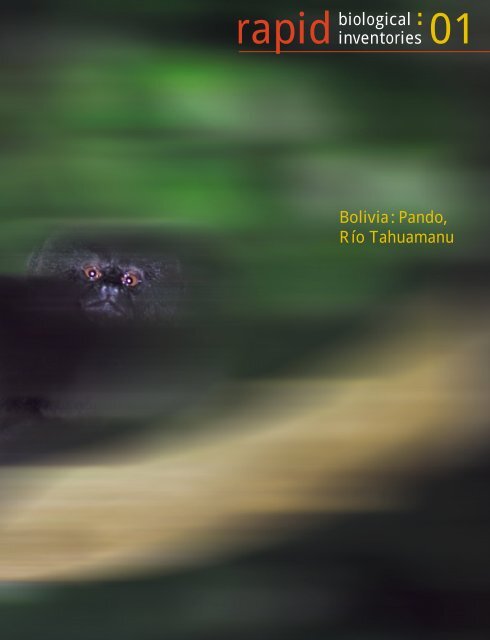
apid<br />
biological<br />
01<br />
inventories<br />
Bolivia: Pando,<br />
Río Tahuamanu
La meta de los inventarios biológicos rápidos es catalizar acciones efectivas de<br />
conservación en regiones amenazadas, las cuales tienen una alta riqueza y singularidad biológica.<br />
El equipo científico se concentra principalmente en los grupos de organismos que sirven como buenos<br />
indicadores del tipo y condición de hábitat, y que pueden ser inventariados rápidamente y con precisión.<br />
Estos inventarios no buscan producir una lista completa de los organismos presentes. Más bien,<br />
usan un método integrado y rápido (1) para identificar comunidades biológicas importantes en el sitio<br />
o región de interés y (2) para determinar si estas comunidades son de calidad sobresaliente y de muy<br />
alta prioridad al nivel regional o mundial.<br />
Los científicos locales son clave para el equipo de campo. La experiencia de estos expertos es<br />
particularmente crítica para entender las áreas donde previamente ha habido poca o ninguna exploración<br />
científica. La investigación y protección de las comunidades naturales a partir del inventario dependen<br />
de las iniciativas de los científicos y conservacionistas locales.<br />
Una vez completado un inventario biológico rápido (típicamente en el plazo de un mes), el equipo<br />
transmite la información del inventario a los responsables de las decisiones, locales e internacionales, quienes<br />
pueden fijar las prioridades y los lineamientos para las acciones de conservación en el país anfitrión.<br />
Inventarios Biológicos Rápidos para Acciones de Conservación www.fieldmuseum.org/rbi<br />
<strong>The</strong> goal of rapid biological inventories is to catalyze effective action for conservation<br />
in threatened regions of high biological diversity and uniqueness. <strong>The</strong> scientific teams focus primarily on<br />
groups of organisms that indicate habitat type and condition and that can be surveyed quickly and accurately.<br />
<strong>The</strong>se inventories do not attempt to produce an exhaustive list of organisms. Rather, the rapid<br />
surveys use a time-effective, integrated approach (1) to identify the important biological communities<br />
in the site or region of interest and (2) to determine whether these communities are of outstanding<br />
quality and significance in a regional or global context.<br />
In-country scientists are central to the field team. <strong>The</strong> experience of local experts is especially<br />
critical for understanding areas with little or no history of scientific exploration. After the inventory,<br />
protection of these natural communities and further research rely on initiatives from local scientists<br />
and conservationists.<br />
Once a rapid biological inventory has been completed (typically within a month), the team<br />
relays the survey information to local and international decision-makers who can set priorities and<br />
guide conservation action in the host country.<br />
Rapid Biological Inventories for Conservation Action www.fieldmuseum.org/rbi
Bolivia: Pando, Río Tahuamanu<br />
PERÚ<br />
BRASIL<br />
Área del<br />
Inventario<br />
Río Tahuamanu<br />
Cobija<br />
•<br />
Río Manuripi<br />
Lago Titicaca<br />
<br />
Río Madre<br />
de Díos<br />
Río Madidi<br />
Río Orthon<br />
Río Beni<br />
BOLIVIA<br />
La Paz<br />
Kilómetros<br />
• 0 50 100 150 200 250<br />
Figure 1 – Area sampled by the rapid biological inventory team (Área del Inventario) along the Río<br />
Tahuamanu in western Pando, Bolivia, in October 1999. <strong>The</strong> state of Pando borders on Peru to the west,<br />
Brazil to the north and east, and the Ríos Beni and Madre de Dios to the south. <strong>The</strong> inset shows the<br />
location of the main map within South America. / Figura 1 – Área muestreada por el equipo del inventario<br />
biológico rápido (Área del Inventario) a lo largo del río Tahuamanu en la parte occidental de<br />
Pando, Bolivia, en octubre de 1999. El Departamento de Pando tiene sus límites con Perú al oeste, Brasil<br />
al norte y al este, y los ríos Beni y Madre de Dios al sur. El recuadro muestra la ubicación del mapa<br />
principal dentro del contexto de América del Sur.<br />
bolivia : pando MARCH/MARZO 2000<br />
<br />
00:13
Figures 2A-B correspond to the Área del Inventario of Figure 1 and depict wild and human communities<br />
in the surveyed Tahuamanu Region. Peru lies southwest of the oblique black line in the lower left<br />
corner of the photo. / Figuras 2A-B corresponden al Área del Inventario de Figura 1 y representan las<br />
comunidades naturales y humanas en la region muestreada. La frontera con Perú se muestra con una<br />
línea negra obliqua en la parte izquierda baja de la foto. (LANDSAT TM image 002-068, 1992, cortesía<br />
de NASA y del Museo Noel Kempff Mercado.)<br />
Figure 2A – Small clearings made by<br />
rubber-tappers and Brazil-nut gatherers<br />
are scattered across the forested<br />
landscape. <strong>The</strong> road from Cobija to<br />
Puerto Heath (both off the map) runs<br />
along the east (right) side of the<br />
photo; fields and pastures along this<br />
road appear as pale blue patches. /<br />
Figura 2A – Chacos pequeños creados<br />
por los seringueros y castañeros están<br />
esparcidos a través del paisaje.<br />
El camino de Cobija a Puerto Heath<br />
(los dos fuera del mapa) corre a lo<br />
largo de la parte este (derecha) de la<br />
foto; campos abiertos y pastizales a<br />
lo largo del camino aparecen como<br />
manchas azules.<br />
Figure 2B – Major habitat types:<br />
green = upland forest (terra firme);<br />
blue = floodplain forest (llanura del<br />
río); yellow = old alluvial terraces<br />
(sartenejal). <strong>The</strong> new logging road<br />
between Rutina and Palmera runs<br />
parallel to the southeast bank of the<br />
Río Muyumanu. / Figura 2B –<br />
Hábitats de mayor importancia:<br />
verde = tierra firme; azul = llanura<br />
del río (bosque de planicie aluvial);<br />
amarillo = sartenejal (terrazas<br />
antiguas aluviales). El nuevo camino<br />
de extracción maderera que va de<br />
Rutina a Palmera corre a lo largo de<br />
la orilla sudeste del río Muyumanu.<br />
Places/Lugares: FI = Filadelfia;<br />
PA = Palmera; PO = Pingo de Oro;<br />
RU = Rutina; SS = San Sebastián.<br />
69˚14’W 69˚8’W 69˚2’W 68˚56’W 68˚50’W 68˚44’W<br />
peru<br />
bolivia<br />
Río Tahuamanu<br />
<br />
PO<br />
<br />
PA<br />
SS<br />
RU<br />
Río Muyumanu<br />
<br />
Río Nareuda<br />
<br />
10 kilómetros<br />
FI<br />
11˚20’S<br />
11˚26’S<br />
11˚32’S<br />
11˚38’S<br />
Figures 3A-D depict the major natural communities in the proposed Tahuamanu Ecological Reserve.<br />
Unique wetlands elsewhere in the region (Figs.3e, f) receive critical protection in the Manuripi-Heath<br />
National Park / Figuras 3A-D representan las comunidades naturales principales en la Reserva Ecológica<br />
Tahuamanu propuesta. Humedales únicos (Figs. 3e, f) en la región reciben protección crítica en el Parque<br />
Nacional Manuripi-Heath<br />
Fig. 3A - Canopy of upland forest<br />
(terra firme) at San Sebastián/<br />
Dosel del bosque de tierra firme en<br />
San Sebastián<br />
Fig. 3B - Floodplain forest (llanura<br />
del río) along the Río Tahuamanu/<br />
Bosque de la llanura del río (planicie<br />
aluvial) a lo largo del río Tahauamanu<br />
Fig. 3C - Sartenejal forest on poorlydrained,<br />
old alluvial terraces along the<br />
Río Tahuamanu (with Vochysia in<br />
flower) / Bosque de sartenejal sobre<br />
terrazas aluviales antiguas mal<br />
drenadas a lo largo del río Tahuamanu<br />
(con Vochysia floreando)<br />
Fig. 3D - Nearly pure stands of<br />
Mauritia flexuosa palm in the<br />
Tahuamanu floodplain/Casi grupos<br />
enteros de la palmera Mauritia<br />
flexuosa en la llanura del río<br />
del Tahuamanu.<br />
Fig. 3E - Black-water lagoon, Lago<br />
Bay, in the Manuripi-Heath National<br />
Park/ Laguna de aguas negras,<br />
Lago Bay, en el Parque Nacional<br />
Manuripi-Heath<br />
Fig. 3F - Wetland north of Chive in<br />
the Manuripi-Heath National Park /<br />
Humedal al norte de Chive en el<br />
Parque Nacional Manuripi-Heath<br />
00:14 RAPID BIOLOGICAL INVENTORIES REPORT/INFORME NO.1<br />
bolivia : pando MARCH/MARZO 2000 00:15
00:16<br />
Figures 4A,C,E–Friends of the forest: the first column of photographs portrays human activities highly<br />
compatible with the diverse plant and animal life in the Tahuamanu forest / Figuras 4A,C,E – Amigos<br />
del bosque: la primera columna de fotografias representa las actividades humanas altamente compatibles<br />
con la diversidad de vida de las plantas y animales en el bosque Tahuamanu / Figures 4B,D,F– Foes<br />
of the forest: the second column depicts activities that lead to the ultimate destruction of rich forest<br />
communities / Figuras 4B, D, F – Enemigos del bosque: la segunda columna representa las actividades<br />
que condujeron a la destrucción final de las comunidades de bosques de alta riqueza<br />
Photo credits: Figures 3A - 3F, R. Foster; 4A, 4B, 4D, V. Sodaro; 4C, 4E, T. Schulenberg; 4F, W. Alverson.<br />
Fig. 4A - Trunk of a rubber tree<br />
(siringa), incised to extract sap/<br />
Tronco del árbol de Siringa, con<br />
incisiones para extraer el latex<br />
Fig. 4B - Forest conversion in the<br />
Tahuamanu region; Brazil-nut trees<br />
left standing are killed by subsequent<br />
fires./ Bosque de conversión en la<br />
región de Tahuamanu; árboles de<br />
castañas aún vivos morirán a causa<br />
de incendios subsequentes.<br />
Fig. 4C - Homemade, natural-rubber<br />
boots at Pingo de Oro, the seringueros’<br />
camp/ Botas de caucho natural, hechas<br />
en casa en Pingo de Oro<br />
Fig. 4D - Cattle on the road to Cobija/<br />
Ganado sobre el camino a Cobija<br />
Fig. 4E - Oxen used seasonally to<br />
transport Brazil nuts from forest camps<br />
to riverside depots / Bueyes usados<br />
durante la temporada para transportar<br />
las castañas de los campamentos del<br />
bosque a los depósitos del río<br />
Fig. 4F - Tree felled for new logging<br />
road / Arbol tumbado para el nuevo<br />
camino maderero<br />
RAPID BIOLOGICAL INVENTORIES REPORT/INFORME NO.1